OGC Standards for Emergency Services pdf
Bạn đang xem bản rút gọn của tài liệu. Xem và tải ngay bản đầy đủ của tài liệu tại đây (2.72 MB, 33 trang )
Copyright © 2010, Open Geospatial Consortium, Inc.,
OGC
OGC
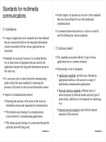
Standards for
Standards for
Emergency Services
Emergency Services
Presentation to
Presentation to
SDO Emergency Services Coordination Workshop
SDO Emergency Services Coordination Workshop
(ESW-7)
(ESW-7)
11-13 May 2010
George Percivall, Chief Architect - presenting
Carl Reed, Chief Technical Officer
Open Geospatial Consortium
Helping the World to Communicate
Geographically
OGC
OGC
for Emergency Services
for Emergency Services
•
What is OGC?
•
OGC support to SDOs
–
OGC role: collaborate consistent conceptual approaches for
location and geospatial topics across multiple SDOs
–
Geopriv, IEEE, ISO, OASIS
•
OGC support of emergency service architectures
–
OGC Web Services
–
OpenLS
–
Sensor Web Enablement
•
CityGML and Indoor Location
Copyright © 2010, Open Geospatial Consortium, Inc.,
Helping the World to Communicate
Geographically
Copyright © 2010, Open Geospatial Consortium, Inc.,
What is the Open Geospatial Consortium (OGC)?
What is the Open Geospatial Consortium (OGC)?
OGC Membership Distribution
By Region
•
An International Voluntary Consensus
Standards Organization, founded in
1994.
•
400 members and growing: industry,
government, research, university
•
28 implementation standards
•
Hundreds of product implementations
in the market
•
Alliances and collaborative activities
with many other SDO’s
OGC Membership Distribution
By Type
OGC Mission
OGC Mission
To lead in the development, promotion and harmonization of
To lead in the development, promotion and harmonization of
open geospatial standards …
open geospatial standards …
Helping the World to Communicate
Geographically
Market Availability
Market Availability
see
see
/> />
•
Free availability of
standards
stimulates market
•
Hundreds of
Products
Implementing
OGC Standards
•
Compliance Test &
Certification
Program
Copyright © 2010, Open Geospatial Consortium, Inc.,
Helping the World to Communicate
Geographically
Copyright (c) 2009, Open Geospatial Consortium, Inc. 5
OGC Geography Markup Language (GML)
OGC Geography Markup Language (GML)
•
XML-based language for encoding geographic information to
be stored and transported over the Internet
•
GML serves as a modeling language for geographic systems
as well as an open interchange format for geographic
transactions on the Internet.
•
GML defines both the geometry and properties of objects that
comprise geographic information.
•
Used in UK, US, Germany, Canada, New Zealand, Holland,
Hong Kong, Google
Helping the World to Communicate
Geographically
Copyright © 2007, Open Geospatial Consortium, Inc., All
Rights Reserved.
GML and IETF PIDF Location Object (LO)
GML and IETF PIDF Location Object (LO)
•
Presence Information Data Format (RFC 4119)
–
The PIDF LO RFC extends PIDF to allow the encapsulation of location
information within a presence document.
–
(PIDF) is a common presence data format for CPP-compliant presence
protocols, allowing presence information to be transferred across CPP-
compliant protocol boundaries without modification, with attendant benefits
for security and performance.
•
Why?
–
Without this standard, cannot provide sufficient Presence Service
•
GeoPriv Working Group in IETF developing a GML GeoShape
Application Schema for use in internet standards.
–
Approved as OGC Best Practices paper, December 2006
•
Now a mandatory requirement for expressing location in a variety of
internet standards
Helping the World to Communicate
Geographically
Copyright © 2007, Open Geospatial Consortium, Inc., All
Rights Reserved.
Use of GML by OASIS
Use of GML by OASIS
•
There is now a GML Oasis Application Schema for use in a
variety of OASIS standards. This application schema was
developed by OGC staff and members and submitted to OASIS.
–
Is now being used in HAVE
–
Is now being used in EDXL-RM
–
Both CAP and EDXL-DE revisions will incorporate this work.
Helping the World to Communicate
Geographically
Copyright © 2007, Open Geospatial Consortium, Inc., All
Rights Reserved.
GeoRSS GML
GeoRSS GML
•
GeoRSS – Simple encoding for location for RSS feeds
•
GeoRSS GML – Points, lines, polygons, and rectangles.
•
Broadly implemented, including support in MS LiveLocal, Google
Earth and Google Maps API
•
Consideration to bring this GML schema into the OGC for
approval.
Helping the World to Communicate
Geographically
Copyright (c) 2009, Open Geospatial Consortium, Inc. 11
One GML data file…
…many different maps!
OpenGIS
Styled
Layer
Descriptor
Helping the World to Communicate
Geographically
KML Encoding Standard
KML Encoding Standard
•
XML for geographic
visualization on 2-D &
3-D Earth browsers
•
Features for display:
placemarks, images,
polygons, 3D models,
text, etc.
•
KML is not a geospatial
modeling language;
consider GML
Copyright (c) 2009, Open Geospatial Consortium, Inc. 12
Helping the World to Communicate
Geographically
Web Map Context
Web Map Context
•
Captures state information of Web Map Service request so the
information can be shared for collaboration
–
XML document includes: server URLs, window size and placement,
bounding box, and other details
–
OGC standard now
•
OWS Context for more general contents
–
Sharing of state for services beyond WMS
–
Under development in OWS-7 Testbed
–
Engineering Report in June 2010
Copyright (c) 2009, Open Geospatial Consortium, Inc. 13
Helping the World to Communicate
Geographically
Open GeoSMS
Open GeoSMS
•
Location in SMS text
•
Open GeoSMS Schema
GeoSMS/Version Num;Latitude;Longitude;Format Type;Data
Section
•
Format B: Basic
GeoSMS/2;2504.8015,N;12133.9766,E;B;
•
Format P: Point of Interest (POI)
GeoSMS/2;2504.8015,N;12133.9766,E;P;NAME/PHONE/ADDR
ESS/DESCRIPTION
•
Now: OGC Discussion Paper; Progressing to Standard
Copyright © 2010, Open Geospatial Consortium, Inc.,
Helping the World to Communicate
Geographically
GeoPDF
GeoPDF
•
GeoPDF specifies “map frames” associated with a PDF page
–
Map frame describes relationship between a coordinate reference
system and an area on the PDF page.
–
Three types of coordinate reference systems supported:
geodetic, projected and unregistered Cartesian (Engineering)
•
GeoPDF is an OGC Best Practice
–
BP publish “as is” to support the large number of GeoPDFs that
have been published to date.
–
Working with community to develop standard
Copyright © 2010, Open Geospatial Consortium, Inc.,
Helping the World to Communicate
Geographically
Other GML Profiles
Other GML Profiles
•
GML Point
•
GML Snapshot
•
GML Simple Features
•
GML in JPEG 2000
•
CityGML
Copyright © 2010, Open Geospatial Consortium, Inc.,
Helping the World to Communicate
Geographically
Copyright (c) 2010, Open Geospatial Consortium, Inc. 17
Use of OGC Specifications enables
Use of OGC Specifications enables
Emergency Service Solutions
Emergency Service Solutions
Helping the World to Communicate
Geographically
OGC Web Services (OWS)
OGC Web Services (OWS)
Web Map Service (WMS)
Web Feature Service (WFS)
Web Coverage Service (WCS)
Catalogue (CSW)
Geography Markup Language (GML)
Web Map Context (WMC)
OGC KML
Others…
Just as http:// is the dial tone of the World Wide Web, and html / xml are the
standard encodings, the geospatial web is enabled by OGC standards:
Relevant to geospatial information applications:
Critical Infrastructure, Emergency Management, Weather, Climate, Aviation,
Defense & Intelligence, Oceans Science, others
Web Map
Server
Web Coverage
Server
Web Feature
Server
Copyright © 2010, Open Geospatial Consortium, Inc.,
OGC
®
Synchronization
Synchronization
using OGC Web Feature Service - Transactional
using OGC Web Feature Service - Transactional
•
Two parties synchronize
•
then make edits
•
then synchronize again
G
e
o
S
y
n
c
G
e
o
S
y
n
c
G
e
o
S
y
n
c
G
e
o
S
y
n
c
G
e
o
S
y
n
c
G
e
o
S
y
n
c
OGC Discussion Paper now; moving to Best Practice
OGC
®
Feature Layers
on Remote
Servers are
registered for
synchronization
Publisher
Submits Change
Request
Reviewer
Approves or
Rejects the
Change
4
4
Inform Publisher
of Approved or
Rejected
Changes
Update Approved
Changes on Registered
Layers using
generated WFS
Transactions
6
6
Inform
Followers of
Changes
Inform Reviewer
of Change
Request
2
2
Publisher creates or
changes features on
a registered layer
CloudSync Services
CloudSync Services
Registered Layers
Registered Layers
Layer A
A
0
A
1
A
n
Schema transposition templates
5
5
1
1
3
3
Copyright © 2009 Carbon Project Inc.
GeoSync application
GeoSync application
Helping the World to Communicate
Geographically
Copyright (c) 2010, Open Geospatial Consortium, Inc. 21
General SWE Architecture
General SWE Architecture
Helping the World to Communicate
Geographically
Open Location Services (OpenLS)
Open Location Services (OpenLS)
•
OpenGIS Location Services (OpenLS)
An open (middleware) platform for location-based application services for
mobile assets and terminals.
The primary goal of the OpenLS initiative series is to dene the specications
for the “Core Services and Abstract Data Types (ADT)” that comprise this
platform.
•
OpenLS : Core Services Standard
–
Part 1-Directory Service
–
Part 2-Gateway Service
–
Part 3-Location Utility Service(Geocoder/Reverse Geocoder)
–
Part 4-Presentation Service
–
Part 5-Route Service
Helping the World to Communicate
Geographically
Copyright © 2009, Open Geospatial Consortium, Inc.
/>Helping the World to Communicate
Geographically
OWS-4 Dirty Bomb Response Demonstration
OWS-4 Dirty Bomb Response Demonstration
•
“Reporting on Advances in
Responding to Emergencies”
•
Filming at PANYNJ
–
EOC
–
Port Newark
–
Newark Airport
–
Demo Audience
•
Sensors deployed at PANYNJ
•
Scene 1 - Radiation event
•
Scene 2 - Preparing Temporary
Hospital Site
•
Scene 3 - Patient Tracking
•
Reported by Dan Dubno,
Former CBS News
Helping the World to Communicate
Geographically
Copyright © 2009, Open Geospatial Consortium, Inc.
OGC CityGML - 3D Urban Models
Source; Thomas Kolbe, Berlin TU
•
Urban Planning
•
Emergency Mgt / Response
•
Transportation / Routing / Logistics
•
Indoor navigation
•
Retail Site analysis
•
Sustainable / Green Communities
•
City Services Management
•
Noise abatement
•
Telecommunications placement
•
Many other uses…
Source: GTA Geoinformatik GmbH, www.gta-geo.de
Helping the World to Communicate
Geographically
CityGML – Modeling Urban Spaces
CityGML – Modeling Urban Spaces
–
Application independent Geospatial Information Model
for virtual 3D city and landscape models
•
Multiple thematic areas
(buildings, vegetation, water, terrain, traffic etc.)
•
Data model (UML) according to ISO 19100 standards
•
Exchange format: rule-based mapping of UML to GML3
•
Adopted OGC standard since 2008
–
CityGML represents
•
3D geometry, 3D topology, semantics, and appearance
•
In 5 discrete scales (Levels of Detail, LOD)
Copyright © 2010, Open Geospatial Consortium, Inc.
Helping the World to Communicate
Geographically
CityGML : 5 levels of details
CityGML : 5 levels of details
LOD 4 – Interior Model
“Walkable” architectural models
LOD 3 – City / Site model
Detailed architectural models, landmarks
LOD 2 – City / Site model
Simple buildings with detailed roof structures
LOD 1 – City / Site model
Prismatic buildings without roof structures
LOD 0 – Regional, landscape model
2.5D Digital terrain model, 3D landmarks
The same object may be represented in different LODs simultaneously
Copyright © 2010, Open Geospatial Consortium, Inc.