Water Conservation Part 3 pdf
Bạn đang xem bản rút gọn của tài liệu. Xem và tải ngay bản đầy đủ của tài liệu tại đây (1.42 MB, 15 trang )
Importance of Percolation Tanks for Water
Conservation for Sustainable Development of Ground Water in Hard-Rock Aquifers in India
21
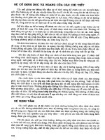
Fig. 1(b). Nearly horizontal lava flows comprising the Deccan Traps or Basalts of Western
India. Location: Western Ghat hills between Pune and Mumbai, Maharashtra State.
3. 3. The aquifer parameters like Storativity (S) and Transmissivity (T) often show erratic
variations within small distances. The annual fluctuation in the value of T is
considerable due to the change in saturated thickness of the aquifer from wet season to
dry season. When different formulae are applied to pump-test data from one well, a
wide range of values of S and T is obtained. The applicability of mathematical modeling
is limited to only a few simpler cases within a watershed. But such cases do not
represent conditions over the whole watershed.
4. 4. The phreatic aquifer comprising the saturated portion of the mantle of weathered
rock or alluvium or laterite, overlying the hard fractured rock, often makes a significant
contribution to the yield obtained from a dug well or bore well.
5. 5. Only a modest quantity of ground water, in the range of one cu. meter up to a
hundred cu. meters or so per day, is available at one spot. Drawdown in a pumping
dug well or bore well is often almost equal to the total saturated thickness of the
aquifer.
Ground water development in hard rock aquifer areas in India and many other countries
has traditionally played a secondary role compared to that in the areas having high-yielding
unconsolidated or semi-consolidated sediments and carbonate rocks. This has been due to
the relatively poor ground water resources in hard rocks, low specific capacity of wells,
erratic variations and discontinuities in the aquifer properties and the difficulties in
exploration and quantitative assessment of the resource.
Water Conservation
22
It should, however, be realized that millions of farmers in developing countries have their
small farms in fractured basement or basaltic terrain. Whatever small supply available from
these poor aquifers is the only hope for these farmers for upgrading their standard of living
by growing irrigated crops or by protecting their rain-fed crops from the vagaries of
Monsoon rainfall. It is also their only source for drinking water for the family and cattle. In
many developing countries, like in India, hard rock hydrogeologists have, therefore, an
important role to play.
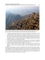
Fig. 2. Red bole (inter-trappean bed) sandwiched between hard, fractured basalt flows.
(Exposure seen in road-side cutting on Pune-Bangalore highway Pune District, Maharashtra
State.)
2. Occurrence of ground water
Ground water under phreatic condition occurs in the soft mantle of weathered rock,
alluvium and laterite overlying the hard rock. Under this soft mantle, ground water is
mostly in semi-confined state in the fissures, fractures, cracks, and joints. (Deolankar
1980) In basaltic terrain the lava flow junctions and red boles sandwiched between two
layers of lava flows, also provide additional porosity (Fig 2). The ratio of the volume of
water stored under semi-confined condition within the body of the hard rock, to the
volume of water in the overlying phreatic aquifer depends on local conditions in the
mini-watershed. Dug-cum-bored wells tap water from the phreatic aquifer and also from
the network of fissures, joints and fractures in the underlying hard rock. (Fig 3 A and Fig
3B).
Importance of Percolation Tanks for Water
Conservation for Sustainable Development of Ground Water in Hard-Rock Aquifers in India
23
GL – Ground Level, HB – Horizontal Bore, HR – Hard Rock, SD – Sheet Fracture or joint,
VB – Vertical Bore, VF – Vertical Fracture, WR – Weathered rock, WT – Water Table.
Fig. 3A. and 3B. Dug cum Bored Wells
The recharge to ground water takes place during the rainy season through direct infiltration
into the soft mantle overlying the hard rock and also into the exposed portions of the
network of fissures and fractures. In India and other Asian countries in Monsoon climate,
the ratio of recharge to rainfall in hard rock terrain is assumed between 3 to 15%. (Limaye
S.D & Limaye D.G. 1986) This ratio depends upon the amount and nature of precipitation,
the nature and thickness of topsoil and weathered zone, type of vegetation, evaporation
from surface of wet soil, profile of underlying hard rock, the topographical features of the
sub-basin and the status of soil and water conservation activities adopted by villagers.
Ground water flow rarely occurs across the topographical water divides and each basin or
sub-basin can be treated as a separate hydrogeological unit for planning the development of
ground water resources. After the rainy season, the fully recharged hard rock aquifer
gradually loses its storage mainly due to pumpage and effluent drainage by streams and
rivers. The dry season flow of the streams is thus supported by ground water outflow. The
flow of ground water is from the peripheral portions of a sub-basin to the central-valley
portion, thereby causing de-watering of the portions closer to topographical water divides.
In many cases, the dug wells and bore wells yielding perennial supply of ground water can
only be located in the central valley portion.
The annual recharge during Monsoons being a sizable part of the total storage of the aquifer,
the whole system in a sub-basin or mini-basin, is very sensitive to the availability of this
recharge. A couple of drought years in succession could pose a serious problem. The low
permeability of hard rock aquifer is a redeeming feature under such conditions because it
makes small quantities of water available, at least for drinking purpose, in the dug wells or
bore wells in the central portion of a sub-basin. If the hard rocks had very high permeability,
Water Conservation
24
the ground water body would have quickly moved towards the main river basin, thereby
leaving the tributary sub-basins high and dry. The low permeability in the range of 0.05 to
1.0 meter per day thus helps in retarding the outflow and regulating the availability of water
in individual farm wells. More farmers are thus able to dig or drill their wells and irrigate
small plots of land without causing harmful mutual interference.
3. Ground water development
In the highly populated but economically backward areas in hard rock terrain, Governments
in many developing countries have taken up schemes to encourage small farmers to dig or
drill wells for small-scale irrigation. This is especially true for the semi-arid regions where
surface water resources are meager. For example, in peninsular India, hard rocks such as
granite, gneiss, schist, quartzite (800,000 sq kms) and basalts (Deccan traps- 500,000 sq kms)
occupy about 1.30 million sq. kms area out of which about 40% is in semi-arid zone,
receiving less than 750 mm rainfall per year. Over 4.00 million dug wells and bore wells are
being used in the semi-arid region for irrigating small farm plots and for providing domestic
water supply.
Development of ground water resources for irrigational and domestic use is thus a key
factor in the economic thrift of vast stretches of semi-arid, hard rock areas. The basic need of
millions of farmers in such areas is to obtain an assured supply for protective irrigation of at
least one rain-fed crop per year and to have a protected, perennial drinking water supply
within a reasonable walking distance. The hard-rock hydrogeologists in many developing
countries have to meet this challenge to impart social and economic stability to the rural
population, which otherwise migrates to the neighboring cities. The problem of rapid
urbanization by exodus of rural population towards the cities, which is common for many
developing countries, can only be solved by providing assurance of at least one crop and
rural employment on farms.
Ground water development in a sub-basin results in increased pumpage and lowering of the
water table due to the new wells, resulting in the reduction of the effluent drainage from the
sub-basin. Such development in several sub-basins draining into the main river of the region
reduces the surface flow and the underflow of the river, thereby affecting the function of the
surface water schemes depending on the river flow. In order to minimize such interference,
it is advisable to augment ground water recharge by adopting artificial recharge techniques
during rainy season and also during dry season. The measures for artificial recharge during
Monsoon rains include contour trenching on hill-slopes, contour bunding of farms, gully
plugging, farm-ponds, underground stream bunds, and forestation of barren lands with
suitable varieties of grass, bushes and trees. Artificial recharge in dry season is achieved
through construction of percolation tanks.
However, increase in pumpage takes place through the initiative of individual farmers to
improve their living standard through irrigation of high value crops, while recharge
augmentation is traditionally considered as Government’s responsibility and always lags far
behind the increase in pumpage. In many parts of the world, particularly in developing
countries, groundwater is thus being massively over-abstracted. This is resulting in falling
water levels and declining well yields; land subsidence; intrusion of salt water into
freshwater supplies; and ecological damages, such as, drying out wetlands.
Groundwater governance through regulations has been attempted without much success,
because the farmers have a strong sense of ownership of ground water occurring in their
Importance of Percolation Tanks for Water
Conservation for Sustainable Development of Ground Water in Hard-Rock Aquifers in India
25
farms. Integrated Water Resources Development (IWRM) is being promoted as a policy or a
principle at national and international levels but in practice at field level, it cannot be
attained without cooperation of rural community. NGOs sometimes play an important role
in educating the villagers and ensure their cooperation.
4. Importance of dry season recharge
During the rainy season from June to September the recharge from rainfall causes
recuperation of water table in a sub-basin from its minimum level in early June to its
maximum level in late September. This is represented by the equation:
P = R + ET + r
Where P is the precipitation, R is surface runoff, ET is evapo-transpiration during the rainy
season and r is the net recharge, represented by the difference between the Minimum
storage and Maximum storage in the aquifer. However, after the aquifer gets fully saturated,
the additional infiltration during the Monsoons is rejected and appears as delayed runoff.
During the dry season, depletion of the aquifer storage in a sub-basin, from its maximum
value to minimum value, is represented by the following equation:
Aquifer storage at the end of rainy season i.e. Maximum storage
Aquifer storage at the end of summer season, i.e. Minimum storage
Pumpage, mainly for irrigation, during the dry season from dug wells
& bore wells
Dry season stream flow and underflow supported by ground water
Recharge, if any, available during the dry season, including the return flow from
irrigated crops
The left-hand side of the above equation has an upper limit, as mentioned above. On the
right-hand side, the minimum storage cannot be depleted beyond a certain limit, due to
requirement for drinking water for people and cattle. Dry season stream flow and
underflow supported by ground water have to be protected, as explained earlier, so that the
projects depending upon the surface flow of the main river are not adversely affected. Any
increase in the pumpage for irrigation during dry season due to new wells must therefore be
balanced by increasing the dry season recharge.
The best way to provide dry season recharge is to create small storages at various places in
the basin by bunding gullies and streams for storing runoff during the rainy season and
allowing it to percolate gradually during the first few months of the dry season. Such
storages created behind earthen bunds put across small streams are popularly known as
percolation tanks. (Fig. 4 and Fig 5). In semi-arid regions, an ideal percolation tank with a
catchment area of 10 sq. kms. or so, holds maximum quantity by end of September and
allows it to percolate for next 4 to 5 months of winter season. Excess of runoff water received
in Monsoon flows over the masonry waste weir constructed at one end of the earthen bund.
By February or March the tank is dry, so that the shallow water body is not exposed to high
rates of evaporation in summer months. (Fig.6) Ground water movement being very slow,
whatever quantity percolates between October and March, is available in the wells on the
downstream side of the tank even in summer months till June or the beginning of next
Water Conservation
26
Monsoon season. Irrigation of small plots by farmers creates greenery in otherwise barren
landscape of the watershed. (Fig.7). Studies carried out in granite-gneiss terrain have
indicated that about 30% of the stored water in the tank percolates as recharge to ground
water in the dry season. The efficiency is thus 30%. In basaltic terrain, if the tank is located
at suitable site and the cut-off trench in the foundation of tank-bund does not reach up to
the hard rock, higher efficiencies up to 70% could be obtained. (Limaye D.G & Limaye S D.
1986) However, more research is required for estimation of the impact of percolation tanks
in recharge augmentation. In the state of Maharashtra in western India, over 10,000
percolation tanks have been constructed so far. (DIRD website, 2011) They are beneficial to
the farmers and are very popular with them.
Fig. 4. Cross section and plan of a typical percolation tank on a stream between two hillocks.
Hillocks are represented by black contours. Earthen Bund of the tank is shown in brown.
Cut-off trench below the bund is in black and accumulated rain water is in pale blue color.
Importance of Percolation Tanks for Water
Conservation for Sustainable Development of Ground Water in Hard-Rock Aquifers in India
27
Fig. 5. Stone Pitching on the face of the earthen bund of a percolation tank under
construction. Photo from village Hivre Bazar, District: Nagar, Maharashtra state.
Fig. 6. A percolation tank about to get dry towards beginning of summer. Location: Village:
Ralegan Siddhi, District: Nagar, Maharashtra State.
Water Conservation
28
Fig. 7. Greenery crated within a dry, semi-arid watershed with the help of water
conservation, farm ponds and percolation tank. The open well has shallow water table even
in summer. A low cost centrifugal pump would soon be installed for small scale irrigation.
(Location: Village Hivre Bazar. Dist: Nagar, Maharashtra State)
The initial efficiency of a percolation tank reduces due to silting of its bottom by receiving
muddy runoff from the watershed. If the watershed is well-forested and has a cover of
grass, bushes and crops, the silting is minimal. But in an average of 5 to 6 Monsoon seasons
the tank bed accumulates about 0.20 to 1.00 meters of silt. Silt reduces the storage capacity of
the tank and also impedes the rate of vertical flow of recharge because of its low
permeability. The efficiency gets reduced due to silting and de-silting of tank bed when it
dries in summer, becomes necessary. (Limaye S D. 2010).
Another type of recharge available during the dry season is the return flow or the percolation
below the root zone of crops, from irrigated farms. This return flow to ground water is usually
estimated at about 25% to 30% of the volume of ground water pumped in dry season and
applied for irrigation. However, due to increasing popularity of more efficient irrigation
methods like sprinkler or drip systems, this type of recharge has a declining trend.
5. Conclusions
A watershed is the meeting point of climatology & hydrology. It is therefore, necessary to
manage our watersheds so as to absorb the climatic shocks likely to come from the erratic
A Farm Pond.
Importance of Percolation Tanks for Water
Conservation for Sustainable Development of Ground Water in Hard-Rock Aquifers in India
29
climatic patterns expected in near future. This can be done only through practicing soil and
water conservation techniques for artificial recharge during rainy season and through
construction of small percolation tanks for artificial recharge during the dry season.
Basin or Sub-Basin management begins with soil and water conservation activities taken up
with people’s active participation in several sub-basins within a large basin. This improves
the shape of hydrograph of the stream or river in the basin, from a ‘small time-based and
sharp-peaked hydrograph’ to a ‘broad time-based and low-peak hydrograph’. Such a
change also increases ground water recharge.
Small water storages or tanks created in the sub-basins by bunding streams and gullies,
store runoff water during the Monsoon season and cause recharge to ground water during
the next few months of dry season. The residence time of water in the basins is thus
increased from a few months to a few years and the percolated water is available in the
wells even during the summer season of a drought year.
After a few years of operation, silting of the tank bed reduces the volume of water stored
and also the rate of vertical infiltration. Regular desilting of tanks by local people is,
therefore, advisable.
A national policy for afforestation of degraded basins with proper species of grass, bushes
and trees should be formulated. Afforestation with eucalyptus trees should not be
encouraged in low rainfall areas as this effectively reduces ground water recharge. The main
aim of forestation of a degraded watershed with local spices of hardy trees, grasses etc.
should be to conserve soil, reduce velocity of runoff water, promote recharge to ground
water and increase the biomass output of the watershed. .
Involvement of NGOs should be encouraged in forestation schemes and soil & water
conservation programs so as to ensure active participation of rural community in recharge
augmentation. NGOs also motivate the farmers to maintain the soil and water
conservation structures put in by Government Departments so as to ensure long-term
augmentation of recharge to ground water. Along with such management on supply side,
demand management is also equally important. NGOs play a significant role in
promoting the use of efficient irrigation methods and selection of crops with low water
requirement.
The website
www.igcp-grownet.org of the UNESCO-IUGS-IGCP Project GROWNET
(Ground Water Network for Best Practices in Ground Water Management in Low-Income
countries) gives several best practices including soil and water conservation, recharge
augmentation etc. for sustainable development of ground water. The author of this Paper
is the Project Leader of GROWNET. The reader is advised to visit the website for detailed
information.
Although the discussion in the Paper refers to hard rock terrain in India, it would be equally
applicable to many other developing countries, having a similar hydro-geological and
climatic set-up.
6. References
Adyalkar PG and Mani VVS (1971) Paloegeography, Geomorphological setting and
groundwater possibilities in Deccan Traps of western Maharashtra. Bull Volcanol.
35: pp 696-708
Deolankar S B (1980) The Deccan Basalts of Maharashtra State, India: Their potential as
aquifers. Ground Water Vol. 18 (5): pp 434-437.
Water Conservation
30
DIRD website www.dird-pune.gov.in/rp_PercolationTank.htm Efficiency of percolation
tanks in Jeur sub Basin of Ahemadnagar District, Maharashtra state, India. (Visited
June 2011)
Limaye D G & Limaye S D (1986) Lakes & Reservoirs: Research and Management 2001.
Vol.6: pp 269-271
Limaye S D and Limaye D G (1986) Proc. of International Conference on ground water
systems under stress. Australian Water Resources Conference Series 13. pp 277-
282
Limaye S.D. (2010) Review: Groundwater development and management in the Deccan
Traps (Basalts) of western India. Hydrogeology Journal (2010) 18: pp 543-558
3
Performance Assessment and Adoption Status
of Family Drip Irrigation System in Tigray State,
Northern Ethiopia
Nigussie Haregeweyn
1,2
, Abraha Gebrekiros
2
, Atsushi Tsunkeawa
1
,
Mitsuru Tsubo
1
, Derege Meshesha
1
and Eyasu Yazew
2
1
Arid Land Research Center, Tottori University, Hamasaka,
2
Department of Land Resources Management and Environmental Protection,
Mekelle University, Ethiopia
1
Japan
2
Ethiopia
1. Introduction
Large irrigation systems are generally incompatible among most of the African smallholder
farming systems (De Lange, 1998) for the reason that support services for farmers, such as
extension and credit are ineffective also often alter the established patterns of land tenure
and land settlement, and have the effect of disrupting or undermining the established
economic institutions. Moreover, improvements of surface irrigation may not be enough
and due to the limited volumes of water harvested and stored as compared to crop water
requirements. As a result, drip irrigation is being considered as one of the alternatives in the
planning of irrigation in Tigray Regional State. Drip irrigation is often promoted as a
technology that can conserve water, increase crop production, and improve crop quality. To
this end, efforts to improve irrigation efficiency through new technologies have been
undertaken in many areas of the Tigray Regional State. As a result, collaboration was
initiated to improve irrigation efficiency between water-sector development organizations
in Tigray, Ethiopia, and India, by the Norwegian Development Fund (DF) through the
Triangular Project (Kirsten et al., 2008). As part of this effort, a family drip irrigation
technology has been transferred from Gujarat in India to Tigray in Ethiopia, and it has
spread throughout the region. There is now even a factory in Tigray that is producing the
family drip irrigation (FDI) kits required for the drip irrigation.
Consequently, both governmental and non-governmental organizations have been
providing technical and financial support to the family FDI beneficiaries in recent years. In
this regard, selected individual household heads received one motor or pressurized treadle
pump, one water tanker made of tin material having a capacity of 400 litters and a set of
family drip kits to develop a 500 m
2
area. In addition, agricultural inputs such as vegetable
seeds, fruit seedlings and fertilizer are also provided. All inputs are supplied on credit basis,
which is to be paid back over a period of five years. The crops being grown were selected
based on market demand.
Water Conservation
32
Therefore, knowledge about performance of new irrigation technology is essential, since it
serves as a base for formulation of irrigation projects. Moreover, it gives a bench mark for
monitoring progresses within a given irrigation system. Thus, there is a need to evaluate the
current small-scale irrigation in general and family drip irrigation in particular in the Tigray
Regional State. The family drip irrigation technology is a case in point that has not been
assessed in light of its technical, operational performance and adoption status. Such an
assessment could assist in identifying constraints for future strategies that address water
scarcity and consequently food security issues at household and national levels. Therefore,
this study was undertaken to assess the performance and identify the factors that influence
the technical and operational performance of family drip irrigation technology as well as its
adoption status.
2. Materials and methods
2.1 Description of the study area
This study had two levels of investigation with regard to addressing the specific objectives
of the study. The first was on assessment of the technical and operational performance of
FDI system which was conducted in Wukro District located at 45 Km north of Mekelle,
Eastern Zone of the Tigray Regional State, northern Ethiopia, while the second was on
assessment of dissemination and adoption of FDI system at Tigray state’s level (Fig. 1).
Fig. 1. Location of the Tigray Regional State and the Wukro district, case study area,
Northern Ethiopia
Performance Assessment and Adoption Status of
Family Drip Irrigation System in Tigray State, Northern Ethiopia
33
The Wukro District is located between 13
°
14’ and 14
°
02’ N and 39
°
34’ and 39
°
37’ E, and covers a
total area of about 100,228 ha (BoARD, 2008) (Fig. 1). It has 63 Kushets (the smallest
administrative unit in the area), a total population of 99,688 with 23,899 household heads
(FDREPCC, 2008). Based on analysis of climate data obtained from the National Meteorological
Services Agency, the mean annual rainfall at Wukro station for the years 1996-2006 was
computed at 723 mm. While the mean annual average daily air temperature is 20°C, with mean
annual daily minimum and maximum values of 11°C and 28°C, respectively. According to IFSP
(1995), the elevation ranges between 1960 and 2600 m.a.s.l. The same report classified the most
common soil types of the area into three: Clay (Baekel), Red (Mekayih) and Black (Walka) .
2.2 Field layout of the FDI system
The installation of family drip irrigation had the following details:
Four lateral pipes of 25 m long each with drippers spaced at 0.3m and a 20 m length
manifold with laterals fitted along it at a spacing of 0.75m interval were laid out to
irrigate an area of 500 m
2
. The FDI kit contains a water tank, a riser, a manifold, laterals,
disc filter, valve, end-cap, and different fittings, where the detailed experimental setup
is given in Figure 2;
The water container was placed at 2m high on a stand made of wooden logs;
The height of water outlet was at 2.1m since the barrel was drilled at 10 cm above the
bottom and a 3/4" socket was welded to it in order to provide the water pressure
required to operate the system and to allow suspended materials to settle;
A 3/4" disc filter was attached to a 3/4" straight adaptor on the barrel;
On the straight adaptor a 3/4" disc filter was attached. Again a female elbow was
connected to a disc filter and to the risers followed by flow regulator up on the
manifold at both left and right sides;
The manifolds having a diameter of 25 mm were laid and connected to the riser at the
center, while the riser was connected to the elbow then to the water container;
The laterals having a diameter of 12 mm were unrolled and laid along the full length of
each bed of which plants to be irrigated;
The laterals were connected with the manifold with the help of connectors at 0.75 m
interval;
The end of the laterals and the manifold were closed with end caps and they were tied
at the beginning as well as at the end on wooden pegs to avoid direct soil contact and
thus to prevent clogging as a result of back siphoning.
2.3 Performance assessment of the FDI system
2.3.1 Uniformity
Uniformity in here referred to what extent the water was uniformly distributed across the
irrigated area. This is affected by the water pressure distribution in the pipe network and by
the hydraulic properties of the emitters used (Smajstrla et al., 2002).
To measure emitter flow rates, a standard graduated cylinder was used and volume of
water was collected for one minute. A stopwatch was used to measure the time. For
uniformity determination, measurements were made three times at 32 locations in each FDI
kits during the crop growing season taking into consideration the minimum recommended
number points by Smajstrla (2002). Care was also taken to distribute the measurement
points throughout the irrigated zone. In order to address all these issues, uniformity
Water Conservation
34
evaluation procedures developed by FAO (1980) were followed with the following details
and also as shown in Figure 3;
Fig. 2. Detailed experimental set up for the family drip irrigation system of this study
Four laterals were located along an operating manifold; one at the left end of the inlet, one at
the right end of the inlet and two located at ½ ways to the right and left from the inlet
midpoint;
On each lateral, 2 adjacent emitters were selected at 8 different emitter locations: at the inlet
end, 1/3 down way of the lateral, 2/3 down way of the lateral and at farthest end point of
the lateral.
Four commonly used uniformity parameters were determined for this study:
The first uniformity parameter used was emission uniformity (E
U
) which is the most useful
system performance indicator for trickle systems. Sometimes in case of field evaluation it is
defined as distributions uniformity (D
U
) which was calculated using Equation 1 (Kruse, 1978).
min
100
u
a
q
E
q
(1)
Where:
E
U
= Field emission uniformity (%);
q
min
= Minimum discharge rate computed from minimum pressure in the system (l/h) and
q
a
= average of all field data emitter discharge rates (l/h).
The second uniformity parameter used was emitter flow variation (q
Var
) which was
calculated using Equation 2 (Wu, 1983):
max min
var
max
q
q
(2)
Performance Assessment and Adoption Status of
Family Drip Irrigation System in Tigray State, Northern Ethiopia
35
Where:
q
max
= maximum emitter flow rate (l/h) and
q
min
= minimum emitter flow rate (l/h).
The third uniformity parameter used was coefficient of variation (C
V
) which was calculated
using Equation 3 (Wu, 1983).
v
a
S
C
q
(3)
Where:
S = standard deviation of emitter flow rates (l/h) and
q
a
= average emitter flow rate (l/h).
The fourth uniformity parameter used was uniformity coefficients (UC) which is often
described in terms of the coefficient of variation defined as the ratio of the standard
deviation to the mean and was calculated using Equation 4 (ASAE, 1985) expressed as:
1100
q
c
a
S
U
q
(4)
Where:
U
C
= uniformity coefficient (%);
S
q
= average absolute deviation of all emitters flow from the average emitter flow (l/h) and
q
a
= average emitter flow rate (l/h).
Fig. 3. Layout of control points and discharge measurement for family drip irrigation system
of this study