VULNERABILITY OF LANDSLIDE HAZARD IN TROPICAL REGION
Bạn đang xem bản rút gọn của tài liệu. Xem và tải ngay bản đầy đủ của tài liệu tại đây (8.43 MB, 161 trang )
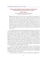
<span class="text_page_counter">Trang 1</span><div class="page_container" data-page="1">
Vulnerability of Landslide Hazard in Tropical
</div><span class="text_page_counter">Trang 3</span><div class="page_container" data-page="3">ii
Sendai, Japan June 1
<small>st</small>, 2016
</div><span class="text_page_counter">Trang 4</span><div class="page_container" data-page="4">i
Preface
Like other South-East Asia countries, Vietnam is the country with mountainous terrain, complicated geological structure and high rainfalls. As the result, landslides occur regularly and seriously in mountainous regions, specially in rainy seasons. Landslide is one of the most dangerous and damaging natural disasters disturbing people living in and the socio-economic development of mountainous areas inVietnam.
Under the efforts to forcast and mitigate impacts of this phenomena on pepole, there were an ODA technical cooperation project funded by Japanese Government named as ‘’Development of Landslide Risk Assessment Technology along Transport Arteries in Vietnam’’. The project’s purpose is to develop landslide risk assessment technology in order to reduce landslide disasters along main transport arteries and on residential areas, totrain and develop the capacity for the effective use of this technology which has been implemented in Viet Nam. The expected outputs of project are (1) Preparation of integrated guidelines for the application of developed landslide risk assessment technology and capacity development by WG1 Joint Team of all groups, (2) Wide-area landslide mapping and identification of landslide risk area by WG2 Mapping Group, (3) Development of landslide risk assessment technology based on soil testing and computer simulation by WG3 Testing Group and (4) Risk evaluation and development of early warning system based on landslide monitoring by WG4 Monitoring Group.
This dissertation is results of the research by WG2 under the mentioned project for many years. The research covers the issues related to vulnerability of landslide hazard of slopes in tropical regions where the Central of Vietnam is a typical region stand for. The contents of research include providing methods to create landslide vulnerability map, proposing a new method for landslide classification, analyzing relationship between occurred landslides with causative factors and building a landslide susceptibility map for the reseached area. For application, a Landsilde Hazard
</div><span class="text_page_counter">Trang 5</span><div class="page_container" data-page="5">ii Vulnerability guidelines were established. I hope my study will contribute to regional landslide disaster management, minimize the damages of landslide phenomenon arising due to climate change to traffic systems particularly and the development of infrastructure in general.
I pay my sincere gratitude to the honorable every renowned Professors of Tohoku Gakuin University, Kyoto University Universities, and Forest Products Research Institute in Japan, many Officers and engineers, many Officers from Governmental and private sector, field officials, Japanese coordinators and especial thanks to Prof. Toyohiko Miyagi, Dr. Eisaku Hamasaki, Dr. Shinro Abe, Dr. Hiroyuki Yoshimatsu, Dr. Kazunari Hayahi who have contributed their outstanding efforts through their presentations, lectures, very hard site survey trips and training course in Vietnam and Japan for supporting me to finished this dissertation.
</div><span class="text_page_counter">Trang 6</span><div class="page_container" data-page="6">iii
Abstract
Landslides are considered as a persistent problem in mountainous regions, especially distribute along transportation corridors. Landslides not only cause damages to properties (houses, buildings, vehicles, etc.) and large numbers of casualties but also disrupt utility services and economic activities. Located on the Eastern Indochina Peninsula, Vietnam has a rate of mountainous terrain up to 3/4 area of its territory with a steep sloped terrain due to earth's crust powerful tectonics. Moreover, it also has a complex geological structure and a tropical monsoon climate with the average annual rainfall from as much as 3,000-4,500mm/year in some regions. Consequently, Vietnam is a typical tropical country with the most serious landslide disaster in Southeast Asia and the Mekong sub-region.
Vulnerability of landslide hazard is refferred as the portability of slopes by landsliding. There are many causes of landslide vulnerability such as conditions of topography, geomorphology, geology, climate and artificial activities. Landslide vulnerability assessment is a large concept concerning to risk assessment on re-active landslides and landslide susceptibility. In order to mitigate the effect of this phenomenon to human life, landslide vulnerability assessment is requirement of fact.
The dissertation purpose is to develop a comprehensive method for the assessment of vulnerability to landslide risk in tropical regions based on providing a significant method for landslide classification, analyzing relationship of landslide phenomena with causative factors and creating a landslide susceptibility map for vulnerability of landslide hazard. Methodology of the dissertation is based on the conclusion as "for the landslides, the past and the present are the key to the future" (Varnes, 1984; Carrera et al., 1991, Hutchinson, 1995). In some cases together with others topography and slope formation processes, the cover of vegetation in tropical forest could delete their signals for recognition. So by this principle, occurred landslides will be recognized as much as possible, depending on capacity of human recognition. Under this hypothesis, landslides in the future may occur in the same
</div><span class="text_page_counter">Trang 7</span><div class="page_container" data-page="7">iv geological conditions, geomorphology and hydrogeology as it happened before. Therefore, to understand clearly about the movement of landslide in the past is very importance to assess landslide causes. From discovered landslides, the rules for landslide appearance will be studied then the prediction to land sliding sensitiveness is evaluated and forecasted.
The study area is a zone limited by a distance of 20 km offset to both sides from the center-line of HCM route, extending northwest and southeast between the latitudes of 16° 40'N and 15° 30'N and longitudes of 106° 15'E and 106° 50'E; extends to three provinces of Quang Binh, Hue, and Quang Nam of Vietnam. Through collecting occured landslides along 300km of the route since 2006 to 2015, in the Central of Vietnam.The research for vulnerability of landslide hazard was carried out through 16 reports and publisments. Five new reports and recently publishments are presented and discussed here for the dissertation.
The contends of dissertation includes (1) a new strategy for landslide prevention and mitigation for road in humid tropical region; (2) A prediction of Landslide Classification by pattern recognition of fuzzy inference method (3) Geological mechanisms of landslide generation in the study area ; (4) Landslide susceptibility mapping along the Ho Chi Minh route in the Central of Vietnam – an AHP approach applied to a humid tropical area and (5) Mitigation landslide hazard vulnerability Guideline.
From the damages of typical landslides in Vietnam on highway No. 37 (at Chen Pass), Son La Province; the Nam Non Bridge on the Western Route, Nghe An Province; at Hai Van Pass Station; on Highway No. 6 and along the Ho Chi Minh route in the central area, it is able to be recognized that the responding in face to this dangerous phenomenon seems to be quite passive. In the dissertation, a general method to prevent and mitigate landslides actively along roads in humid tropical region was also proposed. The core of the study is a new strategy for reduction affection of vulnerability of landslides, which was discussed by combination of the landslide risk assessment map, which is developed from risk assessment to occured landslides and the landslide susceptibility map, which is developed from the evaluation the sensitiveness to sliding of natural slope from landslide causative factors. The general method can contribute to the forecast, prevent and mitigate the negative impact of the landslide phenomenon for planning, land use, construction of infrastructure, ensuring the safety of existing traffic roads and mountainous residential areas in Vietnam. It can be applied to areas with
</div><span class="text_page_counter">Trang 8</span><div class="page_container" data-page="8">v similar conditions to the study area.
From 2012 to 2015, multi landslide investigations have been taken along Ho Chi Minh route in order to collect as many as occured landslides for assessment. According to Varnes classification, the occured landslides were classified. However, because of complicated phenomena and depending on point of observations, there were some landslide cases which had a non-consensus for classification. For landslide mitigation, a degree of risk valuation and the construction of prevention measures are necessary to prevent these landslide disasters. Therefore, it is necessary to execute a pattern recognition of different type classification. Cause of landslide having a various moving styles, but the analysis of this type classification is affected by the various factors. Therefore, we examine this analysis method of Landslide Classification in consideration of fuzzy nature. From results of study, we show that the weathering of the ground, a geological features and landslide scale are important factors through these analysis. The propose method is high technique analysis precision and could be applicated for similar assessment application.
In the Central of Vietnam, Ho Chi Minh Route (HCMR) runs from south to north along the border with Laos. In this area, HCMR is often closed due to numerous landslides during the rainy season. Thus, there is an urgent need to determine the generation mechanism of landslides and to conduct risk assessment. For this purpose, the area was chosen as one of the study areas for this project. This study focuses on landslides occurring at approximately 180 locations along the 150 km distance (linear distance) from Thanh My (west of Da Nang City) and the intersection with National Route 9 (west of Quang tri). The landslides are classified based on the type of movement in order to determine the triggering mechanism. The survey was conducted from 2012 to 2014. The type of landslide movement in this area differs significantly depending on whether if the area is Paleozoic metamorphic zone or Mesozoic sedimentary zone. The type of landslide movement in this area differs significantly depending on whether if the area is Paleozoic metamorphic zone or Mesozoic sedimentary zone. In metamorphic area, weak aspect such as schistosity, beddings, faults, and joints associated with geological structures become shear planes. Translational slides (wedge type) and rotational slide/flow (gulley type) occurs often in this area, with the infiltration of surface water and breaking of rocks by weathering as the cause. On the other hand, in Mesozoic sedimentary area, translational rock-slides are most common, where coal layers disrupted by fold structures function as the slip
</div><span class="text_page_counter">Trang 9</span><div class="page_container" data-page="9">vi surface. It was shown that these landslides are not simply caused by heavy rain and weathering typical of the tropics, but are closely associated with geology, geological structure, development of rivers, and cuesta topography. This result shall be an important indicator in future study of vulnerability of landslide hazard.
To assessment the sensitiveness to vulnerability of the slope by sliding, a landslide susceptibility mapping along the Ho Chi Minh route in the Central of Vietnam was created. Ingeneral there are various possible causes for land sliding with complex inter–relationships. However, in practice a detailed assessment to find the main causes of each landslide is not feasible in most cases. The selection of causative factor for landslide susceptibility map is usually base on expert’s subjective experience. In this study, to analyse landslide manifestation, causative factors are derived of slope angle, type of rock, fault density, distance to the road, land used and precipitation. Maps for causative factors were created, in which each one was divided in to classes. From position of 604 slope failures appeared along the Ho Chi Minh route a landslide distribution was build up. The sensitiveness to landslide of each classical zone of causative factor maps is calculated and then evaluated thought the value of number occurred landslide -NOL and density of occurred landslide DOL. These values were the result of comparison of landslide distribution map and each causative factor maps using GIS application. An analytical hierarchical process (AHP) is used to combine these maps for landslide susceptibility mapping. As the result, A landslide susceptibility zonation map with 4 landslide susceptibility classes, i.e low, moderate, high and very high susceptibility for land sliding, is derived based on the inventory map of observed landslide from 2006-2009. This map indicates that 82.66% total number of occurred landslide, which have been reported fall into highly and very highly susceptible zone. Even there was limited matter concerning relevant, scale and available data, the landslide susceptibility map of this study for corridor along this road is credible for landslide mitigation.
For landslide prevention, response and mitigation, a Landslide Hazard Vulnerability in tropical region a Guideline was proposed. The author approach is to answer for questions “What-Where-When-How’’to landslides. Concept and classification of landslide in study area will be discussed for “What” question. Landslide moving mechanism is mentioned, in which the effect of the pore-pressure rise by raining is confirmed then the relationship between dynamic factor and displacement (signal of landslide recognition) is tagged for observation. As the result,
</div><span class="text_page_counter">Trang 10</span><div class="page_container" data-page="10">vii basic data for landslide management and regional monitoring system are advised that will answer for “When” question. The integrated maps for landslide hazard vulnerability such as landslide inventory map, landslide risk assessment map, landslide susceptibility map and landslide hazard map are presented as basic tools to answer for “Where” question as site prediction. The application of research for landslide prevention, response and mitigation plan, in which landslide knowledge and tools were used to discuss for question “How”. This guideline will contribute for landslide hazard management as a basic document in the the Central of Vietnam.
Vulnerability of Landslide Hazard assessment is one very important issue in the "proactively prevent natural disasters" strategy of Vietnamese government. From landslides survey data in corridors of Ho Chi Minh route in center area of Vietnam, a basic data for occurred landslide was created base on three basic methods, which is commonly used for inventory maps as field recognizance to investigate landslide occurrences, collection of historic information of landslide and interpretation of landslide occurrences from aerial photographs. The relation of occured landslides distribution to causative factors such as topography, geomorphology, geology, climate and Artificial activities were studied. During the research time, the following matters including: new strategy for Landslide prevention and mitigation for road; the prediction of Landslide Classification by pattern recognition of fuzzy inference method; Geological mechanisms of landslide generation; Landslide susceptibility and Mitigation landslide hazard vulnerability Guideline for tropical region were discussed. The results of above studies could apply to similar tropical zone. However, vulnerability of landslide hazard assessment is large matters. Beside of above studies, Creation of Landslide Risk Assessment to occured landslides that using AHP or Fuzzy method not mentioned in this study should be the target of future researches. The studies in this dissertation will contribute to understand and mitigate the vulnerability of landslide hazard disaster in center area of Vietnam particular and humid typical tropical region in general.
</div><span class="text_page_counter">Trang 11</span><div class="page_container" data-page="11">viii
Table of Contents
Preface ... i
Abstract ... iii
Table of Contents ... viii
List of Figures ... xiii
List of Tables ... xvi
CHAPTER 1 – SIGNIFICATION OF THE RESEARCH ... 17
1.1 Landslide Situation in Vietnam ... 17
1.2 Abstract of Vietnamese Government’s Strategy for Response, Mitigation and Prevention of Natural Landslide Disasters ... 22
1.3 Research Experiences ... 23
1.3.1 Civil Engineering Works ... 23
1.3.2 Some Landslide Research References before the Doctoral Dissertation ... 24
1.3.3 List of all Study Reports ... 28
1.4 The research Issues ... 30
1.4.1 Vulnerability of Landslide Hazard ... 30
1.4.2 Landslide Prevention and Mitigation for Roads in Humid Tropical Region (The 4 th Volume of World Landslide Forum 3 - WLF3) ... 31
1.4.3 A Prediction of Landslide Classification by Pattern recognition of Fuzzy Inference Method along the HCMR in the Central of Vietnam (Transactions, Geomorphological Union vol.37-1 in January. 2016.) ... 32
1.4.4 Geological Mechanisms of Landslide Generation along HCMR in the Central of Vietnam (Journal of Japan Landslide Society-Vol 52, No4-226. 2015) .. 32 1.4.5 Landslide Susceptibility Mapping along the HCMR in the Central of Vietnam
- an Application of an AHP Approach to Humid Tropical Area. (Transactions,
</div><span class="text_page_counter">Trang 12</span><div class="page_container" data-page="12">ix
Geomorphological Union vol.37-1 in January. 2016.) ... 33
1.5 Strategy of Report Establishment ... 34
1.5.1 Research Objectives and Subjects ... 34
1.5.2 Research Methodology ... 35
1.5.3 Main contents of research ... 38
CHAPTER 2 –LANDSLIDE PREVENTION AND MITIGATION FOR ROADS IN HUMID TROPICAL REGIONS ... 40
2.1 Vietnam’s Natural Features Relating to Landslides ... 40
2.2 Landslides Damaged the Transport System in Vietnam ... 41
2.2.1 Chen Pass Landslide Case ... 41
2.2.2 Landslides along National Highway No.6 Hoa Binh province ... 42
2.2.3 Landslide at Nam Non Bridge ... 44
2.2.4 Hai Van Station Pass Landslide Case ... 46
2.2.5 Landslides along the HCMR via Vietnam Central... 48
2.3 Current Situation of Survey, Design and Management of Mountainous Roads .. 50
2.3.1 Survey and Design for New Mountainous Roads ... 50
2.3.2 Management and Exploitation of Mountainous Roads ... 52
2.4 Propose a New Strategy Proactively to Prevent and Mitigate Landslide ... 53
2.4.1 Objectives and Principles of LITM ... 54
2.4.2 Landslide Risk Assessment Map... 56
2.4.3 Landslide Susceptibility Map ... 57
2.4.4 Creation of LITM ... 59
2.5 Conclusions ... 59
CHAPTER 3 – LANDSLIDE CLASSIFICATION BY PATTERN RECOGNITION USING FUZZY INTERENCE METHOD ALONG HCMR IN THE CENTRAL OF VIETNAM ... 61
3.1 Introduction ... 61
3.2 Landslide Classification by Fuzzy Theory ... 63
3.2.1 Landslide Classification by Fuzzy If-Then Rules ... 63
3.2.2 Classification Rule of Fuzzy If-Then Rules ... 66
3.2.3 Training Rules of Fuzzy If-then Rules ... 66
3.3 Attribute Factors of HCMR Used for Prediction of Landslide Classification ... 67
3.3.1 Geological Features ... 67
</div><span class="text_page_counter">Trang 13</span><div class="page_container" data-page="13">x
3.3.2 Type Classification of Landslides ... 69
3.3.3 Attribute Factors of Classification ... 70
3.3.3.1Geological and Geologic Structure Features ... 71
3.3.3.2Weathering Features of Slope Bedrock ... 71
3.3.3.3Topographic Features ... 71
3.4 Analysis of Landslide Classification ... 73
3.4.1 Predictive Accuracy of Landslide Classification ... 73
3.4.2 Extraction of Identification Rules for Landslide Classification ... 76
3.4.3 Prediction of Landslide Classification ... 77
3.5 Conclusions ... 78
CHAPTER 4 – GEOLOGICAL MECHANISMS OF LANDSLIDES GENERATING ALONG HCMR IN THE CENTRAL OF VIETNAM ... 80
4.1 Introduction ... 80
4.2 Study Area Outline and Geological Features ... 80
4.3 Landslide Moving Types and Geology ... 83
4.3.1 Landslide Movement Classification and Types ... 83
4.3.2 Landslide Moving Type and Geology ... 84
4.4 Cracks and Landslides ... 85
4.4.1 Cracks in the Bedrock ... 85
4.4.2 Faults ... 87
4.4.3 Cracks and Weathering of the Bedrock ... 88
4.5 Landslides in Mesozoic Sedimentary Rocks ... 89
4.6 Discussions ... 91
4.7 Conclusions ... 95
CHAPTER 5 –LANDSLIDE SUSCEPTIBILITY MAPPING ALONG HCMR IN THE CENTRAL OF VIETNAM: AHP APPROACH APPLIED TO A HUMID TROPICAL REGION ... 97
5.1 Introduction of Natural Characteristics of the Study Area ... 97
5.2 Landslides Occurring along the HCMR and Data Survey Results ... 100
5.3 Landslide Survey Results and Causative Factors ... 101
5.3.1 Natural Slope Angles ... 102
5.3.2 Fault Density ... 104
</div><span class="text_page_counter">Trang 14</span><div class="page_container" data-page="14">xi
5.3.3 Geology ... 105
5.3.4 Precipitation ... 107
5.3.5 Land Usage ... 108
5.3.6 Distance to the Road ... 110
5.4 Methodology for Landslide Susceptibility Mapping ... 111
5.5.1 Selection of Parameter Scale and Discussions ... 113
5.5.2 Mapping Accuracy ... 116
5.5.3 Limitations ... 117
5.5 Conclusions ... 118
CHAPTER 6 – GUIDELINE FOR VULNERABILITY OF LANDSLIDE HAZARD MITIGATION IN HUMID TROPICAL REGIONS ... 119
6.1 Targets for Landslide Hazard Vulnerability Management for Humid Tropical Regions ... 119
6.2 Landslide Types and Moving Mechanism ... 119
6.2.1 Landslide Classification in Region and Recognition Signal ... 119
6.2.1.1Rock fall ... 120
6.2.1.2Translational Shallow Debris Slides ... 121
6.2.1.3Translational Wedge Type Slides ... 122
6.2.1.4Translational Rock Slides ... 122
6.2.1.5Rotational Debrisslide ... 124
6.2.1.6Gully Type Slides and Debris Flows ... 125
6.2.2 Landslide Moving Mechanism ... 125
6.2.3 The Relationship between Dynamic Factor and Displacement/ Signal for Landslide Recognization ... 127
6.3 Tools for Landslide Management by Region ... 130
6.3.1 Basic Data for Landslide Management ... 130
6.3.1.1Landslide Data Collection ... 130
6.3.1.2Regional Monitoring System ... 132
6.3.1.3Rain Gauge - Rainfall Monitoring ... 133
6.3.1.4Extensometers – Displacement Monitoring ... 134
6.3.2 Integrated Maps for Landslide Hazard Vulnerability Mitigation ... 135
</div><span class="text_page_counter">Trang 15</span><div class="page_container" data-page="15">xii
6.3.2.1Landslde Inventory Map ... 135
6.3.2.2Landslide Risk Assessment Map... 136
6.3.2.3Landslide Susceptibility Map ... 137
6.3.2.4Landslide Hazard Maps ... 137
6.3.3 Planning for Landslide Prevention and Mitigation ... 138
6.3.3.1Landslide Prevention Strategies ... 138
6.3.2.5Landslide Respone Strategies ... 138
6.3.2.6Typical Mitigation Strategies ... 139
CHAPTER 7 – CONCLUSIONS AND RECOMMENDATIONS ... 145
7.1 General Landslide Situation in Vietnam ... 145
7.2 Research Targets and Contents ... 146
7.3 The General Method for Landslide Prevention and Mitigation for Roads in Humid Tropical Regions ... 146
7.4 A Prediction of Landslide Classification by Pattern Recognition of Fuzzy Inference Method along the HCMR in the Central of Vietnam ... 148
7.5 Geological Mechanisms of Landslide Generation along HCMR in the Central of Vietnam ... 149
7.6 Landslide Susceptibility Mapping along the HCMR in the Central of Vietnam - an Application of an AHP Approach to Humid Tropical Regions ... 151
7.7 Guidelines for Landslide Hazard Vulnerability in Humid Tropical Regions .... 152
7.8 Conclusions and Future Research ... 153
References ... 154
</div><span class="text_page_counter">Trang 16</span><div class="page_container" data-page="16">xiii
List of Figures
Fig. 1.1 Topography– Geology–Precipitation map of Vietnam... 17
Fig. 1.2 Some pictures of landslide taken in Vietnam ... 20
Fig. 1.3 Location of the study area ... 35
Fig. 1.4 Flow chart for Vulnerability of Landslide Hazard Research ... 36
Fig. 1.5 Landslide micro topography ... 37
Fig. 2.1 Terrain and rainfall distribution map of Vietnam ... 40
Fig. 2.2 Overview of Chen Pass landslide zone ... 42
Fig. 2.3 Description of main scrap on the landslide body ... 42
Fig. 2.4 The landslide distribution map of Hoa Binh Provice area ... 43
Fig. 2.5 The rapid slope failure at Km 138 +750, Dong Bang Commune, Mai Chau District, Hoa Binh Province ... 44
Fig. 2.6 Landslide at Nam Non Bridge, West Nghe An road, My Ly commune, Ky Son district, Nghe An province ... 45
Fig. 2.7 Longitudinal profile of moving mass ... 46
Fig. 2.8 Model Acad 3D of Hai Van Pass Station ... 47
Fig. 2.9 Location landslides at Hai Van Pass station ... 47
Fig. 2.10 Illustrates typical landslides often occur in HCMR -Vietnam ... 48
Fig. 2.11 Illustration of landslides on the HCMR ... 49
Fig. 2.12 Mechanism of flow related to the geology character of surface ... 49
Fig. 2.13 Illustration of the design highways Ban-Etsu, Japan which was designed to avoid sensitive landslides ... 52
Fig. 2.14 General scheme for LRAM ... 55
Fig. 2.15 Block diagram of idealized of a landslide ... 57
Fig. 3.1 Fuzzy partition with fuzzy trapezoidal grid ... 64
Fig. 3.2 Geological Tectonic Division of Vietnam ... 68
Fig. 3.3 Geology and landslide in the study area ... 70
Fig. 3.4 Moving types of landslides along HCMR ... 71
Fig. 3.5 Relation between river and landslide slope-figure shows attack slope- ... 72
Fig. 3.6 Distributive characteristics of attribute factors for each Landslide Classification ... 74
Fig. 3.7 Shape of membership function acquired by training ... 79
</div><span class="text_page_counter">Trang 17</span><div class="page_container" data-page="17">xiv
Fig. 4.1 Study area ... 81
Fig. 4.2 Geological tectonic divisions of Vietnam ... 82
Fig. 4.3 Geological map of the study area ... 82
Fig. 4.4 Moving types of landslides along HCMR ... 83
Fig. 4.5 Moving types pictures of landslides along HCMR ... 84
Fig. 4.6 Landslide movement types based on geology ... 85
Fig. 4.7 Landslide sites and movement types ... 86
Fig. 4.8 Cracks and faults in the Schmidtnet (Lower hemisphere) ... 87
Fig. 4.9 Formation analysis of wedge type slides using the Wulffnet ... 87
Fig. 4.10 Strike, dip, and distribution of Faults in the Schimidtnet ... 88
Fig. 4.11 Photo graphs from the point No. 485 ... 89
Fig. 4.12 The map of Mesozoic sedimentary rocks survey points ... 90
Fig. 4.13 Schematic C-C’ cross-section of Fig. 12 ... 91
Fig. 4.14 Translational rock slide around No. 10-25 ... 91
Fig. 4.15 Landslides in coal seams ... 91
Fig. 4.16Effects of landslides on a 400 m Stretch of the road near No. 356 ... 91
Fig. 4.17Translational rock slide and Slide surface of coal bed –No. 357 ... 91
Fig. 4.18 Schematic diagrams of cracks and faults with wedge type slides in Metamorphic rocks ... 92
Fig. 4.19 A large-scale landslide occurred as a complex of wedge type slides ... 93
Fig. 4.20 X-ray diffraction results of the sliding surface in the coal seam ... 94
Fig. 4.21 Results of ring shear test on sliding surfaces in the coal seam ... 94
Fig. 4.22 Uni-axial compressive strength conversion by the Schmidt hammer ... 94
Fig. 4.23 Large scale translational rock slide in Mesozoic sedimentary area ... 94
Fig. 4.24 Geology and landslide types of the HCMR ... 96
Fig. 5.1 Location and natural feature of the study area ... 97
Fig. 5.2 Topography and landform of the study area ... 99
Fig. 5.3 Photographs of landslides, which often occur on the HCMR in Vietnam 100 Fig. 5.4 Landslide distribution map of the study area and four severe landslide sections ... 102
Fig. 5.5 Digital elevation model of the study area ... 103
Fig. 5.6 Slope angle map of the study area ... 103
Fig. 5.7 Fracture density map of the study area of HCMR corridor ... 104
Fig. 5.8 Fault density distribution map ... 104
</div><span class="text_page_counter">Trang 18</span><div class="page_container" data-page="18">xv
of the study area ... 104
Fig. 5.9 Classification Rock Map of the HCM study area showing seven rock types .... 106
Fig. 5.10 Diagram showing the rainfall distribution of average annual rainfall. Scale 1: 500,000 from the Center of National Hydrometeorology ... 108
Fig. 5.11 Annual average rainfall map ... 108
Fig. 5.12 Vegetation cover map of The Central of Vietnam (1:500,000) ... 109
Fig. 5.13 Vegetation cover map of study area ... 109
Fig. 5.14 Distance road map ... 110
Fig. 5.15 Landslide susceptibility map of the study area, along HCM from Quang Tri to Kontum ... 117
Fig. 6.1 Rock fall on HCMR – Quang Nam section - Vietnam ... 121
Fig. 6.2 (a)Debris Shallow landslide and (b), (c)Translational wedge type slides in HCMR -Hue section-Vietnam ... 121
Fig. 6.3 Deep seated Landslide on Hai Van pass - Da Nang –Vietnam ... 123
Fig. 6.4-aPhoto of Translational rock slideNorthwest ward of Thach My town ... 123
Fig. 6.4-bTopography of Translational rock slide on Khom 9- Kham Duc ... 123
A deep seated Landslide original form changes to many minor debris flow inside its landslide body. B means block slide; D means debris flow ... 123
Fig. 6.5-aPhoto of landslide body of a rotational landslide in HCMR ... 124
Fig. 6.5-bPhoto of main scarp of a rotational landslide in HCMR ... 124
Fig. 6.6 Debris Flow and gully on HCMR-Hue Section-Vietnam ... 125
Fig. 6.7 Landslide-initiation mechanism by the combined effect of earthquake and pore -pressure rise ... 126
Fig. 6.8 The samples were taken from the landslide surface of the 1792 Unzen earthquakes in Japan ... 127
Fig. 6.9 Transitions in landslides from occurrence to termination ... 129
Fig. 6.10 Landslide interpretation of LS No.18 – HCMR – Vietnam ... 130
Fig. 6.11 Pattern diagram of landslide topography ... 132
Fig. 6.13 The results of monitoring relationship between precipitation and displacement at Hai Van landslide – Vietnam ... 134
</div><span class="text_page_counter">Trang 19</span><div class="page_container" data-page="19">xvi
List of Tables
Table. 3.1 Geological and topographical attribute factors of road slope disaster ... 72
Table. 3.2 Analysis of Landslide Classification by fuzzy if-then rules ... 73
Table. 3.3 Landslide Classification result (Gully type slide) ... 75
Table. 3.4 If-then rules obtained by fuzzy recognition analysis ... 77
Table. 3.5 Analysis of Landslide Classification by fuzzy if-then rules using ... 78
Table. 5.1 Analysis Result of NOL and DOL index with Slope Angle classes .... 103
Table. 5.2 Analysis Results of NOL and DOL index with Fault Density Classes 105 Table. 5.3 Analysis Result of NOL and DOL index with Types of rock ... 106
Table. 5.4 Analysis Result of NOL and DOL index with total annual average precipitation classes ... 108
Table. 5.5 Analysis results of NOL and DOL index with land use classes ... 109
Table. 5.6 Analysis Results of NOL and DOL index Distance to the Road Classification . 111 Table. 5.7 Scale of preference between two parameters in AHP ... 112
Table. 5.8 Pair wise comparison matrix and normalized principal eigenvector for landslide causative factors and for the classes within each factor, as required for applying the AHP method ... 115
Table. 6.1 A summary of Vanners’ 1978 classification system ... 120
Table. 6.2 Matric of typical landslide countermeasures for mitigation strategies 142 Table. 6.3 Landslide intergraded guideline list ... 143
</div><span class="text_page_counter">Trang 20</span><div class="page_container" data-page="20">17
CHAPTER 1 – SIGNIFICATION OF THE RESEARCH
1.1 Landslide Situation in Vietnam 1.1.1 Natural Features
1.1.1.1 Topography
Vietnam is a country that has figure like letter “S”, located on the eastern Indochina Peninsula between the latitudes 8°N and 24°N, and the longitudes 102°E and 110°E. It shares borders with China in north, Laos and Cambodia in the west and faces to Pacific Ocean on the east and south with its coastline is 3,444 km in length.
About 75% of its land area is mountainous, mainly located on the north and west area of Vietnam. The elevation of mountainous area is mostly lower 2000 meters above sea level. Fansipan Mountain, the highest peak (3,143 m) in Vietnam, stands in the north, whereas the Annamite Range, comprising lofty peaks of 2,000 m or higher, sits at the Laotian border in the central area of the country. The Hai Van Mountains in the central area divide northern and southern Vietnam. Vietnamese topographical map is presented in Fig1.1.
Fig. 1.1 Topography map (Atlas Vietnam) – Geology map (Tran,1995) – Precipitation map (Atlas Vietnam) of Vietnam
There are two main deltas locate in the north (Red River delta) and in the south
</div><span class="text_page_counter">Trang 21</span><div class="page_container" data-page="21">18 (Mekong River delta). The coastal plain arranged along the east is small, narrow and low economic value. Almost rivers, which run over the country from the northwest to the southeast, heading towards the Eastern Sea has a short length.
1.1.1.2 Climate
The Vietnamese climate is vary from north to the south caused by the figure country expand between different latitudes. It could be classifiable into three basic climate zones. Red river delta area has a tropical monsoon climate zone resembling the northern Vietnam climate. There are 4 clearly seasons in a year with average temperature range from 10 – 38° C. Mekong river delta area has tropical climate zone with 2 seasons in a year as dry and rainy season and temperature range from 21– 35° on average. Center area of Vietnam has transitional one. The average annual temperature is generally higher in the plains than in the mountains, and higher in the south than in the north.
Bordered by Pacific Ocean, Vietnam is influenced by the monsoon climate with the average annual rainfall from as much as 2,200mm to 3,000mm throughout the country and can reach to 4,000mm in some particular areas of the Central and located in one of the highest rainfall area in the world. The high precipitation zone, which covers on mountainous area, distributing on the northwest and the Central of Vietnam could make occurrence landslide seriously. The average annual rainfall map of Vietnam is presented in Fig 1.1. As its geographical location and climate conditions, Vietnam is usually damaged by typhoons and floods with an annual density of 5 to 10 times per year.
Based on statistics, it found that the annual flood season in Vietnam is usually from June to November, equally 99% of frequency of annual floods. Typhoon density changes and tends to increase. On the distribution of typhoon by region, by monitoring data during 105 years (from 1884 to 1989) shows that major storms occur in the central region (up to 68%), followed by North (30 %) and lightest in the south (2%), (ODA Project document-2010).
1.1.1.3 Geology
About perspective geological structures, Vietnam was divided into five blocks as northeast block, northwest block, Truong Son block, Kontum blocks and south blocks. Geology feature of northern zone differs from southern zone significantly,
</div><span class="text_page_counter">Trang 22</span><div class="page_container" data-page="22">19 separated by Kontum a Truong Son blocks.
Northeast and northwest blocks are divided by the Red-River fault. Northern Vietnam has more Paleozoic and Mesozoic formations than southern Vietnam has, and has many faults, with a complicated geological structure. Proterozoic strata are also observed in the northern Red River fault zone. Paleozoic strata are observed only from northern to central Vietnam, all of which are composed mainly of sedimentary rock such as limestone, mudstone, sandstone, and shale.
The oldest geology in Vietnam is Archean Metamorphic rocks in the northwest of the Kontum province in the central part, surrounded by Proterozoic metamorphic rocks. Southern block areas mostly Cenozoic rocks such as sand, silt, clay, clay-silt, clay mixed with gray silt. Hardly any Paleozoic rock distributes in the south of this basement rock. Basalt that erupted in the Neogene and Quaternary era is also distributed in the neighborhood of the western border (Tran, 1995) (JOGMEG - Japan Oil, 2000). Truong Son Block mainly concentrated Mesozoic and Paleozoic such as Ordovician - silurian, carboniferous - premian and clay stone, cretaceous. Kontum block has abundant with Mesozoic and Paleozoic rocks and pre-cambian rock. Geology map of Vietnam is presented in Fig 1.1.
Mesozoic strata are distributed over the whole country as Triassic and Jurassic marine sedimentary and volcano-sedimentary rocks and cretaceous red continental formations. They are composed mainly of limestone, sandstone, siltstone, shale, and conglomerate, and partially coal-bearing deposits known as Hongai flora. Granitic rocks distributed in the whole country include Archean, Proterozoic, Paleozoic, Mesozoic, and Cenozoic.
1.1.2 Landslides and Damages caused by Landslides
High precipitation combined with terrain, complicated geological conditions, especially destroying forested areas causes serious problems related to landslides. As a result, Vietnam is the country has the most serious landslide disasters in Southeast Asia and the Mekong sub-region.
In accordance with ITST’s research results, the scientific base for Vietnamese landslide classification is close to the method provided by (Varnes, 1978) Landslides are classified following the types of movements. There are five typical types of landslide including deep landslide, shallow landslide, debris flow, rock fall and topple. As Statistics, the most popular type is shallow landslide, takes 60%. Deep landslides
</div><span class="text_page_counter">Trang 23</span><div class="page_container" data-page="23">20 just take about 10-15%, however they are the most difficult and expensive for courter measure. The types above usually occur in rainy season depend on respective condition of terrain, geomorphology, geological structure and hydrology. The percentage of debris flow is around 10% but extremely dangerous. Number of rock falls and topples are small.
Fig. 1.2 Some pictures of landslide taken in transport Vietnam map (Atlas Vietnam) On the Fig 1.2, a debris flowed on the local road of Sa Pa – Lao Cai Province. B-Rock fell at Nho Que hydroelectric plant 2 (Meo Vac), Ha Giang province with a volume of about 25,000 m<small>3</small>, made one dead and four missing. C-deep landslide in the local road – Nghe An province made one under constructed bridge stop. D deep landslide interrupted the Highway No. 279 from the town of Pho Rang (Bao Yen, Lao Cai province) to Van Ban district, to Than Uyen district (Lai Chau province). E- Sallow landslide on HCMR – Hue Province. F- Rock fell on the HCMR – Quang Nam province. G- Small gullies with Wedge type occurred on HCMR – Quang Nam Province. H-Sallow landslide appeared on HCMR - Quang Nam province.
</div><span class="text_page_counter">Trang 24</span><div class="page_container" data-page="24">21 According to statistics of the Central Steering Committee for Flood, from 2000 to 2014, it was occurred 250 debris flows and landslides affected residential areas. Landslides caused 646 people dead and missing, nearly 351 people injured; more than 9,700 homes poured away, more than 100,000 homes flooded and damaged, and more than 75,000 hectares of rice and vegetables flooded. The total damage was estimated at over 3,300 billion Vietnamese Dong, equivalent 150 million USD.
Provinces have frequently occurred landslides including mountainous areas of northern zone, central, central highlands and coastal provinces. The landslides concentrate distributing along transport routes with high density.
According to statistics up to 2006 of Ministry of Transport (MOT), total length of highways in Vietnam is about 17,300 km, makes up 6.87% of total length of road network in Vietnam. In which, 3/4 length of highways is on mountainous area and about 30% of those pass through areas with complex geological structures, influenced by the tectonic destruction zone. That is why landslides usually occur every year along transport arteries in Vietnam after rainy seasons, with the annual volume up to millions of cubic meters of soil.
1.1.3 Causes of Landslides
Damage caused by landslides are summarized primarily by objective reasons, such as intense rainfall concentrated in a short period in areas with steep slopes, sensitive geology structural. Beside this, in many cases landslides occurrence have main distributed cause by human economic developing activities that lacks of knowledge of disasters.
Natural environments of Vietnam as the causes of landslides are exacerbated by the fact that Vietnam is a rainy region with tropical monsoon climate. Especially, the high precipitation zone, which covers on mountainous area, distributing on the northwest and the Central of Vietnam could make landslide occurrence seriously. Although Vietnam can be only slightly regarded as an active diastrophic zone, landslides occur frequently in Vietnam. The reasons might include abundance in a sedimentary structure with developed bedding and schistosity as described above, fold structures as a scar of ancient diastrophism, crushing of strata and development of cracks following the fold structures (Tien, D. V. et al., 2016). Therefore, beside characters as natural steep slope, high precipitation, geology took a very importance roll to landslide in Vietnam.
</div><span class="text_page_counter">Trang 25</span><div class="page_container" data-page="25">22 Rapid infrastructure construction, forest cutting down and other customs of agricultural production contribute to increase number of landslide as artificial cause. After the historical flood in 1999 in Middle of Vietnam, landslides occurred on arterial roads caused serious traffic congestion. Vietnamese Government has allowed MOT to conduct difference measures to stabilize of slopes, especially thorough measures with permanent structures to protect and enhance the stability of the slopes along arterial roads impacted by landslides. However, due to limitation of guideline documents and technologies of landslide risk reduction, landslides have fiercely occurred in rainy seasons and continuously caused damages to communities in many parts of the country. Thus, we can say landslide phenomenon is one of the most serious natural disasters in Vietnam, and an urgent matter of Transport sector.
1.2 Abstract of Vietnamese Government’s Strategy for Response, Mitigation and Prevention of Natural Landslide Disasters
The Vietnamese government has assessed landslide is one of the considered natural disasters caused major damages to lives and properties of the communities. Decision No. 172/2007/QD-TTg dated on Nov. 16 2007 by the Prime Minister of Vietnam approving the national strategy for natural disaster prevention, response and mitigation to 2020 provides the responsibilities and solutions include:
Developing science and technologies related to natural disaster prevention, response and mitigation;
Promoting basic investigation and investment for scientific research and new technology application in disaster prevention, response and mitigation; and
Modernizing early warning systems from Central, regional to local levels, focusing on efficient communication methods especially for mountainous areas, territorial water and remote areas.
The State encourages the application of advanced scientific and technological achievements to improve capacities of disaster forecast, prediction, warning, and communication; to improve research capacities to observe the Earth’s variability and natural changes in the region and territory; encourages the application of advanced technology and new materials for disaster prevention, response and mitigation.
Systematically, scientific sectors have been developed related to disaster: emergencies, disaster management, sustainable development, health care, post-disaster environmental and production recovery.
</div><span class="text_page_counter">Trang 26</span><div class="page_container" data-page="26">23 For natural disaster prevention, response and mitigation responsibilities and solutions for mountainous areas and central highlands, the approach of Government Strategy applied for the areas is to "proactively prevent natural disasters", for which the following solutions are focused to:
Define and map areas highly prone to flash floods, landslides, geological hazards; make residential planning, evacuate population in dangerous areas, make land use planning, restructure crops, manage mineral exploitation to prevent harmful impacts on the environment and landslide risks, properly plant and exploit forests;
Establish warning and communication systems down to commune and village levels; build structures to prevent landslides and flash floods; expand flood discharge openings of sluices and bridges on traffic roads to ensure flood drain ability; build reservoir system for both flood and drought control; and
Strengthen the cooperation with bordering countries in forecasting, warning, search and rescue.
1.3 Research Experiences
Here after, I would like to explain my personal research background for much easy understanding of the thesis extraction.
After graduating Civil Engineering University of Vietnam, I was employed to work as a designer / researcher for traffic construction by Institute of Transport Science and Technology (ITST), belong Vietnamese Ministry of Transport
I had over 8 years of experience in Civil engineering research, feasibility, design and construction supervision and management of large-scale civil and highway projects. During the mentioned time, on the work of design of mountainous road, I larger involved to stability of cutting slope. From this, I was interested in landslide field. Then I send over ten years for research of Landslides.
Therefore, my research experience was established by experiences from civil engineering works and researching in landslide field.
1.3.1 Civil Engineering Works
In the field of civil engineering, I had six reports in Vietnamese language related to road construction materials, structural and experiments. Please refer from List of all study reports (item 1.3.3) from (No.19) to (No. 24). For more concretely, I would like to mention as followings:
</div><span class="text_page_counter">Trang 27</span><div class="page_container" data-page="27">24 For structural construction sector, I studied and developed a guideline regarding design reinforced soil retaining wall for road embankment (Report No. 23) in 2003 and involved subjects maintenance and operation to large-scale technology cable-stayed bridge in Vietnam 2000 (Report No. 24).
For road construction materials, two my technical reports were announced in 2010 regarding to new materials for steel deck pavement includes surface coating of Stone Mastic Asphalt (SMA) and waterproofing of bridge (Report No. 20, No. 22). I studied and developed Vietnamese National Standard of natural gradation for road pavement layers - Specification for Construction, published in 2011 (Report No.19) approved to nationwide application.
In the field of experimental working, I researched and reported research and application of Using Falling Weight Dynamic Project (FWD) for rigid pavement evaluation-2004 (Report No.21). This was one of very useful non-destructive tests in USA for assessment of rigid pavements.
1.3.2 Some Landslide Research References before the Doctoral Dissertation
For landslide research, I have studied and published 18 reports yet. The reports are divided into two parts. The first part includes 14 reports (from Report No.5 to Report No.18) referred as experiences of special landslides before the doctoral dissertation, and 4 reports (from Report No.1 to Report No.4) is used as documents for doctoral dissertation.
The first part of research was results report through two researches project regarding landslide as “Landslide Mitigation Project” - a main joint landslide research project between Ministry of Transport (MOT) and Ministry of Science and Technology (MST) – 2010 and the ODA project “Development of Landslide Risk Assessment Technology along Transport Arteries in Vietnam”.
Landslide Mitigation Project-main Joint Landslide Research Project between Ministry of Transport (MOT) and Ministry of Science and Technology (MST) – 2010
After HCMR was opened to national traffic system, there were hundreds of landslide occurred along the road in rainy-stormy seasons, seriously destroyed the roads and made traffic block for several days. The urgent work to research was evaluation the landslide risk and found out how to mitigate this phenomenon. The Ministry of
</div><span class="text_page_counter">Trang 28</span><div class="page_container" data-page="28">25 Transport had assigned me the Landslide Mitigation Project - main joint research project between Ministry of Transport (MOT) and Ministry of Science and Technology (MST) – 2010.
The main outputs of the project included: (1) building up Landslide Basic Data (LBD) of occurred along corridor of HCMR as basic data for research; (2) Creation the method landslide susceptibility base on LBD and causative factors, (3) Making landslide susceptibility map for Thach My- Kham Duc section of HCMR and (4) proposal for countermeasures.
For statistical and survey works of landslide phenomenon, lot of field survey trips were conducted by the research team along the HCMR. There are 548 landslide locations recorded at that time. Each landslide was described and recorded the location from road centerline, the position (relative to pile KM), size and preliminary assessment by the causative factors from the observed landslide signs and characteristics of sliding blocks. In the survey of landslide, causes by lack of the knowledge and experience for study, micro-features were not sufficient care.
Previously, researchers in Vietnam had many views on classification of the phenomena. Landslides were classified to four types as subsidence , erosion collapse, landslides and rock-fall or rock roll (Ho Chat and Tam D. M, 1985); or three types as sliding, flow sliding, fall and rock fall (Ngoc N. S., 2005); or three types as architecture sliding, flexible slip and architecture - flexible slide; or three major landslide categories as falling, landslides, and drifting (Hai D. H and Ho Chat, 2002). The classifications provided by Vietnamese authors agreed with Varnes’ method (Varnes, 1978), which depended on the types of sliding movement and material sliding blocks. Landslides occurring along the HCMR can be divided into four categories as the sallow landslide (55%), deep landslides (32%), erosion and flow type landslide (12%) and rock fall (1%). The above classification is still controversial.
Causative factors affecting landslides were also studied and analyzed. There are many reasons given, focusing on four basic groups: geomorphology-topography, geology, climate and human impacts. In the group, the causes were analyzed and classified as dynamic factors (e.g. pore water pressure) and passive factors (e.g. rock structure), might also be considered in terms of their roles as pre-conditioning factors (e.g. slope angle), preparatory factors (e.g. deforestation), and triggering factors (e.g. rainfall) usually targets of the study. The important factors were selected for the evaluation of the sensitivity of the phenomenon. Depending on the availability of the
</div><span class="text_page_counter">Trang 29</span><div class="page_container" data-page="29">26 data, the factors were considered, including slope angle, weathering, geomorphology, fault density, geology, drainage distance, elevation, precipitation and land usage.
The assessment of sensitivity map was conducted by experts with evaluated views using AHP algorithm. Landslide susceptibility was divided into low, medium, high and very high sensitive classes depending on the evaluation weight. However, the evaluation weights differ by no unified opinion from evaluators. However, as the result, it had 67% of landslide in high and very high area of sensitive classification map.
Along with the results of this research project, three research results (Report No. 16, No.17 and No.18) were published in Vietnamese language. They are landslide classification along HCMR-Proceedings of Symposium ITST 2012; Landslide Susceptibility map for HCMR (Thach My – Kham Duc Section) - Proceedings of Symposium ITST 2011; and Method of mapping the areas of landslide along Ho Chi Minh highway-Vietnam transport Journal, Jan and Feb 2012 (ISSN: 0866-7012).
The Project ‘’Development of Landslide Risk Assessment Technology along Transport Arteries in Vietnam’’
Under the efforts to forecast and mitigate the impacts of landslides, an ODA project has been suggested. The proposal idea of cooperation between Japanese and Vietnamese researchers regarding the landslide risk assessment was discussed. The report No.15 for landslide situation in Vietnam and cooperation with the International Consortium on Landslides in enhancement of research and treatment for landslides on road network has submitted and presented in the 10th Anniversary of ICL – January 2012, Kyoto.
After this project had been approved with the support from the Japanese Government, report No.14 presented the project scientific framework. The project’s purpose is to develop landslide risk assessment technology in order to reduce landslide disasters along main transport arteries and on residential areas, train and develop human capacity for the effective use of this technology. The report was submitted and presented at the IPL Symposium, UNESCO, Paris, 2012.The expected project outputs include: (1) preparation of integrated guidelines for the application of developed landslide risk assessment technology and capacity development by WG1-Joint Team of all groups; (2) wide-area landslide mapping and identification of landslide risk area by WG2 - Mapping Group; (3) development of landslide risk assessment technology based on soil testing and computer simulation by WG 3 - Testing Group; and (4) risk evaluation and development of early warning system based on landslide monitoring by
</div><span class="text_page_counter">Trang 30</span><div class="page_container" data-page="30">27 WG4 - Monitoring Group.
As the WG2 activities in the mentioned project, Reports No. 13 and Report No.10 were submitted and accepted for Proceedings of the SATREPS Workshop on Landslides in Vietnam in July 2014 by ICL ( ISBN: 978-4-9903382-2). Respectively, they regard to the Objective Function based AHP Risk Evaluation System in Humid Tropical Regions and the Change of safety factors by the series of land deformation at a typical landslide along the National Road No. 6, Vietnam.
Report No.11 of new technologies for Landslide Risk assessment was an approved paper for the Journal of Science and Technology of Vietnam published by the Ministry of Science and Technology in 2014 ( ISBN 1859-4794). This article refers to a number of new technologies for risk assessment, which is being development for the generally management as well as in case solutions, in order to minimize the loss of landslide phenomena. Technology used to establish forms of landslide maps with different functions are applied to disaster risk management for the regions on a large scale. The in-room technologies as soil testing and computer simulation, small scale simulation for wireless extensometer in multi-depth monitoring for surface displacement of slopes under artificial rain, landslide monitoring and early warning of landslides are applied for the concrete positions, areas especially for large-scale and high risk landslide cases.
Report No.10 concerning the detection of active landslide zone from aerial photograph interpretation and field survey in central provinces of Vietnam was submitted and accepted in Proceedings of World Landslide Forum 3, 2-6 June 2014, Beijing.
Three reports No.7, 8 and 9 were submitted and presented at the Landslide conference hold by Japanese Landslide Association in 2015. They respectively concentrate on the topographic and geological features of landslides in Vietnam, a trial of risk evaluation based on wide landslide topographic mapping in Vietnam and development of landslide risks assessment technology along transport arteries in Vietnam.
Then, two reports No. 6 and No. 5 respectively named as “Outline, typology and the causes of Landslides in Vietnam” and “The current manual and standards for the survey and design works for Landslide prevention in Vietnam” were carried on causes of landslides, limitations in concept of Landslide evaluation and giving out countermeasures. The reports are presented in the special issue of Transactions,
</div><span class="text_page_counter">Trang 31</span><div class="page_container" data-page="31">28 Geomorphological Union vol.37-1 in January, 2016.
1.3.3 List of all Study Reports
1. Tien D. V. (1) Toyohiko Miyagi (2), Shinro Abe (3), Eisaku Hamasaki (4), Hiroyuki YOSHIMATSU (5) - Landslide susceptibility mapping along the HCMR in the Central of Vietnam - an application of an AHP approach to humid tropical area - Transactions, Japanese Geomorphological Union, vol.37-1; January, 2016;
2. Tien D. V. (1), Hiroyuki Yoshimatsu (2), Kazunari Hayahi (3), Toyohiko Miyagi (5), - A prediction of Landslide Classification by pattern recognition of fuzzy inference method along the HCMR in central zone of Vietnam - Transactions, Japanese Geomorphological Union, vol.37-1; January, 2016;
3. Tien D. V. (1), Shinro Abe (2), Hiroyuki YOSHIMATSU (3), Toyohiko Miyagi (4),- Geological mechanisms of landslide generation along HCMR in the Central of Vietnam -Journal of Japan Landslide Society - Vol .52, No4 (226) July 2015;
4. Tien D. V.(1), Toyohiko Miyagi(2), Eisaku Hamasaki (3), Shinro Abe(4), Nguyen Xuan Khang (5)- Landslide prevention and mitigation for road in humid tropical region - The 4th volume of World Landslide Forum 3 (WLF3) -2-6 June 2014, Beijing; 5. Ngo Doan Dung (1), Tien D. V. (2), Nguyen Xuan Khang (3) - The current manual and standards for the survey and design works for Landslide prevention in Vietnam - Transactions, Japanese Geomorphological Union, vol.37-1; January, 2016;
6. Tien D. V. (1) Shinro Abe (2) Ngo Doan Dung (1) Do Ngoc Ha (1) Toyohiko Miyagi (3)-Outline, typology and the causes of Landslides in Vietnam - Transactions, Japanese Geomorphological Union, vol.37-1; January, 2016;
7. Ngo Doan Dung (1), Tien D. V. (2), Shinro Abe (3), Do Ngoc Trung (4), Toyohiko Miyagi (5)-Topographical and Geological feature of Landslide in Vietnam-2015-Abstracts of the 54nd annual meeting of the Japan landslide Society-(2.5);
8. Toyohiko Miyagi (1), Shinro Abe(2), Eisaku Hamasaki(3), H.Daimaru (4), T.Shibasaki (5) , K.Hayashi (6) , Tien D. V. (7), Le Hong Luong (8), Ngo Doan Dung (9) - Current Study of the Landslide Risk Evaluation in Deep Weathering Region-A Trial of Risk Evaluation base on wide Landslide Topography Mapping in Vietnam – 2015 - Abstracts of the 54<small>nd</small> annual meeting of the Japan landslide Society-(2.4); 9. Kyoji Sassa (1), Hirotaka Ochiai (2), Toyohiko Miyagi (3), Tien D. V. (4) Nguyen Xuan Khang (5), Development of Landslide Risk Assessment Technology along Transport Arteries in Vietnam –2015- Abstracts of the 54<small>th</small>annual meeting of the Japan
</div><span class="text_page_counter">Trang 32</span><div class="page_container" data-page="32">29 landslide Society-(2.3);
10. Le Hong Luong (1), Toyohiko Miyagi (2), Shinro Abe (3), Eisaku Hamasaki(4), Tien D. V. (5), Detection of active landslide zone from aerial photograph interpretation and field survey in central provinces of Vietnam - Proceedings of World Landslide Forum 3, 2-6 June 2014, Beijing;
11. Tien D. V. (1), Xuan Khang Nguyen (2) Kyoji Sassa (3) Eisaku Hamasaki (4), Toyohiko Miyagi (5), Shinro Abe (6), - New technology in Landslide Risk assessment - Journal of Science and Technology of Vietnam - Ministry of Science and Technology-2014 ( ISSN 1859-4794) (*);
12. Ngo Doan Dung (1), Eisaku Hamasaki (2), Tatsuya Shibasaki (3), Toyohiko Miyagi(4), Hiromu Daimaru (5), Tien D. V. (6), Le Hong Luong (7), Change the safety factors by the series of land deformation at a typical landslide along the National Road No.6, Vietnam - Proceedings of the SATREPS Workshop on Landslides in Vietnam, 2014; (ISBN:978-4-9903382-2-0)
13. Eisaku Hamasaki (1), Toyohiko Miyagi (2), Tien D. V. (3), Ngo Doan Dung (4) - Objective Function based AHP Risk Evaluation System in Humid Tropical Regions - Proceedings of the SATREPS Workshop on Landslides in Vietnam, 2014 (ISBN:978-4-9903382-2-0)
14. Tien D. V. - Technical Cooperation Project to Develop Landslide Risk Assessment Technology along Transport Arteries in Vietnam - Proceedings of the IPL Symposium, UNESCO, Paris, 2012;
15. Minh Tam Doan (1), Tien D. V. (2) - Landslide situation in Vietnam and Cooperation with the International Consortium on Landslides in enhancement of research and treatment for landslides on road network - Proceedings of the 10th Anniversary of ICL – January 2012, Kyoto;
16. Tien D. V. – Landslide classification along HCMR – Proceedings of Symposium ITST 2012 (*);
17. Tien D. V. - Landslide Susceptibility map for HCMR ( Nghe An - Thach My - Kham Duc Section) - Proceedings of Symposium ITST 2011 (*);
18. Tien D. V. – Method of mapping the areas of landslide along Ho Chi Minh highway-Vietnam transport Journal, Jan+Feb 2012 (ISSN: 0866-7012)( *)
19. Tien D. V. - Vietnamese National standard (TCVN) - Natural Gradation Using for Road Pavement layer – Specification for Construction. A Vietnamese National Standard, Code TCVN 8858-2011.- Research Project Director (*);
</div><span class="text_page_counter">Trang 33</span><div class="page_container" data-page="33">30 20. Bui ngoc Hung (1), Tien D. V. (2) - Research Project on waterproof materials to preserve the steel bridge deck (2010) research project of Ministry of Transport (MOT) (*);
21. Tien D. V. - Research and application Project of Using Falling weight Dynamic (FWD) for evaluation rigid pavement -2004 (*);
22. Bui Ngoc Hung (1), Tien D. V. (2) - Research and application Project of Stone Mastic Asphalt (SMA) to rehabilitation of surface pavement on the steel bridge deck (2004). Research project of Ministry of Transport (MOT)(*);
23. Tien D. V. - Design guideline on soil reinforced retaining wall for road embankment. ITST research project (2003). Research Director (*);
24. Pham Van He (1), Tien D. V. (2) - Research project on the maintenance and operation technology to large - scale cable-stayed bridge in Viet Nam. Research project of Ministry of Transport (MOT) 2000 - Research member team (*).
Note: (*) The publications were written in Vietnamese.
1.4 The research Issues
1.4.1 Vulnerability of Landslide Hazard
Landslides are a natural phenomenon directly concerning to topography and slope formation processes. These processes are the result of a comprehensive combination of climatic and crustal movement and taking place in very long time. However, looking at a slightly shorter scale, topography is essentially formed through a combination of rock strength, weathering processes, and erosion stress (Eisaku H. and Toyohiko M.i, 2012).
To a natural slope, the stage of its existence depends on internal impact and external factors. Internal factors may change by outside action as weathering, metamorphosis, organization or other geology and morphology phenomenon. External factors such as the rain, earthquake, and stream impact contribute to the increased strain and decreased shearing strength. As the result, balance stage is broken and landslides process is created. Unstable slopes process may have the cause by two factors in the same time or each individual one.
Vulnerability of landslide hazard is portability of slopes by landslides. Slope portability includes the slide of original slope (the slope that in its history creation process got erosion only) and the slope has occurred landslide in the past. For occurred
</div><span class="text_page_counter">Trang 34</span><div class="page_container" data-page="34">31 landslide slopes, this continuous moving of exiting landslide is considered as re-active landslide. So when discuss to vulnerability of landslide hazard we will mention to two scientific concepts. Those are the landslide risk assessment to re-active landslides and the Landslide susceptibility to slope. The issues that I studied concerning to vulnerability of landslide hazard are discussed as following.
1.4.2 Landslide Prevention and Mitigation for Roads in Humid Tropical Region
(The 4 th Volume of World Landslide Forum 3 - WLF3)Report No. 4
The landslide phenomenon is considered as a natural disaster directly affected the development of mountainous areas in general to the traffic and transportation sector particularly. From the damages of typical landslides in Vietnam such as on highway No. 37 (at Chen Pass), Son La province; Nam Non bridge on the Western route, Nghe An province; at Hai Van Pass station; on highway No. 6; and along the HCMR in the Central, it is able to be recognized that the responding in face to this dangerous phenomenon seems to be quite passive.
This paper proposed a new strategy proactively to prevent and mitigate the occurrence of this natural disaster for the new design and management of roads through mountainous terrain areas.
The new strategy core is to build up a vulnerability of landslide integrated tool map (LITM) by the combination of landslide risk assessment map (LRAM) and the landslide susceptibility map (LSM). While LRAM is developed from landslide inventory map, LSM is analyzed from landslide manifestation in study area and landslide causative factors such as topography, geomorphology, geology, climate and human impact as a basis for predicting the future.
For LRAM and LSM, methods of analytical hierarchical process approach or fuzzy relation may be applied. This proposed map indicates boundary, active status of each landslide as well as the susceptibility of each coordination to landslide that is fully effective for landslide prevention and mitigation of hilly and mountainous areas with humid tropical climate, including Vietnam.
</div><span class="text_page_counter">Trang 35</span><div class="page_container" data-page="35">32
1.4.3 A Prediction of Landslide Classification by Pattern recognition of Fuzzy Inference Method along the HCMR in the Central of Vietnam
(Transactions, Geomorphological Union vol.37-1 in January. 2016.) Report No. 3
From 2012 to 2014, multi Landslide investigations have been taken a long HCMR in order to collect as many as occurred landslides for assessment. The occurred landslides were classified according to Varnes Classification. However, because of the complication of phenomena and depending on point of observatory some landslide cases had a non-consensus in classification. Therefore, a study of Landslide Classification by pattern recognition of fuzzy inference method along the HCMR is proposed for study. For landslide mitigation, a degree of risk valuation and the construction of prevention measures are necessary to prevent this landslide disaster. Therefore, it is necessary to execute a pattern recognition of different type classification. Cause of landslide having a various moving style, but the analysis of this type classification is affected by the various factors we examine this analysis method of Landslide Classification in consideration of fuzzy nature. We show that the weathering of the ground, a geological features and landslide scale are important factors through this analysis. The propose method is high technique analysis precision and could be applied for Similar Assessment Application
1.4.4 Geological Mechanisms of Landslide Generation along HCMR in the Central of Vietnam
(Journal of Japan Landslide Society-Vol 52, No4-226. 2015)Report No.2
In the Central of Vietnam, HCMR runs from south to north along the border with Laos. In this area, HCMR is often closed due to numerous landslides during the rainy season. Thus, there is an urgent need to determine the generation mechanism of landslides and to conduct risk assessment.
For this purpose, the area was chosen as one of the study areas for this project. This study focuses on landslides occurring at approximately 180 locations along the 150 km distance (linear distance) from Thanh My (west of Da Nang city) and the intersection with National route 9 (west of Quang tri). The landslides are classified based on the type of movement in order to determine the triggering mechanism. The
</div><span class="text_page_counter">Trang 36</span><div class="page_container" data-page="36">33 survey was conducted from 2012 to 2014.
The type of landslide movement in this area differs significantly depending on whether if the area is Paleozoic metamorphic zone or Mesozoic sedimentary zone. The type of landslide movement in this area differs significantly depending on whether if the area is Paleozoic metamorphic zone or Mesozoic sedimentary zone. In metamorphic area, weak aspect such as schistosity, beddings, faults, and joints associated with geological structures become shear planes. Translational slides (wedge type) and rotational slide/flow (gulley type) occurs often in this area, with the infiltration of surface water and breaking of rocks by weathering as the cause. On the other hand, in Mesozoic sedimentary area, translational rockslides are most common, where coal layers disrupted by fold structures function as the slip surface.
It was shown that these landslides are not simply caused by heavy rain and weathering typical of the tropics, but are closely associated with geology, geological structure, development of rivers, and cuesta topography. This result shall be an important indicator in future study of Vulnerability of Landslide Hazard.
1.4.5 Landslide Susceptibility Mapping along the HCMR in the Central of Vietnam - an Application of an AHP Approach to Humid Tropical Area.
(Transactions, Geomorphological Union vol.37-1 in January. 2016.) Report No.1Landslide is considered as one of the dangerous phenomenon that often occurs in the mountainous region of Vietnam and directly affects to the lives of the people in the region, destroys the traffic infrastructure the road system. This paper introduces an overview of the natural conditions of the studied area locates along the corridor of the HCMR, in the provinces of Quang Tri and Thua Thien-Hue, Quang Nam in order to focus on the spatial analysis of landslide susceptibility in this area. There are various possible causes for land sliding with complex inter–relationships. However, in practice a detailed assessment to find the main causes of each landslide is not feasible in most cases. The selection of causative factor for landslide susceptibility map is usually base on expert’s subjective experience. In this study, to analyze landslide manifestation, causative factors are derived of slope anger, type of rock, fault density, distance to the road, land used and precipitation. Maps for causative factors were created, in which each one was divided in to classes.
From position of 604 slope failures appeared along the HCMR a landslide
</div><span class="text_page_counter">Trang 37</span><div class="page_container" data-page="37">34 distribution was build up. The sensitiveness to landslide of each classical zone of causative factor maps is calculated and then evaluated thought the value of number occurred landslide - NOL and density of occurred landslide DOL. These values were the result of comparison of landslide distribution map and each causative factor maps using GIS application.
An analytical hierarchical process is used to combine these maps for landslide susceptibility mapping. As the result, A landslide susceptibility zonation map with 4 landslide susceptibility classes, i.e. low, moderate, high and very high susceptibility for land sliding, is derived based on the inventory map of observed landslide from 2006-2009. This map indicates that 82.66% total number of occurred landslide, which have been reported fall into highly and very highly susceptible zone.
Even there was limited matter concerning relevant, scale and available data, the landslide susceptibility map of this study for corridor along this road is credible for landslide mitigation.
1.5 Strategy of Report Establishment 1.5.1 Research Objectives and Subjects
In Vietnam, mountainous terrain accounts for up to 3/4 of all territory. The country is situated on a dangerous cleavage terrain affected by the Earth crust’s powerful tectonics. Bordered by the Pacific Ocean, it is also influenced by the monsoon climate, with high average annual rainfall, and complex geological structures with jagged geomorphology. Landslides are the most important “natural hazard”, especially in northern and central Vietnam.
Research objectives are to develop a comprehensive method to assess the vulnerability of landslide hazard of slopes for tropical regions. It should be conducted a study for a significant landslide classification method, analyses of the relationship between landslide phenomena with causative factors, creating a landslide susceptibility map then developing a guideline for vulnerability of landslide hazard. The research will contribute to forecast, prevent and mitigate the negative impact of the landslide phenomenon for planning, land use, construction of infrastructure, ensuring the safety of existing traffic roads and mountainous residential areas in Vietnam. The research results can be applied for areas with similar conditions.
</div><span class="text_page_counter">Trang 38</span><div class="page_container" data-page="38">35 Fig. 1.3 Location of the study area
The study subject is a zone including HCMR corridors in the the Central of Vietnam, where the landslides are regarded as frequent and dangerous phenomena causing widespread economic damage to the transport sector and local residents. The strategic route of HCM is nearly 1800 km long from Hoa Lac (Hanoi) to HCM City. This route is a part of the North–South expressway master plan approved by the Vietnamese government. The target of the study section is approximately 300 km of HCMR, which begins from the junction with national Highway No. 9 (at the cable stay Bridge Dakrong- Quang Tri Province) to Dong Loc, Dak Glei Kontum Province. In this research, the study area is a zone limited by a distance of 20 km offset to both sides from the center-line of HCMR, extending northwest and southeast between the latitudes of 16° 40'N and 15° 30'N and longitudes of 106° 15'E and 106° 50'E; extends to three provinces of Quang Binh, Hue, and Quang Nam. The study area is presented in Fig.1.3.
1.5.2 Research Methodology
The research methodology is applied as under flowchart in Fig.1.4. The principle for building the chart is based on “for the landslides, the past and the present are the key to the future" (Vaners, 1984). By this one, occurred landslides will be
</div><span class="text_page_counter">Trang 39</span><div class="page_container" data-page="39">36 recognized as many as possible, depending on the capacity of recognition in order to build up a landslide basic data. (Because landslides are processes by the time and, the human capacity recognition is limited and in some cases together with other topography and slope formation processes, the cover of vegetation in tropical forest could delete their signals for recognition).
Fig. 1.4 Flow chart for Vulnerability of Landslide Hazard Research
For landslide basic data, three basic methods commonly for inventory maps were employed. They are field recognizance to investigate landslide occurrences, collection of historic information of landslide and interpretation of landslide occurrences from aerial photographs. From investigated landslides, the relationship between causative factors such as topography, geomorphology, geology, climate and artificial activities and landslide distribution, micro topography will be studied. Rules regarding landslide distribution could be obtained for landslide classification, risk assessment and landslide susceptibility.
For landslide classification, conventional one is based on landslide characters regard with material and movement type. A new approaching classification bases on it and additional relation with regarding factor such as weathering of the ground, a geological features and landslide scale is considered. Fuzzy nature method can be applied for this classification.
</div><span class="text_page_counter">Trang 40</span><div class="page_container" data-page="40">37 Landslide risk assessment is the comparison of the sensitiveness to re-activate slide among investigated landslides. Landslide micro topography is the interior of the landslide body, head, side, and toe. To each landslide, the internal micro topography of landslide bodies including compacted hill, flow traces/flow hills, sub scarp, detached scarp/fissured depression is very useful information for understand landslide processes history. Fig.1.5 presents Landslide micro topography (A) for Period of landslide maturation (bedrock) and (B) for Period of landslide occurrence on weathered rock - colluvial soil. The information form basic data concerning to position, micro features and causative factors are very important for assessment. For comparison and evaluation, methods of analytical hierarchical process approach or fuzzy relation are applied. Depend on the value of assessment; the sensitiveness to reactive could be divided in groups of low, moderate of high classes.
Fig. 1.5 Landslide micro topography (Eisaku H. and Toyohiko M.i, 2012) To assess landslide susceptibility, the identification of causative factors, which are classifiable as dynamic factors (e.g. pore water pressure) and passive factors (e.g. rock structure), might also be considered in terms of their roles as pre-conditioning factors (e.g. slope angle), preparatory factors (e.g. deforestation), and triggering factors
</div>