EARTH SCIENCES - Notable Research and Discoveries Part 9 potx
Bạn đang xem bản rút gọn của tài liệu. Xem và tải ngay bản đầy đủ của tài liệu tại đây (369.45 KB, 24 trang )
earth ScienceS
172
tem needs enough sensors to cover
a broad area so that there is a good
chance an earthquake will be de
-
tected early; an earthquake aris-
ing between detectors situated too
sparsely would travel a long time
before being noticed, and the warn
-
ing would come too late for people
who lived nearby. Japan’s system
employs about 1,000 sensors buried
underground. e sensors transmit
information to a computer network
that monitors and analyzes the data.
A few seconds aer an earthquake,
the computer estimates the location
and intensity and sends a warning to
the aected region if the earthquake
is serious enough to pose a threat.
e alarm goes out on the major
television and radio channels. In
-
structions are also provided to pre-
vent a panic, such as a massive rush
for the exits in crowded buildings.
Some of the response can be auto
-
mated; for example, switches to shut o heavy machinery and elevators
can be linked to the warning system. People may also have time to turn
o gas lines, reducing the chance of a re in their home or apartment.
Fires are especially dangerous because the rubble and broken water lines
make ghting res exceptionally dicult in
the aermath of an earth
-
quake. Much of the destruction of the 1906 San Francisco earthquake
resulted from res that burned out of control.
Seismologists and engineers in California are studying plans to build a
similar warning system, but Japan’s system is not yet perfect. Its rst alarm,
issued in April 2008 for an earthquake on the island of Okinawa having an
approximate magnitude of 5.2, came a few seconds too late to provide ade
-
quate warning. e earthquake was minor, though, and did little damage.
Warning systems are also necessary for tsunamis. No alarms went
out during the Indian Ocean tsunami of 2004, which caught everyone
o guard. Undersea earthquakes cause these giant waves by disturbing
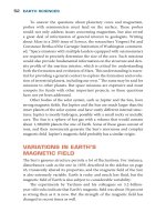
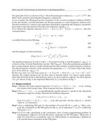
A technician at the
Geotechnic Research Center
in San Salvador, El Salvador,
monitors seismometer
recordings. (Yuri Cortez/
AFP/Getty Images)
FOS_Earth Science_DC.indd 172 2/8/10 10:59:47 AM
173
huge masses of water, but not all undersea earthquakes generate tsuna-
mis. Although it is not yet possible to tell from the seismic waves alone if
an earthquake will cause a tsunami, detection of an undersea earthquake
means that a tsunami is possible. Buoys and sensors to gauge the water
level provide more specic signs of a tsunami and can alert people along
low-lying coastal areas who are at risk. e Pacic and Atlantic Oceans
have tsunami warning systems, and now the Indian Ocean does also.
Systems based on science and technology are extremely useful, but
some observers claim that nature oers its own warning. For example, Sri
Lanka (formerly Ceylon), an island nation o the southern tip of India,
was in the path of the 2004 Indian Ocean tsunami, and Yala National
Park was hit hard—yet few animal carcasses were found, suggesting that
animals suered fewer casualties than humans. Many other reports and
observations through the years claim that certain animals behave strange
-
ly before the onset of seismic activity, as if they can sense the trouble
ahead—or the ground shaking—much sooner than people can.
WatCHdoGS: anIMal bEHaVIoR
PRECEdInG an EaRtHquakE
What could the animals at Yala National Park have sensed to send them
eeing for high ground? It is possible that seismic events such as the
undersea earthquake that caused the Indian Ocean tsunami may emit
low-frequency waves called infrasound. Infrasound refers to sound
waves having a frequency too low for most people to hear (
infra Latin
for “under” or “below”). Adult humans generally cannot hear sounds
with a frequency lower than 20 hertz (although children and young
adults oen do a little better, hearing sounds down to about 15 hertz).
But the hearing range of other animals extends into a lower range, and
elephants communicate with sounds as low as 5–10 hertz, possibly by
using their sensitive trunks or feet to detect low-frequency vibrations.
Vibrations of low frequency but high amplitude preceding the tsunami
may have spooked the elephants at Yala National Park and in other aected
areas, such as ailand. Eyewitness reports on the day of the disaster de
-
scribe agitated elephants eeing from coastal areas. is behavior may have
alerted other animals, or they may have also felt some kind of vibration.
Similar reports have linked agitated behavior of dogs, chickens,
bees, rats, and many other creatures to
impending earthquakes. Such
reports
have been made as long ago as 373
..., when rats and snakes
Predicting Earthquakes
FOS_Earth Science_DC.indd 173 2/8/10 10:59:47 AM
earth ScienceS
174
supposedly ed their burrows prior to a severe earthquake in Greece.
e USGS conducted some studies in the 1970s to test the possibility
that animal behavior may predict earthquakes, but these studies did not
nd any evidence to support the claim. Some researchers in China and
Japan continue to study animal behavior prior to earthquakes, but have
not found any convincing proof.
But the reports continue. Aer the Sichuan earthquake on May
12, 2008, stories in the news described unusual behavior of animals
in zoos or in the wild that had been noticed in the days leading up to
the earthquake, including zoo elephants that swung their trunks and
lions that paced their cages. e problem is that these reports almost
always come aer the fact. Some or even most of the reports may be
true, but even so they are not scientically signicant. ere are many
reasons why animals may become agitated—for example, the pres
-
ence or even just the scent of predators or prey would usually trigger a
similar response. But people will oen recall unusual animal behavior
only when it precedes an earthquake or some other memorable event,
not at other times, so such behavior becomes linked with
earthquakes
even though it happens frequently when there are no earthquakes.
As for the animals at Yala National Park, they may have simply been
able to outrun the waves, or if they failed to outrun them their car
-
casses may have washed out to sea, which would explain why few were
found.
Despite the lack of scientic evidence for animal predictions of
earthquakes, some animals do have extraordinary sensory powers.
Certain snakes can sense infrared radiation, migrating birds and other
animals can detect magnetic elds, and dolphins and bats use high-
frequency sounds waves to nd prey. Some animals may have special
senses that, on certain occasions, might allow them to feel imminent
earthquakes. e California Institute of Technology researcher Joseph
L. Kirschvink suggests that such sensory systems may have evolved
to give animals a greater chance of survival in earthquake-prone ar
-
eas. In an article titled “Earthquake Prediction by Animals: Evolution
and Sensory Perception,” published in a 2000 issue of the
Bulletin of
the Seismological Society of America, Kirschvink proposed that ani-
mals may have developed a variety of sensory mechanisms to predict
the onset of earthquakes. One of the most important mechanisms is
related to vibrations or early movements that may herald
the “main
event.”
FOS_Earth Science_DC.indd 174 2/8/10 10:59:47 AM
175
SIGnS oF an IMPEndInG EaRtHquakE
If certain types of animals are able to sense faint vibrations that may signal
further seismic activity, then scientists with their sensitive seismometers
should be able to do the same. e hypothesis is that these faint vibrations
precede a major earthquake at least on some occasions, which means they
can be used to predict when and where future earthquakes will occur. is
idea is an active area of research in the eld of earthquake prediction.
Earthquakes are well known to occur in clusters. e event of
highest magnitude is sometimes called the main shock, while smaller
earthquakes preceding it are called foreshocks and smaller earthquakes
following it are called aershocks. ese minor earthquakes may oc-
cur hours, days, or weeks before or aer the main shock. e diculty
with using foreshocks to predict large earthquakes is that small, random
earthquakes occur quite frequently; hundreds of thousands of little earth-
quakes happen throughout each year, while only a few major earthquakes
take place. A huge percentage of these low-magnitude earthquakes are
obviously not associated with any high-magnitude earthquake.
Yet there may be reasons for believing that some type of seismic ac-
tivity is common
before major earthquakes hit. An analogous situation
occurs with volcanoes, as magma owing beneath the surface generally
precedes major eruptions, and this ow generates weak seismic waves
known as tremors. Many people use the term tremor as a synonym for
earthquake, but geologists tend to use the term specically to refer to seis-
mic activity associated with the movement of magma. However, other
kinds of activity may induce faint seismic pulses such as tremors. Suppose
that as a fault starts to slip, it shudders or vibrates at a low frequency as
more and more rocks start to crack under the strain. is vibration may
emit low-amplitude seismic waves similar to tremors and would signal a
major fault slippage and a potentially destructive earthquake.
Researchers have begun looking into this possibility. In 2002 Ka-
zushige Obara, a researcher at the National Research Institute for Earth
Science and Disaster Prevention (NIED) in Japan, recorded unusual
tremors with NIED’s network of about 600 seismic stations scattered
throughout Japan. is sensitive network was designed to pick up small
earthquakes, and Obara found tremors typically lasting a few tenths of
a second up to a few seconds emanating from an area with no
volcanic
activity.
e tremors seemed connected to the subduction—sliding un
-
derneath—of the Philippine Sea tectonic plate under the Eurasian plate
that occurs in this part of Japan. Obara reported his nding in a
Sci-
Predicting Earthquakes
FOS_Earth Science_DC.indd 175 2/8/10 10:59:47 AM
earth ScienceS
176
ence paper, “Nonvolcanic Deep Tremor Associated with Subduction in
Southwest Japan.” Researchers have also discovered nonvolcanic trem-
ors in the Nankai Trough, a depression in the oor of the Pacic Ocean
o the southwest coast of Japan created by subduction.
Where exactly are these tremors coming from? David R. Shelly
(now working for USGS) and Gregory C. Beroza of Stanford University,
along with Satoshi Ide and Sho Nakamula at the University of Tokyo in
Japan, studied these seismic waves to determine their point of origin.
Since the waves are weak and episodic, tracing them to their source was
extremely dicult. Aer carefully analyzing more than 1,000 seismo
-
grams from the Nankai Trough recorded in 2002 to 2005, the research-
ers nally determined the arrival times of the waves and could trace
the source. e source turned out to be a region of the fault between
the two tectonic plates that has a pocket of uid under high pressure. A
lot of these waves had low frequencies. e researchers published their
results, “Low-Frequency Earthquakes in Shikoku, Japan, and eir Re
-
lationship to Episodic Tremor and Slip,” in a 2006 issue of Nature.
Shelly, Beroza, and Ide then analyzed the seismograms
to try to
determine
what was causing the tremors. Shelly and his colleagues
discovered that the time course of the tremors matched that of low-
frequency earthquakes in the region. Tremors seem to be swarms of small-
magnitude, low-frequency seismic events associated with movement
along the fault, but extremely slow movement—almost silent, in terms
of seismic activity, except for the faint vibrations. e researchers pub
-
lished their paper, “Non-Volcanic Tremor and Low-Frequency Earth-
quake Swarms,” in a 2007 issue of Nature.
is faint, low-frequency activity could be the beginning of a major
slippage, which means the tremors may prove important in earthquake
prediction, or the events may be part of a normal creaking and groaning
of a fault that has nothing to do with the next major earthquake. Per
-
haps this low-frequency activity intensies immediately prior to a se-
vere earthquake, and perhaps this activity is what agitates certain kinds
of animals just before the earthquake—or perhaps not. An important
goal of future seismological research is to address these issues.
Other researchers have based their eorts on the occurrence of seis
-
mic waves of higher amplitudes. ese researchers study the past seis-
mic activity of a region, as recorded on seismograms, to
determine what
activity
may occur in the future. For example, foreshocks preceding a
major earthquake may have particular patterns at particular faults, and
FOS_Earth Science_DC.indd 176 2/8/10 10:59:48 AM
177
if researchers can identify this pattern, they would be able to anticipate
which minor earthquakes will probably be followed by a major one.
But past performance is not necessarily a predictor of the future (as
stockbrokers and mutual fund managers oen say). Most geologists use
historical data to make forecasts rather than specic predictions. But earth
-
quake forecasts, like stock market forecasts, oen leave a lot to be desired.
EaRtHquakE FoRECaStS and
PRobabIlItIES
Prediction is not yet possible, and people who live in earthquake-prone
areas are apprehensive about the future. To keep these people as informed
as possible—and without possibly misleading them with specic predic
-
tions in which experts presently do not have much condence—Earth
scientists make forecasts. ese forecasts assess future hazards on the ba
-
sis of what has happened, or failed to happen, in the past. For example,
the 2008 report issued by USGS, California Geological Survey, and the
Southern California Earthquake Center announced that California has
more than a 99 percent chance of experiencing an earthquake of magni
-
tude 6.7 M
w
or greater in the next 30 years. e forecasters determined
this probability by studying the past frequency of earthquakes in Califor-
nia as well as slip rates of the major faults in the state.
Several factors govern the probabilities of the 2008 report and other
forecasts. Suppose, for instance, that an earthquake-prone area has been
hit with six earthquakes of magnitude 6.7 M
w
or better in the last 120
years. If those earthquakes occurred at random, then forecasters would
anticipate an earthquake of magnitude 6.7 M
w
or better to happen every
20 years or so.
But earthquakes of the past do not always strike at random intervals.
e current theory of seismology, which holds that most earthquakes
are due to the motion of tectonic plates as they grind or collide along
faults, indicates that fault slippage is a critical component. When fric
-
tion or rock protrusions arrest the motion along a fault, stress builds up,
like a spring being wound tighter and tighter. Stress is nally released
along the fault in a sudden spasm as the rocks crack or fail. is mecha
-
nism suggests that the severest earthquakes occur aer a quiet period,
accompanied by little or no seismic activity since the fault is not slip
-
ping. en, aer a period of years or decades of peace—and probably
Predicting Earthquakes
FOS_Earth Science_DC.indd 177 2/8/10 10:59:48 AM
earth ScienceS
178
just as the residents begin to forget that earthquakes happen—a sudden
rupture, perhaps preceded by tremors, generates a killer earthquake.
Normal slip rates for a given fault, averaged over time, can give ge
-
ologists a clue about whether movement has suddenly stopped. Records
of previous earthquakes, whether written down in recent history or sug
-
gested by geological studies of the ancient past, may also show an in-
dicative pattern of gaps in activity, followed by a series of earthquakes,
then another gap, followed by another series. Seismic activity in some
parts of California has this kind of pattern.
What part of California will be aected in the earthquake forecasted
in the 2008 report? Although forecasts can assign probabilities to dier
-
ent regions—for instance, the 2008 forecast indicated that Los Angeles
has a 67 percent chance of an earthquake of magnitude 6.7 M
w
or larger
in the next 30 years and San Francisco has a 63 percent chance—no
one knows for certain. e lack of certainty is reected in the probabili
-
ties. Overall, California will almost certainly be struck by a major earth-
quake in the next three decades, at least according to the 2008 forecast,
but forecasters can only make educated guesses as to where.
Earthquake forecasts
keep people alert and cognizant of future haz
-
ards, but forecasts lack specics. To do better than issuing probabilities
that apply to time frames extending decades into the future, researchers
must understand earthquakes and seismic activity much better. Specic
earthquake predictions have already been made on occasion, with mixed
success—and such predictions have consequences whether they are right
or wrong.
PREdICtIonS and ConSEquEnCES
A specic prediction states a future earthquake’s time of occurrence,
magnitude, and location. Given these three pieces of information, cit-
izens in the danger zone can take appropriate action to protect their
property as much as possible and then evacuate. Damage will be mini
-
mized and casualties will be few, if any.
e ability to make accurate earthquake predictions would confer
enormous benets, especially in those regions that are prone to earth
-
quakes, such as California and Japan. Scientists as well as people with
little scientic training are working toward this goal. Motivating some
of these people, at least to a certain extent, is the prospect of making a
great deal of money if a successful prediction scheme is patented and sold
FOS_Earth Science_DC.indd 178 2/8/10 10:59:49 AM
179
to governments or private institutions. As a result of these strong incen-
tives, arising from both philanthropy and personal gain, a large number
of prediction methods have been proposed. Some of these methods, such
as those based on animal behavior, incorporate observations and make
some attempt at scientic validity, while others defy logic and reason and
will not be reviewed here. No method has proven adequate.
is is not to say that there have been no successful predictions. e
best-known success came in 1975, when Chinese ocials evacuated the
city of Haicheng, with a population of roughly 1 million, in northeast Chi-
na. In the months preceding the evacuation order, seismologists detected a
distinct increase in minor earthquakes in the region, which scientists inter
-
preted as foreshocks, and many animals exhibited strange behavior—rats
and snakes appeared dazed and chickens would not stay in their coops.
ere were also reports of changes in surface elevation and water levels.
On February 4, 1975, at 7:36
.. (local time), the day aer the government
issued the evacuation order, an earthquake of magnitude 7.3 on the Richter
scale shook the area. Such a major earthquake would have caused tens of
thousands of deaths, possibly even 100,000,
but due to the timely evacua
-
tion, the city only suered 2,041 fatalities and about 25,000 injured.
e success at Haicheng in 1975 may have given Chinese scientists
condence, but it did not last long. On July 28, 1976, at 3:42 .. (local
time), an earthquake of magnitude 7.8 on the Richter scale hit the Chi-
nese city of Tangshan. No warning signs had been noted and no alarms
had been raised. Tangshan’s population at the time of the earthquake
was about the same as Haicheng’s, but the residents of Tangshan were
unprepared, and the fatalities numbered some 250,000.
e failure to warn Tangshan, just a year and a half aer a brilliant suc
-
cess at Haicheng, highlights the diculties of earthquake prediction and
the spotty record of those who have thus far attempted it. In addition to
unforeseen earthquakes, predictions have sometimes warned about earth
-
quakes that failed to materialize, at least in the postulated time frame. In
1985 USGS warned the region around Parkeld, California, a small town
in Monterey County, that an earthquake of magnitude 6.0 M
w
was highly
likely to occur between 1986 and 1993. e region had experienced a num-
ber of earthquakes of similar size
in the recent past, the last (at the time of
the prediction) coming in 1966. A 6.0 M
w
earthquake did strike Parkeld,
but the day was September 28, 2004, more than a decade aer the warning
had expired. e prediction did an excellent job on the magnitude—it was
right on the money—but not so well on the time of the event.
Predicting Earthquakes
FOS_Earth Science_DC.indd 179 2/8/10 10:59:49 AM
earth ScienceS
180
Inaccurate predictions either give a false sense of security when they
fail to predict an earthquake or raise a false alarm when they predict an
earthquake that does not show up. e stakes are high.
Some researchers are pessimistic about ever developing a reliable
method for predicting earthquakes. Similar to stock markets and weath-
er systems, the dynamics underlying tectonic plate motion and associ-
ated earthquakes may be too complex and involve too many variables
for precise predictions. In 1999 the journal
Nature sponsored a debate
over the question, “Is the reliable prediction of individual earthquakes a
realistic scientic goal?” Several researchers weighed in. Robert J. Geller
of Tokyo University summarized why earthquake prediction is so dif
-
cult: “e Earth’s crust (where almost all earthquakes occur) is highly
heterogeneous, as is the distribution of strength and stored elastic strain
energy. e earthquake source process seems to be extremely sensitive
to small variations in the initial conditions (as are fracture and failure
processes in general). ere is complex and highly nonlinear interac
-
tion between faults in the crust, making prediction yet more dicult.”
Geller oered a pessimistic appraisal: “In short, there is no good reason
to think that earthquakes ought to be predictable in the rst place.”
Other researchers
were less gloomy. Max Wyss of the University of
Alaska acknowledged the diculties, yet was hopeful over the long term
because “there can be no doubt that a preparatory process to earthquake
rupture exists (foreshocks demonstrate this), and I am condent that in-
genious and resilient people, who will come aer us and will be amused by
this tempest in a teapot about the prediction of earthquakes, will eventu-
ally improve our ability to predict some earthquakes in favourable areas.”
Perhaps scientists and engineers should invest more time and ef-
fort into construction techniques rather than prediction methods. Aer
all, buildings and bridges must withstand earthquakes—they cannot be
evacuated even if an accurate prediction formula is developed—and re
-
inforced structures would be less likely to fall, which would greatly mini-
mize casualties.
But some researchers continue to remain optimistic about the possi-
bility of earthquake prediction. Faint rumblings or low-frequency vibra-
tions, such as those studied by Shelly, Beroza, Ide, Nakamula, and other
researchers, oer hope of improved prediction techniques. Other strate
-
gies include looking for signs of stress at faults that have been associated
with previous earthquakes, which may indicate that pressure is
starting to
build—and that the clock is ticking until the next major event.
FOS_Earth Science_DC.indd 180 2/8/10 10:59:49 AM
181
StRaIn aCCuMulatIon and SuRFaCE
dEFoRMatIon
Tectonic plate movement exerts tremendous forces on rocks along the
boundaries and at faults, where slabs of Earth’s crust bump and grind
past one another. Although rocks are extremely hard objects, the forces
are so great that strain develops—a change in shape as the rocks bend
or become compressed. ese changes are measurable indicators of tec
-
tonic tension—and an earthquake waiting to happen.
As mentioned earlier, geologists measure fault slippage aer an
earthquake has occurred in order to gauge the magnitude of the event,
and earthquake forecasters take into account fault slippage rates when
estimating the chances of future events. Measuring strain is also possible,
although the deformations tend to be slight. Rocks bulge, bend, or com
-
press, but it does not take much beyond a small change in shape before
the breaking point is reached. At this point, rupture and an earthquake
ensue, followed by a quiet period as the strain accumulates once again.
In conjunction with its earthquake prediction at Parkeld in the
1980s, USGS performed extensive monitoring of this region. Parkeld is
located along the San Andreas Fault. Since forecasters expected an earth
-
quake, researchers
at USGS
and the California Geological Survey wanted
to keep a close watch. Seismic instruments to monitor the area had been
sparse prior to the prediction, but beginning in 1985 scientists established
dozens of monitoring stations around a 15.6-mile (25-km) stretch of the
San Andreas Fault near Parkeld. Instruments included seismometers to
detect seismic waves, strain meters to measure rock deformation, creep
meters to measure fault oset, and global positioning system (GPS) re
-
ceivers to indicate precise positions. Although the earthquake came later
than expected, when it nally arrived it was caught on tape, that is, re
-
corded by the numerous instruments.
e data obtained with these instruments give scientists one of their
best looks at earthquake processes and should help them better under
-
stand fault slips, particularly those that occur along the San Andreas
Fault. But even more data is needed. To get a view closer to the focus
of earthquakes around the Parkeld area, researchers have to dig into
the ssure. As described in the following sidebar, the San Andreas Fault
Observatory at Depth (SAFOD) is a project to study the processes deep
within the fault that generate earthquakes.
Learning about fault slips and movements requires painstaking eorts,
and not much
data is available for most faults. Although the Parkeld and
Predicting Earthquakes
FOS_Earth Science_DC.indd 181 2/8/10 10:59:50 AM
earth ScienceS
182
SAFOD projects should rectify this problem for at least part of the San An-
dreas Fault, other active regions are much more thinly instrumented. But
recently geologists have circumvented some of the di culties by partner-
ing with NASA and getting a bird’s-eye view (or rather a satellite’s).
An important indication of stress is deformation. One of the ad-
vantages satellites provide is the ability to examine a broad area for any
gradual shi in surface features. One of the tools satellites use to do this
is called interferometric synthetic aperture radar. is imaging system
bounces electromagnetic radiation from the surface and uses a property
of the re ected waves known as interference to make precise measure-
ments of surface elevation. Some systems have a sensitivity of about
San Andreas Fault Observatory at
Depth (SAFOD)
The Parkfi eld earthquake prediction missed the mark by about
11 years, but the widely anticipated event drew the attention
and instrumentation of about 100 earthquake researchers
to the area. After nearly 20 years of experience at the San
Andreas Fault near Parkfi eld, researchers decided to probe
deeper. In the summer of 2002, researchers drilled a 1.4-
mile (2.2-km) vertical hole near (but not at) the fault. Funding
this work was the International Continental Scientifi c Drilling
Program, a multinational effort to promote geological stud-
ies involving drilling. This hole was a pilot project, designed
to test researchers’ equipment and their capacity to conduct
experiments at the fault itself. After its success, research-
ers began drilling a deeper hole in June 2004, to install
instruments into and across the fault.
This project is called the San Andreas Fault Observa-
tory at Depth. While much seismological research relies
on instruments placed at the surface or not far below, this
project aimed to monitor fault movement deep below the
surface. The National Science Foundation (NSF), one of the
FOS_Earth Science_DC.indd 182 2/8/10 10:59:50 AM
183
0.04 inches (0.1 cm) under certain conditions, which means that if the
surface moves by that amount, a satellite using this equipment can de-
tect it by comparing its present location with previous images or maps.
Satellite imagery, along with data and tools discussed earlier in this
chapter, have been integrated into an earthquake model program called
QuakeSim. Researchers at NASA, the University of Colorado, and other
institutions developed these computer simulations and algorithms to
study fault mechanisms and associated earthquakes. Although the simu
-
lator does not predict earthquakes, it does identify regions where ma-
jor earthquakes are expected. e researchers, led by John B. Rundle of
the University of Colorado, described general approaches to modeling
main government agencies that funds scientific research in
the United States, provided funding for this phase of the
project, along with USGS. After reaching a vertical depth of
about 5,000 feet (1,520 m), the drillers angled the hole to
about 55 degrees, heading toward the fault zone. On Sep-
tember 28, 2004, the long-anticipated earthquake struck,
and the drill site got quite a shaking but sustained little dam-
age. The project continued, and the hole crossed the fault
zone at a vertical depth of about 10,000 feet (3,050 m).
During several phases of the project, researchers col-
lected sample cores (cylindrical sections of rock cut out by
a drill pipe). As geologists analyze the chemical composition
and mechanical properties, they will learn more about the
stresses to which rocks at the fault are subjected. This infor-
mation is vital because ruptures in this area are the source
of major earthquakes. In September 2007, the drill team
finished up at the site by installing instrumentation at about
10,500 feet (3,200 m). The instruments included seismom-
eters, accelerometers to measure sudden movement, tilt-
meters to measure angle, and a pressure transducer. Over
the coming years, data collected from this site will give ge-
ologists a glimpse of the mechanisms acting directly inside
the fault.
Predicting Earthquakes
FOS_Earth Science_DC.indd 183 2/8/10 10:59:50 AM
earth ScienceS
184
complicated systems occurring in geology and biology in a paper, “Self-
Organization in Leaky reshold Systems: e Inuence of Near-Mean
Field Dynamics and Its Implications for Earthquakes, Neurobiology, and
Forecasting,” in a 2002 issue of
Proceedings of the National Academy of
Sciences. e paper included a map of central and southern California
that specied small areas likely to be struck by an earthquake of at least
magnitude 5. e majority of earthquakes since the researchers issued
this report have taken place in the identied locations.
Incorporating crustal deformation and other data from faults will
improve earthquake forecasts as well as models and simulations. Shi
-
mon Wdowinski at the University of Miami in Florida and colleagues
at the Scripps Institution of Oceanography compared recent models of
faults such as the San Andreas Fault with precise measurements of the
faults over the last two decades. Although the models were oen ac
-
curate, there was a signicant dierence between fault movements in
the models and the observed behavior at a specic section of the San
Andreas Fault and a few other places. To eliminate this discrepancy,
Wdowinski and his colleagues believe that the models need to include
more data on crust strength and stress. e researchers published their
report,
“Diuse Interseismic Deformation across the Pacic-North
America Plate Boundary,” in a 2007 issue of
Geology.
Monitoring faults from the surface, inside deep holes, and from
space will give researchers a great deal of valuable information on the
structure, physics, and motion of these earthquake generators. e
question is whether this data and its subsequent analysis will be su
-
cient to develop an accurate prediction method. e research described
above indicates the increase in knowledge should result in improved
earthquake forecasts, but specic predictions—time, date, place, and
magnitude—may or may not be possible.
ConCluSIon
Centuries of research, beginning with observations of the ancient Greeks
and probably long before, have led to a detailed though still incomplete
understanding of earthquakes. Earthquakes strike much more oen in
some areas of the world than others, and scientists have traced most
earthquakes to their origin—the faults along tectonic plate boundaries,
where huge slabs of slowly moving rocks collide or grind past one an
-
other. By monitoring faults that are particularly earthquake prone, re-
FOS_Earth Science_DC.indd 184 2/8/10 10:59:51 AM
185
searchers have gained enough clues to permit reasonably accurate fore-
casts, though these forecasts are probabilistic, lacking the certainty of a
specic prediction.
New ideas are necessary before accurate earthquake predictions can
be achieved, if they ever can be. One proposal involves monitoring the
entire globe from space. In 2003, a panel of scientists led by Carol A. Ray
-
mond, Soren Madsen, and Wendy Edelstein of NASA’s Jet Propulsion
Laboratory issued a report, “Global Earthquake Satellite System,” outlin-
ing a plan to implement a satellite monitoring system. Some of the tools
needed for this system to work, such as interferometric synthetic aperture
radar, already exist, but the plan calls for further investment to develop
lightweight steerable antennas, low-power radar electronics, and faster
data processing systems for advanced surveillance and image analysis.
For the plan to be eective, NASA would need to launch a number of
satellites dedicated to the mission. e required number depends on al-
titude—higher altitudes enable a satellite to observe and monitor a larger
region, but the costs of launch and maintenance increase with altitude
(more energy is needed to place satellites in orbit and to communicate
with them, due to the greater distances involved). A few
satellites at high-
altitude
orbits could cover the globe, but a larger number of low-orbit
satellites would be required for full coverage. At a minimum, two satel
-
lites at an altitude above 620 miles (1,000 km) are needed to make sure
researchers could observe any surface on Earth in a 24-hour time frame.
Global satellite monitoring with sensitive radar would give geologists
the capacity to study the strain and deformation preceding earthquakes
anywhere in the world. is information could provide the means to un-
derstand more fully the process by which stress builds up and is then
relieved with an earthquake-producing rupture. Although dierent faults
may follow slightly dierent rules, depending on the nature of the move
-
ment and the composition of the rocks, earthquake prediction for many
or even most of the world’s earthquake zones may become possible.
Worldwide coverage is necessary because earthquakes can strike out
-
side of well-known earthquake zones. For instance, at 4:37 .. on April
18, 2008, an earthquake of magnitude 5.2 M
w
struck southern Illinois,
close to the Indiana border. Although the region is far from any plate
boundary, it is close to the Wabash Valley Fault, the earthquake’s origin,
which is an example of a fault within the body of a plate—an intraplate
fault, most of which are not well understood. Residents escaped with only
slight damage—this time.
Predicting Earthquakes
FOS_Earth Science_DC.indd 185 2/8/10 10:59:51 AM
earth ScienceS
186
At present, the global earthquake satellite system is not funded, and
no start date has been set, since funding agencies are unsure if earth-
quake prediction is even feasible. e complexity of tectonic motion
and faults, which has only been sketched in this chapter, may defeat any
and all attempts at precise earthquake prediction. But no one can say
for certain at this point. Perhaps people would be willing to settle for a
system that is accurate most of the time, even though this means some
earthquakes would occur unexpectedly and some false alarms would be
raised. Considering the importance of advanced warning in minimiz
-
ing damage and saving lives, at least a few scientists at the frontiers of
Earth science will continue working toward this goal.
CHRonoloGy
373 b.c.e. People living in Greece notice peculiar behavior in
animals prior to an earthquake.
1760
c.e. e British scientist John Michell (1724–93) proposes
that subsurface motions of rocks cause earthquakes.
1870s Italian researchers such as Filippo Cecchi (1822–
87) begin making early versions of seismometers.
1895 e Scottish-American geologist Andrew Lawson
(1861–1952) discovers the northern portion of the
San Andreas Fault.
1897 e German scientist Emil Wiechert (1861–1928)
fashions
a seismometer that is able to record through-
out an earthquake episode (without breaking!).
1902 e Italian researcher Giuseppe Mercalli (1850–
1914) designs a scale to measure earthquake intensity
based on eyewitnesses and observational evidence.
1906 A powerful earthquake strikes San Francisco, Cali-
fornia, damaging buildings and causing res that
destroyed much of the city and claimed about
3,000 lives.
FOS_Earth Science_DC.indd 186 2/8/10 10:59:51 AM
187
1910 e American geologist Henry F. Reid (1859–1944)
proposes the elastic rebound theory of earthquakes.
1931 e American seismologists Harry Wood and Frank
Neumann modify the Mercalli scale, categorizing
the intensity of earthquakes by Roman numerals
from I to XII, with XII being the maximum.
1935 e American seismologist Charles Richter (1900–
85) and the German-American seismologist Beno
Gutenberg (1889–1960) develop an earthquake
magnitude scale based on the amplitude of the vi
-
brations as measured by their seismograph.
1975 Chinese scientists observe surface deformation and
other signs of an impending earthquake and evacu-
ate the city of Haicheng. A day later, an earthquake
of magnitude 7.3 on the Richter scale strikes, but the
city suers few casualties due to the early warning.
1976 An earthquake of magnitude 7.8 on the Richter
scale hits the Chinese city of Tangshan without
warning, killing about 250,000 people in one of the
worst natural disasters of the 20th century.
1979 e American seismologist omas Hanks and the
Japanese seismologist Hiroo Kanamori introduce
the moment magnitude scale for earthquake inten
-
sity, which most seismologists now prefer to use.
2007 Japan completes installation of a network of seis-
mic sensors in the attempt to provide its
citizens
with
at least a few seconds warning before a major
earthquake hits.
USGS sta nish placing seismic monitoring instru
-
ments deep within the San Andreas Fault, part of the
San Andreas Fault Observatory at Depth project.
2008 USGS announces an earthquake forecast that
warns of a 99 percent probability of an earthquake
Predicting Earthquakes
FOS_Earth Science_DC.indd 187 2/8/10 10:59:52 AM
EARTH SCIENCES
188
of magnitude 6.7 M
w
or greater in California in the
next 30 years.
FuRtHER RESouRCES
Print and Internet
Bolt, Bruce. Earthquakes, 5th ed. New York: W. H. Freeman, 2003. Ex-
cellent for students but not too technical, this book guides readers
through the science of seismology.
Exploratorium Learning Studio. “Earthquakes.” Available online. URL:
Accessed
May 4, 2009. e Exploratorium, a museum of science, art, and per-
ception in San Francisco, has maintained an excellent online presence
since 1993. ese pages discuss earthquake mythology, history, Rich-
ter scale, plate tectonics, seismology, and many other relevant topics.
Geology.com. “Eastern Sichuan, China Earthquake.” Available online.
URL: Accessed
May 4, 2009. is article summarizes the Sichuan earthquake of May
12, 2008.
Global Earthquake Satellite System. “A 20-Year Plan to Enable Earth
-
quake Prediction.” March 2003. Available online. URL: http://
solidearth.jpl.nasa.gov/GESS/3123_GESS_Rep_2003.pdf. Accessed
May 4, 2009. is 2.8 megabyte le describes an ambitious plan to use
satellite technology to develop an earthquake prediction method.
Guardian.co.uk. “ousands Die in China Quake.” May 13, 2008. Avail-
able online. URL: />china.naturaldisasters. Accessed May 4, 2009. is article reports on
the massive earthquake that struck China on May 12, 2008.
Hough, Susan Elizabeth. Earthquaking Science: What We Know (and
Don’t Know) about Earthquakes. Princeton, N.J.: Princeton Univer-
sity
Press, 2002. is accessible book, written by a geophysicist, ex-
plains the current theory of earthquakes and oers a chapter on the
ultimate goal of seismologists—earthquake prediction.
———. Finding Fault in California: An Earthquake Tourist’s Guide. Mis-
soula, Mont.: Mountain Press Publishing, 2004. If a person wants to
FOS_Earth Science_DC.indd 188 2/8/10 10:59:52 AM
189
see what a fault really looks like, then visiting California is a wise
choice. is book will tell the reader how to nd the faults and what
to look for.
Jet Propulsion Laboratory. “QuakeSim.” Available online. URL: http://
quakesim.jpl.nasa.gov/. Accessed May 4, 2009. QuakeSim is project
of JPL—a NASA research center—incorporating data from satellite
imagery, seismometers, and previous earthquake frequencies into a
computerized earthquake model to identify areas of potential seis
-
mic activity. is Web resource gives the details and an updated
scorecard to determine how well they are doing.
Kirschvink, Joseph L. “Earthquake Prediction by Animals: Evolution
and Sensory Perception.” Bulletin of the Seismological Society of
America 90 (2000): 312–323. e author describes what is known
about the study of animal behavior to predict earthquakes and hy-
pothesizes about the mechanisms animals could possibly use to
sense early signs of earthquakes.
National Aeronautics and Space Administration. “Global Earthquake
Satellite System.” Available online. URL: a.
gov/gess.html. Accessed May 4, 2009. e goal is to develop a satel
-
lite-based system to monitor the entire world for surface strain or
deformation that could predict the sites of future earthquakes. A
link to a 104-page report is included.
Nature.com. “Is the Reliable Prediction of Individual Earthquakes a Real-
istic Scientic Goal?”
February 25,
1999. Available online. URL: http://
www.nature.com/nature/debates/earthquake/equake_frameset.html.
Accessed May 4, 2009.
Nature sponsored an open debate to discuss the
possibility of developing accurate methods of earthquake prediction.
Obara, Kazushige. “Nonvolcanic Deep Tremor Associated with Subduc-
tion in Southwest Japan.” Science 296 (May 31, 2002): 1,679–1,681.
Obara recorded unusual tremors in a network of about 600 seismic
stations scattered throughout Japan and found tremors typically
lasting a few tenths of a second up to a few seconds that emanated
from an area with no volcanic activity.
Rundle, J. B., K. F. Tiampo, W. Klein, and J. S. Sá Martins. “Self-Orga
-
nization in Leaky reshold Systems: e Inuence of Near-Mean
Field Dynamics and Its Implications for Earthquakes, Neurobiology,
and Forecasting.”
Proceedings of the National Academy of Sciences 99
Predicting Earthquakes
FOS_Earth Science_DC.indd 189 2/8/10 10:59:52 AM
earth ScienceS
190
(February 19, 2002): 2,514–2,521. e researchers describe general ap-
proaches to modeling complicated systems occurring in geology and
biology.
ScienceDaily. “California Has More an 99% Chance of a Big Earth-
quake Within 30 Years, Report Shows.” News release, April 15,
2008. Available online. URL: />2008/04/080414203459.htm. Accessed May 4, 2009. is news re-
lease summarizes a report of the USGS, California Geological Sur-
vey, and Southern California Earthquake Center.
Shelly, David R., Gregory C. Beroza, Satoshi Ide. “Non-Volcanic Trem-
or and Low-Frequency Earthquake Swarms.” Nature 446 (March
15, 2007): 305–307. e researchers discovered that the time course
of certain tremors match that of low-frequency earthquakes in the
region.
Shelly, David R., Gregory C. Beroza, Satoshi Ide, and Sho Nakamula.
“Low-Frequency Earthquakes in Shikoku, Japan, and eir Rela-
tionship to Episodic Tremor and Slip.” Nature 442 (July 13, 2006):
188–191. e researchers studied more than 1,000 seismograms
from the Nankai Trough recorded in 2002–05 and traced the source
of low-frequency earthquakes to a region of a fault between two tec
-
tonic plates that has a pocket of uid under high pressure.
Ulin, David L. e Myth of Solid Ground: Earthquakes, Prediction, and
the Fault Line Between Reason and Faith. New York: Viking, 2004.
e ability to predict earthquakes has eluded even the brightest ge-
ologists,
but the
importance of making accurate predictions has en-
couraged many people, including those with little training or scientic
acumen, to give it a shot. Ulin introduces the subject, along with the
scientic—and sometimes unscientic—methods and theories.
United States Geological Survey. “Earthquake Hazards Program.”
Available online. URL: Accessed May
4, 2009. An important task of USGS is to monitor earthquakes
across the globe. is Web resource describes this process as well as
providing a ton of basic information on earthquake and earthquake
research, including a section on earthquake prediction.
———. “San Andreas Fault.” Available online. URL: s.
gov/gip/earthq3/contents.html. Accessed May 4, 2009. ese pages
FOS_Earth Science_DC.indd 190 2/8/10 10:59:52 AM
191
describe this long, prominent fault of California and its important
seismological properties.
———. “San Andreas Fault Observatory at Depth.” Available online. URL:
Accessed May 4, 2009. e USGS oers a description of the San
Andreas Fault Observatory at Depth (SAFOD) project, including
an overview and site characterization studies.
———. “USGS Earthquake Magnitude Policy.” Available online. URL:
Accessed May 4, 2009. USGS describes its policies regarding the
techniques used to measure magnitude.
Virtual Museum of the City of San Francisco. “1906 Earthquake and Fire.”
Available online. URL: Ac
-
cessed May 4, 2009. Time lines, historic newspaper clippings, eyewit-
ness accounts, lists of casualties, re and police department reports,
engineering and scientic reports, relief eorts, and a large collection
of photographs tell the story of the disaster and its aermath.
Wdowinski, Shimon, Bridget Smith-Konter, Yehuda Bock, and David
Sandwell. “Diuse Interseismic Deformation across the Pacic-
North America Plate Boundary.”
Geology 35 (2007): 311–314. e
researchers compared recent models of faults such as the San An-
dreas Fault with precise measurements of the faults over the last two
decades.
Winchester, Simon. A Crack in the Edge of the World: America and
the Great California Earthquake of 1906. New York: HarperCollins,
2005. e disastrous 1906 earthquake le San Francisco mostly rub-
ble, as buildings collapsed and res raged out of control. Winchester
revisits
the carnage and discusses the subsequent geological investi
-
gation of the San Andreas Fault.
Predicting Earthquakes
FOS_Earth Science_DC.indd 191 2/8/10 10:59:52 AM
192
FINAL THOUGHTS
Of all the puzzles at the frontiers of Earth science, perhaps the most intrigu-
ing is how life arose on the planet. Plants and animals reproduce their own
kind, though sometimes with variations, as the British naturalist Charles
Darwin (1809–82) recognized when he proposed the theory of evolution.
is process explains how life maintains itself and evolves over time, but it
does not explain how it got started in the rst place.
Where and how life originated is a fascinating topic for many reasons
and has special meaning because the solution to the mystery will reveal
much about the nature of life, including the species known as Homo sa-
piens—modern humans. It is also a controversial topic, since the genesis
and nature of life, particularly Homo sapiens, is also the province of reli-
gion. e author of this book has no intention of denigrating any form
of religious belief, but scienti c evidence, including studies of radioactive
isotopes, clearly indicates that Earth is about 4.5 billion years old, and fos-
sils document the evolution of life on the planet.
No one knows exactly when life began on Earth. Ancient fossils are dif-
cult to nd, and the fossil record that scientists have uncovered to date is
incomplete. And since early organisms were tiny, researchers have trouble
distinguishing the remains of ancient life from the artifacts of chemical or
geological processes. e oldest fossils are presently the subject of debate,
but relics of ancient microbes have been discovered in rocks as old as 3 bil-
lion years. Life began early in Earth’s history—at least 3 billion years ago,
and possibly quite earlier.
Billions of years ago, Earth was much di erent than it is today. Geolo-
gists believe the atmosphere during this time came from volcano outgas-
FOS_Earth Science_DC.indd 192 2/8/10 10:59:53 AM
192
193
sing, which would have contained carbon dioxide, nitrogen, hydrogen,
water vapor, and a few other substances. Hydrogen is so light that some
of it escaped, and some of it combined with carbon or nitrogen to form
methane or ammonia, among other hydrogen-containing compounds.
Oxygen came later, as a by-product of the photosynthesis of plants.
e exact composition of the early atmosphere is unknown, but
in 1953 Stanley Miller (1930–2007), a graduate student studying un-
der Professor Harold Urey (1893–1981) at the University of Chicago,
reported an astonishing experiment in which he assumed the early at-
mosphere had abundant hydrogen compounds. (Hydrogen-rich atmo-
spheres are called reducing atmospheres, since their chemistry would
involve reducing reactions, as opposed to oxidizing reactions.) Miller
put water, hydrogen, methane, ammonia, and carbon monoxide in a
sterilized ask and then exposed the contents to electric sparks that
simulated lightning. e water turned brown a few weeks later. Analyz-
ing the contents, he found a large number of organic—carbon-contain-
ing—compounds, including several di erent types of amino acids, the
building blocks of proteins.
e experiments of Miller and Urey suggested that molecules critical
for life could have developed from simple reactions in a reducing envi-
ronment. Although the experiments did not create life itself, they sug-
gested how the vital components could have arisen. Interactions among
these components presumably led to life, some time in the distant past.
But Earth may not have had such a reducing atmosphere in its early
days. Some researchers have returned to the experiments of Miller and
Urey, but with the focus on a speci c instigator—volcanic activity.
Adam P. Johnson, a graduate student with the NASA Astrobiol-
ogy Institute at Indiana University, and Je rey L. Bada at the Scripps
Institution of Oceanography came across some material le over from
Miller’s 1950s experiments. Miller had moved to the University of Cali-
fornia, San Diego, in 1960, and Bada was a graduate student in his labo-
ratory in 1965–68. In an interview for a NASA press release on October
16, 2008, Bada said, “Stanley and I continued to work on various proj-
ects until he died in 2007. When Adam and I found the samples from
the original experiments, it was a great opportunity to reanalyze these
historic samples using modern methods.”
In some of the experiments, Miller had simulated volcanic erup-
tions by injecting steam into the apparatus. Johnson, Bada, and their
Final Thoughts
FOS_Earth Science_DC.indd 193 2/8/10 10:59:53 AM
earth ScienceS
194
colleagues focused on these experiments because they felt that condi-
tions during a volcanic eruption would be most likely to resemble the
gaseous composition that Miller had chosen. Miller had found ve
dierent kinds of amino acids when he analyzed the results of these
experiments, but Johnson, Bada, and their colleagues found 22 amino
acids when they used the more sensitive instruments available today.
e amount of amino acids these volcanic experiments produced was
at least as great and sometimes greater than in other experimental ar
-
rangements. Johnson, Bada, and their colleagues published their nd-
ings, “e Miller Volcanic Spark Discharge Experiment,” in a 2008
issue of
Science.
e focus on volcanoes is important, because volcanoes emit a con-
siderable amount of hydrogen. In their paper, the researchers noted,
“Geoscientists today doubt that the primitive atmosphere had the high
-
ly reducing composition Miller used. However, the volcanic apparatus
experiment suggests that, even if the overall atmosphere was not reduc
-
ing, localized prebiotic synthesis could have been eective.” In other
words, volcanoes and their emissions would have provided the essential
conditions in which molecules critical to the development of life could
have formed.
e results of this study mark an
important step
toward the eventu
-
al solution to the question of life’s origins, but nobody can be certain in
what direction future experiments and theory will go. Life began under
special circumstances and at a slow speed, at least in terms of human
lifetimes, so replicating the entire process in a laboratory is not possible
at the present time. And a new form of life would be highly unlikely to
arise these days, due to Earth’s altered conditions and the presence of so
much preexisting life that would eat it.
Some people propose that life did not begin on Earth at all, but
came from space in some form, perhaps hitching a ride on meteorites.
But this theory, called panspermia, merely extends the mystery to an
-
other place, for one can ask how life arose there as well. Since there is no
convincing evidence that life came from elsewhere, the simplest expla
-
nation at present is that life on Earth originated here on the planet.
e rise of life, in which large, organic molecules seemed to have
pulled themselves up “by their bootstraps” into living organisms, is a
perplexing question at the frontier of science. Progress toward a solu
-
tion of this mystery would help people learn a great deal about the na-
FOS_Earth Science_DC.indd 194 2/8/10 10:59:54 AM
195
ture of living organisms. Perhaps life is an inevitable process, which
takes place almost everywhere it can get a foothold, in which case the
search for life beyond Earth will one day be successful. Or perhaps life
on Earth is due to a juxtaposition of so many unlikely events that Earth
is the only inhabited planet in the universe.
Research into life’s origins may reveal not only how life got started,
but under what conditions it could possibly end. Considering the global
changes Earth is currently experiencing, this issue might be the most
relevant of all.
Final Thoughts
FOS_Earth Science_DC.indd 195 2/8/10 10:59:54 AM