The next great telecom revolution phần 7 ppsx
Bạn đang xem bản rút gọn của tài liệu. Xem và tải ngay bản đầy đủ của tài liệu tại đây (314.17 KB, 25 trang )
ASSET TRACKING 131
In fact, UWB transmissions pose so little threat of interference with licensed
frequencies that the FCC now allows companies to operate UWB technology
within the 3-GHz to 10-GHz range without obtaining radio spectrum licenses.
The bandwidth of UWB signals is so wide that signal energy is available for
use at both high and low frequencies. “The low-frequency content of UWB
devices can penetrate solid structures,” says Buehrer, an assistant professor of
electrical and computer engineering and the project’s principal investigator.
That would make UWB highly useful for transmitting signals through build-
ings and other manmade and natural obstacles. “Additionally, the high-
frequency content can detect the details of objects,” notes Buehrer. This
capability, combined with the technology’s low power, makes UWB radar an
excellent surveillance tool.
UWB also has the potential to become a significant military communica-
tions medium. “Because of the low level of energy in UWB signals, a military
unit using the technology could communicate without a nearby enemy even
perceiving that transmissions are taking place,” says Buehrer.
UWB also has many commercial applications. For example, most home
wireless devices, such as television remote controls, are limited in the amount
of data they can send and receive. UWB signals can achieve significantly
higher data rates. As a result, there’s a potential for UWB wireless home com-
puter networks, wireless camera-to-computer downloads, and wireless con-
nections to thin-screen wall-mounted televisions.
In the project’s first phase, Buehrer and his colleagues will develop models
to show the characteristics of UWB-transmitted pulses and how the pulses will
look to receivers. “We’ll discover what receivers see when they encounter
UWB signals,” Buehrer says. The research team hopes to continue the project
into a second phase, during which they would use the models developed in the
first phase to design UWB receivers. The project is funded by a $750,000 grant
from the Defense Advanced Research Projects Agency (DARPA).
Buehrer believes that the FCC will continue to allow UWB devices to
operate without licenses, which should help the technology proliferate.“UWB
already has a long history,” he notes. “The technology has been used in radar
devices for some time. Actually, it’s been around since Marconi transmitted
the first telegraph signals.”
6.4 ASSET TRACKING
The Telecosmos promises to give people and businesses unprecedented
control over physical assets. In the years ahead, wireless sensors will help
organizations track and monitor everything from vending machines to
roadways.
Radio Frequency Identification (RFID) has existed for at least a decade,
yet the technology has never lived up to its proponents’ expectations. “It’s
always something that’s ‘the next big thing,’ ” says Jeff Woods, a senior analyst
c6.qxd 8/30/04 2:38 PM Page 131
at Stamford, Connecticut-based Gartner. Like others who follow the industry,
Woods believes that RFID’s acceptance has been hampered by a number of
factors, including high costs, a lack of standards, and global radio frequency
differences that sometimes prevent businesses from shipping RFID-tagged
objects between countries.
Two separate mandates for 2005, set by Wal-Mart and the U.S. Department
of Defense (DoD)—both requiring suppliers to embrace RFID—have pushed
the technology into the public eye. As a result, RFID is rapidly moving from
a company science experiment to boardroom priority, with a focus on improv-
ing enterprise-wide operations. Manufacturers and the suppliers to Wal-Mart
and the DoD are diving into an increasingly busy RFID market already brim-
ming with developing standards, large company entrants, start-up software
developers, and numerous systems integrators. Despite some recognizable
large company names, success is still to be determined, says Erik Michielsen,
a senior analyst with technology research ABI, based in Oyster Bay, New York.
Texas Instruments, Symbol Technologies, NCR, Philips, and Sun Micro-
systems are only some of the big-name companies that have entered the world
of RFID. Some recognizable names have entered the RFID fray as systems
integrators, namely, IBM, Accenture, BearingPoint, Unisys, RedPrairie, and
Manhattan Associates. Process questions abound, such as where to store the
data, what data should be stored, how to secure and maintain data, and what
is the optimal method to integrate data with existing business solutions. Some
integrators, such as SAP, are developing enterprise-level RFID patches for cus-
tomers. There are others, known as warehouse management systems compa-
nies, which include Manhattan Associates, RedPrairie, and Provia. Long-time
DoD integration partners such as Unisys, Lockheed Martin, and Accenture
are stepping up government-based RFID efforts.
“Due to the time constraints and the still-developing standards, prior rela-
tionships will drive RFID integration contracts even more than with previous
rollouts, such as ERP or supply chain management systems,” notes Michielsen.
“This is not necessarily good for the RFID business, as the process discour-
ages competition and rewards relationships over capabilities.The upside is that
established relationships will better enable scalable, successful solutions due
to better understanding of environment, staff, and business goals.”
Another complex issue is that RFID is new and there have been few full-
scale projects to date, especially for supply chain solutions. Although integra-
tors such as SCS, Unisys, and Lockheed Martin have extensive, long-term
relations with the DoD, they do not have extensive experience with passive,
UHF RFID tags.The leading supplier lists for Wal-Mart and the DoD are long,
and integration solutions must conform more than differentiate if these
projects are going to roll out to specification and on time.
Still, many of RFID’s shortcomings are gradually being resolved as the
industry’s vendors join together to make the technology more attractive to
businesses. RFID standards covering agriculture, vehicle management, postal
items, and freight containers are at various stages of maturity. Industry
132 SOMETHING IN THE AIR—RADIO AND LOCATION TECHNOLOGIES
c6.qxd 8/30/04 2:38 PM Page 132
ASSET TRACKING 133
observers are hoping that a basic support framework allowing interoperabil-
ity between vendors’ products will take shape within the next couple of years.
Costs are gradually coming down as the technology matures. Frequency con-
flicts are also becoming less of an issue, as vendors and government agencies
work together to smooth out global differences.As a result, although an RFID
boom isn’t in the wings, steady growth appears likely.
Businesses have much to gain by adopting RFID. The technology provides
key information more efficiently than bar codes in a variety of environments
(even in hurricanes and blizzards) with little or no human intervention. RFID
tags can also contain more information than bar codes, making it possible to
retrieve information about an asset’s type, configuration, version, location,
history of location and maintenance, and other facts. The added speed and rich
information provided by RFID can lead to significant savings. “Early imple-
mentations have shown a 3 percent to 5 percent reduction in supply chain costs
and 2 percent to 7 percent increases in revenue from inventory visibility,” says
Peter Abell, director of retail research for Boston-based AMR Research.
6.4.1 RFID Components
An RFID system consists of two components: tags and readers. Tags (also
known as transponders) incorporate a chip and an antenna. Active tags, which
include a battery, can transmit hundreds of feet and cost upward of $5. Passive
tags are smaller, require no battery, and usually have a range of only a few
feet. Thanks to their simplicity, they generally cost less than a dollar.
Readers (sometimes called interrogators) communicate with tags to
retrieve and, sometimes, write information to the tag. Readers are designed
to work with a specific type of tag in one of the four RFID frequency ranges:
125 to 134kHz, 13.553 to 13.567MHz, 400 to 1GHz, and 2.3 to 2.48GHz. The
reader also relays information into a database and other parts of an organi-
zation’s IT infrastructure.
Despite its many variations, RFID is a fundamentally simple technology.
What isn’t so simple, and what has contributed to RFID’s slow progression
into the mainstream, is its need to mesh with existing business systems and
practices. Databases, networks, employee job duties—even warehouse layouts
and production lines—must all be tweaked or entirely redesigned to accom-
modate RFID. “It really changes many business processes throughout the
organization,” says Gartner’s Woods.
Yet RFID can also provide the rationale for a profitable business-line
restructuring. Carlsberg-Tetley Brewing, for example, identified RFID as an
opportunity to outsource the management of its beer kegs. “It will put the
complexities and the rigor of content management into the hands of a
better provider,” says David Dixon, business solutions executive for the
Northampton, England-based beer maker.
Carlsberg-Tetley, one of the United Kingdom’s largest brewers, recently
sold more than 1 million of its containers (kegs) to Trenstar, a Denver-based
c6.qxd 8/30/04 2:38 PM Page 133
asset management company. Under this arrangement, the brewer pays for use
of the containers on a “per fill” basis, whereas Trenstar retains legal posses-
sion of them. In addition, Trenstar put RFID tags on each container and
installed fixed readers alongside conveyors inside Carlsberg-Tetley’s brew-
eries. Delivery trucks are also equipped with readers that scan the kegs as
before and after delivery.
The arrangement is designed to allow Carlsberg-Tetley to improve its
return on capital by removing the containers from its balance sheet.The RFID
technology, on the other hand, should let Trenstar cut the losses Carlsberg-
Tetley was experiencing from lost and stolen kegs. “That’s the result of the
need to attach tags to over 1 million containers,” Dixon notes.
6.4.2 Tag and Read
As RFID evolves and the prices fall, an ever-wider array of objects will be
tracked. Many observers also expect RFID to eventually find a home inside a
variety of everyday business and consumer products.“RFID is actually already
deployed in many retail environments.People just don’t think about it that way,”
says Woods. For many years, in-store theft prevention systems have relied on
RFID-tagged merchandise to snare shoplifters. More than 6 million consumers
also carry RFID tags on their key chains in the form of Exxon Mobil Speedpass
tokens. The device, when waved in front of a gas pump-mounted reader, sends
an identification code that allows the merchant to deduct the purchase amount
from a linked credit card or checking account.“It’s a great application,”says Joe
Giordano, vice president of Speedpass network business and product develop-
ment at Exxon Mobil in Dallas.“I think it could benefit any retailer,particularly
retailers who have convenience-type transactions.”
Tiny, cheap tags will allow the efficient tracking of even the smallest items,
such as overnight letters and packages.An RFID tag attached to a letter would
not only tell a shipper the package’s current location but also where it’s been
and where it’s scheduled to go. “Pieces of mail will probably wait until [tag
prices] get down to one or two cents,” says AMR’s Abell. Miniature tags—
perhaps in the form of an implantable chip—will also allow pet owners to
affordably and conveniently track the movements of Fido and Fluffy. “[Wild]
animals have been tracked with RFID for a long time,” says Abell.“They even
put them on hummingbirds.”
Then there’s the potential for people tracking. Sporting event and concert
tickets could incorporate tags that allow event organizers to sidetrack coun-
terfeiting, achieve improved crowd flow management, and ensure that people
sit in their assigned seats. Likewise, RFID could help parents track their kids’
movements around an amusement park.At Hyland Hills Waterworld, a water-
park in Federal Heights, Colorado, RFID wristbands have taken the place
of money and credit cards. “People don’t carry their wallets or purses when
they’re in the pool,” says Bob Owens the park’s assistant manager.“We needed
a way to allow people to spend money easily while in the park.”
134 SOMETHING IN THE AIR—RADIO AND LOCATION TECHNOLOGIES
c6.qxd 8/30/04 2:38 PM Page 134
ASSET TRACKING 135
The wristbands work like a wearable debit card, allowing people to spend
money simply by waving their hands past readers located at snack bars, gift
shops, and other park venues. At the end of the day, the wristband is either
thrown away or saved as a souvenir. Although more expensive than barcode
imprinted wristbands, the RFID devices aren’t vulnerable to damage caused
by pool chemicals, the sun, or stretching. “The fact that they’re disposable
means that that we don’t have to worry about the band’s long-term physical
integrity,” says Owens.
More ominously, authoritarian governments could use implantable tags to
track people and create lists of places they’ve visited. “There is a dark side to
this technology,” says AMR Research’s Abell.
6.4.3 RFID in Retail
To find the “store of the future,” you’ll have to travel to Rheinberg, Germany.
That’s where METRO Group, the world’s fifth largest retailer, has created a
convenience store that’s designed to serve as a real world test bed for a variety
of advanced retailing technologies.
The Extra Future Store, as the outlet is formally known, aims to showcase
promising systems that can benefit both shoppers and retailers. Very little
inside the store isn’t touched by some type of technology. Cases, shipping
pallets, shopping carts, and individual products are all tagged with RFID
devices that allow everything from sales tracking to automatic inventory
replenishment to preventing congestion at the checkout line. Consumers can
also take advantage of an intelligent scale that automatically identifies and
weighs fruit and vegetables as well as an RFID-based self-checkout terminal.
Each of the store’s employees has a PDA that’s linked, via a wireless local
area network (WLAN), to all other on-site PDAs and to back-end data. Other
featured technologies include electronic advertising displays, shopping cart-
mounted touch screens that direct customers to specific products, multimedia
information kiosks, and electronic shelf labels that can be instantly updated.
Project partners include IBM, Intel, Philips, SAP, and over 30 other technology
companies.
The store’s goal is to test new retailing technologies and to set standards
that can be implemented on an international scale, says Albrecht von
Truchsess, a METRO Group representative. “We want to practice how a
variety of technological systems can work together in a very complex way.”
He notes that new technologies will be added to the store whenever the
company deems they are ready for public testing.
METRO doesn’t plan to open any additional Future Stores. “It’s a test lab,”
notes von Truchsess. “You normally don’t erect several test labs.” But that
doesn’t mean that technologies tested in the Future Store won’t eventually
find their way into the retail mainstream. “We will get results from this store,
and we will decide which solutions are fit to be brought into other stores,” says
von Truchsess.
c6.qxd 8/30/04 2:38 PM Page 135
6.5 RADIO MONITORS
Unlike RFID tags, which only provide tracking capabilities, inexpensive mon-
itoring circuits allow enterprises to carefully supervise the condition of key
assets. Stockholm, Sweden-based Cypak, for instance, has developed a sensor-
based monitoring technology that’s aimed at product delivery surveillance and
control. Using special conductive inks, Cypak prints a microprocessor, en-
vironmental sensors, antenna, and support electronics directly onto product
and shipping packages. The company’s SecurePak technology stores a unique
identification that can be programmed with unalterable information about
the package’s source, destination, and contents. The device can then record
whether the package it’s attached to has been opened, closed, or tampered
with in any way during shipping; by communicating with external readers, it
can even tell shippers when and where such incidents occurred. The circuitry
adds about $2 to a package’s cost, notes Jakob Ehrensvärd, Cypak’s CEO.
“This is basically a chip on a sticker,” he says. The reader presently costs about
$10.
The Swedish Postal Service recently tested SecurePak for shipping high-
value products, such as computer equipment, precious artworks, and govern-
ment documents. Thord Axelsson, the agency’s chief security officer, says the
technology allows postal employees to almost instantly determine when and
where a package has been opened, rather than waiting the one to two weeks
that a manual investigation would require.
SecurePak can even tell its user exactly how a package was tampered with,
for example, if it was opened indirectly or if a knife was used on the package.
The device’s sensors also allow users to detect whether shipments have been
exposed to potentially damaging environments, such as extreme heat or cold
or traumatic shocks. Axelsson says the technology is cheap enough to be dis-
posable, yet rugged enough to be reused several times. Although Axelsson was
initially dubious that such a small, inexpensive technology could provide so
much information, the recent tests proved SecurePak’s worth. “We can see
now that they are working,” he says.
Cypak’s disposable “cardboard computer” technology can also be used in
pharmaceutical packaging. When a patient breaks open a blister pack to take
a pill, the monitoring circuit records the date and time. The data is then read
from the packaging when the user visits his or her doctor.“It confirms whether
the patient is following the doctor’s instructions,” says Ehrensvärd.
6.6 VEHICULAR TELEMATICS
Telematics—vehicle-based information systems—will make great advances
over the next couple of decades. Current telematics systems, such as General
Motor’s OnStar, already provide several basic support services, such as
location-based news and weather reports and the ability to remotely unlock
136 SOMETHING IN THE AIR—RADIO AND LOCATION TECHNOLOGIES
c6.qxd 8/30/04 2:38 PM Page 136
VEHICULAR TELEMATICS 137
inadvertently locked doors. But Ken Hopkins, director of product innovation
for Farmington, Michigan-based Motorola Automotive, believes that that
many more exciting telematics services are just down the road. He predicts
that by 2025 vehicles will be able to drive themselves without human interac-
tion, providing a much safer traveling environment as well as a true mobile
office. “In other words, you’ll get in, tell the vehicle a destination, and it will
get you there,” he says. In the meantime, Motorola is developing collision-
avoidance technology that will automatically alert drivers to upcoming
obstructions, such as debris in the road or another vehicle ahead. “We’re going
to enter into an era where we can actually prevent accidents,” he says.
The widespread acceptance of global position system (GPS) technology
will be critical to telematics’ overall growth. As consumer awareness of GPS
increases, so will product innovation and total market revenue. Roughly half
of the GPS market today consists of automotive and asset-tracking equipment.
These segments will still continue to grow at rates faster than that of the
broader market for GPS equipment, according to ABI, a technology market
research firm located in Oyster Bay, New York.
Despite the strength of these markets, new GPS applications are constantly
emerging, for example, people-tracking devices and GPS golf systems. The net
result will be a GPS market worth over $22 billion by 2008, according to ABI
figures. Companies like Garmin, Wherify Wireless, and Navman are synony-
mous with integrating GPS receivers into innovative form factors. Advances
in GPS integrated circuits (ICs) will fuel this trend across the entire industry.
Sony’s recent unveiling of a miniature, single-chip IC provides further evi-
dence that more of these novel applications are likely in an ever-increasing
range of devices.
6.6.1 Vehicular Radar
Futurists have long predicted the creation of a vehicle-based radar system that
would allow cars, trucks, and buses to safely avoid obstacles, even in zero-
visibility conditions. High cost and bulky equipment have so far frustrated
numerous attempts to create a practical vehicle radar, but help may soon be
on the way. That’s because California Institute of Technology researchers have
built the world’s first radar on a chip, implementing a novel antenna array
system on a single, silicon device.
The chip contains both a transmitter and receiver (more accurately, a
phased-array transceiver) and works much like a conventional antenna array.
But unlike conventional radar, which involves the mechanical movement of
hardware, Caltech’s as-yet-unnamed chip uses an electrical beam that can steer
the signal in a given direction in space without any mechanical movement. In
cars, an array of the chips—one each in the front, back, and right and left
sides—could provide a smart cruise control. Such a system wouldn’t just keep
the pedal to the metal, but would brake for a slowing vehicle ahead, avoid a
c6.qxd 8/30/04 2:38 PM Page 137
car that suddenly dodges in front, or evade an obstacle that suddenly appears
in the vehicle’s path.
There are other radar systems in development for cars, but these consist of
a large number of modules that use more exotic and expensive technologies
than silicon. The Caltech chip could prove superior because of its fully inte-
grated nature, which allows it to be manufactured at a substantially lower price
and makes the chip more robust in response to design variations and changes
in the environment, such as heat and cold. “Traditional radar costs a couple of
million dollars,” says Ali Hajimiri, an associate professor of electrical engi-
neering at Caltech and the project’s leader. “It’s big and bulky and has thou-
sands of components. This integration in silicon allows us to make it smaller,
cheaper, and much more widespread.”
Silicon is the ubiquitous element used in numerous electronic devices,
including the microprocessor inside personal computers. It is the second most
abundant element in the earth’s crust (after oxygen), and components made
of silicon are cheap to make and are widely manufactured. “In large volumes,
it will only cost a few dollars to manufacture each of these radar chips,” says
Hajimiri.“The key is that we can integrate the whole system into one chip that
can contain the entire high-frequency analog and high-speed signal process-
ing at a low cost,” he notes. “It’s less powerful than the conventional radar
used for aviation, but since we’ve put it on a single, inexpensive chip, we can
have a large number of them, so they can be ubiquitous.”
The chip also has several other telecom applications. For communications
systems, the chip’s ability to steer a beam allows it to provide a clear signal.
Mobile phones, for example, radiate their signal omnidirectionally.That’s what
contributes to interference and clutter in the airwaves. “But with this tech-
nology you can focus the beams in the desired direction instead of radiating
power all over the place and creating additional interference,” says Hajimiri.
“At the same time you’re maintaining a much higher speed and quality of
service.”
The chip can also serve as a wireless, high-frequency communications link,
providing a low-cost replacement for the optical fibers that are currently used
for ultrafast communications. The chip runs at 24GHz (24 billion cycles in one
second), an extremely high speed, which makes it possible to transfer data
wirelessly at speeds available only to the backbone of the Internet (the main
network of connections that carry most of the traffic on the Internet). A small
device based on the Caltech chip could, for example, be placed on the roof
of a house or office building, replacing bulky satellite dishes or cable/DSL
connections.
6.6.2 Train Monitor
Cars, trucks, and buses aren’t the only vehicles that stand to benefit from
telematics technology. A new telecom-equipped monitor could lead to safer
train travel.
138 SOMETHING IN THE AIR—RADIO AND LOCATION TECHNOLOGIES
c6.qxd 8/30/04 2:38 PM Page 138
VEHICULAR TELEMATICS 139
Developed by a U.K. father and son team working at the University of
Newcastle-upon-Tyne’s Stephenson Center, Microlog is an advanced minia-
ture data logger. The device, which is installed on a train’s wheel axles, is able
to detect any abnormal stresses that could be caused by problems on the
track—buckling due to excessive heat, for example. Information collected by
the unit can also help engineers better understand wheel-to-rail interaction
and establish more reliable codes for future axle designs.
Microlog gathers the relevant data via sensors and uses satellite technology
to detect the exact location of problem spots. It then uses GSM phone technol-
ogy to send a warning message to a computer miles away. The remote software
analyzes the data and alerts the train’s operator to any problem that requires
urgent troubleshooting. Microlog can also be remotely accessed and repro-
grammed using a short-range radio link, the Internet or via the GSM network.
The monitor packs 4 MB of memory, a 16-bit microprocessor, and GPS and
GSM technology into a case only one-third of the size of a matchbox.
“Although data loggers have been used for more than two decades, they
have always been relatively big and their use has therefore been limited,” says
lead researcher Jarek Rosinski, who developed Microlog with his 18-year-old
son, Martin, a University of Newcastle student. “Microlog is unique because
of its miniature size, which allows us greater flexibility and means we can fit
it to smaller components such as train axles,” says Rosinski. “We have been
working over several years to perfect the design and we are confident it has
huge potential in a variety of applications, rail safety being just one of them.”
Other Microlog applications include troubleshooting power plants, automo-
tive and marine transportation monitoring, and research and development
data gathering.
Microlog is the product of several years of development by scientists asso-
ciated with the University of Newcastle’s design unit, one of six outreach busi-
ness consultancies that are known collectively as the Stephenson Group. The
group takes its name from Robert Stephenson, the 19th century entrepreneur
who built the groundbreaking Rocket locomotive in a nearby Newcastle
factory with his father, George. Testing on Microlog will start on the GNER
East Coast Main Line, a route that Stephenson was involved in developing
almost two centuries ago.
6.6.3 Satellite Road Tolls
Satellite technology already helps motorists find locations and plan routes.
Within a few years, GPS and similar systems could also be used to automate
the collection of road tolls and insurance payments for European drivers.
In an effort to make toll collection and car insurance rates more “fair,” the
European Space Agency (ESA) is looking into a technology that would imple-
ment “satellite-assisted distance pricing.” The ESA has tapped Mapflow, an
Irish provider of location technology products, to undertake a feasibility study
to examine the possibility of implementing a Europe-wide road tolling system.
c6.qxd 8/30/04 2:38 PM Page 139
The research aims to establish whether satellite technology can be used to
calculate the cost of motoring.
A real-world demonstration of the virtual tolling concept is planned to take
place in Lisbon beginning in late 2004. Also under ESA funding, the Lisbon
project is being conducted by the Portuguese company Skysoft in close co-
operation with the Portuguese motorway authority.
Last April, the European Commission published a proposal that all vehi-
cles should pay road tolls electronically, with full implementation foreseen for
2010. Under the proposal, all vehicles would carry a “black box” and would
be tracked by satellites relaying information on the distance traveled by the
vehicle, the class of road traveled, and the time at which the journey was made.
The research, commissioned by ESA on behalf of the European Union
(EU), aims to evaluate the feasibility of a standard tolling approach through-
out Europe. The study will look at the effects of such a system on Europe’s
road infrastructure as well as associated technology impacts.
Potential benefits of a harmonized road tolling system, according to the
ESA, would be fairer toll and insurance fee implementation by charging on a
“pay for use” basis, lower road building and maintenance costs as the need for
physical infrastructure is reduced, and also lessened road congestion.Germany
recently received EU approval to implement a new tolling system for com-
mercial vehicles.The system currently being tested uses the U.S operated GPS
technology. The German government hopes to raise 650 million euros a year
through the new charges.
EU-wide satellite-assisted tolling would make use of Galileo, Europe’s
planned satellite navigation system. Galileo is a joint initiative between the
European Commission and ESA to develop a global navigation system, sched-
uled to be operational by 2008.
The system will have a constellation of 30 satellites revolving in three cir-
cular medium earth orbits, approximately 24,000 km above the earth. This will
create a network covering the entire globe, relayed at ground level by stations
monitoring the satellites and the quality of their signals.
Once operational, Galileo will provide a highly accurate, guaranteed global
positioning service under civilian control. It will be interoperable with other
global satellite navigation systems, such as GPS, while providing greater accu-
racy, down to two meters. Other applications for Galileo in the transport sector
include vehicle location, taxi and truck fleet management, and monitoring
levels of road use.
6.7 HELPING RANCHERS FROM SPACE
Satellite technology can also be used to track things other than vehicles, includ-
ing ocean currents, migratory animals, and crops. In fact, powerful new
satellite imaging database software is coming to the aid of North American
ranchers and other people who work on the land.
140 SOMETHING IN THE AIR—RADIO AND LOCATION TECHNOLOGIES
c6.qxd 8/30/04 2:38 PM Page 140
SEEING INSIDE WALLS 141
University of Arizona researchers have created a Web database that allows
ranchers to compare land greenness from one year to the next, between years,
against a 14-year average, and at two-week intervals. Such information can be
invaluable for making long-term land management decisions.
Ranchers, forest rangers, and other natural resource managers work directly
on the land nearly every day to observe changes and decide how to handle
them, whether grazing cattle, monitoring wildlife, or assessing fire danger. A
new University of Arizona satellite image database, called RangeView, offers
users a bird’s-eye view of broad terrain. “RangeView provides frequent satel-
lite images online to enhance the ability of natural resource managers, includ-
ing ranchers, to manage the landscape,” says Chuck Hutchinson, director of
the Arizona Remote Sensing Center, part of the Office of Arid Lands Studies
at the University of Arizona’s College of Agriculture and Life Sciences.
Stuart Marsh, professor of arid lands, and arids-lands researcher Barron
Orr, and Hutchinson created the Web site to display NASA digital images in
configurations that allow users to analyze the characteristics of the land. “This
tool offers the ability to zoom in on your ranch, forest, or habitat and monitor
changes in vegetation through time,” says Orr. The RangeView Web site
provides applications for viewing, animating, and analyzing satellite images
to monitor vegetation dynamics through time and across landscapes. The site
also offers a step-by-step tutorial for new users.
The database can be used to find answers to a variety of questions. Hitting
the “animate” button to see two-week variations in vegetation over the past
year, for example, enables users to assess fire potential or other time-depend-
ent applications. To orient themselves, viewers can look at the location of
towns, roads, grazing allotments, and other features. “Our members are so
familiar with the land. When you get them looking at a view of it from space,
they forget they’re using a computer mouse and want to get that cursor arrow
on their ranch,” says Doc Lane, director of natural resources for the Arizona
Cattlemen’s Association and Arizona Wool Producers Association. “You’d be
amazed how quickly people forget they’re using a computer and connect
directly with their ranch on the screen.”
Resolution on the satellite images is one square kilometer, enough to show
vegetation color without violating people’s privacy. Hutchinson says the capa-
bility of the site is somewhere between weather information that is not very
site-specific and field monitoring that is quite site-specific. “This is something
in the middle that can bridge those two scales.” RangeView images are avail-
able for the entire United States, southern Canada, and northern Mexico.
6.8 SEEING INSIDE WALLS
The building community soon may have radio vision—a new way to “see”
moisture inside walls. Building researchers at the National Institute of Stan-
dards and Technology (NIST) have joined forces with Intelligent Automation
c6.qxd 8/30/04 2:38 PM Page 141
Inc. in Rockville, Maryland, to develop a way to use ultra-wide-band radio
waves to nondestructively detect moisture within the walls of a building. As
any homeowner who’s suffered with leaky plumbing or mold problems will
tell you, the present state of the art for pinpointing moisture problem areas
relies mostly on guesswork and a drywall saw.
Based on hardware developed by Intelligent Automation, the new NIST
technique involves sending a broad range of radio frequencies through typical
drywall construction to look for a “moisture” signature in the signal that is
reflected back. Laboratory experiments conducted with a simplified wall
section made of gypsum board, fiberglass insulation, and oriented strand board
(similar to plywood) demonstrated that the new method can locate moisture
pockets to within one centimeter.
The presence of water within the model wall produced a stronger reflection
of radio waves at specific frequencies. The elapsed time between transmission
of the waves and their arrival at a receiving antenna helps determine the loca-
tion of the water. By processing the reflected signals with computer software,
the researchers can create detailed three-dimensional maps that highlight wet
areas.
Research is continuing to see how well the apparatus performs with real
walls that include studs, wires, pipes, and windows, which may complicate the
readings.
6.9 MICROSCILLATOR
Mobile phones and other radio-based devices could be created with the
help of a new microscillator. The tiny, novel device for generating tunable
microwave signals has been developed by researchers at NIST. The device
measures just a few micrometers square and is hundreds of times smaller than
typical microwave signal generators in use today in cell phones, wireless Inter-
net devices, radar systems, and other applications.
The technology works by exploiting the fact that individual electrons in an
electric current behave like minuscule magnets, each one with a “spin” that is
either up or down, just as an ordinary magnet has a north and a south pole.
The device consists of two magnetic films separated by a nonmagnetic layer
of copper. As an electric current passes through the first magnetic film, the
electrons in the current align their spins to match the magnetic orientation in
the film. But when the now aligned electrons flow through the second mag-
netic film, the process is reversed. This time the alignment of the electrons is
transferred to the film. The result is that the magnetization of the film rapidly
switches direction, or oscillates, generating a microwave signal.The microwave
signal can be tuned from less than 5GHz (5 billion oscillations a second) to
greater than 40GHz.
The NIST experiments confirm predictions made by theorists at IBM Corp.
and Carnegie Mellon University in 1996. NIST physicist William Rippard says
142 SOMETHING IN THE AIR—RADIO AND LOCATION TECHNOLOGIES
c6.qxd 8/30/04 2:38 PM Page 142
ANTENNA TECHNOLOGIES 143
the new oscillators can be built into integrated circuits with the same tech-
nologies now used to make computer chips and that they may eventually
replace bulkier technologies at a greatly reduced cost.
6.10 ANTENNA TECHNOLOGIES
For most people, even many engineers, the antenna is the least interesting part
of a radio.Yet radio performance depends greatly on the type of antenna used.
In fact, the best transmitter or receiver is little more than a high-tech doorstop
unless it’s connected to a high-quality antenna. That’s why antenna research
is critical to the future of radio technology.
6.10.1 High Dielectric Antenna
Researchers are working on several new antenna technologies. One promis-
ing design, which could significantly boost 3G wireless data transfer speeds, is
being developed by Cambridge, United Kingdom-based Antenova. The device
breaks all the normal rules of antenna design, yet improves signal quality so
much that handsets can actually support services such as playing real-time
video clips—a feat that has proved elusive to date.
The breakthrough comes from Antenova’s high dielectric antenna (HDA)
technology, which enables two or more antennas to listen independently even
though they are mounted within millimeters of each other. The antenna also
breaks new ground in size and efficiency. The antenna’s reception sensitivity,
which is based on an advanced ceramic material, is significantly improved
compared with a conventional copper antenna, and antenna dimensions are
so small that they’re easily mounted inside a handset.
“The antenna is a cornerstone of all wireless products, yet the technology
has changed little in decades and remains inefficient, inflexible, and problem-
atic to design”, says Colin Ribton, an Antenova spokesman. “High dielectric
antennas completely transform the situation, opening up unprecedented new
potential for all wireless products—from phones and terminals to LAN and
base station infrastructure.”
According to Antenova, HDA not only improves the size and performance
of antennas, it enables completely new design possibilities. These include the
first practical approach to incorporating “antenna diversity” into products,
greatly enhancing signal strengths and with it data communications per-
formance. Directionality is another possibility, which may be used to foster
coexistence of multiple protocols on equipment, to add spatial multiplexing
of spectrum, to increase the capacity of wireless networks, and to reduce
electromagnetic radiation directed toward users.Antenna diversity would also
allow broadband antennas to be specifically designed to mobile phones or
in extremely narrowband versions to eliminate the conventional need for
c6.qxd 8/30/04 2:38 PM Page 143
external pass-band filters. The antennas themselves can be as small as one-
tenth the size of a conventional product, as well as much more sensitive. Effi-
ciencies as high as 70 or 80 percent are easily achievable, claims Antenova.
Antenna diversity simply means using two or more antennas rather than
one, says Ribton.“With this form of antenna, next-generation phones can actu-
ally achieve the headline-making 3G services everyone has been talking about
for years,” he says.“Our trials show that two antennas can improve data recep-
tion speeds by fourfold. That equates to the difference between making an
ordinary voice call and experiencing a video conference.”
Antenova has also constructed a tool suite, including its own simulator,
which allows high-performance antennas to be created rapidly to suit the
specific needs of product developers. The company’s own anechoic chambers
and other test facilities allow samples to be provided rapidly to clients for
evaluation and product prototyping. The design can be provided for OEMs to
manufacture themselves or produced by Antenova in conjunction with
its volume-manufacturing partners. Antenova says it is also working on HDA
technology with developer partners engaged in almost every segment of the
wireless industry.
6.10.2 Nanotube Antenna
Tiny antennas, thousands of times smaller than the width of a human hair,
could soon lead to better performing mobile phones and other radio-based
devices.
Research at the University of Southern California (USC) shows that minus-
cule antennas, in the form of carbon nanotube transistors, can dramatically
enhance the processing of electrical signals. “No one knows exactly how these
little tubes work or even if they will work out in manufacturing, but they are
surprisingly good at detecting electrical signals,” says Bart Kosko, a professor
in USC’s electrical engineering department and the project’s lead researcher.
“Once we figure out all the parameters that are needed to fine tune them, both
physically and chemically, we hope to turn these tubes into powerful little
antennas.” If all goes well, the tubes could start appearing in consumer prod-
ucts within five to ten years, Kosko predicts.
Kosko’s research is focused on a well-known but counterintuitive theory
called “stochastic resonance” that claims noise, or unwanted signals, can actu-
ally improve the detection of faint electrical signals. Kosko set out to show
that the theory was applicable at the nanoscale. Under controlled laboratory
conditions, graduate student Ian Lee generated a sequence of faint electrical
signals ranging from weak to strong. In combination with noise, the faint
signals were then exposed to devices with and without carbon nanotubes. The
signals were significantly enhanced in the container with the nanotubes
compared with those without nanotubes, Kosko says.
Although additional testing must be conducted before the structures can
be of practical use, Kosko sees a big potential for the little tubes. He says they
144 SOMETHING IN THE AIR—RADIO AND LOCATION TECHNOLOGIES
c6.qxd 8/30/04 2:38 PM Page 144
ANTENNA TECHNOLOGIES 145
show promise for improving “spread spectrum” technology, a signal-
processing technique used in many newer phones that allows listeners to
switch to different channels for clearer signals and to prevent others from
eavesdropping. Arrays of the tiny tubes could also process image pixel data,
leading to improved television images, including flat-panel displays, according
to Kosko. The tubes also have the potential to speed up Internet connections.
In a more futuristic application, Kosko believes the tubes have the poten-
tial to act as artificial nerve cells, which could help enhance sensation and
movement to damaged nerves and limbs. The sensors might even be used as
electrical components in artificial limbs, he notes.
By adjusting the shape, length and, chemical composition of the nanotubes,
as well as the size of the tube array, the devices can, in essence, be customized
for a wide variety of electronic needs. “There are likely many good applica-
tions for the technology that we have not foreseen,” says Kosko.
6.10.3 Fractal Antennas
Antennas for the next generation of mobile phones and other wireless
communications devices may bear a striking resemblance to a mountain range
or perhaps a rugged coastline or forest.
University of California-Los Angeles (UCLA) researchers are using frac-
tals—mathematical models of mountains, trees, and coastlines—to develop
antennas that meet the challenging requirements presented by the more
sophisticated technology in new mobile phones and mobile communications
devices. Antennas for these systems must be miniature and they must be able
to operate at different frequencies, simultaneously.“Manufacturers of wireless
equipment, and particularly those in the automotive industry, are interested in
developing a single, compact antenna that can perform all the functions nec-
essary to operate AM and FM radios, cellular communications, and navigation
systems,” says Yahya Rahmat-Samii, who chairs the electrical engineering
department at UCLA’s Henry Samueli School of Engineering and Applied
Science.
Fractals, short for “fractional dimension,” are mathematical models origi-
nally used to measure jagged contours such as coastlines. Like a mountain
range whose profile appears equally craggy when observed from both far and
near, fractals are used to define curves and surfaces, independent of their scale.
Any portion of the curve, when enlarged, appears identical to the whole
curve—a property known as “self-symmetry.” Rahmat-Samii found that the
mathematical principles behind the repetition of these geometrical structures
with similar shapes could be applied to a methodology for developing antenna
designs. Using this method, he has developed antennas that meet two impor-
tant challenges presented by the new generation of wireless devices.They con-
serve space and can operate simultaneously at several different frequencies.
Fractal methodology allows Rahmat-Samii to pack more electrical length
into smaller spaces, he says. Increased electrical length means that the
c6.qxd 8/30/04 2:38 PM Page 145
antennas can resonate at lower frequencies. Because fractal designs are self-
symmetrical (repeat themselves), they are effective in developing antennas
that operate at several different frequencies. “One portion of the antenna can
resonate at one frequency while another portion resonates at another fre-
quency,” notes Rahmat-Samii.
6.10.4 Fractal Antenna Design
At Pennsylvania State University, researchers are beginning to use fractal
theory to design real-world antennas. Engineers have discovered that an
antenna design, composed of an array of fractal-shaped tiles, promises to
provide a 4: 1 to 8 :1 improvement in bandwidth compared with their con-
ventional counterparts. This concept could lead to a new generation of base
station antennas and other radio antennas that are smaller and can operate
across a wider range of frequencies.
Many natural objects, such as tree branches and rivers and their tributar-
ies, are versions of mathematical fractals. These designs appear pleasingly
irregular to the eye but actually comprise self-similar, repeated units. The new
broadband antenna design, developed by the Penn State engineers, is
composed of irregular but self-similar, repeated fractal-shaped unit tiles, or
“fractiles,” that cover an entire plane without any gaps or overlaps. The outer
boundary contour of an array built of fractiles follows a fractal distribution.
Compared with conventional antennas, fractal antennas have a smaller
cross-sectional area, offer wider bandwidth, work without an impedance
matching network, and provide higher gain. Building on the fractal antenna
concept, Douglas H. Werner, a professor of electrical engineering and senior
scientist in Penn State’s Applied Research Laboratory, Waroth Kuhirun, Penn
State graduate student, and Pingjuan Werner, a Penn State associate profes-
sor of electrical engineering have developed a design approach for broadband
phased array antenna systems that combine fractal geometry with aspects of
tiling theory.
The Penn State design exploits the fact that fractal arrays are generated
recursively starting from a simple initial unit. Using this characteristic, the
researchers were able to develop fast recursive algorithms for calculating radi-
ation patterns. Leveraging recursive growth, the researchers were also able to
develop rapid algorithms for adaptive beam forming, especially for arrays with
multiple stages of growth that contain a relatively large number of elements.
“The availability of fast beam-forming algorithms is especially advantageous
for designing smart antenna systems,” notes Werner.
Ultimately, the researchers discovered that a fractile array made of unit tiles
based on the Peano-Gosper curve, a specific type of fractal, offers a perform-
ance advantage over a similarly sized array featuring conventional square
boundaries. A Peano-Gosper fractile array produces no grating lobes over a
much wider frequency band than conventional periodic planar square arrays.
“Grating lobes are sidelobes with the same intensity as the mainbeam,”
146 SOMETHING IN THE AIR—RADIO AND LOCATION TECHNOLOGIES
c6.qxd 8/30/04 2:38 PM Page 146
ANTENNA TECHNOLOGIES 147
explains Werner. “They are undesirable because they take energy away from
the main beam and focus it in unintended directions, causing a reduction in
the gain of an antenna array.”
Penn State is in the process of patenting the team’s approach to Peano-
Gosper and related fractile arrays. The team has also been awarded a grant
through the Applied Research Laboratory to build and test a prototype
antenna.
6.10.5 Towers in the Sky
Although antenna design and construction is important, so is placement. In
radio, generally speaking, the higher an antenna is placed, the better it will
function. That’s why satellites work so well. But satellites are very expensive
to build and launch. That’s why a couple of companies are aiming their sites
somewhat lower.
“A big problem the U.S. has is that 80 percent of the population lives in just
10 percent of the land,” says Knoblach, citing 2000 U.S. Census figures. “If you
build only towers, you could never build the number needed to cover that
sparsest 20 percent of the country because of economics.”
Space Data’s SkySites project plans to launch radio transceivers connected
to latex, expendable weather balloons from 70 sites in 48 states by the end of
2004. The balloons, which are 6 to 8 feet in diameter at launch but grow to
about 25 to 30 feet in the air, are designed to float to 20 miles above the earth’s
surface, and will provide communications services for approximately 12 to 24
hours. At that point, they’ll be replenished with a new “constellation” of
balloons.
The company claims it can launch its weather balloons twice a day, year-
round for about $15 million to $20 million a year, significantly less than what
most carriers would spend on towers to fill the same coverage area. Space
Data’s system works with an array of existing wireless devices, including cell
phones, pagers, and handheld computers. Telephone carriers will be able to
offer service to rural customers with a cost structure previously not possible
with conventional tower-based infrastructure.
The Space Data network will also help wireless service providers improve
customer service by increasing their coverage. “By filling in all the coverage
gaps, we can provide service everywhere,” says Knoblach. The company plans
to bring cell phone service to remote locations—such as Indian tribal lands—
for approximately the same price customers currently pay for cell phone
service in places like Phoenix and Tucson. “The cost we’re targeting is really
the same kind of cost that you pay per month now,” explains Knoblach.
Although initially costs would be a bit more expensive, as they ramp up, Space
Data expects costs to drop closer to rates paid by urban customers.
Knoblach believes that his company is entering a wide-open market. Space
Data’s primary competitors—cell phone tower operators—face the huge
financial burden of building sites in isolated locations that may receive only a
c6.qxd 8/30/04 2:38 PM Page 147
few phone calls per month. The company’s only other competitors, satellite
service providers, have their own problems. “They’ve largely gone bankrupt,”
notes Knoblach. “Although their satellites are installed, they’re aging and
getting close to the end of life. They haven’t got a big enough business to actu-
ally fund the new system to replace them.”
The idea of developing a balloon that functions as a communications satel-
lite captured Knoblach’s imagination in the mid-1990s. In 1996, Knoblach
joined together with Eric Frische, a scientist he met while studying as an under-
graduate at the Massachusetts Institute of Technology. The duo began the
venture by laying down the project’s technical groundwork. By May 2000,
Knoblach and Frische were ready to hire a staff and begin flight testing.“We’ve
been in the R&D phase from then until now,” Knoblach says. Frische would
eventually become Space Data’s vice president of technology and chief
technology officer.
Outside of technical issues, a big part of Space Data’s work over the past
several years has been ironing out federal regulatory issues with the Federal
Aviation Administration and the Federal Communications Commission
(FCC). “We now have a waiver from the FCC to allow us to operate this
system like commercial wireless spectrum,” says Knoblach. Space Data has
also acquired 1.4MHz of frequency space, at a cost of $4.2 million, in the
900-MHz band, necessary for transmitting cell phone signals from the earth to
the balloons and back again. Eventually, Space Data wants to deploy SkySites
internationally, supporting both voice and data communications.
Another company looking toward balloon-based communications is Global
Aerospace Corp. The company is planning a new type of satellite that could
provide communications in remote areas of the world with no technological
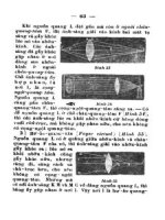
infrastructure. The technology, which it has dubbed “Stratospheric Satellites,”
consists of NASA-developed “super-pressure balloons” that fly at 110,000 feet
(Fig. 6-1). Combined with steering systems and a solar array used for power,
the balloons can carry payloads up to the size and weight of a small truck.
Global Aerospace has developed a trajectory control and solar array system
for the superpressure balloons, allowing them to be steered over disaster areas
and powered over the course of its long life. At a current cost of $1.75 million
per unit for development, and a projected life-cycle cost of $500,000 or less
per unit in production, the Altadena, California-based company believes that
Stratospheric Satellites can be a low-cost alternative to remote communica-
tions platforms provided by aircraft and space-based satellites. Because
Stratospheric Satellites fly much closer to Earth than space-based satellites,
they provide 20 times higher resolution surface images of disasters and 160,000
times higher signal radar than space-based satellites.
“Because they are relatively inexpensive, can be steered, are independently
powered, and can carry a large payload, they will probably be the most cost-
effective way of bridging the last mile in telecommunications coverage,” says
Kerry Nock, Global Aerospace’s president. Nock estimates that a constella-
tion of 400 Stratospheric Satellites covering most of the populated areas in the
148 SOMETHING IN THE AIR—RADIO AND LOCATION TECHNOLOGIES
c6.qxd 8/30/04 2:38 PM Page 148
INTERFERENCE 149
northern hemisphere would cost less than $100 million—less than the cost of
a single space-based satellite including its launch. Nock belies that operational
costs will come in at less than $10 million per year.
6.11 INTERFERENCE
It’s impossible to have a chapter on radio technologies without including some
information on interference. Whether natural or man-made, interference
has been an integral—although unfortunate—part of radio since the days of
crystal sets. At the dawn of the 21st century, researchers are working hard to
remedy one of radio’s oldest problems.
6.11.1 An Allocation Approach
Penn State University engineers have developed an economical way to more
efficiently manage radio spectrum use and prevent interference on wireless
broadband systems for high-speed Internet access. “With this technique,
service providers could offer quality service to more homes using only a
limited span of the radio spectrum,” says Mohsen Kavehrad, director of Penn
Figure 6-1 Stratospheric satellites.
c6.qxd 8/30/04 2:38 PM Page 149
State’s Center for Information and Communications Technology Research.“If
providers can squeeze more customers onto the available bandwidth, it could
translate into lower costs for the consumer.” The approach also promises
equipment cost savings since simulations show that the new scheme maintains
performance at top industry standards with more economical components.
Currently, high-speed Internet access capable of carrying MP3 files, video,
or teleconferencing is available primarily over wired networks. However, wire-
less local loops are being introduced as broadband alternatives in some test
markets. These new wireless networks are facing serious obstacles in compet-
ing for bandwidth, sometimes having to share bands with cordless phones or
even microwave ovens. Even when the wireless providers use licensed bands,
they face the prospect of many customers simultaneously uplinking and down-
linking information across the net, creating cochannel interference.
The wireless local loops work much like cell phones via a base station that
sends the radio signals carrying the Internet connection out to any customer
whose residence or business is equipped with an appropriate antenna. Unlike
cell phone usage, however, the two-directional uplink and downlink traffic
between the customer and the Internet provider’s base station is more asym-
metrical with very little use during sleeping hours and lots of use when kids
come home from school and download music or play games, for example.
Kavehrad says, “The nature of multimedia traffic is not static in uplink and
downlink directions, as with voice telephony, and the bandwidth is more biased
toward downlink transmissions.”
Wireless local loops need both software and hardware that enables the
network to respond to the changes in traffic while also making sure that every
hertz in the available spectrum is used as efficiently as possible. In addition,
the system must contend with the fact that some incoming interfering signals
are stronger than others.
The solution developed by the Penn State engineers is software that allows
the subscriber signal, whose direction of arrival is subject to a lesser number
of strong interferers, to be processed ahead of the ones experiencing the most
interference. In other words, the new strategy is a scheme that allows avoid-
ing strong cochannel interference by sequencing the processing of the signals
according to the amount of interference they are experiencing. Because the
amount of interference any subscriber’s signal experiences varies microsecond
by microsecond, no subscriber has to wait very long for a turn.
“The usual techniques employed to suppress interference use adaptive
spatial filters, which require expensive RF components and a large number of
computations to queue the subscribers’ signals,” says Kavehrad. “However,
with our approach, we need only a simple, cost-effective spatial filter and
relatively fewer computations. Our simulations show that the performance
of the new approach and the traditional technique are comparable. Thus, our
strategy shows a practical compromise between complexity and cost, while
achieving the desired signal quality.”
150 SOMETHING IN THE AIR—RADIO AND LOCATION TECHNOLOGIES
c6.qxd 8/30/04 2:38 PM Page 150
INTERFERENCE 151
6.11.2 Quieter Ovens
As just about anyone who has ever used a wireless phone or WLAN can attest,
wireless ovens are almost as good at creating electrical interference as they
are at heating up TV dinners. Researchers at the University of Michigan
College of Engineering pondered this problem and have developed an ele-
gantly simple technique that dramatically reduces the interference microwave
ovens create in telephones and wireless computer networks.
Worldwide, there are hundreds of millions of microwave ovens in kitchens,
offices, and laboratories, each with a magnetron that creates communications
problems ranging from an aggravating crackle during a friendly telephone call,
to the disruption of 911 calls and the flow of data in wireless computer net-
works. Although these effects are difficult to quantify, it’s safe to say they’re
an annoyance, an economic drain, and potentially life-threatening.
The basic difficulty is that microwave ovens operate at a frequency near
2.45GHz—about the same frequency at which telephones and wireless com-
puters operate. In the microwave oven, there are two magnets, one at each end
of the magnetron. In an amazingly simple discovery, University of Michigan
College of Engineering Professor Ronald Gilgenbach and a research team
composed of Professor Y. Y. Lau and graduate student, Bogdan Neculaes, all
from the department of Nuclear Engineering and Radiological Sciences, found
that when they added four permanent magnets to the outside of one of the
standard magnets, they could disrupt the magnetic field in such a way that it
becomes benign to nearby electrical devices, yet doesn’t significantly affect the
performance of the microwave oven.
The discovery could also have an enormous impact on the signal-to-noise
ratio in radar, say the researchers.
c6.qxd 8/30/04 2:38 PM Page 151
Chapter 7
The Unblinking Eye—
Security and Surveillance
152
Telecosmos: The Next Great Telecom Revolution, edited by John Edwards
ISBN 0-471-65533-3 Copyright © 2005 by John Wiley & Sons, Inc.
Besides allowing people to easily communicate with each other and to obtain
vital information effortlessly, telecom also enables businesses, corporations,
and other organizations and individuals to know what other people are doing.
Emerging telecom technologies, including camera phones, networked surveil-
lance cameras, and wireless security sensors, allow the monitoring of streets
and property to an extent unimaginable only a few years ago.
On the other hand, telecom itself depends on security technologies.Without
systems in place to safeguard devices and networks, telecom systems would be
highly vulnerable to intruders seeking financial gain seeking to create havoc.
This means that security is undoubtedly a double-sided proposition, protect-
ing both people and the systems they use.
7.1 TESTING SECURITY
In the aftermath of September 11, 2001, the federal government has increased
its interest in telecom-driven security and surveillance technologies and cyber-
security in general. Spearheading the government’s security initiative at the
academic level is the National Science Foundation (NSF). The NSF recently
made 23 awards for 11 projects that will develop networking testbeds for
research into cybersecurity, next-generation wireless and optical networking,
and leading-edge scientific applications. These testbeds will let researchers
c7.qxd 8/30/04 2:37 PM Page 152
push new networking technologies to the breaking point and beyond, paving
the way for a more reliable Internet of tomorrow.
“Fundamental networking research has an essential role in advancing the
country’s digital and physical infrastructure,” says NSF’s Mari Maeda, acting
division director for Advanced Networking Infrastructure and Research.
“These testbed projects demonstrate how NSF contributes both to cutting-
edge research and the next-generation networks we will depend on in our
daily lives.” Through NSF support, the testbeds, once deployed, will be open
to experiments by networking researchers from other institutions.
To enhance the country’s cyber defenses, the University of California (UC),
Berkeley, and the University of Southern California have undertaken a large-
scale testbed for experimenting with methods to protect networks against
computer worms, viruses, denials of service, and other cyber attacks. With this
testbed, attacks can be unleashed without a threat to the security of opera-
tional networks.A companion project led by researchers at Pennsylvania State
University, UC Davis, Purdue University, and the International Computer
Science Institute will develop scenarios for testing and evaluating proposed
defense systems. To support these efforts, NSF collaborated with the Depart-
ment of Homeland Security, which is cofunding a portion of $10.8 million
awarded to these two projects.
The explosion of “wi-fi” networking, from coffee-shop hotspots to scientific
networks of remote wireless sensors, is changing the dynamics of what used
to be a primarily wired Internet. NSF has made awards to deploy five testbeds
where researchers can develop technologies for next-generation wireless
networks.
The testbeds will provide opportunities to benchmark new wireless proto-
cols, evaluate prototype hardware, and examine emerging issues such as inter-
ference and efficient spectrum usage. These five testbed efforts each target a
different aspect of wireless networking and are led by scientists at UCLA,
Rutgers University, MIT, the University of Kansas, and the Stevens Institute
of Technology.
Although wi-fi networking has emerged as a key technology for getting
online, the links for network backbones and leading-edge scientific applica-
tions require the blazing performance of wired, optical networks. The $6.7
million DRAGON testbed, deployed by the University of Maryland, Univer-
sity of Southern California (USC), and George Mason University, will advance
networking architecture research and bring about the intelligent control of
optical transport networks.
A $3.5 million optical testbed deployed by the University of Virginia, Oak
Ridge National Laboratory, the City University of New York’s City College,
and North Carolina State University will allow development and testing of
cutting-edge science applications.
For networking research that requires the most realistic networked envi-
ronments, two additional projects totaling $8.8 million will support ongoing
testbed activities. In the first such project, the University of Utah and the
TESTING SECURITY 153
c7.qxd 8/30/04 2:37 PM Page 153
University of Wisconsin, Madison, will link Utah’s Netbed and the Wisconsin
Advanced Internet Laboratory in a testbed that can emulate more than
150,000 wired and wireless connections between tiny wireless sensors, personal
computers, routers, and high-end computing clusters.
The second ongoing testbed activity, PlanetLab, is being supported by
NSF awards to Princeton University, the University of Washington, and UC
Berkeley. PlanetLab is a worldwide network “overlay” that runs on top of,
but doesn’t disrupt, existing networks and lets networking researchers con-
duct experiments at the scale of, and with the unpredictable behavior of, the
global Internet.
7.2 LOCATION-BASED PRIVACY SOFTWARE
Location-based services promise custom-tailored access to a rapidly increas-
ing number of connected activities. Yet existing location-based services don’t
support the possibility that a user’s willingness to share location data may
depend on a range of factors, including recent and current activities, time of
day, and who is requesting the data—in other words, an individual’s context.
Responding to this shortcoming, researchers from Lucent Technologies’
Bell Labs have developed new software technologies that promise to enable
users to tightly control how their location information is shared when using
location-enabled mobile devices, such as mobile phones and PDAs. The soft-
ware, when taken as a whole, provides a framework that will allow users to
specify what location information is shared as well as when, with whom, how,
and under what circumstances.
Bell Labs’ Privacy-Conscious Personalization (PCP) framework relies on
user preferences to intelligently infer context, such as working or shopping,
and then determines with whom location information should be shared. When
a user’s location or other information is requested, it is analogous to someone
making a query of a database. In PCP’s case, the request is checked against
the user’s preferences and filtered through a high-performance rules engine,
known within Bell Labs as “Houdini,” before any action is taken. Because
location and other mobile services require near-real-time performance, this
entire process can take a few milliseconds or less.
Bell Labs’ technology is based on the belief that privacy isn’t a “yes or no”
question but rather is a spectrum of possible answers based on a wide range
of factors and user situations. Today’s location-based services have limited
capabilities—mobile users can choose to show their location to everyone, only
to an explicitly selected group of buddies, or only to authorized officials in
emergency situations using the government-mandated Enhanced 911 (E911).
Currently available location tracking services are essentially “one size fits
all”—users do not have the ability to tailor this capability to meet their indi-
vidual preferences.
154 THE UNBLINKING EYE—SECURITY AND SURVEILLANCE
c7.qxd 8/30/04 2:37 PM Page 154
The PCP framework will enable consumer and business users to specify
which individuals, groups, or businesses can see where they are based on the
users’ preferences. For example, during working hours, field sales representa-
tives could opt to have their presence visible to their boss, but, after 5:30 p.m.,
location sharing with the boss can be disabled. Additionally, a sales rep might
permit important customers to see his or her presence at anytime, but only
with an accuracy of up to 10 miles. This capability would be especially helpful
when a sales rep is visiting a key customers’ competitor, for example.
As for the problem of unsolicited pitches from retailers, whether in the form
of coupon spamming or short message service (SMS) advertisements, the PCP
framework enables users to specify which kinds of businesses are allowed to
see their location in a particular context, if at all. For example, a user may be
interested in receiving a coupon from their favorite coffee retailer only when
shopping, or on weekends before 9:00 a.m., or when within one mile of a
golfing buddy. If none of these conditions holds, that user and his or her
location would not appear to that retailer.
“The Bell Labs PCP framework promises to give mobile users the benefits
they want from sharing location information without having to buy into a
wholesale surveillance mechanism,” says Jason Catlett, president of
Junkbusters, a privacy advocacy firm located in Green Brook, New Jersey.
“The fine-grained options, allowing the user to consent to disclosure of
location according to place, time, and person are important to avoid being
monitored 24/7.”
A key challenge in the personalization of telecommunications services is
the realization that various kinds of factors and preferences are relevant to
different applications (e.g., sharing location information versus call forward-
ing) and different classes of users (e.g., office workers versus students, basic
users versus power users). Bell Labs’ PCP framework will allow network oper-
ators to preconfigure and offer different preference “palettes” tailored to these
different applications and classes of users. The palettes could, for example,
have drop-down menus prepopulated with the kinds of rules most relevant
for specific classes of users, so they can quickly set their own preferences on
personal computers or mobile phones.
“Bell Labs’ technology would give end users more explicit control over how
their network data is interpreted and shared with different requestors of loca-
tion information in near real time,” says Rick Hull, director of network data
and services research at Bell Labs. “By offering powerful personalization
capabilities, network operators can roll out new revenue-generating location
services that also cater to the varying privacy needs and desires of different
classes of users.”
Service providers have generally acknowledged that having a policy engine
to enforce privacy of user location information is a must-have capability.
At the writing of this book, commercial trials of the PCP framework are
being discussed with several carriers, and the “Houdini” rules engine is already
being used by Lucent in prototype demonstrations of context-aware location-
LOCATION-BASED PRIVACY SOFTWARE 155
c7.qxd 8/30/04 2:37 PM Page 155