earth science volume 4
Bạn đang xem bản rút gọn của tài liệu. Xem và tải ngay bản đầy đủ của tài liệu tại đây (5.27 MB, 61 trang )
Rourke’s World of Science
By Tim Clifford
Editorial Consultant
Luana Mitten
Project Editor
Kurt Sturm
Volume 4
Earth Science
© 2008 Rourke Publishing LLC
All rights reserved. No part of this book may be reproduced or utilized in any form or by any means, electronic or
mechanical including photocopying, recording, or by any information storage and retrieval system without
permission in writing from the publisher.
www.rourkepublishing.com
Photo credits: Page 4 © Vera Bogaerts; Page 4b © Jaroslaw Grudzinski; Page 5 © Mares Lucian; Page 5a © Taissiya Shaidarova; Page 5b ©
George Burba; Page 5c © Brykaylo Yuriy; Page 6 © Arkadiy Yarmolenko; Page 6b © Hiroshi Ichikawa; Page 6c © Elder Vieira Salles; Page 8 ©
Sebastian Kaulitzki; Page 11 © magali bolla; Page 13 © Khafizov Ivan Harisovich; Page 15 © Charles Taylor; Page 15b © Lorelyn Medina; Page
15c © Alexander Maksimov; Page 16b © David Dohnal; Page 16d © Guojón Eyjólfur Ólafsson; Page 17b © Walter Quirtmair; Page 17d - Nicholas
Peter Gavin Davies; Page 18 © Michael Ledray; Page 18b © Chung Ooi Tan; Page 19c © T-Design; Page 19e © Jozef Sedmak; Page 19f ©
Kondrashov MIkhail Evgenevich; Page 20 © Joe Gough; Page 20b © oksanaperkins; Page 21a © No Credit; Page 21c © Cheryl Casey; Page 23
© Patrick Hermans; Page 24 © Craig Hansen; Page 24b © Terry Underwood Evans; Page 24c © Aron Brand; Page 24d © Mikael Eriksson; Page
25 © Bychkov Kirill Alexandrovich; Page 27 © Galyna Andrushko; Page 27b © Galyna Andrushko; Page 29 © NASA; Page 29b © USGS; Page
29c © USGS; Page 30 © NASA; Page 31 © Péter Gudella; Page 32 © Peter Wey; Page 33 © Natalia Bratslavsky; Page 33b © pmphoto; Page 34
© Vova Pomortzeff; Page 34b © Jaan-Martin Kuusmann; Page 35 © Miguel Angelo Silva; Page 35b © Photodisc; Page 36 © Allen Furmanski;
Page 36b © US Department of the Interior; Page 36c © Dmcdevit; Page 36d © iofoto; Page 37 © Pichugin Dmitry; Page 37b © Richard Griffin;
Page 38 © Jarno Gonzalez Zarraonandia; Page 38b © Manfred Steinbach; Page 38c © Viktoriya; Page 39 © Thomas Smolek; Page 39b © Adam
Romanowicz; Page 39c © iofoto; Page 40 © salamanderman; Page 40b © William Attard McCarthy; Page 40c © Vova Pomortzeff; Page 41 ©
Naumov Roman; Page 41b © Nick Stubbs; Page 41c © Susan Ridley; Page 42 © Matej Krajcovic; Page 42b © Jack Dagley Photography; Page
43 © U.S. National Oceanic and Atmospheric Administration; Page 44 © Carolina K. Smith; Page 45 © NASA; Page 45b © Robert A. Mansker;
Page 47 © Diana Lundin; Page 48 © Ian Scott; Page 49 © FloridaStock; Page 49b © NASA; Page 50 © NASA; Page 50b © Sebastien Windal;
Page 50c © Pres Panayotov; Page 51 © Povl E. Petersen; Page 51b © Valeriy Kalyuzhnyy; Page 51c © Piotr Sikora; Page 51d © Caleb Foster;
Page 52 © Dariusz Urbanczyk; Page 52b © Pichugin Dmitry;Page 53 © Cristi Bastian; Page 53b © Dr. Morley Read; Page 53c © Brian McEntire;
Page 54 © Brandon Stein; Page 54b © Steffen Foerster Photography; Page 55 © Igor Smichkov; Page 55b © Kaleb Timberlake; Page 56 © David
Hyde; Page 56b © Andrea Booher; Page 57 © Sai Yeung Chan; Page 57b © Peter Zaharov.
Editor: Luana Mitten
Cover design by Nicola Stratford. Blue Door Publishing
Library of Congress Cataloging-in-Publication Data
Rourke's world of science encyclopedia / Marcia Freeman [et al.].
v. cm.
Includes bibliographical references and index.
Contents: [1] Human life
ISBN 978-1-60044-646-7
1. Science Encyclopedias, Juvenile. 2. Technology Encyclopedias, Juvenile. I. Freeman, Marcia S. (Marcia Sheehan), 1937-
Q121.R78 2008
503 dc22
2007042493
Volume 4 of 10
ISBN 978-1-60044-650-4
Printed in the USA
CG/CG
What Is Earth Science? . . . . . . . . . . . . . . . . . . . . . . . . . . . . . . . . . . .4
The Earth’s Hemispheres . . . . . . . . . . . . . . . . . . . . . . . . . . . . . . . . . . . . . . . . . .7
The Origin of Our Planet . . . . . . . . . . . . . . . . . . . . . . . . . . . . . . . . . . . . . . . . . .8
The Earth Today . . . . . . . . . . . . . . . . . . . . . . . . . . . . . . . . . . . . . . . . . . . . . . . . .10
The Parts of the Earth . . . . . . . . . . . . . . . . . . . . . . . . . . . . . . . . . . . .13
The Earth’s Layers . . . . . . . . . . . . . . . . . . . . . . . . . . . . . . . . . . . . . . . . . . . . . . .13
Rocks . . . . . . . . . . . . . . . . . . . . . . . . . . . . . . . . . . . . . . . . . . . . . . . . . . . . . . . . . .16
The Ocean . . . . . . . . . . . . . . . . . . . . . . . . . . . . . . . . . . . . . . . . . . . . . . . . . . . . .20
The Atmosphere . . . . . . . . . . . . . . . . . . . . . . . . . . . . . . . . . . . . . . . . . . . . . . . . .22
Forces That Shape the Earth . . . . . . . . . . . . . . . . . . . . . . . . . . . . . . .24
Plate Tectonics . . . . . . . . . . . . . . . . . . . . . . . . . . . . . . . . . . . . . . . . . . . . . . . . . .25
Continental Drift . . . . . . . . . . . . . . . . . . . . . . . . . . . . . . . . . . . . . . . . . . . . . . . .26
Volcanos . . . . . . . . . . . . . . . . . . . . . . . . . . . . . . . . . . . . . . . . . . . . . . . . . . . . . . .28
Earthquakes . . . . . . . . . . . . . . . . . . . . . . . . . . . . . . . . . . . . . . . . . . . . . . . . . . . . .30
Glaciers . . . . . . . . . . . . . . . . . . . . . . . . . . . . . . . . . . . . . . . . . . . . . . . . . . . . . . . .32
Erosion . . . . . . . . . . . . . . . . . . . . . . . . . . . . . . . . . . . . . . . . . . . . . . . . . . . . . . . .33
Human Activities . . . . . . . . . . . . . . . . . . . . . . . . . . . . . . . . . . . . . . . . . . . . . . . .35
Weather . . . . . . . . . . . . . . . . . . . . . . . . . . . . . . . . . . . . . . . . . . . . . . .37
Wind . . . . . . . . . . . . . . . . . . . . . . . . . . . . . . . . . . . . . . . . . . . . . . . . . . . . . . . . . .37
Clouds . . . . . . . . . . . . . . . . . . . . . . . . . . . . . . . . . . . . . . . . . . . . . . . . . . . . . . . . .38
Rain . . . . . . . . . . . . . . . . . . . . . . . . . . . . . . . . . . . . . . . . . . . . . . . . . . . . . . . . . . .40
Snow . . . . . . . . . . . . . . . . . . . . . . . . . . . . . . . . . . . . . . . . . . . . . . . . . . . . . . . . . .41
Tornados . . . . . . . . . . . . . . . . . . . . . . . . . . . . . . . . . . . . . . . . . . . . . . . . . . . . . . .43
Hurricanes . . . . . . . . . . . . . . . . . . . . . . . . . . . . . . . . . . . . . . . . . . . . . . . . . . . . . .44
The Seasons . . . . . . . . . . . . . . . . . . . . . . . . . . . . . . . . . . . . . . . . . . . . . . . . . . . .46
Habitats . . . . . . . . . . . . . . . . . . . . . . . . . . . . . . . . . . . . . . . . . . . . . . .47
The Ocean . . . . . . . . . . . . . . . . . . . . . . . . . . . . . . . . . . . . . . . . . . . . . . . . . . . . .47
Lakes and Rivers . . . . . . . . . . . . . . . . . . . . . . . . . . . . . . . . . . . . . . . . . . . . . . . . .49
Swamps and Marshes . . . . . . . . . . . . . . . . . . . . . . . . . . . . . . . . . . . . . . . . . . . . .50
Deserts . . . . . . . . . . . . . . . . . . . . . . . . . . . . . . . . . . . . . . . . . . . . . . . . . . . . . . . . .51
Prairies . . . . . . . . . . . . . . . . . . . . . . . . . . . . . . . . . . . . . . . . . . . . . . . . . . . . . . . .52
Forests . . . . . . . . . . . . . . . . . . . . . . . . . . . . . . . . . . . . . . . . . . . . . . . . . . . . . . . . .53
Mountains . . . . . . . . . . . . . . . . . . . . . . . . . . . . . . . . . . . . . . . . . . . . . . . . . . . . . .55
The Environment in Danger . . . . . . . . . . . . . . . . . . . . . . . . . . . . . . .56
Fires . . . . . . . . . . . . . . . . . . . . . . . . . . . . . . . . . . . . . . . . . . . . . . . . . . . . . . . . . . .56
Deforestation . . . . . . . . . . . . . . . . . . . . . . . . . . . . . . . . . . . . . . . . . . . . . . . . . . .57
Smog . . . . . . . . . . . . . . . . . . . . . . . . . . . . . . . . . . . . . . . . . . . . . . . . . . . . . . . . . .57
Acid Rain . . . . . . . . . . . . . . . . . . . . . . . . . . . . . . . . . . . . . . . . . . . . . . . . . . . . . .58
Global Warming . . . . . . . . . . . . . . . . . . . . . . . . . . . . . . . . . . . . . . . . . . . . . . . . .59
People Who Study the Earth . . . . . . . . . . . . . . . . . . . . . . . . . . . . . . .62
Table of Contents
www.rourkepublishing.com –
Post Office Box 3328, Vero Beach, FL 32964
1-800-394-7055
54
Earth ScienceEarth Science
What Is Earth Science?
As far as we know, Earth is the
only place in the solar system that
contains all the ingredients (liquid
water, chemical building blocks,
and an energy source) needed for
life. All the living things we know
of live on Earth. It is home to
plants, animals, and humans.
Everything on the planet needs
everything else to survive. Earth
scientists help us understand and
value our unique home.
Earth science is the study of the
Earth. It includes how the Earth
works and its origin, structure,
and physical features. The term
Earth science is a general term
that includes all the sciences
related to the Earth. It might
surprise you that sciences like
meteorology and oceanography are
both Earth sciences.
EARTH SCIENCES
Science What Is Studied
Glaciology Glaciers and ice
Geology
Solid matter including
rocks and minerals
EARTH SCIENCES
Science What Is Studied
Physical Patterns and processes
Geography
including weathering
and erosion
Limnology Inland waters including lakes,
ponds, rivers, streams,
wetlands, and groundwaters
Meteorology Atmosphere, including
the weather
Oceanography Oceans and seas
Paleontology Fossils and prehistoric life
The Earth’s shape is almost
round like a ball, or sphere. But
unlike a ball, the Earth is made of
different parts. Scientists call these
parts Earth’s spheres. The four
spheres are the lithosphere,
hydrosphere, biosphere, and
atmosphere. Hydro means water.
Can you guess what part of Earth
makes up the hydrosphere? The
hydrosphere includes all forms of
water under, on, and above Earth.
76
Earth ScienceEarth Science
The Earth’s Hemispheres
We call the top half of the Earth
the Northern Hemisphere and the
bottom half the Southern
Hemisphere. The equator is an
imaginary line around the middle
of Earth’s surface separating the
Northern Hemisphere from the
Southern Hemisphere.
At the top of the Northern
Hemisphere is the North Pole. The
South Pole is at the bottom of the
planet in the Southern
Hemisphere. The closer you live to
the equator, the warmer your
weather. And the further away
from the equator you live, the
colder your weather is.
Another imaginary line runs
through the center of the Earth
from the North Pole to the South
Pole. We call this line Earth’s axis.
The axis tilts at 23.45 degrees.
Earth rotates around the axis. The
tilt of Earth’s axis is why our
seasons change.
The seasons in the Southern
Hemisphere are opposite of the
seasons in the Northern
Hemisphere. If it is winter in the
Northern Hemisphere, it is summer
in the Southern Hemisphere.
EARTH SCIENCES
Science What Is Studied
Pedology Soil
V
olcanology Volcanos, lava, and magma
Atmosphere
Hydrosphere
Biosphere
Lithosphere
This photo shows all four Earth spheres.
NORTHERN HEMISPHERE
SOUTHERN HEMISPHERE
EQUATOR
Equator
Night
Day
SUN
EARTH
In this illustration, the Sun’s rays shine more
directly on the Southern Hemisphere, causing
those below the equator to experience summer.
Atmosphere = air
Hydrosphere = water
Biosphere = life
Lithosphere = land
Earth’s Spheres
The young Earth looked very
different than it does today. Intense
heat inside the growing planet
caused molten, or liquid, rock to
form. The hot surface slowly
cooled over millions of years.
Water vapor and other gases made
the atmosphere. Clouds covered
the planet. Rain helped cool the
hot surface. Cooling rocks slowly
began to soak up the falling rain.
When the ground could not hold
any more water, oceans formed.
The land above the level of the
ocean formed continents, and the
continents have been moving and
changing ever since. Sometimes
the continents moved together
forming a supercontinent before
separating again. Pangaea was the
last supercontinent. When Pangaea
separated, the continents moved
into their current formation.
98
Earth ScienceEarth Science
The Origin of Our Planet
Scientists believe the Earth was
created over 4.5 billion years ago.
It came from a cloud of dust and
gas swirling in space. Some of the
dust and gas formed the Sun. The
rest became planets in the solar
system.
What Season Is It?
Months Northern Hemisphere Southern Hemisphere
(approximate range) Season Season
December, January,
F
ebruary Winter Summer
March, April, May
Spring Fall
June, July, August Summer Winter
September, October,
November Fall Spring
equator (i-KWAY-tur): an imaginary line
around the middle of the Earth
pole (pohl): one of the two points that are
farthest away from the equator
, the North Pole
or the South Pole
sphere (sfihr): a solid shape like a basketball
or globe
Did you know Earth
really isn’t a perfect
sphere? Earth bulges
slightly at the equator making the
Earth a geoid. Earth rotates (spins)
faster at the equator than at the poles
because the poles are closer to Earth’s
axis. This is what causes the bulge.
The Sun is the star closest to Earth.
The solar system is composed of eight planets circling the Sun. The asteroid belt can
be seen between the orbits of Mars and Jupiter. Pluto, once called the ninth planet, is
now considered a dwarf planet.
Earth
Sun
The supercontinent Pangaea existed 250
million years ago.
Venus
Mercury
Mars
Jupiter
Saturn
Uranus
Neptune
Pluto
1110
Earth ScienceEarth Science
The ocean is the source of most
of the water on the planet. It
provides much of the water that
makes clouds in the sky
. Water
rises up into the air when it
evaporates. This means that it
turns into a mist you cannot see.
The water comes back down to the
ground as rain. Rain fills the lakes,
rivers, and streams on the land.
Plants and animals need this water
to survive.
The different environments of
Earth support many different
plants, animals, and other
organisms. Deserts, prairies,
forests, and mountains are all
types of environments on the land.
Oceans, lakes, rivers, and ponds
are all types of water
environments. Both water and land
environments depend on a balance
between all the living and nonliving
things in the environment. This
includes everything from the air
and soil to the plants and animals.
The continents weren’t the only
thing changing. The clouds became
thinner and sunlight could shine
through. Heat and other forces
inside the planet continued
changing the surface. Ice ages and
many living organisms came and
went. Over billions of years, the
Earth became the way it is today.
The Earth Today
From outer space, the Earth
looks very blue. That is because
water covers most of the planet.
Nearly three quarters of the Earth’s
surface is oceans, seas, lakes,
rivers, and other bodies of water.
The seven continents cover the rest
of the planet.
South
America
Africa
Australia
Asia
Europe
North
America
PACIFIC
OCEAN
ARCTIC OCEAN
OCEAN
THE WATER CYCLE
Evaporation
ATLANTIC
OCEAN
INDIAN
OCEAN
SOUTHERN OCEAN
Antarctica
Forests and mountains are types
of land environments.
The ocean is a type of water environment.
Cenozoic Era
65 million years ago to present time
Mesozoic Era
248 to 65 million years ago
Paleozoic Era
540 to 548 million years ago
Proterozoic Eon 2.5 billion years ago to 540 million years ago
Archeozic Eon 3.9 billion years ago to 2.5 billion years ago
Hadean Eon 4.6 billion years ago to 3.9 billion years ago
Phanerozoic Eon
543 million years
ago to present time
Precambrian Time
4.6 billion years
ago to 543 million
years ago
Quaternary 1.8 million years ago to today
Tertiary 65 to 1.8 million years ago
Cretaceous 144 to 65 million years ago
Jurassic 206 to 144 million years ago
Triassic 248 to 206 million years ago
Permian 280 to 248 million years ago
Devonian 408 to 360 million years ago
Cambrian 540 to 500 million years ago
GEOLOGIC TIMELINE
PACIFIC
OCEAN
When studying the Earth,
scientists look at the surface of the
Earth and the parts that are above
and below it. The atmosphere is a
part above the surface while the
core is a part below the surface. All
of Earth’s parts work together to
make life possible.
The Earth’s Layers
Earth is a terrestrial planet,
meaning that it is mostly made of
rock. There are three major layers
from the surface of the planet to its
center. They are the crust, the
mantle, and the core. The force of
gravity pulls Earth’s layers together.
Studying how an earthquake
wave moves is one important way
scientists learn about the different
materials in the Earth’s layers.
Scientists estimate that they can
detect nearly 500,000 earthquakes
each year in the world. Fortunately,
only about 100 quakes cause
damage on Earth’s surface.
1312
Earth ScienceEarth Science
The North and South Poles
Would you like to visit the North Pole?
It probably is harder than you think.
There is no land at the North Pole, only huge
moving sheets of ice in the middle of the Arctic
Ocean. An American explorer, Robert E. Peary, is
usually credited as being the first person to reach
the North Pole on April 6, 1909. Peary, his trusted
assistant, Matthew Henson, and four Eskimos
traveled over the ice using dogsleds.
Even though the South Pole is on the continent Antarctica,
it is still difficult to visit. A polar ice sheet that is about 9,000
feet (2,700 m) thick covers the land. The temperatures
in the winter can get down to minus 76 degrees
Fahrenheit (-60 degrees Celsius). It warms up to
minus 18 degrees Fahrenheit (-28 degrees Celsius)
during the summer. Now that’s a cold place to visit!
Year round, scientists live and work at the
Amundsen-Scott South Pole Station run by the
United States. The station, named for polar explorers
Roald Amundsen and Robert Scott, is important to
research.
The Amundsen-Scott South Pole Station sits within 330 feet (100 meters) of the Geographic
South Pole.
The Earth’s layers can move in different
ways during an earthquake, causing
immense damage.
The Parts of the Earth
Earth’s crust
Mantle
Outer
Core
Inner
Core
The Earth has a solid inner core and a liquid
outer core, which is the source of the Earth’s
magnetic field.
The Core
The middle of the Earth is the
core. The core has two different
layers. They are the inner core and
the outer core.
The outer core is right below the
mantle. It is a combination of the
metals iron and nickel. There may
even be sulfur in the outer core.
The outer core is a liquid because
it is so hot.
At the very center of the Earth is
the inner core. The inner core is
made of solid metal. It is also made
of iron and nickel and is very hot.
It is solid metal because the
pressure is so high. If you were
able to travel to Earth’s core, the
high pressure would squeeze you to
be about the size of a pea.
The Crust
The top layer of the Earth is the
crust. Just like the crust on a loaf
of bread, the Earth’s crust covers
the entire planet. This top layer is
also the thinnest layer of the Earth.
There are two types of crust.
Under the oceans, the oceanic crust
is 3-6 miles (5-10 km) thick. Below
the tallest mountains, the
continental crust can be over 40
miles (70 km) thick.
Forty miles sounds thick but if
you compared the Earth to an
apple, the crust is like the apple’s
peel. All life on the planet lives in or
above the crust.
The Mantle
Below the crust is the mantle.
The mantle is the thickest layer of
the Earth. It goes down over 1,800
miles (2,900 km). Most of Earth’s
rocks are in the mantle. Rocks in
the mantle are dense. This means
that the rocks are packed closer
together than rocks in the crust.
They are under the weight of all the
rocks on top of them.
The temperature in the mantle is
very hot. Some rocks even melt and
become molten. This molten rock is
called magma. Sometimes magma
comes to Earth’s surface through
volcanos. Lava is magma that has
reached the surface of the Earth.
1514
Earth ScienceEarth Science
Lava oozes from an erupting volcano.
The deepest man-
made hole in the
Earth’s crust is on the
Kola Peninsula in Russia. It is 7.6
miles (12.3 km) deep. Drilling began
in 1970 and ended in 1992 because
the temperature inside the Earth’s
crust was getting too hot. There
were many different boreholes drilled
from the main hole. The deepest
borehole was drilled in 1989.
The reason for drilling into the
Earth’s crust was not for an oil well
but for research. Scientists learned
new information about the layers of
rock in
Earth’s crust
from samples
taken from
the drill.
Inner Core
• Solid
• Mostly nickel and iron
•
Temperatures reach
9,000 degrees
Fahrenheit (5,000
degrees Celsius)
• 3200-3900 miles
(5,150-6,276km) deep
Outer Core
• Liquid
• Mostly nickel and iron
•
Temperatures from
4,000 to 9,000 degrees
Fahrenheit (2,200-
5,000 degrees Celsius)
• 1,800-3,200 miles
(2,897-5,150 km) deep
This map shows the different
thicknesses of Earth’s crust.
land 12-24 mi
(20-40 km)
24-27 mi
(40-27 km)
27-30 mi
(45-50 km)
30-36 mi
(50-60 km)
36-42 mi
(60-70 km)
42 mi
(70 km)
1716
Earth ScienceEarth Science
Rocks
The Earth’s crust is made of
rocks. The substances that make
up most rocks are minerals. The
three basic kinds of rocks are
igneous, metamorphic, and
sedimentary.
Igneous Rocks
The most common type of rock
is igneous rock. Another name for
igneous rocks is fire rocks,
because they form when magma
cools. Magma is hot liquid rock
that comes from the Earth’s crust
and the mantle.
Igneous rocks can form below
Earth’s surface or above it.
Erupting volcanos bring magma to
the surface. We call this magma
lava. As the lava cools, it forms
igneous rocks.
Metamorphic Rocks
All metamorphic rocks were
once either igneous, sedimentary,
or other metamorphic rocks. Heat
and pressure caused the rocks to
change form. When rocks change
from one type of rock into another,
they change mineral makeup and
texture. The process of
rocks “morphing” from
one form to another can
take thousands of years.
Igneous Rocks
Granite is usually
found in large
slabs. It is very
hard and tough.
Its colors range
from pink to
dark gray or
black.
Pumice is very
porous, or full of
holes. It is
usually white, but
can be yellow,
gray, brown, or
dull red.
Obsidian is a
type of naturally-
occurring glass.
Its edges can be
so thin and sharp
that it was used
in ancient times
for weapons.
Basalt is a
common rock —
it makes up most
of the world's
oceanic crust. It
is usually dark
gray in color.
Textures of Metamorphic Rocks
Foliated Metamorphic Rocks
(Made of many different minerals)
slate
schist
gneiss
Non-Foliated Metamorphic Rocks
(Usually made of one mineral)
marble
quartzite
serpentinite
4.1
1918
Earth ScienceEarth Science
Sedimentary Rocks
Sedimentary rocks form from
sediments, or little bits, of other
rocks. Over time, erosion and
weathering cause little bits to wear
off rocks. Then rain, streams, and
rivers carry the little bits of rock
until they settle on the bottom of
rivers, lakes, seas, or the oceans.
The layers of sediment build up on
top of one another, pressing the
bits of rock together. Slowly these
layers turn into rock.
Sedimentary rocks form layers,
or strata, in the Earth’s crust.
Strata near the surface are newer
than those further underground.
Each layer tells about the Earth’s
past.
The different strata of
sedimentary rock often hold fossils
of plants, animals, and other
organisms that lived long ago. We
usually think of fossils looking like
animal bones, shells, or plant
leaves. But did you know that even
a footprint could become a fossil?
Sedimentary Rocks
Limestone is
produced from
the mineral
calcite (calcium
carbonate) and
sediment.
Shale rock is a type
of sedimentary rock
formed from clay.
Most sandstone
is composed of
quartz and/or
feldspar.
Gypsum is a
soft mineral
composed of
calcium sulfate
dihydrate.
THE GEOLOGIC TIME SCALE
Precambrian Era,
from 4 billion to 540 million
years ago.
Simple life first appeared, such as
bacteria and hard shelled animals.
Paleozoic Era,
from 540 to 250 million
years ago.
The earliest fish, reptiles, and
land plants appeared.
Mesozoic Era,
from 250 to 65 million
years ago.
The dinosaurs appeared, and
became extinct at the end of the era.
Cenozoic Era,
from 65 million years ago to
the present.
Large mammals and
humans evolved.
This fossil, found in Colorado, is a footprint
left by a duck-billed dinosaur that lived
millions of years ago.
2120
Earth ScienceEarth Science
The Ocean
In the solar system, Earth is the
only planet that has liquid water.
Most of this water is in the ocean.
The ocean’s salty water covers
nearly 70 percent of the Earth’s
surface. The first living things
evolved in the ocean. Today, many
more plants and animals live in
the oceans than on the land.
Not only is the ocean home to
lots of plants and animals, it is
important to all life on our planet.
Nearly 97 percent of the Earths
water is in the ocean. The ocean
affects the weather and
temperature on Earth. In the
summer, the ocean cools the land
and air. In the winter, it warms
them. How the ocean moves also
has a big effect on life on land.
Tides
Tides are the rising and falling
of the ocean level near the shore.
During high tides, the water level
rises. During low tides, the water
level falls. The Moon causes most
of the tidal movement. The gravity
of the Moon pulls the water in the
ocean toward it. In most places,
there are two high tides and two
low tides each day.
The Sun also affects the tides. It
is larger than the Moon and has
more gravity, but because the Sun
is farther away, it does not pull on
the oceans as strongly as the Moon.
When the Sun, Moon, and Earth all
line up, the gravitational pulls from
the Sun and Moon work together
making the tides higher.
Plants and animals near the
shore spend their lives adapting to
high and low tides. Land at the
shores, called coastlines, is built up
and torn down by the movement of
the ocean tides.
Waves
The movement of waves also
changes the coastlines. Waves
break up rocks, coral, and shells
into smooth pieces of sand. The
waves carry the sand to the land’s
coastline making beaches.
Many things make waves,
including ship’s wakes, earthquakes,
volcanos, and landslides. But most
waves form from winds blowing
across the water’s surface. Stronger
winds make bigger waves. Some
strong winds in the middle of the
ocean can make waves that hit a
beach very far away.
We usually see waves crashing
onto a beach, making us think that
the water in a wave is moving
forward. Waves in deep water are
really the forward motion of energy,
not the water. The water is only
moving up and down.
Ninety-seven percent of the Earth’s water is
in its salty oceans, but most of the water we
use is from freshwater sources.
Waves erode rock.
Tide pools are formed as a high tide comes
in over a rocky shore.
Waves sculpt sandy beaches.
At low tide, the ocean level lowers exposing
more beach.
dense (DENSS): crowded, or thick
erode (i-RODE): to wear away by water and wind
geologic (jee-
o-LOJ-ik): having to do with the
study of soil and rock
mineral (MIN-ur-uhl): a natural substance, such
as gold, quartz, or copper, that is not a plant or
animal
pressure (PRESH-ur): the force produced by
pressing on something
surface (SUR-fiss): the outside or outermost
layer of something
2322
Earth ScienceEarth Science
The Atmosphere
An atmosphere is the layer of
gases that covers the surface of a
planet. Earth’s atmosphere is about
600 miles (1,000 km) deep. It is
very important to all plants and
animals. It protects our planet from
dangerous radiation from the Sun.
It also provides gases that animals
need to breathe and that plants
need to make food.
Composition Of The Atmosphere
Earth’s atmosphere is made
mostly of nitrogen and oxygen, with
small amounts of argon, carbon
dioxide, hydrogen, methane, and
other gases. Ash from volcanos,
dust, and small drops of water
called vapor are also in the
atmosphere.
The Layers of the Atmosphere
Earth’s atmosphere has many
different layers. The troposphere is
the layer closest to Earth’s surface.
It is where most changes in the
weather happen. Half of the Earth’s
atmosphere is in the troposphere.
Above the troposphere is the
stratosphere. The stratosphere
contains the ozone layer. Ozone is
a form of oxygen that stops most of
the Sun’s ultraviolet radiation from
reaching the lower part of the
atmosphere. If you’ve flown on a
commercial jet, you’ve probably
been in the stratosphere. Pilots
like to fly in the stratosphere
because it is very clear and calm.
The mesosphere is the next
layer up. Meteors burn up as they
move through this layer.
Then, on top of the mesosphere,
is the thermosphere. Space
shuttles orbit the Earth in the
thermosphere.
The exosphere is the highest
layer in the atmosphere, and it just
fades into space. Have you ever
wondered why you get more radio
stations at night than in the day?
Well, thank the exosphere. The
exosphere reflects radio waves.
The Sun affects the exosphere’s
height. The changing height of the
exosphere increases the range of
radio stations after dark.
Tsunamis
A tsunami (tsoo-
NAH-mee) is a
destructive series of waves. T
sunamis
are often called tidal waves, but they
are not caused by tides. They can be
caused by an underwater earthquake
or by a volcano erupting beneath
the ocean.
These waves can be small, but
sometimes they are very large and
cause great destruction. They can
travel at a speed of almost 500 miles
an hour, and reach heights of over
100 feet. Tsunamis are not like
hurricanes that meteorologists track,
allowing people to get out of harm’s
way. Tsunamis can arrive on land
within fifteen minutes of a quake.
A tsunami caused by an
earthquake in the Indian Ocean on
December 26, 2004 killed as many
as 200,000 people. It was one of the
deadliest disasters in modern times.
Because of this disaster, scientists are
working to create better ways of
detecting and warning people of
approaching tsunamis.
NITROGEN
78%
OXYGEN
21%
OTHER
1%
The Earth’s atmosphere is made up of five
distinct layers (not drawn to scale as shown).
composition (kom-puh-ZISH-uhn): what
something is made of
radiation (ray-dee-AY-shuhn): the sending out
of rays of light, heat, or particles
vapor (VAY-pur): fine particles of mist or steam
TROPOSPHERE STRATOSPHERE MESOSPHERE EXOSPHERETHERMOSPHERE
2524
Earth ScienceEarth Science
Forces That Shape the Earth
Many forces can form, or shape,
the Earth. Some of these forces
come from deep within the ground.
Volcanos and earthquakes cause
major changes to the landscape.
Other changes occur because of
natural forces on the surface.
Water and wind shape the planet
every day. Human activity also
plays a role in shaping the world.
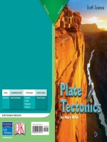
Plate Tectonics
It’s difficult to imagine entire
continents moving, but they do.
The Earth’s crust is not all one
piece. It is broken up into 16 huge
pieces and several smaller ones
called tectonic plates. These plates
make up all the Earth’s dry land
and the ocean floor.
The tectonic plates move at the
rate of about four inches (10 cm) a
year. That may not seem like
much, but over hundreds of
millions of years, the plates have
moved long distances. Plate
tectonics is the idea that the
lithosphere is made of slow moving
plates.
Plates come together to form
ridges on land and underwater.
They form trenches where they
separate from one another.
A plate grows bigger on one edge
where new igneous rock forms.
The other edge of the plate slides
under or on top of another plate.
Forces That Shape The Earth
Volcanos erupt when pressure builds;
sending out lava, hot gases, and ash.
Earthquakes cause cracks that run deep
into the Earth’s crust.
Waves erode rock, sand, and sometimes,
man-made structures.
Sandstorms move huge clouds of sand and
dust from place to place.
Plate tectonics causes earthquakes to
shake, volcanos to erupt, mountains to
grow, and continents to move.
This map shows the world’s tectonic plates. Can you find the
continents drawn in lighter colors?
continent (KON-tuh-nuhnt): one of the seven
large land masses of the Earth
ridge (rij): a narrow, raised strip
trench (trench): a long, narrow ditch
2524
Earth ScienceEarth Science
Forces That Shape the Earth
Many forces can form, or shape,
the Earth. Some of these forces
come from deep within the ground.
Volcanos and earthquakes cause
major changes to the landscape.
Other changes occur because of
natural forces on the surface.
Water and wind shape the planet
every day. Human activity also
plays a role in shaping the world.
Plate Tectonics
It’s difficult to imagine entire
continents moving, but they do.
The Earth’s crust is not all one
piece. It is broken up into 16 huge
pieces and several smaller ones
called tectonic plates. These plates
make up all the Earth’s dry land
and the ocean floor.
The tectonic plates move at the
rate of about four inches (10 cm) a
year. That may not seem like
much, but over hundreds of
millions of years, the plates have
moved long distances. Plate
tectonics is the idea that the
lithosphere is made of slow moving
plates.
Plates come together to form
ridges on land and underwater.
They form trenches where they
separate from one another.
A plate grows bigger on one edge
where new igneous rock forms.
The other edge of the plate slides
under or on top of another plate.
Forces That Shape The Earth
Volcanos erupt when pressure builds;
sending out lava, hot gases, and ash.
Earthquakes cause cracks that run deep
into the Earth’s crust.
Waves erode rock, sand, and sometimes,
man-made structures.
Sandstorms move huge clouds of sand and
dust from place to place.
Plate tectonics causes earthquakes to
shake, volcanos to erupt, mountains to
grow, and continents to move.
This map shows the world’s tectonic plates. Can you find the
continents drawn in lighter colors?
continent (KON-tuh-nuhnt): one of the seven
large land masses of the Earth
ridge (rij): a narrow, raised strip
trench (trench): a long, narrow ditch
Continental Drift
Throughout Earth’s history, the
continents have connected and
separated. The last time all the
continents were connected they
made one huge continent, Pangaea.
Pangaea means “all lands”. Pangaea
broke up about 200 million years
ago. Its pieces drifted apart over
time. They created the continents
as we know them today.
Continental drift is the process of
the continents shifting relative to
one another.
Plate tectonics cause the
continents to drift. The giant
trenches created from this drift are
called rift valleys. The plates on
which the continents sit spread
away from these valleys. The plates
move apart as new material from
within the Earth comes up.
In some places, an ocean plate
will slide below a continental plate.
Mountains are often pushed up
along the plate that stays on top.
The Andes in South America
formed this way. Sometimes, two
continental plates collide. This
causes the plates to crumple and
high mountains to form. India
collided with Asia and formed the
Himalayas.
2726
Earth ScienceEarth Science
Alfred Wegener
Alfred Wegener was born in Germany in 1880. He
dreamed of exploring Greenland and the Arctic. In school,
Wegener studied astronomy, meteorology, and geophysics,
the study of the forces that shape the Earth. He fought in World War I and
was wounded twice.
Wegener is best known for his ideas about continental drift. He looked
at a map of the world and noticed the similar shapes of the coasts of
Africa and South America. Wegener suggested that they were once joined
and then drifted apart. In 1924, he published his theories in the book The
Origin of Continents and Oceans. Wegener died in 1930. It was not until
the 1960’s that discoveries confirmed that continental drift really happens.
Getting to
Know
Getting to
Know
The Himalayas contain the three
highest mountains on Earth.
The Hawaiian Islands are actually mountain
tops poking above the waterline.
There are actually more
mountains under the water than
there are above the water. Many of
these mountains are taller than the
ones we see above the water.
Earth’s longest mountain range,
the Mid-Atlantic Ridge sits in the
middle of the Atlantic Ocean
between South America and Africa.