- Trang chủ >>
- Mầm non - Tiểu học >>
- Lớp 5
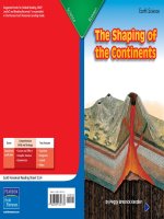
5 5 4 earth the inside story
Bạn đang xem bản rút gọn của tài liệu. Xem và tải ngay bản đầy đủ của tài liệu tại đây (8.15 MB, 14 trang )
Suggested levels for Guided Reading, DRA,™
Lexile,® and Reading Recovery™ are provided
in the Pearson Scott Foresman Leveling Guide.
Earth Science
Earth:
The Inside Story
Genre
Expository
nonfiction
Comprehension
Skills and Strategy
• Cause and Effect
• Fact and Opinion
• Summarize
Text Features
•
•
•
•
Captions
Diagrams
Time Line
Glossary
Scott Foresman Reading Street 5.5.4
ISBN 0-328-13571-2
ì<(sk$m)=bdfhbe< +^-Ä-U-Ä-U
by Camilla Calamandrei
Reader Response
1. What caused people to question whether Earth was
solid? What effect did the discovery of undersea
mountain ridges have? Use a graphic organizer like
this one to record two more cause-effect relationships
discussed in the book.
Earth:
The Inside Story
Cause
Effect
Cause
Effect
2. In your own opinion, which scientist or scholar
featured in the book is most interesting and why?
CamillaDrift”
Calamandrei
3. The termby
“Continental
is not defined in the
book. What do you think it means? How did you
figure that out?
4. Think about the volcanoes and earthquakes described
in this book. How do you think scientists should use
what they learn about Earth to help people?
Editorial Offices: Glenview, Illinois • Parsippany, New Jersey • New York, New York
Sales Offices: Needham, Massachusetts • Duluth, Georgia • Glenview, Illinois
Coppell, Texas • Ontario, California • Mesa, Arizona
Every effort has been made to secure permission and provide appropriate credit for
photographic material. The publisher deeply regrets any omission and pledges to
correct errors called to its attention in subsequent editions.
Today, we understand a great deal about volcanoes,
earthquakes, and tidal waves, and we understand how they
are related.
Unless otherwise acknowledged, all photographs are the property of Scott Foresman,
a division of Pearson Education.
Photo locators denoted as follows: Top (T), Center (C), Bottom (B), Left (L), Right (R),
Background (Bkgd)
Illustrations by Jonathan Massie
1 © Corbis; 3 © Corbis; 5 © Corbis; 13 © DK Images; 23 © Corbis
ISBN: 0-328-13571-2
Copyright © Pearson Education, Inc.
All Rights Reserved. Printed in the United States of America. This publication is
protected by Copyright, and permission should be obtained from the publisher
prior to any prohibited reproduction, storage in a retrieval system, or transmission
in any form by any means, electronic, mechanical, photocopying, recording, or
likewise. For information regarding permission(s), write to: Permissions Department,
Scott Foresman, 1900 East Lake Avenue, Glenview, Illinois 60025.
2 3 4 5 6 7 8 9 10 V0G1 14 13 12 11 10 09 08 07 06 05
The Earth in Motion
Earth may look like a calm planet when viewed
from outer space. But it is anything but calm. In fact,
we live on a planet that is constantly moving and
changing.
Earth moves in a few different ways. First of all,
we now know that Earth revolves around the sun.
We also know that it spins on an axis. But the planet
itself is not one solid piece of rock. Different layers of
Earth itself are moving and changing all the time.
3
Earthquakes, volcanic eruptions, and tidal waves
are all dramatic side effects of layers of the planet
moving into and away from each other. They remind
us that things are always happening within the
planet.
Read on to find out how scientists learned that
Earth is made of layers.
Pieces of a Puzzle
For thousands of years, humans thought
Earth was a solid mass. Even the famous Greek
philosopher Aristotle, who lived more than 2,300
years ago correctly thought Earth was round, long
before others realized it. But he thought, incorrectly,
that Earth was solid.
It was not until 2,000 years later that some
evidence came to light that made a few people
begin to question whether the Earth really was solid.
Before the invention of the airplane, maps were
challenging to make. Early mapmakers had to
reconstruct entire coastlines on paper, even though
they could see and measure only the small area
that was in front of them at any given moment.
Today, our maps are very precise because planes and
satellites allow us to see Earth’s landmasses—and
many miles of coastline—from above.
4
During the 16th century, explorers sailing the
seas in search of new routes from Europe to the East
came upon continents they had not known about.
Each of these expeditions included mapmakers.
These mid-16th century maps revealed something
amazing. It appeared that the western edge of the
African continent and the eastern edge of the South
American continent could fit together like two pieces
of a jigsaw puzzle. Could that really have happened
by chance?
An early map of the world
5
African continent
South American
continent
6
The English philosopher Francis Bacon (1561–
1626) believed that the interlocking shapes of the
coastlines of Africa and South America did not
happen by chance. Other scholars and scientists
felt the same way. Some philosophers believed that
Africa and South America had once been a single,
large landmass.
They were less certain, however, about what had
caused the landmass to split. They did not know how
or why the continents floated so far from each other.
How could such a thing happen if Earth were solid
all the way through?
Some people decided that the waters of a great
flood—described in the Bible—had divided the
original continent and floated its parts to different
hemispheres. The idea that the flood had changed
Earth’s surface became popular. Francis Bacon even
went along with it.
If Earth were solid, though, as people believed,
then where did the water for such a huge flood
come from? Some scientists and scholars decided
that Earth’s entire surface must float on water. They
speculated that chemicals in the water had somehow
dissolved the solid core of Earth and caused it to
break apart.
7
Three Layers
Neptune,
Roman God of the Sea
The idea that the continents floated on water
became known as the Neptunist idea. It was named
for the Roman god of the sea and earthquakes,
Neptune.
A competing idea that emerged in the late 1700s
was called the Plutonist idea. Pluto was the god of
the underworld. The Plutonists believed that Earth’s
surface rested on a mass of molten rock, and they
pointed to Earth’s volcanoes as proof. They said that
if Earth’s crust floated on water, then volcanoes
would spew water instead of molten lava.
By the 1870s, most geologists (scientists who study
Earth’s origin and structure) believed that Earth was
made up of three layers—a rigid crust that encases
Earth, a solid core, and liquid rock that surrounds
Earth’s core.
This basic description of the Earth’s interior was
scientifically confirmed in the late 1800s and early
1900s. Scientific developments in the mid-1900s
allowed even greater, more complex, understanding
of the layers that make up the planet.
Earth’s crust
Liquid rock
Solid core
Pluto,
Roman God of the Underworld
8
9
During the mid-1800s, scientists seemed to have
put aside the question inspired by the maps of the
1500s: How could the continents have moved or
floated away from one another if Earth’s crust is a
rigid shell? They focused on the fact that there was
molten, or liquid, rock under the crust. They called
this layer of liquid rock between Earth’s surface and
its core, the mantle, but they did not explain how
pieces of the crust could have moved.
Geologists didn’t know whether the mantle was
all molten rock or if part of it might be solid. They
also were eager to find proof that Earth had a solid
core, as they believed.
A Solid Core
In 1880, English geologist John Milne and his
team invented the first accurate seismometer. This
machine is used to locate earthquake shocks and
measure the strength of an earthquake. A machine
called a seismograph is used to record earthquakes.
Geologists using seismometers and seismographs
noticed that the shocks, or waves, of earthquakes
varied.
How a Seismograph Works
Weight
Frame
movement
Pen
Paper
Drum
Ground movement
During an earthquake, the frame of the seismograph shakes,
but the weight with the pen attached stays still. When the
frame shakes, it moves the paper below the pen, which
records the size of the shock waves. Scientists use this record to
calculate the earthquake’s strength.
10
11
Experts knew that the waves would have
measured the same if they were traveling through
the same kind of material. The fact that the shock
waves varied told them that the waves were
traveling through different materials. Geologists
began to study the measurements of these
waves for clues about what made up Earth’s
interior.
The English seismologist Richard Dixon
Oldham performed studies in 1906 indicating
that Earth’s core was dense.
In 1936, the Danish seismologist Inge
Lehmann documented that some seismic waves
during an earthquake did not travel through Earth’s
core but bounced back. She concluded that Earth
has a central inner core that is solid iron and a
surrounding outer core that is made of liquid iron.
It is now known that the inner core is a solid iron
ball approximately the size of the moon. It can reach
temperatures from 6,700º to 12,600º Fahrenheit
(possibly more). The intense heat of the inner core
keeps the outer core in a permanently molten state.
At the same time, the pressure from the outer core
keeps the inner core solid.
12
Outer core
Inner core
13
Continental Drift
Crust
Mantle
about 1,600°F
Outer core
about 8,000°F–11,000°F
Inner core
about 6,700°F–12,600°F
In 1912, the German scientist Alfred Wegener
suggested that Africa and South America had once
been one continent. As you know, he was not the
first to have this idea (remember the maps of the
1500s), but he did offer new thinking on the subject.
Wegener noticed two things in his research. First,
fossils of similar extinct plants had been discovered
in both Africa and South America. This suggested
that at the time the fossils were living plants, the
two continents had been one. Second, modern, more
detailed maps showed that other continents besides
South America and Africa had coastlines that seemed
to interlock. This suggested that other continents
may once have been connected as well.
This is how the continents may
have looked millions of years ago.
The pressure and temperature of the earth increases as one
moves closer to the center.
14
15
After gathering more clues, Wegener decided
that all of the continents had once been one
super-continent. He suggested that approximately
200 million years ago, this super-continent (or
Pangaea, as he called it) had split, and its fragments
had gradually drifted apart. He also claimed the
continents were still floating away from one another.
Because most geologists in 1912 still thought
that Earth’s surface was an unbroken shell, they
were unsure of Wegener’s idea. Wegener died while
conducting research in Greenland in 1930. Though
his work still had not been widely accepted, soon it
would be.
In the 1950s, important information about Earth’s
crust came to light. A group of scientists exploring
the ocean floor discovered a long chain of ridges
that formed an underwater mountain range. As
they examined these ridges, they realized that these
undersea mountains had developed along a deep
crack in Earth’s crust. This proved that Earth’s crust is
not an unbroken shell.
16
Just as the philosopher
Aristotle had been right that
Earth was round but wrong
that it was solid, Francis Bacon
was right about one thing
but wrong about another.
Alfred Wegener’s research in
the 1900s showed that Bacon
was right in the 1500s when
he proposed that Africa and
South America had once been
one continent. The discovery
that Earth’s crust floats on
molten rock proved that Bacon
was wrong in thinking that
the continents float on water.
Francis Bacon
Alfred Wegener
By 1960, it was understood that the crust of Earth
is rigid, but it is not one solid piece like a layer of
armor. Instead, Earth’s crust is broken into separate
pieces that scientists call tectonic plates. These plates
float on the layer of molten rock below the crust’s
surface.
The molten rock moves, and it carries the tectonic
plates to different locations. This explains how the
continents moved in the past and introduces the idea
that they are still moving.
17
Once they accepted Wegener’s theory that Earth’s
crust is not an unbroken shell, geologists began to
piece together the history of Earth’s continents.
It is now believed that 225 million years ago,
Earth had one great landmass (Pangaea), as Wegener
had proposed. Then, about 200 million years ago,
Pangaea began to split apart, and there were two
great landmasses. The southern landmass included
the land that would become South America, Africa,
India, Australia, and Antarctica. The northern
landmass included the land that would become all of
Asia (except India), Europe, and North America.
Scientists believe that about 135 million years
ago the two landmasses started to break into the
continents that we know today.
P A
N
G
A
E A
Pangaea 225 million years ago
L A U R A S I A
G
O
N
D
W
AN
AL
AN
D
Northern landmass (Laurasia) and Southern
landmass (Gondwanaland) 200 million years ago
1500s Maps show that African
and South American coastlines
appear to interlock. Philosopher
Francis Bacon (1561–1626) proposes
that Africa and South America must
have once been one continent.
1906 Seismologist
Richard Dixon Oldham
shows that Earth’s core is
dense.
1890
1500
1880
1880 Geologist John
Milne invents the
modern seismograph.
18
1910
190
00
1936 Seismologist
Inge Lehmann
documents that
Earth’s core is solid.
1950
1930
1920
1912–1930 Scientist
Alfred Wegener
introduces the concept
of continental drift.
1960s Plate
Tectonic Theory
is introduced.
1940
1960
1950s Scientists exploring
the ocean floor prove
that Earth’s crust is not an
unbroken shell.
19
Plate Tectonics
The more scientists learn about Earth’s inner
structure, the more they understand how events
occurring in the interior of the planet actually shape
the surface of the planet.
You may have heard people talk about old
mountains versus new mountains. Or perhaps you
know that some volcanoes spew lava and other
volcanoes produce a huge amount of ash during an
eruption. You may have heard that earthquakes tend
to happen along something called a fault line. All
of this is related to plate tectonics—how the plates
of the Earth move into one another, against one
another, away from one another, and so on.
Plates form a fault or fault line where they meet.
Fault lines can run over many miles in a rather
straight line, or they can curve a little like a serpent.
The plates on either side of the fault move past each
other in different directions. Usually, they move
slowly. When they move quickly, an earthquake
occurs.
20
When two plates collide, the plate edges can fold
and produce mountains. Also, when Earth’s crust
is squeezed together by tectonic plate movement,
blocks of land may lift up between two faults and
form mountains.
Finally, a heavier plate and a lighter plate can
meet and produce volcanic mountains. The heavier
plate sinks under the lighter plate, and the edge of
the heavier plate is plunged into the mantle of Earth
where the edge melts. This molten rock then forces
its way to the surface as a volcano. In some cases,
lava will flow out of a volcanic mountain and run
down the sides for miles and miles.
In other cases, huge amounts of ash will explode
from the volcano and fill the sky. This kind of
explosion can do hideous damage to animal and
plant life.
21
Summary
Although scientists have learned a great deal
about the interior of Earth, they continue to do
experiments and conduct research in an effort to
learn more.
As recently as 1996, scientists from Columbia
University’s Lamont-Doherty Earth Observatory in
Palisades, New York, announced that they have
proof that the inner core is spinning independently
of the rest of Earth, and that the core is spinning
faster than Earth itself. This is the first time that the
motion of the inner core has ever been measured.
This discovery provides new information that
may help scientists understand changes in Earth’s
magnetic field.
Earth is a living, growing, changing thing. Earth’s
systems seem to maintain a kind of balance just as
human bodies do. Earth’s interior and exterior parts
interact to keep Earth growing and to maintain
conditions necessary for life on the surface of the
planet.
The more we learn about Earth, the more we appreciate
how much we still have to learn about our amazing planet.
22
23
Reader Response
Glossary
armor n. a protective
outer layer.
hideous adj. shocking,
frightening.
encases v. encloses,
surrounds.
plunged v. to have
been thrown suddenly
downward or forward.
eruption n. the violent
ejection of material,
sudden outburst.
serpent n. snake.
1. What caused people to question whether Earth was
solid? What effect did the discovery of undersea
mountain ridges have? Use a graphic organizer like
this one to record two more cause-effect relationships
discussed in the book.
Cause
Effect
Cause
Effect
extinct adj. no longer
existing.
2. In your own opinion, which scientist or scholar
featured in the book is most interesting and why?
3. The term “Continental Drift” is not defined in the
book. What do you think it means? How did you
figure that out?
4. Think about the volcanoes and earthquakes described
in this book. How do you think scientists should use
what they learn about Earth to help people?
24