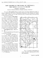
DSpace at VNU: Margin deltas in the northern part of the Red River basin
Bạn đang xem bản rút gọn của tài liệu. Xem và tải ngay bản đầy đủ của tài liệu tại đây (1.83 MB, 10 trang )
VNU Jo u rn al of Science, E arth Sciences 24 (2008) 16-25
Margin deltas in the northem part
of the Red River basin
Doan Dinh Lam1'*, Nguyen Trong Tin2, Nguyen Thi Hong2
1Institute of Geological Sciences, Vietnamese Acaảemy of Science and Technology
2 Vietnam Petroleum ỉnstitute, V ietm m Oil-Cas Group
Received 20 F ebruary 2008; received in rc v ise d form 15 M arch 2008
A b stract. M arg in d cltas are th e last oncs th at vvere ío rm ed in a sh c lí b reak zo n e/ w hen a sea lcvel
h as slo w d o w n d u rin g last tim c of a íorced reg ressio n a n d the b eg in n in g of th e success
tran sg ressio n . T he m arg in d cltas are a b ru p tly thickcned in th e zo n e of sh elf break, bccam e thin n cr
la n d w a rd a n d b asin w a rd . B ccausc they vvere íorm ed in th c sh eỉf edge, thcy h av c a relatively high
san d /clay ratio, p ro n e to tu rb id ite.
In th e n o rth e rn p a rt of th e Red R iver basin, d u rin g th e M ioccnc th c m arg in doltas h ad
d e v e lo p c d eastvvard írom th e plot 103, i.e. from the b o rc h o le 103-TH-1X, 103-TG-1X a n d 1Ơ3-HOL
sea w ard .
An ex isten c e of thc m arg in dcltas in this region confirm s a p resen cc of th c basin íloor fans in
th e Central p art of b asin - vcry im p o rtan t obịects for oil-gas prospccting.
Kcyioords: M argin delta; D elta front dcposit; Red Rivcr basin;
im p o rtan t role in prospecting and exploration
oil an d gas on the shelí. A presence of the
m arg in deltas will help in determ ining
vvhether there is a basin floor fan - an
im p o rtan t object in oil and gas prospecting.
F urtherm ore, them selves, they are also
subject of prosperous potential of oil and gas.
For the íirst stu d y of m argin deltas in the
no rth ern part of the Red River basin, the
M iocene deposits in the northern part of the
Red River basin - vvhere a Continental shelí
vvas vvell developed and has a high potcntial
of oil and gas - vvere chosen. The data used in
this study w as collected from Vietnam
P etroleum Institute and other publications.
1. In tro d u ctio n
VVhen sea-level slow dow ns in the
transgression-rcgression cycle, especially due
to lovvering sea level, a shelí vvas exposed and
a series oí deltas vvere íorm ed. A m argin
delta is the last One that vvas íorm ed during
the last tim e o í lovvstand stage and early time
of the next transgression stage. There are
som e papers d ealin g w ith m argin deltas [5,
6]. The m argin deltas are vvell developed with
a w idth of tens kilom eters and thickness
reached h u n d re d s m eters, their slope is about
3-6°. A stu d y of m argin deltas has an
* Corresponding author. Tel.: 84-4-7754608
E-mail: ddir\hlamc2>y ahoo.com
16
Donn Diĩĩh Lam et al. / V N U Ịournal of Science, Earth Sciences 24 (2008) 16-25
2. Som e characteristics, ío rm in g process and
dev elo p m en t of th e m arg in d eltas
Most of m argin deltas w ere developed in a
passive m argin area. These deltas have a lob or
17
m ultilob form and stretched along strike [5, 6].
The length of these m argin deltas often
reached 30-50 km and their vvidth is of tens, or
even h undred kilom eters (Fig. 1).
Continental slope
M argin delta
c "50 Isopach thickness of m argiu đeltas
20 0
v/atei depth
Fig. 1. G eo m ctry of m arg in d cltas: A -M exican g ulí, B -M ississippi (S.J. Porebski, R.J. Steel, 2001).
The thickness of the m argin deltas is
about 50-70m, even som ew here it reached
m ore than 150m. O n seism ic proíiling, their
reíections are from oblique to tangential form,
dipping to the basin, ended by to p lap under
erosion plane. A key íacies com plex of the
m argin deltas is a com plex of river m outh
bars
and
d elta
íront/slope
deposits.
Landw ard, a river m outh bars consist of fine
to m edium san d s vvith a high thickness.
Thcse sands are m ore or less clean, vvave
bedding or parallel, plane or oblique bedding
w ith a lovv slope. Delta íront deposits are
underlain by shelf deposits that w ere íorm ed
beíore and consist of thick sand layers.
Because delta fro n t dcposits of m argin delta
are underlain by previous íorm ed deltaic
deposits, so norm ally they are consist of very
thick sand layers and also turbidities.
M argin deltas are different from inner
doltas by the íollovving íeatures:
- M argin deltas have a m ultilobe or
accurate to lunate bodies vvhile inner self
deltas have a horsetail form.
- The size of clinoíorm w edges w ith a
m axim um thickness at shelf break is m uch
m ore bigger than the inner or m iddle shelí
delta, reached h u n d red s m eters com paring to
tens m eters of the last.
- In dip direction, m argin delta deposits
are thicken as a clinoíorm w edge tovvards the
shclí edge and becam e thin ị^radually dow n
into u p p er slope deposits.
- Sigm oidal dip cross-section.
- The m ost distinctive íeature of the
m argin delta is their strike-elongate form
Donn Dinh Lam et a i ỉ VNƯ Ịournaỉ o f Science, Earth Sciences 24 (2008) 16-25
18
along shelí ed g e and could reach 30-90 km.
The isopach of th e m argin delta deposits have
a strike elongate form and are augm ented by
íaults.
- Landvvard these deposits are pinchout
by onlap onto sh elí shales and basinvvard the
shelí delta d ep o sits pinchout by dovvnlap to
hem ipelagic shales.
- There is an evidence of shortenning in
stratigraphy.
- The delta íro n t/p ro d eltaic deposits of the
m argin delta are pro n e to turbidite.
- The abundanoe of so called soft deíormation
of the deposits related to the sỉope.
- The absence of a horstail paralic along
shelí edge.
M argin d elta íorm ing process and
evolution history are closely related to a
íorced regression of the sea level d u rin g the
late tim e of the low stand stage, beginning
tim e of the transgression stage (Fig. 2).
Inner-shelí ốela
Highstanđ stage
Progradation to aggradaùon
Miđ-shelf đelta
Lowenng seô-tevel
Progradaton to dơwnstepping
Margin delta
Lowenng and lowstarìd stage
aggradanon
Progradabon to aggradè
to bãckstepping
m
Slop shales
í---------1Rlver m oư h c a r / .
1-------- deta íront deposits
I
1Delta plain ơeposit
^
--------
Inctseđ valeys
I---------1Shôlí shale
G m
Eros,on
P0SS
Fig. 2. F orm ing p ro c esse of a m arg in delta rclated to
sea-level c h a n g e (P orebski, Steel, 2001).
£ M argin delta deposits w ere íorm cd in
reíatively deep w ater and are vvicỉe spread in
the shelf area, w here strong subsidence
occurred. The m argin deltas are com posed of
a series vvedges, the u p p er bo u n d ary of
w hich is a trace of sedim ent supply or of
com plex
erosion/transgressive
erosion.
Because m argin deltas are íorm ed in the shelí
break. zone so their thickness is abruptly
increased at the shelf break and dcltaic
clinoíorm s have bigger size com pared to
others. W hen deltas have reached to the shelí
m argin as a result oí low ering sea-level,
heterolithic delta íront deposits w ith small
b ed d in g becam e m ore turbidite becausc
su p p lied rivers vvill debouch directly to a
slope area, vvhich has a longer distancc and
higher slope, creating a good condition for a
hyperpicnal flow. This is vvhy the clinoíorm s
of m arg in deltas have a bigger size com pared
to others.
3. Som e geological characteristics of study area
T he stu d y area includes zones 102, 103,
104 an d a w est p art oí zone 107 (Fig. 3). The
sea d e p th is from 40-50m to 80-100m. Oil and
gas prospection and exploration in this area
vvere started from an earlier time.
Since 80-s of the 20 century, a prospect
w as carried out m ore intensively. Foreign
investors and V ietnam ese prospectors had
carried o u t thousands kilom eters of 2D and
h u n d re d s kilom eters of 3D seismic proíiling.
M any deep boreholes w ere set up for
investigation
oil-gas
potential
of the
V ietnam ese shelí. A lthough investigations in
different zones w ere not at the sam e level b u t
results of these investigations have revealed
som e geological characteristics and evolution
of the Red River basin in general.
G eochronologically, the M iocene deposits
Doan Dinh Lam et ai / VNU Ịournaỉ of Science, Earth Sciences 24 (2008) 16-25
vvere d ivided into 3 u n its as follow:
3 .2 . P h o n g C h a u ĩ o r m a t i o n (N i 1 p c h )
This íorm ation vvas establishcd in 1972 by
Palustovich and N g u y en N goe Cu, based on
cross-section from l,820m to 3,0001X1 oí the
borehole GK 100 in P hong C hau District, Thai
Binh Province. This cross section is
charactcrized by intercalated of m edium to
íine grained san d sto n es of grey to w hitish/
dark green color vvith silty sandstones vvith
vcry thin stratiíication, from som e m illim eters
to som e centim eters, th.1 t íorm ed an "eye"
structure, lenses o r w ave and called a
19
"striped" rock. A cem ent of sandstones is
m ainly carbonate vvith high content (25%).
Secondary m inerals are glauconite and pyrite.
The thiekness of íorm atìon reached l.lSOm.
The Phong Chau Form ation is distributed
m ainly in Khoai C hau - Tien H ai area and
developed to the Bac Bo G ulf (Borehole 103TH). It is com posed of sandstones, silty
sandstones and claystones vvith som e coal
traces or thin lim estones (borehole 103-TH,
1Ũ3-HOL). Their cem cnt is carbonate.
C laystones are light grey, brow nish red,
parallel
or
w avy
stratiíication.
Their
com position is com poscd m ainly of kaolinite
and illite.
Fig. 3. A stu d y arca.
In the seism ic cross-sections, Phong Chau
Form ation is ap p e a re d as a parallel reílection
vvith
a
good
continuity.
Based
on
palynological analysis, Phan H u y Q uynh and
Do Bat (1985, 1993, 1995) have established a
com plex of Betula- Alnipollenites and zone
20
Doan Dinh Lam et al. / VNƯ Ịoum al of Science, Earth Sciences 24 (2008) ĩ 6-25
Florschuctzia levipoli ot early Miocene.
D eposits of P h o n g Chau Form ation vvere
íorm ed in the deltaic condition and shelí
(Borehole 104), vvith som e phases of
transgression (borehole 100). M arine deposits
increased seaw ard . They are underlain vvith
unconíorm ity by D inh Cao Form ation or
older rocks.
3.2. Phu Cu ĩorm atìon
The Phu Cu Form ation w as established by
G olovenok V.K an d Le Van C han in 1966,
w ho íirst tim e described this íorm ation from
borehole GK 2 (from 960m to 1,1801X1) in Phu
Cu structure oí H a Noi D epression. Hovvever,
at this tim e a b o tto m of this íorm ation vvas
not clear. T he íorm ation is consists of
deposits that are characterized by clear
cyclicity of m ed iu m
sandstones, silty
sandstones vvith thin stratiíication (vvavy,
lenses, cross bedding), silstones, claystones of
m assive stru cture, contain a lot oí ílora,
bottom animals, íoraminiíers and thin beds of
lignites. S andstones are m onom inerals, well
sorted and ro u n d ed . Beside turm aline, zircon
as secondary m in erals som ew here glauconite
and garnet are occurred. Later, after careíul
check oi all cross sections of Phu Cu Formation
of the deep b orẹholes that penetrated across
the vvhole íorm ation, Phan H uy Q uynh and
Do Bat (1983) a n d Le Van Cu (1985) have
divided the P h u Cu íorm ation into 3 parts
according to cyclicity point of vievv. Each p art
consists of sand sto n e, siltstone, claystone
contain coal an d ílora íossils. Som ew here
foram inifers an d brackish m olluscs are
occurred.
The Phu C u dep o sits are w ide spread in
H anoi D epression. Its thickness becam e lovver
in D ong Q uan area and higher seavvard in
Bac Bo Gulf. D eposits consist of sandstones,
silty. claystones, coals and somevvhere thin
layers of carbonates. Sandstones have a light
grey to light green color. They are fine to
m edium grainsized/ average to well sorted.
Their typical íeature is thin bedding. There
are siderite nodules or glauconites (boreholes
GK 100, 102, 110, 104). A carbonate cem ent oí
sandstone is a b u n d a n t clay cem ent is rare.
Silty claystones are light grey to d ark grey
color, contain a little of carbonates, flora and
coals (borehole GK 103-TH). The thickness of
this íorm ation is varies írom l^OOm to
2,000111. This íorm ation is distinguished by a
high content oí organic m atter, about
0.86%wt, that reached a criterion of source
rocks and in fact, in Hanoi D epression, oil
and condensats w ere íound in this íorm ation.
O n seismic cross-sections, deposits of this
íorm ation are displayed as a parallel or
chaostic reílectors w ith high am plitude and
írequency that related vvith coal bearing
layers. Their M iddle M iocene w as established
based on a com plex of íossils: Florshuetzia
trilobata and F i Semiỉobata and Gỉoborotralia
mayeri, Orbulina universa.
The Phu Cu Form ation is coníorm ably
u nderlain by the Phong Chau Form ation and
vvas form ed in the deltaic and shelí condition
w ith som e phases of m arine transgressions.
Seaw ard to the Bac Bo Gulf/ these deposits
have changed into u n d erw ater delta, delta
íront deposits.
3.3. Tien Hung ĩormation
The
Tien
H ung
Form ation
w as
established by G olovenok V.K and Le Van
C han (1966) and its nam e - Tien H ung is a
locality of Thai Binh Province, w here its
stratotype w as established in the borehole
GK-4 from 250m to 1,01 Om. The Tien H ung
Form ation consists of deposits that have very
Doan Dinh Lam ct al. í VNU Ịournal of Science, Earth Sciences 24 (2008) ĩ 6-25
clear cyclicity. Each cycle started by brecia,
sandstones th at changed into silstones,
claystones vvith som e lignite layers. The
thickness of coarse deposits is thicker than
íinegrained deposits. The am ount of observed
cvcles in this íorm ation is 15-18. Sandstones
and brecias arc vveekly cem ented, bad sorted
and rounded, contain m any garnets. There
are sandstones o f vvhitish grey color contain
siderites nodules in the low er part. The
thickness of the íorm ation in this borchole is
about 760m.
Because of íacies change, it is difficult to
determ ine thc b o u n d ary betw een Ticn H ung
and Phu Cu íorm ations. In the lovver part of
Tien H ung Form ation, Phan H uy Q uvnh and
Do Bat (1985) h av e íound a layer of grey
sandstone, contains a m arks of leavcs that is
quite vvidely occurred in the m ost boreholes
in the Hanoi D cpression. They consider it as a
sign of change to Continental condition after
íorm ing the Phu Cu Form ation. The bottom
of this san d sto n e is regarded as a lovver
boundary of th e Tien H ung Form ation. The
Tien H ung Form ation is w idely distributed in
most boreholes of the H anoi D epression and
oííshore in Bac Bo Gulf. S andstones of this
íorm ation
have
a
thick
to
massive
stratiíication, ligh t grey color to greenish
grey, average to bad sorted. Their cem ent is
carbonate or clays. Silty claystones have a
dark grey to light grcy color, somevvhere
brovvnish grey, d ark grey (Borehole 104, 102HD), contain
coals and
íossils with
glauconites and pyrites (borcholes 100, 103TH). Total thickness of this íorm ation is
varied from 760m to 3,000111.
On seismic cross-sections, the Tien H ung
Formation is disp lay ed as a sequence vvith a
vveak stratiíication, high am plitude. The Tien
H ung Form ation has a contact vvith the
underneath P hu Cu Form ation by an
21
uncỏníorm ity that has a sign of regression in
upliít zone with two phases of non-continuity
reílectors. Fossils íounded in the Tien K ung
Form ation consist of a m ark of flora, spore
and pollens, foram inifers and nanoplankton.
A typical com plex w as íound in m edium
sandstones such as Quercus lobbii, Ziziphu$.
This layer is occurred vvidely in the Hanoi
D epression as vvell as in the N orth Vietnam
such as in Tam Cha (Na D uong, Lang Son),
Bach Long Vi, Trinh Q uan (Phu Tho). The
Late M iocene age of this íorm ation vvas
established based on a pollen spore complex:
Dacrydiumllex, Quercus, Florschuetzia trilobata,
Acrosticum, Stenochlaena as vvell as a
íoram ỉniíer
complex:
Pseudorotaỉia
sp.,
Ammonia sp.. Dcpositional environm ent of this
íormation is mainly dcltaic with some phases of
shallovv marine and underw ater deltas.
4. Sea-level ílu ctu atio n an d ío rm atío n of
m argin deltas in the n o rth e m p art of the
Red R iver basin
A stu d y result on the Red River basin has
revealed 8 transgression/regression cycles
d u rin g the M iocene. There are 2 cycles in
Early Miocene, and 3 cycles in M iddle and
Late M iocene [1, 2, 4]. A m ong these cycleSy
the ones in M iddle M iocene are m ost
developed. D uring transgression, the sea
level w as higher the recent one. The study on
sea-Ievel
íluctuation
in
the
region,
characteristics of the u p p cr suríaces of U pper,
M iddle and Lovver M iocene deposits (Fig. 4),
as vvell as study on lithological íeatures,
depositional íacies, structures,... of the
boreholes 102-CQ-1X, 102-HD-1X, 103-TH-lX,
103-TG-1X, and 103 HOL-1X, had revealed
that in Early M iocene in n o rth ern p art of the
Red River basừi, m argin deltas have
22
Doatĩ Dinh Lam et a i i V biu Ịournal o f Science, Earth Sciences 24 (2008) 16-25
developed only eastvvard írom plot N° 103,
i.e. írom borehole 103 HOL seavvard. D uring
M iddle and Late Mioeene, the m argin deltas
had developed eastw ard from borehole 103TH-1X and 103-TG-1X. A slope of shelí
during Late M iocene vvas 4-5° at borehole
103-TH-1X and 103-TG-1X and this w as a
shelí break.
second sequence of the P hong Chau
Form ation of borehole 103-TG-1X, u p p er part
of the íirst sequence of the Phu Cu Form ation
(borehole 103-TH-1X and 103-TG-1X) are
river m outh bars (Fig. 5). These river m outh
bars consist of íine to m edium grained sands
(varied from 35% to 40%). S ands are elean,
well to average sorted, light grey color. The
cem ent are calcite, silic and clay, contain
mica, glauconite. River m outh bar have a
very thick sands (10-2001), coarsening
upw ard . Bioturbation in the lovver p art is
week and sands do not contain íossils, or
som e scared bivalves and flora. Sands have a
parallel, vvavy bedding or even massive
structure. Their seism ic speciíic íeatures show
divergent, not continuous w ith am plitude
from average to high, lovv írequency and high
speed (5.7km/s). The thickness of river m outh
Fig. 4. Isoliths o f tho u p p e r su ríaces of M iocene
d ep osits in the N o rtn e rn p a rt o f th e Red River basin.
(A-Loiver Miocene; B -M iddỉe Miocene; C -U pper Miocene)
5. Some íeatu res of m argin deltas in the
n o rth e m p art o f the R ed R iver b asin
In the n crth ern part of the Red River
basin, m argin deltas have developed
eastvvard from the borehole 103-TH-1X. They
are com posed of river m outh bars and delta
íront deposits. A ccording to obtained results
from boreholeSy in the stu d y area the upper
part of the second sequence of the Phong
Chau Form ation from borehole 103-TH-1X,
bars are of 15-20 to 30-40m. Geochronologically,
the river m outh bars are overlain by delta
íront deposits. Delta íront deposits became
thinner in both sides and changed to claystone,
silty claystone w ith thin stratiíication of inner
or m iddle shelí deposits.
In the study area, delta íront deposits are
distributed as follow:
In the borehole 103TH-1X, delta front
deposits are third sequence of the Phong
C hau Form ation, second sequence of the Phu
Cu Porm ation and first sequence of the Tien
H u n g Form ation. In the borehole 103-TG-1X,
the sedim ents of the second and third
sequences of the Phong Chau Form ation, íirst
and second sequences oí the Phu Cu
Form ation and third sequence of the Tien
H u n g Form ation are delta íront deposits.
In the borehole ÌOỈ-HOL, as the delta íront
deposits can be considered sedim ents of the
third sequence of the Phu Cu Formation and
ửứrd sequence of the Tien H ung Formation.
These delta íront deposits consist of silty sands,
Donn Dinh Lam et a i Ị VN U Ịournaỉ of Science, Earth Sciences 24 (2008) 16-25
sandy silts, fine sands, poorly fossiliferous.
They composed the progradational vvedges,
thickness of which increased seavvard (Fig. 7).
The sand/clay ratio changed írom 40% (103-THIX) to 35% (103-TG-1X).
Fig. 5. S and m o u th b ar a n d its vvell logs (B orehole
103-TH-1X).
The sands are clcan, fine to m edium
grained, average to poorly sorted of light
grey, grey color. These san d s are vveekly
Consolidated; they contain mica, pyrite,
siderites, glauconites and m ontm orillonites.
The sands are m ostly íeldspathic litharenite
and litharenite. M ost sand layers have a
thickness from 10-20m to 60m (103-TH-1X),
(Fig. 8). T he a m o u n t of ío ssils in d e lta íro n t
23
deposits is m uch m ore abu n d an t than in
sand-m outh bar. Delta íront deposits are thin
bedded, parallel lam inated to vvavy. Thin
beds of parallel lam inated sands and thick
clay m u d layers, none or poorly bioturbated
here is interpreted as delta íront turbidites
deposits (Fig. 6).
M ost ab u n d an t phenom ena in delta íront
deposits is a slum p, that m akes delta front
deposits of m argin delta are prone to
turbidite and w hy a slum p is a very typical
characteristic of m argin delta. Bccause vvhen
reached to the shelí edge a slope will be
changed very quickly, creating a good
condition for a slum p to develop.
The vvell logs of thc delta íront deposits
have a bell, tunnel, sym m etric saw-tcx)th
forms. On the seismic cross-sections, thc delta
íront deposits show
a m ound, non
continuous vvith a high to average am plitude
and average írcquency (Fig. 6 and 7), v=2.52.7km/s in the borchole 103-TG-1X and
radiate and m ound íorm , average continuity,
high am plitude, v= 2.2-2.4km/s in the
borehole 103-TH. Sanđs are stratìíied
diííerently, some sandlayers in borehole 103TH have a thickness over 20ITI, even reached
óOm, in others they are thinner, less than 20m.
D eposits contain foram inifers such as
Ammơnia sp., Pseudọrotala s p v Quinqueloculina
sp., Cyclmmina sp., Globigerinoides sp.7 and
som e spore and
pollens: Florschuetzia
meridiotialis, Florschuetzia levipolis, ĩỉorschuetiia
trilobata,... (103-TG-1X, 103-TH-1X).
Doan Dinh Lam et ai. / VNU Ịournal of Science, Earth Sàences 24 (2008) 16-25
Lqaer M iorgne
Fig. 6. T urbiditcs of the U pper M iocene (C ross-scction GPGT93-201).
Fig. 7. P ro g rad atio n al w cd g e of th e sh elí-m arg in dclta.
Fig.8. D elta front san d s, san d y silts and w ell logs (b o reh o le 103-TG-1X)
Donn Dinh Lum el ai / VNU Ịournaì of Science, Earth Sciences 24 (2008) 26-25
6. C onclusions
- In the northern part of thc Red Rivcr
basin, during the Miocene, m argin dcltas
have developed eastw ard from the plot
N°103. Thcse m argin dcltas w ere íormecỉ and
developed at the end of the low stand stage,
beginning of the transgressive stage. A
thickness of these delta deposits varied írom
40-60 to 80-1 OOm.
- An existence of the m argin deltas in
Miocene in the n o rth crn part of the Red River
basin coníirms a prescnce of basin íloor fans
in the Central p a rt of the Red River basin.
These basin floor ían s are im portant objects of
oil-gas prospecting that need to take in
account.
25
R eíerences
[1] N g u y ên Thi H ong, Study, appỉication of sequence
stratigraphy in analì/sis oiỉ-gas systems o f the
Neơgene deposits in the northern part of the Red
River basiĩĩ, MSc thcsis, C ollege of Scicncc, VNU,
H a noi, 2007 (in V ietnam ese).
(2) Bui
V an T hanh,
C ao
V an
tran sg rcssiv e/rcg rcssiv e
N co g en e
d ep o sits
P roceedings
of
th e
Dao, D eterm ine
scquences
in
borehole
C o ngrcss
in
the
colum ns.
"30 years
of
Vietnamese oiỉ-gas, neiv chances and cỉtalỉenges"
H anoi, 2005 (in V ictnam ese).
[3Ị T ran H u u Than, Geoỉogicaỉ evoỉution and oiỉ-gas
Ịìotential of the Red Rivcr basỉn, S đ en tiíic rcport,
A rchive in th c V ietnam
P etroleum Institute,
2004 (in V ietnam ese).
|4) N guyen Trong Tin, N guy en The H ung, Tran H uu
Than, Do Bat, Doan Dinh Lam, Application of
scqucnce stratigraphv in prospcx^ing oil-gas in the
no rth em part oí thc Red River b a s ia some
A cknovvledgem ents
This paper vvas com pleted w ithin the
íramevvork o í F undam ental Research Proịcct
709306 íunded by Vietnam M inistry of
Science and Technology.
cxamplcs, Ịoumaỉ of Oiỉ - Gas 1 (2006) 15 (in
Vietnamese).
[5] J.R. Suter, J.R. Berryhill, L atc Q u atern ary m argin
dcltas, n o rth w c st g u lf of Mexico, Americaỉ
Association of Petroleum Geology BuII. 69 (1985) 77.
[6] S zczepan ). Porebski, R onald J. Steel, M argin
deỉtas:
relation
thcir stra tig ra p h ic
to
d e e p ív a te r
Revieivs 62 (2001) 283.
signiíicance and
sands,
Earth
Science