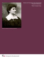
Berichte der Geologischen Bundesanstalt Vol 49-gesamt
Bạn đang xem bản rút gọn của tài liệu. Xem và tải ngay bản đầy đủ của tài liệu tại đây (6.95 MB, 121 trang )
Berichte der Geologischen Bundesanstalt, Band 49, ISSN 1017-8880, 113 S., 43 Abb., Wien 1999
Forum of the European Geological Surveys Directors
FOREGS '99 Vienna
150 Years Geological Survey of Austria
Field trip guide
Vienna - Dachstein - Hallstatt - Salzkammergut
(UNESCO World Heritage Area)
Gerhard W. MANDL (Editor)
with contributions by
Fritz E. BARTH, Thomas HOFMANN,
Hans Georg KRENMAYR, Harald LOBITZER,
Gerhard W. MANDL, Rudolf PAVUZA,
Werner E. PILLER, Wolfgang SCHNABEL,
Hans-Peter SCHÖNLAUB, Günter STUMMER,
Hubert TRIMMEL, Godfrid WESSELY
FOREGS '99 - Dachstein-Hallstatt-Salzkammergut Region
Contents
Preface (H.-P. SCHÖNLAUB)
3
1.
Excursion itinerary
4
2.
Introduction to selected geological main units of Austria
2.1. The Bohemian Massif - a short introduction (Th. HOFMANN)
2.2. The Neogene of the Vienna Basin (W.E. PILLER)
Oil and Gas Occurrences of the Vienna Basin (G. WESSELY)
2.3. The Austrian sector of the North Alpine Molasse:
A classical foreland basin (H.G. KRENMAYR)
2.4. The Flysch Zone of the Eastern Alps (W. SCHNABEL)
2.5. Geology of the central and eastern sector of the
Northern Calcareous Alps (G.W. MANDL)
3.
Road side geology - from Vienna to Hallstatt
(Th. HOFMANN & H.G. KRENMAYR)
3.1. Bus tour Vienna - Gmunden
3.2. Stop Gmundner Berg
3.3. Bus tour Gmunden - Hallstatt
4. The Dachstein-Hallstatt-Salzkammergut Region
4.1. A brief history of geological research of the
Dachstein-Hallstatt-Salzkammergut Region
(H. LOBITZER & G.W. MANDL)
4.2. Geological overview of the "Juvavic" Realm (G.W. MANDL)
6
6
11
20
22
27
36
54
54
66
67
68
68
78
5. The Hallstatt Salzberg
5.1. Archaeological heritage of the Hallstatt region (F.E. BARTH)
5.2. Short notes on the Hallstatt salt rock - the "Haselgebirge"
(G.W. MANDL)
83
83
6. The Loser panorama road (H. LOBITZER & G.W. MANDL)
6.1. Cyclicity of the Dachstein Limestone - the dominant feature
of the Dachstein landscape
6.2. Panoramic view: Dachstein glaciers, Pleistocene basin of Aussee
and Upper Jurassic limestones of Trisselwand and Tressenstein
96
7. The Dachstein Caves
7.1. The Dachstein region - its karst and its caves
(R. PAVUZA & G. STUMMER)
7.2. Legislative cave conservation in Austria: Experiences and results
(H. TRIMMEL)
8. The Dachstein-reef of the Gosaukamm - An Upper Triassic
carbonate platform and its margins (G.W. MANDL & H. LOBITZER)
Appendix
Authors addresses
Salzkammergut Panorama map - Excursion sites
-2-
91
96
98
101
101
106
108
FOREGS '99 - Dachstein-Hallstatt-Salzkammergut Region
Preface
Hans-Peter SCHÖNLAUB
The Annual FOREGS'99 Meeting held in Vienna, Austria, is concluded by an excursion to the
Unesco Cultural Heritage Landscape of Hallstatt-Dachstein. The decision to establish this region
as a World Heritage Site was accompanied in December 1997 with the following remarks: "The
Hallstatt-Dachstein/Salzkammergut Alpine region is an outstanding example of a natural landscape
of great beauty and scientific interest which also contains evidence of a fundamental human
economic activity, the whole integrated in a harmonious and mutually beneficial manner."
According to Article 1 of the Unesco World Heritage Convention such a landscape represents the
"combined works of nature and of man" or - expressed in a simple way - a region in which the local
population is strongly dependent on the surrounding nature. During the excursion we will try to
demonstrate this intimate relationship.
This Guidebook provided by Earth scientists is intended as a starting point to complement the
formal political decision to nominate parts of the Salzkammergut as a World Heritage Site. It has
specifically been compiled for this event and benefits from contributions from various authors and
sources who contributed published and unpublished data from different fields of expertise including
historical and applied geology, archaeology and research in karst speleology. Primarily, however,
the recently published new Geological Map of the Dachstein Region at the scale 1:50.000 should
be mentioned which had been compiled by Gerhard Mandl from the Geological Survey of Austria
with support from the Federal Environment Agency. Both the Guidebook and the Map should
stimulate further research, relevant PR products and the necessary infrastructural measures to
fulfill the aims of the Convention and the expectations of the wider public.
In the Salzkammergut region geoscientific research has a long tradition. In fact, the area represents one of the key areas for the understanding of Triassic and Jurassic stratigraphy and the
corresponding facies development of the whole Alps, having further implications for the broader
Tethys realm of almost global significance. Besides others, this fact is reflected by the currently
used ammonite biostratigraphic zonation based on the Salzkammergut area. Presumably, during
the 5th International Cephalopod Symposium taking place shortly after the FOREGS '99 Meeting in
Vienna this linkage will be discussed at length.
The majority of visitors to the Hallstatt-Dachstein region are equally impressed by the surrounding
mountains and the beauty of the villages with its traditionally styled houses decorated with many
flowers. Such a truly sustainable development is the result of a long lasting economic development
based on salt mining since Celtic times when the so-called "Hallstatt Culture" flourished in this
region. Later on, beginning in the 19th century also forest industry and tourism became a major
source of wealth for this region.
Economic geology, i.e. salt mining, general geology, hydrogeology, palaeontology and archaeology
may guarantee further welfare in this region if treated carefully and responsibly. The declaration as
a "cultural landscape" and its strong relationship with geology provides a first step in this future
direction.
The organizers of this excursion greatly acknowledge the generous help of all authors who
contributed to this Guidebook including general reviews on road-side geology. In particular, we are
indebted to Gerhard MANDL and co-workers from the Geological Survey for their authorship and
guidance during the excursion.
Hans Peter Schönlaub (Director)
-3-
FOREGS '99 - Dachstein-Hallstatt-Salzkammergut Region
1.
Excursion itinerary
Monday, August 30,1999
12:30 -18:00: Bus tour Vienna-Gmunden-Hallstatt (310 km)
For explanations of road-side geology see chapter 3.
about 18:00:
Arrival at Hallstatt (Hotel Bergfried)
Tuesday, August 31,1999
8:30 - 9:30:
Boat tour on Lake Hallstatt with an introduction to the regional geology.
For additional information see chapters 2.5 and 4.2
10:00:
Congress Center Hallstatt: Welcome by Mr. Scheutz, Mayor of Hallstatt
10:15 -12:30:
Presentations by local representatives on "The Hallstatt-Dachstein region
as UNESCO Cultural Heritage Landscape" and by GBA representatives
on "Marketing geology in the Hallstatt-Dachstein region"
10:15 -12:30: Partners Programme: Guided tour in Hallstatt
14:00-17:00: Ascent by cable-railway to the world's oldest underground saltmine, still
operating since the year 1.000 ВС, with a special prehistoric tour of where
the "Man in Salt" was found over 300 years ago
For additional information see chapter 5.
Panoramic view from the Rudolf Tower over the idyllic community of
Hallstatt and the Salzkammergut
-4-
FOREGS '99 - Dachstein-Hallstatt-Salzkammergut Region
Wednesday, September 1,1999
8:30 -10:00:
Bus tour from Hallstatt via Bad Aussee to Loser Mountain with panoramic
view at altitude 1600 m and presentation of regional & local geology.
For additional information see chapter 6.
11:00:
Departure for Grundlsee and Toplitzsee
12:00 -14:00: Lunch at Fischerhütte/Toplitzsee with optional boat tour
14:00 -15:00: Bus tour to Obertraun/Dachstein Cable Car
Ascent and a 10 minutes walk to the entrance of the Ice Cave
15:30 -17:00: Visit to Giant Ice Cave (1 hour; be ready for a temperature of + 2°C only!)
For additional information see chapter 7.
17:00:
Descent and return to hotel
Thursday, September 2,1999
8:30:
Departure from Hallstatt to the village of Gosau and Gosau Lake
9:30 -10:30:
Ascent by cable car to Gosaukamm (1475 m)
10:30-12:30:
Panoramic view from Gablonzer Hütte to Dachstein and Gosaukamm.
Introduction to local geology and short walk to fossiliferous Triassic strata.
For additional information see chapter 8.
13:30:
Return and departure for Vienna
about 18:00:
Arrival in Vienna. End of FOREGS '99 Excursion
-5-
FOREGS '99 - Dachstein-Hallstatt-Salzkammergut Region
2.
Introduction to selected geological main units of Austria
2.1.
The Bohemian Massif - a short introduction
Thomas HOFMANN
The Bohemian Massif is part of the Variscan orogenic belt of Europe which comprises
different metamorphic units and granitic intrusions. The surface outcrops North of the river
Danube belongs to the Bohemian Massif which extends as well to the South below the
Rhenodanubian Flysch Zone and the Molasse Zone. It represents a former fragment of
Northern Gondwana that split off during early Paleozoic time and collided with Avalonia
and Baltica during middle Paleozoic time. This block is essentially composed of mediumgrade metamorphic rocks derived from early to late Proterozoic and early Paleozoic
precursory and extensive granites of Variscan age.
Structurally, the Bohemian Massif of Austria consists of two units, the Moldanubian Zone
in the west and the Moravian Zone in the east. The former consists of paragneisses
overlain by a complex of variegated crystalline rocks, granulites, and orthogneisses while
the latter exhibits low- to medium-grade micaschists, metasedimentary rocks, orthogneisses and a cadomian granite (Thaya Batholith). During the Variscan Orogeny the
Moldanubian Zone was thrust upon the Moravian Zone. Their complex lithologies and
different evolutionary histories suggests, that originally the two zones may have
represented two separate microplates.
The Moldanubian Zone
The Moldanubian part of the central European Variscan Belt shows characteristics of a
collisional orogen. Nappe tectonics and high-P/high-T metamorphism have been identified.
In the southeastern part of the Moldanubian zone, the development of the early Variscan
metamorphism with subsequent nappe piling can be observed. The late orogenic development in the Moldanubian zone is dominated by high-T/low-P metamorphism within the
lowermost structural units. The high temperatures led to regional migmatisation and the
generation of granitoid magmas which formed the South Bohemian Batholith and other
plutons.
The Moldanubian nappe pile consists, from top to bottom, of three major units: the
Gföhl nappe complex (or Gföhl unit), the
Drosendorf unit and the
Ostrong unit (= Monotonous Series).
The Gföhl nappe complex consists of an internal framework of different units (granulites,
Raabs unit, Gföhl gneiss and Meisling unit), of generally high-grade (up to granulite-facies)
metamorphism. The Meisling unit composed of amphibolites, orthogneisses and metasediments separates the Gföhl unit and the Drosendorf unit.
Fig. 2.: Geological Map of Austria and
FOREGS '99 Excursion route
-6-
->
Layout and realisation:
M. BRÜGGEMANN-LEDOLTER,
EDP-realisalion:
M BRÜGGEMANN-LEDOLTER. J RUTHNER
FOREGS '99 - Dachstein-Hallstatt-Salzkammergut Region
The Drosendorf unit has a Proterozoic basement (Dobra gneiss) overlain by mainly
metasedimentary units (Variegated unit) of probable Palaecozoic primary age. It consists f
para- and orthogneisses, amphibolites, calcsilicates and marbles. The depositional
environment was probably a passive continental margin. The mafic layers within the Dobra
gneiss are interpreted as former basaltic dikes, while those in the Variegated unit are
derived from synsedimentary volcanics.
Fig. 2.1.: Tectonic map of the Bohemian Massif in Austria and adjacent areas
(modified from FRANKE, 1989)
The lowest structural unit in the southeastern Moldanubian zone is the Ostrong unit, which
is separated from the Drosendorf unit by a tectonic contact. Metapelitic rocks with
cordierite and sillimanite dominate in the former called Monotonous Series. In addition,
garnet-bearing ortho- and paragneisses and amphibolites occur. The protoliths of the
metapelites and paragneisses were most probably pelites and greywackes.
The igneous rocks of the eastern part of the South Bohemian Batholith cut the Moldanubian nappe system. The South Bohemian Batholith extends for 160 km from Jihlava
(Czech Republic) in the north to the Danube river in the south, and forms large areas in
the Austrian part of the Bohemian Massif. The granitoids are late-orogenic plutonic complexes within the Variscan orogenic belt. The are emplaced at mid- to upper-crustal levels
into hot country rocks shortly after the thermal peak of regional metamorphism. Clockwise
P-T paths in the country rocks suggest that granite formation, low-P/high-T metamorphism
and extensional thinning was preceded by a phase of intense crustal thickening which
occurred within the framework of the late Palaeozoic continent-continent collision between
Baltica and Gondwana. Apart from subordinate basic and intermediate rocks related to the
granitoids the South Bohemian Batholith consists of different types of granites.
-7-
FOREGS '99 - Dachstein-Hallstatt-Salzkammergut Region
1. The Rastenberg Granodiorite intruded along the tectonic contact between the
Drosendorf and the Monotonous unit. The pluton is granodioritic to quartzmonzonitic in
composition. A typical feature of this pluton is the occurrence of dioritic enclaves due
to magma mingling. These mafic bodies are more frequent than in any other granitoids
of the South Bohemian Batholith.
2. The coarse grained Weinsberg Granite is the most widespread. In general the
Weinsberg granite shows a large geochemical variation partly as l-type and partly as
S-type granite. Like the Rastenberg granodiorite, it is coarse grained and contains
idioblastic K-feldspar of up to 12 cm in size. S-type material, such as amphibolitefacies metasediments, particularly metagreywackes, were the possible protoliths for
the Weinsberg granite. Post-plutonic aplites, fine-grained granites and porphyrites cut
the Rastenberg granodiorite and the Weinsberg granite. Both granitoids were
classified as members of the "older plutons" in the succession of the South Bohemian
Batholith.
3. The Eisgarn Granite, which is commonly a muscovite rich granite with clear S-type
characteristics. Andalusite is a typical accessory mineral and indicates a crystallisation
at a relative small P-T-field formed by the intersection of the andalusite stability field
and the granite minimum melt curve. It is obviously contemporaneous with the
Weinsberg Granite.
4. The Mauthausen Granite varies from granodioritic to granitic composition and most of
the fine-grained biotite granites have been related to this group. They form dikes and
irregularly stocks within or in the vicinity of the Weinsberg granite. They are characterized by a clear l-type geochemistry. Inclusions of xenoliths and K-feldspar xenocrysts
derived from the Weinsberg type granite are a common phenomenon for Mauthausen
granite. In some parts it is considerably younger than the above mentioned types.
The Moravian Zone
The Moravian Zone is regarded as former western marginal zone of the so called BrunoVistulian Block, which is an old, at the latest Cadomian consolidated continental micro
plate in the eastern part of the Bohemian Massif. Today the Moravian Zone is dissected
from the Bruno-Vistulian Block by post-Variscan sinistral strike slip movements along the
Diendorf-Boskovice wrench-fault system, which amounted at least 25 km.
During Variscan orogeny the western marginal parts of the Bruno-Vistulian Block were
overthrusted by a hot nappe pile of the Moldanubian mobile belt. Thrusting occurred in
connection with a strong dextral transpression between the Moldanubicum and the
western flank of the Bruno-Vistulian Block. This transpression is responsible for the very
charakteristic North-South-trending elongation of the westernmost Moravian lithological
units and demonstrates the strong indentation that occurred within the Variscan continentcollision zone of Central Europe. The transpressional movements are followed by local
updoming. All these Variscan events together are responsible for the distinct metamorphic
and structural style of the Moravian Zone: a high degree of deformation and medium grade
metamorphism on top, continously decreasing towards the east and towards the northern
and southern ends of the Thaya Dome.
The deepest structural unit of the Moravian Zone is the weakly metamorphosed and
deformed granitoid complex of the Thaya Batholith of Cadomian Age. With regard to its
petrographical and geochemical characteristics the granitiods of the Thaya Batholith
broadly fit the definition of l-type granitoids.
-8-
FOREGS '99 - Dachstein-Hallstatt-Salzkammergut Region
Based on field mapping and chemical work four major lithologies could be distinguished
within the Thaya Batholith: the "Hauptgranite"-type (=main granite type) comprises
medium-grained light granites and granodiorites with low biotite, the "Gumping"-type
defines a more or less gneissic biotite-rich granodiorites and quartz-monzodiorites with
blocky K-feldspar phenocrysts and amphibole altered to biotite, the"Passendorf"-type
comprises essentially fine- to medium-grained tonalites and meta-tonalites or their gneisses
and the "Gaudemdorf"-type is a fine grainde granitic to granodioritic rock with somewhat higher
biotite contents than the "Hauptgranite" type.
Therasburg Formation
Toward the west the Thaya Batholith is overlain by the Therasburg Formation. It consists
of micaschists partly with a considerable amount of albite and/or oligoclase leading to fine
grained gneisses. The assumed stratigraphic position is inferred from some preserved
intrusive contacts and migmatites of the Cadomian Thaya Batholith as Precadomian.
Stengelgneis of Weitersfeld
This distict gneisss body separates the Therasburg Formation from the tectonical higher
sequence of the Pernegg formation. The Weitersfeld gneiss sensu stricto is restricted to
the northern part of the Moravian Zone showing a granitic composition with a partly well
developed Augen-structure, but seems to be in most parts derived from metaarkoses.
Pernegg-Formation
The Pernegg-Formation comprises micaschists, calcschists and pure marbles, which
grade into each other. The marbles prevail in the upper part of the sequence as coherent
layers, partly as elongated lenses. The uppermost part of the marbles is formed by a very
distict horizon of calcsilicate schists, the so called "Fugnitzer Kalksilikatschiefer". It is an
only several meters thick layer, sometimes also found as small layers and lenses in the
above lying Bittesch Gneiss.
Bittesch Gneiss
The Bittesch Gneiss is the uppermost unit of the Moravian Zone. It is a highly deformed
orthogneiss with well developed Augen structure. Dark ampibolite layers up to 50cm thick
are restricted to the uppermost 20 to 30 meters.
Acknowledgement
The author wants to express special thanks to Susanna SCHARBERT for critical reading and
constructive comments.
-9-
FOREGS '99 - Dachstein-Hallstatt-Salzkammergut Region
References
BÜTTNER, S. & KRUHL, J.-H. (1997): The Evolution of the late-Variscan high-T/low-P region: the
southeastern margin of the Bohemian Massif.- Geol. Rdsch, 86, 21-38, 14 figs.
FINGER, F. & RIEGLER, G. (1999): Der Thayabatohlith und der kristalline Untergrund des Weinviertels.- In:
ROETZEL, R. [Hrsg.]: Arbeitstagung 1999 Retz - Hollabrunn, 23-31, 3 figs.
FRANKE, W. (1989): Tectonostratigraphic units in the Variscan belt of Central Europe.- Geol. Soc. America,
Spec. Pap., 230, 67-90
FRASL, G., HOCK, V. & FINGER, F. (1990): The Moravian Zone in Austria.- In: FRANKE, W. [Ed.]: Terranes
in the Circum-atlantic paleozoic Orogens.- Field Guide "Bohemian Massif" IGCP 233, 127-136
FUCHS, G. & MATURA, A. (1976): Zur Geologie des Kristallins der südlichen Böhmischen Masse.- Jb. Geol.
B.-A., 119, 1-43
GERDES, A„ WÖRNER, G. & FINGER, F. (1998): Late-orogenic magmatism in the southern Bohemian
Massif - geochemical and isotopic constraints on possible sources and magma evolution.- Acta Univ.
Carol. 42(1), 41-45
HÖCK, V. (1999): Der geologische Bau des Grundgebirges.- In: STEININGER, F.F. [Hrsg.]: Erdgeschichte
des Waldviertels. - Schriftenreihe des Waldviertler Heimatbundes, 38, 2. Aufl., 37-60, 5 figs., 1 tab.
KOLLER, F. (1999): Plutonische Gesteine.- In: STEININGER, F.F. [Hrsg.]: Erdgeschichte des Waldviertels. Schriftenreihe des Waldviertler Heimatbundes, 38, 2. Aufl., 25-36, 8 figs., 1 tab.
PETRAKAKIS, К. (1997). Evolution of Moldanubian rocks in Austria: review and synthesis.- J. metamorphic
Geol., 15,203-222, 8 figs.
-10-
FOREGS '99 - Dachstein-Hallstatt-Salzkammergut Region
2.2.
The Neogene of the Vienna Basin
WERNER E. PILLER
Introduction
The Vienna Basin, located between the Eastern Alps, the West Carpathians and the
western part of the Pannonian Basin represents one of the best studied large pull-apart
basins of the world (ROYDEN, 1985; WESSELY, 1988). Similar to other European Tertiary
Basins (e.g., Paris Basin, London Basin, Mainz Basin) the Vienna Basin was the goal of
very early geological studies (e.g., STÜTZ, 1807; PREVOST, 1820; SUESS, 1885;
SCHAFFER, 1907). The importance for hydrocarbon exploration, however, distinctly
enhanced our stratigraphic, sedimentologic and tectonic knowledge of the basin during the
last 60 years. The different fields of interest studied cover all topics from palaeontology,
sedimentology, stratigraphy, tectonics, to natural resources like thermal water and
hydrocarbon.
Due to this overall importance the Vienna Basin was the target for several field trips in the
course of earth science conferences during the last years. As a result of these activities a
variety of field guides were produced (e.g., PILLER & KLEEMANN, 1991; PILLER &
VAVRA, 1991; SAUER et al., 1992; PILLER, 1993; PILLER et al., 1996) and the following
presentation widely duplicates earlier papers.
Geographical setting
The Vienna Basin is of rhombohedral shape, strikes roughly southwest-northeast, is 200
km long and nearly 60 km wide, and extends from Gloggnitz (Lower Austria) in the SSW to
Napajedl in Czekia in the NNE. The western border is bound to the south by the
morphological eastern margin of the Northern Alps (represented by several Alpine tectonic
units: Greywacke Zone, Northern Calcareous Alps, Flysch Zone) and to the north by the
Waschberg Zone. In the east it is bordered in the south by the hills of the Rosaliengebirge,
Leithagebirge and the Hainburger Berge, and in the north by the Little Carpathian
Mountains; all four hill ranges are part of the Alpine-Carpathian Central Zone. The Vienna
Basin is connected with the Little Hungarian Basin via the Hainburger Pforte and with the
Eisenstadt Basin via the Wiener Neustädter Pforte. The Eisenstadt Basin has a triangular
shape and is bordered in the east by the Rüster Höhenzug, in the north by the
Leithagebirge, in the west by the Rosaliengebirge, and in the south by the Brennberg. Its
maximum dimensions are approx. 20 by 20 km. The subsurface separation from the
Vienna Basin is represented by the continuation between the Rosalien- and Leithagebirge;
its tectonic and sedimentary history, however, is very similar and the Eisenstadt Basin is
therefore considered as a subbasin of the Vienna Basin.
-11 -
FOREGS '99 - Dachstein-Hallstatt-Salzkammergut Region
Stratigraphy, facial and tectonic development
The Vienna Basin is part of the Paratethys which formed together with the Mediterranean
Sea after vanishing of the Tethys Ocean. Due to its isolated position for most of the time a
regional stratigraphic stage system different from that of the Mediterranean had to be
established (e. g., RÖGL & STEININGER, 1983; SENES & STEININGER, 1985;
STEININGER et al., 1988; STEININGER et al., 1990; RÖGL, 1996; Fig. 14).
Due to the rhombohedral shape and the left-stepping pattern of en-enchelon faults firstly
ROYDEN (1985) interpreted the basin as pull-apart structure. This idea was strengthened
later on (ROYDEN, 1988; WESSELY, 1988), however, based on more profound data a
much more complex tectonic evolution was shown by several authors (DECKER et al.,
1994; DECKER, 1996; DECKER & LANKREIJER, 1996; DECKER & PERESSON, 1996).
The pull-apart mechanism started to act during the Karpatian (STEININGER et al., 1986;
SEIFERT, 1992; DECKER, 1996), older sediments (Eggenburgian-Ottnangian) at the base
of the northern part of the Vienna Basin belong to an earlier piggy-back basin of the
Molasse cycle (STEININGER et al., 1986, p. 295, PILLER et al., 1996; DECKER, 1996).
Between the Karpatian and Pannonian the subsidence in the central Vienna Basin
reached up to 5.5 km (WESSELY et al., 1993). Since the basin is subdivided by a
morphological high structure, the Spannberg ridge, into a northern and a southern part,
during the Karpatian sedimentation was restricted to the north (north of the Danube) and
extended into the south only during the Badenian. Due to the complex fault system the
basin was internally highly structured into horst and graben systems. Especially at the
western border of the basin, relatively uplifted blocks occur; these are separated from the
deep depressions located in the east along major faults (e.g., Mistelbach block along the
Steinberg fault in the northern, Mödling block along the Leopoldsdorf fault in the southern
basin). The interplay of highly active synsedimentary tectonics with rapid changing transand regression cycles (RÖGL & STEININGER, 1983) produced a complex facial pattern
inside the basin depending on distance from land and on position of the particular blocks.
The basement of the basin is built by those Alpine-Carpathian nappes bordering the basin
also on the surface. The Neogene sediment fill of the basin reaches a thickness of up to
6000 m. At the base mainly clastic sediments are developed representing fluvial facies;
occasionally lignite deposits occur (STEININGER et al., 1989). A fully marine development
over the entire basin was established only in the Early Badenian (Lower Lagenid Zone).
These sediments consist not only of elastics but also carbonates were deposited. This
facial development with local coral reefs and widespread coralline algal limestones is
restricted to the Badenian. During the Sarmatian, a reduction in salinity already started
leading to non-marine and subsequently continental conditions in the Pannonian-Pontian.
Although tectonic subsidence was high the basin was rapidly filled due to the short
distance to the source of clastic sediments and the basin cycle is therefore limited to the
Middle Miocene.
Badenian (16.4. -13 ma bp)
Due to the major marine transgression at the beginning of the Middle Miocene (RÖGL &
STEININGER, 1983, 1984) subtropical biotas entered the Paratethys. In the Vienna Basin
conditions for carbonate sedimentation and growth of coral buildups were favourable only
during the Badenian stage. Within the context of the meeting the development and facial
distribution for this period should be discussed in more detail.
-12-
FOREGS '99 - Dachstein-Hallstatt-Salzkammergut Region
The general biostratigraphic subdivision (PAPP et al., 1978) into Lower Badenian (Lower
and Upper Lagenid Zone), Middle Badenian (Spiroplectammina Zone) and Upper Badenian (Bulimina-Bolivina Zone, Rotalia Zone) is based on typical foraminiferal assemblages,
reflecting in fact an ecostratigraphical sequence. This sequence documents the salinity
reduction in the uppermost Badenian. The zonal scheme works well in central basinal
sections, in marginal position, however, reliability is limited. Besides these assemblages,
planktic foraminifers and certain benthic groups are also of special importance, e.g.,
uvigerinids, bolivinids, and to some extent also calcareous nannoplankton (e.g., STEININGER, 1977; PAPP, CICHA & CTYROKA, 1978; PAPP et al., 1978; PAPP & SCHMID,
1978; PAPP, 1978; FUCHS & STRADNER, 1977). Some species of the larger foraminferal
genus Planostegina (= Heterostegina in older literature) were considered as stratigraphically usefull (e.g., PAPP & KÜPPER, 1954; PAPP, 1978). Recent investigations, however,
brought forth opposite results (PILLER et al., 1995; ABDELGHANY et al., 1996).
The sediments of the lowermost Badenian (Lower Lagenid Zone) are confined to the
northern Vienna Basin. During the Upper Lagenid Zone, sedimentation is fully developed
in the entire basin. At the same time marine sedimentation starts in the Eisenstadt
Subbasin and facial differentiation reached its climax.
<
<
II
О
о
BIOZONES
AGE
Q_
Ш
CENTRAL
EASIhKN
PARATETHYS PARATETHYS
STAGES
STAGES
Berggrenetal., 1995
CO
о ,a>
11
•= J?
™ о
a. u-
si
1°
3 Е
CD
Oz
5—
IjLLI
ZANCLEAN
DACIAN
KIMMERIAN
PL1
NN12
5.3
LU
Z
LU
MESSINIAN
PONTIAN
M14
PONTIAN
b
О
о
to
10—
TORTONIAN
я
MAEOTIAN
15—
CD
T3
"O
SARMATIAN
SERRAVALLIAN
BADENIAN
LANGHIAN
Khersonian
Bessarabian
CO <
Volhynian
Konkian
Karaganian
Tshofrakian
M12
ми
ме
20—
OTTNANGIAN
EGGENBURGIAN
О
М4
KOTSAKHURIAN
NN4
МЗ
NN3
SAKARAULIAN
М2
NN2
CD
23.8
NN6
М5
>s
•c
Ш
NN9a/8
NN7
NN5
Мб
TARKHANIAN
KARPATIAN
BURDIGALIAN
NN9b
M7
16.4
LU
Z
LU
Ü
NN11
NN10
а
z
LU
о
M13
PANNONIAN
_i
11.0
z
Ш
о
СО
О Z
NN13
AQUITANIAN
EGERIAN
CAUCASIAN
М1
Fig. 2.2.1.: Chronostratigraphy and marine biochronology of the Miocene
(after RÖGL, 1996)
13-
b
а
NN1
FOREGS '99 - Dachstein-Hallstatt-Salzkammergut Region
The facial development roughly reflects a distinction between marginal and central basin
facies:
Along the basin margins in dependence on the hinterland and coastal morphology the
most complex facies pattern is developed. In general siliciclastics and carbonates can be
differentiated, both exhibting a rich facial diversity.
In general, the western border of the southern Vienna Basin is highly influenced by the
clastic sediment influx from the Northern Alps. Around the Leithagebirge, which
represented an island, a chain of islands or a shoal during the Badenian, and along the
Rüster Höhenzug, autochthonous carbonate sediments dominate (irrespective of
sometimes thick basal transgressive sediments).
The coastal development along the western margin shows strong fluvial influx at some
locations, expressed by thick conglomerates dominated by material derived from the
Northern Calcareous Alps as well as the Flysch Zone (Baden [Vöslau] Conglomerate;
comp. BRIX & PLÖCHINGER, 1988). In some places, steep rocky shores with large
boulders are also preserved (e.g., W Sooß), while wide coastal or marginal areas are
covered by sands (Gainfarn Sands) with a rich and excellently preserved fauna. These
sands interfinger with the basinal Baden Tegel.
CENTRAL
PARATETHYS
STAGES
<
2
5
5—
—
Q-O
5.3
5.3
Ш
z
ш
VIENNA BASIN
northern part
VIENNA BASIN
southern part
VIENNA BASIN
central part
DACIAN
DACIAN
(uplift
(uplift and
and erosion)
erosion)
PONTIAN
о
о
10
1
0—
—
5
£
го
_|
(limnic)
Pannonian A - H
PANNONIAN
(brackish)
11.0
ш
Z
ш
15
1
5—
—
SARMATIAN
\ ,
(brackish)
о
о
Rotelia - Zone
(reduced salinity)
ф
•о
Bulimina-Bolivina -Zone
Spiroplectammina - Zone
(marin)
тз
BADENIAN
16.4
KARPATIAN
LU
LU
Z
Z
OTTNANGIAN
о
о
EGGENBURGIAN
ш
20
2
0—
—
Nonlongranosum
-Zone
Elphidium hauerinum - Zone
Elphidium reginum - Zone
Upper Lagenid-Zone
Lower Lagenid-Zone
Laa Beds (marin)
'
/
LuschfeBeds
(mann)
(reduced salinity)
(marin)
/
'
'
/
/
/
'
>.
•с
га
Ш
23.8
EGERIAN
(marin)
Upper Lagenid-Zone
*
(marin)
Lower Lagenid-Zone
\ Aderklaa B.<1>
Gänsemdorf B. (2)
' Bockfließ B.
'
„ - - - ' " "
(1) (limnic, fluvial)
(2) (terrestrial, limnic)
i
Fig. 2.2.2.: Facial development and stratigraphy of the Vienna Basin with schematic
representation of the spannberg ridge in the central part of the basin
(after WESSELY, 1988, changed).
-14-
FOREGS '99 - Dachstein-Hallstatt-Salzkammergut Region
The most widespread facies unit along the Leithagebirge and the Rüster Höhenzug as well
as at certain sites along the western margins of the Vienna Basin with reduced terrigenous
input (e.g., around Wöllersdorf) is the Leitha Limestone. The name of this unit was already
established by KEFERSTEIN (1828) and is well known also outside the Vienna Basin. The
unit was redefined by PAPP & STEININGER (in:) PAPP et al. (1978) considering the
broad facial range and selecting a faciostratotype (comp. Stop 4). The microfacial diversity
was worked out by DULLO (1983) into detail describing 10 microfacies types.
Due to its high abundance of coralline red algae this Leithakalk is also well known as
Nullipora or Lithothamnium Limestone. Historically important is the first description of a
fossil coralline red algae out of this limestone: Nullipora ramosissima REUSS 1847. The
original material of this taxon was recently rediscovered and the species was assigned to
the genus Lithothamnion (PILLER, 1994).
In general, the limestone is characterized by the occurrence of coralline algae in various
growth forms, ranging from rhodolith dominated types of various growth forms to maerl
facies. Coral buildups of limited size are developed only locally. Such buildups are rare
along the western margin of the Vienna Basin due to the high terrigenous input and
represented only by small patch reefs. Also along the Rüster Höhenzug no significant coral
settlement is developed (or preserved); organic buildups are predominantly made up of
bivalve beds accompanied, in some places, by corals (comp. DULLO, 1983, p. 37). The
best developed coral buildups are present at the southern tip of the Leithagebirge, where
the limestones reach the greatest spatial extent and the thickest sequences (about 50 m).
Here, due to the island position, no major terrigenous influx restricted coral growth. On the
contrary, it can be assumed that water currents or relatively strong waves favoured their
growth at the southern tip of the Leithagebirge. The corals are represented mainly by
various taxa of Pontes, accompanied by Tarbellastraea, Caulastrea, Acanthastrea, and
Stylocora (PILLER & KLEEMANN, 1991).
The basinal facies is characterized by the Baden Tegel, a marl with variable sand and clay
content. Intercalated into the marls are sandy layers. This latter material is transported
from marginal sources. The marls and sandy interbeddings are highly fossiliferous,
containing an extremely rich micro- (foraminifers, ostracods) and macrofauna as well as
calcareous nannoplankton (comp. PAPP et al., 1978). The macrofauna is well documented
since the 19th century (e.g., D'ORBIGNY, 1846; REUSS, 1849; KARRER, 1861;
HÖRNES, 1856, 1870; HÖRNES & AUINGER, 1879) and is represented by solitary
scleractinians, brachiopods, decapod crustaceans, molluscs, and fish remains (teeth and
otoliths). In the sediments of the Lower Badenian the foraminiferal fauna is extremely rich,
containing not only planktic and smaller benthic representatives but in the sandy
interbeddings also larger forms as Amphistegina, Planostegina and Borelis melo.
Remarkable is the high diversity and good preservation of molluscs (gastropods, bivalves,
scaphopods).
The depositional depth of this fine-clastic material can be interpreted as being not deeper
than 50 - 100 m (PAPP & STEININGER [in:] PAPP et al., 1978, p. 140) or 100 - 200 m
(TOLLMANN, 1985, p. 500). The sandy layers are transported by gravitational transport
from marginal areas. Although subsidence of the basin during the Badenian was very
rapid, the relatively shallow water depth of the autochthonous sediments can be explained
by a high sedimentation rate leading to a sediment accumulation of approx. 1500 m in the
central basin during the Badenian (e.g., WESSELY, 1988, p. 342). In the Eisenstadt Basin
thickness of the Baden Tegel is distinctly less.
-15-
FOREGS '99 - Dachstein-Hallstatt-Salzkammergut Region
Sarmatian (13 -11.5 ma bp)
The salinity reduction which already started in the uppermost Badenian continues during
the Sarmatian. Salinity decreased generally from 30-17 %o and reflects the isolation of the
Paratethys from the world oceans. The westernmost extension of the Paratethys during
the Sarmatian ended in Lower Austria (near Langenlois). The sedimentological inventory
ranges from coastal gravel and sands, to calcareous sandstones ("Atzgersdorfer Stein")
and marls (Tegel) exhibiting similarities to Badenian sediments. Additionally, "detrital
Leitha Limestone" occurs which mainly represents reworked Badenian Leitha Limestone.
The total thickness of Sarmatian sediments surpasses 1000 m in central basin positions.
The reduced salinity of the Sarmatian sea caused a low diversity fauna rich in individuals.
Stenohaline organisms are nearly absent, some groups (e. g., foraminifers, bryozoa,
molluscs) are represented by a few genera only but occur in high densities (for molluscs
comp. Stop 5). In contrast to the diverse Badenian algal flora only 2 species of coralline
algae were described (KAMPTNER, 1942). These coralline algae produce small buildups
in coastal areas together with the sessile foraminifer Sinzowella caespitosa
(STEINMANN). In some locations also thin serpulid biostromes and ooliths are developed.
Based on macro- and microfaunal associations an ecostratigraphic subdivision of the
Sarmatian is possible into 5 zones:
Late Sarmatian:
Middle Sarmatian:
Early Sarmatian:
"Verarmungszone"
Mactra Beds (= middle Nonion granosum zone)
Upper Ervilia Beds (= lower Nonion granosum zone)
Lower Ervilia Beds (= Elphidium hauerinum zone)
Mohrensternia Beds (= Rissoa Beds) (= Elphidium reginum zone)
Pannonian (11.5 - 7.1 ma bp)
After a short regressive phase at the Sarmatian/Pannonian boundary which corresponds
to a worldwide regressive tendency and local/regional tectonics the Pannonian Basin
became finally isolated from the Eastern Paratethys (STEININGER & RÖGL, 1983, 1984).
A following transgression was linked with a further salinity reduction to 5 %o. In the
uppermost part of the Pannonian (Zones F-H) limnic-fluvial conditions already prevailed. In
central basin positions sedimentation of marls (Tegel) continued reaching a thickness >
1.500 m; in marginal positions sands and gravelly sediments were deposited.
According to the salinity reduction biotic diversity decreased further compared to the
Sarmatian and particularly mollusc faunas are characterized by mass occurrences of a few
taxa only which exhibit, however, a fast evolutionary development. Most important taxa are
Melanopsis, Congeria, and Limnocardium (Stop 5), whose evolutionary lineages provide
the base for the subdivision of the Pannonian into 5 zones (Zone A - E) (PAPP, 1949,
1951, 1953).
-16-
FOREGS '99 - Dachstein-Hallstatt-Salzkammergut Region
References
ABDELGHANY, O., PILLER, W.E. & TOLEIKIS, R., 1996: Nummulitide Foraminiferen (Gattung:
Pianostegina) im Unter- und Mittel-Miozän der Paratethys und des mediterranen Raumes. - Sediment
'96,11. Sedimentologentreffen, Kurzfassungen, 1, Wien.
BACHMAYER, F. & TOLLMANN, A., 1953: Die Crustaceen-Fauna aus dem tortonischen Leithakalk
(Steinbrüche der Firma Fenk) bei Groß-Höflein im Burgenland. - [in:] KÜPPER, H., EXNER, CH. &
GRUBINGER, H. (eds.): Skizzen zum Antlitz der Erde, 308-314, 1 Taf., Wien (Brüder Hollinek).
BRIX, F. & PLÖCHINGER, В., 1988: Erläuterungen zu Blatt 76 Wiener Neustadt. - 85 pp., 7 Abb., Wien
(Geol. B.-A.).
BRIX, F. & SCHULTZ, O., 1993: Erdöl und Erdgas in Österreich. 2. Auflage. - Veröffentlichungen aus dem
Naturhistorischen Museum Wien, N. F. 19, XXIV+688 S., 200 Abb., 17 Beil., Wien.
DECKER, K., 1996: Miocene tectonics at the Alpine-Carpathian junction and the evolution of the Vienna
basin. - Mitt. Ges. Geol Bergbaustud. Österr. 41: 33-44, Wien.
DECKER, К. & LANKREIJER, A., 1996: Das Wiener Becken - Tektonik, Subsidenz und Modellierung eines
„thin-skinned" Pull-Apart-Beckens. - Sediment '96, 11. Sedimentologentreffen, Kurzfassungen, 25,
Wien.
DECKER, K. PERESSON, H. & FAUPL, P., 1994: Die miozäne Tektonik der östlichen Kalkalpen: Kinematik,
Paläospannungen und Deformationsaufteilung während der "lateralen Extrusion" der Zentralalpen. Jahrbuch der Geologischen Bundes-Anstalt 137 (1), 5-18, Wien.
DECKER, K. & PERESSON, H., 1996: Tertiary kinematics in the Alpane-Carpathian-Pannonian System: links
between thrusting, transform faulting and drustal extension. - [in:] WESSELY, G., & LIEBL, W., (Ed.): Oil
and Gas in Alpidic Thrustbelts and Basins of Central and Eastern Europe, EAPG Spec. Pub. 5, London.
DECKER, K. & PERESSON, H., 1996: Rollover and hanging-wall collapse during Sarmatian/Pannonian
synsedimentary extension in the Eisenstadt Basin. - Mitt. Ges. Geol. Bergbaustud. Österr., 41: 45-52.
DULLO, W.-Ch., 1983: Fossildiagenese im miozänen Leitha-Kalk der Paratethys von Österreich: Ein Beispiel
für Faunenverschiebungen durch Diageneseunterschiede. - Facies, 8, 1 -112, 15 Taf., 22 Abb.,
Erlangen.
FUCHS, W., 1965: Geologie des Rüster Berglandes (Burgenland). - Jb. Geol. В. A., 108,155-94, Wien.
FUCHS, W. & GRILL, R,. 1984: Geologische Karte von Wien und Umgebung 1:200.000 - Wien (Geol. B.-A.).
FUCHS, R. & STRADNER, H., 1977: Über Nannofossilien im Badenien (Mittelmiozän) der Zentralen
Paratethys. - Beitr. Paläont. Österr., 2,1-58, 5 Abb., 8 Taf., Wien.
GEARY, D.H., 1986: The Evolutionary Radiation of Melanopsid Gastropods in the Pannonian Basin (Late
Miocene, Eastern Europe). - unpubl. Ph.D. thesis Harvard Univ., Cambridge, Massachusetts, 1-221.
HÖRNES, M., 1856: Die fossilen Mollusken des Tertiaer-Beckens von Wien. 1. Band: Univalven. - Abh. к. k.
Geol. Reichsanst., 3,1-736,1 Karte, Atlas mit 52 Taf., Wien.
HÖRNES, M., 1870: Die fossilen Mollusken des Tertiaer-Beckens von Wien. 2. Band: Bivalven. - Abh. к. k.
Geol. Reichsanst., 4,1-479, Atlas mit 85 Taf., Wien.
HÖRNES, R. & AUINGER, M., 1879: Gasteropoden der Meeres-Ablagerungen der ersten und zweiten
miocänen Mediterran-Stufe in der Österreichisch-Ungarischen Monarchie. - Abh. k.k. Geol. Reichsanst.,
12(1), 1 -382, 50 Taf., Wien.
KAMPTNER, E., 1942: Zwei Corallinaceen aus dem Sarmat des Alpen-Ostrandes und der Hainburger
Berge. - Ann. Naturhistor. Mus. Wien, 52 (1941), 5-19, Wien.
KARRER, F., 1861: Über das Auftreten der Foraminiferen in den marinen Tegeln des Wiener Beckens. Sitzber. kaiserl. Akad. Wiss., math.-naturwiss. Cl., Abt. I, 427 - 459, 2 Taf., Wien.
KEFERSTEIN, C , 1828: Beobachtungen und Ansichten über die geognostischen Verhältnisse der
nördlichen Kalk-Alpenkette in Österreich-Bayern. - Teutschland geognostisch-geologisch dargestellt,
5/3, 425 pp., Weimar.
D'ORBIGNY, A., 1846: Die fossilen Foraminiferen des tertiären Beckens von Wien. - XXXVII + 312 S., 21
Taf., Raris (Gide et Comp.)
PAPP, A., 1949: Fauna und Gliederung des Sarmats im Wiener Becken. - Anz. Akad. Wiss., math.naturwiss. Kl., 1949 (13), 256-266, 2 Tab., Wien.
PAPP, A., 1951: Das Pannon des Wiener Beckens. - Mitt. Geol. Ges. Wien, 39-41 (1946-48), 99-193, 7
Abb., 4 Tab., Wien.
PAPP, A., 1953: Die Moluskenfauna des Pannon im Wiener Becken. - Mitt. geol. Ges. Wien, 44 (1951), 85222, 1 Abb., 7 Tab., 25 Taf., Wien.
PAPP, A., 1954: Die Molluskenfauna im Sarmat des Wiener Beckens. - Mitt. Geol. Ges. Wien, 45 (1952): 1112, Wien.
-17-
FOREGS '99 - Dachstein-Hallstatt-Salzkammergut Region
PAPP, A., 1978: Die Entwicklung der Heterosteginen im Badenien. - [in:] PAPP, A., CICHA, I., SENES, J. &
STEININGER, F. (eds.): M4 - Badenien (Moravien, Wielicien, Kosovien). - Chronostratigraphie und
Neostratotypen. Miozän der Zentralen Paratethys, 6, 284 - 288, Tat. 1 2 - 1 3 , Bratislava (Slowak. Akad.
Wiss.).
PAPP, A., MARINESCU, F. & SENES, J (1974): M5. Sarmatien. - Chronostratigraphie und Neostratotypen,
4: 1-707, Bratislava (VEDA).
PAPP, A., CICHA, I. & CTYROKA, J., 1978: Allgemeine Charakteristik der Foraminiferenfauna im Badenien.
- [in:] PAPP, A., CICHA, I., SENES, J. & STEININGER, F. (eds.): M4 - Badenien (Moravien, Wielicien,
Kosovien). - Chronostratigraphie und Neostratotypen. Miozän der Zentralen Paratethys, 6, 263 - 268,
Abb. 55 - 57, Bratislava (Slowak. Akad. Wiss.).
PAPP, A., CICHA, I., SENES, J. & STEININGER, F. (eds.), 1978: M4 - Badenien (Moravien, Wielicien,
Kosovien). - Chronostratigraphie und Neostratotypen. Miozän der Zentralen Paratethys, 6, 1 - 594,
Bratislava (Slowak. Akad. Wiss.).
PAPP, A. & KÜPPER, К., 1954: The genus Heterostegina in the upper Tertiary of Europe. - Contr. Cushman
Found. Foraminif. Res., 5, 108-127, New York.
PAPP, A., RÖGL, F., CICHA, I., CTYROKA, J. & PISHVANOVA, S., 1978: Planktonische Foraminiferen im
Badenien. - [in:] PAPP, A., CICHA, I., SENES, J. & STEININGER, F. (eds.): M4 - Badenien (Moravien,
Wielicien, Kosovien). - Chronostratigraphie und Neostratotypen. Miozän der Zentralen Paratethys, 6,
268 - 278, Tat. 1 - 8, Bratislava (Slowak. Akad. Wiss.).
PAPP, A. & SCHMID, M. E., 1978: Die Entwicklung der Uvigerinen im Badenien der Zentralen Paratethys. [in:] PAPP, A., CICHA, I., SENES, J. & STEININGER, F. (eds.): M4 - Badenien (Moravien, Wielicien,
Kosovien). - Chronostratigraphie und Neostratotypen. Miozän der Zentralen Paratethys, 6, 279 - 284,
Tat. 9 - 1 1 , Bratislava (Slowak. Akad. Wiss.).
PAPP. A., JAMBOR A. & STEININGER F.F., 1985: M6. Pannonien. - Chronostratigraphie und
Neostratotypen, 7: 1-636, Budapest (Akademiai Kiado).
PILLER, W.E., 1993: Facies development and coralline algae in the Vienna and Eisenstadt Basins
(Miocene). - [in:] HÖFLING, R., MOUSSAVIAN, E. & PILLER, W.E. (eds.): Facial development of algaebearing carbonate sequencies in the Eastern Alps. Field Trip Guidebook. - B7, 1-24, 6 Fig., 4 PL,
München.
PILLER, W.E., 1994: Nullipora ramosissima REUSS, 1847 - a re-discovery. - Beiträge Paläontologie, 19,
181-189, 2 Fig., 2 PI.,Wien.
PILLER, W.E. & KLEEMANN, К., 1991: Middle Miocene Reefs and related fades in Eastern Austria. I)
Vienna Basin. - VI. International Symposium on Fossil Cnidaria including Archaeocyatha and Porifera,
Excursion-Guidebook, Excursion B4, 1-28, 12 Fig., Münster.
PILLER, W.E. & VAVRA, N., 1991: Das Tertiär im Wiener und Eisenstädter Becken. - [in:] ROETZEL, R. &
NAGEL, D. (ed.): Exkursionen im Tertiär Österreichs, Molassezone-Waschbergzone-Korneuburger
Becken - Wiener Becken - Eisenstädter Becken. -161-216, Abb. 41-49, Wien (Österr. Paläont. Ges.).
PILLER, W.E., ABDELGHANY, O. & TOLEIKIS, R., 1995: Über die stratigraphische Verbreitung
nummulitider Foraminiferen (Gattung: Pianostegina) im Unter- und Mittel-Miozän der Paratethys und
des mediterranen Raumes. - 2. Tagung der Österreichischen Paläontologischen Gesellschaft,
Kurzfassungen der Vorträge und Poster, 25-26, Graz.
PILLER, W.E., DECKER, K. & HAAS, M., 1996: Sedimentologie und Beckendynamik des wiener Beckens. Berichte Geol. B.-A. (Exkursionsführer Sediment '96, 11. Sedimentologentreffen Exkursion A 1), 33, 141, Wien.
PREVOST, C , 1820: Essai sur la constitution physique et geognostique du bassin de Vienne en Autriche. Journal de physique, 1820, 34pp, 2 Abb., Paris.
REUSS, A.E., 1847: I. Die fossilen Polyparien des Wiener Tertiärbeckens. Ein monographischer Versuch. Naturwiss. Abh., HAIDINGER, W. (ed.), 2, 1 -109, 11 Taf., Wien.
REUSS, A.E., 1849: Neue Foraminiferen aus den Schichten des österreichischen Tertiärbeckens. Denkschr. K. Akad. Wiss., math.-naturwiss. Cl., 1, 365 - 390, 6 Taf., Wien.
RÖGL, F., 1996: Stratigraphic correlation of the Paratethys Oligocene and Miocene. - Mitt. Ges. Geol
Bergbaustud. Österr. 41: 65-73, Wien.
RÖGL, F. & STEININGER, F.F., 1983: Vom Zerfall der Tethys zu Mediterran und Paratethys. Die neogene
Paläogeographie und Palinspastik des zirkum-mediterranen Raumes. - Ann. Naturhist. Mus. Wien,
85/A, 135 -163, 2 Abb., 14 Taf., Wien.
RÖGL, F. & STEININER, F.F., 1984: Neogene Paratethys, Mediterranean and Indo-pacific Seaways. - [in:]
BRENCHLEY, P.J. (ed.): Fossils and Climate, 171-200, Chichester (John Wiley & Sons).
ROYDEN, L.H., 1985: The Vienna Basin: A thin-skinned pull-apart basin. - [in:] BIDDLE, К. Т., CHRISTIEBLICK, N., (eds.): Strike slip deformation, basin formation and sedimentation. Society of Economic
Paleontologists and Mineralogists, Special Publication 37, 319-338.
-18-
FOREGS '99 - Dachstein-Hallstatt-Salzkammergut Region
ROYDEN, L.H., 1988: Late Cenozoic tectonics of the Pannonian basin system. - [in:] ROYDEN, L. H., &
HORVATH, F., (eds.): The Pannonian Basin - A study in basin evolution. American Association of
Petroleum Geologists, Memoir 45,27-48,13 Fig., Tulsa (Oklahoma).
SAUER, R., SEIFERT, P. & WESSELY, G., 1992: Guidbook to Excursions in the Vienna Basin and the
Adjacent Alpine-Carpathian Thrustbelt in Austria. - Mitt. Geol. Ges., 85, 1-264, 200 Abb., Wien.
SAUERZOPF, F., 1950: Fauna und Gliederung der Schichten des Pannon im südlichen Burgenland. unpubl. Diss. Univ. Wien, 1-162, Wien.
SCHAFFER, F.X., 1907: Geologischer Führer für Exkursionen im Inneralpinen Wiener Becken der nächsten
Umgebung von Wien. - Samml. geol. Führer, 12, VIII + 127pp, 11 Abb., Berlin (Bornträger).
SEIFERT, P., 1992: Vienna Basin. [in:] BRIX, F. & SCHULTZ, O., 1993: Erdöl und Erdgas in Österreich. Veröff. nathist. Mus. Wien, 19,688pp., Wien.
SENES, J. & STEININGER, F.F., 1985: I. Mediterranean Tethys and Paratethys Neogene Stages and their
current correlation. - [in:] STEININGER, F. F., SENES, J., KLEEMANN, K. & RÖGL, F. (eds.): Neogene
of the Mediterranean Tethys and Paratethys. Stratigraphic correlation tables and sediment distribution
maps. - vol. 1 : 1 - 1 0 , Wien (Inst. Paleontology).
STEININGER, F.F., 1977: Integrated Assemblage-Zone Biostratigraphy at Marine-Nonmarine Boundaries:
Examples from the Neogene of Central Europe. - [in.:] KAUFFMANN, E. G. & HAZEL, J. E. (eds.):
Concepts and Methods of Biostratigraphy, 235 - 256, 11 Text-Fig., Stroudsburg, Pennsylvania
(Dowden, Hutchinson & Ross).
STEININGER, F.F., SENES, J., KLEEMANN, К. & RÖGL, F. (eds.), 1985: Neogene of the Mediterranean
Tethys and Paratethys. Stratigraphic correlation tables and sediment distribution maps. - vol. 1: XIV +
189 pp.; vol. 2: XXVI + 536 pp., Wien (Inst. Paleontology).
STEININGER, F.F., WESSELY, G., RÖGL, F. & WAGNER, L, 1986: Tertiary sedimentary history and
tectonic evolution of the Eastern Alpine Foredeep. - Giornale di Geologia, ser. 3, 48/1-2, 285-297, 10
Fig., Bologna.
STEININGER, F.F., MÜLLER, С. & RÖGL, F., 1988: Correlation of Central Paratethys, Eastern Paratethys,
and Mediterranean Neogene Stages. - [in:] ROYDEN, L.H. & HORVATH, F. (eds.): The Pannonian
System. A study in basin evolution. - Amer. Assoc. Petrol. Geol. Mem. 45, 79 - 87, 3 Fig., Tulsa
(Oklahoma).
STEININGER, F.F., RÖGL, F., HOCHULI, P., & MÜLLER, С , 1989: Lignite deposition and marine cycles. The
Austrian Tertiary lignite deposits - A case history. - Sitzungsbericht der Akademie der Wissenschaften
Wien, mathematisch-naturwissenschafliehe Klasse 197 (5-10), 309-332.
STEININGER, F.F., BERNOR, R.L. & FAHLBUSCH, V., 1990: European Neogene marine/continental
Chronologie correlations. - [in:] LINDSAY, E. H., FAHLBUSCH, V. & MEIN, P. (eds.): European
Neogene Mammal Chronology. -15 - 46, 1 Fig., New York (Plenum Press).
STÜTZ, A., 1807: Mineralogisches Taschenbuch. Enhatlend eine Oryctographie von Unterösterreich etc. 394pp, Wien-Triest (Geistinger).
SUESS, E., 1885: Das Antlitz der Erde. Bd. 1. - 778 S., illustr. (Tempsky), Prag (Freytag), Leipzig.
TOLLMANN, A., 1955: Das Neogen am Nordwestrand der Eisenstädter Bucht. - Wissenschaftliche Arbeiten
Burgenland, 10, 1-75, 7 Fig., Profile A-G, 1 geol. Karte, Eisenstadt.
TOLLMANN, A., 1985: Geologie von Österreich. Band II. Außerzentralalpiner Anteil. - 710 S., 287 Abb.,
Wien (Deuticke).
WESSELY, G., 1988: Structure and Development of the Vienna Basin in Austria. - [in:] ROYDEN, L. H. &
HORVATH, F. (eds.): The Pannonian System. A study in basin evolution. - Amer. Assoc. Petrol. Geol.
Mem. 45, 333 - 346,10 Fig., Tulsa (Oklahoma).
WESSELY, G., KRÖLL, A., JIRICEK, R., & NEMEC, F. 1993: Wiener Becken und angrenzende Gebiete Geologische Einheiten des präneogenen Beckenuntergrundes. - Geologische Themenkarte der Republik
Österreich 1:200.000, Wien (Geol. B.-A.).
-19-
FOREGS '99 - Dachstein-Hallstatt-Salzkammergut Region
Oil and Gas Occurrences of the Vienna Basin
Godfrid WESSELY
The oil- and gas provinces of the Vienna Basin (FRIEDL, 1957; KRÖLL, 1980; LADWEIN,
F. SCHMIDT, SEIFERT & G. WESSELY, 1991, BRIX & SCHULTZ 1993) are connected to
distinct structural features. A concentration occurs over the depocenter of deeply buried
autochthonous Malmian marls below the northern Vienna Basin.
The structural trapping features are the large fault systems of the northern Vienna Basin in
Austria, in particular the Steinberg Fault system, the median highzones of Matzen Aderklaa - Enzersdorf including the Preneogene Calcareous Alpine floor, and the southern
and southeastern fault systems.
The northern and central provinces contain oil and gas of thermocatalytic origin. Gas of
biogenic and mixed origin was found in the southern and southeastern regions.
Lower and Middle Miocene transgressive and regressive sandstone cycles resulted in a
stack of multiple productive zones (KREUTZER, 1986). As a result nearly every field in the
Neogene floor produces from several horizons. At Matzen field, for example, at least 9
Lower Miocene, 16 Badenian, 9 Sarmatian and 4 Lower Pannonian horizons contain
hydrocarbons. The best productive zone is the transgressive 16th Badenian horizon in the
Matzen field.
The trapping mechanism is primarily structural. Tilting along flanks of structures also
causes combined stratigraphic and structural traps, particularly in the Lower Miocene.
Along the faulted zones, accumulations of hydrocarbons have been found in parallel
striking, often rather narrow faultblocks. Along the downthrown block complex of the
Steinberg Fault, classical drag- and rollover structures have been found. The rollover
structures have downfaulted crests in some cases. In the upthrown block anticlines cause
trapping. Along the median highzones, traps are extended anticlines, such as at Matzen,
Aderklaa and Zwerndorf.
The Flysch Zone below the Neogene is only productive in the area of the Steinberg High
and neighbouring structures. Like the Neogene, it has multiple productive zones in
Paleocene to Eocene turbiditic sandstones.
The oil- and gas fields of the Calcareous-Alpine floor of the Vienna Basin are mainly
situated along the median highzones. The reservoirs are thick Upper Triassic dolomites
(Hauptdolomit) and, in one case, dolomitic limestones (Dachstein Limestone). The
hydrocarbons are trapped in flat to very steep dipping structures. In the latter case, vertical
gas columns of several hundred meters occur, as in the Schönkirchen area.
Two types of traps can be distinguished: relief and internal. In the first, Neogene marls act
as a caprock, whereas for the second, tight sediments within the Calc Alpine complex (for
example Cretaceous to Paleocene shales and sandstones) unconformably cover the
dolomites. The Schönkirchen Tief, Prottes Tief oil fields and the Aderklaa and Baumgarten
gasfield are relief pools, while the Schönkirchen Übertief, Reyersdorf and Aderklaa Tief
gas fields are internal ones. All gas is sour gas. Schönkirchen Tief is the second largest oil
reservoir in Austria and Schönkirchen Übertief is the second largest gas reservoir.
The Vienna Basin has played a leading role in the development of oil and gas production
in Austria first from the Neogene floor, and later from the Calcareous Alpine dolomites of
the second floor.
-20-
FOREGS '99 - Dachstein-Hallstatt-Salzkammergut Region
In the Austrian part of the Vienna Basin, at least 46 fields have been found. The largest
cumulative oil production (till the end of 1991) was achieved in Matzen (Neogene, 65.6 Mio
t), Schönkirchen Tief and Prottes (Hauptdolomit, 8.8 Mio t) and Mühlberg (Neogene, 5.5
Mio t). The largest cumulative production of gas has been in Matzen (Neogene, 24.9 Bill
m3n), Schönkirchen Übertief (Hauptdolomit, 6.6 Bill. m3n) and Zwemdorf (Neogene, 12.2
Bill m3n).
References
BRIX, F. & SCHULTZ, О., 1993: Erdöl und Erdgas in Österreich. 2. Auflage. - Veröffentlichungen aus dem
Naturhistorischen Museum Wien, N. F. 19, XXIV+688 S., 200 Abb., 17 Beil., Wien.
FRIEDL, K.: Das Wiener Becken. - (In:) BACHMAYER, F. (Ed.): Erdöl in Österreich. - 55-75, 16 Abb., 2 Tab.,
Wien (Verlag Natur und Technik) 1957.
KREUTZER, N.: Die Ablagerungssequenzen der miozänen Badener Serie im Feld Matzen und im zentralen
Wiener Becken. - Erdöl-Erdgas-Kohle, 102/11, 492-503, 14 Abb., Hamburg-Wien 1986.
KRÖLL, A.: Die österreichischen Erdöl- und Erdgasprovinzen: Das Wiener Becken. - (In:) Bachmayer , F.:
Erdöl und Erdgas in Österreich. -147-179, 15 Abb., 1 Taf., Wien (Nat.hist. Museum) 1980.
LADWEIN, H.W., SCHMIDT, F., SEIFERT, P. & WESSELY, G.: Geodynamics and generation of
hydrocarbons in the region of the Vienna basin, Austria. - (In:) SPENCER, A.M.(Ed.): Generation,
accumulation and production od Europes hydrocarbons. - Spec. Publ. Europ. Ass. Petrol. Geologists, 1,
289-305, 21 figs., Oxford 1991.
-21 -
FOREGS '99 - Dachstein-Hallstatt-Salzkammergut Region
2.3.
The Austrian sector of the North Alpine Molasse:
A classic foreland basin
Hans Georg KRENMAYR
^^^
r^s^TjTl
*T^\v^
Г-v-^iS
Hallstatt
* J f l Vienna
_^^y;b~)
The North Alpine Molasse extends from the French Maritime Alps to the area of Vienna,
where the Alpine nappe pile largely disappears below the intra-orogenic Vienna Basin. The
"North Alpine" Molasse extends northeastward from the Danube west of Vienna and
farther into the Carpathian Foredeep.
The term "molasse" was introduced into the scientific literature by H.B. DE SAUSSURE in 1779.
Etymologically it can either be inferred from the latin „mola" (whetstone or grindstone) or from the
french "molasse" (slack or very soft), which refers to the widespread occurrence of soft sandstones
and loose sands.
The Austrian Molasse is of considerable scientific interest due to the occurrence of
hydrocarbons, which created the somehow paradox situation, that the subsurface of the
basin is partly better known than the surface geology. In recent times special attention has
been paid to the Molasse Basin because of its mirror function of Alpine uplift history.
Throughout the Austrian sector of the Molasse Basin the southern edge of the Variscan
Bohemian Massif forms the northern bordering zone of the Tertiary basin fill. The
metamorphic and magmatic basement rocks continue far below the Alpine nappe wedge
to at least 50 km behind the northern thrust front. Structural depressions of the basement
locally contain relicts of Late Carboniferous (?) to Permian molasse-type sediments of the
Variscan orogenic cycle, whereas wide regions of the basement to the west and east of
the southward extending so called "spur" of the Bohemian Massif are covered with epi
continental Jurassic and Cretaceous sedimentary rocks.
The Austrian Molasse Basin is strongly assymetric in two respects. There is a marked
increase of basin depth and thickness of Tertiary strata towards the south, with a
maximum value of >4000 m at the Alpine thrust front, which is a typical feature of foreland
basins (Fig. 2.3.1.). Secondly, in a W-E profile the basin is shallowing and narrowing (-500
m deep and -10 km wide in the region of the town of Amstetten) towards the spur of the
Bohemian Massif.
Southern parts of the Molasse Basin have been overthrusted by the Alpine nappe wedge.
A palinspastic reconstruction of the area northeast of Salzburg shows that the present
zone of outcropping Tertiary strata between the Alpine thrust front and the Bohemian
Massif, which is about 60 km wide, corresponds to less than a quarter of the former basin
width. This situation requires the definition of three tectonic settings of Tertiary Molasse
deposits:
1. The Authochthonous Molasse: comprises mainly flat-lying Molasse sediments under
neath and in front of the Alpine body.
Fig. 2.3.1.:
Geological Cross-section of the Molasse Zone in the region of map
sheet GÖK 49 Wels from the Bohemian Massif to the Northern
Calcareous Alps (from WAGNER, 1996).
-22-
•*
"П
О
m
CD
CO
«5
со
О
ш
о
CO
I-*T O T E S
G E B I R G E
g>.
з'
I
I
го
ы
W
Я
- юоо - _
CO
Ё.
- 2000 -
N
7?
Ш
-3000-
3
-4000-
Helveticum
-5000-
- е ооо -7000-
J S J K ' S I Upper Puchkirchen Fm. (Egerian)
t = = ^ = l Serpenlinile
ЦЩЩЩ Lower Puchkirchen Fm. (Egerian)
l%%]
FlyschZone
|
g § § ]
Northern Calcareous Alps
| | | | | | | | Rupelian
Ц^~--~~| Innviertel Fm. (Ottnangium)
Hall Fm. (Eggenburgium)
Imbricated Zone
|"
fri;i:i:i:ii
CQ
С
| Schlier (Egerian)
3J
CD
mj Eocene - Lattorfian
Mesozoic (Cretaceous - Jurassic)
I I ' J v I l Crystalline of the Bohemian Massif
Graphik- J. Ruthntr
eg
o'
3
FOREGS '99 - Dachstein-Hallstatt-Salzkammergut Region
2. The Allochthonous Molasse: comprises folded and/or imbricated Molasse sediments
underneath and in front of the Alpine body, which have been sheared off from the
subalpine Autochthonous Molasse. Regionally (e.g. in the Waschberg Zone, N of
Vienna) slices of the Mesozoic basement cover are incorporated within the imbricates.
Along the strike of the Alpine thrust front the imbricates are partly covered by
sediments postdating the Authochthonous Molasse. This is especially the case in the
provinces of Upper Austria and Salzburg, where the Molasse imbricates form textbook-like triangle zones on seismic lines.
3. The Parautochthonous Molasse: this term refers to rare erosional relics of Molasse
deposits resting on top of the Alpine nappe wedge (e.g. the „Unterinntal Tertiär", SW of
Kufstein in the Northern Calcareous Alps). They have been subjected to block-faulting,
northward transport and wrench-faulting together with their stratigraphic basement
units in partly synsedimentary to postsedimentary times.
Post-Cretaceous sedimentation in the area of the Molasse Basin (Fig. 2.3.2.) started with a
Late Eocene (Priabonian) transgression, as a consequence of a major tectonic event of
the evolving Alpine orogen, which resulted in the partial elimination of the Penninic flysch
troughs and integration of their sedimentary infill into the northward advancing nappe pile.
Sedimentation at that time was still dominated by shallow to deep-marine carbonate
facies, including red-algal bioherms. In Late Eocene times large parts of the East Alpine
realm were below sea-level.
The onset of „Molasse-sedimentation", which coincides with the emergence of the
Paratethys-bioprovince, can be defined with the appearance of the typical deep-marine
anoxic facies of the "Fish Shale" (= Schöneck Fm.; source rocks for hydrocarbons! ) in the
lowermost Oligocene. Isolation of the basin can be explained by the further advance of
Alpine nappes across the relictic Penninic as well as Helvetic realm and uplift of southern
parts of the Alpine body above sea-level. The simultaneous subsidence of the foreland
basin was triggered by tectonic loading and flexural downbending of the European
lithosphere by the Alpine nappe body. Additionally a pronounced eustatic sea-level rise
(Tejas A 4.4) at that time may have enhanced this process. The Fish Shale is overlain by a
thin package of nannoplankton ooze (Dynow Fm.). Sedimentation of thick terrigenous
units, already influenced by turbidites commenced only in Late Kilcellian (Late Rupelian)
times („Rupelian Marls").
A first pulse of imbrication of Molasse sediments, caused by another northward shift of the
Alpine nappe complex correlates with a distinct eustatic sea-level fall (Tejas A 4.5/B 1.1)
and the incision of a slope-parallel, deep-marine trough by strong bottom currents. The
sedimentary infilling of this depression (Lower Puchkirchen Fm.; Early Egerian [-Chattian])
was largely achieved by huge slump masses from both the passive northern and
tectonically oversteepened southern slope of the basin. Sandy turbidites play only a minor
role, however, they display important reservoir rocks for natural gas. After another regression (Tejas В 1.3/ В 1.4) and northward shift of the Alpine nappe pile around the
Oligocene/Miocene boundary the described processes repeated once again, documented
in the Upper Puchkirchen Fm. of Late Egerian (-Aquitanian) age and the lowermost part of
the Hall Fm. of Eggenburgian (lowermost Burdigalian) age. Contemporaneous sediments
of the Lower and Upper Puchkirchen Fm., representing the northern margin-facies of the
basin comprise coal-bearing continental to brackish clays and sands (Pielach Fm.),
shallow-marine sands (Linz Fm., Melk Fm.) and dark, partly diatomit-bearing offshore
shales (e.g. Ebelsberg Fm.). In Bavaria, west of the Inn river, the Paratethys is nearly
totally dominated by continental sedimentary successions within the same time interval.
Fig. 2.3.2.: Stratigraphic chart of the Austrian sector of the North Alpine Molasse Basin - *
-24-