Nghiên cứu thay đổi dòng chảy và diễn biến bồi xói sông vàm nao do ảnh hưởng của hệ thống đê bao khu vực đồng bằng sông cửu long
Bạn đang xem bản rút gọn của tài liệu. Xem và tải ngay bản đầy đủ của tài liệu tại đây (11.84 MB, 123 trang )
ĐẠI HỌC QUỐC GIA TP. HCM
TRƯỜNG ĐẠI HỌC BÁCH KHOA
--------------------
NGUYỄN THỊ THẠCH THẢO
NGHIÊN CỨU THAY ĐỔI DÒNG CHẢY VÀ DIỄN BIẾN BỒI
XĨI SƠNG VÀM NAO DO ẢNH HƯỞNG CỦA HỆ THỐNG
ĐÊ BAO KHU VỰC ĐỒNG BẰNG SÔNG CỬU LONG
Chuyên ngành : Quản Lý Tài Nguyên Và Môi Trường
Mã số: 8850101
LUẬN VĂN THẠC SĨ
TP. HỒ CHÍ MINH, tháng 02 năm 2020
CƠNG TRÌNH ĐƯỢC HỒN THÀNH TẠI
TRƯỜNG ĐẠI HỌC BÁCH KHOA –ĐHQG -HCM
Cán bộ hướng dẫn khoa học :
PGS. TS Lê Song Giang
Cán bộ chấm nhận xét 1 :
PGS. TS Lê Hoàng Nghiêm
Cán bộ chấm nhận xét 2 :
PGS. TS Nguyễn Thống
Luận văn thạc sĩ được bảo vệ tại Trường Đại học Bách Khoa, ĐHQG Tp. HCM
ngày 06 tháng 01 năm 2020.
Thành phần Hội đồng đánh giá luận văn thạc sĩ gồm:
1. PGS. TS Võ Lê Phú
2. PGS. TS Lê Hoàng Nghiêm
3. PGS. TS Nguyễn Thống
4. PGS. TS Chế Đình Lý
5. TS. Hà Dương Xuân Bảo
Xác nhận của Chủ tịch Hội đồng đánh giá LV và Trưởng Khoa quản lý chuyên
ngành sau khi luận văn đã được sửa chữa (nếu có).
CHỦ TỊCH HỘI ĐỒNG
PGS. TS Võ Lê Phú
TRƯỞNG KHOA
MÔI TRƯỜNG VÀ TÀI NGUYÊN
PGS. TS Võ Lê Phú
ĐẠI HỌC QUỐC GIA TP.HCM
TRƯỜNG ĐẠI HỌC BÁCH KHOA
CỘNG HÒA XÃ HỘI CHỦ NGHĨA VIỆT NAM
Độc lập - Tự do - Hạnh phúc
_______________________
_____________________
NHIỆM VỤ LUẬN VĂN THẠC SĨ
Họ tên học viên: Nguyễn Thị Thạch Thảo
MSHV: 1870065
Ngày, tháng, năm sinh: 20/01/1995
Nơi sinh: Bình Dương
Chun ngành: Quản lý Tài ngun và Mơi trường
Mã số : 8850101
I. TÊN ĐỀ TÀI:
Tên Tiếng Việt : Nghiên cứu thay đổi dòng chảy và diễn biến bồi xói sơng Vàm Nao do
ảnh hưởng của hệ thống đê bao khu vực đồng bằng sông Cửu Long.
Tên Tiếng Anh: Numerical study of the change of flow and sedimentation in Vam Nao
river due to levee systems in Mekong Delta.
II. NHIỆM VỤ VÀ NỘI DUNG:
Nhiệm vụ: Nghiên cứu các tác động của đê bao trên Đồng bằng Sông Cửu Long đến chế
độ dịng chảy và chế độ bồi xói sơng Vàm Nao (An Giang).
Nội dung:
+ Tổng quan tài liệu nghiên cứu.
+ Xây dựng mơ hình tốn dịng chảy và tính tốn bùn cát theo 2 kịch bản: có đê bao và
khơng có đê bao.
+ Đề xuất phương án quản lý giảm thiểu tác động của hệ thống đê bao đến chế độ thủy
văn và bùn cát trên sông Vàm Nao.
III. NGÀY GIAO NHIỆM VỤ: 11/02/2019
IV. NGÀY HOÀN THÀNH NHIỆM VỤ: 08/12/2019
V. CÁN BỘ HƯỚNG DẪN : PGS. TS Lê Song Giang
Tp. HCM, ngày 25 tháng 02 năm 2020
CÁN BỘ HƯỚNG DẪN
(Họ tên và chữ ký)
CHỦ NHIỆM BỘ MÔN ĐÀO TẠO
(Họ tên và chữ ký)
PGS.TS Lê Song Giang
TS. Lâm Văn Giang
TRƯỞNG KHOA MÔI TRƯỜNG VÀ TÀI NGUYÊN
(Họ tên và chữ ký)
PGS.TS Võ Lê Phú
ACKNOWLEDGEMENT
First of all, I would like to express my deep respects and sincere gratitude to my
supervisor Assoc. Prof. Dr Le Song Giang for his devoted guidance, numerous
valuable suggestions, and encouragement throughout this work. He tried to guide me
to enhance the quality of this work and present it in the best possible way. He taught
me how to be a good researcher. He is one of few people have influenced me
personally and academically over the years in my student life. I thank you for helping
me on how to handle heavy work and live loads. For all, thank you, professor Le Song
Giang.
I would like to thank M.S Tran Thi My Hong. I greatly benefited from her keen
scientific insight, their knack for solving seemingly intractable practical difficulties,
and their ability to put complex ideas into simple terms. Every result described in this
thesis was accomplished with the help and support of my study group without their
efforts my job would have undoubtedly been more difficult.
My thanks also go to the department of fluid mechanic. During this stay, I met the
people who inspired me to stay in lab, research and got there in the end. I would like
to thank the various members of fluid mechanic laboratory and teachers work in
department with whom I had the opportunity to work and have not already mentioned
for their help, moral support and cooperation which contributed in various ways to the
completion of this dissertation.
To complete my long journey, I also would like to thank from deep within hearts to
Mom, Dad and my sister for their constant love and support. Especially, sincere thanks
to Mr Vo Quang Minh Hoang for their valuable comments me, patience and
understanding in difficult times of this thesis. I will never forget the days near the
deadline, you have always encouraged and helped me a lot. Without you all, I would
certainly not be here today to submit my master thesis. Thank you everyone for all!
Your sincerely,
Nguyen Thi Thach Thao.
i
ABTRACT
In recent 20 years, a large number of levees (flood dykes) have been built by humans
or formed naturally along the Vietnamese Mekong Delta. River levees, considered as a
defense structure, are constructed to prevent flooding of the basin, protect livelihood
and confine the flow of the river for higher and faster flow. Although the construction
of dykes helps local communities to increase agricultural production, contribute to
poverty alleviation and reduce flood-driven damage, it also leads to the alteration of
the natural hydrological regimes of the floodplains and the increase of flood risks to
other areas in the delta. Thus, hydrodynamic modelling is needed to further understand
the impact of levee systems on the hydrology of the region and will help formulate
appropriate water resources management and development plan options. By using a
3D integrated model of F28 software and detailed application of a hydrodynamic
model for the Mekong floodplains and delta the effects of levees were confirmed.
TÓM TẮT
Trong 20 năm trở lại đây, một số lượng lớn đê bao (đê chống lũ) đã được xây dựng
hoặc hình thành tự nhiên dọc theo Đồng bằng Sông Cửu Long. Đê bao được coi là một
cấu trúc phòng thủ, được xây dựng để ngăn lũ lụt đồng bằng, bảo vệ sinh kế của người
dân và hạn chế tốc độ dòng chảy. Mặc dù việc xây dựng đê giúp cộng đồng địa
phương tăng gia sản xuất nơng nghiệp, góp phần xóa đói giảm nghèo và giảm thiệt hại
do lũ lụt, nhưng nó cũng dẫn đến sự thay đổi chế độ thủy văn tự nhiên của vùng lũ và
tăng rủi ro lũ lụt cho các khu vực khác ở đồng bằng. Do đó, việc ứng dụng mơ hình
thủy động lực vào quản lý là cần thiết để hiểu thêm về các tác động của các hệ thống
đê đối với thủy văn của khu vực và đồng thời góp phần hình thành việc lựa chọn kế
hoạch phát triển và quản lý tài nguyên nước thích hợp. Bằng việc sử dụng mơ hình tích
hợp 3D của phần mềm F28 và ứng dụng chi tiết mơ hình thủy động lực cho vùng đồng
bằng sông Cửu Long, các tác động của đê đã được làm rõ.
ii
LỜI CAM ĐOAN
Tơi xin cam đoan đây là cơng trình nghiên cứu của tôi. Các số liệu, thông tin, tài liệu
trích dẫn được sử dụng trong luận văn có nguồn gốc rõ ràng. Kết quả nghiên cứu trung
thực và chưa từng được ai cơng bố trong bất cứ cơng trình nào khác.
Người thực hiện
Nguyễn Thị Thạch Thảo
iii
TABLE OF CONTENTS
TABLE OF CONTENTS .............................................................................................iv
LIST OF FIGURES ......................................................................................................vi
LIST OF TABLES ..................................................................................................... viii
LIST OF ABBREVIATIONS ......................................................................................ix
CHAPTER 1 INTRODUCTION..................................................................................1
1.1
Problem statement ..............................................................................................2
1.2
Research objectives ............................................................................................4
1.2.1
The general objective ..................................................................................4
1.2.2
The specific objective .................................................................................4
1.3
Scope and limitations of the thesis.....................................................................5
1.3.1
Study scope .................................................................................................5
1.3.2
Study subjects ..............................................................................................5
1.4
Research contents ...............................................................................................5
1.5
The meaning of research ....................................................................................6
1.5.1
Scientific meaning .......................................................................................6
1.5.2
Practical meaning ........................................................................................7
1.5.3
The novelty of this research ........................................................................7
CHAPTER 2 LITERATURE REVIEW .....................................................................8
2.1. The general hydrology and flooding at the Vietnamese VMD (VMD) ...............9
2.1.1. The general hydrology at the VMD ..............................................................9
2.1.2. The general flooding at the Vietnamese Mekong Delta ..............................11
2.1.3 Mechanisms of physical erosion and sediment transport in Vietnamese
Mekong Delta ........................................................................................................13
2.2. Vam Nao River ...................................................................................................16
2.2.1. Geographical conditions ..............................................................................16
2.2.2. Hydrological characterises in Vam Nao river .............................................17
2.3. Erosion and landslide situation of the Vietnamese Mekong Delta and Vam Nao
River ..........................................................................................................................18
iv
2.4. Levee system in Vietnamese Mekong Delta .....................................................23
2.5. Regional and local studies ..................................................................................26
2.5.1. Developing the physical models for experiment or use situ methods .........26
2.5.2. Developing methods and calculation tools that are mainly computer
software .................................................................................................................27
2.5.3. Calculate specific math problems ................................................................28
CHAPTER 3 METHODOLOGY ..............................................................................29
3.1. Research Data Collection Method ......................................................................30
3.1.1. Qualitative Research Data ...........................................................................30
3.1.2. Spatial data ..................................................................................................30
3.1.3. References Data ...........................................................................................30
3.2. Field Methods .....................................................................................................30
3.3. 1D2D3D integrated description ..........................................................................31
3.3.1. The basic formulas ......................................................................................31
3.3.2. Sediment transport process in river flow .....................................................33
3.4. Model construction .............................................................................................37
3.4.1. 1D2D3D integrated setup ............................................................................37
3.4.2. Hydrodynamic modeling scenarios .............................................................39
CHAPTER 4 RESULTS AND DISCUSSIONS ........................................................40
4.1. The flow structure and morphology properties in Vam Nao river before building
the levee systems in the VMD upstream ...................................................................41
4.2. The impacts of levee system on the flow regime of Vam Nao river ..................45
4.3. The impacts of levee system on the sedimentation of Vam Nao river ...............54
4.3.1. Bed erosion ..................................................................................................54
4.3.2. Sediment process .........................................................................................61
4.4. Recommendation for water resources management ...........................................64
LIST OF RELATED RESEARCH HAS BEEN PUBLISHED ..............................71
REFERENCES ............................................................................................................73
APENDIX .....................................................................................................................80
v
LIST OF FIGURES
Figure 1-1 Land use types of the Vietnamese Mekong Delta (Chapman, 2018) ............2
Figure 1-2 Vam Nao River ..............................................................................................5
Figure 2-1 The two seasons of the Mekong River’s hydrological year (Adamson,
2006) ................................................................................................................................9
Figure 2-2 The Lower VMD Zone including two main tributaries: the Mekong (Tien
river) to the North, and Bassac (Hau river) to the South. (Marchesiello et al., 2019). .10
Figure 2-3 The distribution diagram of bottom sediment in Tien and Hau rivers
(Source: Marcello et al., 2017) ......................................................................................15
Figure 2-4 Hjulstrom-Sungborg diagram (Hjulstrom, 1935) ........................................16
Figure 2-5 Online map of coastal erosion, river bank erosion and landslide sites in the
VMD (Source: , update on 7:00AM, 7th
December 2019 ) ...........................................................................................................20
Figure 2-6 Vam Nao river after the landslide on 22 April 2017 ...................................20
Figure 2-7 The situation of sedimentation and landslide at the junction of Hau river Vam Nao river (Ngoc, 2018) .........................................................................................22
Figure 2-8 Levee systems in Vietnamese Mekong Delta (Source: Vietnam News
Agency) .........................................................................................................................23
Figure 2-9 Levee networks of the Vietnamese Mekong Delta (Chapman and Darby,
2016) ..............................................................................................................................25
Figure 2-10 The location of high levee system (green dots) in upstream provinces of
the Vietnamese Mekong Delta (Triet et al., 2017). .......................................................25
Figure 3-1 Sampling sites in Vam Nao river .................................................................31
Figure 3-2 Broad-crested spillway ................................................................................32
Figure 3-3 Lateral link at river banks ............................................................................33
Figure 3-4 Modes of sediment transport: bed load transport at small shear stresses (A),
sheet flow (B), suspended sediment (C) ........................................................................34
Figure 3-5 1D sub-model (left) and 2D sub-model .......................................................37
Figure 3-6 Computational mesh of VamNao river 3D model integrated in Mekong
delta model ....................................................................................................................38
Figure 4-1 Morphology schematic of the study area .....................................................40
Figure 4-2 The morphology of the Vam Nao river bed after flood periods of 1998,
1992 and 2011 ...............................................................................................................43
Figure 4-3 The velocity field on the surface (blue vector) and at the bottom (red
vector) Vam-Nao river during the flood-peaks of 1998 (small flood), 1992 (moderate
flood), 2011 (huge flood) ..............................................................................................44
vi
Figure 4-4 The typical velocity field in the Vam Nao river (1998, 1992, 2011) ..........45
Figure 4-5 The velocity vector fields at Vam nao - Bassac river confluence during the
peak-flood of 1998 (A), 1992 (B), 2011 (C) in two cases of with levees and no levees.
(G1: at the bottom, G5: on surface) ...............................................................................48
Figure 4-6 The velocity vector fields at Vam nao – Tien river confluence during the
peak-flood of 1998 (A), 1992 (B), 2011 (C) in two cases of with levees and no levees.
(G1: at the bottom, G5: on surface) ...............................................................................51
Figure 4-7 The change of velocity due to levees at Vam Nao - Bassac confl at the
bottom (G1) and the flow uence during floods in 1998, 1992 and 2011 (in percent)
between the flow on the surface (G5 .............................................................................53
Figure 4-8 The water level at nodes in the flood peaks of 1998, 1992 and 2011 with
two screnarios (no levees, with levees) .........................................................................54
Figure 4-9 Velocity on the section plane and velocity perpendicular to the section
during flood peaks in yeas of 1998, 1992, 2011. ..........................................................58
Figure 4-10 The change of river bed depth at 2 cross-sections in the huge flood (2011)
.......................................................................................................................................59
Figure 4-11 Location of cross-sections .........................................................................60
Figure 4-12 The sedimentation process due to levees at Vam Nao - Bassac confluence
during floods in 1998, 1992 and 2011 between without levees scenario and with
present levees scenario ..................................................................................................62
Figure 4-13 The sedimentaion process due to levees at Vam Nao – Tien river
confluence during floods in 1998, 1992 and 2000 between without levees scenario and
with present levees scenario .........................................................................................63
Figure 4-14 Suspended sediment concentrations (g/l) during flood years (1998, 1992,
2011) at two scenarios ..................................................................................................64
Figure 4-15 The relative change in the channel-bed sediment of flood years (1998,
1992, 2011) in two scenarios ........................................................................................64
Figure 4-16 The management Option 1.........................................................................65
Figure 4-17 The line graph of the flow (Q), the velocity (V), and the water level (Z) in
Vam Nao river in Option 1 ............................................................................................66
Figure 4-18 The management Option 2.........................................................................67
Figure 4-19 The line graph of the flow (Q), the velocity (V), and the water level (Z) in
Vam Nao river in Option 2 ............................................................................................68
vii
LIST OF TABLES
Table 2-1: Cumulative threats and potential risks for the Mekong river delta (Kondolf
et al., 2018) ....................................................................................................................19
Table 2-2. Scale and level of riverbank erosion in An Giang province (Tuan et al.,
2016) ..............................................................................................................................21
Table 4-1 The change of of river bed depth at 2 cross-sections in the huge flood (2011)
.......................................................................................................................................58
viii
LIST OF ABBREVIATIONS
DONRE
DTM
IMHEN
LXQ
MONRE
MRC
SIWRR
USD
VMD
VND
Department of Natural Resources and Environment
Dong Thap Muoi
Vietnam Institute of Meteorology, Hydrology and Climate Change
Long Xuyen Quadrangle
Ministry of Natural Resources and Environment
Mekong River Commission
Southern Institue of Water Resources Research
United States Dollar
Vietnamese Mekong Delta
Vietnamese Dong
ix
CHAPTER 1
INTRODUCTION
1
1.1 Problem statement
In rivers, flow regime and sediment transport are the principal characteristics of river
channels and play a vital role in riverbank stability, floodplain processes and the
overall productivity of the Vietnamese Mekong Delta (VMD) for thousands of years.
Only formed and developed more than 7,000 years ago due to the sedimentation
brought in from the Mekong River and the coastal sediment created, the VMD has
become a “biological treasure trove” with an area of around 50,000 km2 (WWW,
2016; Liu et al., 2017). It is also known as the third widest low-lying delta plain in the
world after Amazon and GangesBrahmaputra Deltas (Coleman et al.,2003).
Nowadays, this place is a homeland of 20% Vietnam’s population and is a wealthy
agricultural civilization. The VMD accounts for over than half of the paddy rice
harvested in Vietnam annually (Kontgis et al., 2015), and besides, constitutes 2.4% of
the global paddy rice harvest (as per 2017) base on FAO data. In addition to the great
potential of agriculture, in the past years, the Mekong Delta has also contributed more
than 65% of aquatic products and about 70% of the country's fruit trees (FAOstat,
2017).
Figure 1-1 Land use types of the Vietnamese Mekong Delta (Chapman, 2018)
2
In the last decades, along with the economic development and against climate change
backdrop, a levee systems with thousands of kilometers were built in the VMD. The
formation of the levees opens a great opportunity to exploit the full potential and
strength of this prosperous plain. However, those levees made the human livelihoods
that based on an interplay between flow regime, sedimentation and nutrient transport
more become tenuous (Chapman, 2018).
Some studies in the world and Vietnam have indicated the negative impacts of the
levee system development for hydraulic dynamics on rivers. Firstly, the narrowing of
the river channel due to the construction of levees can actually exacerbate to the
impact of floods in downstream (Gerald, 1995; Chapman and Darby, 2016). These
levee networks not only increases in the frequency and intensity of fluvial but also
have greatly the natural hydrodynamic conditions and sediment transport regime in the
Vietnamese part of the delta (Triet et al., 2017). Tran and Le (2015) have reported that
the levees made increase flood discharges in the Mekong and Bassac rivers. In 1998,
the peak-flood discharge in Bassac river at Chau Doc went up to 23%. However,
discharge in Mekong river at Tan Chau has increased only 1.2%. The change of
discharge in these two rivers, especially the inequality of the change, could lead to
significant changes of the flow in Vam Nao river located behind Tan Chau and Chau
Doc and play the vital of redistributing the water between Mekong River and Bassac
river. Secondly, levee networks interrupted the river and floodplain within the flood
season causing decreased the fertile sediment inflows, typically LXQ and DTM (Manh
et al., 2015; Dung et al., 2019). Thirdly, in the dry season, the risk of saline intrusion is
caused by levees holding water in the floodplain (Smajgl et al., 2015; Hoang et al.,
2016). Finally, the sudden increase in velocity of the river on the one hand due to
large-scale sand mining and groundwater extraction. On the other hand, the ability to
retain water and sediment in the floodplains is poor due to the flood dikes. That was
the reasons leading to erosion and landslides in the VMD (Anthony et al., 2015; Dung
et al., 2019).
Vam Nao river area, specifically Hau river - Vam Nao river junction area in recent
years is tending to frequent landslides with increasing severit. It is notable to note that
3
on April 22 2017, at Vam Nao river bank (My Hoi Dong commune, Cho Moi district,
An Giang province), a serious landslide caused 14 houses to be submerged, the length
of the landslide was eroded about 70 m, 35m deep and cut off inter-commune roads.
On April 26, 2017 at the landslide site, there was a tendency to expand and develop
with a length of 94 houses, 01 milling factory, My Hoi Dong A Primary School
affected. This raises a big question whether the levee system has been built still really
improve livelihoods, minimize the impact of flooding on the people or only generate
short-term benefits and exacerbate instability of rivers?
While the risks that were related to the impact of the levee system were considered, a
sediment database of Vam Nao river is lacking and the flow regime and sedimentation
processes remail poorly understood, especially confluence between rivers. This gap
was filled by calculating and assessing the effects of two scenarios (have levees and no
levee) through three typical floods (1992, 1998 and 1998) in this study “Numerical
study of the change of flow and sedimentation in Vam Nao river due to levee systems
in Mekong Delta”. Using the 1D2D3D integrated model, the change of flow structure
and sediment – erosion process was investigated.
1.2
Research objectives
1.2.1 The general objective
In this research, the aim was to perform calculates in detail to determine the impacts of
the levee system, which was built in the past on the VMD, on the flow regime and
sediment-erosion for the VMD.
1.2.2 The specific objective
- Learning to proficiently use the F28 hydraulic modeling and apply it in calculating
sediment transport in rivers.
- Studying the change of flow of Vam Nao river due to impacts of levee system.
- Studying sedimentation process of Vam Nao river due to impacts of levee system.
- Proposing an appropriate management plan to narrow the impact of levee system on
river banks.
4
1.3 Scope and limitations of the thesis
1.3.1 Study scope
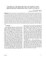
In this study, the interested area is the Vam Nao river in An Giang province,
which in particular confluence into the Hau River. This confluence formerly
experienced severe erosion are now has a high potential of land slides in recent years
(Figure 1-2).
Figure 1-2 Vam Nao River
1.3.2 Study subjects
- The change of flow in Vam Nao river caused by the levee systems.
- The change of sedimentation process in Vam Nao river caused by the levee systems.
1.4 Research contents
In order to achieve the set objectives, the research content needs to be carried out in
the thesis including 3 contents:
5
Content 1: Overview of the research situation.
Seeking studies related to the change of flow, erosion, and methods of
implementation in Vietnam and abroads.
Collect and synthesize existing documents and data, in Vietnam and abroads,
on the causes, mechanism and situation of flow and sedimentation process in
the lower Mekong region for research.
Surveying the field and collect hydrological data for study.
Content 2: Set up a numerical hydraulic model and evaluate research results
Setting model grid and calculation conditions.
Calibrate the model.
Simulate 2 scenarios to assess the change of flow and erosion progress in the
study area:
+
The current levees situation.
+
The situation is completely without levees.
Statistics and analysis of results to draw conclusions about the relationship of
the levee system to changes in flow to Vam Nao river.
Content 3: Proposal of solutions
Propose appropriate management solutions to limit the impact of the levee
systems on the stability of the study area.
1.5 The meaning of research
1.5.1 Scientific meaning
The study opens a broader perspective on the causes and trends of river flow to the risk
of landslides and bank erosion.
6
1.5.2 Practical meaning
Proposing solutions to control landslides, bank erosion for the Vam Nao River, and
schedule of additional investment in solutions to reduce the risk of bank erosion in the
future, in order to protect people living along the river.
1.5.3
The novelty of this research
Assessing the relationship between bank erosion at Vam Nao river and the levee
system that has been built in the past in Mekong Delta through the three-dimensional
integrated model with detailed calculations and high reliability.
7
CHAPTER 2
LITERATURE REVIEW
8
2.1. The general hydrology and flooding at the Vietnamese VMD (VMD)
2.1.1. The general hydrology at the VMD
The Mekong is one of the ten largest rivers on over the world both in terms of its flow
discharge and its sediment load (World Resources Institute 2003, Gupta and Liew,
2007). The total catchment Mekong area of 795,000 km2 with an annual runoff of over
475 billion cubic meters of water at its mouth in the South China Sea (MRC, 2005).
The southern Vietnam where the Mekong River drains into the South China Sea is the
largest part of VMD with an area of 39,000 km2. Moreover, the region also supports
the livelihood for more than 17 million people (Kondolf et al., 2018; GSO, 2018)
The hydrology of the Mekong River is defined by a vast mean annual discharge
through dry season and flood season, which is shows at Figure 2-1 (Adamson, 2016).
The annual minimum daily discharge usually occurs in early April (point 1). The first
transition season starts in late May with the doubling discharge of point 1 (point 2).
The flood season starts within a few days at the end of June (point 3). The transition
season 2 occurs the period between the end of the flood season (point 4) and the start
of the dry season (point 5). Generally, the rainfall regime is symbolized by a dry
season between November and April, and a flood season from May to October.
A = Transistion Season 1
B = Transistion Season 2
Figure 2-1 The two seasons of the Mekong River’s hydrological year (Adamson,
2006)
9
The Mekong River flows into the territory of Vietnam with an average flow of
13650m3/s plits into two major channels which are the Mekong (or Tien river) and the
Bassac (or Hau river) rivers (Figure 2-2). The Vam Nao River downstream is a section
of the Mekong River flows to the Bassac River. The water flow is almost equally
distributed between the two major rivers. After the Hau river receives water from the
Tien river through the Vam Nao river, the average discharge of the two rivers are 51%
and 49%, respectively (The Netherlands Delta Development team, 1974). However, in
the dry season, the flow on the Vam Nao river varies with the tide, so the hydrological
regime in this area is relatively complicated.
Figure 2-2 The Lower VMD Zone including two main tributaries: the Mekong (Tien
river) to the North, and Bassac (Hau river) to the South. (Marchesiello et al., 2019).
The Mekong flood flows into the VMD along the mainstream and from flooded areas
of Cambodia. According to the study results of the IMHEN in 2013, the average peak
10
flood discharge is about 38,000 m3/s (corresponds to the water level of Tan Chau 4.40
m and Chau Doc 3.88 m). In years of heavy flooding, the flow can reach 40,00045,000 m3/s, of which through the main stream about 32,000-34,000 m3/s (accounting
for 75-80%), overflow the border from 8,000-12,000 m3/s (accounting for 20-25%), of
which the LXQ is 2,000-4,000 m3/s and DTM is 6,000-9,000 m3/s. On the main
stream, the flow through Tan Chau is 24,000-26,000 m3/s (accounting for 82-86%) and
through Chau Doc 7,000-9,000 m3/s (accounting for 14-18%). The total flood into the
VMD is about 350-400 billion m3, of which the main flow is 80-85%, the flow over
the border is 15-20%.
Hydrological regime in the VMD also depends on the influence of two tidal sources in
the East and West Sea. The tides of the East Sea have an irregular semi-diurnal regime
and the West Sea has an irregular diurnal regime. Tides always fluctuate in cycles,
from short (days) to medium (half months, months) and long (years, years). In
addition, human impacts on hydrology connectivity and flow regime such as the
unnatural channel, dams, levee systems or dyke systems have enormously altered the
natural hydrodynamic conditions in the Vietnamese part of the VMD (Kondolf et al.,
2006). These barriers will reduce flooding in mainstream rivers, which means reducing
tributary-derived fine sediments accumulated on the bed and reducing permeability
(Kondolf và Wilcock, 1996; Rahel 2006).
2.1.2. The general flooding at the Vietnamese Mekong Delta
The floodplain inundation plays an important role in the agricultural ecosystem and
social and economic benefits of VMD. They do not only cater natural flood retention
but also reduce the discharge peaks in the flood season. Floodwaters stay on floodplain
long enough to recharge groundwater and provide water to floodplain forests (Kondolf
et al., 2006). Besides, slow-velocity water on floodplain provides habitat juvenile fish
benefit from food availability. Furthermore, silt deposits on floodplain, providing
natural soil fertility.
Flooding in the VMD can be divided into 3 periods. At the beginning of the flood
season (May-August), flood discharge on the main river rises quickly and follows the
canals flowing into the fields to fill up the fields. During this period, floodwaters
11
carried much sediment, which was the main source of inland flooding during the flood
season. The second period was when the flood water was high (Tan Chau exceeded 4.0
m, Chau Doc exceeded 3.8 m), floods in the VMD in two directions from the main
river down and from the Vietnam-Cambodia border. The border overflow after
flooding and deposition of most of the sediment in the flooded areas of Cambodia
began to spill heavily into DTM, LXQ. It does not only overwhelms the floodwaters
that are more alluvial from the Tien and Hau rivers into the field but also reduces the
ability to receive more alluvium, increasing fertility for these areas. The third period, is
the period of flood recession, is usually originating from the last week of October
when the Cambodian overflow has decreased, and the floodwater of the VMD
decreases gradually until December, most of the area in DTM and LXQ almost run out
of floods.
There are three aspects influenced to the inundations in the VMD (Hung et al., 1998):
(1) The hydrograph of flood starting in the Mekong basin upstream of Kratie.
(2) The shielding of the flood wave in the Tonle Sap lake networks.
(3) The tides of the Thailand Gulf and the South China Sea.
The Tonle Sap hits the most vital part with regard to the flood duration in the Delta.
In the flood season, the flow is divided into two sections: flow to the Tonle Sap Lake
and flow draining into the Delta. The Tonle Sap Lake discharge flows back to the
Mekong River when the rain of Mekong River is lower than the lake rain level. This
buffer system reduces the negative impact of floods, but it extended floods compared
to the floods at Kratie. The input flows of Tonle Sap beginnings around the middle of
June, while the return discharge to the Mekong River typically initiates at the
beginning of October. The average annual inflow and outflow of the Tonle Sap Lake
are around 79.0 km3 and 78.6 km3, respectively (Kummu and Sarkkula, 2008). The
early peak enters between mid-July and mid-August and the other from September to
October which is correlated with the typhoons from the South China Sea.
12
2.1.3 Mechanisms of physical erosion and sediment transport in Vietnamese
Mekong Delta
Sediment, also called ‘silt’ or ‘alluvium’, is included solid particles of organic material
and mineral which are transported by water. In river systems, the amount of sediment
transported is controlled by both the transport capacity of the flow and the supply of
sediment. The suspended sediment load alludes to the fine sediment that is carried in
suspension and this can comprise material picked up from the bed of the river
(suspended bed material) and material washed into the river from the surrounding land
(wash load). The wash load is normally finer than the suspended bed material. In
contrast, the bedload includes larger sediment particles which are transported on the
bed of the river by sliding, rolling or saltation. According to the flow conditions, most
rivers will transport sediment in each of these load forms.
Erosion in the VMD usually occurs in two forms including erosion and bank erosion.
Erosion is a phenomenon when the surface of a riverbed or riverbank is eroded and
banked when the riverbank is unstable and slipped downstream. Erosion and
sedimentation occur when particles of sediment separate from the surface and move by
rolling on the river bed or floating in the stream. When it comes to locations where the
flow velocity decreases, sediments are no longer carried away and accumulate,
resulting in deposition. On the contrary, the places where flow velocity increases, the
ability to separate sediment particles at the bottom (or river banks) increases while the
amount of sediment that is not enough to compensate will cause erosion. Thus, erosion
and sedimentation phenomenon is an unbalance in the movement of sediment and to
evaluate sedimentation or erosion, it is often used the following sediment balance
method:
Where: q – sediment flux,
time period,
– the porosity,
- the discharge changes the sediment flux in
– the bottom height,
– the river length.
13
,
- the river bed inclination,
-