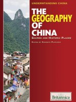
the geography of china sacred and historic places (understanding china)
Bạn đang xem bản rút gọn của tài liệu. Xem và tải ngay bản đầy đủ của tài liệu tại đây (11.51 MB, 384 trang )
Published in 2011 by Britannica Educational Publishing
(a trademark of Encyclopædia Britannica, Inc.)
in association with Rosen Educational Services, LLC
29 East 21st Street, New York, NY 10010.
Copyright © 2011 Encyclopædia Britannica, Inc. Britannica, Encyclopædia Britannica,
and the Thistle logo are registered trademarks of Encyclopædia Britannica, Inc. All
rights reserved.
Rosen Educational Services materials copyright © 2011 Rosen Educational Services, LLC.
All rights reserved.
Distributed exclusively by Rosen Educational Services.
For a listing of additional Britannica Educational Publishing titles, call toll free (800) 237-9932.
First Edition
Britannica Educational Publishing
Michael I. Levy: Executive Editor
J.E. Luebering: Senior Manager
Marilyn L. Barton: Senior Coordinator, Production Control
Steven Bosco: Director, Editorial Technologies
Lisa S. Braucher: Senior Producer and Data Editor
Yvette Charboneau: Senior Copy Editor
Kathy Nakamura: Manager, Media Acquisition
Kenneth Pletcher: Senior Editor, Geography and History
Rosen Educational Services
Alexandra Hanson-Harding: Editor
Nelson Sá: Art Director
Cindy Reiman: Photography Manager
Matthew Cauli: Designer, Cover Design
Introduction by Carolyn Jackson
Library of Congress Cataloging-in-Publication Data
The geography of China: sacred and historic places / edited by Kenneth Pletcher.—1st ed.
p. cm.—(Understanding China)
“In association with Britannica Educational Publishing, Rosen Educational Services.”
Includes bibliographical references and index.
ISBN 978-1-61530-182-9 (eBook)
1. China—Geography. 2. Historic sites—China. 3. Sacred space—China. 4. China—History,
Local. I. Pletcher, Kenneth.
DS706.7.G46 2011
915.1—dc22
2010002170
Cover: The main tourist street in Yangshuo with the famous karsts (steep hills) of
Guangxi province in the background. Ed Freeman/Photodisc/Getty Images; p. 18:
Fisherman with cormorant on bamboo raft on the Li River in Guilin, Guangxi province,
China. Dennis Cox/Time & Life Pictures/Getty Images; back cover: Summer Palace in
Beijing. © www.istockphoto.com/Nikada.
Page 18: Fisherman with cormorant on bamboo raft on the Li River in Guilin, Guangxi
Province, China. Dennis Cox/Time & Life Pictures/Getty Images.
CONTENTS
Introduction 18
C 1: G O 25
Relief 25
The Eastern Region 28
The Northeast Plain 28
The Changbai Mountains 29
The North China Plain 29
The Loess Plateau 30
The Shandong Hills 30
The Qin Mountains 31
The Sichuan Basin 31
The Southeastern Mountains 31
Plains of the Middle and Lower Yangtze 31
The Nan Mountains 32
The Southwestern Region 32
The Yunnan-Guizhou Plateau 32
The Plateau of Tibet 32
The Northwestern Region 34
The Tarim Basin 34
The Junggar Basin 34
The Tien Shan 34
Drainage 35
Soils 36
Climate 38
The Air Masses 38
Temperature 39
Precipitation 40
Plant and Animal Life 42
Flora 42
Animal Life 44
C 2: H I
C’ E 46
Settlement Patterns 46
Rural Areas 46
Urban Areas 48
China’s Land Use and Its Economy 49
Agriculture, Forestry, and Fishing 50
Farming and Livestock 50
Rice 51
Forestry and Fishing 53
52
48
64
Resources and Power 53
Minerals 54
Hydroelectric Potential 55
Transportation 56
Railways 56
Road Networks 57
Waterways 58
Port Facilities and Shipping 61
Aviation 61
C 3: M C P
F 63
Yangtze River 63
The Upper Course 64
The Middle Course 65
The Lower Course 67
Dongting Lake 68
The Yangtze Delta 69
History 70
Huang He 70
Physical Features 71
The Upper Course 71
The Middle Course 72
The Lower Course 73
Hydrology 74
Economic Development 76
Study and Exploration 76
Xi River System 76
Land 77
People and Economy 79
Kunlun Mountains 80
Physical Features 80
Physiography 80
Geology 81
Drainage and Glaciation 81
Climate 82
Plant and Animal Life 83
People and Economy 83
Study and Exploration 84
Takla Makan Desert 85
Physical Features 85
Physiography 85
Climate 86
Drainage 87
Plant and Animal Life 87
People and Economy 88
Study and Exploration 88
C 4: S C’
W H S O
N L 90
Great Wall of China 90
History of Construction 92
Early Building 92
The Han Through Yuan Dynasties 93
The Ming Dynasty to the Present 95
Design of the Fortifi cations 96
Passes 96
Signal Towers 96
Walls 96
Military Administration 97
Tradition and Conservation 97
Other Cultural Sites 98
Forbidden City 98
Grand Canal 99
Longmen Caves 101
Mogao Caves Near Dunhuang 102
Potala Palace 103
Qin Tomb 105
The Confucian Temple Complex of Qufu 106
Yungang Caves 107
Zhoukoudian 108
Natural Sites 109
Huang Mountains 109
Lu Mountains 110
Lake Tai 110
Mount Tai 112
Mount Wutai 113
Wuyi Mountains 114
C 5: B 116
Character of the City 117
Landscape 118
City Site 118
Climate 119
104
Plant Life 120
City Layout 121
Housing 123
Architecture 124
Traditional Dwellings 124
Public and Commercial Buildings 125
People 129
Economy 130
Agriculture 130
Industry 131
Commerce and Finance 132
Tourism 134
Transportation 134
Administration and Society 136
Government 136
Municipal Services 137
Health 138
Education 139
Cultural Life 141
The Arts 142
Museums and Libraries 142
Recreation 143
History 146
The Early Empires 146
The Ming and Qing Dynasties 148
The Modern City 149
C 6: T M C
N C 151
Tianjin 151
Landscape 152
City Site 152
Climate 153
Drainage 153
Plant and Animal Life 154
City Layout 154
Housing and Architecture 154
People 155
Economy 155
Industry 155
Finance 156
Transportation 156
145
135
Administration and Society 157
Government 157
Public Utilities 157
Health 157
Education 158
Cultural Life 158
History 158
Evolution of the City 159
The Contemporary City 160
Other Important Northern Chinese Cities 160
Harbin 160
History 160
The Contemporary City 162
Shenyang 163
History 163
The Contemporary City 164
Dalian 165
History 165
The Contemporary City 168
Qingdao 169
Jinan 170
History 170
The Contemporary City 171
Taiyuan 172
History 172
The Contemporary City 173
Kaifeng 173
History 174
The Contemporary City 175
Zhengzhou 175
Luoyang 177
Xi’an 180
History 180
The Contemporary City 181
C 7: T T G C
S C 183
Shanghai 183
Landscape 184
City Site 184
Climate 184
Layout 184
161
152
People 188
Economy 189
Industry 189
Commerce 190
Finance and Trade 190
Transportation 190
Administration and Society 191
Government 191
Public Utilities 192
Health 192
Education 192
Cultural Life 193
History 194
Evolution of the City 194
The Contemporary City 195
Nanjing 196
Landscape 196
City Site 196
Climate 196
City Layout 197
People 198
Economy 198
Agriculture 198
Manufacturing 199
Transportation 199
Administration and Society 200
Government 200
Health 200
Education 201
Cultural Life 201
History 201
The Early Empires 201
The Contemporary City 203
Guangzhou 205
Landscape 205
City Site 205
Climate 207
City Layout 207
People 209
Economy 209
Manufacturing and Tourism 209
Trade and Finance 210
Transportation 210
206
Administration and Society 211
Government 211
Health 211
Education 212
Cultural Life 212
History 213
The Early Period 213
The Contemporary City 215
C 8: O M C
S C 217
Wuxi 217
Suzhou 219
History 219
The Contemporary City 220
Hangzhou 220
History 221
The Contemporary City 223
Ningbo 224
History 224
The Contemporary City 225
Fuzhou 226
History 226
The Contemporary City 227
Xiamen 228
History 228
The Contemporary City 229
Wuhan 229
History 230
The Contemporary City 231
Changsha 233
History 233
The Contemporary City 233
C 9: T M C
S W C 235
Chongqing 235
Landscape 236
City Site 236
Climate 236
City Layout 237
People 239
225
Economy 240
Manufacturing 240
Trade 241
Transportation 242
Administration and Society 243
Government 243
Public Utilities 243
Health 244
Education 244
Cultural Life 244
History 246
The Early Period 246
The Modern Period 247
Other Important Southern and Western
Chinese Cities 248
Yan’an 248
Yinchuan 250
Lanzhou 252
History 252
The Contemporary City 253
Guilin 254
Nanning 255
History 255
The Contemporary City 257
Chengdu 257
History 258
The Contemporary City 258
Kunming 259
History 259
The Contemporary City 260
Lhasa 261
Ürümqi 262
History 263
The Contemporary City 263
C 10: S A
R 265
Hong Kong 265
Land 267
Relief 267
Drainage 268
Soils 268
256
Climate 269
Plant and Animal Life 269
People 270
Ethnic Groups 270
Languages 270
Religion 270
Settlement Patterns 272
Demographic Trends 273
Economy 273
Agriculture and Fishing 275
Resources and Power 275
Manufacturing 276
Finance 276
Trade and Tourism 277
Transportation and
Telecommunications 277
Government and Society 278
Constitutional Framework 279
Health and Welfare 280
Housing 280
Education 281
Cultural Life 282
Cultural Milieu and the Arts 282
Recreation 282
Cultural Institutions 283
Press and Broadcasting 283
History 283
Early Settlement 284
Events Before and During
World War II 284
Contemporary Hong Kong 285
Macau 286
Land 287
People 287
Economy 287
Government and Society 288
Cultural Life 289
History 291
C 11: S A
R 293
Tibet 293
279
Land 294
Relief 294
Drainage and Soils 295
Climate 295
Plant and Animal Life 296
People 297
Population Composition 297
Settlement Patterns 298
Economy 298
Resources and Power 299
Agriculture and Forestry 299
Manufacturing 300
Tourism 300
Transportation 301
Government and Society 301
Constitutional Framework 301
Health and Welfare 302
Education 302
Cultural Life 302
The Arts 302
Customs 303
Food and Drink 303
Festivals 304
Superstitions 305
History 305
Early History to the 9th Century 305
Disunity, 9th to 14th Century 306
Tibet, 14th to 19th Century 308
Tibet Since 1900 311
Xinjiang 314
Land 314
Relief 314
Drainage 316
Climate 316
Plant and Animal Life 317
People 318
Population Composition 318
Settlement Patterns 319
Economy 319
Agriculture 319
Resources and Manufacturing 320
Transportation 320
313
Government and Society 322
Constitutional Framework 322
Education 322
Cultural Life 322
History 324
C 12: S P 326
Shandong 326
Land 327
Relief 327
Drainage 329
Soils 329
Climate 330
Plant and Animal Life 331
People 332
Population Composition 332
Settlement Patterns 332
Economy 332
Agriculture and Fishing 333
Resources and Power 334
Manufacturing 334
Transportation 335
Government and Society 336
Constitutional Framework 336
Health and Welfare 336
Education 337
Cultural Life 337
History 338
Guangdong 340
Land 340
Relief 341
Drainage 341
Climate 341
Soils 343
Plant and Animal Life 343
People 344
Population Composition 344
Settlement Patterns 345
Demographic Trends 345
328
Economy 346
Agriculture 346
Resources and Manufacturing 346
Transportation 347
Government and Society 348
Constitutional Framework 348
Health and Welfare 348
Education 349
Cultural Life 349
History 350
Sichuan 351
Land 352
Relief 352
Drainage 353
Soils 354
Climate 354
Plant and Animal Life 355
People 356
Population Composition 356
Settlement Patterns 357
Economy 357
Agriculture and Forestry 358
Resources and Power 359
Manufacturing 359
Transportation 360
Government and Society 360
Constitutional Framework 361
Health and Welfare 361
Education 361
Cultural Life 362
History 362
Conclusion 363
Appendix: Statistical Summary 365
Glossary 369
For Further Reading 371
Index 373
355
353
I | 19
T
he Three Gorges Dam, the world’s
largest when completed in 2006, is
built across the Yangtze River in the heart
of China. The project has been heavily
criticized—to build the dam, more than
1.2 million people were moved from
nearly 500 cities, towns, and villages, and
1,200 historical and archaeological sites
were flooded. But proponents say it will
help control deadly floods, create a deep-
water reservoir, and allow for easier
navigation for oceangoing freighters. Its
26 turbines will also create a massive
amount of hydroelectric energy that will
bring electricity to millions of people.
Throughout its long history, the needs of
China’s people have spurred it to under-
take giant projects that shape their land.
That is a necessity, because although it
is only slightly larger in area than the
United States, China has today roughly
1 billion more people. In fact, about one
in five people in the world is Chinese.
In this book, readers will learn how
the contours, fertility, and weather pat-
terns of China’s land have shaped its
people. They will also learn how China’s
population—the largest in the world—has
put special pressure on the land. Peoples’
needs for water, food, fuel, and space have
caused them to change and mold the
landscape over time. Readers will also
get an overview of China, from its land-
scapes to its cityscapes. This book
explores many of the places that give
China its character, from the Great Wall
to vast mountain ranges to great cities
and ancient provinces.
Eons before humans arrived, the
Indian subcontinent was separate from
the Asian mainland. Some 50 million
years ago, India began crashing into
Asia. The pressure created when the
subcontinent was forced under the Asian
landmass created the Himalayas, a vast
mountain chain that has continued to
slowly grow taller. The pressure also
pushed up a wide region of land to the
north of the mountains, so that today
China is like a table tilting from west to
east. This western part, the Plateau of
Tibet (or Qiangtang), is known as the
“roof of the world.” The world’s highest
peak, Mount Everest, is in the Himalayas
on China’s border with Nepal. Just north
of the Tibetan Plateau is the Turfan
Depression, China’s lowest spot, 508 feet
(155 metres) below sea level. Also in
western China, north of Tibet, lie the
Kunlun Mountains. But the country
generally slopes eastward until it reaches
the Pacific Ocean. China’s more than
50,000 rivers flow, with a few exceptions,
from west to east.
The Huang He, or Yellow River, is the
most northern of China’s three main
rivers. It rises on the Plateau of Tibet and
drains into the Bo Hai (Gulf of Chihli),
part of the Yellow Sea. The mighty river,
which gets its name because it is so filled
with silt that it appears to be yellow-
brown in colour, enriches the land with
the soil it deposits, making it fertile for
farming. It also has been called “China’s
Sorrow” because the shifting river often
overflows its banks and floods the North
20 | The Geography of China: Sacred and Historic Places
the earliest evidence of human civiliza-
tion in China has been found in the Loess
Plateau.
In the south, the hot, humid weather
is suitable for growing rice. Despite the
acidity of the soil, skilled farmers have
learned how to cultivate the land inten-
sively enough to grow two or even three
crops per year.
Urban grown accelerated in the mid-
1980s as China entered the global
economy. Today, some two in five Chinese
live in cities. More than 70 cities have
more than a million people, and several
dozen top a half-million.
Rural life began to change in the
late 1970s as China’s industrial economy
grew. When many farmers moved to cities
to look for jobs, the government helped
create light manufacturing jobs in thou-
sands of villages to help raise the standard
of living.
To fuel these jobs, China uses some
of its vast hydrocarbon resources, such as
coal, which is China’s main fuel and
which is found in every province. The
country has oil reserves, as well as natu-
ral gas. Rivers remain important sources
of hydroelectric power.
There are many world-famous tourist
attractions in China. Among them is the
world’s longest human-made waterway,
the Grand Canal (Da Yunhe). Begun in
the 4th century BCE and expanded over
the centuries, the canal is 1,085 miles
(1,747 km) long and links Hangzhou (in
the south) with Beijing (in the north). It is
still being used to transport goods.
China Plain. The Huang He has changed
course many times. In the past 4,000
years for instance, the river has entered
the Yellow Sea at points that vary as
much as 500 miles (800 km).
The Yangtze is the longest of China’s
rivers, flowing from the Plateau of Tibet
to the East China Sea north of Shanghai.
It divides northern and southern China.
The longest river in Asia, it is the third
longest river in the world—3,915 miles
(6,300 km). It is also has the greatest
depth of any river in the world—in some
spots it is as much as 500 to 600 feet
(150 to 180 m) deep. Over history, the
Yangtze has been responsible for many
devastating floods along its fertile, highly
populated banks.
The Xi is the most southern of
China’s great river systems; it flows
from the Yunnan-Guizhou Plateau past
picturesque mountains and into the Pearl
River Delta, where it meets with two other
rivers and flows into the South China
Sea at Guangzhou. The Xi, whose flow
is second only to the Yangtze, is 80 feet
(25 m) higher in summer than winter
because it is swelled by monsoon rains.
Important cities line its banks as well.
Rainfall and temperatures in China
vary greatly, and so do its soils. In gen-
eral, the northern, wheat-growing, part of
the country is cool and dry, and its soils
tend to be alkaline. One important kind
of soil in northern China is loess, which is
very fertile but erodes away easily. In
China, much of this loose, silty material
is borne away by the Huang He. Some of
I | 21
experience China’s fast-growing cities.
The skyline of Beijing, the nation’s capi-
tal, is punctuated by modern skyscrapers,
including many high-rise apartment
buildings that house a growing number
of the more than 15.8 million residents in
the capital region.
Except for brief periods, Beijing has
been China’s capital for eight centuries.
In the summer of 2008, millions of tour-
ists visited Beijing for the Olympic
Games. Development for the games
greatly changed Beijing for its residents
as well. On the one hand, the already
blistering pace of change was sped up—
the subway system was extended, new
sports facilities were built, and so was
housing. On the other, many hutongs—
alleyways with quaint, traditional homes,
were destroyed.
There is much to see in Beijing, such
as the Forbidden City, a series of palaces
within palaces built for China’s emperors
and first occupied in 1420. At the Museum
of Chinese History, visitors can see evi-
dence of human habitation of the area
around Beijing dating to about 770,000
years ago—the age of the earliest bones
of Peking man discovered near the city.
Among the cities of southeastern
China that this book explores is Shanghai.
With more than 18 million people in its
metropolitan area, Shanghai is China’s
largest city. Located on the coast of the
East China Sea, it is one of the world’s
largest ports. Its industries produce
everything from steel to consumer elec-
tronics, which creates heavy pollution.
China has always been vulnerable to
invasion from the north. From the
Xiongnu to the Mongols, nomadic peoples
have always been tempted by China’s
rich civilization. To protect its territory,
the Chinese started building the Great
Wall in the 7th century BCE. Over the
course of many centuries and dynasties,
one emperor after another expanded the
wall until it spanned some 5,500 miles
(8,850 km) from east to west across
northern China and southern Mongolia.
It was named a UNESCO World Heritage
site in 1987. Tourists can see portions of
the wall as it stretches over hills and visit
beacon towers where soldiers once sent
military signals to each other with smoke,
fire, banners, and sound.
Visitors also can visit the ancient Qin
Tomb near the modern city of Xi’an. There
the first sovereign emperor of the Qin
dynasty (Shihuangdi) built a funeral com-
pound with some 8,000 life-size terracotta
(baked clay) figures of soldiers and horses
that were discovered, buried, in 1974, more
than 2100 years after his death.
China has places of great natural
beauty as well. The Huang Mountains in
southern Anhui province have more
than 400 scenic spots and hot springs.
Crescent-shaped Lake Tai, between
Zhejiang and Jiangsu provinces, has
been settled since the first century BCE.
Mount Wutai in the province of Shanxi is
a cluster of five flat-top peaks and one of
the great holy places of Buddhism.
The importance of serene beauty
becomes apparent when travelers
22 | The Geography of China: Sacred and Historic Places
discussed here. They are neighbours and
the largest and most remote of China’s
subdivisions. Tibet was brought into the
People’s Republic of China beginning in
1950, and this has remained a highly con-
troversial issue. Lhasa, considered holy
by Tibetan Buddhists, is its capital. The
thousand-room Potala Palace in Lhasa was
once the seat of the Tibetan government
and the main residence of the Dalai
Lama (religious leader; the current
Dalai Lama went into exile in 1959). It
was spared during the Cultural Revolution
when many of China’s historical and
sacred objects were destroyed. A first
palace was built there in the 7th century,
but the current one, begun in 1645, was
built there under the fifth Dalai Lama.
China has 22 provinces. Three—
Shandong, Guangdong, and Sichuan—are
explored here. Shandong, located on
China’s northeast coast, is the country’s
third most populous province. Its capital
and chief cultural centre is Jinan. Among
its many agricultural products are peanuts,
which are pressed into oil, and also cotton,
tobacco, hemp, and fruit. The province is
also known for its silk production, and it is
rich in coal and oil. It came under the influ-
ence of the Germans, British, and Japanese
in the late 19th and early 20th centuries.
Shandong is famous for being the home
of China’s greatest philosopher, Confucius,
who was born in 551 BCE in Qufu in the
southwestern part of the province. Visitors
can still see his tomb, a tree he is said to
have planted, and a well that he drank from.
Guangdong is the southernmost main-
land province in China. This heavily
Shanghai is a hub of scientific and tech-
nological research, with the nation’s most
highly skilled workforce.
Next, readers will explore southern and
western China. One of the greatest cities
of southwest-central China, Chongqing is
located where the Yantgze and Jialing
rivers meet, 1,400 miles (2,250 km) from
the sea. Settled more than 3,000 years
ago, it was the capital of Nationalist
China during World War II. Chongqing
is so foggy from fall to spring that it is
called the “fog capital” of China.
Unfortunately, the thick fog not only
makes it dicult for planes to land, but it
also traps acid rain and soot. In the far
west, Ürümqi is the capital of the Uygur
Autonomous Region of Xinjiang. Most
Uighurs are Muslim. Kazakh, Dungan,
and Manchu peoples also live in Xinjiang,
but the majority are Han Chinese, many
of whom have come there since the 1990s.
Hong Kong, once British-ruled, and
Macau, long under Portuguese rule, were
returned to China at the end of the 20th
century. Both are now designated special
administrative regions under Beijing’s
control, though each has some economic
and administrative autonomy. Hong Kong
Island is volcanic in origin and sits in
Victoria Harbor of the South China Sea.
Hong Kong is densely packed with people
speaking Cantonese, Mandarin and
English. Macao is located on a peninsula
in the South China Sea about 25 miles
(40 km) from Hong Kong. Like Hong
Kong, it is an important trading centre.
China also has five autonomous
regions; two—Tibet and Xinjiang—are
I | 23
Sichuan, the second largest province
in China, is also famous for its food—
though it is more hot and spicy than
Cantonese and features flavourful ingre-
dients such as chili peppers, garlic, and
peanuts. Sichuan is located in central
China, at the upper reaches of the Yangtze
River, and most of its people are farmers.
Mountains protect Sichuan from cold, so
the growing season is very long. In the
east, it has been called the “land of one
million steps,” because so much of the
farmland consists of terraced hillsides—
long narrow strips of land on steep slopes.
Its capital city is Chengdu, and not far
away are nature reserves, where rare
giant pandas can be seen—it is a UNESCO
world heritage site. In 2008, a large-scale
earthquake killed tens of thousands of
people in the province.
In this book you will learn more about
these and many other distinctive features
of China that help to make up this diverse
and spectacular land.
populated province with its long coastline,
had early exposure to Western influence.
The city of Guangzhou, some 90 miles
(145 km) inland from the South China Sea
near the head of the Pearl River, is the cap-
ital of Guangdong. Gangzhou was the first
Chinese port visited by European traders,
who called it Canton. Guangzhou, now
with more than eight million residents, is
one of the wealthiest and most Westernized
cities in China. By the late 17th century
the overpopulated Guangdong region
had become a source of emigration, and
in the mid-19th century these migrants
began to pour into Southeast Asia and
North America. Less than one fifth of land
is cultivated, but some of the crops that
are grown here include rice, rubber, palm
oil, hemp, coee, black pepper, sweet pota-
toes, tea, and some 300 kinds of fruit,
including citrus, litchi, and pineapples.
Cantonese cuisine features tasty dishes
such as dim sum, noodles, seafood, and
fresh vegetables.
Pearl River waterfront, Guangzhou (Canton),
China. G. Richardson/Robert Harding World
Imagery/Getty Images

