commercialisation, change and continuity an archaeological study of rural commercial practice in the scottish highlands
Bạn đang xem bản rút gọn của tài liệu. Xem và tải ngay bản đầy đủ của tài liệu tại đây (19.55 MB, 354 trang )
Glasgow Theses Service
Adamson, Donald Beck (2014) Commercialisation, change and
continuity: an archaeological study of rural commercial practice in the
Scottish Highlands. PhD thesis.
Copyright and moral rights for this thesis are retained by the author
A copy can be downloaded for personal non-commercial research or
study, without prior permission or charge
This thesis cannot be reproduced or quoted extensively from without first
obtaining permission in writing from the Author
The content must not be changed in any way or sold commercially in any
format or medium without the formal permission of the Author
When referring to this work, full bibliographic details including the
author, title, awarding institution and date of the thesis must be given
Commercialisation, Change and Continuity: an
archaeological study of rural commercial practice
in the Scottish Highlands
Donald Beck Adamson
M.A. (New College, Oxford)
MLitt with distinction (University of Glasgow)
Submitted in fulfilment of the requirements for the Degree of Doctor of Philosophy
University of Glasgow
Archaeology
College of Arts
January 2014
©
Donald Beck Adamson 2014
2
Abstract
This is a study of the movement of cattle and grain out of the Scottish Highlands in the
period before and during Improvement. It uses the combined approach of historical
archaeology (archaeological, documentary and cartographic research) to focus on the
growth and implications of commercial practice in a predominately rural region.
The growth of the cattle trade is evidenced in archaeological terms by drove roads and
associated structures such as cattle stances, enclosures, bothies and inns. The thesis studies
two droving routes. One is through central Sutherland, and the other in Cowal and west
Loch Lomondside. The case-studies trace the route of cattle towards distant markets
outside of the Highlands, and record and analyse overnight stopping places along the way.
The development of a trade in grain from certain low lying fertile areas of the Highlands is
evidenced by the building of grain storehouses or ‘girnals’ which were related to jetties,
anchorages and harbours from which the grain was exported. The thesis considers the
archaeology of the grain trade in Easter Ross, and also in the southern Highlands.
Practice is central to everyday life, and the practices associated with moving cattle and
grain have embedded themselves into the archaeology of the landscapes through which
they passed. The seasonal routines by which drovers moved herds of black cattle or estate
tenants brought grain to the girnals, and thence onto ships, were indicative of a mesh of
social relationships. The material culture of the cattle and grain trades both structured and
was structured by that routine practice. Thus the archaeology gives evidence of past social
relationships and how they changed over time.
This thesis considers for the first time the archaeological evidence for cattle and grain
export from Highland Scotland. Therefore it gives a new understanding of the increasing
impact of markets and market forces on social relations, as well as the tension between
change and continuity in those relationships. It does not deny political or cultural drivers of
change in the Scottish Highlands, but does emphasise what might be termed economic
factors. It has something to say about the rise of the individual over community, and how
individuals dealt with change in the light of asymmetrical power relationships. These
issues still resonate in contemporary Scotland. Ultimately this study is about how people,
mostly unnamed in documentary records, dealt with change, and it is about the
archaeological legacy of their actions.
3
Contents
Abstract 2
List of Figures 7
List of accompanying material 11
Acknowledgements 12
Author’s Declaration 14
1 Introduction 15
1.1 Research Questions 15
1.2 Structure 17
1.3 Approach 20
2 A research context: situating the current research within relevant literature 23
2.1 Introduction 23
2.2 Community and individualism 24
2.2.1 Introduction: simplicity and complexity; static or changing? 24
2.2.2 Clanship: a communal society? 24
2.2.3 Rampant individualism: diverging interests 27
2.2.4 Recognising differences within the Highlands 28
2.3 Explanations of models of change in Scottish Gaeldom before Improvement 30
2.3.1 Introduction: a debate obscured by current political issues? 30
2.3.2 Political Models of Change 31
2.3.3 Economic models of change 34
2.3.4 Cultural Models of Change 37
2.3.5 Synthesis 38
2.4 Commercialisation in the Highlands before Improvement 39
2.4.1 Introduction: a truth only recently acknowledged 39
2.4.2 Archaeological and historical evidence for commercialisation in the pre-
Improvement Highlands 40
2.4.3 Missing evidence: cattle stances and grain girnals 44
2.5 Developing an archaeology of (rural) commercial practice 46
3 Theoretical Routes and Directions 48
3.1 A personal journey 48
3.2 Practice, Resistance and Agency 50
3.2.1 Practice theory 51
3.2.2 Agency 57
3.2.3 Resistance Theory 58
3.3 Adam Smith, markets, World-Systems and globalization. 60
3.3.1 Adam Smith and friends 61
3.3.2 Markets 63
3.3.3 World-Systems theory and modernisation theory 64
3.3.4 Globalisation 66
3.4 Landscapes: change, continuity, edges and lines 68
3.4.1 Unity is strength 68
3.4.2 Change and Continuity; Boundaries and Edges 70
3.4.3 Moving through the landscape 71
3.5 Conclusions 74
4 Methodology 76
4.1 Introduction: Moving down the lines; Resting at the dots 76
4
4.2 Identifying the case study areas 77
4.2.1 Why were the case studies selected? 77
4.2.2 How the case studies were identified, defined and researched: archives 79
4.2.3 How the case studies were identified, defined and researched: maps 84
4.2.4 How the case studies were identified, defined and researched: local
information 87
4.2.5 How the case studies were identified, defined and researched: secondary
sources89
4.2.6 How the case studies were identified, defined and researched: archaeology 91
4.3 Recording the case studies 91
4.3.1 How the case studies were recorded: recording forms and data-base 91
4.3.2 How the case studies were recorded: GPS and GIS technology 97
4.3.3 How the case studies were recorded: the practical bit 98
4.4 Analysing the information recorded in the case studies 99
4.5 A methodological conclusion 100
5 Fieldwork on a droving route in central Sutherland 102
5.1 Introduction 102
5.1.1 The coastal droving route through Sutherland 102
5.1.2 An alternative route south? 103
5.2 Fieldwork: following the drove road through central Sutherland 106
5.2.1 The stance at Kinbrace (NC 2866 9287) 106
5.2.2 The route from Kinbrace to Achamor 108
5.2.3 The stance and township at Achamor (NC 2781 9227) 127
5.2.4 The route from Achamor to Sciberscross 138
5.2.5 A possible stance at Sciberscross (NC 2775 9103) 141
5.2.6 The route from Sciberscross to Bad Leathan 150
5.2.7 The stance at Bad Leathan (NC 2657 9029) 157
5.2.8 The route from Bad Leathan to Monbuie 164
5.2.9 The stance at Monbuie (NC 2598 8965) 167
5.2.10 The route from Monbuie to Port na Lice 173
5.3 Conclusion: The end of the road 175
6 Fieldwork on a droving route in Cowal and Loch Lomondside 178
6.1 Introduction 178
6.2 Bute 184
6.2.1 Knockinreoch (NS 0801 6501) 184
6.2.2 Bullochreg (NS 0385 7235) 187
6.2.3 Rhubodach (NS 0275 7433) 189
6.3 Southern and Central Cowal 190
6.3.1 Northwards from Colintraive 190
6.3.2 Coille Mhor enclosures (NS 0235 8235) 194
6.3.3 Northwards from Coille Mhor 200
6.3.4 Possible stance in Caol Glen (NS 0635 9585) 201
6.3.5 Caol Glen to Cairndow 206
6.3.6 Eastward from Coille Mhor stance to the Loch Long shore 206
6.3.7 The ferry at Port Dornaige (NS 2012 8990) 208
6.4 The route from Cairndow to Inverarnan 213
6.4.1 The stance at Cairndow (NN 1835 1115) 214
6.4.2 Cairndow to Inverarnan 219
6.4.3 The stance at Inverarnan (NN 3185 1835) 228
6.5 The route from Cairndow to Luss 230
6.5.1 Cairndow to Stronafyne 231
5
6.5.2 Stronafyne stance (NN 3011 0527) 235
6.5.3 Alternative routes to the Rest and Be Thankful and Glen Croe 237
6.5.4 The enclosures in Upper Glen Kinglas (NN 2633 1292) 240
6.5.5 The stance at Inbhir-Laraichean (NN 3082 0694) 249
6.5.6 Stronafyne to Luss 251
6.6 Full Circle: Some Conclusions 261
7 The Girnals of Easter Ross 263
7.1 Introduction 263
7.2 The Easter Ross grain trade 267
7.3 The archaeology of the Easter Ross grain trade 269
7.3.1 Portmahomack Girnals (NH 915 846) 269
7.3.2 Cromarty Girnal (NH 786 677) 274
7.3.3 Nigg Girnal (NH 796 687) 278
7.3.4 Ankerville Corner Girnal (NH 818 744) 280
7.3.5 Invergordon Girnal (NH 709 685) 281
7.3.6 Alness Point Girnal (NH 656 679) 284
7.3.7 Foulis Ferry Point Girnal (NH 599 636) 286
7.3.8 Ferryton Point Girnal (NH 680 670) 290
7.3.9 Little Ferry Girnal (NH 802 957) 293
7.4 Some Conclusions: similarities and differences 295
8 A possible girnal on the island of Bute 298
8.1 Introduction: was there an export of grain from any part of the southern
Highlands? 298
8.2 Evidence from the Archives 300
8.3 Archaeological evidence 301
8.4 Cartographic and Place–Name evidence 302
8.5 304
8.6 Conclusion 304
9 Discussion around the research questions 306
9.1 Introduction 306
9.2 Operational Matters 306
9.2.1 Operational Matters: an overview of the implications of the archaeological
evidence 306
9.2.2 Operational Matters: an overview of the implications of the documentary
evidence 308
9.2.3 The interaction of droves with landscape 310
9.2.4 The interaction of droves with settled farming communities 313
9.2.5 The archaeology of the girnals – functionality and impact on practice 318
9.3 Social relationships 321
9.4 Variation and similarity within the Highlands 330
9.4.1 Comparing and contrasting the archaeology of cattle droving in Sutherland
with that in Cowal and Loch Lomondside 330
9.4.2 Comparing and contrasting the archaeology of grain export in Easter Ross
with that in the southern Highlands 334
9.4.3 Regional variations in practice, social impact and the nature of change within
the Highlands 335
9.5 An archaeological insight relative to recent historical research 338
9.6 Possible areas of further research 340
10 Conclusions 342
10.1 A Walk into The Past 342
6
10.2 A Straw in the Wind 343
10.3 Final thoughts 344
Bibliography 345
7
List of Figures
Figure 1 Image of Scotland showing case study areas. 19
Figure 2 Plan of Living Room and Kitchen of 53 King’s Place, Rosyth (1956 -1970). 53
Figure 3 Plan of 8 Elliot Hill Street, Dunfermline (1957-70). 53
Figure 4 Mr and Mrs Thomson, December 1962. 54
Figure 5 Silver Teapot, circa 1923. 55
Figure 6 Two cups and saucers used by Mrs Joan Thomson 56
Figure 7 A drover’s account of cattle bought from tenants of the Sutherland Estate 81
Figure 8 Reverse of drover’s account, showing that Alexander McKay had received cattle
from the listed tenants 82
Figure 9 Archaeological route record sheet used during research. 92
Figure 10 Archaeological site record form used during research. 94
Figure 11 Database entry for archaeological site record. 96
Figure 12 Database entry for archaeological route record. 97
Figure 13 A.R.B. Haldane’s map of main droving routes in Northern Highlands of
Scotland 103
Figure 14 Kinbrace to Port-na-Lice 104
Figure 15 Kinbrace to Port-na-Lech in detail 105
Figure 16 The stance at Kinbrace in the Strath of Kildonan 106
Figure 17 Measured sketch map of stance at Kinbrace 107
Figure 18 Roy Map 1747-55 of upper Strath of Kildonan 108
Figure 19 Map by Aaron Arrowsmith 1807 109
Figure 20 Map by Lewis Hebert 1823 110
Figure 21 Map by John Thomson 1832 110
Figure 22 Map by Frederick Charington 1846 111
Figure 23 Map by John Arrowsmith 1875 112
Figure 24 Roy Map 1747-55 of Skinsdale 112
Figure 25 Kinbrace stance to Achamor stance 115
Figure 26 Dalcharn Hill, eastern side 115
Figure 27 Dalcharn House 116
Figure 28 List of Sutherland Estate Leases 1815 117
Figure 29 Sutherland Estate Map 1815 118
Figure 30 The Feranach Broch 119
Figure 31 Extract from Sutherland Estate Leases 1815 120
Figure 32 Comment on list of Sutherland Estate leases 1815 120
Figure 33 Feranach Head Dyke and droving route 121
Figure 34 Feranach township infield 122
Figure 35 Droving route at Achan 123
Figure 36 Tomich parks 124
Figure 37 Ford at Alltanduin 124
Figure 38 “The Irishman” stone 125
Figure 39 Route heading south in Skinsdale 127
Figure 40 Measured sketch plan of Achamor 128
Figure 41 Achamor stance from the south-west 129
Figure 42 Stance at Achamor 130
Figure 43 The stance entrance at Achamor 131
Figure 44 Cultivated area in centre of township 132
Figure 45 Domestic structure within an enclosure 133
Figure 46 Row of domestic structures looking southwards 134
Figure 47 South-west corner of a small field 135
Figure 48 Circular nineteenth century sheepfold 136
Figure 49 Map of eastern part of Sutherland Estate in 1816 138
8
Figure 50 The route from Achamor to Sciberscross 139
Figure 51 Estate road from Ben Armine to Sciberscross 141
Figure 52 First Edition OS map –from Survey 1872 142
Figure 53 Second Edition OS map –from Survey 1894 144
Figure 54 Third Edition OS Map –from Survey 1912 144
Figure 55 Measured sketch map of a possible cattle stance at Sciberscross 146
Figure 56 South-East corner of possible stance at Sciberscross 147
Figure 57 Northern edge of enclosure looking westwards 148
Figure 58 Original routeway to the east of the enclosure 149
Figure 59 The route from Sciberscross to Bad Leathan 150
Figure 60 Arrowsmith map 1807 152
Figure 61 Thomson map 1832 153
Figure 62 Burnett and Scott map 1855 154
Figure 63 Acheilidh, looking eastwards down Strath Fleet 155
Figure 64 Track from Acheilidh to Bad Leathan 156
Figure 65 First Edition OS Map - 1872 Survey 157
Figure 66 Measured sketch plan of Bad Leathan 158
Figure 67 Bad Leathan dwelling and kailyard, looking north 159
Figure 68 Routeway through the Bad Leathan enclosure 160
Figure 69 Bad Leathan: ring dyke 161
Figure 70 Bad Leathan exit 162
Figure 71 Bad Leathan: patch of rig and furrow 163
Figure 72 The route from Bad Leathan to Monbuie 164
Figure 73 Garvary 165
Figure 74 Clais na Faire (Defile of the Watching) 166
Figure 75 Coirshellach 166
Figure 76 A measured sketch map of Monbuie 168
Figure 77 Monbuie 169
Figure 78 Monbuie 169
Figure 79 Monbuie 170
Figure 80 Monbuie 171
Figure 81 Monbuie 172
Figure 82 Dam across the Henman’s Burn 172
Figure 83 Pond created by dam, adjacent to cattle stance 173
Figure 84 Invershin Railway Bridge and Port na Lice 174
Figure 85 Bute to Crieff and the lowland markets 180
Figure 86 Sites on Bute which may have had cattle droving associations 181
Figure 87 Colintraive to Cairndow 182
Figure 88 Cairndow to Inverarnan 183
Figure 89 Cairndow to Luss 184
Figure 90 Bute Estate Map, 1780-82, by Peter May 186
Figure 91 Knockinreoch 187
Figure 92 Bute Estate Map, 1759, by John Foulis 188
Figure 93 Bullochreg 189
Figure 94 Sketch Map of Cowal by William Edgar, 1745 191
Figure 95 Langlands Map of Cowal, 1801 192
Figure 96 Thomson’s Map of Cowal, 1832 193
Figure 97 1
st
Edition OS Map, 1865 193
Figure 98 Old routeway between Otter and Dunoon 194
Figure 99 Enclosures at Coille Mhor 195
Figure 100 North Dyke on Enclosure A, Coille Mhor 196
Figure 101 Possible rectangular bothy structure within Enclosure A, Coille Mhor 197
Figure 102 Southern turf dyke of Enclosure B, Coille Mhor 198
9
Figure 103 Northern section of Dyke of Enclosure C, Coille Mhor 199
Figure 104 The old Otter to Holy Loch/Dunoon routeway, Coille Mhor 199
Figure 105 The Cailleach Glas stone 201
Figure 106 The Witch’s Bridge 202
Figure 107 1st Edition OS Map of Tigh Caol, 1865 203
Figure 108 Tigh Caol plan 204
Figure 109 Tigh Caol Inn 205
Figure 110 Route past Tigh Caol Inn, looking northwards 206
Figure 111 Pont Map 16, 1583-1601 208
Figure 112 Port Dornaige, 1st Edition OS map, 1865 209
Figure 113 Port Dornaige 210
Figure 114 Remnants of Port Dornaige 211
Figure 115 The stone and turf dyke of the enclosure at Port Dornaige 211
Figure 116 Meadow, south of Port Dornaige 212
Figure 117 Looking eastwards across Loch Long to Port-an-Lochain 213
Figure 118 Cairndow stance, 1st Edition OS Map 1870 215
Figure 119 Cairndow Stance, 2nd Edition OS Map 1914 215
Figure 120 Cairndow Stance 216
Figure 121 Cairndow Stance 217
Figure 122 Cairndow Stance 218
Figure 123 Cairndow Stance 219
Figure 124 Route through Glen Fyne, Roy Map 1747-1755 220
Figure 125 The steep slopes east of Auchreoch, Glen Fyne 221
Figure 126 West end of Larig Arnan, above Glen Fyne 222
Figure 127 Larig Arnan, the dam at west end of reservoir 223
Figure 128 Larig Arnan, William Roy 1747-1755 224
Figure 129 Larig Arnan, south of reservoir 225
Figure 130 Larig Arnan, shieling structures 226
Figure 131 Larig Arnan, Circular shieling structure associated with Figure 130 226
Figure 132 Larig Arnan, shieling 227
Figure 133 Inverarnan, William Roy 1747-1755 228
Figure 134 Inverarnan Inn 229
Figure 135 Inverarnan Inn, 1
st
Edition Ordnance Survey Map, 1860-1871 229
Figure 136 ‘Rest and Be Thankful’ pass 232
Figure 137 ‘Rest and be Thankful’ pass 233
Figure 138 Glen Croe 234
Figure 139 Glen Croe 235
Figure 140 Stronafyne, 1st Edition OS map 1860 236
Figure 141 Stance at Stronafyne 236
Figure 142 “Lairg Garris”, Timothy Pont Map 1583-1601 238
Figure 143 West Loch Lomond, 1
st
Edition OS 1860 240
Figure 144 Upper Glen Kinglas Enclosues 241
Figure 145 South enclosure at Upper Glen Kinglas 242
Figure 146 Southern enclosure at Allt a’Cnoic, Glen Kinglas 243
Figure 147 Southern enclosure at Allt a’Cnoic, Glen Kinglas 244
Figure 148 North enclosure at Upper Glen Kinglas 245
Figure 149 Northern enclosure at Allt a’Cnoic, Glen Kinglas 246
Figure 150 This shows the eastern enclosure at Allt a’Cnoic, Glen Kinglas 247
Figure 151 Eastern enclosure at Allt a’ Cnoic, Glen Kinglas 248
Figure 152 Inbhir-Laraichean 249
Figure 153 Inbhir-Laraichean 250
Figure 154 Inbhir-Laraichean 251
Figure 155 Tynalarach 253
10
Figure 156 Corrie above Invergroin 254
Figure 157 Invergroin Farm 255
Figure 158 Glen Douglas 257
Figure 159 Route to Glen Mollochan 258
Figure 160 Glen Mollochan 259
Figure 161 Killoin 260
Figure 162 The girnals of Easter Ross and south-east Sutherland 264
Figure 163 The geology of Easter Ross 265
Figure 164 17
th
Century girnal at Portmahomack 271
Figure 165 Eighteenth century girnal at Portmahomack 272
Figure 166 Portmahomack Harbour re-built in 1816 273
Figure 167 Remains of seventeenth century girnal at Cromarty 275
Figure 168 The east and south walls at Cromarty 276
Figure 169 Join of south and west walls at Cromarty 277
Figure 170 Nigg Ferry Girnal 279
Figure 171 Ankerville Corner Girnal 281
Figure 172 Invergordon Girnal from estate plan of circa 1750 282
Figure 173 South side of Invergordon Girnal 283
Figure 174 North side of Invergordon Girnal 284
Figure 175 Alness Point Girnal in 1983 285
Figure 176 Alness Point Girnal in 2010 286
Figure 177 Display of working girnal within Foulis Ferry Point Girnal 287
Figure 178 First Edition Ordnance Survey showing the farms on the Foulis estate 288
Figure 179 Foulis Ferry Point Girnal 289
Figure 180 Ferryton Point Girnal 291
Figure 181 Restored Ferryton Point Girnal 292
Figure 182 Ferryton Point 293
Figure 183 Little Ferry Girnal 294
Figure 184 Little Ferry Girnal 295
Figure 185 Possible girnal adjacent to Rothesay harbour 302
Figure 186 Store Lane, Rothesay, Isle of Bute 303
Figure 187 Bute Estate map by P. May 1780-82 304
11
List of accompanying material
The following appendix appears on a CD at the end of the thesis:
Data-base of Sites and Routes (on Microsoft Access).
12
Acknowledgements
My thanks are due to many, many people who have contributed to the creation of this
thesis. I hope that those who are not named individually know that I am very grateful for
all the help and assistance that I have received from them.
First and foremost I acknowledge the huge debt that I owe to my supervisors Dr Chris
Dalglish and Dr Michael Given. I could not have been more fortunate. They have inspired,
challenged, encouraged and informed my thinking. I hold them in the highest regard.
I have received considerable help and encouragement from a range of academics and
archaeologists both in the University of Glasgow and in other institutions. In particular I
must thank Professor Stephen Driscoll, Dr Tony Pollard and Dr Ewan Campbell who
assiduously kept tabs on my progress and sparked many interesting lines of thought. In
addition, I received advice and suggestions from Dr Iain Banks, Dr Kenny Brophy,
Professor Peter van Dommelen, Professor Bill Hanson, Gilbert Markus (University of
Glasgow); Dr Carolyn Anderson (University of Edinburgh); Dr Annie Tindley (Glasgow
Caledonian University); Professor Hugh Cheape, Dr Karen Cullen (University of the
Highlands and Islands); Chris Fleet (National Library of Scotland); Piers Dixon (Royal
Commission on the Ancient and Historical Monuments of Scotland); Dr Malcolm Bangor-
Jones (Historic Scotland); Paul Duffy (Discover Bute Landscape Partnership); Dr John
Atkinson (GUARD Archaeology) and Dr Sarah Janes. A large number of institutions have
helped my research but in particular I must mention the staff of the National Library of
Scotland, the National Archives of Scotland, the Mitchell Library, Glasgow and especially
Andrew McLean and Barbara McLean, archivists at Mount Stuart, Bute.
I spent much time in the case-study areas, and received help from estate owners, estate
managers, ghillies, farmers and crofters. In particular I must mention two local history
societies being the Clyne Heritage Society, Brora, and the Strachur and District Local
History Society in Cowal whose members rendered great help, advice about the locality
and wise counsel. In Sutherland and Easter Ross I would like to thank Jackie Aitken,
Elizabeth Beaton, Bertie Boa, Alec Campbell, Janey Clarke, David Glass, Dr Nick
Lindsay, John Macdonald, Alistair Maciver, Donald Mackay, Jean Mackay, John
McMorran, Hector Munro of Foulis, Liz and Geoff Smyth and Sir Michael Wigan. In
Cowal and Bute, I would like to thank Fiona Campbell, Dr David Dorren, Sue Furness,
Angus Hannah, Tom and Vivien Hill, Nina Henry, Fiona Jackson, Alastair MacCallum,
13
Ian MacEachern, Iain and Mavis McGregor, Alistair McIntyre, John McNaughton, Jean
Maskell, John Mirilees, John Mitchell, Cathy Montgomery, Willie Montgomery, Adhamh
O’Broin and Mairi Paterson. An essential part of the droving case-studies was walking the
routes. As I was frequently in some pretty isolated areas I always walked with a
companion, and would like to thank Allan Burnett, John Craig, Eric Gunn, Neil Ramsay
and Malcolm Watson, for carrying assorted poles, tapes, forms and cameras, as well as the
odd tent.
I would like to acknowledge the supportive and fun-loving Archaeology postgraduate
community at the University of Glasgow, and in particular Adrian, Amanda, Anthony, Bill,
Carmen, Courtney, Dene, Elizabeth, Jen, Kevin, Louisa, Morgana, Owen, Rebecca, Ryan,
Tom and most of all the late Kenny Macrae whose pungent views on anything and
everything are sadly missed.
Thanks are due to my history and economic tutors at the University of Oxford being the
late Dr Gary Bennett, the late Professor Max Hartwell, the late Roger Opie and the late Dr
Penry Williams; as well as Dr Eric Christiansen and Chris Allsopp. I realise now that I was
supremely fortunate to be exposed to such intellects at an early age. I would also like to
acknowledge my grandfather, Douglas Thomson, the man who started a life long love of
archaeology with discussions on Roman engineering techniques.
Finally, most thanks, and love, are for my wife, Susan Smith who has demonstrated
tolerance, good humour and resilience in the face of six years of research in the Highlands
of Scotland, not to mention both sheep ticks and midges. I thank her with all my heart.
14
Author’s Declaration
I declare that, except where explicit reference is made to the contribution of others, that
this thesis is the result of my own work and has not been submitted for any other degree at
the University of Glasgow or any other institution.
Donald Beck Adamson
15
1 Introduction
1.1 Research Questions
This is an archaeological study of the movement of cattle and grain out of the Highlands of
Scotland in the period before and during Improvement. No such archaeological study has
been attempted before.
The growth of the cattle trade is evidenced in archaeological terms by drove roads and
associated structures such as cattle stances, enclosures, bothies and inns. The development
of a trade in grain from certain parts of the Highlands is shown by the building of grain
storehouses or ‘girnals’, which were related to jetties, anchorages and harbours. Unusually
for an archaeological study this work is centred on movement. The cattle walked to
markets sometimes hundreds of miles distant from where they were raised. Grain is a
bulky commodity, and bearing in mind the lack of road infrastructure, it was most
efficiently moved by sea.
The development of trade in commodities such as cattle and grain points to a growing
commercialisation of social relationships in the seventeenth and eighteenth centuries in the
Highlands. Other goods, mainly primary products, such as timber, slate and fish were sold
outside the Highlands in the period under review but, in researching the process of
commercialisation, I have chosen to focus on the main exports of the region: cattle, which
was the principal export of the Scottish Highlands as a whole, and grain, which was the
primary product of certain low lying, fertile areas.
Through the combined approach of historical archaeology (archaeological, documentary
and cartographic research) my objective has been to study the growth and implications of
commercial practice in the Scottish Highlands. In order to facilitate the research, this aim
has been broken down into a series of related questions:
How did the logistics, infrastructure and practices of the cattle and grain trades operate in
practice?
What did the development of these trades mean for Highland society and how did society
change as a result? What were the implications of the growth of these trades for farming
communities, pre-existing social relationships and the landed estates of the Highlands?
Chapter 1 16
What does the archaeology reveal in terms of the tension between change and continuity in
those relationships?
Were there significant differences in practices between estates and between different parts
of the Highlands? Did the social impact vary, and if so, why? Did the pace and nature of
change differ in different parts of the Highlands?
How might the insights deriving from an archaeological analysis of the cattle and grain
trades relate to recent historical research on this topic? More generally, what does it imply
about changes in patterns of social relationships the Highlands in the seventeenth and
eighteenth centuries?
This study is closely linked to the process of Improvement, and the growth to dominance
of capitalism in the Scottish Highlands.
By Improvement I mean that process in the eighteenth century and later which profoundly
altered the social relationships of people by emphasising “the individualized relationships
of capitalism over those of community and kin” (Dalglish 2003: 1). In terms of physical
expression, Improvement altered the physical environment on many levels from the wider
landscape, the layout of agricultural enterprise, settlement patterns, and domestic
architecture through to the use of domestic space. It has many aspects, but I am particularly
interested in how it impacted individual practices, routines and relationships between
people. There is a much longer tradition of commercial markets and trading in Scotland
which extends at least as far back as the early Middle Ages and the creation of burghs
(Duncan 2000: 465-473), as well as during the Viking period, which is particularly
relevant to the Highlands (Ritchie 1993). However, my focus is on the post medieval
period prior to and during Improvement, although I do recognise the existence of
commercialised relationships much earlier in particular circumstances. Indeed this is one of
my critiques of simplistic accounts of the pre-Improvement Highlands (see 2.2.2).
In terms of capitalism, I focus particularly on its ideas around personal ownership,
privately owned assets and the emphasis on the individual as opposed to broader social
groupings.
Chapter 1 17
1.2 Structure
Chapter 2 reviews literature in relevant fields, thereby putting the current work into a wider
context. I consider literature which deals with the changing nature of social relationships in
the Highlands, and in particular the perceived shift from a society characterised by
communal relationships to one with an individualised nature. I do this by juxtaposing
recent historical discussions of social relations in a clan-based society with discussions of
the post-Improvement Highlands. I highlight the complexity of the situation with a tension
between change and continuity even before Improvement takes place, and very
considerable differences in various parts of the Highlands. I suggest that this exposes to
criticism previously dominant static models, which suggested an unchanging or
‘traditional’ way of life in the Highlands, with very little adaptation over many centuries
until the second half of the eighteenth century. Further I argue that artificial barriers of
geography and time should be challenged when considering societal change. By this I
mean treating the Scottish Highlands in isolation from other geographic areas, and also
focussing on certain events, usually of a political or military nature, such as the ’45
Rebellion, as hermetically sealing the past from the future in a sharp and decisive manner.
Secondly, I look at the various drivers of change which have been used to explain why
social relationships in the Highlands changed. I divide these into those giving political,
economic and cultural explanations, but note that modern scholarship increasingly
perceives all three as linked. I reject an alternative analysis which splits the explanations
between ‘people’s histories’ and ‘economic histories’ as being likely to remove agency
from the population at large, whilst portraying landlords and their tenants as homogeneous
entities bound in inherently oppositional relationships. Thirdly, I consider previous
scholarship, both archaeological and historical, for commercial activities in the Highlands
before Improvement. I suggest that a focus on the archaeological evidence of changing
agricultural practices, the principal economic activity, would have wide implications. One
aspect of that might be the export of cattle and grain.
In Chapter 3, I set out the theoretical constructs which inform the thesis and which I
believe give the study a depth of insight which would otherwise be lacking in a purely
empirical work. I use practice, resistance and agency theory at a micro level to understand
the actions of individuals and their consequent impact on the landscape. This is about
untangling the social relationships arising out of moving cattle, corn and people through
the landscape. At a macro level, I use economic theory to help understand the growth of
global markets which had a dramatic effect on patterns of personal relationships in the
Chapter 1 18
Scottish Highlands (as elsewhere) as a result of changes in economic activity. Specifically
I use comparative advantage and market theory to explain why the micro-level
relationships of the individual are always subject to change. I then use landscape theory to
look at how roads, pathways and the related buildings, structures and sites of importance to
those routeways, can be regarded as not only visible products of change but also conduits
of that change. I argue that societal change and continuity, as observed by archaeologists
through material culture, should not be seen as binary opposites. Instead an analysis which
embraces complexity is preferred, and this is one where society is in a constant state of
flux, albeit one where the pace of that change varies. This creates new relationships in the
landscape but does not necessarily discard the old all at once. There are aspects of both in
play at all times. The methodology and research agenda which underpins the thesis has
been created by marrying these different areas of social and economic theory.
Chapter 4 covers the methodology used to answer questions about the changing nature of
social relationships arising from the passage of cattle and grain through the landscape. This
chapter explains, firstly, why and how I selected the routes and sites discussed in the four
case-study chapters. I looked at two broad regions (one north, one south) within the
Highlands, with each region having a droving and an adjacent grain exporting case-study.
This facilitated an analysis of similarities and differences between cattle droving and grain
exporting in the northern and southern Highlands. In turn this enabled a discussion on
change and continuity in social relationships before and during Improvement. The specific
case-studies were identified using information from archives, maps, local information,
secondary sources and indeed the archaeology in each area itself. In total, seventy
individual route sections were recorded and twenty-two sites. In chapter 4, I explain how
this evidence was identified and recorded including some of the practical considerations it
was necessary to take into account. Thirdly I explain how the evidence was analysed. This
was based on a research agenda which was centred on context, physical attribute and form,
and agency and practice.
Chapters 5-8 present the results of the case-study research.
Firstly I consider two droving routes which are studded with cattle stances suitable for
overnight stays. Chapter 5 is concerned with a route running through the centre of
Sutherland from upper Strath of Kildonan to the crossing over the Kyle of Sutherland to
Easter Ross. Improvement came late to the Sutherland estate relative to the southern
Highlands, but made a dramatic entrance when the population was cleared between 1810
Chapter 1 19
and 1820. As a result of this Clearance, the routeway largely ceased to be used at that time.
Many parts of the 75 kilometre route require considerable stamina to walk, and indeed
some camping, because of the nature of the drove road and its present-day remoteness. On
the other hand, the quality of surviving archaeology is very good, and there were five
stances surveyed on the route. Chapter 6 traces the route of cattle from the island of Bute
along the route to Crieff Tryst, as far as Inverarnan at the head of Loch Lomond. Crieff
was the dominant Scottish cattle market until 1770. In addition, the chapter follows cattle
along the route to the lowland markets at Dumbarton, Glasgow and Falkirk, as far as Luss.
This case-study covers a more complex series of routeways than Chapter 5, stretching
across southern Argyllshire (Cowal) and western Dunbartonshire (west Loch Lomondside).
In researching the chapter, a further 75 kilometres were walked, and five stances surveyed
in detail. The area has been subject to substantial afforestation, especially in southern
Cowal. This is an area where there was no experience of widespread forced Clearance, and
with a series of estates which were early adopters of Improvement values.
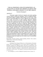
Figure 1 Image of Scotland showing case study areas.
Secondly, I look at two grain-growing areas in the Scottish Highlands. Easter Ross
(Chapter 7), in the north-east Highlands, has a unique series of grain storehouses or girnals
which were connected with the export of barley and oats by sea. I consider nine of these
seventeenth and eighteenth century girnals and the related anchorages and harbours. I then
look in Chapter 8 at the island of Bute, in the southern Highlands, where there was a
substantial grain export trade in the eighteenth century. My work in Easter Ross has
Chapter 1 20
allowed me to identify what I believe to have been the site of the island’s girnal. I also
consider the position in other fertile parts of the southern Highlands where no known
girnals or grain export trade existed.
Whilst I make comments and observations on the archaeology in the four case-study
chapters, I reserve Chapter 9 for a deeper, more general discussion which seeks to extend
my interpretation of the evidence on a thematic basis, including comparisons and contrasts
between case-study areas in the northern and southern Highlands. It is there that I seek to
examine the research questions posed at the start of the thesis.
I draw matters to a conclusion in Chapter 10 referring back to the research question posed
at the outset and the archaeology considered in the thesis.
1.3 Approach
My approach from the outset has been unashamedly inter-disciplinary in nature. This is
probably coloured by my background. My first degree was originally in history but I
broadened it to do joint honours in history and economics because my interests at the time
demanded, I felt, a broader perspective. Later in life I ran a successful professional services
business. One of my biggest challenges was to get specialists to work together in a holistic
manner to address the problems of clients. Breaking down silos was a business imperative.
Consequently, this thesis draws on economic as well as archaeological theory; information
from archives and maps; input from documents and oral sources, as well as the core
archaeological field-work.
Happily this sits very well with the modern Scottish academic movement of rural
settlement and landscape studies. Starting out from solid foundations in archaeology and
geography, this has recently grown to encompass planning, economics and policy
specialists. So for example, in the 1990s conferences were held in Scotland, involving a
range of contributors from inside and outside archaeology, which led to publications
including Medieval or Later Rural Settlement (MOLRS) Study: Recommendations
Towards a Policy Statement (Atkinson 1995), and Townships to Farmsteads: Rural
settlement in Scotland, England and Wales (Atkinson et al. [eds.] 2000).
A growing emphasis on inter-disciplinary landscape research has also been seen more
widely. Such an approach has, for instance, been promoted by the Landscape Research
Chapter 1 21
Group, and its journal ‘Landscape Research’ (), in
publications such as ‘The Routledge Companion to Landscape Studies’ (2013) (Howard et
al. [eds.] 2013) and indeed in academic courses which are deliberately inter-disciplinary in
character. Archaeology has long been teamed with ethnology, cultural studies, geography,
economics, town and country planning, as well as history in its many guises, such as
social, oral, cultural and economic in this academic tradition.
I hesitate to locate myself within any particular tradition of interpretation or practice.
However, it would be fair to say that I find myself at least adjacent to several. These
include historical archaeology, landscape archaeology, the archaeology of practice and the
archaeology of capitalism.
I have been influenced by the work of Matthew Johnson, especially with regard to his call
for a research agenda in respect of the archaeology of historic landscapes (Johnson 2007:
149-161). This involves an assessment of the context of the archaeology. The historical
context helps to put the everyday realities of social practice in the landscape into
perspective. So attention is brought to bear on why and how movement occurs around and
over the landscape on an everyday and seasonal basis. This impacts landscape in a physical
way with the rutting of drove tracks, the building of harbours, the creation of turf dykes to
keep cattle from the crops and the beaten path between a bothy and a stance. In addition, as
the shape or form of the archaeological evidence changes over time this gives clues to
changes in social practice and relationships. Thus questions are raised, for example as to
why cattle stances, which were previously melded into the landscape in an irregular but
very practical way, give way to rectilinear enclosures, as the eighteenth century progresses.
This work also has some resonance with developments in American historical archaeology,
especially with calls to consider not only what was happening locally, on site and nearby,
but also how local developments interacted with developments at a wider, even global,
scale. This is what has been referred to as the “dialectics of scale” (Orser 1996).
My belief is that practice is embedded in everyday life and, in the specific contexts
considered by this thesis, the practices of moving cattle and grain through the landscape
and resting at certain locations have embedded themselves into the landscape and into the
archaeological record. Whilst the archaeology of practice is perhaps more commonly
associated with prehistoric rather than post-medieval archaeology there are now many
examples of it being applied in post-medieval situations (for example Rackham 1990;
Dalglish 2003). In this case, the seasonal routines in which drovers collect cattle from
Chapter 1 22
landlords or tenants and then set off with the herd to market, passing by many other people
is indicative of a network of social relationships. The related material culture both
structures and is structured by that routine practice (Hodder and Hutson 2003: 90-106). So
the archaeology gives evidence of the constitution of past social relationships and how they
may have changed over time. Having walked over 150km on rough droving-related
routeways, I can testify that the engagement with the landscape was very direct (Roberts
and Wrathmell 2002), with constant checking of sightlines, assessment of river crossings,
and the avoidance of unnecessary ascents.
One of my main themes is the rise of the individual over the community in the Highlands.
Indeed this is discussed at the very outset of Chapter 2. This places the work in the area
discussed by archaeologies of capitalism, however that term is understood (Leone and
Potter [eds.] 1999; Hall and Silliman [eds.] 2006; Orser 2009). Capitalism is interpreted
(in this thesis at least) as a type of social relationship whereby people position themselves
to others as autonomous individuals. The exact form is governed by existing social
practice, and it is accepted that a capitalist society can encompass other ways of looking at
the world, and other, older, relationship patterns, such as the clan system, may subsist at
the same time. Equally in a capitalist society, it is given that social relationships are
asymmetrical in power terms. At the heart of this study are markets, and for them to
operate there must be the possibility of market exchange. Cattle and grain go to market, are
exchanged, and then value is returned in cash which is a bearer of options for the holder.
How that value is shared is indicative of the asymmetrical nature of those social
relationships.
23
2 A research context: situating the current research
within relevant literature
2.1 Introduction
The research, which I have just outlined, is centred on commercial practice and changing
social relationships in the Scottish Highlands before and during Improvement. It considers
these issues by studying the archaeology of cattle and grain export in different parts of the
Highlands. As such, it is a new area of research. That is not to say, however, that there has
not been work done on closely related fields. Indeed the literature, and especially the
historical literature, on life and events in the Scottish Highlands is enormous. The
archaeological literature is not as extensive, although it is growing. In this chapter I will
review literature relevant to my area of study, using it to set the wider context of the
research. I will show some of the gaps in existing knowledge, as well as some of the
problems which it has in explaining the changing nature of social relationships at this time
in the Highlands. At the end of the chapter I show how this review helped me to begin to
develop a research agenda, by indicating the need for new research in specific areas, which
would make an original contribution to the existing body of knowledge.
In the first section, I look at the changing nature of social relationships in the Scottish
Highlands by focussing on a perceived shift from community (clanship) to individualism. I
analyse the literature in terms of what it has to say about the nature of Highland society,
and particularly the question of the extent to which this was communal or individualistic. I
use recent scholarship to describe some features of what Allan Macinnes refers to as “the
traditional basis of clanship” (1996: 1-29). I then juxtapose this view of life with a picture
of society as it emerged, apparently transformed, in the post-Improvement Highlands. I
highlight the complexity of the situation whereby some features of clan-based society were
far from communal in nature, and may be argued to be precursors of later
commercialisation. This complexity also extends to the differing speed and nature of
change in different parts of the Highlands.
In the second section, I look at the various models of change which have been used to
explain changing patterns of social relationships in the Scottish Highlands. For
convenience, I have divided these into political, cultural and economic explanations. I
argue, however, that modern scholarship is increasingly seeing all three as connected. It
should also be noted that the great majority of narrative histories make little attempt to
Chapter 2 24
explain why change happens at all, but describe it in a non-theoretical, empirical manner. I
critique these models, and show that they have a lasting resonance in current-day Scotland,
being often used for political ends. It is an irony that such contemporary use often results
in the removal of personal agency from those being discussed.
Thirdly I consider the evidence that there was increasing commercialisation in the
Highlands before Improvement. I draw upon both archaeological and historical sources in
this discussion, but specifically look at the role of archaeology. I suggest that the evidence
does exist, but may have been marginalised by an understandable focus on the dramatic
events related to Clearance. Might an archaeology of rural commercial practice be of use?
Finally, my research is placed against these themes, together with their gaps and problems,
in order to consider how it might make a positive contribution to enhancing knowledge. In
so doing I begin to develop a research agenda which is explored further both theoretically
and methodologically in the following chapters.
2.2 Community and individualism
2.2.1 Introduction: simplicity and complexity; static or changing?
It is frequently asserted that at some point in an undefined past that a self-sufficient,
communal, albeit backward, society existed in the Highlands before Improvement (Gray
1957: 3-54). This was a clan based society. At a later time, after Improvement, a different
society emerged in the Highlands. This was one, it is claimed, where individualism had
come to dominate social structures (Hunter 2000: 1-30). These represent essentially static
models which have been used to express idealised and simplified positions. Here, I wish to
consider these contrasting societies. I focus on recent scholarship which has begun to shift
away from static representations of society to representations which seek to embody
change within their descriptive accounts. I suggest that this points to a position of
considerable complexity in social relationships, where there is also a tension between
continuity and change, and where artificial geographic and temporal boundaries should be
challenged.
2.2.2 Clanship: a communal society?
Books about Scottish clans and tartans are ubiquitous on Scottish family bookcases.
Johnston & Bacon have been producing such works on Highland clans, their organisation