- Trang chủ >>
- THPT Quốc Gia >>
- Hóa
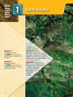
EARTH SCIENCE geology, the environment, and the universe 2008 (10)
Bạn đang xem bản rút gọn của tài liệu. Xem và tải ngay bản đầy đủ của tài liệu tại đây (3.58 MB, 28 trang )
(l)Carl & Ann Purcell/CORBIS, (r)Elliott Kaufman/Beateworks/CORBIS, (bkgd)Martin Garwood/Photo Researchers
Surface Water
BIG Idea Surface water
moves materials produced by
weathering and shapes the
surface of Earth.
9.1 Surface Water
Movement
MAIN Idea Running water is
an agent of erosion, carrying
sediments in streams and rivers
and depositing them
downstream.
Waterfall
9.2 Stream Development
MAIN Idea Streams erode
paths through sediment and
rock, forming V-shaped stream
valleys.
9.3 Lakes and
Freshwater Wetlands
MAIN Idea As the amount of
water changes and the amount
of sediments increases, lakes can
be transformed into wetlands
and eventually into dry land.
GeoFacts
• The United States has
approximately 5,600,000 km of
rivers.
• The Missouri River is about
4087 km long, making it the
longest river in North America.
• The Mississippi River Basin
drains 41 percent of the
United States.
222
Slow-moving water
Start-Up Activities
Stream Development Make
this Foldable that features the
steps in stream development.
LAUNCH Lab
How does water infiltrate?
When water soaks into the ground, it moves at different rates through the different materials that make
up Earth’s surface.
Procedure
1. Read and complete the lab safety form.
2. Place a small window screen on each of
two clear plastic shoe boxes.
3. Place an 8-cm × 16-cm clump of grass or
sod on one screen.
4. Place an 8-cm × 16-cm clump of barren
soil on the other screen.
5. Lightly sprinkle 500 mL of water on each
clump.
6. Observe the clumps for 5 min.
7. Measure the amount of water in each box.
Analysis
1. Describe what happens to the water after
5 min.
2. Infer the reason for any differences in the
amount of water collected in each box.
STEP 1 Fold three
sheets of notebook paper
in half horizontally to find
the middle. Holding two of
the sheets together, make
a 3-cm cut at the fold line
on each side of the paper.
STEP 2 On the third
sheet, cut along the fold
line to within 3-cm of
each edge.
STEP 3 Slip the first
two sheets through the
cut in the third sheet to
make a six-page book.
Label your
book Stream
Development.
STEP 4
Stream
Development
FOLDABLES Use this Foldable with Section 9.2.
As you read this section, use the pages of your
Foldable to describe and illustrate the steps in
stream development.
Visit glencoe.com to
study entire chapters online;
explore
•
Interactive Time Lines
•
Interactive Figures
•
Interactive Tables
animations:
access Web Links for more information, projects,
and activities;
review content with the Interactive
Tutor and take Self-Check Quizzes.
Section 1Chapter
• XXXXXXXXXXXXXXXXXX
9 • Surface Water 223
Section 9 . 1
Objectives
◗ Describe how surface water can
move weathered materials.
◗ Explain how a stream carries its
load.
◗ Describe how a floodplain
develops.
Review Vocabulary
solution: a homogeneous mixture in
which the component particles cannot
be distinguished
New Vocabulary
runoff
watershed
divide
suspension
bed load
discharge
flood
floodplain
Surface Water Movement
MAIN Idea Running water is an agent of erosion, carrying
sediments in streams and rivers and depositing them downstream.
Real-World Reading Link Have you ever noticed that sometimes a river is
muddy but other times it is clear? In floods, rivers can carry greater amounts of
materials, which makes them muddy. Under normal conditions, they often carry
less sediment, which makes them clearer.
The Water Cycle
Earth’s water supply is recycled in a continuous process called the
water cycle, shown in Figure 9.1. Water molecules move
continuously through the water cycle following many pathways:
they evaporate from a body of water or the surface of Earth, condense into cloud droplets, fall as precipitation back to Earth’s surface, and infiltrate the ground. As part of a continuous cycle, the
water molecules eventually evaporate back to the atmosphere, form
clouds, fall as precipitation, and the cycle repeats. Understanding
the mechanics of the water cycle will help you understand the reasons for variations in the amount of water that is available
throughout the world.
Often, a water molecule’s pathway involves time spent within a
living organism or as part of a snowfield, glacier, lake, or ocean.
Although water molecules might follow a number of different
pathways, the overall process is one of repeated evaporation and
condensation powered by the Sun’s energy.
Reading Check Explain What happens once water reaches Earth’s
surface?
Figure 9.1 The water cycle, also
referred to as the hydrologic cycle, is a
never-ending, natural circulation of
water through Earth’s systems.
Identify the driving force for
the water cycle.
■
Sun
Condensation
Precipitation
Evaporation
Runoff
Interactive Figure To see an
animation of the water cycle, visit
glencoe.com.
Oceans
Transpiration
Land
Rivers
Groundwater
224 Chapter 9 • Surface Water
Infiltration
Runoff
Water flowing downslope along Earth’s surface is called runoff.
Runoff might reach a stream, river, or lake, it might evaporate, or
it might accumulate as puddles in small depressions and infiltrate
the ground. During and after heavy rains, you can observe these
processes in your yard or local park. Water that infiltrates Earth’s
surface becomes groundwater.
A number of conditions determine whether water on Earth’s
surface will infiltrate the ground or become runoff. For water to
enter the ground, there must be large enough pores or spaces in the
soil and rock to accommodate the water’s volume, as in the loose
soil illustrated in Figure 9.2. If the pores already contain water,
the newly fallen precipitation will either remain in puddles on top
of the ground or, if the area has a slope, run downhill. Water standing on the surface of Earth eventually evaporates, flows away, or
slowly enters the groundwater.
VOCABULARY
ACADEMIC VOCABULARY
Accommodate
to hold without crowding or
inconvenience
The teacher said she could
accommodate three more students
in her classroom.
Soil composition The physical and chemical composition of
soil affects its water-holding capacity. Soil consists of decayed
organic matter, called humus, and minerals. Humus creates pores in
the soil, thereby increasing a soil’s ability to retain water. The minerals in soil have different particle sizes, which are classified as sand,
silt, or clay. As you learned in Chapter 7, the percentages of particles
of each size vary from soil to soil. Soil with a high percentage of
coarse particles, such as sand, has relatively large pores between its
particles that allow water to enter and pass through the soil quickly.
In contrast, soil with a high percentage of fine particles, such as
clay, clumps together and has few or no spaces between the particles. Small pores restrict both the amount of water that can enter
the ground and the ease of movement of water through the soil.
Rate of precipitation Light, gentle precipitation can infiltrate
dry ground. However, the rate of precipitation might temporarily
exceed the rate of infiltration. For example, during heavy precipitation, water falls too quickly to infiltrate the ground and becomes
runoff. Thus, a gentle, long-lasting rainfall is more beneficial to
plants and causes less erosion by runoff than a torrential downpour. If you have a garden, remember that more water will enter
the ground if you water your plants slowly and gently.
Sand
grains
Sand
grains
Silt
grains
Pore
spaces
0
■ Figure 9.2 Soil that has open surface
pores allows water to infiltrate. The particle size
that makes up a soil helps determine the pore
space of the soil.
1 mm
Large grain size
Pore
spaces
0
1 mm
Fine grain size
Pore
spaces
0
1 mm
Silt
grains
Mixed grain size
Section 1 • Surface Water Movement 225
■ Figure 9.3 Vegetation can slow the
rate of runoff of surface water. Raindrops
are slowed when they strike the leaves of
trees or blades of grass, and they trickle
down slowly.
Grasses slow
the movement of
runoff water.
Vegetation Soils that contain grasses or other vegetation allow
more water to enter the ground than do soils with no vegetation.
Precipitation falling on vegetation slowly flows down leaves and
branches and eventually drops gently to the ground, where the
plants’ root systems help maintain the pore space needed to hold
water, as shown in Figure 9.3. In contrast, precipitation falls with
far more force onto barren land. In such areas, soil particles clump
together and form dense aggregates with little space between them.
The force of falling rain can then push the soil clumps together,
thereby closing pores and allowing less water to enter.
Slope The slope of a land area plays a significant role in determining the ability of water to enter the ground. Water from precipitation falling on slopes flows to areas of lower elevation. The
steeper the slope, the faster the water flows. There is also greater
potential for erosion on steep slopes. In areas with steep slopes,
much of the precipitation is carried away as runoff.
Stream Systems
Precipitation that does not enter the ground usually runs off the
surface quickly. Some surface water flows in thin sheets and eventually collects in small channels, which are the physical areas where
streams flow. As the amount of runoff increases, the channels
widen, deepen, and become longer. Although these small channels
often dry up after precipitation stops, the channels fill with water
each time it rains and become larger and longer.
Tributaries All streams flow downslope to lower elevations.
However, the path of a stream can vary considerably, depending on
the slope and the type of material through which the stream flows.
Some streams flow into lakes, while others flow directly into the
ocean. Rivers that flow into other streams are called tributaries. For
example, as shown in Figure 9.4, the Missouri River is a tributary
of the Mississippi River.
226
Chapter 9 • Surface Water
Drainage basin of
the Mississippi River
Mi
s
uri
R iv
.
er
sippi R
s is
Mi
sso
■ Figure 9.4 The watershed of the
Mississippi River includes many stream systems,
including the Mississippi, Missouri and Ohio
Rivers. The Continental Divide marks the western boundary of the watershed.
Identify what portion of the continental
United States eventually drains into the
Mississippi River.
ver
o Ri
Ohi
Continental
Divide
Mississippi
Delta
0
500 km
Watersheds and divides All of the land area whose water
drains into a stream system is called the system’s watershed.
Watersheds can be relatively small or extremely large in area.
A divide is a high land area that separates one watershed from
another. In a watershed, the water flows away from the divide,
as this is the high point of the watershed.
Each tributary in a stream system has its own watershed and
divides, but they are all part of the larger stream system to which
the tributary belongs. The watershed of the Mississippi River,
shown in Figure 9.4, is the largest in North America.
Reading Check Describe what a divide is and what role it plays in
a watershed.
PROBLEM-SOLVING Lab
Interpret the Graph
Think Critically
1. Identify at what velocity flowing water
would pick up a pebble.
2. Identify at what range of velocities flowing
water would carry a pebble.
3. Infer which object would not fall into the
same size range as a pebble: an egg, a baseball, a golf ball, a table tennis ball, a volleyball, and a pea. How would you test your
conclusions?
Stream Velocity and Particle Size
100.0
Particle diameter (cm)
How do sediments move in a stream? The
critical velocity of water determines the size
of particles that can be moved. The higher the
stream velocity, the larger the particles that
can be transported.
10.0
Boulders
Cobbles
1.0
Pebbles
25.6 cm
6.4 cm
0.2 cm
0.1
Sand
0.01
0.006 cm
0.001
Silt
0.0004 cm
0.0001
Clay
0.00001
0
100 200 300
400 500 600 700 800
Stream velocity (cm/s)
Section 1 • Surface Water Movement 227
Stream Load
The material that a stream carries is known as stream load. Stream
load is carried in three ways.
Materials in suspension Suspension is the method of transport for all particles small enough to be held up by the turbulence of a
stream’s moving water. Particles such as silt, clay, and sand are part of a
stream’s suspended load. The amount of material in suspension varies
with the volume and velocity of the stream water. Rapidly moving
water carries larger particles in suspension than slowly moving water.
■ Figure 9.5 Particles rub, scrape,
and grind against one another in a
streambed, which can create potholes.
Bed load Sediment that is too large or heavy to be held up by turbulent water is transported by streams in another manner. A stream’s
bed load consists of sand, pebbles, and cobbles that the stream’s
water can roll or push along the bed of the stream. The faster the
water moves, the larger the particles it can carry. As the particles
move, they rub against one another or the solid rock of the streambed, which can erode the surface of the streambed, as shown in
Figure 9.5.
Materials in solution Solution is the method of transport
for materials that are dissolved in a stream’s water. When water runs
through or over rocks with soluble minerals, it dissolves small amounts
of the minerals and carries them away in the solution. Groundwater
adds the majority of the dissolved load to streams. The amount of dissolved material that water carries is often expressed in parts per million (ppm). For example, a measurement of 10 ppm means that there
are 10 parts of dissolved material for every 1 million parts of water.
The total concentration of materials in solution in streams averages
115–120 ppm, although some streams carry as little dissolved material
as 10 ppm. Values greater than 10,000 ppm have been observed for
streams draining desert basins.
■
Figure 9.6
Floods in Focus
Floods have shaped the landscape and
affected human lives.
1927 Heavy rains flood the
Mississippi River from Illinois
to Louisiana leaving more
than 600,000 people homeless.
1902 In Egypt, the Aswan
Dam is built to stabilize the
flow of annual flood waters
that create the fertile Nile
Delta.
228 Chapter 9 • Surface Water
(tl)Salvatore Vasapolli/Animals Animals, (bl)Lloyd Cluff/CORBIS, (br)Anthony Cooper/Ecoscene/CORBIS
1931 China’s Yellow River
floods when heavy rain causes
the river’s large silt deposits
to shift and block the channel.
1958 Following a flood that
claimed almost 2000 lives,
Holland begins creating a
vast network of dams, dikes,
and barriers, shortening its
coastline by 700 km.
Stream Carrying Capacity
The ability of a stream to transport material, referred to as its
carrying capacity, depends on both the velocity and the amount
of water moving in the stream. The channel’s slope, depth, and
width all affect the speed and direction the water moves within it.
A stream’s water moves more quickly where there is less friction;
consequently, smooth-sided channels with great slope and depth
allow water to move the most rapidly. The total volume of moving
water also affects a stream’s carrying capacity. Discharge, shown in
Figure 9.7, is the measure of the volume of stream water that flows
past a particular location within a given period of time. Discharge is
commonly expressed in cubic meters per second (m3/s). The following formula is used to calculate the discharge of a stream.
discharge = average width × average depth × average velocity
(m)
(m)
(m/s)
(m3/s)
Average
depth
Average
velocity
Average
width
Figure 9.7 Stream discharge is
the product of a stream’s average width,
average depth, and the velocity of the
water.
■
The largest river in North America, the Mississippi River, has a
huge average discharge of about 17,000 m3/s. The Amazon River,
the largest river in the world, has a discharge of about ten times
that amount. The discharge from the Amazon River over a twohour period would supply New York City’s water needs for an
entire year!
As a stream’s discharge increases, its capacity also increases.
Both water velocity and volume increase during times of heavy precipitation, rapid melting of snow, and flooding. In addition to
increasing a stream’s carrying capacity, these conditions heighten a
stream’s ability to erode the land over which it passes. As a result of
an increase in erosional power, a streambed can widen and deepen,
adding to the stream’s carrying capacity. Streams shape the landscape both during periods of normal flow and during floods, as
highlighted in Figure 9.6.
1988 Monsoon rains
in Bangladesh flood
two-thirds of the country,
affecting 45 million people.
1974 The United Kingdom
begins building the Thames
Barrier to protect London from
rising tide levels as the city sinks
and sea levels rise.
2005 Category 5 Hurricane Katrina
slams into Louisiana, Mississippi, and
Alabama, devastating New Orleans.
1996 Volcanic eruptions in
Iceland release meltwater from
under the Vatnajökull glacier
that washes away power lines,
major roads, and bridges.
Interactive Time Line To learn
more about these discoveries and
others, visit
glencoe.com.
Section 1 • Surface Water Movement 229
Jerry Grayson/Helifilms Australia PTY Ltd/Getty Images
■ Figure 9.8 When rivers overflow their banks, the floodwater deposits sediment.
Over time, sediment accumulates along the edges of a river, resulting in natural levees.
Flood plain
Sand
Sediment deposited
during flood
Natural levees
Clay
Floods
Figure 9.9 This flood was caused
by heavy rainfall upstream. Notice the
farm fields that have been covered in
floodwater.
Analyze What long-term effects
might this flood have on the crops
grown in this area?
■
The amount of water being transported in a particular stream at
any given time varies with weather conditions. Sometimes, more
water pours into a stream than the banks of the stream channel can
hold. A flood occurs when water spills over the sides of a stream’s
banks onto the adjacent land. The broad, flat area that extends out
from a stream’s bank and is covered by excess water during times
of flooding is known as the stream’s floodplain.
Floodwater carries along with it a great amount of sediment
eroded from Earth’s surface and the sides of the stream channel.
As floodwater recedes and its volume and speed decrease, the water
drops its sediment load onto the stream’s floodplain. After repeated
floods over time, sediments deposited by floods tend to accumulate
along the banks of the stream. These develop into continuous
ridges along the sides of a river, called natural levees, as shown in
Figure 9.8. Floodplains develop highly fertile soils as more sediment is deposited with each subsequent flood. The fertile soils of
floodplains make some of the best croplands in the world.
Reading Check Describe what happens when floodwaters recede.
Flood stages Floods are a natural occurrence. After a rain
event or snowmelt, it takes time for runoff water to reach the
streams. As water enters the streams, the water level continues to
rise and might reach its highest point, called its crest, days after
precipitation ends. When the water level in a stream rises higher
than its banks, the river is said to be at flood stage. The resulting
flooding might occur over localized areas or across large regions.
The flooding of a small area is known as an upstream flood.
Heavy accumulation of excess water from large regional drainage systems results in downstream floods. Such floods occur during or after long-lasting, intense storms or spring thaws of large
snowpacks. The tremendous volume of water involved in a downstream flood can result in extensive damage. The effects of flooding on the landscape are shown in Figure 9.9.
230
Chapter 9 • Surface Water
Barrie Rokeach/Getty Images
USGS
■ Figure 9.10 Gaging stations, like
this one, can send data to meteorologic
stations. There, scientists can process the
information and alert the public to potential floods.
Flood Monitoring and Warning Systems
In order to provide warnings for people at risk, government
agencies, such as the National Weather Service, monitor potential
flood conditions. Earth-orbiting weather satellites photograph Earth
and collect and transmit information about weather conditions,
storms, and streams. In addition, the U.S. Geological Survey (USGS)
has established approximately 7300 gaging stations in the United
States to provide a continuous record of the water level in each
stream as shown in Figure 9.10. These gaging systems often
transmit data to satellites and telephone lines where the information
is then sent to the local monitoring office.
In areas that are prone to severe flooding, warning systems are
the first step in implementing emergency management plans. Flood
warnings and emergency plans often allow people to safely
evacuate an area in advance of a flood.
Section 9.
9.1
1
Assessment
Section Summary
Understand Main Ideas
◗ Infiltration of water into the ground
depends on the number of open
pores.
1.
◗ All the land area that drains into
a stream system is the system’s
watershed.
◗ Elevated land areas called divides
separate one watershed from
another.
◗ A stream’s load is the material the
stream carries.
◗ Flooding occurs in small, localized
areas as upstream floods or in large
downstream floods.
MAIN Idea
Analyze ways in which moving water can carve a landscape.
2. Describe the three ways in which a stream carries its load.
3. Analyze the relationship between the carrying capacity of a stream and its
discharge and velocity.
4. Determine why little water from runoff infiltrates the ground in areas with steep
slopes.
Think Critically
5. Determine how a floodplain forms and why people live on floodplains.
6. Analyze how levees prevent flood damage.
MATH in Earth Science
7. Design a data table that compares how silt, clay, sand, and large pebbles settle
to the bottom of a stream as the velocity of water decreases.
Self-Check Quiz glencoe.com
Section 1 • Surface Water Movement
231
Section 9.
9.2
2
Objectives
◗ Describe some of the physical features of stream development.
◗ Describe the relationship between
meanders and stream flow.
◗ Explain the process of rejuvenation
in the stream development.
Review Vocabulary
abrasion: process of erosion in
which windblown or waterborne particles, such as sand, scrape against rock
surfaces or other materials and wear
them away
New Vocabulary
stream channel
stream bank
base level
meander
delta
rejuvenation
■ Figure 9.11 The headward erosion of Stream A cuts into Stream B
and draws away from its water into
one stream.
Stream Development
MAIN Idea Streams erode paths through sediment and rock,
forming V-shaped stream valleys.
Real-World Reading Link When was the last time you saw water flow
uphill? Water in all rivers travels downslope to the lowest point. This allows
geologists to predict the path of the river based on the features of an area.
Supply of Water
Stream formation relies on an adequate water supply. Precipitation
provides water for the beginnings of stream formation. Streams can
also be fed by underground deposits of water. As a stream develops,
it changes width and size, and shapes the land over which it flows.
Stream channels The region where water first accumulates to
supply a stream is called the headwaters. It is common for a stream’s
headwaters to be high in the mountains. Falling precipitation
accumulates in small gullies at these higher elevations and forms
briskly moving streams. As surface water begins its flow, its path
might not be well defined. In time, the moving water carves a narrow
pathway into the sediment or rock called the stream channel. The
channel widens and deepens as more water accumulates and cuts into
Earth’s surface. Stream banks hold the moving water within them.
When small streams erode away the rock or soil at the head of
a stream, it is known as headward erosion. These streams move
swiftly over rough terrain and often form waterfalls and rapids as
they flow over steep inclines. Sometimes, a stream erodes the high
area separating two drainage basins and joins another stream, and
then draws water away from the other stream. This process is
called stream capture, shown in Figure 9.11.
Stream B
Stream
capture
Headward
erosion
Stream A
232
Chapter 9 • Surface Water
Stream B
Stream A
Maximum energy for
downward erosion
Figure 9.12 The height of a stream
above its base level determines how much
downcutting energy the stream will have.
■
Minimum energy for
downward erosion
Sea level
Base level of streams
Formation of Stream Valleys
The driving force of a stream is the force of gravity on water. This
means that the energy of a stream comes from the movement of
water down a slope called a stream gradient. When the gradient
of a stream is steep, water in the stream moves downhill rapidly,
cutting steep valleys. The gradient of the stream depends on its
base level, which is the elevation at which it enters another stream
or body of water. The lowest base level possible for any stream is
sea level, the point at which the stream enters the ocean, as shown
in Figure 9.12.
Far from its base level, a stream actively erodes a path through
the sediment or rock, and a V-shaped channel develops. V-shaped
channels have steep sides and sometimes form canyons or gorges.
The Yellowstone River in Wyoming flows through an impressive
example of this type of narrow, deep gorge carved by a stream.
Figure 9.13 shows the classic V-shaped valley. As a stream
approaches its base level, it has less energy for downward erosion.
Instead, streams that are near their base level tend to erode at the
sides of the stream channel, and over time result in broader valleys
with gentle slopes, as shown in Figure 9.13.
FOLDABLES
Incorporate information
from this section into
your Foldable.
Figure 9.13 A V-shaped valley is formed
by the downcutting of a stream. A wide, broad
valley is a result of stream erosion over a long
period of time.
Identify which river is closer to its base
level.
■
Section 2 • Stream Development 233
(l)Mike Norton/Animals Animals, (r)Tom Bean/CORBIS
VOCABULARY
SCIENCE USAGE V. COMMON USAGE
Meander
Science usage: a bend or curve in
a stream channel caused by
moving water
Common usage: a winding path
or course
Meanders As stream channels develop into broader valleys, the
volume of water and sediment that they are able to carry increases.
In addition, a stream’s gradient decreases as it nears its base level,
and the channel gets wider as a result. The decrease in gradient
causes an increase in the volume of water the stream channel can
carry. Sometimes, the water begins to erode the sides of the channel in such a way that the overall path of the stream starts to bend
or wind. A bend or curve in a stream channel caused by moving
water is called a meander, shown in Figure 9.14.
Water in the straight parts of a stream flows at different velocities, depending on its location in the channel. In a straight length
of a stream, water in the center of the channel flows at the maximum velocity. Water along the bottom and sides of the channel
flows more slowly because it experiences friction as it moves
against the land.
In contrast, the water moving along the outside of a meander
curve experiences the greatest velocity within the meander. The
water that flows along this outside part of the curve continues to
erode away the sides of the streambed, thus making the meander
larger. Along the inside of the meander, the water moves more
slowly and deposition is dominant. These differences in the velocity within meanders cause the meanders to become more accentuated over time. This process is illustrated in Figure 9.15.
Oxbow lakes Stream meanders continue to develop and become
larger and wider over time. After enough winding, however, it is
common for a stream to cut off a meander and once again flow
along a straighter path. The stream then deposits material along
the adjoining meander and eventually blocks off its water supply,
as shown in Figure 9.14. The blocked-off meander becomes an
oxbow lake, which eventually dries up.
As a stream approaches a larger body of water or its endpoint,
the ocean, the streambed’s gradient flattens out and its channel
becomes very wide. The area of the stream that leads into the ocean
or another large body of water is called the mouth.
■ Figure 9.14 As the path of the
stream bends and winds, it creates
meanders and eventually oxbow lakes.
Interactive Figure To see an animation of
meander formation, visit glencoe.com.
234
Chapter 9 • Surface Water
S.J. Krasemann/Peter Arnold, Inc.
Visualizing Erosion and
Deposition in a Meander
Figure 9.15 As the water travels down a meander, the area of maximum velocity changes. As shown in cross-section A, when the
meander is straight, the maximum velocity is located near the center. When the meander curves, the maximum velocity shifts to the outside
of the curve, as shown in cross-section B. As the meander travels around to cross-section C, the maximum velocity shifts again to the outside of the curve. Erosion occurs around curves in the meander in areas of high velocity. The high velocity of the water carries the sediment
downstream and deposits it where the velocity decreases, on the inside of a curve. The area where the erosion occurs is called a cutbank
and the area where the deposition occurs is called a point bar.
Maximum velocity
A
Erosion and
cutbank
Deposition of
point bar
B
Maximum velocity
C
Maximum velocity
To explore more about erosion and
deposition, visit glencoe.com.
Section 2 • Stream Development 235
Deposition of Sediment
The velocity of a stream determines how much sediment it can
transport. Rapidly flowing streams have the energy to transport
sediment as large as gravel. When streams lose velocity, they lose
some of the energy needed to transport sediment, and deposition
of sediment occurs.
Figure 9.16 An alluvial fan is a
fan-shaped depositional feature.
■
Alluvial fans A stream’s velocity lessens and its sediment load
drops when its gradient abruptly decreases. In dry regions such as
the North American Southwest, mountain streams flow intermittently down steep, rocky slopes and then flatten out onto expansive
dry lake beds. In areas such as these, a stream’s gradient suddenly
decreases, causing the stream to drop its sediment at the base of
the mountain in a fan-shaped deposit called an alluvial fan.
Alluvial fans are sloping depositional features formed at the bases
of slopes and are composed mostly of sand and gravel. An example
of an alluvial fan is shown in Figure 9.16.
Reading Check Describe how an alluvial fan is formed.
■ Figure 9.17 The Mississippi River Delta
was formed from the deposition of river sediments. The area in the top left of both images
is a marshland used for both recreation and
business. Since 1973, waters upstream of the
Mississippi River have been dammed, reducing
the sediment flow. Over the course of 30 years,
the area of the marshland has decreased without the sediment from upstream.
1973
236
Chapter 9 • Surface Water
(tl)Michael Andrews/Animals Animals, (bl)USGS, (br)USGS
Deltas Streams also lose velocity and some of their capacity to
carry sediment when they join larger bodies of quiet water. The
triangular deposit that forms where a stream enters a large body of
water is called a delta, named for the triangle-shaped Greek letter
delta (Δ). Delta deposits usually consist of layers of silt and clay
particles. As a delta develops, sediments build up and slow the
stream water, sometimes even blocking its movement. Smaller distributary streams then form to carry the stream water through the
developing delta. Deltas, such as the Mississippi River Delta, are
normally areas where the stream flow changes direction frequently.
Over the course of thousands of years, the Mississippi River
Delta has changed frequently. Today, any small change in the drainage channels can result in catastrophic flooding for local communities. To prevent floods, an extensive system of dams and levees is in
place to protect people and economic activities. A consequence of
flood control is the decrease in the regular deposition of sediment
throughout the delta. In the absence of regular deposition throughout the delta, normal processes of coastal erosion have caused the
delta to shrink over time, as shown in Figure 9.17.
2003
Louie Psihoyos/CORBIS
Rejuvenation
During the process of stream formation,
downcutting can occur. Downcutting is the
wearing away of the streambed and is a major
erosional process that influences the stream
until it reaches its base level. If the base level
drops as a result of geologic processes, the
stream undergoes rejuvenation.
Rejuvenation means to make young again.
During rejuvenation, a stream actively
resumes the process of downcutting toward its
base level. This causes an increase in the
stream’s velocity and the stream’s channel once
again cuts downward into the existing meanders. Rejuvenation can cause deep-sided canyons to form. A well-known example of
rejuvenation is the Grand Canyon, shown in
Figure 9.18.
Figure 9.18 Rejuvenation shaped the Grand Canyon when
the base level of the Colorado River changed and the river began
downcutting into existing meanders.
■
Millions of years ago, the Colorado River was
near its base level, like much of the Mississippi
River today. Then the land was uplifted compared to the level of the ocean, which caused the
base level of the Colorado River to drop. This
caused the process of rejuvenation, in which the
river began cutting downward into the existing
meanders. The result is the 1.6-km-deep canyons, which attract millions of visitors each year
from all over the world.
Section 9 . 2
Assessment
Section Summary
Understand Main Ideas
◗ Water from precipitation gathers in
gullies at a stream’s headwaters.
1.
◗ Stream water flows in channels confined by the stream’s banks.
3. Compare the velocity on the inside of a meander curve with that on the outside
of the curve.
◗ Alluvial fans and deltas form when
stream velocity decreases and sediment is deposited.
◗ Alluvial fans are fan-shaped and
form where water flows down steep
slopes onto flat plains.
◗ Deltas are triangular and form when
streams enter wide, relatively quiet
bodies of water.
MAIN Idea
Describe how a V-shaped valley is formed.
2. Identify four changes that a stream undergoes before it reaches the ocean.
Think Scientifically
4. Analyze how the type of bedrock over which a stream flows affects the time it
takes for the stream to reach its base level.
5. Infer how you can tell that rejuvenation has modified the landscape.
MATH in Earth Science
6. Create a line graph that plots the direction of change in a hypothetical stream’s
rate of flow at the stream’s headwaters, at midstream, and at its mouth.
Self-Check Quiz glencoe.com
Section 2 • Stream Development 237
Section 9 . 3
Objectives
◗ Explain the formation of freshwater lakes and wetlands.
◗ Describe the process of
eutrophication.
◗ Recognize the effects of human
activity on lake development.
Review Vocabulary
kettle: a depression resulting from
the melting of an ice block left behind
by a glacier
New Vocabulary
lake
eutrophication
wetland
■ Figure 9.19 Lakes such as these in
Minnesota were formed from blocks of ice left
behind after vast glaciers melted.
238 Chapter 9 • Surface Water
Phil Schermeister/CORBIS
Lakes and Freshwater Wetlands
MAIN Idea As the amount of water changes and the amount of
sediments increases, lakes can be transformed into wetlands and
eventually into dry land.
Real-World Reading Link Have you ever felt the bottom of a lake with your
feet? It was probably soft and squishy from deposits of fine sediments. Lakes
and ponds receive materials that are carried by rivers from upland areas. Over
time, accumulation of these sediments changes the characteristics of the lake.
Origins of Lakes
Natural lakes, bodies of water surrounded by land, form in different ways in surface depressions and in low areas. As you learned in
Section 9.2, oxbow lakes form when streams cut off meanders and
leave isolated channels of water. Lakes also form when stream flow
becomes blocked by sediment from landslides or other sources.
Still other lakes have glacial origins, as you learned in Chapter 8.
The basins of these lakes formed as glaciers gouged out the land
during the ice ages. Most of the lakes in Europe and North
America are in recently glaciated areas. Glacial moraines originally
dammed some of these depressions and restricted the outward
flow of water. The lakes that formed as a result are known as
moraine-dammed lakes. In another process, cirques carved high in
the mountains by valley glaciers filled with water to form cirque
lakes. Other lakes formed as blocks of ice left on the outwash plain
ahead of melting glaciers eventually melted, leaving depressions
called kettles. When these depressions filled with water, they
formed kettle lakes such as those shown in Figure 9.19.
(t)Michael Gadomski/Animals Animals, (b)Niall Benvie/CORBIS
Lakes Undergo Change
Water from precipitation, runoff, and underground
sources can maintain a lake’s water supply. Some lakes
contain water only during times of heavy rain or excessive runoff from spring thaws. A depression that
receives more water than it loses to evaporation or use
by humans will exist as a lake for a long period of time.
However, most lakes are temporary water-holding areas;
over hundreds of thousands of years, lakes usually fill in
with sediment and become part of a new landscape.
■ Figure 9.20 Eutrophication is a natural process
that can be accelerated with the addition of nitrogen
and phosphorus to a body of water. Once the process
begins, it can cause rapid changes in the plant and animal communities in the affected body of water.
Eutrophication Through the process of photosynthesis, plants such as green algae add oxygen to lake
water. Animals that live in a lake need oxygen in the
water. Throughout their life cycle, the animals add waste
products to the water. Oxygen is also consumed during
the decay process that occurs after plants and animals
living in the body of water die. Scientist use the amount
of dissolved oxygen present in a body of water to assess
the overall quality of the water. Dissolved oxygen is one
quality a body of water must have to support life.
The process by which bodies of water become rich in
nutrients from the surrounding watershed that stimulate excessive plant growth is called eutrophication.
Although eutrophication is a natural process, it can be
sped up with the addition of nutrients, such as fertilizers, that contain nitrogen and phosphorus. Other major
sources of nutrients that concentrate in lakes are animal
wastes and phosphate detergents.
When eutrophication occurs, the animal and plant
communities in the lake can change rapidly. Algae growing at the surface of the water can suddenly multiply very
quickly. The excessive algae growth in a lake or pond
appears as a green blanket, as shown in Figure 9.20.
Other organisms that eat the algae can multiply in numbers as well. In addition, the population of algae on the
surface can block sunlight from penetrating to the bottom of the lake, causing sunlight-dependent plants and
other organisms below the surface to die. The resulting
overpopulation and, later, the decay of a large number of
plants and animals depletes the water’s oxygen supply.
Fish and other sensitive organisms might die as a result
of the lack of oxygen in the water. In some cases, the
algae can also release toxins into the water that are harmful to the other organisms.
Reading Check Identify the effects of eutrophication on
the aquatic animals in an affected lake system.
Section 3 • Lakes and Freshwater Wetlands
239
Careers In Earth Science
Geochemist Technician Some
geochemist technicians take core
samples from lakes to analyze the
pollutants in lake sediments. To learn
more about Earth science careers,
visit glencoe.com.
Freshwater wetlands A wetland is any land area that is covered with water for a part of the year. Wetlands include environments commonly known as bogs, marshes, and swamps. They have
certain soil types and support specific plant species. Their soil
types depend on the degree of water saturation.
Bogs Bogs are not stream-fed but instead receive their water from
precipitation. The waterlogged soil tends to be rich in Sphagnum,
also called peat moss. The breakdown of peat moss produces acids,
thereby contributing to the soil’s acidity. The waterlogged, acidic
soil supports unusual plant species, including insect-eating pitcher
plants such as sundew and Venus flytrap.
Reading Check Identify how a bog receives water.
Marshes Freshwater marshes frequently form along the mouths
of streams and in areas with extensive deltas. The constant supply
of water and nutrients allows for the lush growth of marsh grasses.
The shallow roots of the grasses anchor deposits of silt and mud on
the delta, thereby slowing the water and expanding the marsh area.
Grasses, reeds, sedges, and rushes, along with abundant wildlife,
are common in marsh areas.
Swamps Swamps are low-lying areas often located near streams.
Swamps can develop from marshes that have filled in sufficiently
to support the growth of shrubs and trees. As these larger plants
grow and begin to shade the marsh plants, the marsh plants die.
Swamps that existed about 200 mya developed into present-day
coal reserves that are common in Pennsylvania and many other
locations in the United States and around the world.
Model Lake Formation
How do surface materials determine where lakes form? Lakes form when depressions or low
areas fill with water. Different Earth materials allow lakes to form in different places.
Procedure
1. Read and complete the lab safety form.
2. Use three clear plastic shoe boxes. Half fill each one with Earth materials: clay, sand, and gravel.
3. Slightly compress the material in each shoe box. Make a shallow depression in each surface.
4. Slowly pour 500 mL of water into each of the depressions.
Analysis
1. Describe what happened to the 500 mL of water that was added to each shoe box.
2. Compare this activity to what happens on Earth’s surface when a lake forms.
3. Infer in which Earth materials lakes most commonly form.
240 Chapter 9 • Surface Water
Percentage of Wetland Area Lost, 1780s–1980s
Alaska
0.1%
WA
31%
OR
38%
ID
56%
NV
52%
CA
91%
Hawaii
12%
MT
27%
WY
38%
UT
30%
AZ
33%
Over 80%
70–79%
60–69%
50–59%
Below 50%
CO
50%
NM
36%
ND
49%
SD
35%
VT
35%
MN
42%
NE
35%
KS
48%
OK
67%
TX
52%
WI
50%
WV
24%
NH
9%
NY
60%
PA
56%
MI
50%
IL IN OH
85% 87% 90%
VA
MO
42%
87%
KY 81%
NC 49%
TN 59%
AR
SC 27%
AL
72%
MS 50% GA
23%
LA 59%
46%
FL
46%
IA
89%
ME
20%
MA
28%
RI
37%
CT
74%
DE
54%
NJ
39%
MD
73%
Figure 9.21 The area of
wetlands in the United States was
drastically reduced until the 1980s.
Since then, efforts have been
made to preserve wetlands.
■
Wetlands and water quality Wetlands play a valuable role
in improving water quality. They serve as a filtering system that
traps pollutants, sediments, and pathogenic bacteria contained in
water sources. Wetlands also provide vital habitats for migratory
waterbirds and homes for an abundance of other wildlife. In the
past, it was common for wetland areas to be filled in to create more
land on which to build. Government data reveal that from the late
1700s to the mid-1980s, the continental United States lost 50 percent of its wetlands, as shown in Figure 9.21. By 1985, it was estimated that 50 percent of the wetlands in Europe were drained.
Now, however, the preservation of wetland areas has become a
global concern.
Section 9 .3
Assessment
Section Summary
Understand Main Ideas
◗ Lakes form in a variety of ways when
depressions on land fill with water.
1.
◗ Eutrophication is a natural nutrientenrichment process that can be
accelerated when nutrients from fertilizers, detergents, or sewage are
added.
2. Describe the conditions necessary for the formation of a natural lake.
◗ Wetlands are low-lying areas that
are periodically saturated with water
and support specific plant species.
4. Organize a data table to compare various types of lakes and their origins.
MAIN Idea Explain the transformation process that a lake might undergo as it
changes to dry land.
3. Identify human activities that might affect the process of eutrophication in a lake
near you.
Think Critically
5. Analyze a situation in which protection of wetlands might conflict with human
plans for land use.
Earth Science
6. Write an essay explaining the role wetlands play in improving water quality.
Self-Check Quiz glencoe.com
Section 3 • Lakes and Freshwater Wetlands
241
Guy Motil/CORBIS
The World of Water
Humans have basic physiological needs. These
include the need to breathe, to eat, to regulate
body temperature, to dispose of bodily wastes,
to sleep, and to have access to clean water.
Humans need clean water to drink, for cleaning, cooking, and waste disposal.
A global problem Almost every continent
has areas that lack safe drinking water. Rural
areas of developing countries and overpopulated urban areas often have inadequate
supplies of safe drinking water. Even though
adequate supplies of this natural resource may
exist globally, it is not distributed evenly. In
addition, naturally occurring contaminants and
pollution from human impact can make a
water supply unhealthy.
Safe water The World Health Organization
(WHO) defines safe drinking water as water
from a source that is less than 1 km away from
where it is used; that at least 20 L of water per
member of the household per day can be
obtained reliably; and that meets the national
standards for microbial and contaminant
levels.
Health concerns In developing countries, children are at the greatest risk for water-related
diseases. Worldwide, more than 5000 children
under the age of five die each day from waterrelated diseases. The most common health concerns from contaminated water are diarrhea and
intestinal worms.
Diarrhea is a common condition caused by bacteria often found in unsafe drinking water.
Without proper treatment, diarrhea can lead to
severe dehydration and death, especially in children. In developed countries, children suffering
from diarrhea often receive the necessary
treatment. However, in developing countries,
diarrhea accounts for the death of nearly 2
million children each year.
242
Chapter 9 • Surface Water
Contaminated water can be a problem in developed countries as well
as developing countries. This beach is closed because of unsafe water.
Another danger from contaminated water,
especially for children, is intestinal parasites.
Parasites that live in the intestines of the host,
humans in this case, can cause malnutrition,
anemia, and other illnesses.
A global solution The inability to
adequately supply this basic human need has
been acknowledged by the United Nations as
one of the greatest failures of the twentieth
century. The United Nations has created an
international task force to help fund the creation of sanitation systems and water purifiers.
In the future, with effort and global cooperation, every human being might have access to
safe drinking water and proper sanitation.
Earth Science
Brochure March 22 is World Water Day.
Create a brochure explaining the need for
such an event and why more people should
participate. For more information on
World Water Day, visit glencoe.com.
PREDICT THE VELOCITY OF A STREAM
Background: Water in streams flows from areas of
high elevation to areas of low elevation. Stream flow
is measured by recording the water’s velocity. The
velocity varies from one stream to another and also
in different areas of the same stream. Many components of the stream affect the velocity, including sediment, slope, and rainfall.
Protractor
String
Question How does slope affect velocity?
Weight
Materials
1-m length of vinyl gutter pipe
ring stand and clamp
water source with hose
protractor with plumb bob
sink or container to catch water
stopwatch
grease pencil
meterstick
paper
three-hole punch
Safety Precautions
Procedure
1. Read and complete the lab safety form.
2. Work in groups of three to four.
3. Use a three-hole punch to make 10 to 15 paper circles to be used as floating markers.
4. Use the illustration as a guide to set up the protractor
with the plumb bob.
5. Use the grease pencil to mark two lines across the
inside of the gutter pipe at a distance of 40 cm apart.
6. Use the ring stand and clamp to hold the gutter pipe
at an angle of 10°. Place the end of the pipe in a sink
or basin to collect the discharged flow of water.
7. Attach a long hose to a water faucet in the sink.
8. Keep the hose in the sink until you are ready to use
it. Turn on the water and adjust the flow until the
water moves quickly enough to provide a steady flow.
9. Bend the hose to block the water flow until the hose
90°
is positioned at least 5 cm above the top line marked
on the pipe. Allow the water to flow. Allow the water
to flow at the same rate for all slope angles.
10. Drop a floating marker approximately 4 cm above
the top line on the pipe into the flowing water.
11. Measure the time it takes for the floating marker to
move from the top line to the bottom line. Record
the time in your science journal.
12. Repeat Step 9 two more times.
13. Repeat Steps 9 and 10, but change the slope to 20°,
30°, and then 40°.
14. Make a line graph of the average velocity.
Analyze and Conclude
1. Interpret Data What is the relationship between
the velocity and the angle of the slope?
2. Apply Describe one reason that a stream’s slope
might change.
3. Infer Where would you expect to find streams with
the highest velocity?
4. Predict Using your graph, predict the velocity for a
35° slope.
INQUIRY EXTENSION
Design Your Own As discussed in the chapter, the texture of the streambed can affect the rate of stream flow.
Design an experiment to test this variable.
GeoLab 243
Download quizzes, key
terms, and flash cards
from glencoe.com.
BIG Idea Surface water moves materials produced by weathering and shapes the
surface of Earth.
Vocabulary
Key Concepts
Section 9.1 Surface Water Movement
•
•
•
•
•
•
•
•
bed load (p. 228)
discharge (p. 229)
divide (p. 227)
flood (p. 230)
floodplain (p. 230)
runoff (p. 225)
suspension (p. 228)
watershed (p. 227)
Running water is an agent of erosion, carrying sediments in
streams and rivers and depositing them downstream.
Infiltration of water into the ground depends on the number of open
pores.
All the land area that drains into a stream system is the system’s
watershed.
Elevated land areas called divides separate one watershed from another.
A stream’s load is the material the stream carries.
Flooding occurs in small, localized areas as upstream floods or in large
downstream floods.
MAIN Idea
•
•
•
•
•
Section 9.2 Stream Development
•
•
•
•
•
•
base level (p. 233)
delta (p. 236)
meander (p. 234)
rejuvenation (p. 237)
stream bank (p. 232)
stream channel (p. 232)
Streams erode paths through sediment and rock, forming
V-shaped stream valleys.
Water from precipitation gathers in gullies at a stream’s headwaters.
Stream water flows in channels confined by the stream’s banks.
Alluvial fans and deltas form when stream velocity decreases and sediment is deposited.
Alluvial fans are fan-shaped and form where water flows down steep
slopes onto flat plains.
Deltas are triangular and form when streams enter wide, relatively quiet
bodies of water.
MAIN Idea
•
•
•
•
•
Section 9.3 Lakes and Freshwater Wetlands
• eutrophication (p. 239)
• lake (p. 238)
• wetland (p. 240)
244 Chapter 9 • Study Guide
As the amount of water changes and the amount of sediments
increases, lakes can be transformed into wetlands and eventually into dry
land.
• Lakes form in a variety of ways when depressions on land fill with water.
• Eutrophication is a natural nutrient-enrichment process that can be
accelerated when nutrients from fertilizers, detergents, or sewage are
added.
• Wetlands are low-lying areas that are periodically saturated with water
and support specific plant species.
MAIN Idea
Vocabulary
PuzzleMaker
glencoe.com
Vocabulary
PuzzleMaker
biologygmh.com
Vocabulary Review
Choose the vocabulary term from the Study Guide that
best describes each phrase.
1. influenced by vegetation, precipitation, soil composition, and slope
2. the land area whose water drains into a stream
3. sediments that are transported by streams but are
too large to be held up in suspension
4. the measure of the volume of stream water that
flows over a particular location within a given
period of time
5. the triangular deposit of sediment that forms
where a stream enters a large body of water such as
a lake or ocean
6. the narrow channel carved over time by the water
of a stream into sediment or rock layers
Understand Key Concepts
13. Which scenario most likely formed most large
lakes in North America and Europe?
A. Lakes formed from stream meanders that were
cut off.
B. Landslides blocked the flow of streams,
creating lakes.
C. Glacial activity on continental masses scoured
the landscape and left depressions behind.
D. Reservoirs were created for the purpose of
storing water for communities.
14. What is the driving force of a stream?
A. velocity
B. gravity
C. discharge
D. downcutting
Use the figure below to answer Question 15.
7. the process by which a stream resumes downcutting toward its base level
The sentences below include terms that have been used
incorrectly. Make the sentences true by replacing each
italicized word with a vocabulary term from the Study
Guide.
8. A depression that receives more water than is
removed will exist as a stream for a long period
of time.
9. Enrichment is the process by which lakes become
rich in nutrients, resulting in a change in the kinds
of organisms in the lake.
10. Marshes, swamps, and bogs are all types of
inundated areas.
11. Solution is the method of transport for all particles
small enough to be held up by the turbulence of a
stream’s moving water.
12. The area that extends from a stream’s bank and is
covered by excess water during times of flooding is
known as a wetland.
Chapter Test glencoe.com
15. Which part of a river is shown?
A. the headwater
B. the main channel
C. the streambed
D. the mouth
16. When does downcutting of the streambed stop
during stream formation?
A. when the water reaches a porous layer
B. when the water reaches a base level
C. when the water reaches a new level
D. when the water reaches a nonpermeable layer
Chapter 9 • Assessment 245
Yann Arthus-Bertrand/CORBIS
Use the figure below to answer Question 17.
17. How did this terrain feature form?
A. It formed by a meander of a stream that has
been cut off.
B. It formed from a glacier that scoured out the land.
C. It is the result of a flood.
D. It is the result of eutrophication.
18. What type of streams form V-shaped valleys?
A. streams that carry a lot of sediment
B. streams that are far from ultimate base level
C. streams that meander
D. streams that carry no bed load
23. Which characteristic of the soil in a depression
is most important in allowing the formation of
a lake?
A. high content of organic material
B. high content of mostly of inorganic material
C. gravelly soil
D. relatively impermeable layer of soil
24. If a stream is carrying sand, large boulders, clay,
and small pebbles, which type of particle is
deposited last as the stream begins to slow down?
A. clay
B. sand
C. large boulders
D. small pebbles
Constructed Response
25. Compare and contrast the formation of a river
delta to an alluvial fan.
Use the following aerial view of a stream to answer
Questions 26 to 28.
19. Which is not a way in which lakes are typically
formed?
A. from cutoff meanders of streams
B. from asteroid craters
C. from landslides that block rivers
D. from glacial carving
20. Which substance plays a major role in the eutrophication process?
A. iron
C. ozone
B. phosphate
D. salt
21. Which factors determine the discharge of a
stream?
A. width, length, depth
B. width, length, velocity
C. width, depth, velocity
D. length, depth, runoff
22. Which process would result in rejuvenation of a
stream?
A. lifting of existing base level
B. lowering of existing base level
C. lowering of the land
D. lifting of the stream banks
246
Chapter 9 • Assessment
(l)Dominique Braud/Animals Animals, (r)Staffan Widstrand/CORBIS
26. Identify the location at which the stream has the
greatest velocity.
27. Identify the location at which deposition most
actively occurs.
28. Identify the location at which erosion most
actively occurs.
29. Calculate the discharge of a stream that has a
velocity of 300 m/s and is 25 m wide and 3 m deep.
Chapter Test glencoe.com