- Trang chủ >>
- THPT Quốc Gia >>
- Hóa
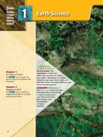
EARTH SCIENCE geology, the environment, and the universe 2008 (32)
Bạn đang xem bản rút gọn của tài liệu. Xem và tải ngay bản đầy đủ của tài liệu tại đây (10.32 MB, 50 trang )
Swim the Okavango...
Explore the African
Landscape...
Dig for Dinosaurs...
W
hat is it like to scuba dive with
crocodiles in the Okavango
delta? Or fly in a bush plane
over the African continent? Or dig for dinosaurs in
China? The National Geographic Expeditions allow
you to share in the excitement and adventures of
explorers, scientists, and environmentalists as they
venture into the unknown. Each Expedition takes
you on a journey that enriches your learning about
our dynamic planet.
890
David Doubilet/National Geographic Image Collection
eXpeditions!
Table of Contents
892
Tracing the Human Footprint
898
State of Rock
904
Okavango
910
Super Storms
916
The Next Big One
922
Jewels in the Ash
928
Frogs
934
Night Vision
Use with Chapter 2
Use with Chapters 7 and 8
Use with Chapters 9 and 10
Use with Chapters 11 and 13
Use with Chapter 19
Use with Chapter 21
Use with Chapter 26
Use with Chapters 27 and 28
For more information on these Expeditions, visit glencoe.com. You
can also link to original National Geographic articles that cover
these topics and more.
891
George Steinmetz/National Geographic Image Collection
892
NG Maps/National Geographic Image Collection
Peter Ragg
eXpeditions!
Africa by Air
Tracing the Human
Footprint
From a low-flying plane is how
● ABOVE: Biologist J. Michael Fay
catches some sleep after eight hours
in the air. On board this and another
Cessna, Fay, pilots, photographers,
and others risk their lives to map
humanity’s impact on tropical forests, savannas, and deserts. Along
the way on this “Megaflyover” they
struggle against malaria, sandstorms, and brushfires and try to
keep the planes, computers, digital
cameras, and GPS systems running.
● LEFT: The map of Africa shows
the zig-zag route taken by Michael
Fay during a joint project—the
Human Footprint—of the Wildlife
Conservation Society (WCS) and the
National Geographic Society.
J. Michael Fay sees the land on a mild
December morning, as an heirloom
Cessna 182 carrying him and three
others approaches the Aïr Massif, a vast
range of highlands standing up from the Sahara. The Cessna is
painted scarlet and specially equipped for collecting data. The
plane looks like a toy, or an enameled piñata, but it bears serious
purposes, not candy. With a young Austrian pilot named Mario
Scherer at the controls, and Fay in the right seat amid a rat’s nest
of custom-rigged digital hardware and cables, it caresses the
topography, circling here, dipping a wing there, rising nervily
through high notches to put peaks close at eye level on each
side. Mounted in its right door is a high-resolution digital camera that automatically, every 20 seconds, takes a vertical shot of
the ground. The photos, each tagged with Global Positioning
Satellite (GPS) data registering exact time, latitude, longitude,
and altitude, are uploaded into a computer on Fay’s lap, through
which he can add notes. A similar computer, scrolling out a map
along the plane’s flight line, rests under his left elbow. Fay’s
attention flicks constantly, tirelessly, between the computer
screens and the terrain passing below.
893
● ABOVE: The Namib Desert is just one of the 104 terrestrial
ecoregions identified in Africa. Among Earth’s driest places—and
perhaps the oldest desert—it boasts orange sand dunes made
sharp and steep by the blowing wind.
● BELOW: The Ituri Forest in the Congo is a vastly different type of
ecoregion from the Namib Desert in terms of the amount of rainfall,
types of vegetation, and animal life.
The Realities of Land Use
Today is our tenth day of survey flying in Niger,
and the 187th day since Fay and his chief pilot,
Peter Ragg, departed from an airfield in South
Africa. Fay’s aerial enterprise is closely linked with
an ambitious initiative of the Wildlife Conservation
Society — the Human Footprint project. That project involves a program of multidimensional mapping to show gradients of wildness and human
impacts around the world.
Fay himself, a restless individualist with a surprisingly good nose for politics, wants nothing less
than to change the way the world perceives and
uses ecosystems and natural resources — starting
with perceptions in Washington, D.C. The ultimate
goal of his Africa Megaflyover, he says, is to convince “the powers that be, in particular the U.S.
Congress,” that integrating natural resource management into American foreign policy is “a very,
very smart thing to do. And a good investment.”
Wherever humans live at high population densities, making unsustainable demands on natural systems, he notes, you eventually see ecological
breakdown. Unmet needs and tensions lead toward
conflict. A pilot himself, he recognized the value of
low-altitude flying to illuminate the realities of land
use.
894
(t)George Steinmetz/National Geographic Image Collection,(b)George Steinmetz/National Geographic Image Collection
George Steinmetz/National Geographic Image Collection
eXpeditions!
A bush plane shows you patterns
you’ll never perceive from the ground. It
allows flexibly targeted coverage (“Let’s
circle that spot again”) and the capture of
fine details you can’t get from a satellite.
Africa, the continent he knows and loves
best after 25 years of working there, was
the logical place.
What Is Africa?
Of course Africa isn’t really a place;
it’s a million places. Nowadays it encompasses 47 countries (not counting
Madagascar and other islands) with a
total population of 900 million humans.
It can also be parsed into 104 terrestrial
ecoregions, each unique in its physical
and climatic features. Each one harbors
a distinct plant and animal community.
Ecoregions in many cases transcend
national boundaries. Within or near all
● ABOVE: Lake Natron straddles Tanzania and Kenya. Along Kenya’s section
of the lake, microorganisms living in the water’s salty crust create a palate of
these ecoregions live people whose most
pink. Pigments in the organisms cause the feathers of the flamingos that
elemental struggles and aspirations trandepend on the lake for food to turn pink.
scend ecological boundaries as well as
national ones. Africans want better and
None of these concerns is unique to Africa.
fuller employment. They want food
But Africa particularly deserves special attention.
security and education for their children. They
Africa’s glories and successes deserve special attenwant good governance, free of oppression and cortion, too. African peoples produce magnificent art,
ruption. They want fair, sensible arrangements for
graceful cultures, terrific music, great works of the
the management of wild landscapes and natural
resources — arrangements chosen and controlled by mind, and astonishing acts of political and moral
courage.
Africans. They want peace.
Along with the human struggles come human
impacts. Although some areas of Africa are less
Documenting Ecological Dimensions
heavily inhabited than they might be, others are
Fay’s intent is to document the ecological dimenoverburdened, eroded and blighted by the presence
sions of that variousness. His conceptual starting
and demands of too many people. Because the
point was the World Wildlife Fund map of 104
African landmass is so large, climate change may
African ecoregions and the Human Footprint projaffect its interior regions by bringing considerably
ect, conceived by Eric W. Sanderson and a team of
higher temperatures and worse droughts and
floods. This contributes to increased desertification colleagues at the WCS and Columbia University.
and new patterns of disease. Poaching wildlife, both Sanderson’s group used nine different geographic
for subsistence and commercially, is an old problem data sets (measuring factors such as road density,
railways, population density, nighttime lighting) to
but still serious. Timber harvesting, even when
represent the weight of human influence all over
done selectively, often brings workers who empty
the planet, including Africa.
a forest of its fauna for bush meat.
895
● ABOVE: A herd of buffalo is seen wallowing in the muddy swamps
of the Zambezi Delta in Mozambique. Protection efforts there seem
to have buffalo populations increasing.
Beginning the Megaflyover
● ABOVE: View of an area near the Mahajamba River on
Madagascar reveals a rocky terrain. Madagascar is considered a hot
spot for conservation because its unique flora and fauna are found
nowhere else and there are tremendous population and resource
pressures on the land.
896
The first takeoff was on June 8, 2004, from
Swartkop Air Force Base near Pretoria. Soon
after,— OK, it was five minutes — Fay’s network of
digital gizmos suffered an outage. The camera quit,
the computers went to battery power, and he
sniffed a hint of electrical fire. Oh well, he thought,
better a data-system meltdown than full-on engine
failure within sight of the runway. He re-rigged.
Hopping his way across southern Africa and
then northward on a chain of one-day flights, Fay
arranged collaborations wherever possible. He
assisted local conservationists, field scientists, or
national agencies with their aerial-survey needs as
well as adding data to his own comprehensive
trove. Wherever he went, Fay tried to complement
the aerial data-gathering with contacts, conversations, and observations on the ground.
Many computer crashes, camera shutdowns, and
other minor problems have followed that first glitch
above Swartkop. Most were easily repaired. There
have also been a few dire aviation scares, caused by
high winds, drastic loss of oil pressure, and other
forms of mischance.
(t)George Steinmetz/National Geographic Image Collection, (b)George Steinmetz/National Geographic Image Collection
Fay wanted to cover as many of the 104 regions
as time, budget, and politics would allow. Then he
would present an enormous body of data — between
what is possible to what is actually happening — to
decision-makers and say: Here’s some information
that might be relevant to your resources-andsecurity planning.
Fay recruited Ragg, an experienced bush pilot
(and, in an earlier life, a successful optometrist in
Austria), who offered his flying skills and the use of
his two vintage airplanes, one for primary data
gathering, one for support. Ragg in turn enlisted
his fellow Austrian, Mario Scherer, who had found
African bush flying a lively change from his recent
work as a war-crimes investigator in Kosovo. Fay
drummed up support from various sources—the
Human Footprint lab at WCS, the WILD
Foundation, the Bateleurs (an Africa-based organization of bush pilots volunteering for conservation), and, as chief financial sponsor, the National
Geographic Society.
(t)George Steinmetz/National Geographic Image Collection, (c)George Steinmetz/National Geographic Image Collection
eXpeditions!
By the time I [David Quammen] met
them in Niger, Fay and his pilots had
flown 600 hours, crisscrossing 16 countries, usually at about 150 meters (500
feet) above the ground. One of the
Cessnas had gotten a new engine. Both
planes needed maintenance.
Theme of Absence
From the air over Niger we enjoyed
some notable sights. A pair of addaxes
skittered like sand crabs along a
linear dune. Seven Barbary
sheep galloped up sausage-like
towers of dark sandstone along
the Djado Plateau. Camels
stood stuporous and serene in
the middle of nowhere. Near
one village we gawked down at
a cluster of saltmaking pits.
Each pit, a nice disk, variously
sized, shone azure or turquoise
or coppery green from the
mineral solutions of their individual sumps — all together a
necklace of bright-colored
jewels.
Mostly what we observed
and recorded, though, were
variations on a theme of absence. Some days we
flew a 650-kilometer (400-mile) loop without
glimpsing a single animal, and dozens of miles
without spotting so much as a plant. Even absence
is a form of data. Niger is a country desolated by
recent human-caused losses. The addax is nearly
extinct here, for instance, and the Barbary sheep,
and the desert cheetah. Their disappearance from
remote habitat areas may correlate with the presence of four-by-four tracks, indicating unimpeded
access by poachers. Such tracks show clearly from
150 meters (500 feet) up.
Another sight came into view: a large green oval.
It was a pond, evidently spring-fed from beneath
the sands. Water? Fay peered down for a moment,
having noticed something, tapped a note into his
computer: “no animal tracks.” It hadn’t struck me,
● ABOVE: An old abandoned town north of
Dirkou, Niger, is built of blocks of salt. The houses
without roofs reveal room after room, some only a
few feet square. Newer towns are built of mud
brick and have satellite dishes and telephones.
● LEFT: Casablanca, Morocco, is an enormous
place, with miles and miles of buildings. Water
availability is evident from the green vegetation.
but of course: A water hole out here should attract
gazelles and other mammals from many miles
around — attract them, that is, if any exist. He
tapped again: “4x4.” Meaning, tire marks. An
absence of animal sign, a presence of human sign.
Cause and effect? Anyway, data. The challenge for
Fay is that he must deliver meaning from the
mountainous pile of facts and photographs he has
collected.
eXpeditions activity
Consider the kind of variation there must
be to have 104 distinct ecoregions in
Africa. Verbally illustrate an ecoregion by
listing and describing some of its factors.
897
898
Frans Lanting/National Geographic Image Collection
eXpeditions!
Where the Elements Reign`
State of
Rock
● RIGHT: Blasted by wind, broken by water, the Colorado
Plateau spreads across 336,700
square kilometers (130,000
square miles) of Arizona, New
Mexico, Utah, and Colorado. This
arid expanse, best seen by air,
has been called useless by some,
a landscape that conspires
against human settlement. For
others it’s nature’s grandest
work in progress.
● LEFT: Hoodoos are columns of
rock in fantastic shapes that are
found in western North America.
These appear in Utah’s Bryce
Canyon National Park.
Bizarre. Is that the right word for the Colorado Plateau,
this thirsty sprawl of gaudy-hued stone festooned with such names
as Hell Roaring Canyon, Scorpion Gulch, and Horsethief Point?
Edward Abbey began his classic Desert Solitaire with the simple
“This is the most beautiful place on earth.” Fiery rock can do that
to a person. Others trying to understand the attraction of the plateau country apply adjectives like “amazing” and “awesome.” In
truth, a single adjective may not suffice. All the same, as I [Mike
Edwards] fly over the plateau on a May morning, looking down on
whalebacks of slickrock, on crashing waves of rock, on minarets
and pyramids of rock hewn by water and wind—how could any
word fit better than “bizarre”?
899
NG Maps/National Geographic Image Collection
● TOP LEFT: Dawn casts a Martian glow over the Buttes of the
Cross in Glen Canyon National Recreation Area. Miners once scoured
this backcountry for uranium. Today the mines are silent.
● TOP RIGHT: A water-carved fist jabs across a canyon in Utah’s
Capitol Reef National Park.
● ABOVE: Factory Butte looms over unproductive curves and folds
of shale, salty sediments deposited by an ancient sea.
900
Desert this is, but water’s tattoo is everywhere.
Spidery little arroyos coalesce into bigger arroyos
that plunge into the still deeper groove of a river,
maybe into the thousand-foot-deep canyon of the
Escalante, a scalpel-cut in red rock, so narrow that
the stream and its fringe of willows and tamarisks
are invisible unless you’re dead-on overhead.
Most of the collected runoff, if it hasn’t vaporized
or died in a mudflat, swells the Colorado River. By
the time the river courses into Arizona and roars
into the plateau country’s most dazzling feature, the
Grand Canyon, it is plowing a furrow more than a
mile deep. Pretty impressive digging, this, considering that the precipitation in parts of the plateau
averages only six inches a year.
Water was also present at the creation, in far
greater abundance. Tens of millions of years ago,
seas, swamps, and rivers deposited dozens of layers
of rock: limestones, mudstones, shales, many reddened by traces of iron. In those eons the plateau
country was flat and much lower than its heights
today, which are typically 1,524 meters (5,000 feet)
above sea level. Winds also contributed raw material, the makings of sandstone layers hundreds of
feet thick. The whole shebang was thrust upward
by forces within the Earth.
(tl)Melissa Farlow/National Geographic Image Collection, (tr)Frans Lanting/National Geographic Image Collection, (bl)Adriel Heisey/National Geographic Image Collection
Water’s Tattoo
eXpeditions!
Colliding tectonic plates tilted
and bent layers like cardboard.
Everywhere then as now, water
attacked the soft stones, carving
canyons. That’s Plateau Geology
101, slightly abbreviated.
Powell’s HundredDay Journey
Winging 762 meters (2,500
feet) over this rockscape, I feel a
tenuous kinship with John
Wesley Powell. On his scary hundred-day journey down the
Green and Colorado Rivers in
1869, that indefatigable adventurer-scientist surmounted cliff
tops to reconnoiter the uncharted
territory he had penetrated. Of
course, I’m riding shotgun in a
Cessna while Powell had to pull
himself up one-armed from a riverine chasm to a lookout; he lost
his right arm at Shiloh in the
Civil War. But we gaped at the
same sights. “The landscape
everywhere . . . ,” he wrote, “is of
rock—cliffs of rock, tables of
rock, plateaus of rock, crags of
rock—ten thousand strangely
carved forms.”
Clearly Powell was awed by the
fantastical convolutions of this
land. He became the chief expositor of the “plateau province,” as
he called it, documenting not
only the geology but also the
ways and lineages of its Indians,
meanwhile campaigning for sensible husbanding of the water.
● ABOVE: A bathtub ring of bleached rock—a sign of severe drought—lines Lake
Powell, the country’s second largest human-made lake and canteen for much of the
Southwest. Long years of drought and demand from distant cities have depleted the
lake’s reserves. The years 2000–2005 are the driest five years in a century.
● RIGHT MIDDLE: Swelling beneath Arizona’s
Coyote Buttes, sandstone waves evoke white
water.
● RIGHT BOTTOM: This view of Earth’s outer
layers shows fractures in sandstone that form
car-size blisters.
901
(t)Adriel Heisey/National Geographic Image Collection, (c)Frans Lanting/National Geographic Image Collection, (b)Frans Lanting/National Geographic Image Collection
Protecting
The Landscape
● ABOVE: Photographer Adriel Heisey found a paradise of form as he soared over bands of
shale and sandstone. “Everywhere I turned,” he says, “there were geometric patterns that
defied my ability to comprehend.”
● BELOW: Sunlight pours over Jacobs Chair, a Utah butte named for a cattleman who
drowned fording a storm-swollen creek nearby. In the late 1800s Mormon pioneers left
a trail of names as they hacked a wagon route across southern Utah during the grueling
Hole-in-the-Rock expedition.
Powell hadn’t glimpsed some
of the craziest rock shapes—the
pinnacle-like hoodoos of Bryce
Canyon or the vaulting spans of
Arches, canonized by Edward
Abbey. Bryce and Arches are two
of the roughly 30 parks and other
national preserves that make the
heart of the province one of the
nation’s most protected regions.
It isn’t perfect protection; environmentalists decry its insufficiencies
while locals, ingrained with the
Westerner’s mistrust of bureaucracy, grumble about overkill. In
the largest unit, the 1.9-millionacre national monument Grand
Staircase–Escalante, created only in
1996, off-road vehicles plow tracks
that won’t disappear for decades.
On the other hand many mining
claims have been relinquished or
bought out by those devious Feds,
and no new claims are permitted.
And while allowing multiple uses,
including ranching (yes, there’s a
little grass here and there), the
Bureau of Land Management is
charged with superintending the
monument to protect its attributes.
Protecting
Earth’s History
Gaudy vistas are only one of
those attributes. The plateau is a
time machine nonpareil, holding
who knows what secrets. When the
rocks at the bottom of the Grand
Canyon are counted in, the swath
of Earth’s history exposed by
water’s relentless gouging of the
plateau is reckoned by geologists to
reach back 1.7 billion years, more
than a third of Earth’s existence.
902
(t)Adriel Heisey/National Geographic Image Collection, (b)Adriel Heisey/National Geographic Image Collection
Frans Lanting/National Geographic Image Collection
eXpeditions!
● ABOVE: Standing tall against the cold, Castle Rock (on the right), and other buttes bear a dusting of snow
in Monument Valley. With each season the elements shape the plateau anew, shattering canyon walls and cliff
faces, chiseling subtle changes into the enduring symbols of the West.
One afternoon, puffing along behind Alan Titus,
a BLM paleontologist, I dropped back a mere 75
million years or so. Titus assured me we were
tramping through a swamp where ferns and magnolias had flourished, although it looked awfully
like a forest of stunted piñons and junipers. “The
whistles and shrieks you hear are not birds,” Titus
said, coaxing my imagination into play. “They’re
dinosaurs.” Soon he had me seeing huge crocodiles
and snakes sloshing lazily in warm pools. And then,
guiding me to a row of dark, roundish objects halfburied in the soil, Titus said: “You’re looking at the
remains of an animal that’s been extinct for 65 million years or more”—the fossilized vertebrae of a
duck-billed dinosaur that lived in the Cretaceous
period. Titus says this specimen was 25 feet long.
“I’m waiting for that big tyrannosaur,” he said. “I
want to find one before I retire.”
On another afternoon I climbed to a high cliff ’s
edge. The setting sun infused the rocky layers vaulting away to the horizon with a crimson incandescence—the kind of glow, surely, that compelled
Edward Abbey to pronounce these rocks beautiful.
A hot, dry wind came up, gusting stronger and
stronger, and as it assaulted the cliff faces it whined
and screamed. Sounded just like dinosaur shrieks.
eXpeditions activity
Research the status of and plans for conservation
on the Colorado Plateau. Discuss whether changes
in weather have affected the status and plans and
how the plans may affect people who depend on the
Colorado River for their main source of water.
903
904
David Doubilet/National Geographic Image Collection
August 1994 Landsat image by Thomas Gumbricht; NOAA AVHRR image pair by Philip Frost, Thomas Gumbricht, Jenny M. McCarthy and Frank Seidel/NG Maps/National Geographic Image Collection
eXpeditions!
Africa’s Miracle Delta
Okavango
● RIGHT: The miracle happens in
slow motion, for this part of southern Africa is so flat (a gradient of
about a hundredth degree) that the
floodwaters take three months to
reach the delta and four more to traverse its 240-kilometer (150-mile)
length. Yet by the time its force is
spent, the flood has increased the
Okavango’s wetland area by two or
three times, creating an oasis up to
half the size of Lake Erie. It is one of
the largest inland deltas on Earth.
From space the delta looks like the
footprint of a bird. Water flows into
the system through the leg, called
the Panhandle, a strip of land 96
kilometers (60 miles) long and 14
kilometers (9 miles) wide along
which the Okavango River meanders
in lazy loops. Forward-pointing toes
channel water through the delta.
● LEFT: Suspended in an ethereal
realm of water lilies, and light, a
river Bushman, pole in hand, peers
into the emerald forest of
Botswana’s Okavango River. As if by
magic it ebbs and flows with seasonal floods before vanishing in the
Kalahari Desert. The result: an oasis
for wild things above and below the
surface.
The Miracle Is This: Under cloudless skies at the driest
time of Botswana’s year, when rain is both a fading memory
and a distant promise, a flood comes to the Okavango Delta.
Generated by rainfall 804 kilometers (500 miles) and two
countries away in the highlands of Angola, the flood wave
snakes down the Okavango River and spreads across the delta,
swelling its lagoons and channels and spilling outward to
inundate its floodplains. In a land withered by drought, this
gift of water is like unction, and all nature responds to it.
“My surface gives you life. Below is death.”
The delta’s deepest, most diverse underwater habitats lie in the
Panhandle. The flood peaks here in April, raising the level of the
Okavango River by six feet. In May the level has started to drop. Sediment
borne on the flood wave has settled, and the water in Ncamasere channel,
an offshoot of the main river midway down the Panhandle, becomes
clean and clear. And deadly. The waters of the delta are full of crocodiles.
The Bayei people, one of several Okavango tribes, say as much in a poem
they teach their children: “I am the river. My surface gives you life. Below
is death.” For photographer David Doubilet and me [Kennedy Warne],
going below the surface was an essential part of our work.
905
We wanted to see the delta as few had dared to
see it before—a croc’s-eye view. People in passing
boats, noticing our wet suits and scuba gear, didn’t
hesitate to give their opinion on croc-watching:
you’re out of your minds. Perhaps we were, but it
was winter, and we reasoned that because crocodiles are reptiles, their metabolism would be
sluggish.
The larger crocodiles spent much of the day
basking on the riverbanks in well-used haul-outs,
usually with chutes down which they slid into the
water if disturbed. In the cool of the night the
warmth-loving crocs came to life for the hunt,
floating at the water’s edge. Their eyes gleamed
blood-red in our spotlight as we motored up the
channel. Although Nile crocodiles are one of only a
handful of predators that actively hunt humans, I
figured that if I initiated an encounter, thus denying
the animal its advantage of surprise, I would retain
the upper hand.
Crocodiles are the delta’s most feared aquatic
predator, but locals say that hippopotamuses cause
more deaths and injuries. Accidental meetings in
narrow channels are often the trigger for an attack.
Hippos can bite a canoe in half with one snap of
their jaws, and their teeth can puncture an aluminum boat as if it were a can.
● BELOW: In the crocodile’s lair, photographer Jennifer Hayes explores
caverns formed by floating mats of papyrus in the deep waters of the
Ncamasere channel in the Panhandle. Croc tracks were everywhere.
906
David Doubilet/National Geographic Image Collection
The two-ton vegetarians aren’t slowpokes, either.
Guy Lobjoit, an Okavango fishing guide, told me he
once had a hippo keep up with him while he was
doing nearly 20 miles an hour in his runabout.
Okavango’s Bounty
People have been living with the dangers and the
bounty of the delta for at least 100,000 years. The
seasonal floodplain, the webbing between the delta’s
toes, is a rich part of the Okavango larder. Here the
floodwater forms a lake six inches to a foot deep,
dotted with countless islands. The water brings a
flush of plant growth, which in turn attracts wildlife
into these fertile, sun-warmed shallows. The local
people make good use of the molapo, as the floodplain is called. During the flood they fish, and in
the dry season they graze cattle. All year round they
harvest fruits, cut thatching grass and reeds, and
hunt game on these productive lands.
At Guma, near the top of the delta, a Bayei man
known simply as Madala, Old One, and a young
fishing guide called Fish took me into the molapo
during the flood season to show me something of
their way of life. We journeyed by mokoro, or dugout canoe, the mode of transport in the delta. The
mokoro that Fish poled was made from kiaat, a
teak-like timber, with metal patches covering cracks
he called its wounds. Madala’s canoe was fiberglass.
He explained that the new synthetic canoes are
more stable than the traditional wooden ones.
More sustainable too, as trees suitable for mokoromaking are a limited resource in the delta.
Poling is a hypnotically beautiful way to travel.
Each thrust of the wooden pole moved the mokoro
through beds of reed and sedge that rustled against
the hull. The foghorn snort of a hippo warned us to
avoid its channel.
As we poked along, Fish would point to various
plants and describe their properties. The root of the
star apple makes an excellent toothbrush; the bark
of the rain tree can be ground up and thrown into
the water to paralyze fish; chewed sickle bush leaves
are good for treating snakebite. Madala cut a tall
papyrus stem and pounded the fleshy white base
against his palm to soften it before handing it to me
to eat. It was sweet, fibrous, and refreshing, reminiscent of fresh coconut.
Jennifer S. Hayes/National Geographic Image Collection
eXpeditions!
We made camp under the boughs
of a sycamore fig. While Madala set
his net in a lagoon thick with water
lilies, Fish waded into the floodplain
to spear small fish with a porcupine
quill. I climbed a baobab tree to collect its maraca-shaped fruits containing a white pulp that substitutes well
for cream of tartar. Madala mixed it
with water to make a tangy sauce.
That night we rolled balls of cornmeal
porridge with our fingers and dipped
them in a casserole of freshly caught
bream, water lily fruit, and heart of
palm. Other than the presence of a
few tourists—and a carton of long-life
milk for our tea—I suspected that little in this scene had changed since the
first European explorers visited the
Okavango over 150 years ago.
● ABOVE: Following the water, hundreds of African buffalo graze in
the lower delta during the flood. Herds here reach into the thousands,
their numbers regulated more by grass than predators.
Water . . . Life is coming
One thing that has changed—and continues to
change—is the path the water takes through the
delta. In 1849, much of the flow was down the
western channel system and into Lake Ngami. In
the 1880s the water flow, responding to a range of
subtle landscape cues, began to favor the eastern
channels. The sluggish western channel became
choked with vegetation, and Lake Ngami dried up.
The Batawana people, Botswana’s dominant tribe,
followed the water, shifting their main settlement to
a lush site on the delta’s southern edge. They called
the place Maun, “place of reeds.”
Today Maun is a town of 45,000, with barely a
reed to be found. Water flow seems to be moving
westward once more, and floods, which follow a
natural cycle of higher and lower volumes, have
diminished in size. The result is this commercial
gateway to the delta has a water shortage. It has
become a place of dust. Not surprisingly, when the
annual flood does reach Maun (though there is no
guarantee that it will), the whole town celebrates.
On a breathless July day—the sky the eggshell blue
of the Botswana flag, the air full of the smell of wild
sage—I watched as the flood crept down the broad,
dry bed of the river that runs through town.
Children dug furiously with sticks in the sand to
encourage the trickle to run faster. Some leaped back
and forth across the steadily widening stream, laughing for joy. Others just let it run over their bare feet,
looking at it as if it was the first time they had seen
water. “The water is coming,” I heard a father explain
to his daughter. “The fish are coming. The water lilies are coming. Life is coming.”
On a bank of the river, behind a twig fence that
didn’t look as if it could keep out a goat, let alone a
cow or a hippo, a man who told me his name was
Flay Million Dube walked around his vegetable plot.
He told me, “I’m not working today because I’m so
happy.” He had just been down to the river to wash
his face and hands in the new water, he said.
Tomorrow he would put fresh, cool mud around his
beds of spinach, broccoli, and kings onion.
The dry season
By October the time of sadness has come. The
flood has vanished, ten billion tons of water sucked
up into the atmosphere whence it came. People cast
thirsty glances at the sky, where glowering thunderclouds build in the afternoons, but the summer rains
are still two months away. The floodplains dry out,
and water levels in the channels and lagoons drop to
their lowest levels. As the delta shrinks, life retreats.
907
Maun broils in temperatures of 100 plus. Hot
winds sandblast the town, and the sky becomes
white with dust. The Thamalakane River, where I
had witnessed the arrival of the new water three
months earlier, was again bone-dry. Flay Million
Dube’s garden was bare soil, not a plant to be seen.
No children played in the riverbed. Only a few dust
devils whirled in the heat haze.
Not since the 1960s has the Thamalakane flowed
all year round, delivering water to the delta’s outlet,
the once mighty Boteti River. Fifty miles southeast
of Maun, at a camp called Meno A Kwena, all that
remains of the Boteti is groundwater, the legacy of
floods past. Larger animals can dig for it, but with
each successive year of low flood volumes the water
table drops a little farther out of reach.
David Dugmore, who runs the camp, has made
it a personal mission to provide water for at least
some of the thirsty animals—pumping groundwater
to fill a small water hole. But his is only one small
relief station in a vast arid landscape. Maintaining
the supply line is also a problem, he told me, pointing to lion tooth marks in the pipe that runs from
pump to pool. “The lions are so desperate for water
they bite into the pipe, working their way along
until they reach the water hole.”
An hour’s drive down sandy tracks brought us to
a group of hippopotamuses stranded in a pond.
908
There was no water for miles upriver or down, so
the hippos were marooned. There was little grazing
to be had, and it was with relief that we saw a wildlife ranger drive up and unload half a dozen hay
bales, which he cut open and spread beside the
pool. The hippos trotted out of the water and began
to munch. Were it not for their daily handout, they
would starve.
Is climate change casting its long shadow over
the miracle delta? Apparently not, according to
researchers, who have detected an 18-year oscillation in rainfall in the region and an 80-year cycle
of high and low flood volumes. We’re reaching the
end of the 40-year low part of the cycle, they say,
and should see larger floods in the future, peaking
in mid-century. Rainfall should also increase over
the next few years.
River and rain contribute in roughly equal
measure to the delta’s water budget. The summer
rains have the function of recharging the groundwater aquifer. If the rains are good, little floodwater is needed to bring the water table to the
surface, and the bulk of the inflowing water then
spills into the seasonal floodplains, creating a
large flooded area. If the rains are poor, much of
the floodwater soaks into the ground, filling the
gap left by lack of rain, and the area of inundation is reduced.
David Doubilet/National Geographic Image Collection
● LEFT: One of the
many elephants that
came from the south,
lumbering toward the
widening ribbon of
water, trunk cocked in
an S, snuffing the sweet
elixir. Standing at the
water’s edge, the thirsty
animal sucked up trunkfuls and gushed it into
its mouth, spilling barely
a drop.
eXpeditions!
Biological influences are part of a system as intricate
and responsive as any on Earth. Yet the delta is
Terence McCarthy, a professor in the School of
not immune to human disturbance. The chief threats
Geosciences at the University of the Witwatersrand,
lie upstream, in the two countries with which
in Johannesburg, speaks of the delta as a living
Botswana shares the inflowing water. Angola and
organism with a circulatory system. McCarthy and
Namibia both experienced long, brutal wars in the
his colleagues, who have been studying the delta
latter part of the 20th century and now look to rivers
since 1985, have discovered that one of the largest
to help build their economies. Two aspects of develcontributions to the life of the delta is made by one
opment, the increased use of agricultural fertilizers
of its smallest inhabitants: termites. Their colonies
and the production of hydroelectricity, could have
are giant construction companies that have transdisastrous downstream effects on the delta.
formed the Okavango Delta from a piece of flat real
Papyrus can thrive in nutrient-poor conditions.
estate into a mosaic of an estimated 150,000 islands.
It stems from the termites’ need for air-conditioning. Enrichment of the delta through fertilizer runoff
from irrigated farmland upstream
Some species build above-ground air
“IT
WAS
STRANGE
TO
THINK
could cause rampant growth of
vents to control the temperature in
THAT
THE
WATER
FLOWING
papyrus and lead to wholesale chantheir networks of galleries and tunBENEATH ME WAS BRINGING nel blockage. “If the Panhandle
nels. These turrets, sometimes ten
becomes blocked,” said Map Ives, of
feet high, and their surrounding
LIFE TO A DISTANT DELTA.”
a large tourism company, “it’s good
earthworks are above flood level,
night
Okavango
Delta.” Damming the rivers that
providing dry, fertile sites on which trees can become
supply the delta would be equally catastrophic.
established.
Scientists such as Terence McCarthy point out that
Trees can be thought of as kidneys of the delta,
dams deprive rivers of sediment that is vital to the
cleansing the system by removing its salts. They do
functioning of the delta. More than 200,000 tons of it
this by sucking water out of the ground and pumpis deposited in the delta’s upper reaches each year,
ing it into the atmosphere by transpiration. In the
raising the channel beds and starting the process of
process, soluble salts are deposited around the tree
roots—a “toxic waste storage system,” McCarthy calls channel switching by which the Okavango renews
itself. Without an annual injection of sand, channels
it. Without the delta’s millions of tree pumps, the
would be scoured out instead of built up, becoming
400,000 tons of salts carried in yearly by the
ever deeper and swifter. Channel switching would
Okavango River would be poisoning the delta. By
cease; whole sections of the delta would be lost.
concentrating salts in the soil and groundwater
I was near the grazing country of the Bié Plateau.
beneath them, trees not only keep the water in the
It was November, and the summer rains were startdelta fresh but also expand the size of their island
ing. It was strange to think that the water flowing
platforms.
beneath me was bringing life to a distant delta. But it
Most channels in the delta have a life expectancy
was: In a few weeks the flood would start to rise in
of about a hundred years. During that time sandy
the Panhandle. Relief would come to the Okavango’s
sediment gradually raises the height of the channel
parched plains. The miracle would begin again.
bed, slowing the current and allowing the fringing
stands of papyrus to spread into the channel. Clumps
of papyrus eventually break off and jam the channel
until it becomes completely blocked. At this point
eXpeditions activity
the hippos come to the aid of the delta’s circulatory
Research the use of fertilizers and the dams built north of
system, breaking through papyrus jams and forming
the Panhandle since 2004. How have they affected the
new channel connections. It is only because the delta
Okavango delta? What other measures might be taken to
is so flat that water follows such randomly created
provide water to the area in a way that will not harm the
corridors—the paths the hippos have trod.
ecosystem?
Influences on the Okavango
909
910
NASA
(l to r)Tim Loomis/NOAA Environmental Visualization Program/NG Maps/National Geographic Image Collection, (2)Tim Loomis/NOAA Environmental Visualization Program/NG Maps/National GeographicImage Collection, (3)Tim Loomis/NOAA Environmental Visualization Program, (4)Tim Loomis/NOAA Environmental Visualization Program
eXpeditions!
No End in Sight
Super Storms
● ABOVE: Year 2005: Never
before had a hurricane caused
as much economic damage as
Katrina. Never before had the
Atlantic seen 27 named tropical
storms — so many that the list
of storm names had to be
extended with Greek letters.
Seven made landfall in the
United States. Never had 15
hurricanes been spotted in one
season, including four Category
5 storms. Each image shows an
area 1,191 km (740 miles) wide.
● LEFT: As Hurricane Wilma
spun toward the Yucatán
Peninsula on October 19, 2005
(the day this image was shot
from the International Space
Station), a hurricane hunter
plane recorded an atmospheric
pressure of 882 millibars in the
eye of the storm. The record
low drove winds of 185 mph.
When the fiercest hurricane ever recorded in the
Atlantic is bearing down on you, a salvaged armchair under a
wood-and-tin awning might seem a poor choice of shelter. But
that’s where Don E. (“I’d rather keep my last name out of it”) was
parked when Wilma hit South Florida at 6:30 a.m. October 24,
2005. For Don and a buddy, it was the start of the workday at
Jimbo’s Place, a bait shop down by the water on Miami’s Virginia
Key. “Once we got out here, it was kind of too late to do anything
but ride it out,” Don says.
Jimbo’s looks like nothing so much as an abandoned shack. But
whether through good luck or unexpectedly sound construction,
it survived Wilma’s fury. Mercifully, the winds had ebbed from 185
miles per hour at sea to 120 miles per hour by the time the storm
hit, but Wilma still left almost all of South Florida without power.
Season of Record Breakers
Wilma was a record breaker in a season of unsettling records. Katrina, at
the end of August, killed more than a thousand people and left much of New
Orleans and the neighboring coast in ruins. The damage exceeded a hundred
billion dollars — the costliest natural disaster in U.S. history — and the toll in
fractured lives is incalculable. Rita, in September, rivaled Wilma in intensity
and ravaged the Gulf Coast through western Louisiana and East Texas.
911
Days after Wilma, one visitor to Jimbo’s was
hurricane. But those ingredients often produce
already worrying about what future hurricane
nothing more than a tropical disturbance — an
seasons might bring. Sharan Majumdar, 34, is a
unremarkable cluster of thunderstorms.
hurricane researcher at the University of Miami’s
“Disturbances look very similar day to day,” says
Rosenstiel School of Marine and Atmospheric
David Nolan of the Rosenstiel School, “and then all
Science, just across the highway from Jimbo’s. He is of a sudden you get a big burst of convection, then
one of a cadre of scientists trying to understand
within six hours it becomes a depression, then it
nature’s most powerful storms and more reliably
becomes a hurricane, then it’s flooding my apartpredict their surges, ebbs, and lurching paths from
ment.” Katrina soaked Nolan’s 14th-floor Miami
Beach home as the storm crossed Florida on its
birth to landfall.
fateful course to New Orleans and the Gulf Coast.
Majumdar says he can’t really blame his fellow
“It would be really nice to say what you need to
patrons at Jimbo’s for deciding to stay put during
Wilma. Forecasts can get hurricane tracks wrong by make a hurricane,” he adds. “And we really can’t do
hundreds of miles and wind speeds by tens of miles that yet.”
One thing was clear in 2005: Conditions were
per hour. As a result, Majumdar says, “people often
ideal for making hurricanes. Yet 2005 was just a
return after an evacuation to find nothing really
continuation of the upward trend that began in
happened.” The solution, he says, is to improve
1995. Because of a tropical cliforecasting through better science.
“IT WOULD BE REALLY NICE TO mate shift that brought warmer
“That’s the only way to get people to
SAY WHAT YOU NEED TO MAKE waters and reduced wind shear,
trust the warnings.”
the Atlantic has spawned unusual
A HURRICANE…AND WE
numbers of hurricanes for nine of
REALLY CAN’T DO THAT YET.”
Why Hurricanes Form
the past eleven seasons. “We’re
Like all weather, hurricanes are
11 years into the cycle of high activity and landfall,”
fueled by heat — the heat of sun-drenched tropical
National Oceanic & Atmospheric Administration
seas, which powers the storms by sending warm,
(NOAA) meteorologist Gerry Bell says, “but I can’t
moist air rushing toward the frigid upper atmotell you if it will last another ten years, or thirty.”
sphere like smoke up a chimney.
As surrounding air is sucked in at the base of the
storm, Earth’s rotation gives it a twist, creating a
whorl of rain bands. These whiptails of thunderstorm activity are strongest where they converge in
a ring of rising, spinning air, the eyewall, which
encloses the cloud-free eye.
Hurricanes (called typhoons in the western
Pacific and tropical cyclones in the Indian Ocean)
can propel themselves to an altitude of 15,240
meters (50,000 feet) or more, where the rising air
finally vents itself in spiraling exhaust jets of cirrus
clouds. The largest ever, the 1979 Pacific typhoon
Tip, sent gale-force winds across more than 1,046
kilometers (650 miles). Even an average hurricane
packs some 1.5 trillion watts of power in its winds ,
or half the world’s electrical generating capacity.
Starting this great weather engine requires surface waters of 80 degrees or more, moist air, and little wind shear — a difference in wind speed at the
surface and aloft that can tear apart a developing
912
Hurricane Tracking Technology
Weather satellites make it easy for meteorologists
to keep tabs on hurricanes. But ordinary satellite
images show only the cloud tops. Space-borne
infrared sensors can reveal more detail, charting the
size and shape of the warm eye, and satellite radar
and microwave sensors can map the rain. Hurricane
hunter aircraft actually fly right into Atlantic hurricanes. But they only probe conditions at altitudes of
several thousand feet, above the worst turbulence,
Jack Beven of the National Hurricane Center
(NHC) in Miami says — “not at the surface, where
they really matter to people.”
In 2005, scientists flew a robotic aircraft straight
into the maelstrom when tropical storm Ophelia
was off the mid-Atlantic coast. The craft, called
Aerosonde, swooped and circled for ten hours,
monitoring winds and the flow of heat and moisture from the ocean into the storm.
eXpeditions!
● ABOVE: Meteorologists work at improving computer
models to better forecast hurricane conditions. In 2007,
a high-resolution NOAA hurricane Weather Research
and Forecasting (HWRF) model became operational.
● ABOVE LEFT: Compare the model used in 2005 on the
morning of August 28 when Hurricane Katrina intensified to Category 5 with an experimental model with an
even higher resolution than the 2007 HWRF model.
That was a test, but forecasters routinely probe
the heart of storms with shorter lived devices called
dropsondes. Released from high-flying aircraft into
hurricanes and the surrounding winds, these
instrument-packed tubes descend by parachute.
“They take about 15 minutes from 12,192 meters
(40,000 feet) to splash,” Majumdar says. Along the
way, they measure temperature, pressure, humidity,
and wind every half second, transmitting it all to
the airplane before they hit the water.
By cranking dropsonde data into computer models that can simulate a storm and how it is likely to
evolve, researchers have sharpened their forecasts of
storm tracks. Three-day forecasts of Atlantic storm
positions were off by an average of 708 kilometers
(440 miles) in the 1970s; by 2005 the average error
was 278 kilometers (173 miles). But one-day forecasts were still wide of the mark by an average of
113 kilometers (70 miles) — more than enough to
keep coastal dwellers second-guessing the experts.
Shifts in Storm Intensity
Storm intensity is proving even harder to forecast. Three-day wind-speed forecasts, off by an
average of 37 kilometers per hour (23 miles per
hour) in the early 1990s, had improved only marginally by 2005.
Hurricanes regularly surprise observers with
their mood shifts. In a matter of hours, a Category
5 storm (winds over 249 km/hr) can fade to a
Category 3 (179–209 km/hr), or a mere tropical
storm can explode into a killer. “Intensity changes
are the things that really hurt people,” says NOAA’s
Bell.
The state of the ocean below a storm explains
some intensity shifts. In 1995, tropical storm Opal
was inching toward Category 1 status — an entrylevel hurricane — as it made its way through the
western Gulf of Mexico. Then, in just 14 hours, it
surged to Category 4. Satellite readings of the warm
sea surface showed nothing unusual.
913
(l)NGM ART/national Geographic Image Collection, (r)NGM ART/National Geographic Image Collection
But Nick Shay of the Rosenstiel School and his
colleagues discovered that the warm layer wasn’t
limited to the top few yards of the ocean, as it usually is in the Gulf. Cold water at greater depths acts
as a brake on hurricane intensity when the winds
churn it to the surface. But Opal had strayed across
a pool of warm water extending hundreds of feet
down. No matter how hard the wind blew, it stirred
up more hurricane fuel, causing the storm to
intensify.
The tropical ocean is littered with these deep warm
pockets, and their importance was underscored last
year by both Katrina and Rita, which shot up to
Category 5 when they passed over a deep band of
warm Gulf water called the Loop Current. Satellites
can detect subsurface warmth by looking for subtle
bulges in the sea surface, Shay says. “It’s not really
rocket science, but here’s something that works and
improves intensity forecasts by 5 to 15 percent.”
Waves, on the other hand, can blunt a storm.
Whipped up by a hurricane, they can reach heights
of more than a hundred feet, exerting a drag on the
winds that created them. “Heat adds fuel, but waves
slow the winds down — they’re fighting each other,”
says Shuyi Chen of the Rosenstiel School, who is
914
collaborating on a powerful new computer model,
called the Hurricane Weather and Research
Forecasting model, that will simulate the fine details
of the interplay between atmosphere, waves, and
ocean. “You can get a forecast one to two categories
wrong if you don’t get the waves right.”
Forecasters also need to understand a hurricane’s
internal workings. Katrina, for example, had grown
into a certifiable monster by the morning of
Sunday, August 28. Sucking energy from the Loop
Current, the storm had screamed from the low end
of Category 3 to a peak of 175 miles per hour, well
into Category 5, in just 12 hours. And then, swiftly
and remarkably, the storm took a breather. In satellite images late Sunday, hours before landfall, a
huge bite appeared in the southern side of the
eyewall.
Scientists probing the storm with aircraft and
radar in a project called RAINEX worked out what
had happened. Katrina’s ferocious rain bands had
converged toward the heart of the storm, cutting off
the eyewall’s moisture supply. The old eyewall broke
up and a new one formed farther out — an inertial
brake that slowed the storm just as a skater’s arms
slow her spin when she thrusts them outward.
Dr. Lynn ‘Nick’ Shay/Rosenstiel School of Marine & Atmospheric Science
● LEFT: Hurricanes Katrina and Rita strengthened dramatically when they crossed the Loop
Current in the Gulf of Mexico. Ocean probes
showed that the Loop Current’s warmth
extended to a depth of 91 meters (300 feet),
increasing the supply of heat to the storms.
The image shows the Loop Current three days
before Katrina’s landfall. The storm intensified
as it traveled over warmer waters (dark red).