Assessing the Impact of Using Different Land Cover Classification in Regional Modeling Studies for the Manaus Area, Brazil
Bạn đang xem bản rút gọn của tài liệu. Xem và tải ngay bản đầy đủ của tài liệu tại đây (909.94 KB, 7 trang )
See discussions, stats, and author profiles for this publication at: />
Assessing the Impact of Using Different Land Cover Classification in Regional
Modeling Studies for the Manaus Area, Brazil
Article · August 2015
DOI: 10.4236/gep.2015.36013
CITATIONS
READS
4
56
6 authors, including:
Sameh Abou Rafee
Ana Beatriz Kawashima
Federal Techonological University of Paraná, Brazil, Brazil, Londrina
Universidade Estadual de Londrina
16 PUBLICATIONS 39 CITATIONS
10 PUBLICATIONS 19 CITATIONS
SEE PROFILE
SEE PROFILE
Marcos Vinicius Bueno de Morais
Viviana Urbina Guerrero
Universidad Católica del Maule
Federal University of Technology - Paraná/Brazil (UTFPR)
35 PUBLICATIONS 47 CITATIONS
21 PUBLICATIONS 31 CITATIONS
SEE PROFILE
SEE PROFILE
Some of the authors of this publication are also working on these related projects:
Gases and particulate matter (< PM 2.5) in urban atmosphere. View project
Indicators of the effects on human health from climate change and air quality: An observational and integrating modeling analysis stratified by age View project
All content following this page was uploaded by Viviana Urbina Guerrero on 01 September 2015.
The user has requested enhancement of the downloaded file.
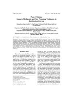
Journal of Geoscience and Environment Protection, 2015, 3, 77-82
Published Online August 2015 in SciRes. /> />
Assessing the Impact of Using Different Land
Cover Classification in Regional Modeling
Studies for the Manaus Area, Brazil
Sameh Adib Abou Rafee1*, Ana Beatriz Kawashima1, Marcos Vinícius Bueno de Morais1,
Viviana Urbina3, Leila Droprinchinski Martins2, Jorge Alberto Martins¹
1
Department of Physics, Federal University of Technology-Parana, Londrina, Brazil
Department of Chemistry, Federal University of Technology-Parana, Londrina, Brazil
3
Department of Atmospheric Sciences, University of São Paulo, São Paulo, Brazil
*
Email:
2
Received 11 June 2015; accepted 21 August 2015; published 25 August 2015
Abstract
Land cover classification is one of the main components of the modern weather research and forecasting models, which can influence the meteorological variable, and in turn the concentration
of air pollutants. In this study the impact of using two traditional land use classifications, the
United States Geological Survey (USGS) and the Moderate-resolution Imaging Spectroradiometer
(MODIS), were evaluated. The Weather Research and Forecasting model (WRF, version 3.2.1) was
run for the period 18 - 22 August, 2014 (dry season) at a grid spacing of 3 km centered on the city
of Manaus. The comparison between simulated and ground-based observed data revealed significant differences in the meteorological fields, for instance, the temperature. Compared to USGS,
MODIS classification showed better skill in representing observed temperature for urban areas of
Manaus, while the two files showed similar results for nearby areas. The analysis of the files suggests that the better quality of the simulations favorable to the MODIS file is straightly related to
its better representation of urban class of land use, which is observed to be not adequately represented by USGS.
Keywords
Land Use and Land Cover Classification, Regional Modeling Studies, Urban Air Quality
1. Introduction
Land cover classification is an important component of the weather research and forecasting models, especially
if the simulations are performed by using coupled chemistry. Spatial distribution of different database of land
cover will influence the meteorological variables, which in turn are associated with the transport and dispersion
of air pollutants. This influence was noted by [1], wherein observed that the temperature in urban areas was
*
Corresponding author.
How to cite this paper: Rafee, S.A.A, Kawashima, A.B., de Morais, M.V.B., Urbina, V., Martins, L.D. and Martins, J.A. (2015)
Assessing the Impact of Using Different Land Cover Classification in Regional Modeling Studies for the Manaus Area, Brazil.
Journal of Geoscience and Environment Protection, 3, 77-82. />
S. A. A. Rafee et al.
higher than in rural areas. The increase in temperature accelerates the rate of diffusion, which leads to the formation of upward vertical movement causing increased thermal turbulence, generating entrainment of the pollutants from lower levels to higher levels. Another important aspect is the representation of forest class, where the
presence of these in a region can change temperature and relative humidity. In addition, accurate representation
of forest can influence the concentration of volatile organic compounds in the atmosphere and consequently the
secondary chemical compounds [2] [3].
In this study, the impact of using suitable classes of land use and land cover to represent the temperature by
regional atmospheric modeling was addressed for Manaus region, Brazil.
2. Materials and Methods
2.1. Study Area
The domain of study includes the urban area of Manaus and its surroundings, with a total area of 232,560 km2
(Figure 1). The city of Manaus is located in the Northern Region of Brazil, in central Amazon, at coordinates
03˚06'07''S and 60˚01'30''W. Manaus has an urbanized area of approximately 230 km2, equivalent to about 0.1%
of the selected domain of study. Manaus has an estimated population of about 2 million inhabitants, representing 52% of the total population of the state of Amazonas [4].
2.2. WRF Model
The Weather Research and Forecasting model (WRF, version 3.2.1) is a non-hydrostatic mesoscale prediction
and atmospheric simulation system [5]. The WRF code is available at The
WRF model was run with a grid spacing of 3 km with 190 × 136 grid points in horizontal domain, centered on
the city of Manaus, at 3.07˚S and 59.99˚W. The simulation comprises the period 18 - 22 August, 2014, representing the dry season of the region. The physics configurations that were considered in the simulations are presented in Table 1.
Figure 1. Geographic location of the study area.
78
S. A. A. Rafee et al.
Table 1. Physics configurations options in the WRF simulations.
Process
Scheme
Cloud microphysics
Milbrandt-Yau
Superficial layer
MM5
Land-surface
Noah
Boundary layer
Yonsei University
Short-wave radiation
Dudhia
Long-wave radiation
Rapid Radiative Transfer Model
Cumulus cloud
Grell three-dimensional
2.3. Data Sources
To evaluate the impact of land cover, two traditional classifications, the United States Geological Survey (USGS)
and the Moderate-resolution Imaging Spectroradiometer (MODIS), were used. USGS data are derived from the
Advanced Very High Resolution Radiometer (AVHRR) sensor, and measurements based on Normalized Difference Vegetation Index (NDVI) with a resolution of 1.0 km, obtained between from April 1992 to March 1993
[6]. The MODIS-2005, with a spatial resolution of 500 meters, comprises data acquired in 36 spectral bands distributed between the visible and thermal infrared (0.4 - 14.3 μm) [7].
Simulated temperature fields were compared with observations measured in four meteorological stations located in different sites (Figure 2): T1, which was located within the city of Manaus, at National Institute for
Amazonian Research (INPA); T3, which was located north of Manacapuru, about 100 km from Manaus, a site
of the project Green Ocean Amazon (GOAmazon, 2014); EMBRAPA_AM010, which was located at the Brazilian Agricultural Research Corporation (Embrapa) at AM-010 highway; and EMBRAPA_IRANDUBA, which
was located in the municipality of Iranduba, a site associated to the Project REMCLAM Network of Climate
Change Amazon.
3. Results and Discussion
Figure 3 shows a comparison between the two land cover databases used in this work. Significant differences
can be observed on spatial distribution of land cover classes of the two files. The USGS classification does not
recognize the urban class for Manaus city, whereas it is better represented by MODIS. Urban and built up land
cover fraction is zero from USGS and 0.1% from MODIS. This later value matches the official values for urbanized area of Manaus. In terms of water bodies, there are significant differences between the two files, highlighting the fact that Balbina Reservoir, with about 2360 km2, is not recognized as a water body by USGS. In
addition, there are differences on Evergreen Broadleaf Forest.
The simulated temperature profile was observed to be in good agreement with observed ground-based data, as
shown in Figure 4, except for T1 station, which was located in urban area of Manaus. It can be noted that the
simulation with USGS file underestimated the values of temperature in urban site. In this case, the better skill
showed by MODIS can be attributed to its more adequate representation of urban land cover class. The three
sites where a good level of agreement is observed for both, USGS and MODIS, are those located in forested
areas.
Comparing the temperature fields for the urban area of Manaus, at 13 LT, it is notable that the presence of
urban area generates an increased temperature at the center of city, which is caused by the disturbed natural environment [8]. The maximum simulated temperature at 13 LT, by using MODIS, is 1˚C higher than obtained
USGS is used. The parameters Pearson’s Correlation (r), Mean Bias (MB), Root-mean-square error (RMSE) and
Skill of Pielke (Spielke) were used to analyze the skill of simulations [9] [10]. The statistical parameters calculated
are listed in Table 2. The parameters from USGS and MODIS simulations are similar for the stations T3,
EMBRAPA_AM010, EMBRAPA_IRANDUBA. However, for T1, MODIS shows statistical parameters with
better quality when compared to USGS. In the case of Skill of Pielke, USGS does not attend the criteria of being
representing the atmospheric observed conditions.
79
S. A. A. Rafee et al.
Figure 2. Location of meteorological stations in the study region.
Figure 3. Land use and land cover maps from USGS and MODIS. 1: (red) represents urban and built-up land; 2: dryland
cropland and pasture; 3: irrigated cropland and pasture; 4: mixed dryland/irrigated cropland and pasture; 5: cropland/grassland mosaic; 6: cropland/woodland mosaic; 7: grassland; 8: shrubland; 9: mixed shrubland/grassland; 10: savanna;
deciduous broadleaf forest; 11: deciduous needeleaf forest; 12: deciduous broadleaf forest; 13: evergreen broadleaf forest; 14:
evergreen neddleleaf forest; 15: mixed forest; 16: water bodies; 17: herbaceous wetland; 18: wooded wetland.
Table 2. Comparison of statistical parameters for MODIS and USGS simulations for temperature (˚C).
Stations
EMBRAPA_IRANDUBA
EMBRAPA_AM010
T3
T1
Simulations
MODIS
USGS
MODIS
USGS
MODIS
USGS
MODIS
USGS
Obs. Ave.
Obs. Ave.
r
MB
RMSE
26.78
0.92
−0.75
1.55
0.93
26.90
0.93
−0.63
1.39
0.80
26.71
0.95
−0.55
2.46
1.18
26.68
0.96
−0.58
2.37
1.16
26.81
0.84
−0.44
1.55
0.72
26.84
0.87
−0.41
1.41
0.72
27.53
27.26
27.25
29.47
Spielke
29.92
0.92
0.45
2.06
1.80
26.93
0.93
−2.55
3.78
3.89
4. Conclusion
The results of this work indicate that differences in files of land cover classification can impact the quality of
simulations. The comparison among simulated scenarios by using two traditional databases frequently used in
80
S. A. A. Rafee et al.
Figure 4. Comparison between simulated and observation temperatures at four meteorological stations. MODIS (red),
USGS (green) and measurements (black).
numerical simulations, USGS and MODIS, show different level of agreement with observed meteorological
fields, especially temperature. The results show that a more realistic database of land use and cover is fundamental to get good skills in regional atmospheric simulations, especially the temperature in urban areas, which
impact straightly on air quality diagnostics.
Acknowledgements
This work received funding support from CNPq (National Counsel of Technological and Scientific Development, process 404104/2013-4), CAPES (Coordination for the Improvement of Higher Education Personnel) and
Araucária Foundation.
References
[1]
Oke, T.R. (1987) Boundary Layer Climates. 2ed Edition, Methuen, New York, 435 p.
[2]
Kesselmeier, et al. (2000) Atmospheric Volatile Organic Compounds (VOC) at a Remote Tropical Forest Site in Central Amazonia. Atmospheric Environment, 34, 4063-4072. />
[3]
Gehlhausen, S.M., Schwartz, M.W. and Augspurger, C.K. (2000) Vegetation and Microclimatic Edge Effects in Two
Mixed-Mesophytic Forest Fragments. Plant Ecology, 147, 21-35. />
[4]
IBGE—Instituto Brasileiro de Geografia e Estatística. Censo Demográfico.
/>
[5]
Skamarock, W.C., et al. (2008) Description of the Advanced Research WRF Version 3. National Center for Atmospheric Research Boulder, Colorado.
[6]
Hansen, M. and Reed, B.C. (2000) A Comparison of the IGBP Discover and University of Maryland Global Land
Cover Products. International Journal of Remote Sensing, 21, 1365-1374. />
[7]
Schneider, A., Friedl, M.A. and Potere, D. (2009) A New Map of Global Urban Extent from MODIS Data. Environmental Research Letters, 4. />
[8]
Kalnay, E. and Cai, M. (2003) Impact of Urbanization and Land-Use Change on Climate. Nature, 423, 528-531.
/>
[9]
Pielke, R.A. (2002) Mesoscale Meteorological Modeling. 2nd Edition, International Geophysics Series, Vol. 78, 676.
81
S. A. A. Rafee et al.
[10] Hallak, R. and Perreira Filho, A.J. (2001) Metodologia para análise de desempenho de simulações de sistemas
convectivos na região metropolitana de São Paulo com o modelo ARPS: sensibilidade a variações com os esquemas de
advecção e assimilação de dados. Revista Brasileira de Meteorologia, 26, 591-608.
82
View publication stats