Towards an uncertainty reduction framework for land-cover change prediction using possibility theory
Bạn đang xem bản rút gọn của tài liệu. Xem và tải ngay bản đầy đủ của tài liệu tại đây (3.97 MB, 15 trang )
Vietnam J Comput Sci (2017) 4:195–209
DOI 10.1007/s40595-016-0088-7
REGULAR PAPER
Towards an uncertainty reduction framework for land-cover
change prediction using possibility theory
Ahlem Ferchichi1 · Wadii Boulila1,2 · Imed Riadh Farah1,2
Received: 30 April 2016 / Accepted: 3 October 2016 / Published online: 18 October 2016
© The Author(s) 2016. This article is published with open access at Springerlink.com
Abstract This paper presents an approach for reducing
uncertainty related to the process of land-cover change (LCC)
prediction. LCC prediction models have, almost, two sources
of uncertainty which are the uncertainty related to model
parameters and the uncertainty related to model structure.
These uncertainties have a big impact on decisions of the
prediction model. To deal with these problems, the proposed
approach is divided into three main steps: (1) an uncertainty
propagation step based on possibility theory is used as a
tool to evaluate the performance of the model; (2) a sensitivity analysis step based on Hartley-like measure is then
used to find the most important sources of uncertainty; and
(3) a knowledge base based on machine learning algorithm
is built to identify the reduction factors of all uncertainty
sources of parameters and to reshape their values to reduce
in a significant way the uncertainty about future changes of
land cover. In this study, the present and future growths of
two case studies were anticipated using multi-temporal Spot4 and Landsat satellite images. These data are used for the
preparation of prediction map of year 2025. The results show
that our approach based on possibility theory has a potential
for reducing uncertainty in LCC prediction modeling.
B
Ahlem Ferchichi
Wadii Boulila
Imed Riadh Farah
1
RIADI Laboratory, National School of Computer Sciences,
University of Manouba, Manouba, Tunisia
2
ITI Department, Telecom-Bretagne, Brest, France
Keywords LCC prediction · Parameter uncertainty ·
Structural uncertainty · Possibility theory · Sensitivity
analysis
1 Introduction
LCC is a central issue in the sustainability debate because of
its wide range of environmental impacts. Models of LCC start
with an initial land-cover situation for a given case study area.
Then, they use an inferred transition function, representing
the processes of change, to simulate the expansion and contraction of a predefined set of land-cover types over a given
period. LCC models help to improve our understanding of the
land system by establishing cause-effect relations and testing
them on historic data. They help to identify the drivers of LCC
and their relative importance. In addition, LCC models can
be used to explore future land-cover pathways for different
scenarios. However, the performance of the LCC prediction
models is affected by different types of uncertainties (i.e.,
aleatory or/and epistemic uncertainties). These uncertainties
can be subdivided into two sources: parameter uncertainty
(adequate values of model parameters) [1,2] and structural
uncertainty (ability of the model to describe the catchment’s
response) [3]. These sources contribute with different levels
to the uncertainty associated with the predictive model. It is
important to quantify the uncertainty due to uncertain model
parameter, but methods for quantifying uncertainty due to
uncertainty in model structure are less well developed. For
quantifying, probability theory is generally used. Moreover,
numerous authors conclude that there are limitations in using
probability theory in this context. So far, several alternative
frameworks based on non-probabilistic theories have been
proposed in the literature. By no means do the promoters
of theories pretend to replace probability theory; they just
123
196
present different levels of expressiveness that leave room for
properly representing the lack of background knowledge [4].
The most common theories that are used from these alternatives are imprecise probabilities [5], random sets [6], belief
function theory [7], fuzzy sets [8], and possibility theory [9].
In our context of continuous measurements, the possibility theory is more adapted, because it generalises interval
analysis and provides a bridge with probability theory by its
ability to represent a family of probability distributions. In
summary, the possibility distribution has the ability to handle both aleatory and epistemic uncertainty of pixel detection
through a possibility and a necessity measures. In this framework, the possibility distributions of the model outputs are
used to derive the prediction uncertainty bounds.
Understanding the impact of parameter and structural
uncertainty on LCC prediction models outcomes is crucial
to the successful use of these models. On the other hand,
model optimization with multiple uncertainty sources is complex and very time-consuming task. However, the sensitivity
analysis has been proved to be efficient and robust to find
the most important sources of uncertainty that have effect
on LCC prediction models output [1,9,10]. Parameter sensitivity analysis allows to examine effects of model parameter
on results, whereas structural sensitivity analysis allows to
modify the structure of the model and to identify the possible structural factors that affect the robustness of the results
(vary structure of model and see impact on results and tradeoffs between choices). Several sensitivity analysis methods
exist, including screening method [11], differential analysis
[12], variance-based methods [13], sampling-based methods
[14], and a relative entropy-based method [15]. However,
all these require specific probability distribution in modeling both model parameters and model structure. In the
literature, previous non-probabilistic methods of sensitivity
analysis are developed [16,17]. Several studies have confirmed the robustness of use of Hartley-like measure to apply
sensitivity analysis in fuzzy theory framework in numerous fields [33–35]. Minimum value to Hartley-like measure
of the model output is considered to be the most sensitive
source.
Based on possibilistic approach, this study proposes an
approach for reducing parameter and structural uncertainty in
LCC prediction modeling. The proposed approach is divided
into three main steps: (1) an uncertainty propagation step
based on possibility theory is used as a tool to evaluate the performance of the model; (2) a sensitivity analysis step based
on Hartley-like measure is used to find the most important
sources of uncertainty; and (3) a knowledge base based on
machine learning algorithm is built to identify the reduction
factors of all uncertainty sources of parameters. Then, values
of these parameters are reshaped to improve decisions about
future changes of land cover in Saint-Denis city, Reunion
Island and Cairo region, Egypt.
123
Vietnam J Comput Sci (2017) 4:195–209
The rest of this paper is organized as follows: Sect. 2
presents a description of the proposed approach for reducing
uncertainty throughout the model of LCC prediction. Results
are given and described in Sect. 3. Finally, conclusion and
future works are outlined in Sect. 4.
2 Proposed approach
Modeling LCC helps analyzing causes and consequences
of land change to support land-cover planning and policy.
In the literature, previous models are proposed for predicting LCC [18–23]. In this study, we use the LCC prediction
model described by Boulila et al. in [18]. This model exploits
machine learning tools to build predictions and decisions for
several remote sensing fields. It takes into account uncertainty related to the spatiotemporal mining process to provide
more reliable and accurate information about LCC in satellite
images.
In this paper, the proposed approach for reducing parameter and structural uncertainty is applied to model presented
in [18] and it has the following steps (Fig. 1): (1) identifying uncertainty related to parameters and model structure;
(2) propagating the uncertainty through the LCC prediction model using the possibility theory; (3) performing a
sensitivity analysis using the Hartley-like measure; and (4)
constructing knowledge base using machine learning algorithm to improve parameters’ quality.
2.1 Step 1: identifying parameters and structure
of LCC prediction model
2.1.1 Choice of parameters
Input parameters of LCC prediction model describe the
objects’ features extracted from satellite images which are
the subject of studying changes. In this study, we consider
26 features: ten spectral, five texture, seven shape, one vegetation, and three climate features. Spectral features are: mean
values and standard deviation values of green (MG, SDG),
red (MR, SDR), NIR (MN, SDN), SWIR (MS, SDS), and
monospectral (MM, SDM) bands for each image object. Texture features are: homogeneity (Hom), contrast (Ctr), entropy
(Ent), standard deviation (SD), and correlation (Cor) generated from gray-level co-occurrence matrix (GLCM). Shape
and spatial relationship features are: area (A), length/width
(LW), shape index (SI), roundness (R), density (D), metric
relations (MR), and direction relations (DR). Vegetation feature is: Normalized Difference Vegetation Index (NDVI) that
is the ratio of the difference between NIR and red reflectance.
Finally, climate features are: temperature (Tem), humidity
(Hum), and pressure (Pre). These features are selected based
on previous results, as reported in [18], and are considered
as input parameters to the LCC model.
Vietnam J Comput Sci (2017) 4:195–209
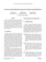
197
Fig. 1 General modeling
proposed framework
Uncertainties related to these input parameters are very
numerous and affect model outputs. In general, these uncertainties can be of two types: epistemic and aleatory. The type
of uncertainty of each parameter depends on sources of its
uncertainty. Therefore, it is necessary to identify uncertainty
sources related to input parameters:
– Uncertainty sources of spectral parameters Several studies investigated effects of spectral parameters [28].
Among these effects, we list: spectral reflectance of the
surface (S1), sensor calibration (S2), effect of mixed pixels (S3), effect of a shift in the channel location (S4),
pixel registration between several spectral channels (S5),
atmospheric temperature and moisture profile (S6), effect
of haze particles (S7), instrument’s operation conditions
(S8), atmospheric conditions (S9), as well as by the stability of the instrument itself characteristics (S10).
– Uncertainty sources of texture parameters Among these
sources, we list: the spatial interaction between the size
of the object in the scene and the spatial resolution of the
sensor (S11), a border effect (S12), and ambiguity in the
object/background distinction (S13).
– Uncertainty sources of shape parameters Uncertainty
related to shape parameters can rely to the following factors [28]: accounting for the seasonal position of the sun
with respect to the Earth (S14), conditions in which the
image was acquired changes in the scene’s illumination
(S15), atmospheric conditions (S16), and observation
geometry (S17).
– Uncertainty sources of NDVI Among factors that affect
NDVI, we can list: variation in the brightness of soil
background (S18), red and NIR bands (S19), atmospheric
perturbations (S20), and variability in the sub-pixel structure (S21).
– Uncertainty sources of climate parameters According to
[29], uncertainty sources related to climate parameters
can be: atmospheric correction (S22), noise of the sensor
(S23), land surface emissivity (S24), aerosols and other
gaseous absorbers (S25), angular effects (S26), wavelength uncertainty (S27), full-width half-maximum of the
sensor (S28), and bandpass effects (S29).
2.1.2 Description of model structure
In this study, we use the LCC prediction model described in
[18]. This model is divided into three main steps. It starts
by a similarity measurement step to find similar states (in
the object database) to a query state (representing the query
object at a given date). Here, a state is a set of attributes
describing an object at a given data. The second step is composed by three substeps: (1) finding the corresponding model
for the state; (2) finding all forthcoming states in the model
(states having dates superior to the date of the retrieved state);
and (3) for each forthcoming date, build the spatiotemporal
change tree for the retrieved state. The third step is to construct the spatiotemporal changes for the query state. Each of
these steps is based on a number of assumptions as follows:
– Similarity measure step: Distance between
states (d(St , St1 ) ≥ 0.9 indicates a higher similarity
between the query and the retrieved states). In addition, similarity measure between states is based on time
assumption.
123
198
Vietnam J Comput Sci (2017) 4:195–209
– Spatiotemporal change tree building
step: The aim of this step is to determine the confidence degrees and the percentage of changes of the model
between two dates and for different land-cover types. The
confidence degree of changes is achieved by a fuzzy decision tree (fuzzy ID3). This method is based on a number
of assumptions such as: the proportion of a data set of
land-cover type, the size of a data set, etc. The percentage of changes is achieved by computing the distances
between two states and the centroid of the classes.
In this study, we consider structural uncertainty as uncertainty associated with assumptions of model structure,
including distance between states, time assumption for similarity measure, assumptions of fuzzy ID3, and distance
between states and centroid for changes percentage.
2.2 Step 2: propagating the uncertainty
In this step, we focus on how to propagate parameter and
structural uncertainty through the LCC prediction model
described in [18] via the possibility theory.
2.2.1 Basics of possibility theory
The possibility theory developed by Dubois and Prade [30]
handles uncertainty in a qualitative way, but encodes it in the
interval [0, 1] called possibilistic scale. The basic building
block in the possibility theory is named possibility distribution. A possibility distribution is defined as a mapping
π : Ω → [0, 1]. It is formally equivalent to the fuzzy set
μ(x) = π(x). Distribution π describes the more or less
plausible values of some uncertain variable X. A possibility distribution is associated with two measures, namely, the
possibility (Π ) and necessity (N ) measures, which are represented by Eq. (1):
possibility distribution can be understood as the probabilistic constraint P(X ∈ [x α , x α ]) ≥ 1 − α. In this setting,
necessity degrees are equated to lower probability bounds
and possibility degrees to upper probability bounds.
2.2.2 Propagation of parameter uncertainty
In this section, the procedures of propagating unified structures dealing with parameter uncertainty of LCC prediction
model will be addressed. Let us denote by Y = f (X ) =
f (X 1 , X 2 , . . . , X j , . . . , X n ) the model for LCC prediction
with n uncertain parameters X j , j = 1, 2, . . . , n, that are
possibilistic, i.e. , their uncertainties are described by possibility distributions π X 1 (x1 ), π X 2 (x2 ), . . . , π X j (x j ), . . . ,
π X n (xn ). In more detail, the operative steps of the procedure
are the following:
1. Set α = 0.
Xj
2. Select the α cuts AαX 1 , AαX 2 , , Aα , . . . , AαX n of the possibility distributions π X 1 (x1 ), π X 2 (x2 ), . . . , π X j (x j ), . . . ,
π X n (xn ) of the possibilistic parameters X j , j = 1,
2, . . . , n, as intervals of possible values x j,α , x j,α
j = 1, 2, . . . , n.
3. Calculate the smallest and largest values of Y, denoted by
y α and y α , respectively, letting variables X j range within
the intervals x j,α , x j,α j = 1, 2, . . . , n; in particular,
y α = inf j,X j ∈[x j,α ,x l,α ] f (X 1 , X 2 , . . . , X j , . . . , X n ) and
y α = sup j,X j ∈[x j,α ,x l,α ] f (X 1 , X 2 , . . . , X j , . . . , X n ).
4. Take the values y α and y α found in step 3 as the lower
and upper limits of the α cut AαY of Y;
5. If α < 1, then set α = α + α and return to step 2;
otherwise, stop the algorithm. The possibility distribution
πY (y) of Y = f (X 1 , X 2 , . . . , X n ) is constructed as the
collection of the values y α and y α for each α cut.
2.2.3 Propagation of structural uncertainty
Π (A) = supx∈A π(x),
N (A) = inf x ∈A
/ (1 − π(x)).
(1)
The possibility measure indicates to which extent event A
is plausible, while the necessity measure indicates to which
extent it is certain. They are dual, in the sense that Π (A) =
1 − N (A), with A the complement of A. They obey the following axioms:
Π (A ∪ B) = max(Π (A), Π (B))
(2)
N (A ∩ B) = min(N (A), N (B))
(3)
An α cut of π is the interval [x α , x α ] = {x, π(x) ≥ α}. The
degree of certainty that [x α , x α ] contains the true value of X
is N ([x α , x α ]) = 1 − α. Conversely, a collection of nested
sets Ai with (lower) confidence levels λi can be modeled as
a possibility distribution, since the α cut of a (continuous)
123
The propagation of structural uncertainty is implemented in
combination with the propagation of parameter uncertainty.
In this section, as parameter uncertainty is modeled by possibility theory, we use this method in this framework.
Suppose that a set of model structures Mk , 1 ≤ k ≤ K
represents the uncertainty related to the choice of model. For
each model Mk , parameter uncertainty is propagated through
this model. Consequently, the output indicator Y is characterized by a set of uncertainty representations according to
each model structure. Thus, for all model structures Mk ,
1 ≤ k ≤ K , we have a set of possibility distributions for
output variable Y , noted πY1 (y), πY2 (y), . . . , πY K (y). The
difference between these representations reflects the variation associated with structural uncertainty of LCC prediction
model. These different representations πYi (y), 1 ≤ i ≤ K
Vietnam J Comput Sci (2017) 4:195–209
199
can be combined into a single representation. Therefore, the
final uncertainty representation of output variable Y can be
obtained by the following formulas:
most likely value, for a particular point of observation, leads
to finding the most sensitive parameter. We can use the same
measure to perform structural sensitivity analysis.
y ∗α = inf i,Yi ∈[y
2.4 Step 4: constructing the knowledge base
y ∗α
i,α
= supi,Yi ∈[y
,y l,α ]
f (Y1 , Y2 , . . . , Yi , . . . , Y K )
(4)
,y l,α ]
f (Y1 , Y2 , . . . , Yi , . . . , Y K ).
(5)
i,α
The possibility distribution πY (y) of Y = f (Y1 , Y2 , . . . , Y K )
is constructed as the collection of the values y ∗α and y ∗α for
each α cut. This distribution takes into account both parameter and structural uncertainty in the final output results of the
prediction model.
2.3 Step 3: performing the sensitivity analysis
Based on Hartley-like measure, the third step consists to test
impact of parameter and structural uncertainties on LCC prediction model output. The Hartley-like measure quantifies
the most fundamental type of uncertainty (i.e., aleatory and
epistemic uncertainty). This measure is generalized to fuzzy
set by Higashi and Klir [31,32]. How to perform sensitivity analysis of both uncertainty sources in the possibilistic
framework? The generalized measure H for any non-empty
possibility distribution A defined on a finite universal set X
has the following form:
H (A) =
1
h(A)
h(a)
0
log2 |Aα |dα,
(6)
where Aα denotes the cardinality of the α cuts of the possibility distributions A and h(A) the height of A. For possibilistic
intervals or numbers on the real line, the Hartley-like measure
is defined as
1
H L(A) =
0
log2 (1 + λ(Aα ))dα,
(7)
where λ(Aα ) is the Lebesgue measure of Aα [31]. Mathematically, for a possibilistic number A = [a L , am , a R ] given
by the possibility distribution
⎧ x−a L
⎨ am −a L , if a L ≤ x ≤ am
R
π A (x) = ax−a
, if am ≤ x ≤ a R
⎩ m −a R
0,
otherwise
(8)
the Hartley-like measure is given by the expression as follows:
H L(A) =
1
× ([1 + (a R − a L )]
(a L − a R ) ln(2)
ln[1 + (a R − a L )] − (a R − a L )).
(9)
The minimum value of Hartley-like measure of the model
output with respect to fixing a particular parameter to the
After performing parameter and structural sensitivity analysis, the main purpose of this step is to identify reduction
approaches of all uncertainty sources of LCC model parameters. In general, the knowledge base stores the embedded
knowledge in the system and the rules defined by an expert.
In this study, we used an inductive learning technique to
automatically build a knowledge base. Two main steps are
proposed which are training and decision tree generation. The
learning step provides examples of concepts to be learned.
The second step is the decision tree generation. This step
generates the first decision trees from the training data.
These decision trees are then transformed into production
rules. Then, our knowledge base that contains all uncertainty
sources and their reduction approaches is presented in Fig. 2.
This knowledge base is used to improve data quality and
then reduce in a significant way the uncertainty about future
changes of land cover.
3 Experimental results
The aim of this section is to validate and to evaluate the performance of the proposed approach through two case studies
for reducing parameter and structural uncertainty in LCC
prediction modeling.
3.1 Case study 1
3.1.1 Description of the study area and data
Reunion Island is a French territory of 2500 km2 located in
the Indian Ocean, 200 km South-West of Mauritius and 700
km to the East of Madagascar (Fig. 3). Mean annual temperatures decrease from 24 ◦ C in the lowlands to 12 ◦ C at
ca 2000 m. Mean annual precipitation ranges from 3 m on
the eastern windward coast, up to 8 m in the mountains and
down to 1 m along the south western coast. Vegetation is
most clearly structured along gradients of altitude and rainfall [27].
Reunion Island has a strong growth in a limited area with
an estimated population of 833,000 in 2010 that will probably
be more than 1 million in 2030 [24]. It has been significant changes, putting pressure on agricultural and natural
areas. The urban areas expanded by 189 % over the period
from 1989 to 2002 [25] and available land became a rare and
coveted resource. The landscapes are now expected to fulfil
multiple functions, i.e., urbanization, agriculture production,
123
200
Vietnam J Comput Sci (2017) 4:195–209
Fig. 2 Production rules
generated from uncertainty
sources of input parameters
Fig. 3 Studied area for case
study 1
and ecosystem conservation, and this causes conflicts among
stakeholders about their planning and management [26].
Saint Denis is the capital of Reunion Island and the city
with the most inhabitants on the island (Fig. 3). It hosts
all the important administrative offices, and it is also a cultural center with numerous museums. Saint-Denis is also the
largest city in all the French Overseas Departments. Available remote sensing data for this research include classified
images of land over of Saint Denis from SPOT-4 images
for the years 2006 and 2011 (Fig. 4). For this case, satellite data are classified after initial corrections and processing
to prepare the data for extracting useful information. Spec-
123
tral, geometric, and atmospheric corrections of images are
conducted to make features manifest, to increase the quality
of images, and to eliminate the adverse effects of light and
atmosphere. According to the study objective, five categories,
including water, urban, forest, bare soil, and vegetation, are
identified and classified.
3.1.2 Results of uncertainty propagation
As mentioned perviously, the model parameter and model
structure of LCC prediction are marred by uncertainty. Ignoring each of these sources can affect the results of uncertainty
Vietnam J Comput Sci (2017) 4:195–209
201
Fig. 4 Land-cover maps
Fig. 5 Possibility distribution of LCC prediction model output for only
parameter uncertainty
Fig. 6 Possibility distributions of LCC for three different prediction
model structures
propagation. To illustrate the importance of propagating
uncertainty related to model parameter and model structure
through the LCC prediction model, the analysis with pure
parameter uncertainty assumption is conducted. In this case,
the possibility distribution of output representing only parameter uncertainty is obtained via possibility theory. Figure 5
shows this distribution based on 10,000 samples. With uncertainty in model parameter, there is uncertainty in model structure. Therefore, it is also import to illustrate the importance
of structural uncertainty in LCC prediction modeling by the
proposed approach. This is the reason behind using the LCC
prediction model described in [18] with three different structures. Then, we obtain three different models (M1 , M2 ,, and
M3 ) with different assumptions. To take into account structural uncertainty in the final result, uncertainty related to parameters is first propagated and this for each prediction model.
Figure 5 shows the possibility distribution of the LCC
prediction model output, where only parameter uncertainty
is propagated.
After propagating uncertainty of parameters through three
different model structures, we obtain three uncertain representations of LCC, which are shown in Fig. 6. The difference
between these three representations illustrates the impact of
structural uncertainty. Compared with the result of the original LCC prediction model (M1 ), we can see that these is an
important difference between them.
Figure 7 shows possibility distribution representing integrated parameter and structural uncertainty through the LCC
prediction modeling. Note that combining parameter and
structural uncertainty can be crucially important to enhance
the accuracy of the LCC prediction model.
123
202
Vietnam J Comput Sci (2017) 4:195–209
3.1.3 Results of sensitivity analysis
In this paper, the sensitivity analysis based on Hartley-like
measure is implemented to estimate the effect of 26 uncertain parameters through three different LCC prediction model
structures. Results of the sensitivity analysis are shown in
Fig. 8.
The different heights of the bars reveal the various levels of sensitivity, and a long bar indicates high sensitivity
parameter. Parameter variations are illustrated individually
for each of the three model structures M1 , M2 , and M3 . The
most complex model structure generally shows a higher sensitivity of parameters. M1 and M2 have given, almost, the
same results. On the other hand, parameters in M3 are relatively sensitive compared to M1 and M2 . According to these
differences, structural uncertainty plays an important role in
the sensitivity analysis and should not be overlooked as part
of overall uncertainty reductions. The overall contribution of
spectral, shape, and NDVI parameters to the LCC prediction model, which are the highest and the indicative of the
most sensitive for the three model structures. After applying
the sensitivity analysis process, we will only consider these
parameters for preprocessing based on the knowledge base
and for optimal parameter estimation. Then, the uncertainty
propagation based on possibility theory method is applied to
reduce the parameter and structural uncertainty of the LCC
prediction model.
3.1.4 Results of LCC prediction maps
Fig. 7 Possibility distribution of the combined parameter and structural uncertainty of LCC prediction model output
LCC prediction maps are validated based on temporal series
of multispectral SPOT images. First, the 2011 LCC was simulated using the 2006 data sets. Then, the simulated changes
are compared with the real LCC in 2011 to evaluate the accu-
Fig. 8 Comparison between the sensitivity of uncertain parameters in three different LCC prediction model structures based on Hartley-like
measure
Table 1 Percentages of LCC of the actual and simulated LCC
Water (%)
Urban (%)
Forest (%)
Predicted changes in 2025
1.9
37.4
39.31
26.95
26.7
Output of proposed model
1.5
23.18
35.97
22.87
20.08
Real changes in 2011
1.7
21.4
36.1
24.1
16.7
123
Bare soil (%)
Vegetation (%)
Vietnam J Comput Sci (2017) 4:195–209
203
Fig. 9 Comparison between the land-cover maps for years 2006 and 2011 and the predicted land-cover map for 2025
racy and the performance of the proposed approach. Second,
the process of LCC is conducted to predict land-cover distributions for forthcoming dates.
Table 1 illustrates a comparison between the actual and
simulated percentages occupied by the different land-cover
types (water, urban, forest, bare soil, and vegetation) between
2006 and 2011. It shows that the modeled changes generally
matched that of the actual changes. These results confirm that
the proposed approach can simulate the prediction of LCC
with an acceptable accuracy.
After the validation, the next step is to simulate the LCC
in 2025, assuming the changes between 2006 and 2011. In
this simulation, the LCC and the parameters acquired in 2011
are used as input to simulate the LCC in 2025.
Table 1 shows the simulated changes between 2006 and
2025. Urban expansion is the dominant change process. This
can be attributed to the increase in population by increased
demands for residential land. There have been significant
LCC, where urban land covered 21.4 % of simulated changes
in 2011 and 37.4 % in 2025. From these results, it can be
found the replacing of the land natural cover (forest and veg-
etation lands) in the study area by residential land (urban
land).
Figure 9 depicts the simulated future changes compared
with land-cover maps for the years 2006 and 2011.
3.1.5 Evaluation of the proposed approach
To evaluate the proposed approach in improving LCC prediction, we apply the proposed uncertainty propagation
approach on the LCC model described by Qiang and Lam
in [40] to the Saint-Denis city, Reunion Island. The LCC
prediction model proposed in [40] uses the Artificial Neural
Network (ANN) to derive the LCC rules and then applies the
Cellular Automate (CA) model to simulate future scenarios.
Table 2 depicts the percentages of change of the five landcover types (water, urban, bare soil, forest, and non-dense
vegetation). It shows the difference between real changes,
predicted changes of the proposed approach, and changes
made by the proposed approach applied to model described
in [40].
123
204
Vietnam J Comput Sci (2017) 4:195–209
Table 2 Comparison between real changes, predicted changes of the proposed approach, and changes made by the proposed approach applied to
model described in [40]
Proposed approach
Water (%)
Urban (%)
Forest (%)
Bare soil (%)
Vegetation (%)
1.5
23.18
35.97
22.87
20.08
Approach applied to model in [40]
1.5
25.32
34.98
20.03
16.24
Real changes in 2011
1.7
21.4
36.1
24.1
16.7
Fig. 10 Location of the study
area for the case study 2
3.2 Case study 2
3.2.1 Description of the study area and data
Cairo, the capital of Egypt, is one of the most crowded
cities in Egypt (Fig. 10) and is considered as a world megacity. Mapping LCC is important to understand and analyze
the relationships between the geomorphology (highlands
and deserts), natural resources (agricultural lands and the
Nile River), and human activities. Agricultural lands around
Cairo have witnessed severe encroachment practices due to
the accelerated population growth. However, adjacent desert
plains have also witnessed urbanization practices to encompass the intensive population growth. Different studies have
previously been carried out for LCC detection and modeling
in the Cairo Region [36–39]. Population of Cairo (Cairo city
and Giza) increased from about 6.4 millions in 1976 [36] to
about 12.5 million in 2006 according to the Egyptian Central
Agency for Public Mobilization and Statistics. The importance of Cairo arises from its location in the mid-way between
the Nile Valley and the delta. Main government facilities and
services occur at Cairo.
In this case, two Landsat TM5 satellite images are
obtained from the United States Geological Survey (USGS)
database online resources. These two images acquired in
6 April 1987 and 15 March 2014, respectively, are classified into four land-cover types which are urban, agriculture,
123
desert, and water to produce LCC maps (Fig. 11). During this
time period, Cairo population has increased from an estimated 7 million in 1987 to over 15 million in 2014. The
recent population growth has caused the city and its associated urban areas to expand into the surrounding desert, as
seen in the right image in Fig. 11. Within the main Nile River
Valley, these two images also show an overall increase in
developed urban area (red) versus agricultural land (green).
As new urban and agricultural areas are being developed in
the desert, they require diversion of water supplies from the
main Nile River Valley.
In this case study, satellite data are classified after initial
corrections and processing to prepare the data for extracting useful information. Spectral, geometric, and atmospheric
corrections of images are conducted to make features manifest, to increase the quality of images, and to eliminate the
adverse effects of light and atmosphere.
3.2.2 Results of uncertainty propagation
As we mentioned in the first case study, it is necessary to
study the effect of both uncertainty sources through LCC
prediction model. Figure 12 shows the possibility distribution of output representing only parameter uncertainty
based on 10,000 samples. Therefore, it is also import to
illustrate the importance of structural uncertainty in LCC
prediction modeling by proposed approach. Figure 13 shows
Vietnam J Comput Sci (2017) 4:195–209
205
Fig. 11 Land-cover maps
Fig. 12 Possibility distribution of LCC prediction model output for
only parameter uncertainty
Fig. 14 Possibility distribution of the combined parameter and structural uncertainties of LCC prediction model output
the possibility distributions of output representing parameter uncertainty through three different model structures. The
difference between these three representations presents the
impact of structural uncertainty. In this case study, results of
the uncertainty propagation of both parameter and structural
uncertainties are shown in Fig. 14.
3.2.3 Results of sensitivity analysis
Fig. 13 Possibility distributions of LCCs for three different prediction
model structures
In this case study, we have also used Hartley-like measure
to estimate the 26 uncertain parameters through three different LCC prediction model structures. The main objective
is to test the impact of parameter and structural uncertainties. Results of the sensitivity analysis are shown in Fig. 15.
In this case, parameters in M3 are highly sensitive com-
123
206
Vietnam J Comput Sci (2017) 4:195–209
Fig. 15 Comparison between the sensitivity of uncertain parameters in three different LCC prediction model structures based on Hartley-like
measure
Table 3 Output of the proposed
LCC prediction model in
comparison with real changes
between 1987 and 2014 in Cairo
region
Table 4 Output of the proposed
LCC prediction model of the
predicted LCC between 2014
and 2025 in Cairo region
Urban (%)
Agriculture (%)
Water (%)
Desert (%)
Output of proposed model
15.63
13.80
0.01
4.03
Real changes in 2014
17.32
13.00
0.02
5.00
Urban (%)
Agriculture (%)
Water (%)
Desert (%)
Predicted changes in 2025
20.16
14.72
0.03
6.11
Real changes in 2014
17.32
13.00
0.02
5.00
pared to M1 and M2 . On the other hand, as in the first case
study, the overall contribution of spectral, shape, and NDVI
parameters to the LCC prediction model is the highest and
represents the most sensitive parameters for the three model
structures.
3.2.4 Results of LCC prediction maps
The validation of LCC prediction maps consists of two
phases. First, the 2014 LCC is simulated using the 1987 data
sets, which is then compared with the real LCC in 2014 to
evaluate the accuracy and the performance of the proposed
approach. Second, future changes are simulated using the
real 2014 data sets.
To check the accuracy of our approach, Table 3 compares
actual and simulated percentages occupied by the different land-cover types (urban, agriculture, water, and desert)
between 1987 and 2014. According to the proposed model
output, the most significant changes in this period are the transitions from agriculture and desert to urban areas (Fig. 11).
Over 27 years, from 1987 to 2014, agriculture lost 12 %
to urban areas. In addition, 4 % of desert areas became
urban between 1987 and 2014, which is equivalent to 24,687
123
hectares. This percentage results from the application of
desert reconstruction strategies to build new communities
outside the Nile Valley. The obtained results depict that the
proposed approach gives an accurate prediction with about
3.96 % of error through a comparison with the real changes
in Cairo region. These results confirm that the proposed LCC
prediction model is able to describe the LCC. The proposed
approach can simulate the prediction of LCC with an accepTable accuracy. After the validation of the proposed approach,
the next step is to simulate the LCC in 2025, assuming that
the changes between 1987 and 2014 will continue during
the next 11 years. In this simulation, the LCC and the input
parameters acquired in 2014 are used as input to simulate the
LCC in 2025.
Table 4 shows the simulated changes between 2014 and
2025. There have been significant LCC, where urban land
covered 15.63 % of simulated changes in 2014 and 20.16 %
in 2025. This could be attributed to the increase in population by increased demands for residential land. The resulting
effect is the decrease in desert land. From these results, we
note that the desert land cover in the study area is replaced by
residential land (urban land). Knowing the current and estimated urbanization situation will help decision makers to
Vietnam J Comput Sci (2017) 4:195–209
207
Fig. 16 Comparison between the land-cover maps for years 1987 and 2014 and the predicted land-cover map for 2025
Table 5 Comparaison between
real changes and changes
prediction for the proposed
approach and the proposed
approach applied to model
described in [40]
Urban (%)
Agriculture (%)
Water (%)
Desert (%)
Proposed approach
15.63
13.80
0.01
4.03
Approach applied to model in [40]
14.93
13.61
0.01
5.92
Real changes in 2014
17.32
13.00
0.02
5.00
adjust and develop new plans to achieve a sustainable development of urban areas and to protect the historical locations.
Figure 16 depicts the simulated future changes compared
with land-cover maps for the years 1987 and 2014. These
results indicate usefulness and applicability of the proposed
approach in predicting the LCC.
3.2.5 Evaluation of the proposed approach
In this case study, we also apply the proposed uncertainty
propagation approach on the LCC model described by Qiang
and Lam in [40] to the Cairo region, Egypt.
Table 5 depicts the percentages of change of the four
land-cover types (urban, agriculture, water, and desert).
This table shows the difference between real changes and
changes prediction for the proposed approach and the proposed approach applied to model described in [40].
4 Conclusion
This study has proposed an approach for reducing parameter
and structural uncertainty in LCC prediction modeling. The
proposed approach herein quantifies uncertainty based on
possibility theory. Subsequently, the Hartley-like measure is
used to perform the sensitivity of the LCC prediction model
parameter and structure. Using the sensitivity analysis, we
are able to quantify precisely the effect of each LCC prediction model parameter, and also the effect of model structure.
This analysis yields that the spectral, shape, and vegetation
parameters are the most sensitive parameters in three different model structures.
123
208
To validate the proposed approach, we choose two case
studies which are: Saint-Denis city, Reunion Island, and
Cairo region, Egypt. We study spectral parameters, texture parameters, shape parameters, vegetation parameter, and
climate parameters for three different model structures to
simulate forthcoming LCC. Results show that the urban
expansion in the two case studies is rapid and should be
monitored in the future.
As future work, we propose to put online a tool for
uncertainty propagation and sensitivity analysis based on
possibility theory. This tool will help researchers to improve
the performance of their models. It has also as input parameters of a considered model and as output which of these
input parameters that most influence the model output.
Open Access This article is distributed under the terms of the Creative
Commons Attribution 4.0 International License (http://creativecomm
ons.org/licenses/by/4.0/), which permits unrestricted use, distribution,
and reproduction in any medium, provided you give appropriate credit
to the original author(s) and the source, provide a link to the Creative
Commons license, and indicate if changes were made.
References
1. Boulila, W., Bouatay, A., Farah, I.R.: A probabilistic collocation
method for the imperfection propagation: application to land cover
change prediction. J. Multimed. Process. Technol. 5(1), 12–32
(2014)
2. Liu, R., Sun, J., Wang, J., Li, X.: Study of remote sensing based
parameter uncertainty in production efficiency models. In: IEEE
International Geoscience and Remote Sensing Symposium, pp.
3303–3306 (2010)
3. Jacquin, A.P.: Possibilistic uncertainty analysis of a conceptual
model of snowmelt runoff. Hydrol. Earth Syst. Sci. 14, 1681–1695
(2010)
4. Dubois, D., Prade, H.: Formal representations of uncertainty. In:
Decision-Making Process: Concepts and Methods, ch. 3, pp. 85–
156. ISTE and Wiley, London (2010)
5. Caselton, W.F., Luo, W.: Decision making with imprecise probabilities: Dempster–Shafer theory and application. Water Resour.
Res. 28(12), 3071–3083 (1992)
6. Zhao, X., Stein, A., Chen, X.: Application of random sets to model
uncertainties of natural entities extracted from remote sensing
images. Stoch. Environ. Res. Risk Assess. 24(5), 713–723 (2009)
7. Hgarat-Mascle, S.L., Bloch, I., Vidal-Madjar, D.: Application of
Dempster–Shafer evidence theory to unsupervised classification in
multisource remote sensing. IEEE Trans. Geosci. Remote Sens.
35(4), 1018–1031 (1997)
8. Gomez, D., Javier, M.: Fuzzy sets in remote sensing classification.
Soft Comput. 12(3), 243–249 (2008)
9. Ferchichi, A., Boulila, W., Farah, I.R.: An intelligent possibilistic
approach to reduce the effect of the imperfection propagation on
land cover change prediction. Int. Conf. Comput. Collect. Intell.
9330, 520–529 (2015)
10. Mondal, M.S., Garg, P.K., Sharma, N., Kappas, M.: Cellular
automata (ca) markov modeling of LULC change and sensitivity
analysis to identify sensitive parameter(s). In: Proceedings of the
27th International Cartographic Conference, vol. 38(818) (2015)
123
Vietnam J Comput Sci (2017) 4:195–209
11. Sanchez-Canales, M., Benito, A.L., Passuello, A., Terrado, M., Ziv,
G., Acuna, V., Schuhmacher, M., Elorza, F.J.: Sensitivity analysis
of ecosystem service valuation in a Mediterranean watershed. Sci.
Total Environ. 440, 140–153 (2012)
12. Bettemier, O.H.: Error estimation of orthorectification of small
satellite images by differential sensitivity analysis. J. Aeronaut.
Space Technol. 4(4), 65–74 (2010)
13. Zielinskaa, A.L., Sunb, L.: Applying time-dependent variancebased global sensitivity analysis to represent the dynamics of an
agent-based model of land use change. Int. J. Geogr. Inf. Sci.
24(12), 1829–1850 (2010)
14. Helton, J.C., Johnson, J.D., Sallaberry, C.J., Storlie, C.B.: Survey
of sampling-based methods for uncertainty and sensitivity analysis.
Reliab. Eng. Syst. Saf. 91(10–11), 1175–1209 (2006)
15. Li, C., Wang, W., Xiong, J., Chen, P.: Sensitivity analysis for urban
drainage modeling using mutual information. Entropy 16, 5738–
5752 (2014)
16. Sengupta, A., Pal, T.K.: Theory and methodology: on comparing
interval numbers. Eur. J. Oper. Res. 127, 28–43 (2000)
17. Ferson, S., Tucker, W.T.: Sensitivity analysis using probability
bounding. Reliab. Eng. Syst. Saf. 91(1011), 1435–1442 (2006)
18. Boulila, W., Farah, I.R., Ettabaa, K.S., Solaiman, B., Ben Ghzala,
H.: A data mining based approach to predict spatio-temporal
changes in satellite images. Int. J. Appl. Earth Obs. Geoinf. 13(3),
386–395 (2011)
19. Ballestores, F., Jr., Qiu, Z., Nedorezova, B.N., Nedorezov, L.V.,
Ferrarini, A., Ramathilaga, A., Ackah, M.: An integrated parcelbased land use change model using cellular automata and decision
tree. In: Proceedings of the International Academy of Ecology and
Environmental Sciences, vol. 2(2), pp. 53–69 (2012)
20. Razavi, B.S.: Predicting the trend of land use changes using
artificial neural network and markov chain model (Case Study: Kermanshah City). Res. J. Environ. Earth Sci. 6(4), 215–226 (2014)
21. Tayyebi, A., Perry, P.C., Tayyebi, A.H.: Predicting the expansion
of an urban boundary using spatial logistic regression and hybrid
rastervector routines with remote sensing and GIS. Int. J. Geogr.
Inf. Sci. 28(4), 1–21 (2013)
22. Ralha, C.G., Abreu, C.G., Coelho, C.G., Zaghetto, A., Macchiavello, B., Machado, R.B.: A multi-agent model system for
land-use change simulation. Environ. Model. Softw. 42, 30–46
(2013)
23. Li, X., Yeh, A.G.O.: Neural-network-based cellular automata for
simulating multiple land use changes using GIS. Int. J. Geogr. Inf.
Sci. 16(4), 323–343 (2002)
24. INSEE Reunion: Bilan dmographique 2009, Rsultats (40) (2011)
25. Durieux, L., Lagabrielle, E., Andrew, N.: A method for monitoring building construction in urban sprawl areas using object-based
analysis of Spot 5 images and existing GIS data. ISPRS J. Photogramm. 63, 399–408 (2008)
26. van der Valk, A.: The Dutch planning experience. Landsc. Urban
Plan. 58(2), 201–210 (2002)
27. Cadet, T.: La vegetation de l’ile de La reunion, tude phytocologique
et phytosociologique. Ph.D. Thesis, University of Aix Marseille
(1980)
28. Atanassov, V., Jelev, G., Kraleva, L.: Some peculiarities of the preprocessing of spectral data and images. J. Ship. Ocean Eng. 3,
55–60 (2013)
29. Jimenez-Munoz, J.C., Sobrino, J.A.: Error sources on the land surface temperature retrieved from thermal infrared single channel
remote sensing data. Int. J. Remote Sens. 27(5), 999–1014 (2006)
30. Dubois, D., Prade, H.: When upper probabilities are possibility
measures. Fuzzy Sets Syst. 49, 65–74 (1992)
31. Klir, G.J., Wiermann, M.J.: Uncertainty Based Information. Elements of Generalised Information Theory. Physica-Verlg, Heidelberg (1998)
Vietnam J Comput Sci (2017) 4:195–209
32. Hagashi, M., Klir, G.J.: Measure of uncertainty and information
based on possibility distribution. Int. J. Gen. Syst. 9, 43–58 (1983)
33. Chutta, R., Mahanta, S., Datta, D.: Sensitivity analysis of
atmospheric dispersion model-Rimpuff using Hartley-like measure. J. Appl. Math. Inform. 31(1–2), 99–110 (2013)
34. Datta D.: Measures of sensitivity and uncertainty with the fuzzy
model of solute transport through groundwater. In: International
Conference on Communication and Industrial Application, pp. 1–
6 (2011)
35. Ivanov, L.M., Tokmakian, R.T.: Sensitivity analysis of nonlinear
models to parameter perturbations for small size ensembles of
model outputs. Int. J. Bifurc. Chaos 21(12), 3589–3609 (2011)
36. Sutton, K., Fahmi, W.: Cairo’s urban growth and strategic master
plans in the light of Egypt’s 1996 population census results. Cities
18(3), 135–149 (2001)
209
37. Yin, Z.Y., Stewart, D.J., Bullard, S., Maclachlan, J.T.: Changes in
urban built-up surface and population distribution patterns during
1986–1999: a case study of Cairo, Egypt. Comput. Environ. Urban
Syst. 29, 595–616 (2005)
38. Hereher, M.E.: Analysis of urban growth at Cairo, Egypt using
remote sensing and GIS. Nat. Sci. 4, 355–361 (2012)
39. de Noronha, V.E., Caetano, M., Nijkamp, P.: Trapped between
antiquity and urbanism—a multi-criteria assessment model of the
Greater Cairo Metropolitan Area. J. Land Use Sci. 6, 283–299
(2011)
40. Qiang, Y., Lam, N.S.N.: Modeling land use and land cover changes
in a vulnerable coastal region using artificial neural networks and
cellular automata. Environ. Monit. Assess. 187(57), 1–16 (2015)
123