Tài liệu Sensors and Methods for Mobile Robot Positioning P1 pptx
Bạn đang xem bản rút gọn của tài liệu. Xem và tải ngay bản đầy đủ của tài liệu tại đây (2.15 MB, 30 trang )
7KH8QLYHUVLW\RI0LFKLJDQ
7KH8QLYHUVLW\RI0LFKLJDQ
Where am I?
Sensors and Methods for
Mobile Robot Positioning
by
J. Borenstein , H. R. Everett , and L. Feng
123
Contributing authors: S. W. Lee and R. H. Byrne
Edited and compiled by J. Borenstein
April 1996
Prepared by the University of Michigan
For the Oak Ridge National Lab (ORNL) D&D Program
and the
United States Department of Energy's
Robotics Technology Development Program
Within the Environmental Restoration, Decontamination and Dismantlement Project
Dr. Johann Borenstein Commander H. R. Everett Dr. Liqiang Feng
1)
The University of Michigan Naval Command, Control, and The University of Michigan
Department of Mechanical Ocean Surveillance Center Department of Mechanical
Engineering and Applied Mechanics RDT&E Division 5303 Engineering and Applied Mechanics
Mobile Robotics Laboratory 271 Catalina Boulevard Mobile Robotics Laboratory
1101 Beal Avenue San Diego, CA 92152-5001 1101 Beal Avenue
Ann Arbor, MI 48109 Ph.: (619) 553-3672 Ann Arbor, MI 48109
Ph.: (313) 763-1560 Fax: (619) 553-6188 Ph.: (313) 936-9362
Fax: (313) 944-1113 Email: Fax: (313) 763-1260
Email: Email:
2) 3)
Please direct all inquiries to Johann Borenstein
.
How to Use this Document
The use of the Acrobat Reader utility is straight-forward; if necessary, help is available from
theHelp Menu. Here are some tips:
You may wish to enable View => Bookmarks & Page to see a list of bookmarks besides the
current page. Clicking on a bookmark will cause the Acrobat Reader to jump directly to the
location marked by the bookmark (e.g., the first page in a specific chapter).
You may wish to enable View => Thumbnails & Page to see each page as a small thumbnail-
sized image besides the current page. This allows you to quickly locate a page that you remember
because of a table or graphics element. Clicking on a thumbnail will cause the Acrobat Reader to
jump directly to the page marked by the thumbnail.
Occasionally a term will be marked by a red rectangle, indicating a reference to an external
document. Clicking inside the rectangle will automatically load the referenced document and
display it. Clicking on the € key will return the Acrobat Reader to the original document.
Occasionally a term will be marked by a blue rectangle. This indicates a link to an external
video clip. Clicking inside the blue rectangle will bring up the video player (provided one is
installed on your platform).
If you would like to check the video clips, If you would like to contribute your own
click here for a list and instructions: material for next year's edition of the
"Where am I" Report, click here for instruc-
tions.
4
Acknowledgments
This research was sponsored by the
Office of Technology Development, U.S. Department of Energy,
under contract DE-FG02-86NE37969
with the University of Michigan
Significant portions of the text were adapted from
"
Sensors for Mobile Robots: Theory and Application
"
by H. R. Everett,
A K Peters, Ltd., Wellesley, MA, Publishers, 1995.
Chapter 9 was contributed entirely by
Sang W. Lee from the Artificial Intelligence Lab
at the University of Michigan
Significant portions of Chapter 3 were adapted from
“Global Positioning System Receiver Evaluation Results.”
by Raymond H. Byrne, originally published as
Sandia Report SAND93-0827, Sandia National Laboratories, 1993.
The authors wish to thank the Department of Energy (DOE), and especially
Dr. Linton W. Yarbrough, DOE Program Manager, Dr. William R. Hamel, D&D
Technical Coordinator, and Dr. Clyde Ward, Landfill Operations Technical
Coordinator for their technical and financial support of the
research, which forms the basis of this work.
The authors further wish to thank Professors David K. Wehe and Yoram Koren
at the University of Michigan for their support, and Mr. Harry Alter (DOE)
who has befriended many of the graduate students and sired several of our robots.
Thanks are also due to Todd Ashley Everett for making most of the line-art drawings.
5
Table of Contents
Introduction
................................................................10
P
ART
I
S
ENSORS FOR
M
OBILE
R
OBOT
P
OSITIONING
Chapter 1 Sensors for Dead Reckoning
.........................................13
1.1 Optical Encoders ........................................................13
1.1.1 Incremental Optical Encoders ..........................................14
1.1.2 Absolute Optical Encoders ........................................... 16
1.2 Doppler Sensors .........................................................17
1.2.1 Micro-Trak Trak-Star Ultrasonic Speed Sensor ............................18
1.2.2 Other Doppler-Effect Systems .........................................19
1.3 Typical Mobility Configurations ............................................19
1.3.1 Differential Drive ...................................................19
1.3.2 Tricycle Drive ..................................................... 21
1.3.3 Ackerman Steering ................................................. 21
1.3.4 Synchro Drive ..................................................... 23
1.3.5 Omnidirectional Drive ............................................... 25
1.3.6 Multi-Degree-of-Freedom Vehicles .....................................26
1.3.7 MDOF Vehicle with Compliant Linkage ................................. 27
1.3.8 Tracked Vehicles ................................................... 28
Chapter 2 Heading Sensors
...................................................30
2.1 Mechanical Gyroscopes ..................................................30
2.1.1 Space-Stable Gyroscopes .............................................31
2.1.2 Gyrocompasses .................................................... 32
2.1.3 Commercially Available Mechanical Gyroscopes ..........................32
2.1.3.1 Futaba Model Helicopter Gyro .....................................33
2.1.3.2 Gyration, Inc. ..................................................33
2.2 Piezoelectric Gyroscopes .................................................33
2.3 Optical Gyroscopes ......................................................34
2.3.1 Active Ring Laser Gyros ............................................. 36
2.3.2 Passive Ring Resonator Gyros ........................................ 38
2.3.3 Open-Loop Interferometric Fiber Optic Gyros .............................39
2.3.4 Closed-Loop Interferometric Fiber Optic Gyros ............................42
2.3.5 Resonant Fiber Optic Gyros .......................................... 42
2.3.6 Commercially Available Optical Gyroscopes ..............................43
2.3.6.1 The Andrew “Autogyro" ..........................................43
2.3.6.2 Hitachi Cable Ltd. OFG-3 .......................................... 44
2.4 Geomagnetic Sensors ....................................................45
2.4.1 Mechanical Magnetic Compasses .......................................46
2.4.2 Fluxgate Compasses ................................................ 47
2.4.2.1 Zemco Fluxgate Compasses .......................................52
6
2.4.2.2 Watson Gyrocompass ............................................55
2.4.2.3 KVH Fluxgate Compasses .........................................56
2.4.3 Hall-Effect Compasses .............................................. 57
2.4.4 Magnetoresistive Compasses .......................................... 59
2.4.4.1 Philips AMR Compass ............................................59
2.4.5 Magnetoelastic Compasses ........................................... 60
Chapter 3 Ground-Based RF-Beacons and GPS ..................................65
3.1 Ground-Based RF Systems ............................................... 65
3.1.1 Loran ............................................................ 65
3.1.2 Kaman Sciences Radio Frequency Navigation Grid ....................... 66
3.1.3 Precision Location Tracking and Telemetry System .........................67
3.1.4 Motorola Mini-Ranger Falcon ........................................ 68
3.1.5 Harris Infogeometric System.......................................... 69
3.2 Overview of Global Positioning Systems (GPSs) ...............................70
3.3 Evaluation of Five GPS Receivers by Byrne [1993] ............................78
3.3.1 Project Goals ...................................................... 78
3.3.2 Test Methodology .................................................. 78
3.3.2.1 Parameters tested ................................................79
3.3.2.2 Test hardware ..................................................81
3.3.2.3 Data post processing .............................................82
3.3.3 Test Results ....................................................... 83
3.3.3.1 Static test results ................................................84
3.3.3.2 Dynamic test results ..............................................88
3.3.3.3 Summary of test results ............................................ 91
3.3.4 Recommendations .................................................. 91
3.3.4.1 Summary of problems encountered with the tested GPS receivers ..........92
3.3.4.2 Summary of critical integration issues ................................92
Chapter 4 Sensors for Map-Based Positioning .................................. 95
4.1 Time-of-Flight Range Sensors ..............................................95
4.1.1 Ultrasonic TOF Systems ............................................. 97
4.1.1.1 Massa Products Ultrasonic Ranging Module Subsystems .................97
4.1.1.2 Polaroid Ultrasonic Ranging Modules ................................99
4.1.2 Laser-Based TOF Systems .......................................... 101
4.1.2.1 Schwartz Electro-Optics Laser Rangefinders .........................101
4.1.2.2 RIEGL Laser Measurement Systems ...............................107
4.1.2.3 RVSI Long Optical Ranging and Detection System ....................109
4.2 Phase-Shift Measurement ................................................112
4.2.1 Odetics Scanning Laser Imaging System .................................115
4.2.2 ESP Optical Ranging System ........................................ 116
4.2.3 Acuity Research AccuRange 3000 .....................................117
4.2.4 TRC Light Direction and Ranging System .............................. 119
4.2.5 Swiss Federal Institute of Technology's “3-D Imaging Scanner” ..............120
4.2.6 Improving Lidar Performance .........................................121
4.3 Frequency Modulation ................................................. 123
7
4.3.1 Eaton VORAD Vehicle Detection and Driver Alert System .................125
4.3.2 Safety First Systems Vehicular Obstacle Detection and Warning System .......127
P
ART
II
S
YSTEMS AND
M
ETHODS FOR
M
OBILE
R
OBOT
P
OSITIONING
Chapter 5 Odometry and Other Dead-Reckoning Methods
.......................130
5.1 Systematic and Non-Systematic Odometry Errors .............................130
5.2 Measurement of Odometry Errors .........................................132
5.2.1 Measurement of Systematic Odometry Errors ............................132
5.2.1.1 The Unidirectional Square-Path Test ................................132
5.2.1.2 The Bidirectional Square-Path Experiment ...........................134
5.2.2 Measurement of Non-Systematic Errors .................................136
5.3 Reduction of Odometry Errors ............................................137
5.3.1 Reduction of Systematic Odometry Errors .............................. 138
5.3.1.1 Auxiliary Wheels and Basic Encoder Trailer .........................138
5.3.1.2 The Basic Encoder Trailer ........................................139
5.3.1.3 Systematic Calibration ...........................................139
5.3.2 Reducing Non-Systematic Odometry Errors ..............................143
5.3.2.1 Mutual Referencing .............................................143
5.3.2.2 Internal Position Error Correction ..................................143
5.4 Inertial Navigation ......................................................145
5.4.1 Accelerometers ................................................... 146
5.4.2 Gyros ........................................................... 146
5.4.2.1 Barshan and Durrant-Whyte [1993; 1994; 1995] ......................147
5.4.2.2 Komoriya and Oyama [1994] .....................................148
5.5 Summary ............................................................ 149
Chapter 6 Active Beacon Navigation Systems
...................................151
6.1 Discussion on Triangulation Methods .......................................152
6.1.1 Three-Point Triangulation ............................................152
6.1.2 Triangulation with More Than Three Landmarks ..........................153
6.2 Ultrasonic Transponder Trilateration .......................................154
6.2.1 IS Robotics 2-D Location System ..................................... 155
6.2.2 Tulane University 3-D Location System ................................ 155
6.3 Optical Positioning Systems ............................................. 157
6.3.1 Cybermotion Docking Beacon ....................................... 158
6.3.2 Hilare .......................................................... 159
6.3.3 NAMCO LASERNET .............................................. 160
6.3.3.1 U.S. Bureau of Mines' application of the LaserNet sensor ...............161
6.3.4 Denning Branch International Robotics LaserNav Position Sensor ........... 163
6.3.5 TRC Beacon Navigation System...................................... 163
6.3.6 Siman Sensors and Intelligent Machines Ltd., ROBOSENSE .................164
6.3.7 Imperial College Beacon Navigation System .............................165
6.3.8 MTI Research CONAC ........................................... 166
TM
6.3.9 Spatial Positioning Systems, inc.: Odyssey .............................. 170
8
6.4 Summary ............................................................ 172
Chapter 7 Landmark Navigation ............................................ 173
7.1 Natural Landmarks .....................................................174
7.2 Artificial Landmarks ....................................................175
7.2.1 Global Vision ..................................................... 176
7.3 Artificial Landmark Navigation Systems ....................................176
7.3.1 MDARS Lateral-Post Sensor......................................... 177
7.3.2 Caterpillar Self Guided Vehicle ...................................... 178
7.3.3 Komatsu Ltd, Z-shaped landmark ..................................... 179
7.4 Line Navigation ........................................................180
7.4.1 Thermal Navigational Marker .........................................181
7.4.2 Volatile Chemicals Navigational Marker.................................181
7.5 Summary ............................................................ 183
Chapter 8 Map-based Positioning ........................................... 184
8.1 Map Building ......................................................... 185
8.1.1 Map-Building and Sensor Fusion...................................... 186
8.1.2 Phenomenological vs. Geometric Representation, Engelson & McDermott [1992] 186
8.2 Map Matching ........................................................ 187
8.2.1 Schiele and Crowley [1994] ......................................... 188
8.2.2 Hinkel and Knieriemen [1988] — The Angle Histogram ....................189
8.2.3 Weiß, Wetzler, and Puttkamer — More on the Angle Histogram .............191
8.2.4 Siemens' Roamer .................................................. 193
8.2.5 Bauer and Rencken: Path Planning for Feature-based Navigation.............194
8.3 Geometric and Topological Maps ........................................196
8.3.1 Geometric Maps for Navigation .......................................197
8.3.1.1 Cox [1991] ....................................................198
8.3.1.2 Crowley [1989] ................................................199
8.3.1.3 Adams and von Flüe ............................................202
8.3.2 Topological Maps for Navigation ......................................203
8.3.2.1 Taylor [1991] ..................................................203
8.3.2.2 Courtney and Jain [1994] ........................................203
8.3.2.3 Kortenkamp and Weymouth [1993] ................................204
8.4 Summary ............................................................ 206
9
Chapter 9 Vision-Based Positioning .........................................207
9.1 Camera Model and Localization .........................................207
9.2 Landmark-Based Positioning ............................................209
9.2.1 Two-Dimensional Positioning Using a Single Camera .....................209
9.2.2 Two-Dimensional Positioning Using Stereo Cameras ......................211
9.3 Camera-Calibration Approaches .........................................211
9.4 Model-Based Approaches ..............................................213
9.4.1 Three-Dimensional Geometric Model-Based Positioning ...................214
9.4.2 Digital Elevation Map-Based Localization ..............................215
9.5 Feature-Based Visual Map Building ......................................215
9.6 Summary and Discussion ...............................................216
Appendix A A Word on Kalman Filters ......................................218
Appendix B Unit Conversions and Abbreviations ..............................219
Appendix C Systems-at-a-Glance Tables .....................................221
References ..............................................................236
Subject Index ............................................................262
Author Index ............................................................274
Company Index ..........................................................278
Bookmark Index .........................................................279
Video Index .............................................................280
Full-length Papers Index ...................................................281
10
I
NTRODUCTION
Leonard and Durrant-Whyte [1991] summarized the general problem of mobile robot navigation by
three questions: “Where am I?,” “Where am I going?,” and “How should I get there?.” This report
surveys the state-of-the-art in sensors, systems, methods, and technologies that aim at answering the
first question, that is: robot positioning in its environment.
Perhaps the most important result from surveying the vast body of literature on mobile robot
positioning is that to date there is no truly elegant solution for the problem. The many partial
solutions can roughly be categorized into two groups: relative and absolute position measurements.
Because of the lack of a single, generally good method, developers of automated guided vehicles
(AGVs) and mobile robots usually combine two methods, one from each category. The two
categories can be further divided into the following subgroups.
Relative Position Measurements
a. Odometry This method uses encoders to measure wheel rotation and/or steering orientation.
Odometry has the advantage that it is totally self-contained, and it is always capable of providing
the vehicle with an estimate of its position. The disadvantage of odometry is that the position
error grows without bound unless an independent reference is used periodically to reduce the
error [Cox, 1991].
b. Inertial Navigation This method uses gyroscopes and sometimes accelerometers to measure rate
of rotation and acceleration. Measurements are integrated once (or twice) to yield position.
Inertial navigation systems also have the advantage that they are self-contained. On the downside,
inertial sensor data drifts with time because of the need to integrate rate data to yield position;
any small constant error increases without bound after integration. Inertial sensors are thus
unsuitable for accurate positioning over an extended period of time. Another problem with inertial
navigation is the high equipment cost. For example, highly accurate gyros, used in airplanes, are
inhibitively expensive. Very recently fiber-optic gyros (also called laser gyros), which are said to
be very accurate, have fallen dramatically in price and have become a very attractive solution for
mobile robot navigation.
Absolute Position Measurements
c. Active Beacons This method computes the absolute position of the robot from measuring the
direction of incidence of three or more actively transmitted beacons. The transmitters, usually
using light or radio frequencies, must be located at known sites in the environment.
d. Artificial Landmark Recognition In this method distinctive artificial landmarks are placed at
known locations in the environment. The advantage of artificial landmarks is that they can be
designed for optimal detectability even under adverse environmental conditions. As with active
beacons, three or more landmarks must be “in view” to allow position estimation. Landmark
positioning has the advantage that the position errors are bounded, but detection of external
11
landmarks and real-time position fixing may not always be possible. Unlike the usually point-
shaped beacons, artificial landmarks may be defined as a set of features, e.g., a shape or an area.
Additional information, for example distance, can be derived from measuring the geometric
properties of the landmark, but this approach is computationally intensive and not very accurate.
e. Natural Landmark Recognition Here the landmarks are distinctive features in the environment.
There is no need for preparation of the environment, but the environment must be known in
advance. The reliability of this method is not as high as with artificial landmarks.
f. Model Matching In this method information acquired from the robot's onboard sensors is
compared to a map or world model of the environment. If features from the sensor-based map
and the world model map match, then the vehicle's absolute location can be estimated. Map-
based positioning often includes improving global maps based on the new sensory observations
in a dynamic environment and integrating local maps into the global map to cover previously
unexplored areas. The maps used in navigation include two major types: geometric maps and
topological maps. Geometric maps represent the world in a global coordinate system, while
topological maps represent the world as a network of nodes and arcs.
This book presents and discusses the state-of-the-art in each of the above six categories. The
material is organized in two parts: Part I deals with the sensors used in mobile robot positioning, and
Part II discusses the methods and techniques that make use of these sensors.
Mobile robot navigation is a very diverse area, and a useful comparison of different approaches
is difficult because of the lack of commonly accepted test standards and procedures. The research
platforms used differ greatly and so do the key assumptions used in different approaches. Further
difficulty arises from the fact that different systems are at different stages in their development. For
example, one system may be commercially available, while another system, perhaps with better
performance, has been tested only under a limited set of laboratory conditions. For these reasons we
generally refrain from comparing or even judging the performance of different systems or
techniques. Furthermore, we have not tested most of the systems and techniques, so the results and
specifications given in this book are merely quoted from the respective research papers or product
spec-sheets.
Because of the above challenges we have defined the purpose of this book to be a survey of the
expanding field of mobile robot positioning. It took well over 1.5 man-years to gather and compile
the material for this book; we hope this work will help the reader to gain greater understanding in
much less time.
12
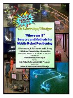
CARMEL, the University of Michigan's first mobile robot, has been in service since 1987. Since then, CARMEL
has served as a reliable testbed for countless sensor systems. In the extra “shelf” underneath the robot is an
8086 XT compatible single-board computer that runs U of M's ultrasonic sensor firing algorithm. Since this code
was written in 1987, the computer has been booting up and running from
floppy disk
. The program was written
in FORTH and was never altered; should anything ever go wrong with the floppy, it will take a computer
historian
to recover the code...
Part I
Sensors for
Mobile Robot Positioning