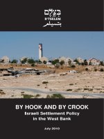
BY HOOK AND BY CROOK - Israeli Settlement Policy in the West Bank potx
Bạn đang xem bản rút gọn của tài liệu. Xem và tải ngay bản đầy đủ của tài liệu tại đây (945.9 KB, 71 trang )
BY HOOK AND BY CROOK
Israeli Settlement Policy
in the West Bank
July 2010
BY HOOK AND BY CROOK
July 2010
B’TSELEM
B’TSELEM - The Israeli Information Center for Human Rights in the Occupied Territories
8 Hata’asiya St., Talpiot P.O. Box 53132 Jerusalem 91531
Tel. (972) 2-6735599
I
Fax. (972) 2-6749111
www.btselem.org
I
By Hook and by Crook
Israeli Settlement Policy in the
West Bank
July 2010
Written and researched by Eyal Hareuveni
Edited by Yael Stein
Translated by Zvi Shulman
English editing by Michelle Bubis
Processing geographical data by Shai Efrati
Cover photo: The Carmel settlement in the southern Hebron hills, with the Beduin village of Khirbet
Umm al-Khir in the foreground, July 2010 (Silan Dalal)
B’Tselem thanks Hagit Ofran, director of Peace Now’s Settlement Watch Team; Dror Etkes, director
of Yesh Din’s Lands Project; Nir Shalev and Alon Cohen-Lifshitz, Area C coordinators of Bimkom-
Planners for Human Rights; and Prof. Oren Yiftachel of the Geography Department at Ben Gurion
University and co-chair of the B’Tselem board of directors.
Table of Contents
Summary 5
Introduction 7
Chapter 1 Data on the settlements 9
Chapter 2 Israeli policy 15
Chapter 3 Mechanisms for taking control of West Bank land and illegal
construction in settlements 21
Chapter 4 Benefits and economic incentives to settlers and settlements 37
Chapter 5 The settlements in international law and violations of Palestinians’
human rights in the West Bank 49
Conclusions 57
Appendix Maps 59
5
Summary
Some half a million Israelis are now living over the Green Line: more than 300,000 in 121
settlements and about one hundred outposts, which control 42 percent of the land area of the
West Bank, and the rest in twelve neighborhoods that Israel established on land it annexed to the
Jerusalem Municipality. The report analyzes the means employed by Israel to gain control of land
for building the settlements. In preparing the report, B’Tselem relied on official state data and
documents, among them Attorney Talia Sasson’s report on the outposts, the database produced
by Brigadier General Baruch Spiegel, reports of the state comptroller, and maps of the Civil
Administration.
The settlement enterprise has been characterized, since its inception, by an instrumental, cynical,
and even criminal approach to international law, local legislation, Israeli military orders, and Israeli
law, which has enabled the continuous pilfering of land from Palestinians in the West Bank.
The principal means Israel used for this purpose was declaration of “state land,” a mechanism that
resulted in the seizure of more than 900,000 dunams of land (sixteen percent of the West Bank), with
most of the declarations being made in 1979-1992. The interpretation that the State Attorney’s Office
gave to the concept “state land” in the Ottoman Land Law contradicted explicit statutory provisions
and judgments of the Mandatory Supreme Court. Without this distorted interpretation, Israel would
not have been able to allocate such extensive areas of land for the settlements.
In addition, the settlements seized control of private Palestinian land. By cross-checking data of the
Civil Administration, the settlements’ jurisdictional area, and aerial photos of the settlements taken
in 2009, B’Tselem found that 21 percent of the built-up area of the settlements is land that Israel
recognizes as private property, owned by Palestinians.
To encourage Israelis to move to the settlements, Israel created a mechanism for providing benefits
and incentives to settlements and settlers, regardless of their economic condition, which often was
financially secure. Most of the settlements in the West Bank hold the status of National Priority Area
A, which entitles them to a number of benefits: in housing, by enabling settlers to purchase quality,
inexpensive apartments, with an automatic grant of a subsidized mortgage; wide-ranging benefits
in education, such as free education from age three, extended school days, free transportation to
schools, and higher teachers’ salaries; for industry and agriculture, by grants and subsidies, and
indemnification for the taxes imposed on their produce by the European Union; in taxation, by
imposing taxes significantly lower than in communities inside the Green Line, and by providing larger
balancing grants to the settlements, to aid in covering deficits.
Establishment of the settlements violates international humanitarian law. Israel has ignored the
relevant rules of law, adopting its own interpretation, which is not accepted by almost all leading
jurists around the world and by the international community.
The settlement enterprise has caused continuing, cumulative infringement of the Palestinians’ human
rights, as follows:
• the right of property, by seizing control of extensive stretches of West Bank land in favor
of the settlements;
• the right to equality and due process, by establishing separate legal systems, in which the
person’s rights are based on his national origin, the settlers being subject to Israel’s legal
system, which is based on human rights and democratic values, while the Palestinians
are subject to the military legal system, which systematically deprives them of their
rights;
6
By Hook and by Crook - Israeli Settlement Policy in the West Bank
• the right to an adequate standard of living, since the settlements were intentionally
established in a way that prevents urban development of Palestinian communities,
and Israel’s control of the water sources prevents the development of Palestinian
agriculture;
• the right to freedom of movement, by means of the checkpoints and other obstructions
on Palestinian movement in the West Bank, which are intended to protect the settlements
and the settler’s traffic arteries;
• the right to self-determination, by severing Palestinian territorial contiguity and creating
dozens of enclaves that prevent the establishment of an independent and viable
Palestinian state.
The cloak of legality that Israel has sought to give to the settlement enterprise is aimed at covering
the ongoing theft of West Bank land, thereby removing the basic values of legality and justice
from Israel’s system of law enforcement in the West Bank. The report exposes the system Israel
has adopted as a tool to advance political objectives, enabling the systematic infringement of the
Palestinians’ human rights.
The extensive geographic-spatial changes that Israel has made in the landscape of the West Bank
undermine the negotiations that Israel has conducted for eighteen years with the Palestinians and
breach its international obligations. The settlement enterprise, being based on discrimination against
the Palestinians living in the West Bank, also weakens the pillars of the State of Israel as a democratic
country and diminishes its status among the nations of the world.
7
Introduction
This report examines the establishment of settlements in the West Bank, which has been one of Israel’s
main national enterprises for the past 43 years. As of May 2010, there are over 200 settlements
– some official, some unauthorized, and some neighborhoods on land annexed to the Jerusalem
Municipality’s area of jurisdiction. The settlements, constructed in blatant breach of international
humanitarian law, lead to the ongoing violation of many human rights of the Palestinian residents of
the area, including the right to property, the right to equality, the right to an adequate standard of
living, the right to freedom of movement, and the right to self-determination.
This report updates B’Tselem’s report of May 2002, Land Grab: Israel’s Settlement Policy in the
West Bank, demonstrating again that Israel’s arguments intended to justify the building of these
settlements are misleading and baseless.
Chapter One of this report presents statistical data regarding the settlements. Chapter Two surveys
Israel’s settlement policy in recent years, reviewing the commitments made by Israeli governments.
Chapter Three examines the mechanisms used by Israeli bodies, both governmental and unofficial,
to gain control of West Bank land. This information is based on Israeli governmental sources such
as the Report on Unauthorized Outposts, by Attorney Talia Sasson (hereafter the “Sasson Report”),
the database on settlements compiled by Brig. Gen. (res.) Baruch Spiegel, and reports of the state
comptroller. Chapter Four describes the sophisticated governmental apparatus that encourages Israelis
to live in settlements by offering benefits and economic incentives not available to other citizens.
Finally, Chapter Five discusses the illegality of the settlements and the violation of the human rights
of Palestinians resulting from their establishment, continuing existence, and expansion.
A draft of this report was sent to the Ministry of Justice for its response. Attorney Hila Tene-Gilad,
who is responsible for human rights and liaison with international organizations in the Department for
International Agreements and International Litigation and the Human Rights and Foreign Relations
Division in the Ministry of Justice, informed B’Tselem that the state will not respond to the report “in
light of its political nature.”
1
1. E-mail correspondence of 17 May 2010 from Attorney Hila Tene-Gilad to B’Tselem.
9
Chapter One
Data on the settlements
Between 1967 and May 2010, 121 official Israeli settlements were built in the West Bank. Another
approximately 100 outposts were built – settlements established without official authorization, but with
the support and assistance of government ministries. These figures do not include four settlements in
the northern West Bank that Israel evacuated as part of the “Disengagement Plan” in 2005.
In addition, Israel established 12 neighborhoods on land annexed to the Jerusalem Municipality after
1967; under international law, these are considered settlements. The government also supported and
assisted the establishment of several enclaves of settlers in the heart of Palestinian neighborhoods
in the eastern part of Jerusalem – among them the Muslim Quarter of the Old City, Silwan, Sheikh
Jarrah, Mount of Olives, Ras al-‘Amud, Abu Dis, and Jabel Mukabber.
According to the latest figures, half a million persons live in the West Bank settlements and in the
Israeli neighborhoods established in East Jerusalem.
A. Population of the settlements
Table 1: Settlements and settlers in the West Bank
(not including East Jerusalem)
2
Year
Number of
settlements
Population
Annual
population
growth
(by percentage)
1967 1
No figures available
-
1968 3 NFA -
1969 8 NFA -
1970 10 NFA -
1971 12 NFA -
1972 14 NFA -
1973 14 NFA -
1974 14 NFA -
1975 19 NFA -
1976 20 3,200 -
1977 31 4,400 37.5
1978 39 7,400 68.1
1979 43 10,000 35.1
1980 53 12,500 25.0
1981 68 16,200 29.6
1982 73 21,000 8.6
1983 76 22,800 8.6
1984 102 35,300 25.2
1985 105 44,200 15.6
1986 110 51,100 13.3
1987 110 57,900 13.3
1988 110 63,600 9.8
2. These figures relate to settlements recognized by the Ministry of the Interior and do not include outposts.
10
By Hook and by Crook - Israeli Settlement Policy in the West Bank
Year
Number of
settlements
Population
Annual
population
growth
(by percentage)
1989 115 69,800 9.7
1990 118 78,600 12.6
1991 119 90,300 14.9
1992 120 100,500 11.3
1993 120 110,900 10.3
1994 120 122,700 10.6
1995 120 127,900 9.4
1996 121 139,974 8.8
1997 122 152,277 8.2
1998 123 164,800 7.6
1999 123 177,327 7.3
2000 123 190,206 7.2
2001 123 200,297 5.3
2002 123 211,416 5.5
2003 123 223,954 5.9
2004 123 235,263 5.0
2005 121 247,514 5.2
2006 121 261,879 5.8
2007 121 276,462 5.5
2008 121 290,400 5.0
2009
3
121 301,200 3.7
Source: Central Bureau of Statistics, Israel Statistical Yearbook (various years). For the years 1967-1981, see Meron
Benvenisti and Shlomo Khayat, The West Bank and Gaza Atlas (Jerusalem: West Bank Data Project, The Jerusalem Post,
1987), pp. 138-40.
3
Table 2: Settlers in East Jerusalem
4
5
Year Number of
residents
Annual growth
(by percentage)
1989 118,100 No figures
available
1990 127,500 7.9
1991 132,200 3.6
1992 141,000 6.6
1993 146,800 4.1
1994 152,700 4.0
1995 157,300 3.0
1996 160,400 1.9
1997 156,412 -2.5
0
3. Provisional figures of the CBS, as of 30 September 2009. See
(accessed 16 June 2010) and Haim Levinson, “Civil Administration Report: Rate of Population Growth in 66% of Settlements
Higher than in Israel,” Ha’aretz, 2 February 2010.
4. Jerusalem Institute for Israel Studies, Statistical Yearbooks.
5. Regarding 2001, the Jerusalem Institute for Israel Studies does not have population data based on a division into statistical
areas; accordingly, it is not possible to provide a precise calculation of the population of settlers in East Jerusalem for this year.
Year Number of
residents
Annual growth
(by percentage)
1998 160,862 2.8
1999 165,076 2.6
2000 167,230 1.3
2001 NFA
5
–
2002 171,859 –
2003 173,034 0.7
2004 176,566 2.0
2005 178,973 1.4
2006 181,823 1.6
2007 184,707 1.6
11
B. Land area of the settlements
In this report, the calculation of the total land area of the settlements is based on official state
maps prepared by the Civil Administration, dating December 2006. According to these maps, the
total area of the West Bank, including the areas annexed to the jurisdictional area of the Jerusalem
Municipality, is 5,602,951 dunam (one dunam is equivalent to 1,000 square meters, 0.1 hectares, or
0.247 acres).
6
The total built-up area of settlements was calculated using one of two measurements:
the boundaries of the built-up areas in each settlement, including parts within these areas that have
not been built up, or a sum total of the built-up areas in settlements where these areas are separate
from each other. The boundaries of the built-up areas were calculated by superimposing aerial photos
of settlements and outposts, taken in 2009, on the Civil Administration maps.
7
Table 3: Area of the settlements as a proportion of the area of the West Bank
8910
Total area
controlled
by the
settlements
10
Total areas
of regional
councils
9
Total municipal
jurisdictional
areas in
settlements
8
Total built-
up areas in
settlements
42.833.59.280.99
Percentage of
West Bank area
(2009)
2,399,8241,879,774520,05055,479
Area in dunams
(2009)
To illustrate the expansion of the settlements, we examined the three largest settlements in the
West Bank (excluding East Jerusalem) – Modi’in Illit, Betar Illit, and Ma’ale Adummim. The built-
up areas of all three settlements expanded significantly from 2001 to 2009, and their population
rose substantially. The built-up area of Modi’in Illit expanded by 78 percent, from 1,287 to 2,290
dunam; the built-up area of Betar Illit rose by 55 percent, from 1,270 to 1,975 dunam; and in Ma’ale
Adummim, the built-up area increased by 34 percent, from 2,500 to 3,342 dunam (see appended
maps).
The population growth in these three settlements was greater than the annual growth of the settler
population as a whole. From 2004, when Israel undertook to freeze settlement construction in the
framework of the Road Map, to the end of September 2009, the population of Modi’in Illit rose by
6. Among the maps, which were provided to Peace Now by order of the District Court in Jerusalem, is a digital map showing
the private Palestinian land in Area C. Peace Now has also obtained maps that the Civil Administration made in 2004, marking
“state land” and survey land. See the decision of the Jerusalem District Court in session as an Administrative Law Court, Admin
Pet 00135/6, Peace Now and The Movement for Freedom of Information v. Civil Administration in Judea and Samaria, 9 January
2007. See also Dror Etkes, “Petition for Freedom of Information,” on Peace Now’s website, available at cenow.
org.il/site/en/peace.asp?pi=370&docid=1662 (accessed 16 June 2010). These maps are more precise than the ones B’Tselem
previously had and are drawn to a relatively large scale (1:10,000).
7. A different method was used in the 2002 report Land Grab, in which calculations were based on a map drawn by the US
State Department in medium scale (1:150,000), making the area of the West Bank and East Jerusalem slightly larger –
5,608,000 dunam. The boundaries of the built-up areas were calculated according to the developed area in each settlement,
and included land that was used for any development, other than open agricultural areas, and approved building plans that
had not yet been implemented, to the extent that B’Tselem was aware of such plans. Since the publication of Land Grab,
B’Tselem found that the construction plans in the settlements – whether approved or in preparation – will double the number of
structures in the settlements. Thus, the inclusion of areas where nothing had actually been built artificially raised the figures for
the total built-up area in the settlements. In addition, in Land Grab, the boundaries of the municipal jurisdictional areas in some
settlements were based on the settlements’ outline plans, which might not have defined the entire municipal area available
to each settlement. The calculation methods used in the current report are more accurate and based on GIS (a geographical
information system).
8. According to the OC Command’s orders, the municipal jurisdictional areas of the settlements in the West Bank do not include
lands within the jurisdictional areas of the regional councils. Source: Civil Administration geographical information layer.
9. Areas not under the jurisdiction of the settlements, but included in the jurisdictional areas of the regional councils.
10. Many settlements exceed their jurisdictional area as set in the OC Command’s orders, so the actual area under control of
the settlements is even greater than these figures.
12
By Hook and by Crook - Israeli Settlement Policy in the West Bank
64 percent, from 27,386 to 44,900 residents; of Betar Illit, by 46 percent, from 24,895 to 36,400
residents; and in Ma’ale Adummim, by 20 percent, from 28,923 to 34,600 residents.
11
C. Spatial layout of the settlements
In the West Bank, there are now more than 200 settlements that are connected to one another, and
to Israel, by an elaborate network of roads. This network cuts across the areas that were handed
over to Palestinian control, creating territorial islands of Areas A, which are under full Palestinian
control, and Areas B, whose civil affairs are under Palestinian control.
The settlements were established along three strips running north to south, and around the Jerusalem
metropolitan area.
The Eastern Strip includes the Jordan Valley, the shores of the Dead Sea up to the Green Line, and the
eastern slopes of the mountain ridge that splits the West Bank lengthwise. The first settlements, built
in the late 1960s, were established in this strip, which includes the largest land reserves in the West
Bank. The jurisdictional areas of the regional councils Arvot Hayarden, Biq’at Hayarden, and Megilot
in the northern Dead Sea area, are contiguous; together, their boundaries match the boundaries of
the strip. The water resources in this strip have enabled the settlements there to develop agriculture
that requires intensive irrigation.
The Mountain Strip, which is also called the watershed line, spans the peaks of the ridge that cuts
the West Bank lengthwise and adjacent areas. Situated along the strip are the six largest and most
populated Palestinian towns in the West Bank – Jenin, Nablus, Ramallah, East Jerusalem, Bethlehem,
and Hebron. One chain of settlements in the strip is spread out along Route 60, which is the main
north-south traffic artery in the West Bank. These were built to ensure Israeli control of this traffic
artery and to prevent Palestinian construction that would create contiguous Palestinian built-up areas
on both sides of the road. Most of the road is in Area C, which is under complete Israeli control. A
second chain of settlements was built east of Route 60, along Route 458 (the “Allon Road”).
The Western Hills Strip includes the area west of the mountain ridge through to the Green Line. The
width of this strip varies from 10 to 20 kilometers, and the settlements in it run east to west alongside
the latitudinal roads that connect to Route 60. The boundaries of these settlements lie close to one
another, creating contiguous, or almost contiguous, urban expanses. Many of these settlements lie
west of the Separation Barrier route.
Metropolitan Jerusalem forms part of the Mountain Strip in geographical terms, but the settlements
there are linked to Jerusalem. They include the neighborhoods established in the areas annexed to
the Jerusalem Municipality, which are considered settlements under international law, as well as the
settlement blocs in the “Greater Jerusalem” area – Giv’at Ze’ev, Givon, Givon Hahadasha, and Bet
Horon in the northwest; Kochav Ya’akov, Tel Zion, Geva Binyamin, and the Sha’ar Binyamin industrial
area in the northeast; Ma’ale Adummim in the east; and Betar Illit and the Gush Etzion settlements
in the south.
12
11. In 2009, the estimated annual population growth of Modi’in Illit was 9.5 percent, of Betar Illit 6.2 percent, and of Ma’ale
Adumim 3.1 percent. Table 3, “Population of communities with more than 2,000 residents and other rural populations on 30
September 2009”, Central Bureau of Statistics, available at (accessed 16
June 2010).
12. For a more extensive discussion, see Land Grab, Chapter Seven.
13
D. Outposts
Outposts are settlements built without government approval but with the support of various government
ministries, the army, and the Civil Administration.
13
The establishment of outposts began in 1996,
following the government decision that the establishment of new settlements requires the approval
of the entire government. This decision also empowered the minister of defense to approve or freeze
any stage of procedures to allocate land to a settlement and any stage of procedures to approve
building plans in settlements.
14
The outposts were established on land that the government had not
allocated for them, and some were also built on private Palestinian land. They were built without
approved building plans and without the regional military commander having set their jurisdictional
borders.
15
Despite these continuing violations of the law and repeated promises to evacuate them,
as yet, the government has refrained from evacuating almost all the outposts, and has dismantled
none of the large ones.
According to Peace Now, as of June 2009, approximately 100 outposts exist in the West Bank. Half of
these were built after February 2001, when Ariel Sharon took office as prime minister. The outposts
control some 16,000 dunams of land, of which 7,000 are private, Palestinian-owned land. Peace Now
estimates that the population of the outposts in 2009 was 3,371.
16
13. State Comptroller, Report 54B, pp. 362-7 (5 May 2004).
14. Government Resolution No. 150, 2 August 1996. See Talia Sasson, Interim Report on the Subject of Unauthorized Outposts
(hereafter “Sasson Report,”) pp. 64-6. The report, which was submitted to the Sharon government in March 2005, is available
in Hebrew, at (accessed 16
June 2010).
15. Sasson Report, pp. 19-23. See footnote 14.
16. Hagit Ofran, “Outposts – Some Order in the Mess,” June 2009. Available on Peace Now’s website, in Hebrew, at http://
peacenow.org.il/site/he/peace.asp?pi=62&docid=3682 (accessed 16 June 2010).
15
Chapter Two
Israeli policy
“Israel will meet all its obligations with regard to construction in the settlements.
There will be no construction beyond the existing construction line,
no expropriation of land for construction, no special economic incentives, and no
construction of new settlements.”
Prime Minister Ariel Sharon, 18 December 2003
17
In September 1967, just three months after Israel occupied the West Bank, the government
established the first settlement there – Kfar Etzion. In the following decade, the Labor Alignment
governments promoted the Allon Plan, which recommended annexation to Israel of areas in the West
Bank that were not densely populated with Palestinians, such as the Jordan Valley, areas around
Jerusalem, Gush Etzion, most of the Judean Desert, and a strip of land in the southern Hebron hills.
In this framework, almost 30 settlements were established throughout the West Bank. The Likud,
voted into office in 1977, established dozens more settlements in crowded Palestinian areas, such
as the Mountain Strip and the Western Hills Strip close to the Green Line. The Rabin government,
which took power in 1992, undertook not to establish new settlements, except in the Jordan Valley
and the “greater Jerusalem area.”
18
It did, however, expand existing settlements in the framework of
what was termed “the natural growth of the settler population,” a term that has never been precisely
defined.
19
Since 1993, when the Oslo process began, the settler population in the West Bank, not
counting those living in East Jerusalem, has almost tripled, rising from 110,900 to 301,200. The
entire settler population, including those in East Jerusalem, has grown from 241,000 to more than
half a million persons.
Since 2003, Israeli governments have several times undertaken to freeze construction in the
settlements and not expand them. All the governments, including the present one, have breached
these undertakings.
The Road Map
On 25 May 2003, the government endorsed Prime Minister Sharon’s announcement that Israel
accepted US President George W. Bush’s plan, defined as “a performance-based roadmap to a
permanent two-state solution to the Israeli-Palestinian conflict” (hereafter “the Road Map”). The plan
proposed a gradual process to take place over the course of several years, monitored and aided by
the Quartet – the United States, the European Union, Russia, and the United Nations.
20
The Road Map
was also adopted later that year by the UN Security Council.
21
For the first time, the Road Map included an Israeli commitment to freeze settlement activity. In the
words of this document, “Consistent with the Mitchell Report, GOI [Government of Israel] freezes
17. From the prime minister’s speech at the Herzliya Conference, available at />Speeches/2003/12/Speeches7635.htm (accessed 16 June 2010).
18. Section B of Government Resolution No. 360, dated 22 November 1992, which states: “To approve cessation of construction
in Israeli communities in Judea and Samaria and the Gaza Strip, carried out pursuant to previous government decisions found
in the government’s secretariat.” Cf. Sasson Report, pp. 62-3, see footnote 14.
19. Land Grab, pp. 11-17.
20. The text of the Road Map is available at (accessed 16 June
2010).
21. UN Security Council Resolution 1515 (2003), 19 November 2003.
16
By Hook and by Crook - Israeli Settlement Policy in the West Bank
all settlement activity (including natural growth of settlements).”
22
In addition, Israel undertook to
dismantle all the outposts built after March 2001, a month after Sharon became prime minister. The
government attached 14 reservations to its approval, none of which objected to the obligation to
freeze the construction of settlements. The ninth reservation, which deals with the question of the
permanent agreement, expressly states that “there will be no involvement with issues pertaining
to the final settlement. Among issues not to be discussed: settlement in Judea, Samaria, and Gaza
(excluding a settlement freeze and illegal outposts)…”
23
The government reiterated its commitment to the Road Map on several occasions. For example, its
decision regarding the Sasson Report states that Israel “will meet its commitment” under the Road
Map to dismantle the outposts established since March 2001.
24
Also, at the Annapolis conference
held in November 2007 in which Israel, the Palestinian Authority, the Quartet, and representatives of
Arab League countries took part, Israeli prime minister Ehud Olmert repeated Israel’s commitment
to the plan.
25
The understandings between Israel and the Bush Administration
Despite the government’s explicit commitments to freeze all settlement activity and evacuate
the post-March 2001 outposts, the Sharon government reached four unofficial understandings
with the US Administration, as follows: no new settlements will be built; construction will not be
allowed outside “existing construction lines” in the settlements; new land will not be allocated or
expropriated for settlement construction; and economic incentives will not be provided to settlers.
These understandings were subsequently restated by Elliott Abrams, deputy national security advisor
in the Bush Administration, and Prime Minister Ehud Olmert.
26
These understandings were not formally published or publicly approved by the Bush Administration
while it was in office. According to a letter from President Bush to Prime Minister Sharon, they
were based on the Administration’s belief that, since Israel’s complete withdrawal to the Green Line
would be “unrealistic” in light of the great number of settlers in the West Bank, it should be allowed
to discuss retaining “Israeli population centers” there within the framework of a “realistic” peace
agreement.
27
Dan Kurtzer, former US ambassador to Israel, published several articles describing how
Israel breached these understandings and construed them broadly to enable continued building in
the settlements. For example, Israel avoided a clear definition of “existing construction lines” in the
settlements, despite promises made by Dov Weisglass, Director General of the Prime Minister’s Office,
to Condoleezza Rice, U.S. Secretary of State. Kurtzer added that one of the key provisions of Bush’s
letter was that U.S. support for Israel’s retaining some settlements was predicated on there being
an “agreed outcome” of negotiations with the Palestinians, and that the Bush Administration did not
recognize Israel’s interpretation that it was allowed to continue building in the settlement blocs of Ariel,
22. The Mitchell Report, submitted on 4 May 2001, concluded the work of the international investigation committee headed
by former US senator George Mitchell to investigate the factors that led to the outbreak of the second intifada. The committee
held, inter alia, that “It will be difficult to prevent a recurrence of Israeli-Palestinian violence unless the Government of Israel
halts all construction in the settlements.” The report is available at />Report%20of%20the%20Sharm%20el-Sheikh%20Fact-Finding%20Committ (accessed 16 June 2010).
23. The full text of Israel’s reservations to the Road Map is available at />response_eng.htm (accessed 16 June 2010).
24. Section 7 of Government Resolution No. 3376, dated 13 March 2005, regarding the Sasson Report, available in Hebrew at
(accessed 16 June 2010).
25. The text of the announcement is available on the White House website at />news/releases/2007/11/20071127.html (accessed 16 June 2010).
26. See Prime Minister Olmert’s speech at the Herzliya Conference, 19 December 2003, available at />PMO/Archive/Speeches/2003/12/Speeches8996.htm. See also Ehud Olmert, “How to Achieve a Lasting Peace: Stop Focusing
on the Settlements,” The Washington Post, 17 July 2009; Elliott Abrams, “Hillary Is Wrong about the Settlements: The U.S. and
Israel Reached a Clear Understanding about Natural Growth,” The Wall Street Journal, 26 June 2009.
27. Letter of 14 April 2004 from President Bush to Prime Minister Sharon, as it appears on the Knesset’s website, available at
(accessed 16 June 2010). See also Abrams, ibid.
17
Ma’ale Adummim, and Gush Etzion. Israel also did not provide the U.S. Administration with a list of
outposts or a timetable for their evacuation, despite its commitment to do so. Kurtzer concluded one
of his articles by repeating the position of every U.S. Administration since 1967: “…that settlements
jeopardize the possibility of achieving peace and thus settlement activity should stop.”
28
The Netanyahu government’s freeze policy
In a speech given in June 2009 at Bar-Ilan University, Prime Minister Binyamin Netanyahu announced,
“we have no intention of building new settlements or of expropriating additional land for existing
settlements.” He also declared that “Jerusalem must remain the united capital of Israel.” He did
not address the outpost issue.
29
Six months later, on 25 November 2009, the political-security
cabinet decided to temporarily freeze all public and private construction in the settlements for ten
months. Following this decision, OC Central Command issued an order freezing construction in all the
settlements, except for buildings for which permits had already been issued and whose foundations
had been laid.
30
Although the wording of the decision was sweeping, Ha’aretz reported that it was
not intended to apply to East Jerusalem, to 2,500 apartments already under construction, and to 455
other apartments whose marketing had been approved by the defense minister prior to the decision
of 25 November.
31
Breach of Israel’s commitments
Despite the commitments cited above, Israel has continued over the years to build in existing
settlements, to plan and establish new ones, to expropriate land for settlements, and to grant
exceptional incentives to Israeli citizens to move to settlements. Moreover, Israel has evacuated
almost none of the outposts it promised to dismantle as part of the Road Map.
Israel was supposed to begin implementing its Road Map obligations in May 2003. However, extensive
construction in settlements continued, as did the generous incentives Israel offers settlers. As a
result, from 2004 to the end of 2009, the settler population (not including those in East Jerusalem)
grew by 28 percent, from 235,263 to 301,200 persons. In 2008, the annual growth of the settler
population was three times greater than that of the population inside Israel – 5 percent as opposed to
1.8 percent, respectively. In the ultra-Orthodox settlements of Betar Illit and Modi’in Illit, the figures
for 2009 were even higher.
32
The net migration rate to settlements in the West Bank is higher than
the migration rate to every district inside Israel. In 2006, the figure stood at 20.1 percent, more
than twice the rate in the Central District communities, while other districts in Israel had a negative
migration rate.
33
28. Daniel Kurtzer, ‘The Settlements Facts,” The Washington Post, 14 June 2009, available at />wp-dyn/content/article/2009/06/12/AR2009061203498.html; Daniel Kurtzer, “Behind The Settlements,” The American Interest
Online, March-April 2010, available at (both accessed on 16 June
2010).
29. The speech, given at the Begin-Sadat Center at Bar-Ilan University on 14 June 2009, is available at .
gov.il/MFA/Government/Speeches+by+Israeli+leaders/2009/Address_PM_Netanyahu_Bar-Ilan_University_14-Jun-2009.htm
(accessed 16 June 2010).
30. Announcement of the spokesperson of the Prime Minister’s Office, “Temporary Suspension of Residential Construction and
Building Starts in Judea and Samaria,” 25 November 2009.
31. Ministerial Committee on National Security Affairs (the Political-Security Cabinet), Decision No. B/22, of 25 November 2009,
on suspending building permits in Judea and Samaria, available in Hebrew at />htm (accessed 16 June 2010). See also Amos Harel, “The Settlement Freeze: Pleasing Nobody,” Ha’aretz, 8 September 2009,
available at (accessed 1 July 2010).
32. Prof. Dan Suan and Dr. Vered Ne’eman-Haviv (eds.), Judea and Samaria Statistical Yearbook for 2007 (Ariel: Ariel
University Center of Samaria and the Samaria & Jordan Valley Regional R&D Center, 2008), p. 1; Central Bureau of Statistics,
CBS press release of 18 September 2009. See also Haim Levinson, “Civil Administration Report: Population Growth Rate in 66%
of Settlements Higher than in Israel,” Ha’aretz, 2 February 2010.
33. Suan and Ne’eman-Haviv, “Table 1.13 – Internal Migration between Communities by District, 2006,” p. 24.
18
By Hook and by Crook - Israeli Settlement Policy in the West Bank
In addition to expanding existing settlements, Israel has continued to build new ones. In late 2003, for
example, extensive infrastructure was built and land was prepared for the construction of residential
neighborhoods in E-1, an area located north of Ma’ale Adummim and separate from it. This was carried
out as part of the road works undertaken to create access to the Judea and Samaria Police headquarters
in the area, despite the fact that no permits were issued for the construction.
34
In addition, Defense
Minister Ehud Barak approved turning the Maskiyot pre-military religious preparatory program in the
Jordan Valley into a new settlement, and construction of a new neighborhood there has begun. Barak
also approved proceeding with plans to change Sensena, which is currently considered part of the
Eshkolot settlement in the southern Hebron hills, into an independent settlement.
35
Israel also continues to plan settlement expansion. According to an analysis by Bimkom based on the
database compiled by Brig. Gen. (res.) Baruch Spiegel,
36
the potential for construction in settlements
under existing plans amounts to more than 50,000 apartments – twice the current number of
apartments there.
37
One plan is to expand the Geva’ot settlement, in the Etzion Bloc, ostensibly a
neighborhood of the Alon Shvut settlement even though it is physically separated from it, where
12 families currently live. The intention is to turn it into an independent settlement, containing 500
apartments in the first stage and subsequently 5,000 apartments.
38
The Civil Administration continues to declare land in the West Bank as “state land” (see Chapter Three).
Between 2003 and 2009, it declared 5,114 dunam in Area C to be government property.
39
In 2009, in
notices published in the Palestinian newspaper Al-Quds, the state announced its intention to declare
some 138,000 dunam as “state land”, including stretches of land exposed due to the evaporation of
the Dead Sea. This land comprises almost 2.5 percent of the West Bank.
40
The same year, the state
informed Israel’s High Court of Justice that it intended to expropriate private Palestinian land in order
to enable the completion of a wastewater treatment plant for the Ofra settlement. Previous stages of
construction of the plant had been carried out without the requisite permits.
41
The government has seldom enforced its decisions regarding settlements. In April 2010, the State
Attorney’s Office informed the High Court of Justice that, since the freeze had started five months
34. HCJ 2705/06, Al-Eizariya Local Council et al. v. Civil Administration Supreme Planning Committee, Petition from 20 March
2006; Amos Harel, “Israel Plans to Build Up West Bank Corridor on Contested Land”, Ha’aretz, 1 January 2009, available at
(accessed 7 July
2010). See also the presentation by Shaul Arieli, available at />Power-Point%20Show/The_story_of%20the_Ma%E2%80%99ale_Adumim_area_comp.pps (accessed 16 June 2010).
35. “Defense Ministry Unfreezes Construction in Maskiyot,” Ha’aretz, 24 July 2008; Nir Shalev and Alon Cohen-Lifshitz, “Detailed
Objection to Detailed Outline Plan 505/1 – Sensena,” Bimkom, 17 March 2009. See also Akiva Eldar, “Border Control – Nothing
Natural About It,” Ha’aretz, 2 June 2009 available at />natural-about-it-1.277137 (accessed 1 July 2010).
36. Brigadier General (res.) Baruch Spiegel was appointed by the Defense Ministry to create a database regarding the
settlements. This database, compiled over a period of two and a half years, is updated to 2006 and was published on the
Ha’aretz website. See Uri Blau, “Secret Israeli Database Reveals Full Extent of Illegal Settlement,” Ha’aretz, 31 January 2009.
37. E-mail from Architect Alon Cohen-Lifshitz of Bimkom, 23 June 2009. According to the Center for Political Economics, there
are 32,711 apartments and 22,997 private houses in the settlements. See, A Comparative Analysis of the Israeli Construction in
the West Bank Settlements between 2004 and 2008, Final Report (Tel Aviv: The Center for Political Economics), January 2010.
38. Minutes of meeting no. 1/08 of the Supreme Planning Committee’s Subcommittee for Environmental Issues, 18
June 2008. See also “Settlement Expansion Plans” on B’Tselem’s website, available at />settlements/20090227_settlement_expansion.asp.
39. Letter of 27 July 2009 from the public requests monitoring officer in the Civil Administration, Second Lt. Inbal Lidan, to Nir
Shalev, of Bimkom.
40. Twelve notices of the Land Registration Office in Ma’ale Adumim, Al-Quds, 26 July 2009. See also Hagit Ofran, “Registration
of 138,600 Dunam near the Dead Sea as State Land – July 2009,” Peace Now website, July 2009, available at http://www.
peacenow.org.il/site/en/peace.asp?pi=61&fld=495&pos=1&docid=4497.
41. HCJ 4457/09, Muhammad Ahmad Yassin Mana’ et al. v. Minister of Defense et al. See also Akiva Eldar, “The State: We May
Expropriate Palestinian Land for the Ofra Settlement,” Ha’aretz, 28 December 2009.
19
earlier, 423 files had been opened on illegal construction in settlements.
42
The current government
has also refrained from staffing the ministerial committee that was supposed to implement the
conclusions of the 2005 Sasson Report, and is even seeking to authorize some of the outposts
discussed in the report.
43
For example, in the case of the Migron outpost, which was established
in 2002 on private Palestinian land, the state proposed building a new neighborhood in the Geva
Binyamin settlement for the lawbreaking settlers, if they agreed to leave their present location.
44
Recently, the state informed the High Court of its intention to conduct a land survey (see Chapter
Three) to legalize construction in the outposts Derekh Ha’avot, Haresha, and Hayovel, and
to enable the expropriation of additional land, some of which is recognized by Israel as private
Palestinian land.
45
42. Response of Deputy Defense Minister Matan Vilnai to a parliamentary query by Knesset member Haim Oron, 26 January
2010. According to Peace Now, freeze orders were breached in at least 33 settlements. See, “Ministry of Defense Admits: One
Quarter of all Settlements Breached the Settlement Freeze,” February 2010, available on Peace Now’s website at http://www.
peacenow.org.il/site/en/peace.asp?pi=61&docid=4564 (accessed 16 June 2010). See also the supplementary statement of
the defendants in HCJ 8255/08, ‘Ali Muhammad ‘Issa Musa et al. v. Minister of Defense et al., 25 April 2010. According to this
statement, enforcement action led to the seizure of 39 tools “suspected of having been used to commit offenses.”
43. Akiva Eldar, “Netanyahu Did Not Staff Ministerial Committee to Implement Sasson Report,” Ha’aretz, 12 June 2009. See also
Government Resolution No. 3376, 13 March 2005, about the Sasson Report.
44. See the supplemental response affidavit of the state in HCJ 8887/06, Yusef Musa ‘Abd a-Razeq al-Nabut et al. v. Minister of
Defense et al., 28 June 2009.
45. Supplemental statement of the defendants in HCJ 8255/08, see footnote 42; updating affidavit of the defendants in HCJ
9053/05, Peace Now et al. v. Minister of Defense et al., 7 May 2010. See also Talia Sasson, “Making a Mockery of the Law,”
Ha’aretz, 5 May 2010.
21
Chapter Three
Mechanisms for taking control of West Bank land and
illegal construction in settlements
Israeli settlements have been established only after an exhaustive investigation
process, under the supervision of the Supreme Court of Israel, designed to
ensure that no communities are established on private Arab land.
From the Israeli Foreign Ministry’s website, May 2001
46
Israel operates a complex legal and bureaucratic apparatus in the West Bank for seizing control of
hundreds of thousands of dunams of Palestinian land, some privately owned. These are allocated
for establishing new settlements or expanding existing ones. The main methods Israel uses are
requisitioning land for “military needs,” declaring or registering land as “state land,” and expropriating
land for “public needs.” Using these methods, Israel has gained control of approximately half
the West Bank.
47
In addition, settlers have often seized private Palestinian land independently,
with the relevant authorities doing almost nothing to enforce the law and return the land to its
rightful owner.
According to Spiegel’s database, the status of land in at least 67 settlements is not uniform and
is made up of various combinations: land requisitioned by military orders, areas declared “state
land”, survey land, and private Palestinian land.
48
Some private Palestinian lands have become
enclaves within settlements. Some land was taken as a result of negligent implementation of military
requisition orders and demarcation of “state land”, and some was unlawfully seized by settlements
or individual settlers. Since Land Grab was published in 2002, several official reports have addressed
this issue. One is the Sasson Report, which deals with outposts and the political, legal, municipal, and
planning aspects of establishing a settlement.
49
Another is Spiegel’s database, which classifies the
kinds of ownership of land in the settlements and in some of the outposts.
The database documents
the approved and completed construction plans in settlements and records the scope of construction
carried out without a permit, including construction that entailed taking over private Palestinian land
and systematic deviation from the boundaries of the construction plans and the areas allotted to the
settlements.
50
Also, several of the state comptroller’s annual reports have dealt with the issue of
taking control of West Bank land.
In all the official publications, the authors noted that information on the scope of land involved and
the measures used to take control of it is only partially available. In some cases, ministries and
government agencies concealed data from the researchers. In others, no official took the trouble to
gather vital information on these subjects. Often, the information provided by different government
officials was contradictory. Sasson points out, for example, that some of the information she required
“is not out in the open. I cannot say, even after examination and demands, that I had access to all
46. Available at />nal+Law.htm.
47. For a more extensive discussion on this issue, see Land Grab, Ch. 3.
48. The database relates only to land allotted to the settlements in which building plans were prepared or approved, and not to
the municipal or demarcated area of the settlements. Spiegel was appointed by Prime Minister Sharon to create the database,
which took two and a half years to complete. The database was published on Ha’aretz’s website. See Uri Blau, “Secret Israeli
Database”.
49. See footnote 14.
50. See footnote 36.
22
By Hook and by Crook - Israeli Settlement Policy in the West Bank
the necessary information.”
51
The state comptroller concluded that the Civil Administration’s land
registry does not properly reflect land rights in the West Bank.
52
Spiegel was unable to verify the
status of the land in a number of settlements and noted that it was “unclear.” With respect to other
settlements, he stated that there had “apparently” been incursions onto private Palestinian land.
Bimkom and the Association for Civil Rights in Israel had to petition the District Court to obtain
information about “state land” that, for over a year, the Civil Administration refused to provide, even
though it was required to do so by law.
53
Similarly, the Civil Administration provided Peace Now with a
map of private Palestinian land in the West Bank only after the District Court in Jerusalem compelled
it to do so.
54
This chapter relates only to land that Israel took control of and allocated to settlements. The report
does not deal with additional swathes of West Bank land over which Israel gained control by similar
means and used for army bases, firing zones, nature reserves, roads, or construction of the Separation
Barrier, unless these lands were designated for the direct use of settlements.
55
A. Requisition of land for “military needs”
In the first decade of settlement activity, Israel used military requisition orders to take possession
of private Palestinian land, claiming that the settlements served security-military functions. This
contention was made because international humanitarian law permits the occupying country to
appropriate property under private ownership for military purposes, albeit on a temporary basis only.
Appropriation of this kind does not grant property rights, and the occupying country is not permitted
to sell the assets it has appropriated.
56
Settlements, some of which began as Nahal army bases that
were subsequently declared civilian sites, were built on the requisitioned land.
The High Court of Justice supported this policy until the case of the Elon Moreh settlement, in 1979.
In the case, both the settlers and former Chief-of-Staff Haim Bar-Lev presented positions to the
court – each with their own arguments – that challenged the state’s position that establishment of
the settlement was necessary for security purposes.
57
The High Court ordered the seized property to
be returned to its owners. Following the case, the use of military requisition orders increase dropped
sharply, but did not end entirely.
58
Other than the case of Elon Moreh, and despite the explicit ruling of the High Court of Justice, Israel
has not returned land appropriated by military order to its Palestinian owners. According to Spiegel’s
database and a map of land appropriated by the army that the Civil Administration provided to
Yesh Din, military requisition orders were used to seize at least 31,000 dunam for 42 settlements
since 1967. In 11 of these settlements, the land was appropriated after the High Court rendered its
judgment in Elon Moreh, and in 7 settlements, the requisition orders were replaced by declarations
51. Sasson Report, p. 8. See footnote 14.
52. State Comptroller, Report 56A (hereafter State Comptroller Report), 31 August 2005, p. 214.
53. Administrative Petition 40223-03-10, District Court in Jerusalem sitting as the Court for Administrative Matters, Bimkom –
Planners for Planning Rights and the Association for Civil Rights in Israel v. Civil Administration et al., 23 March 2010.
54. See footnote 6.
55. According to the state comptroller, until November 2003, the custodian of government land and abandoned property
allocated 3,480 dunam to the army for bases, checkpoints, and firing zones. State Comptroller Report, p. 193, footnote 52.
According to Peace Now, there are some 890,000 dunam of nature reserves in the West Bank, while national parks encompass
some 14,000 dunam. See Dror Etkes and Hagit Ofran, “Settlements and Outposts on Nature Reserve Land in West Bank –
February 2007,” available at (accessed 16 June
2010).
56. See, inter alia, Article 46 of the Hague Regulations Attached to the Hague Convention on the Laws and Customs of War on
Land of 1907, and article 53 of the Fourth Geneva Convention Relative to the Protection of Civilians in Time of War, of 1949.
57. For an in-depth discussion of this issue, see Idith Zertal and Akiva Eldar, Lords of the Land: The War for Israel’s Settlements
in the Occupied Territories, 1967-2007 (Nation Books, 2007).
58. For an extensive discussion of this issue, see Land Grab, pp. 48-50. See footnote 12.
23
of “state land”. One settlement was evacuated as part of the 2005 “Disengagement Plan”.
59
Spiegel’s
database notes at least three settlements in which the land seized deviated from the area specified in
the military order, “apparently due to an imprecise interpretation of the requisition order.”
60
In none
of these cases is there mention that the land was removed from the settlement’s jurisdiction after
the deviation was discovered.
In settlements where military requisition orders were not replaced by declarations of “state land”
(see below), the orders remain in effect. The state comptroller found in one particular area of the
West Bank, whose name he withheld, that the military orders issued in 1980 to appropriate 4,000
dunams of land were not issued for “critical military needs,” but rather served to replace a legal
investigation prior to declaring most of the property “state land.” Even after this declaration, however,
the military orders were not cancelled. The state comptroller notes that, as a result, Palestinians
were prevented for more than 20 years from working their land in the appropriated areas, enabling
the residents of two settlements to seize the land for their own needs. The state comptroller
concluded that the use of military orders in this case “cannot be reconciled with the law and proper
administrative procedure.”
61
In 2002, Israel again made extensive use of military requisition orders to build the Separation
Barrier, appropriating tens of thousands of dunams of private Palestinian land. Some 85 percent of
the Barrier runs inside the West Bank, leaving 60 settlements between the Barrier and the Green
Line.
62
Substantial portions of the Barrier were routed so that land intended for the expansion of
settlements would be located west of it; in some cases, the expansion plans were not discussed
or approved by the planning authorities.
63
The High Court of Justice accepted the state’s position
that military requisition orders may be used to build the Separation Barrier even though most of
the route runs through the Occupied Territories.
64
In some cases, the Court even agreed with the
state’s position that the route may include land intended for settlement expansion, as in the case of
Giv’at Ze’ev.
65
Israel also used military requisition orders to close off “special security areas” around settlements.
So far, 12 settlements have been encircled by a new fence, one that is distant from the settlement’s
houses and old fence, which in effect annexes land to the settlements. Using this method, Israel
enlarged the area of these settlements by 4,559 dunam, an increase of 240 percent, between 2002
and 2008.
66
59. Spiegel’s database reflected the situation in 2006, and the Civil Administration map was updated to 2007.
60. The settlements are Elazar, Kochav Hashahar, and Mechora.
61. State Comptroller Report, p. 212. See footnote 52.
62. OCHA, Occupied Palestinian Territory, Five Years after the International Court of Justice Advisory Opinion: A Summary of
the Humanitarian Impact of the Barrier, August 2009. See also B’Tselem, Under the Guise of Security: Routing the Separation
Barrier to Enable the Expansion of Israeli Settlements in the West Bank (December 2005).
63. B’Tselem, Under the Guise of Security, pp. 19-81.
64. Section 32 of the court’s decision, of 30 June 2004, in HCJ 2056/04, Beit Surik Village Council et al. v. Government of Israel
et al.
65. Ibid. In section 80 of this ruling, Supreme Court Chief Justice Aharon Barak wrote, “We also accept that ‘The Gazelles’
Basin’ is a part of Giv’at Ze’ev and requires defense just like it.”
66. For detailed discussion of this issue, see B’Tselem, Access Denied: Israeli measures to deny Palestinians access to land
around settlements (September 2008), pp. 34-7.
24
By Hook and by Crook - Israeli Settlement Policy in the West Bank
B. Declaration of “state land”
In November 1979, following the ruling given in Elon Moreh, the Israeli government decided “to
expand settlement in Judea, Samaria, the Jordan Valley, the Gaza Strip, and the Golan Heights by
adding population to the existing communities and establishing additional communities on state-
owned land.”
67
This decision meant that Israel would no longer seize private Palestinian land to
build settlements.
The declaration of “state land”, which is based on the Ottoman Land Law of 1858, became Israel’s
primary mechanism for gaining control of land, both in terms of the frequency of its use and the
amount of land taken. This procedure ensured huge land reserves for the continuing development of
the settlements.
Israel has declared more than 913,000 dunams to be “state land”, which amounts to 16 percent of
the West Bank; most of the declarations were made between 1979 and 1992.
68
This is in addition to
some 600,000 dunams that were considered “state land” during the British Mandate and the period
of the Jordanian government, primarily in the Jordan Valley and Judean Desert. “State land” now
constitutes some 1.5 million dunams, or 26.7 percent of the West Bank.
Most settlements in the heart of built-up Palestinian areas, in the Mountain Strip and in the Western
Hills Strip adjacent to the Green Line, were constructed on this land.
69
B’Tselem’s analysis, which
is based on the Civil Administration’s maps of state land, updated to 2004, and on aerial photos of
the built-up areas of settlements from 2009, indicates that “state land” comprises 75 percent of the
settlements’ municipal area and 66 percent of their built-up area.
On this subject, too, precise and comprehensive data are lacking. According to Spiegel’s database,
“state land” comprises a major component of the land mass of 111 settlements and some 50
outposts. The head of the State Attorney’s Office’s Civil Division, Attorney Plia Albeck, whose opinion
formed the basis for adopting this procedure to gain control of West Bank land, said, “More than
one hundred communities were built on the basis of my opinion.”
70
The Sasson Report states that at
least 26 outposts were built on “state land”, and another 39 on land in which “state land” is a major
component. However, Sasson notes that she did not have a final list of the outposts, in part because
the lists kept by the Defense Ministry and the Civil Administration are imprecise, due to the Civil
Administration’s faulty supervision of illegal construction in the settlements.
71
In 1992, following the Rabin government’s decision to freeze construction in the settlements, the
frequency of declarations of “state land” fell.
72
In 1997, when the first government under Prime Minister
Binyamin Netanyahu took office, Israel renewed the process using the “survey land procedure” (see
below). However, the frequency of declaring “state land” and the amount of land so declared were
low in comparison with the past. From 2003 to 2009, 5,114 dunams of West Bank land were declared
“state land”.
73
67. Government Decision No. 145, 11 November 1979; Sasson Report, pp. 59-61, see footnote 14. This chapter is based on Nir
Shalev, Report on State Lands (in preparation), B’Tselem, 2010.
68. State Comptroller Report, 190. See also the letter of Second Lieutenant Inbal Lidan.
69. Land Grab, pp. 51-8. See footnote 12.
70. Aluf Benn, “Settlements Have Element of Temporariness, Settlers Have No Property Rights in Their Homes,” Ha’aretz, 4 April
2005.
71. Sasson Report, pp. 95-6, 105-10, see footnote 14. Spiegel used data from Peace Now and the US Embassy’s comments on
the list.
72. Government Decision 13, dated 19 July 1992, notes “the implementation of government decisions on establishment of
communities that have not yet been executed shall require re-approval by the government;” and Government Decision 360,
dated 22 November 92, Article B, states, “to approve the halting of construction in Israeli communities in Judea, Samaria and the
Gaza Strip, which was carried out based on resolutions of previous governments ” See Sasson Report, pp. 62-4, footnote 14.
73. State Comptroller Report, p. 206, see footnote 52. The state comptroller notes that, “beginning in 1993, the land
registration of declared state land in Judea and Samaria came to a halt.” Letter from Second Lt. Inbal Lidan, see footnote 39.