Atmospheric Acoustic Remote Sensing - Chapter 1 ppt
Bạn đang xem bản rút gọn của tài liệu. Xem và tải ngay bản đầy đủ của tài liệu tại đây (4.92 MB, 36 trang )
Atmospheric
Acoustic
Remote Sensing
3588.indb 1 11/27/07 4:06:59 PM
© 2008 by Taylor & Francis Group, LLC
Stuart Bradley
CRC Press is an imprint of the
Taylor & Francis Group, an informa business
Boca Raton London New York
3588.indb 3 11/27/07 4:06:59 PM
© 2008 by Taylor & Francis Group, LLC
ATMOSPHERIC
ACOUSTIC
REMOTE SENSING
STUART BRADLEY
CRC Press
Taylor & Francis Group
Boca Raton London New York
CRC Press is an imprint
of
the
Taylor
&
Francis Group,
an
informa business
CRC Press
Taylor & Francis Group
6000 Broken Sound Parkway NW, Suite 300
Boca Raton, FL 33487-2742
© 2008 by Taylor & Francis Group, LLC
CRC Press is an imprint of Taylor & Francis Group, an Informa business
No claim to original U.S. Government works
Printed in the United States of America on acid-free paper
10 9 8 7 6 5 4 3 2 1
International Standard Book Number-13: 978-0-8493-3588-4 (Hardcover)
This book contains information obtained from authentic and highly regarded sources Reason-
able efforts have been made to publish reliable data and information, but the author and publisher
cannot assume responsibility for the validity of all materials or the consequences of their use. The
Authors and Publishers have attempted to trace the copyright holders of all material reproduced
in this publication and apologize to copyright holders if permission to publish in this form has not
been obtained. If any copyright material has not been acknowledged please write and let us know so
we may rectify in any future reprint
Except as permitted under U.S. Copyright Law, no part of this book may be reprinted, reproduced,
transmitted, or utilized in any form by any electronic, mechanical, or other means, now known or
hereafter invented, including photocopying, microfilming, and recording, or in any information
storage or retrieval system, without written permission from the publishers.
For permission to photocopy or use material electronically from this work, please access www.
copyright.com ( or contact the Copyright Clearance Center, Inc. (CCC)
222 Rosewood Drive, Danvers, MA 01923, 978-750-8400. CCC is a not-for-profit organization that
provides licenses and registration for a variety of users. For organizations that have been granted a
photocopy license by the CCC, a separate system of payment has been arranged.
Trademark Notice: Product or corporate names may be trademarks or registered trademarks, and
are used only for identification and explanation without intent to infringe.
Library of Congress Cataloging-in-Publication Data
Bradley, Stuart.
Atmospheric acoustic remote sensing / author, Stuart Bradley.
p. cm.
Includes bibliographical references and index.
ISBN 978-0-8493-3588-4 (hardback : alk. paper)
1. Atmosphere Remote sensing. 2. Echo sounding. I. Title.
QC871.B73 2006
551.5028’4 dc22 2007034585
Visit the Taylor & Francis Web site at
and the CRC Press Web site at
3588.indb 4 11/27/07 4:07:00 PM
© 2008 by Taylor & Francis Group, LLC
v
Contents
Preface xi
Ack nowledgments xi ii
Author xv
Symbol List xvii
Chapter 1 W hat Is Atmospher ic Acoustic Remote Sensi ng? 1
1.1 Direct Measurements and Remote Measurements 1
1.2 How Can Measurements Be Made Remotely? 2
1.3 Passive a nd Active Remote Sensing 3
1.4 Some History 3
1.5 Why Us e Acoustics? 4
1.6 Direct Sound Propagation from a Source to a Receiver 4
1.7 Acoustic Targets 5
1.8 Creating Our Own Target 5
1.9 Modern Acoustic Remote Sensing 6
1.10 Applications 7
1.11 W here to f rom Here? 8
References 9
Chapter 2 The Atmosphere Near the Ground 11
2.1 Temperatu re Proles nea r the Surface 11
2.2 Wind Proles near the Surface 13
2.3 Richardson Number 16
2.4 The Prandtl Number 17
2.5 The Structure of Turbulence 18
2.6 Monin-Oboukhov Length 20
2.7 Simi la rity Relationships 20
2.8 Proles of C
T
2
and C
V
2
22
2.9 Probability Distribution of Wind Spee ds 23
2.10 Summary 23
References 25
Chapter 3 Sound in the Atmosphere 27
3.1 Basics of Sound Waves 27
3.2 Frequency Spe ctra 30
3.3 Background and System Noise 32
3.4 Reect ion and Refraction 34
3.5 Dif fr action 36
3.6 Doppler Shif t 37
3588.indb 5 11/27/07 4:07:09 PM
© 2008 by Taylor & Francis Group, LLC
vi Atmospheric Acoustic Remote Sensing
3.7 Scattering 39
3.7.1 Scattering from Turbulence 39
3.7.2 Intensity in Term s of Str uct ure Fu nction Pa ramet ers 43
3.7.3 Scattering from Rain 44
3.8 Attenuation 47
3.8.1 Losses Due to Spherical Spreading 47
3.8.2 Losses Due to Absorpt ion 47
3.8.3 Losses Due t o Scattering out of the Beam 48
3.9 Sound Propagation Hor izont al ly 51
3.10 Summary 52
References 53
Chapter 4 Sound Transmission and Reception 55
4.1 Geometric Objective of SODAR Design 55
4.2 Speakers, Horns, and Antennas 56
4.2.1 Speaker Polar Response 56
4.2.2 Dish A nten nas 57
4.2.3 Phased Array Antennas 61
4.2.4 Anten na Shading 66
4.2.5 Receive Phasing 69
4.2.6 Reectors 70
4.3 Monostatic and Bistatic SODAR Systems 71
4.4 Doppler Shift from Monostatic and Bistatic SODARs 73
4.5 Beam Width Effects on Doppler Shift 82
4.6 Continuous and Pulsed Systems 83
4.7 Geometr y of Scatter ing 89
4.8 The Acoustic Radar Equation 90
4.9 Acoustic Bafes 91
4.10 Frequency-Dependent Form of the Acoustic Radar Equation 96
4.11 Obtaining Wind Vectors 97
4.12 Multiple Frequencies 10 0
4.13 Pulse Coding Methods 100
4.14 Summary 103
References 103
Chapter 5 SODAR Systems and Signal Quality 105
5.1 Tra nsducer and A nt enna Combinations 105
5.1.1 Speakers and Microphones 105
5.1.2 Hor ns 108
5.1.3 Phased-Array Frequency Range 109
5.1.4 Dish Design 110
5.1.5 Designing for Absorption and Background Noise 111
5.1.6 Rejecting Rain Clutter 112
5.1.7 How Much Power Should Be Transmitted? 114
3588.indb 6 11/27/07 4:07:10 PM
© 2008 by Taylor & Francis Group, LLC
Contents vii
5.2 SODAR Timing 115
5.2.1 Pulse Shape, Duration, and Repetition 115
5.2.2 Range Gates 117
5.3 Basic Hardware Units 120
5.3.1 The Basic Components of a SODAR Receiver 120
5.3.2 Microphone Array 120
5.3.3 Low-Noise Ampl i ers 121
5.3.4 Ramp Gain 122
5.3.5 Filters 123
5.3.6 Mixing to Lower Frequencies (Demodulation) 123
5.3.7 Switch i ng f rom Tr an smit to Receive, a nd A nten na Ri nging 126
5.4 Data Availability 127
5.4.1 The Highest Useful Range 127
5.5 Loss of Signal in Noise 128
5.5.1 Loss of Signal Due to Beam Drift 132
5.6 Calibrat ion 134
5.6.1 Why Are Calibrations Required? 134
5.6.2 Effect ive Beam Angle 137
5.6.3 What Accuracy Is Required? 138
5.6.4 Calibrations against Various Potential Standards 138
5.6.5 The PIE Field Campaign Setup 140
5.6.6 Raw SODAR Data versus Mast 141
5.6.7 Numer ical Filter ing of Dat a 143
5.6.8 Correlation Method 145
5.6.9 Distribution of Wind Speed Data 147
5.6.10 Regression Slope 149
5.6.11 Variations with Height 152
5.6.12 Wind Direction Regressions 154
5.7 Summary 154
References 156
Chapter 6 SODAR Signal Analysis 157
6.1 Signal Acquisition 157
6.1.1 Sampling 157
6.1.2 Aliasing 157
6.1.3 Mixing 158
6.1.4 Windowing and Signal Modulation 160
6.1.5 Dynamic Range 160
6.2 Detecting Signals in Noise 162
6.2.1 Height of the Peak above a Noise Threshold 162
6.2.2 Constancy over Severa l Spectr a 162
6.2.3 Not Genera lly Being at Z ero Frequency 163
6.2.4 Shape 163
6.2.5 Scaling with Transmit Frequency 164
6.3 Consistency Methods 164
3588.indb 7 11/27/07 4:07:11 PM
© 2008 by Taylor & Francis Group, LLC
viii Atmospheric Acoustic Remote Sensing
6.4 Turbulent Intensities 166
6.4.1 Second Moment Dat a 167
6.5 Peak Detection Methods of AeroVironment and Metek 168
6.5.1 AeroVironment 168
6.5.2 Metek 168
6.6 Robust Estimation of Doppler Shift from SODAR Spectra 170
6.6.1 Fitting to the Spectral Peak 170
6.6.2 Estimation of T
w
174
6.7 Averaging to Improve SNR 175
6.7.1 VarianceinWindSpeedandDirectionoverOneAveraging
Period 176
6.7.2 Combining Wind Data from a Number of Averaging Periods 177
6.7.3 Different Averaging Schemes for SODAR and Standard Cup
Anemometers 180
6.7.4 Calculating Wind Components from Incomplete Beam Data 182
6.7.5 WhichGivesLessUncertainty:A3-Beamora5-Beam
System? 183
6.8 Spatial and Temporal Separation of Sampling Volumes 185
6.9 Sources of Measurement Error 188
6.9.1 Height Estimation Errors 188
6.9.2 Errors in Beam Angle 189
6.9.3 Out- of-L evel Errors 190
6.9.4 Bias Due to Beam Spread 190
6.9.5 Beam Dr i f t Effects 19 0
6.10 A Mo d el for SODAR Response to a Prescribed Atmosphere 193
6.11 Summary 195
References 195
Chapter 7 R ASS Syst ems 197
7.1 RADAR Fundamentals 197
7.2 Reect ion of RA DAR Signa ls f rom Sound Waves 198
7.3 Estimation of Measured Height 201
7.4 Deduction of Temperature 202
7.4.1 Doppler-RASS 202
7.4.2 Bragg-RASS 203
7.5 Wind Measurements 204
7.6 Turbulance Measurements 204
7.7 R ASS Designs 20 4
7.8 Antennas 206
7.8.1 Bafes 207
7.9 Limitations 207
7.9.1 Range 208
7.9.2 Temperature 208
7.10 Summary 211
References 211
3588.indb 8 11/27/07 4:07:12 PM
© 2008 by Taylor & Francis Group, LLC
Contents ix
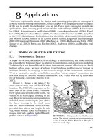
Chapter 8 Applications 213
8.1 Review of Selected Applications 213
8.1.1 Envi ronmental Resea rch 213
8.1.2 Boundar y Layer Resea rch 215
8.1.3 Wind Power and Loading 217
8.1.4 Complex Terrain 217
8.1.5 Sound Speed Proles 220
8.1.6 Hazards 222
8.2 Summary 223
References 224
Appendix 1 Mathematical Background 227
A1.1 Complex Exponentials 227
A1.2 Fourier Transforms 228
A1.3 Autocorrelation and Convolution 230
A1.4 Least-squares Fitting 232
Appendix 2 Sample Data Sets and Matlab Code 235
Appendix 3 Available Systems 237
A3.1 AeroVironment Inc. [California, USA] 237
A3.2 AQ Systems [Stock holm, Sweden] 237
A3.2.1 AQ500 SODAR 237
A3.3 Atmospheric Research Pty. Inc. [Canberra, Austral ia] 238
A3.4 AtmosphericResearchandTechnologyLLC(ART)[Hawaii,USA]
and Kaijo Corporation [Tokyo, Japan] 239
A3.5 Atmospheric Systems Corporation (ASC) [California, USA] 239
A3.6 METEK GmbH [Elmshorn, Germany] 240
A3.7 R EM TEC H SA [Fra nce] 241
A3.8 Scintec GmbH [Tübingen, Germany] 242
Appendix 4 Acoustic Travel Time Tomography 247
Appendix 5 Installation of a SODAR or RASS 249
A5.1 Guidelines for the Use of Sodar in Wind Energy Resource Assessment 249
A5.1.1 Calibration and Testing 249
A5.1.2 Operating Requirements 250
A5.1.2.1 Temp er at ure 251
A5.1.2.2 Precipitation 251
A5.1.2.3 Vert ical Range a nd Resolut ion 251
A5.1.2.4 Reliability Criter ia 252
3588.indb 9 11/27/07 4:07:12 PM
© 2008 by Taylor & Francis Group, LLC
x Atmospheric Acoustic Remote Sensing
A5.1.3 Siting and Noise 253
A5.1.3.1 Acoustic Noise (Passive and Active) 253
A5.1.3.2 Electronic Noise 254
A5.1.3.3 Public Annoyance 254
A5.1.4 Power Supply and Site Documentation 254
A5.1.5 Data Collection and Processing 255
A5.1.5.1 Data Pa ra meters and Sampling/Recording I ntervals 255
A5.1.5.2 Calculation of Wind Shear 255
A5.1.5.3 Mea sur ement Per iod 256
A5.1.5.4 Exclusion of Precipitation Periods 257
A5.1.6 Comparisons with Mechanical Anemometry 257
A5.1.7 Other Considerations for Incorporating SODAR Information
into a Resource Assessment Program 258
A5.2 Analysis of The AeroVironment 4000 SODAR Data Processing
Methods 260
A5.2.1 Parameter settings 260
A5.2.2 Interrelations of Parameters and Conditions for Parameter
Values 260
A5.2.3 Use of an Articial Signal to Verify Performance 261
References 265
3588.indb 10 11/27/07 4:07:13 PM
© 2008 by Taylor & Francis Group, LLC
xi
Preface
In2001Iwascontactedbyaconsortiumofresearchinstitutionsandwindenergy
interestswitharequesttoprovidesomebackgroundinformationontheoperational
characteristics of acoustic radars or SODARs. The consortium partners had set
upandbeenfundedforanEuropeanEUprojecttoevaluateSODARsasatoolin
monitoring wind ows at wind turbine sites. They felt reasonably condent in their
knowledgeofSODARsandhadpurchasedsomeinstruments,butwantedtobeable
to consult on any more complex issues which arose. Ultimately this developed into a
relatively simple contract in which my colleague at the University of Salford, Sabine
vonHünerbein,andIdeliveredanintensivetwo-dayshortcourseonSODARstoa
small group of scientists and engineers at ECN headquarters in Amsterdam. There
were two aspects of this short course which impressed themselves upon me. The
rstwasthevolumeofinformationrequiredtoadequatelycovertheprinciplesof
operationanddatainterpretationforSODARsperformingwindmeasurementsinthe
atmospheric boundary layer. The second aspect was that intelligent and extremely
technically capable people, already working in the area of wind measurement, did
notadequatelyobtainenoughinformationaboutremotesensinginstrumentsfrom
manufacturers’ information manuals and data sheets.
Theinitialinteractionwiththe‘WISE’EUconsortiumledtoSabineandme
being responsible for overseeing the major calibration work-package in the project.
Thenalreportfromthegroupworkingonthatwork-packagewasarguablythe
most comprehensive investigation of SODAR-mast calibrations. But, of necessity,
that report was focused on wind energy applications and target goals for calibration
accuracy. Therestillremainedaneedtomakeavailableamoregeneraldescription
of SODAR and other atmospheric acoustic remote sensing principles for a wider
audience.
Thereisahugebodyofliteratureavailableinjournalpaperswhichcoversappli-
cations of acoustic remote sensing methodology in sensing atmospheric properties in
the 1-km layer nearest the ground. But the body of literature describing design and
operating principles is much more conned and also often rather specialized. Fre-
quent requests from a range of scientists, engineers, local authorities, and other areas
indicate that there is a demand for a more comprehensive collection of information
on ‘how things work’.
The difculty in writing a book of this nature is to cover the principles of opera-
tion in detail sufcient enough that the reader is not left wondering about gaps in the
descriptions,butatthesametimetryingtogiveamoreintuitivefeelforinteractions
between various atmospheric and instrumental components than might be found in a
pedantically accurate textbook. Although the resulting book does contain consider-
ablealgebra,extensiveuseofdiagramsmakesforbetterreadabilityandeffortshave
been made to avoid the more abstruse mathematical treatments.
SODARs and RASS instruments are endemic in monitoring atmospheric bound-
ary layer wind systems, turbulent transports, and thermal properties. There is of
3588.indb 11 11/27/07 4:07:14 PM
© 2008 by Taylor & Francis Group, LLC
xii Atmospheric Acoustic Remote Sensing
course competition from other technologies such as mast-mounted cup anemometers
and sonic anemometers, scintillometers, radar wind prolers, LIDARs, and radi-
ometers. But it is still difcult to comprehensively replace, using these alternative
technologies, the acoustic remote sensing capabilities of inexpensively providing
wind, turbulence, and temperature proles. As newer methods emerge, it is also
veryimportanttobeabletocompetentlycompareoutputproducts.
For all these reasons, this book is aimed at providing a useful description of how
atmospheric acoustic remote sensing systems work and giving the reader insights
into their strengths and limitations.
Stuart Bradley
Auckland, New Zealand, 2007
3588.indb 12 11/27/07 4:07:14 PM
© 2008 by Taylor & Francis Group, LLC
xiii
Acknowledgments
Getting to the point of writing a book is a long road involving many years of per-
sonal interest in the research area targeted by atmospheric acoustic remote sensing.
Clearlythisisnotreallyanindividualeffortatall,butrestsontheenthusiasmand
knowledgebaseofmanycolleaguesaswellassupportandfaithfromfamilyand
friends.
The people at CRC Press, Taisuke Soda, Theresa Delforn, Jim McGovern and so
manyothers,havebeenastonishinglypatientwithmymanyexcusesanddelays.
Iamgratefultomymanycolleaguesandfriendsinthe“ISARScommunity”who
meeteverysecondyeartosharetheirlatestinsightsattheInternationalSymposiafor
Acoustic Remote Sensing. In particular the various organisers have added so much
tothisgeneraleld. Ofthese,myfriendBillNeffofNOAAhasbeenanever-ending
source of encouragement and inspiration (it is difcult to do something in this eld
whichisentirelyoriginalandwhichhasn’talreadybeenvisitedbyBillinsomeway),
Margo Kallistratova adds such useful insights while maintaining a twinkle in her
eye,andErichMursch-Radlgruberisalwayssoinnovativewithhislatesthardware
developments as well as knowing all the best wine cellars in Vienna! A seminal
inuenceonthisbookhasalsobeenfromtheactivitiesoftheEUWISEconsortium,
andinparticularSabinevonHünerbein,IoannisAntoniou,DetlefKindler,Hans
Jørgensen, and Manuel De Noord. A number of these people have gone on to form
thenucleusoftheEUUpWindremotesensinggroup.
All the manufacturers of SODARs and RASS have been happy to discuss aspects
oftheirdesigns. InparticularIwouldliketothankHans-JürgenKirtzelandGer
-
hard Peters of Metek, and Ken Underwood of ASC for their friendship and many
enjoyableanalysesoverabeer.
Many students and Post-doctoral Fellows at the University of Auckland and the
University of Salford have worked happily with me in building my experience in
acoustic remote sensing. I have really enjoyed the interaction with the group at Uni
-
versityofReading,andlookforwardtoon-goinginterestingworkwithJanetBarlow
on urban meteorology.
SabinevonHünerbeinoftheUniversityofSalfordhasworkedextensivelywith
me.Herpragmaticviewofthescienceandquestioningapproachisrefreshingand
keepsme‘onmytoes’. Thetwoofuscanseldommeetwithoutgettingintodeep
discussion about some aspect of SODAR or RASS operations, and I greatly value
Sabine’s input into aspects of this book.
UnderpinningeverythingisChrissie,mywife. Sheissoverypatientinthe
panic times when deadlines loom, and endlessly encouraging in the quieter moments.
WhenthingsbecomefrustratingIknowIcanrelyontalkingwithherandhearing
herwordsofwisdomonhowtotacklepriorities. Thisbookwouldnothavebeen
possible without her always being there for me.
3588.indb 13 11/27/07 4:07:15 PM
© 2008 by Taylor & Francis Group, LLC
xv
Author
StuartBradleywasbornandeducatedinNewZealand,workingasaresearcherwith
theNewZealandMeteorologicalServiceandwithCSIROinAustraliabeforetaking
apositioninthePhysicsDepartmentattheUniversityofAuckland.Hedesignedone
oftheearliestphased-arrayminiacousticradarsandanumberofmoresophisticated
instruments, as well as consulting for major manufacturers.
In 2000 Stuart accepted a Chair of Acoustics at the University of Salford in
Manchester, UK, with a highly regarded acoustics research group. His work there
included proling of winds and temperature structure to better understand outdoor
sound propagation; research relating to surface-atmosphere coupling in the Antarc-
tic; and acoustic noise in cellular phones generated by micro-turbulence. He was
a partner in the EU-funded ‘WISE’ project, which aimed to use acoustic remote
sensing for evaluation of wind turbine performance. Together with Dr Sabine von
HünerbeinatSalfordandothercollaboratorsinWISE,ProfessorBradleyproduced
a comprehensive analysis of the state of the art of acoustic wind prolers.
StuartreturnedtotheUniversityofAucklandinmid-2004,whereheiscurrently
Head of the Physics Department. He holds a dual academic position in Salford
whereheisaProfessorintheAcousticsResearchCentre,engagedthroughtheEU
‘UpWind’projectindesignofnewacoustictechnologiesforwindenergy.
3588.indb 15 11/27/07 4:07:15 PM
© 2008 by Taylor & Francis Group, LLC
xvii
Symbol List
SYMBOL DEFINITION
B ratioofpowerspectrumvariancetopulsespectralvariance
B, B
e
absorption coefcient, excess absorption coefcient
C scattering angle
C fractionofpulseateachendusedforshaping
D
m
, D
h
similarity functions for momentum and heat
E fractional part of f/fs
F kinetic energy dissipation rate
F error vector
F ratioofmolecularweightofwatertomolecularweightofdryair
F
2
dissipation rate for heat energy
K phase
K
x
, K
y
incremental phase shifts in x and y directions
'
n
powerspectrumofrefractiveindexuctuations
H ratio of specic heats
( gamma function
I along-beamDopplervelocitycomponent
G beam azimuth angle
G
R
,
T
azimuthanglesfromreceiver,transmittertopointbelowscattering
' latitude
'
V
, '
T
kinetic energy, thermal spectral density
L
m
von Karman constant
L spatial wavenumber
L
D
Doppler-modied Bragg wavenumber
M wavelength
M
a
M
e
acoustic,electricwavelength
M
D
wavelength of Doppler-shifted wave
M
L
largestwavelengthforahorn
- drop size distribution parameter
µ temperature ratio
R zenith angle
R beam tilt angle
∆R widthofmainbeam
R
i
, R
r
, R
t
angles of incidence, reection, and refraction
R
R
, R
T
zenith angle for receiver, transmitter
R
L
angular width of side lobe
2 potential temperature
S air density
S radial distance
3588.indb 17 11/27/07 4:07:16 PM
© 2008 by Taylor & Francis Group, LLC
xviii Atmospheric Acoustic Remote Sensing
S spatial correlation coefcient
S
d
, S
v
densityofdryair,watervapor
S
R
, S
T
distance of receiver, transmitter from point below scattering volume
T
D
standard deviation in Doppler spectrum
T
E
standard deviation of spectral noise
T
f
standard deviation of frequency spectrum
T
m
standard deviation of Gaussian pulse envelope
T
m
standard deviation in slope
T
w
standard deviation of vertical velocity
T
R
rain scattering cross-section
T
V
standard deviation of wind speed
T
s
differential scattering cross-section
U pulse duration
V scaled height parameter
X angular frequency
Ω angular velocity of rotation of Earth
Y,
ˆ
/ff
DT
Z wind direction
[ z/L
a radius
a amplitude
A amplitude
A
e
antenna effective area for receiving
b focal length
b proportionality between absorption coefcient and f
2
B matrix of beam directions
c, c
a
speed of sound
`
c uctuating speed of sound
c
e
speed of EM radiation
c
p
specic heat
C calibration matrix
C
n
2
refrative index structure function parameter
CC
TV
22
,
temperature and velocity structure function parameters
d size of turbulent patch
d speakerdiameterorspacing
D distance between transmitter and receiver
D drop diameter
D driftdistanceofRASSfocus
D distance from speakers to reector
D matrix of measured times
D wind vector to radial component transformation
E matrix of measurement errors
E random noise amplitude spectrum
f frequency
f
0
reference frequency
3588.indb 18 11/27/07 4:07:21 PM
© 2008 by Taylor & Francis Group, LLC
Symbol List xix
f
N
Nyquist frequency
ff
NO
22
,
absorption resonant frequencies for N
2
and O
2
f
s
sampling frequency
f
D
Doppler frequency
f
T
transmit frequency
F matrix of frequency transformations
F focal distance
g acceleration due to gravity
G antenna gain for transmitting
G
L
antennagainforasidelobe
h antenna height
h water vapour molecular fraction
H heat ux
H Hanning lter function
i spectral index
I in-phase signal component
I sound intensity
I
0
reference sound intensity
I
s
scattered intensity
j 1
J
0
, J
1
Bessel functions
k wavenumber
K
K
h
thermal diffusivity
K
m
eddy viscosity
K
n
basis function for constrained tting
l layer spacing
l mixing length
l
0
inner scale
L
E
Ekman length
L Monin-Obukhov length
L
0
outer scale
L
p
sound pressure level (SPL)
L
I
sound intensity level
m sample number
m pulse modulation
m slopeofcalibration
m frequencystepnumber
m, n speaker numbers
M number of samples
M number of frequency steps
M Fouriertransformofpulsemodulationfunction
M, N numbersofspeakersineachdirection
M
d r y a i r
,M
water
molecular weights
M average molecular weight
3588.indb 19 11/27/07 4:07:24 PM
© 2008 by Taylor & Francis Group, LLC
xx Atmospheric Acoustic Remote Sensing
n frequency bin index
n refractive index
n
D
drop concentration
n
0
maximumdropconcentration
`
n uctuating refractive index
N noise spectrum
N matrix of along-beam velocities
N
0
reference noise spectrum value
N
m
number of speakers in row m
p acoustic pressure
p probability distribution function for wind speed
p
R
, p
T
received and transmitted signals
p
atm
atmospheric pressure
p
max
maximum acoustic pressure
p
rms
root mean square acoustic pressure
p
0
referenceacousticpressure
P power spectrum
P
A
powerscatteredbyatmosphericturbulence
P
F
powerreectedfromxedobjects
P
r
Prandtl number
P
L
powerreceivedfromasidelobe
P
P
powerscatteredbyprecipitation
P
N
noise power
P
R
received power
P
T
transmitted power
q constant
Q number of points in quadratic t
Q qualityfactorofBPlter
Q quadrature-phase signal component
r radial distance
r relative humidity
r regression coefcient
r
x
radiusofahornatdistancex from the mouth
r
T
, r
R
distance from transmitter, receiver, to scattering volume
R radiusofcurvature
R radial distance
R rotation matrix
R universal gas constant
R
d
specic gas constant for dry air
R
f
uxRichardsonnumber
R
i
bulk Richardson number
s signal
s offsetdistanceforspeakerabovedish
S Fourier transform of scattering cross-section
SNR signal-to-noise power ratio
t time
3588.indb 20 11/27/07 4:07:25 PM
© 2008 by Taylor & Francis Group, LLC
Symbol List xxi
t
s
, t
r
, t
s
*
, t
r
*
travel times in Doppler calculation
t
downwind
, t
upwind
acoustictraveltimedownwindandupwind
T temperature
T beam tilt matrix
T matrix of unknown temperatures
T
D
period of Doppler shifted wave
T
v
virtual temperature
T, T
*
period
`
T uctuating temperature
T
mean temperature
u, v, w wind components
uvw,, mean wind components
`` `
uvw,, uctuatingpartsofwindcomponents
ˆ
,
ˆ
,
ˆ
uvw
velocity component estimates
u
friction velocity
v
m
sampled signal voltages
V wind speed
V vector of wind components
V
s
wind speed recorded by SODAR
V
c
wind speed recorded by cup anemometer
V mean wind speed
V
c
wind speed aloft
ˆ
V wind speed estimate
V
0
referencewindspeed
V
rms
rms voltage
w water vapour mixing ratio
w
m
amplitudeweightingforspeakerm
x, y, z spatial coordinates
X matrix of distances
z
min
,z
max
minimumandmaximumheightsforsignalreception
ˆ
z estimated height
z
0
roughness length
Z length of reector
Z
m
mixing layer height
3588.indb 21 11/27/07 4:07:34 PM
© 2008 by Taylor & Francis Group, LLC
1
1
What Is Atmospheric
Acoustic Remote
Sensing?
A quick look at a bookshelf in a library on “remote sensing” will show many texts
devoted to satellite sensing of clouds and the Earth’s land and ocean surface. It is clear
that satellite sensors are very remote, but does distance dene “remote sensing”?
Audible sound is one of the human senses with which we are very familiar.
Beyond that, we can also readily imagine the world of bats, cats, and dogs which
use ultrasound and, with a little more difculty, imagine sensing infrasound vibra-
tions. In most cases, we use direct sound to communicate or detect something nearby
rather than to sense any properties of the air around us. So what advantages does the
use of sound have for investigating the atmosphere?
In this chapter, we rst give some background information to answer these
questions. Then the development of atmospheric acoustic remote sensing is briey
described, giving some idea of the status of this technology today, and future trends.
1.1 DIRECT MEASUREMENTS AND REMOTE MEASUREMENTS
A direct measurement is one in which the instrument is in close contact with, or
close to, the object or region being measured. A remote measurement usually uses
light, heat, or sound emitted from an object or region, and landing some distance
away from the instrument. Remote measurements are characterized by the operator
not being able to get close enough to do a “hands on” measurement. One feature of
remote measurements is that there are often assumptions which need to be made
about how the light, heat, or sound is emitted by an object or region, and how it
travels across the intervening space to the instrument. An example is the RADAR
(RAdio Detection And Ranging) in a speed camera. No actual contact is made with
the car, and in fact the assumption is that the car reected the RADAR signal rather
than, for example, a bird or someone opening a window nearby. Assumptions are
also made about what happens when it rains, for example.
All measurements contain errors. Errors can be systematic, which means that
they are the same each time a measurement is made, or random, which means that
they are different every time. There are good theoretical ways of handling random
errors, as long as you know something about the probability of an error being of a
certain size range. But systematic errors generally require good knowledge of the
instrument and the ways in which the measurement was done. One of the biggest
problems with remote sensing is in handling the errors and in estimating how “good”
the resulting measurement numbers are.
3588_C001.indd 1 11/20/07 5:16:41 PM
© 2008 by Taylor & Francis Group, LLC
2 Atmospheric Acoustic Remote Sensing
Because of the need for assumptions in remote measurements, any new instru-
ment needs to be compared to ground truth. This is the term used for direct measure-
ments which can support the assumptions and calibrations applied to some remote
measurement (the term comes from people going out into a eld and doing direct
measurements to compare with satellite remote-sensing measurements). At a new
site, or periodically for older instruments, it is probably also desirable to occasion-
ally do a ground truth measurement. For some meteorological instruments, such a
comparison can be made using an instrumented mast. For other measurements, such
as cloud thickness, ground truth comparisons can still be done (e.g., by an aircraft)
but at much greater cost. Some of the most difcult ground truth comparisons are
for planetary exploration.
Ground truth provides a calibration. Calibration gives the correspondence
between the number provided by a remote measurement and the actual physical
parameter it is trying to estimate. Usually it is assumed that the errors in the ground
truth measurement method are much smaller than the errors in the remote measure-
ment (otherwise the error analysis and working out what the measurement means
get tricky).
There are a number of ways to take ground truth measurements. The rst is a
eld campaign. This is where several scientists and technicians take a lot of equip-
ment and set it up somewhere for a short but intense period of measurement. Often
they go some place rather simple, such as the middle of at land, an island or ship
in the middle of the ocean, or an ice shelf at one of the poles. A lot of information is
obtained from eld campaigns, but they are expensive and only run for a short time.
1.2 HOW CAN MEASUREMENTS BE MADE REMOTELY?
To measure at a distance requires some form of information to travel from the target
to the instrument. Usually this is light, heat, or sound but you could probably mea-
sure wind speed, for example, by measuring the shape of the splash mark made by a
raindrop on blotting paper!
The rst problem then is to be certain that the information came from the target
region of interest. If you are doing measurements of sunspot activity, this is not a
problem, but for many atmospheric remote-sensing instruments there is a mixture
of information coming from the target and other sources. An acoustic sensor, for
example, might have sound coming from the target, as well as sound from trucks,
bees, trees rustling, and birds.
This means that some type of matching to the target is usually required. Simply
making the remote-sensing instrument directional is often enough. For example, the
speed-camera RADAR would be a very poor design if it was sensitive to things mov-
ing all around it, rather than focussing on the car on the roadway in front of the cam-
era. So beam-forming is a part of the background needed to design a remote-sensing
instrument. Secondly, most instruments try to match the energy emitted by the target
to the type of energy to which the instrument is most sensitive. For example, mea-
surements of ocean chlorophyll using a satellite will have a set of green color lters
in the optics so that chlorophyll shows good contrast compared to seawater. This is
spectral-ltering (the spectrum is the range of colors or wavelengths measured).
3588_C001.indd 2 11/20/07 5:16:42 PM
© 2008 by Taylor & Francis Group, LLC
What Is Atmospheric Acoustic Remote Sensing? 3
In addition to beam-forming and spectral-ltering, many remote-sensing instru-
ments will also make use of time or rate-of-change information. The sound produced
by a particular bird might be quite distinctive in duration compared with that from
other birds in the neighborhood. Another example would be studying the activity of
shrimp by listening to the underwater sound. If it is known that the shrimp are noisy
when they are feeding at dawn, then all the acoustic data might be ltered to select
only the hour before dawn and the hour after. This is using temporal-gating.
1.3 PASSIVE AND ACTIVE REMOTE SENSING
It is important to distinguish active sensors from passive sensors. A passive sen-
sor measures the energy transmitted or reected by some object when the source of
energy is natural. An active sensor sends out a signal to illuminate the object and
records or measures the response from the target or surface. Active sensors are largely
independent of the environment around them and can operate 24 hours a day.
One of the best known active sensors is RADAR. RADAR is an acronym for
RAdio Detection And Ranging. The scene to be “photographed” is illuminated with
microwave radiation. Microwave images provide information about roughness and
composition, which makes RADAR images more difcult to interpret than optical
images. This book mostly concerns SODAR (SOund Detection And Ranging) which
has many features in common with RADAR.
1.4 SOME HISTORY
John Tyndall rst detected acoustic back-scatter from temperature and wind struc-
tures in the atmosphere in 1873 using a large fog horn. Little further work was done
until 70 years later, when information about temperature inversions was required for
early studies on microwave communications. Although an intriguing amount of atmo-
spheric structure was observed in these 1946 measurements, and the term “SODAR”
was coined, the interaction of sound with turbulence was not understood.
Theoretical work by Russian scientists Kallistratova and Tartarski in 1959 and
1960 established the principles of turbulent scattering of sound, but McAllister rst
showed that echoes could be reliably obtained from heights of several hundreds of
meters and that the temporal structure of stable and unstable atmospheres could
be analyzed through time–height plots of echo strength (McAllister, 1968). Much
more theoretical and practical work followed, with a major advance being the rst
measurements of wind speeds based on the Doppler shift of echo signals (Beran et
al., 1971). The signicance of this advance at that time can be judged from the paper
being published in Nature.
SODARs appeared to have reached the limit of their potential, until the design
of compact high-frequency sounders together with digital output revitalized their use
in meteorology (Moulsley and Cole, 1979). Design of both hardware and software
rapidly improved so that today these instruments are portable, inexpensive, and very
reliable if installed and operated correctly.
The use of a combination of an acoustic transmitter and RADAR, in what was called
a RASS (Radio Acoustic Sounding System), rst appeared in the early 1970s (North et al.,
1973). These instruments use a transmitted acoustic wave as the target for a RADAR.
3588_C001.indd 3 11/20/07 5:16:43 PM
© 2008 by Taylor & Francis Group, LLC
4 Atmospheric Acoustic Remote Sensing
1.5 WHY USE ACOUSTICS?
Turbulence transports heat from higher-temperature regions to lower-temperature
regions. This means that turbulent patches of air have a different temperature from
their surroundings, and therefore a different density and refractive index n.
Refractive index changes cause scattering of light, microwaves, and sound. For
example, turbulent scattering of starlight causes “twinkling.” But the dependence of
refractive index on temperature is very much weaker for electromagnetic radiation
than it is for sound (Table 1.1). Note, however, that microwave radiation may also be
refracted by humidity gradients.
Sound therefore reects more strongly from turbulence. The generally lower
cost of acoustic equipment makes sensing of atmospheric turbulence by sound even
more attractive.
How large are the temperature variations in a turbulent patch? As discussed
later, SODARs reect efciently from patches having diameters of half an acoustic
wavelength, say 0.1 m. Even if a patch had the full background temperature variation
(0.01 C/m) across it, this would mean a temperature variation of only 10
–3
C and a
refractive index variation of order one part in 10
6
.
1.6 DIRECT SOUND PROPAGATION
FROM A SOURCE TO A RECEIVER
The SODAR and RASS instruments record energy scattered back from the atmo-
sphere. An alternative remote-sensing methodology is to use direct sound transmis-
sion and to either monitor the intensity at a receiver, or monitor the travel time of
the sound from the transmitter to the receiver. The former technique is really a part
of the study of outdoor sound propagation and has not been very much used as a
remote-sensing method, partly because of continuing disagreement between obser-
vations and models. New methods of signal coding and analysis may well make this
a viable tool in the near future. The second method is acoustic travel-time tomog-
raphy and has successfully been used to study turbulence and coherent structures
moving across pastures.
The limitation of both these direct methods is that they essentially measure in
the horizontal, and vertical proles are not easily obtained. For example, an approxi-
mate guide to the height reached by sound energy which is directly measured in a
horizontal propagation path is one-tenth of the horizontal range. This would mean a
horizontal spacing of 1 km between the source and the receiver if refraction effects
TABLE 1.1
The sensitivity of electromagnetic and acoustic remote-sensing instruments
to temperature variations
Refractive index variation with temperature
RADAR 1.3×10
–6
per °C
SODAR 1.7×10
–3
per °C
3588_C001.indd 4 11/20/07 5:16:43 PM
© 2008 by Taylor & Francis Group, LLC
What Is Atmospheric Acoustic Remote Sensing? 5
were going to be used to sense atmospheric properties to a height of 100 m. Above
these sorts of distances, the ground effects can be troublesome. In the case of travel-
time tomography, refraction effects are undesirable, and this puts a limit on the likely
horizontal range.
1.7 ACOUSTIC TARGETS
What are the reectors when sound is sent vertically? Reections of sound occur
only if there is a change of density or air velocity, known as a change in acoustic
refractive index. The air does generally change its density and wind speed slowly
with height, but this type of continuous gradient is not sufcient to give measurable
reections. In practice, it is only when many reections from small uctuations add
together that acoustic scattering can be measured. As we will see later, this is a cal-
culable effect, and relates quite directly to the turbulent state of the atmosphere.
It should be noted that birds, insects, and precipitation within the acoustic beam
can also act as reectors. The occasional signal “spike” from a bird can readily be
detected and removed by software lters, but precipitation is much more trouble-
some. Similarly, sound leaking from the instrument sideways and reecting off a
hard structure such as a building can swamp a valid reection from turbulence. For
these reasons, good understanding of the acoustic design of a SODAR’s antenna is
required. Antenna designs vary considerably, as seen from Figure 1.1 to 1.3.
1.8 CREATING OUR OWN TARGET
The principle of the RASS is to create the refractive index uctuations deliberately
and systematically by transmitting an acoustic beam vertically which is “tuned” so
as to give strong reections of the RADAR signal. This has the advantage that the
FIGURE 1.1 (See color insert following page 10) An experimental SODAR installed in
2004 at the British Antarctic Survey base at Halley in the Antarctic.
3588_C001.indd 5 11/20/07 5:16:44 PM
© 2008 by Taylor & Francis Group, LLC
6 Atmospheric Acoustic Remote Sensing
turbulent strength in the atmosphere is immaterial, and a signal is always received.
The method has also been transferred to RADAR wind-prolers, with both the
acoustic and RADAR beams transmitted at several angles to the vertical so as to
sense various components of the wind.
1.9 MODERN ACOUSTIC REMOTE SENSING
SODARs and RASS now have a long pedigree as operational and research instru-
ments. They are sufciently compact to be carried in a small 4-wheel drive vehicle,
and can generally be installed in a remote site within a few hours. Routine operation
thereafter is really only a matter of periodically checking data quality in case there
has been a change caused, for example, by a power failure, degradation of one or
more acoustic transducers, or some physical misalignment occurring.
FIGURE 1.2 (See color insert following page 10) An AeroVironment (now Atmospheric
Systems) SODAR conducting measurements of valley ows high in the Southern Alps of
New Zealand.
FIGURE 1.3 (See color insert following page 10) Scintec’s modern SFAS mini-SODAR
antenna (left-hand photograph) and a Metek SODAR–RASS (right-hand photograph).
3588_C001.indd 6 11/20/07 5:16:45 PM
© 2008 by Taylor & Francis Group, LLC
What Is Atmospheric Acoustic Remote Sensing? 7
The quality of data available is now very high. For example, Figures 1.4 and 1.5
show routine plots from the Metek SODAR–RASS of temperature and wind speed.
Many other parameters can also be displayed.
Similarly, Figure 1.6 shows a plot of wind vectors recorded by an AeroViron
-
ment 4000 SODAR during a three-hour period.
Accuracy, with some care, can be better than 1% of wind speed, as shown in
Figure 1.7.
1.10 APPLICATIONS
Applications are in all those areas where wind, turbulence, and temperature infor-
mation is required. Figure 1.8 gives some indication.
24
12
0
Local Time
800
40
400
Height (m)
6 18°C
10
14
FIGURE 1.4 (See color insert following page 10) The atmospheric temperature recorded
during one day by the Metek DSDPA90.64 SODAR–RASS.
FIGURE 1.5 (See color insert following page 10) Wind speed proles recorded during one
day by the Metek DSDPA 90.64 SODAR.
3588_C001.indd 7 11/20/07 5:16:49 PM
© 2008 by Taylor & Francis Group, LLC
24
12
0
Local Time
Height (m)
800
40
400
10 ms
–1
0