- Trang chủ >>
- Khoa Học Tự Nhiên >>
- Vật lý
OBJECT-ORIENTED ANALYSIS AND DESIGN CONCEPTS OF SPACE AND TIME Phần 8 ppt
Bạn đang xem bản rút gọn của tài liệu. Xem và tải ngay bản đầy đủ của tài liệu tại đây (1.96 MB, 14 trang )
Figure 6.9 Execution of the update scenario—stage 1
Figure 6.10 Execution of the update scenario—stage 2
Figure 6.12 Execution of the update scenario—stage 4
Figure 6.13 Execution of the update scenario—stage 5
IMPLEMENTATION OF THE STDM
83
view of the VMDS. This indicates the existence of a proprietary database (VMDS)
being managed by an object-oriented environment (Magik).
6.2 PUBLIC BOUNDARY ENTRY SCENARIO
The public boundary entry scenario represents the states and events that are concerned
with the allocation events within the system. This means that, based on some
assumptions, the user will select ground features to be a future public boundary. The
final allocation decision will be taken by the user, who will assign a ground feature to
be a draft boundary. The execution of this scenario has been divided into four stages,
illustrated by diagrams. The first stage focuses on the creation circumstance of a
space-time path of a public boundary. It represents the origin of a space-time path
within Smallworld GIS.
Stage 1: creation
In our example the origin has been attached to the assumption event of the STDM.
The user has made a statement perhaps based on a boundary commission demand
which determines that a possible future public boundary will be created in a certain
region. Figure 6.1 illustrates this situation in which the Assumption menu (bottom
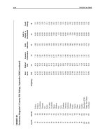
Table 6.1 Smallworld GIS: object-oriented features.
a
Equivalent to primary keys in the relational model.
OBJECT-ORIENTED DESIGN FOR TEMPORAL GIS
84
right) represents the assumption event involved in the creation of a space-time path. It
shows the properties previously defined for the Assumption class of the STDM:
statement, validated, and valid from/to. In this example the boundary commission
demand for creating a public boundary has not been validated by an order or act. This
demand has been valid since 12 September 1987.
The user can select any instance that belongs to the GroundFeature,
DraftBoundary, NewBoundary or OldBoundary classes, or any instance that
belongs to the Assumption, Allocation, Delimitation or Demarcation
classes. The origin of a space-time path in the VMDS can never be modified. In this
example the origin of a space-time path is created once the properties of the Assumption
class have been inserted in the data store view of the VMDS. This is still true even
though the space-time path does not exist at this stage. In other words, the relationship
between the instance of the Assumption class and the instance of the GroundFeature
class has not yet been generated in Smallworld GIS. Therefore the ground
features element in the Assumption menu shows the number 0.
Stages 2, 3: selecting a ground feature
In stage 2 the user is searching for the ground feature designated by the boundary
commission, e.g. Gilbert Road, which is deemed to belong to the proposed public
Figure 6.1 Execution of the public boundary entry scenario—stage 1
IMPLEMENTATION OF THE STDM
85
boundary. This is accomplished by querying where Gilbert Road is located by
using the Road Editor menu provided by Smallworld GIS. In Figure 6.2 (see colour
section) the Road Editor menu (bottom right) shows the properties that belong to
Gilbert Road. The Application menu (top right) highlights where this road is
located.
Once Gilbert Road has been identified on the screen, the user can then make the
assumption that this road can be a public boundary as a result of the boundary
commission demand. This is achieved by clicking on the arrow beside the ground
features element in the Assumption menu (Figure 6.2, bottom left), which will
activate the Assumption-GroundFeature menu (Figure 6.3, top right).
In fact, the activated Assumption-GroundFeature menu is the state of an instance
in the GroundFeature class. It shows the properties of the GroundFeature
class: point, line, area and type. The insert operation is invoked when the user assigns
the values of the properties of the GroundFeature class and inserts them into the
VMDS by clicking on the Insert element of the AssumptionGroundFeature menu.
After creating the state of an instance in the GroundFeature class, the ground
features element in the Assumption menu (Figure 6.3, bottom left) is updated to
the number 1, telling the user that one state of a ground feature has been created for
the specific assumption. In other words, there exists a space-time path between the
instances of the Assumption class and the GroundFeature class. In terms of
Figure 6.3 Execution of the public boundary entry scenario—stage 3
OBJECT-ORIENTED DESIGN FOR TEMPORAL GIS
86
Smallworld GIS, there exists a join relationship between the records of the
Assumption class and the GroundFeature class.
This implies that the version significant attributes (point, line and area) of
the GroundFeature class can only be updated in a non-destructive manner
(see Table 5.5). An update in one of these attributes pertaining to the Ground-
Feature class will create a version that will be the new instance of
the GroundFeatureRevolutionaryState class. The update procedure
element of the Assumption-GroundFeature menu shows the number 0, which informs
the user that no update procedure has been carried out. Section 6.4 considers update
procedures in more detail.
Stage 4: allocation
In stage 4 the allocation decision is taken by the user, so the ground feature is selected
to be a draft boundary. In terms of the STDM, the GroundFeature, Allocation
and DraftBoundary classes are affected by this allocation decision. The execution
of this scenario is accomplished by activating the Allocation menu (Figure 6.4, top
right—see colour section) which represents the Allocation class within the system.
The user can provide information about the map scale used for the allocation, a textual
description of the allocation and the date on which the allocation took place (Figure
6.4, colour section).
The Allocation-GroundFeature menu (Figure 6.4, bottom left—see colour section)
shows that the user has selected Gilbert Road to be a draft boundary. The Application
menu (Figure 6.4, top left) highlights where this road is located. The user can then
assign this ground feature to be a draft boundary. This is achieved by clicking on the
draft boundary element of the Allocation menu, which will activate the Allocation-
DraftBoundary menu (Figure 6.4, bottom right). The activated menu represents the
instance of the DraftBoundary class. The user has inserted the attribute values
into the VMDS by clicking on the Insert element of the Allocation-DraftBoundary
menu. In this case all attributes of the DraftBoundary class have been defined as
non-version significant attributes in the STDM (see Table 5.5). They can be updated
without creating a new version.
The available elements of each of the menus displayed at this stage (Figure 6.4)
are as follows:
< The ground features element shows the number 1, indicating that Gilbert
Road has been selected to be a draft boundary.
< The draft boundary element shows the number 1, indicating that Gilbert
Road has been allocated to be a draft boundary.
< The update procedure element shows the number 0, indicating that no
update procedures have been carried out so far.
< The delimitation element shows the number 0, indicating that the
delimitation process has not yet occurred at this stage.
IMPLEMENTATION OF THE STDM
87
The STDM design, which governs the behaviour of the states on a space-time path,
does impose some constraints on this scenario, e.g. coupling constraints and capacity
constraints. For example, a draft boundary state will never be created if its
corresponding ground feature state does not previously exist in the VMDS of
Smallworld GIS. In the same way, an allocation cannot take place without the
previous existence of a ground feature state. This has been achieved by defining
update methods for the invariant and version significant attributes of the relevant
classes.
6.3 EVOLUTION TRACKING SCENARIO
Both delimitation and demarcation events are described in the evolution tracking
scenario. In the delimitation event, a draft boundary is confirmed by an act or order,
so the draft boundary state becomes a new boundary state. For the demarcation
event, surveyors ratify the position of the new boundary on the ground, then the state
is changed from new boundary to old boundary. The execution of this scenario has
been divided into four stages. The DraftBoundary, Delimitation,
NewBoundary, Demarcation and OldBoundary classes of the STDM are used
to illustrate our example. The focus is on demonstrating the independent incremental
modification mechanism developed for the space-time path of the STDM. Since the
inheritance mechanism is not supported by the data store view of Smallworld GIS,
the independent incremental mechanism has been implemented through the join
relationships between the classes. The aim is to illustrate how a user could handle
space-time paths in a GIS.
Stages 1, 2: delimitation
Stages 1 and 2 focus on the delimitation event for the existence circumstance of a
space-time path. Continuing with the Gilbert Road example, the draft boundary state
has been selected by the user, as shown from the Allocation-DraftBoundary menu
(Figure 6.5, top right); the draft boundary is highlighted in the Application menu
(Figure 6.5, left).
The delimitation event is activated within the system by clicking on the
delimitation element of the Allocation-DraftBoundary menu. The DraftBoundary-
Delimitation menu appears (bottom right) containing the relevant attributes that belong
to the Delimitation class of the STDM. These attributes include the statutory
document and the map scale used for the delimitation, as well as the operative, effective
and actual dates related to the delimitation event.
Once the attribute values of the Delimitation class have been inserted into the
VMDS, the delimitation element of the Allocation-DraftBoundary menu shows
the number 1. This number indicates as many delimitations as have been inserted by
the user into the VMDS. On the other hand, the new boundary element of the
DraftBoundary-Delimitation menu displays the number 0 since the new boundary
state has not yet been created in the VMDS.
OBJECT-ORIENTED DESIGN FOR TEMPORAL GIS
88
Once the user has decided to create the new boundary state in the system, they
have to click on the new boundary element of the DraftBoundary-Delimitation menu
in order to activate the Delimitation-NewBoundary menu (Figure 6.6, bottom right—
see colour section). This activated menu represents a new instance of the
NewBoundary class.
A state is created when the user inserts the values of the attributes of the
NewBoundary class by clicking on the Insert element of the Delimitation-
NewBoundary menu. As a result, the new boundary element of the DraftBoundary-
Delimitation menu (Figure 6.6, top right) is automatically updated to the number 1.
The user is then aware of the existence of a new boundary state in the VMDS of
Smallworld GIS. In this case all attributes belonging to this new boundary state have
been defined as non-significant attributes within the STDM. Their updates do not
create versions in the system.
Stages 3, 4: demarcation
The description of stages 3 and 4 has been devised to avoid mentioning the conceptual
elements behind the application. This has been important in demonstrating how simple
and repetitive are the stages in building up space-time paths within Smallworld GIS.
In general, the user has only to follow the successor-in-time creation of different
Figure 6.5 Execution of the evolution tracking scenario—stage 1
IMPLEMENTATION OF THE STDM
89
states within the system. A newer state can only be created if its corresponding older
state in the space-time path already exists.
Stage 3 denotes when the demarcation event takes place within the system. This
involves the creation of an old boundary state from its corresponding new boundary
state. The user clicks on the demarcation element of the Delimitation-NewBoundary
menu, activating the display of the NewBoundary-Demarcation menu (Figure 6.7,
bottom right). This menu displays the relevant information about the demarcation
event, including the properties defined for the Demarcation class: the name of the
surveyor in charge of carrying out the demarcation, the map scale used, and the time
taken by the surveyor to demarcate the boundary on the ground.
At this stage, the old boundary state has not yet been created in the system. The
old boundaries element in the NewBoundary-Demarcation menu shows the
number 0. The user activates the Demarcation-OldBoundary menu (Figure 6.8, bottom
right—see colour section) by clicking the old boundaries element in the
NewBoundary-Demarcation menu. Once the attributes related to an old boundary
state have been inserted into the VMDS by the user, the old boundaries element
in the NewBoundary-Demarcation menu (Figure 6.8, top right) shows the number 1.
The Demarcation-OldBoundary menu shows two important elements, the
archive element and the update procedure element. The archive
element, if activated, will archive the selected old boundary. This is discussed in
Figure 6.7 Execution of the evolution tracking scenario—stage 3
OBJECT-ORIENTED DESIGN FOR TEMPORAL GIS
90
more detail in Section 6.5. The update procedure element indicates that no
update procedure has been carried out over the selected old boundary state. This is
discussed in more detail in the following section. Both NewBoundary and
OldBoundary classes have different display scales as designed in the STDM.
They have been implemented using the Magik programming environment of
Smallworld GIS.
6.4 UPDATE SCENARIO
The update scenario handles the update procedures due to natural changes and new
demarcation descriptions occurring over public boundaries. Three update procedures
have been defined as creation of a new object, creation of a new object from an existing
object, and relocation of an existing object (Chapter 5, Section 3.3). The aim here is
to illustrate the main aspects involved in creating the versions due to these update
procedures, by using the overlapping incremental modification of the STDM. The
first update procedure has already been considered, so this section concentrates on
the second update procedure (stages 1 to 3) and the third update procedure (stages 4
and 5).
Stages 1, 2, 3: creation from an existing object
Suppose the user has selected as ground feature the Barnwell Road object, as shown
in the Road menu (Figure 6.9, bottom right—see colour section) and highlighted in
the Application menu. The GroundFeature menu (Figure 6.9, top right) shows the
instance of the GroundFeature class that represents Barnwell Road. In fact, this
represents the instance of this class which is about to be updated. The update procedure
creates a new version in the GroundFeatureRevolutionaryState class using
the previous version in the GroundFeature class.
The user can perform the update procedure by clicking on the update
procedure element of the GroundFeature menu. This will activate the
GroundFeature-GroundFeatureRevolutionaryState menu (Figure 6.10, bottom
right—see colour section). This activated menu represents the version (i.e. the
instance of the GroundFeatureRevolutionaryState class) which is created
in such a way that the invariant attribute (i.e. type) of the GroundFeature class is
inherited by the new instance of the GroundFeatureRevolutionaryState
class (Figure 6.10, colour section). In this example the inherited attribute is min_road
type.
The version significant attributes (point, line and area) belonging to the
GroundFeature class are not inherited. In order to differentiate, the
GroundFeatureRevolutionaryState class presents updated point, updated
line and updated area as attributes. All the attributes of the
GroundFeatureRevolutionaryState class are now considered as invariant
attributes. They cannot be modified or deleted by any user at any time.
IMPLEMENTATION OF THE STDM
91
The user creates a new version of the ground feature object, in this case Barnwell
Road, by digitising its new position and inserting it as the updated line attribute of
the GroundFeatureRevolutionaryState class. Once the user has inserted
the new updated line for the GroundFeatureRevolutionaryState class,
the update procedure element of the GroundFeature menu (Figure 6.10, top
right) is changed to 1, indicating that one update has occurred to this particular
ground feature. The perambulation element of the GroundFeature–
GroundFeatureRevolutionaryState menu indicates the number 0, which signifies that
the user has updated the ground feature on the system, but this has not yet been
confirmed on the landscape by the surveyors.
The perambulation event occurs after the surveyors have confirmed that the change
in position of the ground feature has taken place on the landscape. The user can then
insert this information into the system by clicking on the perambulation element
of the GroundFeature–GroundFeatureRevolutionaryState menu. This will activate the
Perambulation menu (Figure 6.11, centre right) which contains the attributes
concerning the perambulation event, e.g. the name of the surveyor and the date when
the perambulation occurred. At this stage, the perambulation element of the
GroundFeatureRevolutionaryState menu indicates that one perambulation event has
occurred for the selected ground feature revolutionary state.
Figure 6.11 Execution of the update scenario—stage 3
OBJECT-ORIENTED DESIGN FOR TEMPORAL GIS
92
Stages 4, 5: relocation of an existing object
The last update procedure in the STDM involves the relocation of an existing
object. The same boundary used for illustrating the evolution tracking scenario
has been chosen to illustrate this update procedure in the update scenario. Figure
6.11 shows the relocation of this boundary. This is illustrated by the Demarcation-
OldBoundary menu (Figure 6.12, top right—see colour section), in which the
state of this boundary is displayed. The update procedure has been carried out by
activating the OldBoundary-OldBoundaryRevolutionaryState menu (Figure 6.12,
bottom right) using the update procedure element of the Demarcation-
OldBoundary menu.
The user has inserted the new updated line into the VMDS, so the update
procedure indicates the number 1. The OldBoundary-OldBoundaryRevolutionary-
State menu represents the invariant attributes of the instance of the
GroundFeatureRevolutionaryState class.
Once the old boundary is relocated and its new updated line is inserted into the
system, the instance of the old boundary revolutionary state is created. This state
presents only invariant attributes, and it cannot be updated again. Once the
confirmation of the public boundary’s new position in the landscape is obtained, the
user can insert the relevant information about the perambulation event by
clicking on the perambulation element of the OldBoundary-
OldBoundaryRevolutionaryState menu. The OldBoundaryRevolutionaryState-
Perambulation menu (Figure 6.13, bottom right—see colour section) is activated,
and the user is then able to capture the attribute values of the perambulation event
within the system.
6.5 ARCHIVING SCENARIO
The archiving scenario represents the archiving of old boundaries that are no longer
effective. It involves the creation of an obsolete state during the lifespan of a public
boundary. This is achieved by clicking on the archive element of the OldBoundary
menu (see Figure 6.8). Smallworld GIS allow users to store obsolete boundary states
on a mass storage device such as a CD-ROM, maintaining the other states on a
conventional hard disk.
6.6 HISTORICAL VIEWS
Historical views have been designed in the spatio-temporal data model in order to
visualise the incremental mechanism of space-time paths. They provide direct access
to historical data concerned with a particular public boundary. This has been achieved
by creating HistoricalView classes in Smallworld GIS. The independent
incremental mechanism of the STDM is illustrated in Figure 6.14. Two historical
views are displayed as the Delimitation Historical View menu and the Demarcation
IMPLEMENTATION OF THE STDM
93
Historical View menu. Both menus represent the union of all properties that belong to
the parent, modifier, and resultant classes in the evolution tracking scenario. The
historical view provides a snapshot of all properties of a specific public boundary
which are selected by the user through a query statement. In Figure 6.14 the delimitation
historical view provides the selection of all properties that belong to DraftBoundary,
Delimitation and NewBoundary classes.
The overlapping incremental mechanism of space-time paths has been illustrated
by creating a historical view termed update historical view (Figure 6.15). In this case
the Update Historical View menu illustrates the selection of properties from the
GroundFeature, GroundFeatureRevolutionaryState, Perambulation,
OldBoundary and OldBoundaryRevolutionaryState classes.
In fact, the user can create as many historical views as they need for their
application. And they can specify the classes that should belong to each historical
view. However, further research work is needed to address the historical views
effectively. Geographic visualisation of historical views may provide a tool to assist
the user in displaying the historical views in graphic, symbolic and ideally dynamic
forms, such as animated graphics, graphs or diagrams, or even a combination of
them.
Geographic visualisation may generate a great deal of graphical information
(McCormick, Defanti and Brown, 1987) so users need to have a natural acuity for
recognising and interpreting visual patterns (Fedra, 1992; Buttenfield, 1993), and an
intuitive understanding of large amounts of data, processes and interdependencies
Figure 6.14 Historical views for the evolution tracking scenario
OBJECT-ORIENTED DESIGN FOR TEMPORAL GIS
94
between historical views. The role of geographic visualisation is to provide the means
for a better understanding of the STDM and the information stored in the database.
6.7 CONCLUSIONS
This chapter has illustrated some examples of how space-time paths can be created by
a user. The states and events designed in the STDM are visualised as edit menus
within the system. This allows a better understanding of how space-time paths can be
implemented in Smallworld GIS. The prototype implementation has been undertaken
mainly as a ‘proof-of-concept’ of the ideas developed in the STDM. Several drawbacks
have been identified in implementing this prototype into Smallworld:
< The data store view of the VMDS does not allow references attributes or
inheritance relationships between objects (see Table 6.1). Foreign keys have had
to be used to implement the join relationships.
< Because the Magik image and the data store view support different levels of
referential integrity (see Table 6.1), the prototype implementation has shown a
discrepancy between these levels when they are executed for checking the
correctness of the relationships between states and events on space-time paths.
The garbage collection algorithms in the Magik image are more resilient as a
referential integrity approach. They detect a greater variety of errors than the
checking support in a data store view.
< Although historical views have been implemented in the system, a geographic
visualisation tool has proved essential for displaying the spatio-temporal data
Figure 6.15 The update historical view