Báo cáo nghiên cứu khoa học " ĐÁNH GIÁ SỰ TƯƠNG TÁC GIỮA KHỐI NƯỚC VÙNG CỬA SÔNG MÊ KÔNG VÀ VÙNG NƯỚC TRỒI NAM TRUNG BỘ " pot
Bạn đang xem bản rút gọn của tài liệu. Xem và tải ngay bản đầy đủ của tài liệu tại đây (2.73 MB, 13 trang )
Hội nghị Khoa học và Cơng nghệ biển tồn quốc lần thứ V - Tiểu ban Khí tượng, Thủy văn và Động lực học biển
ĐÁNH GIÁ SỰ TƯƠNG TÁC GIỮA KHỐI NƯỚC VÙNG CỬA SÔNG
MÊ KÔNG VÀ VÙNG NƯỚC TRỒI NAM TRUNG BỘ
Lê Đình Mầu1, Bùi Hồng Long1, Thomas Pohlmann2, Bùi Xn Thơng3, Hartmut Hein5,
Đồn Văn Bộ4, Nguyễn Kim Vinh1, Birte Hein2,5, Nguyễn Văn Tn1, Phạm Sỹ Hồn1
và Nguyễn Chí Công1
(1): Viện Hải dương học, 01 Cầu Đá, Nha Trang; (2): Trường Đại học Tổng hợp Hăm Buốc,
53, D-20146 Hăm Buốc, CHLB Đức; (3): Trung tâm KTTV biển, 62 Nguyễn Chí Thanh, Đống
Đa, Hà Nội; (4): Trường Đại học KHTN, 334 Nguyễn Trãi, Hà Nội; (5) Viện Thuỷ văn Liên
Bang, Am Mainzer Tor 1, D-56068 Koblenz, CHLB Đức
Email:
Tóm tắt:
Báo cáo trình bày một trong những kết quả nghiên cứu chính của Nhiệm vụ
hợp tác quốc tế theo Nghị định thư Việt Nam-CHLB Đức do Viện Hải dương
học chủ trì. Giai đoạn 2003-2006 (Phase-I): nghiên cứu cấu trúc, biến động và
những hiệu ứng sinh thái của vùng nước trồi mạnh Nam Trung Bộ (NTB). Giai
đoạn 2007-2010 (Phase-II): nghiên cứu vùng cửa sơng Mê Kơng và các q
trình tương tác giữa chúng và vùng nước trồi NTB. Bằng phương pháp phân
tích đặc trưng các khối nước, phân tích ảnh viễn thám và mơ hình hố cho
thấy địa hình ven bờ, thuỷ triều, lưu lượng nước sơng, hồn lưu theo mùa ven
bờ Tây Biển Đơng là những tác nhân chính trong sự tương tác giữa khối nước
vùng cửa sông Mê Kông và vùng nước trồi NTB. Nhận định bước đầu cho thấy
phạm vi tương tác của hai khối nước trải dài từ Bình Thuận đến Cà Mau và ra
đến đảo Phú Quý và Côn Đảo.
ASSESSMENT OF THE INTERACTIVE PROCESSES BETWEEN
MEKONG RIVER MOUTH AND UPWELLING WATER MASSES
Abstract:
This paper presents one of the main study results of the co-operative project
between Vietnam and Germany on oceanography which was carried out by
Institute of Oceanography, Nhatrang, Vietnam. Phase –I (2003-2006): study
on the structure, variation and ecology-environmental effects of Vietnamese
upwelling area. Phase-II (2007-2010): study on the hydro-litho-dynamic, and
ecology-environmental features in the Mekong River mouth area and the
interactive processes between Mekong River mouth and upwelling water
masses. Using water mass analysis, remote-sensing technique and modeling
methods, study results show that the features of nearshore bathymetry, tide,
river discharge and monsoonal circulation along the west coast of the South
China Sea are the main causes of the interactive processes between Mekong
River mouth and upwelling water masses. Preliminary studies show that the
interactive processes extend to the area between Binhthuan and Camau and
from the coast to Phyquy and Condao Islands.
I. INTRODUCTION
Mekong River mouth and upwelling areas are the most important regions for economical
development and environmental protection of Vietnam. The governing processes, structure
and variation of the upwelling area, the hydro-litho-dynamical processes in the Mekong River
mouth area, the interactive processes between Mekong River mouth water and upwelling
115
Hội nghị Khoa học và Cơng nghệ biển tồn quốc lần thứ V - Tiểu ban Khí tượng, Thủy văn và Động lực học biển
water masses and their ecology-environmental effects are of most concern for oceanographers
in Vietnam and internationally. To solve these scientific questions the co-operation project
between Vietnam and Germany on oceanography was established. Phase–I (2003-2006):
study on the forming processes, structure, variation and ecology-environmental effects of
upwelling area. Phase-II (2007-2010): study on the hydro-litho-dynamic processes, ecologyenvironmental features in the Mekong River mouth area and the interactive processes between
Mekong River mouth and upwelling water masses. The co-operative project was carried out
based on most advanced measuring instruments, data analysis and modeling techniques. The
co-operative project results form an important scientific base for marine economical
development and environmental protection of Vietnam. The content of this paper is as
follows.
1. General scientific results of the co-operative project.
2. Assessment of the interactive processes between Mekong River mouth and upwelling
water masses.
II. DATA AND METHODS
+ The main study results of Phase-I (2003-2006) were taken from the final scientific
report of the project [1].
+ The main study results of Phase-II (2007-2010) were taken from the final scientific
report of the project [6].
Table 1: Data analysis and modeling methods
S.No.
Problems
Methods
1
- Statistic of longtime measured - Gamble Distribution Function [2].
meteo-hydrologic data.
- Water masse feature
- Curved line T-S method [3], [7]
2
Circulation with large scale for Model circulation-3D (developed)
the South China Sea
3
Circulation with meso scale for Models: HAMSOM (Hamburg University,
study area
Germany) and DELFT-3D (Holland)
4
Transport
of
suspended Models: ECOMSED (HydroQual, Holland) and
particulated matters
HAMSOM (Module: SPM)
5
Hydro-ecology-environmental
Model: ROMS (USA)
processes
6
Water exchange rate at a section
Ekman formula [3], [7]
7
Stability of water column
Model of Potential Energy Anomaly (Hamburg
University, Germany)
In there, to solve the problem: “Assessment of the interactive processes between Mekong
River mouth and upwelling water masses” the following data and methods were used:
Wind data were collected from Condao station (1989-2008) and Phuquy Island (19872007). Mekong River discharge data were collected from Cantho and Mythuan
stations (1997-2007). Hourly water level data were collected from Vungtau station
(1987-2006). Bottom topography in the study area was taken from hydrographic map
with scale of 1/50.000 (Published in 2004). Sediment characteristics were taken from
the cruise (9/2009) which was carried out by the Institute of Oceanography. Also, the
other related data have been collected from different projects.
Criteria to classify the brackish and sea water masses was 32 psu [8].
The method of data analysis and modeling were used are as follows (table 1).
116
Hội nghị Khoa học và Cơng nghệ biển tồn quốc lần thứ V - Tiểu ban Khí tượng, Thủy văn và Động lực học biển
III. STUDY RESULTS
1. Main study results of Phase-I (2003-2006) and Phase-II (2007-2010)
a. Origin of the project:
In the year of 2003 the Ministry of Science and Technology (Vietnam) and
Development Fund – DFG (Germany) have been signed a co-operative program on marine
research with the main contents as follows:
- Impact assessment of the short-time and long-time variations of the atmosphere-oceancontinent system to hydrodynamic processes and primary productivity in the upwelling
area. Developing the suitable models.
- Clearing the upwelling related phenomena and their interaction with adjacent regions.
- Enhancement of bilateral co-operation between Vietnam and Germany on marine
research to upgrade marine research potential of Vietnam.
b. Main study results of Phase-I (2003-2006):
To enforce the co-operation program, from 2003 to 2006 Vietnam and Germany have been
carried out the project with title:”Study on the upwelling phenomenon and related processes
on the South Vietnam shelf. Field expedition were carried in a large area extending from
Phuyen to Vungtau and from the coast to about 100 miles offshore, up to a water depth of ≈
1000m (especially sediment trap was deployed at water depth of ≈ 3000m) for 4 seasons with
9 cruises. Meteo-hydrodynamical, biology, ecology-environment, geology, etc. parameters
have been collected. Oceanographical parameters were collected by modern instruments such
as:
+ Ship: Sonne (2006), Nghien cuu bien (2003, 2004, 2005), NCB-95 (2006, 2007), HQ683
(2007) (Fig.1).
+ Measuring Instruments: CTD + Fluoro-meter + Backscatter, Current meter profiler
(ADCP). Whereby, T, S, v represent physical parameters, fluorescence biological and
Turbidity, SPM geological ones (Fig.2).
+ Physical Oceanography:
- It was the first time the two layers structure of seasonal varying current system along
Southern Central Vietnamese coast has been studied so intensively (offshore boundary is
located about 80km offshore, the depth of surface layer is about of 50 to 60 m).
- Circulation model – a 3D baroclinic model using the nonlinear method was applied to
investigate the upwelling phenomenon. Modeled results show that under the influence of SW
monsoon along the southern Central Vietnamese Coast the upwelling phenomenon occurred
especially from June to August (with an offshore directed velocity V ≈ 60cm/s in the surface
layer).
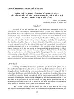
a. Nghien Cuu Bien
b. NCB-95
c. HQ638
Figure 1: Vessels participating in project Phase-I (2003-2006)
117
d. Sonne
Hội nghị Khoa học và Cơng nghệ biển tồn quốc lần thứ V - Tiểu ban Khí tượng, Thủy văn và Động lực học biển
Figure 2: Some of the instruments which were deployed
+ Measured stations are shown in Fig.3
a. Location of measured stations
b. Location of Biogeochemical flux traps
Figure 3: System of measuring stations during Phase-I (2003-2006)
- Method of empirical orthogonal function (EOF) was used to indicate the main structure of
SST in the South China Sea under the influence of monsoonal winds and the effects of global
climate change.
- The region of strongest upwelling along southern Central Vietnamese coast was identified
by using the wind stress data from Pacific Center for Fishery.
- Variation of SST, Chlorophyll-a, Primary Production in the surface layer of the southern
Central Vietnamese coast were studied by using the data extracted from MODIS and
SeaWiFS.
- Seasonal circulation patterns in the southern Central Vietnamese water were clarified by
using MCC method to extract the data from AVHRR. Study results show that there exists a
permanent large scale anticyclonic current in the study area throughout all seasons.
118
Hội nghị Khoa học và Cơng nghệ biển tồn quốc lần thứ V - Tiểu ban Khí tượng, Thủy văn và Động lực học biển
+ Ecology-Environment:
- During July a strong intrusion phenomenon of nutrients from deep layers to surface layer
exists in the upwelling area. This phenomenon affected the phosphate content; nutrients will
settle at the bottom and seriously affect the ecological-environmental condition especially
during summer while the oxygen content is low.
- Distribution of nutrients reflects the intrusion mechanic from deep water layers to the
photosynthetic layer.
- Primary production in the coastal water of Khanhhoa-Ninhthuan is dependent on the
intensity of upwelling.
- During strong upwelling events, two centers of highest primary production are formed in
Khanhhoa-Ninhthuan waters, chl-a content is highest in the upwelling season.
+ Marine planktons and particulated flux:
- Many species of planktons and small fishes have been detected.
- Highest density of cells occurred in the nearshore zone and at the layer between 20 and 40
m during the upwelling period.
- Highest biomass of plankton occurred in the nearshore zone from Tuyphong to Khanhhoa
and the offshore region of Phuyen waters during upwelling period.
- Highest quantity and density of spawning occurred in the nearshore zone from Camranh to
Vungtau and at surface layer during the upwelling period.
- Highest density of marine algae (spherical lime and silic) occurred during upwelling
period along southern Central Vietnamese Coast.
- Publication of a monography about the upwelling area and its related processes.
Project results obtained in Phase-I play an important role as they are of high scientific and
practical values, because they contribute to the understanding of the upwelling phenomenon
off southern Vietnam. However, the remaining problems which have to be tackled in further
studies are:
-
Seasonal variations of the interactive processes between the circulation at the west coast of
the South China Sea with Mekong River water and upwelling water masses.
-
The processes forming the hydrological fronts and their interaction with involved water
masses.
The question whether the upwelling area has received the material from Mekong River
system.
Enlargement of the data base for the upwelling region including interactive processes
between upwelling and Mekong River mouth water masses.
-
c. Main study results of Phase-II (2007-2010)
The joint project in Phase-II (2007-2010) continued with the study of the remained
problems of Phase-I (2003-2006) with the title: “Study on the coastal processes in the Mekong
River mouth area and the interactive processes between Mekong River and the upwelling
water masses”. The main objectives of joint project are as follows.
1. To assess the interactive processes between Mekong River and upwelling water
masses;
2. To assess the frontal features: structures and variations;
3. To construct a scientific base for the assessment and prediction of the marine
resources for sustainable development of coastal economic;
4. To improve the potential of Vietnamese Oceanographers to perform studies,
applications and international cooperations.
119
Hội nghị Khoa học và Cơng nghệ biển tồn quốc lần thứ V - Tiểu ban Khí tượng, Thủy văn và Động lực học biển
The main organizations that participated in the joint project are shown in Table 2.
Table 2: The main organizations participated in the joint project
Serial
Name of Organizations
No.
A. Vietnamese side
1
Institute of Oceanography
Responsibilities
Responsibility of all joint project
activities
2
Center for Marine dynamic and Water masses and hydrological fronts
environment, College of Science, Vietnam
National University, Hanoi.
3
Institute of Marine Resources and Construction of the data base
Environment
4
Center for Meteo-hydrological data Supply and analysis of long term
(National Center for Meteo-hydrology)
meteo-hydrological data
5
College of Science, Vietnam National Survey and computation of wave
University, Hochiminh City
characteristics
B. German side
1
Institute of Oceanography, Hamburg Survey and modeling of meteo-hydroUniversity, Germany
dynamical processes
2
Institute of Bio-geo-chemical, Hamburg Survey and study on sedimentation
University, Germany
processes
3
Institute of Marine Science Baltic Survey and study on nutrients, primary
Warnemünde, University of Rostock, production, biology, and hydroGermany
chemical features
- Field investigation: 4 cruises were carried out during low (4/2007, 4/2010) and high
(9/2008, 9/2009) river discharge periods, sampling the following parameters:
1. Meteo-hydro-dynamical: Wind, wave, current, water temperature-salinity, water
transparency, etc.);
2. Nutrients: Total P (mg/l), Nitrate (NO3-N mg/l), Nitrite (N-NH4, N-NO2), Total N
(inorganic, organic- mg/l).
3. Ecology: Chlorophyll a (mg/l), SPM (C g/m3), Primary production (C g/m3/day.
raw), Dissolve Oxygen, Silic;
4. Plankton (quantity and quality);
5. Geo-morphological condition (bottom sediment)
Field investigation stations are shown in Fig.4a,b,c.
The main study results of Phase-II are as follows.
- The long-term data of wind, typhoon strength, wave, sea water level (SWL), Mekong River
discharge, rain fall, etc. have been collected and analysis to estimate the features of meteohydrodynamical processes in the study area. Statistical results show that the study area is
strongly affected by monsoonal winds (NE monsoon from October to April, SW monsoon
from June to August, May and September are transitional periods). Typhoons occur from
October to December, especially in November (55%). In general, this area is less affected by
typhoon (0.57 typhoons/year) than the northern parts of Vietnam. High Mekong River
discharge occurred from June to November, especially in September with Qmax ≈ 15,800 m3/s
at Mythuan Station (9/2001) and 15,000 m3/s at Cantho Station (9/2001). Low river discharge
occurred from December to May, especially in March and April with Qmin ≈ 800 m3/s at
Mythuan Station (3/2005) and ≈ 760 m3/s at Cantho Station (4/2004). The tidal regime is
irregular semidiurnal with a maximum value of the SWL of 490 cm occurring in November.
120
Hội nghị Khoa học và Cơng nghệ biển tồn quốc lần thứ V - Tiểu ban Khí tượng, Thủy văn và Động lực học biển
0
11
Phanthiet
Tp.HCM
Vungtau
Phuquy Island
Tiengiang
20122 24
21 23 25
10
Bentr e
0
2
Tr avinh
Soctr ang
Baclieu
9
18
17
16
3
4
5
6
78
9
19
10
15
14
13
12
11
0
0
Condao Island
: depth contours (m)
: measured stations
8
: continuous stations
0
0
105.5
106
0
107
0
108
0
0
109
Figure 4a: System of measured stations during Phase-II: 2007-2010 (4/2007)
106.0
11.0
106.5
107.0
107.5
108.0
11.0
Phanthiet
Tp.HCM
10.5
Vungtau
10.5
37
2
1
3
10.0
36
5
Bentr e
13
12 11 10
15
635
7
8
34
9
10.0
33
32b
32
16
17b
17
31
Tr avinh
24
25
9.5
Soctr ang
23
30
29
22
27
28
18
19
21
20
: depth contours (m)
: measured stations
(floating)
: measured stations
(anchorage)
: continuous stations
AS1
26
9.0
106.0
106.5
9.5
0
107.0
107.5
0
9.0
0
108.0
Figure 4b: System of measured stations during Phase-II: 2007-2010 (9/2008)
121
Hội nghị Khoa học và Cơng nghệ biển tồn quốc lần thứ V - Tiểu ban Khí tượng, Thủy văn và Động lực học biển
10.5
: continuous measured
stations
0
50 Km
Phanthiet
Tp. HCM
Tien
H
Scale: 1/200 000
10
au
Phuquy Island
: depth contour (m)
: measured stations
Vungtau
Soa
øi
1
Tiengiang r ap M
out
2(I)
h
Dai Mouth
Riv
er
Ri
ve
r
3
Bentr e
4
Hamluong Mouth
5
Cunghau Mouth
7 (II)
8
Dinhan Mouth
9
13
10
6
Tr avinh
Soctr ang
9.5
11
14
Baclieu
12
15
16
9
17
Camau
18
Condao Island
8.5
105
105.5
106
106.5
107
107.5
108
Figure 4c: System of measured stations during Phase-II: 2007-2010 (9/2009 and 4/2010)
- Hydro-litho-dynamical processes in the study area were affected by monsoonal wind, river
discharge, tides and bottom topography. During the SW monsoonal wind period and high
river discharge, Mekong River water spreads up to about 80 to 100 km offshore inclining in
the northern part of study area towards the transect between Kega Headland and Phuquy
Island. During the NE monsoonal wind period under the effect of the cold boundary current
flowing parallel to the southern Vietnamese Coast from north to south, the Mekong River
water is constrained to the coast and directed to Camau Headland.
- In general, nutrients were mainly discharged from Mekong River. The content of Suspended
Particulate Matter (SPM) in the study area is approximately between 0.7 and 28.86 mg/l, with
an average value of 6.92 ± 5.6 mg/l. This SPM concentration is less than 50 mg/l (permission
threshold for critical nearshore water quality). During high river discharge period, the
concentration of chlorophyll-a and primary production rates are increasing from south to
north in the study area. During low river discharge period, the study area is a poor-nutrients
region. Concentration of plankton is 10 times higher during high river discharge periods
compared to low river discharge periods. Plankton is distributed mostly in the northern part
during SW monsoon and high river discharge, whereas, during low river discharge periods it
is distributed only around the river mouths.
- Mekong River mouth area is a region where water masses of the northern and southern
South China Sea interact with upwelling water, fresh water from river run-off. The interaction
of the above mentioned water masses induced the formation and distribution of seasonal
hydrological fronts. The density of total phytoplankton was mainly determined by silic algae,
whereas the density of toxic algae was low.
- Mekong River mouth area can be divided in to 3 regions depending on the affect of river
water. They are river water, intermediate and sea water dominated regions. Each region has its
specific ecology-environmental feature and bio-resources.
- The features of upwelling and Mekong River mouth water masses and their interaction are
depended on the western boundary current regime of the South China Sea and Mekong River
discharge.
122
Hội nghị Khoa học và Cơng nghệ biển tồn quốc lần thứ V - Tiểu ban Khí tượng, Thủy văn và Động lực học biển
- During NE monsoonal period (low river discharge), the water mass from the northern part of
the South China Sea with its characteristics of low temperature and high salinity follows the
western boundary current to the Mekong River estuary with characteristics of low salinity and
high temperature. Due to the interaction processes, it formed a water mass with characteristics
of T ≈ 25 0C, S ≈ 34 psu. This water mass covered the area from Phanthiet to Camau, and
extends as far as about 200 to 250 km offshore, except in the Mekong River mouth areas.
Mekong River water discharge is constrained to the nearshore and flows to Camau Headland.
- During SW monsoonal period (high river discharge) the characteristics of governing
processes are the dispersion of Mekong River mouth water to the upwelling region under the
affected of the western boundary circulation of the South China Sea from south to north.
Study results show that the extent of Mekong River mouth water mass with characteristics of
T ≥ 290C and S ≤ 32‰ in case of high river discharge and prevailing SW monsoonal wind
can reach to Phanthiet and enter the Condao and Phuquy Island region. The transect
Phanthiet-Phuquy marks the front of two water masses. In case of highest Mekong River
discharge (10/2005) the extent can be as far as 200 km off the coast. The thickness of Mekong
River water plume with a characteristic of S ≤ 32 psu [8] at the transect Longhai (off
Vungtau) was about 10 m. During the SW monsoonal period, the water mass along the
southern Central Vietnamese Coast has a T-S characteristic of 12 -29 0C and 31 -34,8 psu
from surface to 200 m depth. These T-S values are similar to the T-S values in the deep layer
of the Mekong River mouth shelf region. This is a proof of the dispersion of Mekong River
mouth water to the upwelling region. Preliminary calculations show that during the high
Mekong River discharge period and prevailing SW monsoonal winds (V = 6.8 m/s) the mass
transport through the transect Longhai (off Vungtau) was Q ≈ 1.2 .106 m3/s (1.2 Sv).
- The Mekong River mouth is a region of high primary production and biodiversity. However,
the exploitation level of bio-resources was critical. The impacts of global climate change
especially the SWL increase and lack of scientific base for the construction of hydroelectric
power dams in the upstream reaches of the Mekong River induce a significant sea water
intrusion as well as coastal erosion. These problems will form the main challenge for a future
sustainable development in the Mekong River delta.
d. Some comments for the joint project:
- The joint project carried out was necessary to obtain the concerned objectives from both
parties. In general, the main objectives of the joint project have been achieved as they are: a)
Preliminary the understanding of the features related to the upwelling phenomenon and its
interaction with adjacent regions, b) Estimation of the main hydro-litho-dynamical processes
and features of ecology-environment in the Mekong River mouth area, and c) qualitative
assessment of the interactive processes between Mekong River mouth and upwelling water
masses.
- The joint project carried out was an enhancement for the bilateral co-operation between
Vietnam and Germany on marine research and upgraded the marine research potential of
Vietnam, especially the application of modern equipment and study methods, like numerical
models [4].
However, some shortcomings have occurred during the execution of the joint project, namely:
+ Since the joint project proposal was approved from each country separately, unfortunately
the financial support was not available for the same time. As an example, the joint project
Phase-II was approved in Germany starting from 2007, but for Vietnamese side it took until
2009 before Phase II was approved. One more example: during 2000-2003 the joint project
between Vietnam and India was also approved at different times (in the year of 2000 the
Vietnamese side was approved, but the Indian side was approved in 2001). These problems
123
Hội nghị Khoa học và Cơng nghệ biển tồn quốc lần thứ V - Tiểu ban Khí tượng, Thủy văn và Động lực học biển
seriously affected the bilateral co-operation works. In fact, this situation led to independent
works of each side, consequently the effectiveness of the joint project with regard to scientific
and financial aspects was not optimal.
+ In general, the collaboration had worked nicely during field surveys, whereas, the
Vietnamese role in data analysis, professional works and publications was rather limited and
was mainly conducted by the foreign partner.
2. Interaction processes between Mekong River Mouth and upwelling water masses
This section illustrates some study results of the interaction processes between Mekong
River Mouth and upwelling water masses.
2.1. During NE monsoonal period
The study results are shown in Fig. 5a,b,c.
0
50 Km
10.5
Soõn
gT
So
õng
Vũng Tàu
ien
Ha
Tien Giang
Beỏn Tr e
ọu
Kiên Giang
10
Baứ Rũa-Vuừng Tầu
Tp. HCM
Tr à Vinh
Sóc Tr ăng
9.5
Bạc Liêu
9
Cµ Mau
Côn Đảo
8.5
105
105.5
106
106.5
107
107.5
108
Figure 5a: Distribution of the thickness (m) of Mekong River mouth water in April 2010
(S ≤ 32 psu)
0C
12
32
11.5
31
11
30
29
10.5
28
10
27
26
9.5
25
9
24
23
8.5
22
8
104.5
105
105.5
106
106.5
107
107.5
108
108.5
109
109.5
Figure 5b: Distribution of surface temperature (oC)
during January
124
Figure 5c: SPM concentration in
January (Model: HAMSOM [5])
Hội nghị Khoa học và Cơng nghệ biển tồn quốc lần thứ V - Tiểu ban Khí tượng, Thủy văn và Động lực học biển
The main findings are that during the NE monsoonal period the water mass from upwelling
area spreads into the Mekong River mouth region and the Mekong River water is constrained
to the coast and flows in southward direction up to Camau Headland (Fig. 5b,c). During the
transition period in April 2010 the Mekong River water occurred only around the river mouth
area (Fig. 5a).
3.2.2. During SW monsoonal period
The study results are shown in Fig. 6a,b,c,d,e.
0
50 Km
10.5
Sôn
gT
So
âng
H
Vịng Tµu
iền
Tiền Giang
Bến Tr e
ậ u
Kiên Giang
10
Baứ Rũa-Vuừng Tau
Tp. HCM
Tr aứ Vinh
Soực Tr aờng
9.5
Baùc Lieõu
9
Cà Mau
Côn Đảo
8.5
105
105.5
106
106.5
107
107.5
108
Figure 6a: Distribution of the thickness (m) of Mekong River mouth water in September 2009
(S ≤ 32 psu)
0
-5
-10
-15
-20
14
-10
16
-8
18
-6
20
-4
22
-2
0
2
4
6
8
10
12
Figure 6b: Distribution of salinity (S psu) at continuous station LT-I
during 14h/19/8 – 12h/20/8/2009 (Vungtau transect)
125
Hội nghị Khoa học và Cơng nghệ biển tồn quốc lần thứ V - Tiểu ban Khí tượng, Thủy văn và Động lực học biển
W
E
0
Tr.1
-10
Tr.2
-20
Tr.3
-30
Tr.4
Tr.5
Tr.6
m
107.0
107.2
107.4
Tr.7
Tr.8
107.6
Tr.9
o
107.8 N
Tr.10
Figure 6c: Distribution of salinity (S psu) in the transect Dai Mouth – Lagi (8/2009)
Figure 6d: SPM concentration on 24/9/2009
(MODIS Image)
Figure 6e: SPM
concentration in August
(Model: HAMSOM)
During SW monsoonal period and high river discharge, the main study results are that the
water mass from Mekong River mouth region spreads into the upwelling region. In September
2009, the Mekong River mouth water (S ≤ 32 psu) extended as far as 100 km off the coast
with the thickness of about 15 m (Fig. 6a), and spreads to the north up to Lagi water (Fig. 6c)
with the thickness of about 10 m. During August 2009 an intrusion of Mekong River water
was observed on the Vungtau transect with a thickness from surface to the bottom (Fig. 6b).
However, this study was still not sufficient to quantify the total volume of Mekong River
water spreading into the upwelling region.
IV. CONCLUSIONS
- The joint project carried out was necessary to obtain the concerned objectives from both
parties. In general, the main objectives of the joint project have been achieved as they are: a)
Preliminary the understanding of the features related to the upwelling phenomenon and its
interaction with adjacent regions, b) Estimation of the main hydro-litho-dynamical processes
and features of ecology-environment in the Mekong River mouth area, and c) qualitative
assessment of the interactive processes between Mekong River mouth and upwelling water
masses. The joint project carried out was an enhancement for the bilateral co-operation
between Vietnam and Germany on marine research and upgraded the marine research
potential of Vietnam, especially the application of modern equipment and study methods, like
126
Hội nghị Khoa học và Cơng nghệ biển tồn quốc lần thứ V - Tiểu ban Khí tượng, Thủy văn và Động lực học biển
numerical models. However, some shortcomings have occurred during the execution of the
joint project, these problems have to be solved in the future.
- During the NE monsoonal period the water mass from upwelling area spreads into the
Mekong River mouth region and the Mekong River water is constrained to the coast and
flows in southward direction up to Camau Headland. In contrast during the SW monsoonal
period and high river discharge, the main study results are that the water mass from Mekong
River mouth region spreads into the upwelling region. However, our study was still not
sufficient to quantify the total volume of Mekong River water dispersion into the upwelling
region.
ACKNOWLEDGEMENTS
The authors gratefully acknowledge all colleagues for their kind help and encouragement
throughout the preparation of this paper.
REFERENCES
1.
2.
3.
4.
5.
6.
7.
8.
Bui Hong Long, “Study on the structure, variation and ecology-environmental effects of
Vietnamese upwelling area”. Final report of the joint project between Vietnam-Germany,
Phase-I: 2003-2006. Nhatrang, 2006, 223 ps.
CEM, Coastal Engineering Manual, 2006 (replacement to Shore Protection Manual
1984). Publication Number: EM 1110-2-1100. U.S. Army Corps of Engineers (USACE).
Egorop, N.I, Physical Oceanography. (In Vietnamese), Volume I and II, 1981, University
and Training School Publisher, Hanoi.
Hein, H., T. Pohlmann; B.H. Long, N.K. Vinh, Inter-annual variability in the South
China Sea and its consequences on the Vietnamese upwelling area, 2011. Submitted to:
Global and Planetary Change.
Hein, H., B. Hein, T. Pohlmann, Recent sediment dynamics in the Mekong ROFI, 2011.
Submitted to: Global and Planetary Change.
Le Dinh Mau, “Study on the hydro-litho-dynamic, and ecology-environmental features in
the Mekong River mouth area and the interactive processes between Mekong River mouth
and upwelling water masses”. Final report of the joint project between VietnamGermany, 2011, Phase-II: 2007-2010. Nhatrang, 180 ps.
Pickard, G. L. and W. J. Emery, Descriptive Physical Oceanography. An Introduction,
Fifth enlarged Edition (in SI units), 1993. Pergamon Press, 320ps.
Robinson, M. K, The physical oceanography of the Gulf of Thailand, NAGA Expedition.
La Jolla, California: NAGA Report, 1974, v. 3, P. 1, p. 5-110.
127