ENCYCLOPEDIA OF ENVIRONMENTAL SCIENCE AND ENGINEERING - GEOGRAPHIC INFORMATION SYSTEMS doc
Bạn đang xem bản rút gọn của tài liệu. Xem và tải ngay bản đầy đủ của tài liệu tại đây (119.75 KB, 2 trang )
425
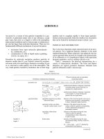
G
G EOGRAPHIC INFORMATION SYSTEMS
The term “Geographic Information System” (GIS) varies as
a matter of perspective, and ranges in scope from specific
computer software packages to software, hardware and data,
to software, hardware, data, and support personnel. The most
exhaustive definition is given by Dueker and Kjern as:
Geographic Information System—A system of hardware,
software, data, people, organizations, and institutional
arrangements for collecting, storing, analyzing, and dissemi-
nating information about areas of the earth.
While this is an all-inclusive definition, the software
packages at the heart of a GIS have their roots in the work
of two researchers at Ohio State University, Marble and
Tomlinson, in the mid to late 1960s. These men coined the
phrase “Geographic Information System,” and defined a GIS
as having the following four components:
1. Data Input and the ability to process data.
2. Data Storage and Retrieval with the ability to
edit.
3. Data Manipulation and Analysis.
4. Data Reporting Systems for the display of tabular
and graphic information.
Data input, storage/retrieval, and reporting were (and still
are) common to two other computer software packages—
Computer Assisted Mapping (CAM) and Database
Management Systems (DBMS) which separately managed
graphical and tabular information. The development of GIS
combined these packages to provide what many refer to as
“intelligent maps,” which are maps with extended informa-
tion. Extended information can include information from
areas such as census, tax assessment, natural resources
availability/quality, which may be linked to a map, but
are managed as part of a separate database. However, the
true distinction of a GIS is Marble and Tomlinson’s third
component—the ability to analyze spatial information. The
analysis capability enables a GIS to automatically evaluate
information from several sources as a function of their spa-
tial context. CAM systems may provide some of the same
information as a GIS through a series of separate maps, but
they require manual interpretation.
There are six basic analytical questions which many GIS
software packages are able to address, partially or in full.
These are:
1. Location—“What is it?”—What types of features
exist at a certain place, such as “What is the popu-
lation of a given census tract?”
2. Condition—“Where is it?”—Finding a site with
certain characteristics, such as “Which agricul-
tural fields are within 100 meters of a stream?”
3. Trend—“What has changed?”—Evaluation of
spatial data as a function of time.
4. Routing—“Which is the best way?”—A variety of
problems to determine paths through a network,
such as finding the shortest path or optimum flow
rates.
5. Pattern—“What is the pattern?”—A function
which allows environmental and social planners to
account for spatial distribution. Examples include
the spread of diseases, population distribution
versus urban development, or targeting specific
consumer trends.
6. Modeling—“What if?”—Allow model develop-
ment and evaluation, including “Monte Carlo”
evaluation, where a variety of factors influence
a situation, and their relationship is determined
by varying one factor while holding the others
constant.
A GIS is able to perform the above operations because
they maintain the topology, or spatial associations, of the
elements of their database. For example, an individual look-
ing for 617 East Central Avenue on a map is able to see that
this address is between 6th and 7th streets, on the south side
of the street. Furthermore, if the individual wants to drive
© 2006 by Taylor & Francis Group, LLC
426 GEOGRAPHIC INFORMATION SYSTEMS
to this address and the map indicates that these streets are
one-way in given directions, they are able to plan their route
accordingly. A GIS may perform the same operation because
it has the same information—that 6th and 7th intersect
Central Avenue, the directed flow of traffic on these streets,
and the distinction of areas on the left and right side of a line.
This case is an example of what is called a “vector format”
GIS, where space is represented by a two dimensional mani-
fold of polygons (city blocks) which are bounded by a set of
directed line segments (streets).
The other format by which a GIS may represent spa-
tial data is referred to as “raster format.” In this format, an
area or volume is represented by a two or three dimensional
matrix of uniform data elements, called “grid cells.” Grid
cells are the smallest areas that this type of GIS may resolve
and are artificial constructs uniform in size and shape and
are considered to have homogeneous data properties. An
example would be a Soil map represented as a series of 30
meter by 30 meter plots of ground, where each plot is con-
sidered to be one particular type of soil, or a uniform blend
of multiple soil types. An advantage of the raster format is
the ability to show gradual changes and trends over a spatial
area, because the matrix indices of the grid cell coordinates
inherently imply the topology of the GIS data set. One of the
disadvantages of the raster format is that data in the “real
world” may not conveniently break down into uniform grid
cells. Consequently, using this format involves an optimiza-
tion problem to select a grid cell resolution that adequately
represent the given data set, while minimizing the database
size. Decreasing the size of gird cells in a raster exponen-
tially increases the database size.
With the growing usage of Geographic Information
Systems, there is a corresponding need for standardization.
Standardization does not mean that all GIS databases con-
tain the same format and quality of information; instead it
provides a common terminology and format for maintaining
appropriate metadata, or data about data. Currently in the
United States, the official federal standard regarding GIS is
the Spatial Data Transfer Standard, which provides a spe-
cific terminology for GIS through a set of definitions and
format for maintaining an appropriate spatial data quality
report for metadata. The importance of providing a stan-
dard, such as the SDTS, is that it provides the end user with
and ability to assess whether or not the output from a GIS
has the quality necessary to carry out further operations or
analysis.
Dueker and Kjern’s definition of a GIS is the most appropri-
ate to consider, because the successful adoption of a GIS does
not rely only on purchasing a software package. A GIS relies
on people gathering the appropriate data, which is then input
and manipulated in the GIS software environment, and which
has knowledgeable individuals interpreting and analyzing
results for their acceptability. Therefore, these elements must
be considered as part of a Geographic Information System.
REFERENCES
Cooke, D.F., 1992, Spatial Decision Support System: Not Just Another GIS,
Geo Info Systems, May 1992, pp. 46–49.
Cowen, D.J., 1988, GIS versus CAD versus DBMS: What Are the Differ-
ences Photogrammetric Engineering and Remote Sensing, Vol. 54,
No. 11, pp. 1551–1555.
Dueker, K.J., 1987, Geographic Information Systems and Computer Aided
Mapping, APA Journal, Vol. 53, No. 3, pp. 383–390.
Joffe, B.A. and B.S. Bergstrand, 1992, Managing Engineering Drawings in
a GIS Environment, Geo Info Systems, April 1992, pp. 58–63.
Huxhold, W.E., 1991, Information in the Organization, An Introduction
to Urban Geographic Information Systems, Oxford University Press,
New York, pp. 3–24.
National Institute of Standards and Technology (NIST), 1992, Federal
Information Processing Standard Publication 173: Spatial Data Trans-
fer Standard, Part 1, U.S. Department of Commerce.
TODD HEPWORTH
University of Wisconsin
© 2006 by Taylor & Francis Group, LLC