the american practical navigator chapt 32
Bạn đang xem bản rút gọn của tài liệu. Xem và tải ngay bản đầy đủ của tài liệu tại đây (859.38 KB, 12 trang )
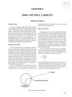
CHAPTER 32
WAVES, BREAKERS AND SURF
OCEAN WAVES
3200. Introduction
3202. Wave Characteristics
Ocean waves, the most easily observed phenomenon at
sea, are probably the least understood by the average
seaman. More than any other single factor, ocean waves are
likely to cause a navigator to change course or speed to
avoid damage to ship and cargo. Wind-generated ocean
waves have been measured at more than 100 feet high, and
tsunamis, caused by earthquakes, far higher. A mariner
with knowledge of basic facts concerning waves is able to
use them to his advantage, avoid hazardous conditions, and
operate with a minimum of danger if such conditions
cannot be avoided. See Chapter 37, Weather Routing, for
details on how to avoid areas of severe waves.
Ocean waves are very nearly in the shape of an inverted cycloid, the figure formed by a point inside the
rim of a wheel rolling along a level surface. This shape
is shown in Figure 3202a. The highest parts of waves are
called crests, and the intervening lowest parts, troughs.
Since the crests are steeper and narrower than the
troughs, the mean or still water level is a little lower than
halfway between the crests and troughs. The vertical distance between trough and crest is called wave height,
labeled H in Figure 3202a. The horizontal distance between successive crests, measured in the direction of
travel, is called wavelength, labeled L. The time interval
between passage of successive crests at a stationary
point is called wave period (P). Wave height, length,
and period depend upon a number of factors, such as the
wind speed, the length of time it has blown, and its fetch
(the straight distance it has traveled over the surface).
Table 3202 indicates the relationship between wind
speed, fetch, length of time the wind blows, wave height,
and wave period in deep water.
3201. Causes of Waves
Waves on the surface of the sea are caused principally
by wind, but other factors, such as submarine earthquakes,
volcanic eruptions, and the tide, also cause waves. If a
breeze of less than 2 knots starts to blow across smooth
water, small wavelets called ripples form almost instantaneously. When the breeze dies, the ripples disappear as
suddenly as they formed, the level surface being restored by
surface tension of the water. If the wind speed exceeds 2
knots, more stable gravity waves gradually form, and
progress with the wind.
While the generating wind blows, the resulting waves
may be referred to as sea. When the wind stops or changes
direction, waves that continue on without relation to local
winds are called swell.
Unlike wind and current, waves are not deflected
appreciably by the rotation of the Earth, but move in the
direction in which the generating wind blows. When this
wind ceases, friction and spreading cause the waves to be
reduced in height, or attenuated, as they move. However,
the reduction takes place so slowly that swell often
continues until it reaches some obstruction, such as a shore.
The Fleet Numerical Meteorology and Oceanography
Center produces synoptic analyses and predictions of ocean
wave heights using a spectral numerical model. The wave
information consists of heights and directions for different
periods and wavelengths. Verification of projected data has
proven the model to be very good. Information from the model
is provided to the U.S. Navy on a routine basis and is a vital
input to the Optimum Track Ship Routing program.
Figure 3202a. A typical sea wave.
If the water is deeper than one-half the wavelength (L),
this length in feet is theoretically related to period (P) in
seconds by the formula:
2
L = 5.12 P .
The actual value has been found to be a little less than
this for swell, and about two-thirds the length determined
by this formula for sea. When the waves leave the generating area and continue as free waves, the wavelength and
period continue to increase, while the height decreases. The
rate of change gradually decreases.
The speed (S) of a free wave in deep water is nearly
independent of its height or steepness. For swell, its
441
442
BEAUFORT NUMBER
3
Fetch
T
4. 4
7. 1
9. 8
12. 0
14. 0
16. 0
18. 0
20. 0
23. 6
27. 1
31. 1
36. 6
43. 2
50. 0
H
P
1. 8
2. 0
2. 0
2. 0
2. 0
2. 0
2. 0
2. 0
2. 0
2. 0
2. 0
2. 0
2. 0
2. 0
2. 1
2. 5
2. 8
3. 0
3. 2
3. 5
3. 7
3. 8
3. 9
4. 0
4. 2
4. 5
4. 9
4. 9
T
3. 7
6. 2
8. 3
10. 3
12. 4
14. 0
15. 8
17. 0
18. 8
20. 0
22. 4
25. 8
28. 4
30. 9
33. 5
36. 5
39. 2
41. 9
44. 5
47. 0
5
H
P
2. 6
3. 2
3. 8
3. 9
4. 0
4. 0
4. 0
4. 0
4. 0
4. 0
4. 1
4. 2
4. 2
4. 3
4. 3
4. 4
4. 4
4. 4
4. 4
4. 4
2. 4
2. 9
3. 3
3. 6
3. 8
4. 0
4. 1
4. 2
4. 3
4. 4
4. 7
4. 9
5. 2
5. 4
5. 6
5. 8
5. 9
6. 0
6. 2
6. 3
T
3. 2
5. 4
7. 2
8. 9
11. 0
12. 0
13. 5
15. 0
16. 5
17. 5
20. 0
22. 5
24. 3
27. 0
29. 0
31. 1
33. 1
34. 9
36. 8
38. 5
40. 5
42. 4
44. 2
46. 1
48. 0
50. 0
52. 0
54. 0
56. 0
58. 0
6
H
P
3. 5
4. 9
5. 8
6. 2
6. 5
6. 8
7. 0
7. 2
7. 3
7. 3
7. 8
7. 9
7. 9
8. 0
8. 0
8. 0
8. 0
8. 0
8. 0
8. 0
8. 0
8. 0
8. 0
8. 0
8. 0
8. 0
8. 0
8. 0
8. 0
8. 0
2. 8
3. 3
3. 7
4. 1
4. 4
4. 6
4. 8
4. 9
5. 1
5. 3
5. 4
5. 8
6. 0
6. 2
6. 4
6. 6
6. 8
6. 9
7. 0
7. 1
7. 2
7. 3
7. 4
7. 5
7. 7
7. 8
7. 9
8. 0
8. 1
8. 2
T
H
2. 7
4. 7
6. 2
7. 8
9. 1
10. 2
11. 9
13. 0
14. 1
15. 1
17. 0
19. 1
21. 1
23. 1
25. 4
27. 2
29. 0
30. 5
32. 4
34. 1
36. 0
37. 6
38. 8
40. 2
42. 2
43. 5
44. 7
46. 2
47. 8
49. 2
53. 0
56. 3
5. 0
7. 0
8. 0
9. 0
9. 8
10. 3
10. 8
11. 0
11. 2
11. 4
11. 7
11. 9
12. 0
12. 1
12. 2
12. 3
12. 4
12. 6
12. 9
13. 1
13. 3
13. 4
13. 4
13. 5
13. 5
13. 6
13. 7
13. 7
13. 7
13. 8
13. 8
13. 8
7
P
3. 1
3. 8
4. 2
4. 6
4. 8
5. 1
5. 4
5. 6
5. 8
6. 0
6. 2
6. 4
6. 6
6. 8
7. 1
7. 2
7. 3
7. 5
7. 8
8. 0
8. 2
8. 3
8. 4
8. 5
8. 6
8. 7
8. 8
8. 9
9. 0
9. 1
9. 3
9. 5
8
9
10
11
T
H
P
T
H
P
T
H
P
T
H
P
T
H
2. 5
4. 2
5. 8
7. 1
8. 4
9. 6
10. 5
12. 0
13. 0
14. 0
15. 9
17. 6
19. 5
21. 3
23. 1
25. 0
26. 8
28. 0
29. 5
31. 5
33. 0
34. 2
35. 7
37. 1
38. 8
40. 0
41. 3
42. 8
44. 0
45. 5
48. 5
51. 8
55. 0
58. 5
6. 0
8. 6
10. 0
11. 2
12. 2
13. 2
13. 9
14. 5
15. 0
15. 5
16. 0
16. 2
16. 5
17. 0
17. 5
17. 9
17. 9
18. 0
18. 0
18. 0
18. 0
18. 0
18. 1
18. 2
18. 4
18. 7
18. 8
19. 0
19. 0
19. 1
19. 5
19. 7
19. 8
19. 8
3. 4
4. 3
4. 6
4. 9
5. 2
5. 5
5. 7
6. 0
6. 3
6. 5
6. 7
7. 0
7. 3
7. 5
7. 7
8. 0
8. 2
8. 4
8. 5
8. 7
8. 9
9. 0
9. 1
9. 3
9. 5
9. 6
9. 7
9. 8
9. 9
10. 1
10. 3
10. 5
10. 7
11. 0
2. 3
3. 9
5. 2
6. 5
7. 7
8. 7
9. 9
11. 0
12. 0
12. 8
14. 5
16. 0
18. 0
19. 9
21. 5
22. 9
24. 4
26. 0
27. 7
29. 0
30. 2
31. 6
33. 0
34. 2
35. 6
36. 9
38. 1
39. 5
41. 0
42. 1
44. 9
47. 7
50. 3
53. 2
56. 2
59. 2
7. 3
10. 0
12. 1
14. 0
15. 7
17. 0
18. 0
18. 9
20. 0
20. 5
21. 5
22. 0
23. 0
23. 5
23. 5
24. 0
24. 5
25. 0
25. 0
25. 0
25. 0
25. 0
25. 0
25. 5
26. 0
26. 5
27. 0
27. 5
27. 5
27. 5
27. 5
27. 5
27. 5
27. 5
27. 5
27. 5
3. 9
4. 4
5. 0
5. 4
5. 6
6. 0
6. 4
6. 6
6. 7
6. 9
7. 3
7. 6
8. 0
8. 3
8. 5
8. 8
9. 0
9. 2
9. 4
9. 5
9. 6
9. 8
9. 9
10. 0
10. 2
10. 3
10. 4
10. 6
10. 8
10. 9
11. 1
11. 3
11. 6
11. 8
12. 1
12. 3
2. 0
3. 5
4. 7
5. 8
6. 9
8. 0
9. 0
10. 0
11. 0
11. 9
13. 1
14. 8
16. 4
18. 0
19. 3
20. 9
22. 0
23. 5
25. 0
26. 3
27. 6
29. 0
30. 0
31. 3
32. 5
33. 7
34. 8
36. 0
37. 0
38. 3
41. 0
43. 6
46. 4
49. 0
51. 0
53. 8
56. 2
58. 2
8. 0
12. 0
15. 8
17. 7
19. 8
21. 0
22. 5
24. 0
25. 0
26. 5
27. 5
29. 0
30. 5
31. 5
32. 5
34. 0
34. 5
34. 5
35. 0
35. 0
35. 5
36. 0
36. 5
37. 0
37. 0
37. 5
37. 5
37. 5
37. 5
38. 0
38. 5
39. 0
39. 5
40. 0
40. 0
40. 0
40. 0
40. 0
4. 1
5. 0
5. 5
5. 9
6. 3
6. 5
6. 8
7. 1
7. 2
7. 6
7. 9
8. 3
8. 7
9. 0
9. 2
9. 6
9. 8
10. 0
10. 2
10. 4
10. 6
10. 8
10. 9
11. 1
11. 2
11. 4
11. 5
11. 7
11. 8
11. 9
12. 2
12. 5
12. 8
13. 1
13. 3
13. 5
13. 8
14. 0
1. 9
3. 2
4. 4
5. 4
6. 4
7. 4
8. 3
9. 3
10. 2
11. 0
12. 3
13. 9
15. 1
16. 5
18. 1
19. 1
20. 5
21. 8
23. 0
24. 3
25. 5
26. 7
27. 7
29. 1
30. 2
31. 5
32. 5
33. 5
34. 5
35. 5
38. 2
40. 3
43. 0
45. 4
48. 0
50. 6
52. 5
54. 6
57. 2
59. 3
10. 0
14. 0
18. 0
21. 0
23. 0
25. 0
26. 5
28. 0
30. 0
32. 0
33. 5
35. 5
37. 0
38. 5
40. 0
41. 5
43. 0
44. 0
45. 0
45. 0
45. 5
46. 0
46. 5
47. 0
47. 5
47. 5
48. 0
48. 5
49. 0
49. 0
50. 0
50. 0
50. 0
50. 5
51. 0
51. 5
52. 0
52. 0
52. 0
52. 0
4. 2
5. 2
6. 0
6. 3
6. 7
7. 0
7. 3
7. 7
7. 9
8. 1
8. 4
8. 8
9. 1
9. 5
9. 8
10. 1
10. 3
10. 6
10. 9
11. 1
11. 2
11. 4
11. 6
11. 8
12. 0
12. 2
12. 3
12. 5
12. 6
12. 7
13. 0
13. 3
13. 7
14. 0
14. 2
14. 5
14. 6
14. 9
15. 1
15. 3
1. 8
3. 0
4. 1
5. 1
6. 1
7. 0
7. 8
8. 6
9. 5
10. 3
11. 5
13. 0
14. 5
16. 0
17. 1
18. 2
19. 5
20. 9
22. 0
23. 2
24. 5
25. 5
26. 6
27. 7
28. 9
29. 6
30. 9
31. 8
32. 7
33. 9
36. 5
38. 7
41. 0
43. 5
45. 8
47. 8
50. 0
52. 0
54. 0
56. 3
10. 0
16. 0
19. 8
22. 5
25. 0
27. 5
29. 5
31. 5
34. 0
35. 0
37. 5
40. 0
42. 5
44. 5
46. 0
47. 5
49. 0
50. 5
51. 5
53. 0
54. 0
55. 0
55. 0
55. 5
56. 0
56. 5
57. 0
57. 5
57. 5
58. 0
59. 0
60. 0
60. 0
60. 5
61. 0
61. 5
62. 0
62. 5
63. 0
63. 0
Table 3202. Minimum Time (T) in hours that wind must blow to form waves of H significant height (in feet) and P period (in seconds). Fetch in nautical miles.
Fetch
P
5. 0 10
5. 9 20
6. 3 30
6. 7 40
7. 1 50
7. 5 60
7. 7 70
7. 9 80
8. 2 90
8. 5 100
8. 8 120
9. 2 140
9. 6 160
10. 0 180
10. 3 200
10. 6 220
10. 8 240
11. 1 260
11. 3 280
11. 6 300
11. 8 320
12. 0 340
12. 2 360
12. 4 380
12. 6 400
12. 7 420
12. 9 440
13. 1 460
13. 2 480
13. 4 500
13. 7 550
14. 0 600
14. 2 650
14. 5 700
14. 8 750
15. 0 800
15. 2 850
15. 5 900
15. 7 950
16. 0 1000
WAVES, BREAKERS AND SURF
10
20
30
40
50
60
70
80
90
100
120
140
160
180
200
220
240
260
280
300
320
340
360
380
400
420
440
460
480
500
550
600
650
700
750
800
850
900
950
1000
4
WAVES, BREAKERS AND SURF
443
Figure 3202b. Relationship between speed, length, and period of waves in deep water, based upon the theoretical
relationship between period and length.
relationship in knots to the period (P) in seconds is given by
the formula
S = 3.03P .
The relationship for sea is not known.
The theoretical relationship between speed, wavelength,
and period is shown in Figure 3202b. As waves continue on
beyond the generating area, the period, wavelength, and
speed remain the same. Because the waves of each period
have different speeds they tend to sort themselves by periods
as they move away from the generating area. The longer period waves move at a greater speed and move ahead. At great
enough distances from a storm area the waves will have sorted themselves into sets based on period.
All waves are attenuated as they propagate but the
short period waves attenuate faster, so that far from a storm
only the longer waves remain.
The time needed for a wave system to travel a given
distance is double that which would be indicated by the
speed of individual waves. This is because each leading
wave in succession gradually disappears and transfers
its energy to following wave. The process occurs such
that the whole wave system advances at a speed which
is just half that of each individual wave. This process
can easily be seen in the bow wave of a vessel. The
speed at which the wave system advances is called
group velocity.
Because of the existence of many independent wave
Figure 3202c. Interference. The upper part of A shows two
waves of equal height and nearly equal length traveling in
the same direction. The lower part of A shows the resulting
wave pattern. In B similar information is shown for short
waves and long swell.
systems at the same time, the sea surface acquires a
complex and irregular pattern. Since the longer waves
overrun the shorter ones, the resulting interference adds to
the complexity of the pattern. The process of interference,
illustrated in Figure 3202c, is duplicated many times in the
sea; it is the principal reason that successive waves are
not of the same height. The irregularity of the surface may
be further accentuated by the presence of wave systems
crossing at an angle to each other, producing peak-like
rises.
444
WAVES, BREAKERS AND SURF
In reporting average wave heights, the mariner has a
tendency to neglect the lower ones. It has been found that
the reported value is about the average for the highest onethird. This is sometimes called the “significant” wave
height. The approximate relationship between this height
and others, is as follows:
Wave
Average
Significant
Highest 10 percent
Highest
Relative height
0.64
1.00
1.29
1.87
3203. Path of Water Particles in a Wave
As shown in Figure 3203, a particle of water on the
surface of the ocean follows a somewhat circular orbit as a
wave passes, but moves very little in the direction of motion
of the wave. The common wave producing this action is
called an oscillatory wave. As the crest passes, the particle
moves forward, giving the water the appearance of moving
with the wave. As the trough passes, the motion is in the
opposite direction. The radius of the circular orbit decreases
with depth, approaching zero at a depth equal to about half
the wavelength. In shallower water the orbits become more
elliptical, and in very shallow water the vertical motion
disappears almost completely.
3204. Effects of Current and Ice on Waves
A following current increases wavelengths and
decreases wave heights. An opposing current has the
opposite effect, decreasing the length and increasing the
height. This effect can be dangerous in certain areas of the
world where a stream current opposes waves generated by
severe weather. An example of this effect is off the coast of
South Africa, where the Agulhas current is often opposed
by westerly storms, creating steep, dangerous seas. A
strong opposing current may cause the waves to break, as in
the case of overfalls in tidal currents. The extent of wave
alteration is dependent upon the ratio of the still-water wave
speed to the speed of the current.
Moderate ocean currents running at oblique angles to
wave directions appear to have little effect, but strong tidal
currents perpendicular to a system of waves have been
observed to completely destroy them in a short period of
time.
When ice crystals form in seawater, internal friction is
greatly increased. This results in smoothing of the sea
surface. The effect of pack ice is even more pronounced. A
vessel following a lead through such ice may be in smooth
water even when a gale is blowing and heavy seas are
beating against the outer edge of the pack. Hail or torrential
rain is also effective in flattening the sea, even in a high
wind.
3205. Waves and Shallow Water
Figure 3203. Orbital motion and displacement, s, of a
particle on the surface of deep water during two wave
periods.
Since the speed is greater at the top of the orbit than at
the bottom, the particle is not at exactly its original point
following passage of a wave, but has moved slightly in the
wave’s direction of motion. However, since this advance is
small in relation to the vertical displacement, a floating
object is raised and lowered by passage of a wave, but
moved little from its original position. If this were not so, a
slow moving vessel might experience considerable
difficulty in making way against a wave train. In Figure
3203 the forward displacement is greatly exaggerated.
When a wave encounters shallow water, the movement
of the water is restricted by the bottom, resulting in reduced
wave speed. In deep water wave speed is a function of
period. In shallow water, the wave speed becomes a function
of depth. The shallower the water, the slower the wave
speed. As the wave speed slows, the period remains the
same, so the wavelength becomes shorter. Since the energy
in the waves remains the same, the shortening of
wavelengths results in increased heights. This process is
called shoaling. If the wave approaches a shallow area at an
angle, each part is slowed successively as the depth
decreases. This causes a change in direction of motion, or
refraction, the wave tending to change direction parallel to
the depth curves. The effect is similar to the refraction of
light and other forms of radiant energy.
As each wave slows, the next wave behind it, in deeper
water, tends to catch up. As the wavelength decreases, the
height generally becomes greater. The lower part of a wave,
being nearest the bottom, is slowed more than the top. This
may cause the wave to become unstable, the faster-moving
top falling forward or breaking. Such a wave is called a
breaker, and a series of breakers is surf.
Swell passing over a shoal but not breaking undergoes
a decrease in wavelength and speed, and an increase in
height, which may be sudden and dramatic, depending on
the steepness of the seafloor’s slope. This ground swell
WAVES, BREAKERS AND SURF
445
Figure 3205. Alteration of the characteristics of waves crossing a shoal.
may cause heavy rolling if it is on the beam and its period
is the same as the period of roll of a vessel, even though the
sea may appear relatively calm. It may also cause a rage
sea, when the swell waves encounter water shoal enough to
make them break. Rage seas are dangerous to small craft,
particularly approaching from seaward, as the vessel can be
overwhelmed by enormous breakers in perfectly calm
weather. The swell waves, of course, may have been
generated hundreds of miles away. In the open ocean they
are almost unnoticed due to their very long period and
wavelength. Figure 3205 illustrates the approximate
alteration of the characteristics of waves as they cross a
shoal.
3206. Energy Of Waves
The potential energy of a wave is related to the vertical
distance of each particle from its still-water position. Therefore
potential energy moves with the wave. In contrast, the kinetic
energy of a wave is related to the speed of the particles,
distributed evenly along the entire wave.
The amount of kinetic energy in a wave is tremendous. A
4-foot, 10-second wave striking a coast expends more than
35,000 horsepower per mile of beach. For each 56 miles of
coast, the energy expended equals the power generated at
Hoover Dam. An increase in temperature of the water in the
relatively narrow surf zone in which this energy is expended
would seem to be indicated, but no pronounced increase has
been measured. Apparently, any heat that may be generated is
dissipated to the deeper water beyond the surf zone.
3207. Wave Measurement Aboard Ship
With suitable equipment and adequate training,
reliable measurements of the height, length, period, and
speed of waves can be made. However, the mariner’s
estimates of height and length often contain relatively large
errors. There is a tendency to underestimate the heights of
low waves, and overestimate the heights of high ones.
There are numerous accounts of waves 75 to 80 feet high,
or even higher, although waves more than 55 feet high are
very rare. Wavelength is usually underestimated. The
motions of the vessel from which measurements are made
contribute to such errors.
Height. Measurement of wave height is particularly
difficult. A microbarograph can be used if the wave is long
enough or the vessel small enough to permit the vessel to
ride from crest to trough. If the waves are approaching from
dead ahead or dead astern, this requires a wavelength at
least twice the length of the vessel. For most accurate
results the instrument should be placed at the center of roll
and pitch, to minimize the effects of these motions. Wave
height can often be estimated with reasonable accuracy by
comparing it with freeboard of the vessel. This is less
accurate as wave height and vessel motion increase. If a
point of observation can be found at which the top of a wave
is in line with the horizon when the observer is in the
trough, the wave height is equal to height of eye. However,
if the vessel is rolling or pitching, this height at the moment
of observation may be difficult to determine. The highest
wave ever reliably reported was 112 feet observed from the
USS Ramapo in 1933.
Length. The dimensions of the vessel can be used to
determine wavelength. Errors are introduced by perspective
and disturbance of the wave pattern by the vessel. These
errors are minimized if observations are made from
maximum height. Best results are obtained if the sea is from
dead ahead or dead astern.
Period. If allowance is made for the motion of the
vessel, wave period can be determined by measuring the
446
WAVES, BREAKERS AND SURF
interval between passages of wave crests past the observer.
The relative motion of the vessel can be eliminated by timing
the passage of successive wave crests past a patch of foam or
a floating object at some distance from the vessel. Accuracy
of results can be improved by averaging several
observations.
Speed. Speed can be determined by timing the passage
of the wave between measured points along the side of the
ship, if corrections are applied for the direction of travel for
the wave and the speed of the ship.
The length, period, and speed of waves are interrelated
by the relationships indicated previously. There is no
definite mathematical relationship between wave height
and length, period, or speed.
3208. Tsunamis
A Tsunami is an ocean wave produced by sudden,
large-scale motion of a portion of the ocean floor or the
shore, such as a volcanic eruption, earthquake (sometimes
called seaquake if it occurs at sea), or landslide. If they are
caused by a submarine earthquake, they are usually called
seismic sea waves. The point directly above the
disturbance, at which the waves originate, is called the
epicenter. Either a tsunami or a storm tide that overflows
the land is popularly called a tidal wave, although it bears
no relation to the tide.
If a volcanic eruption occurs below the surface of the
sea, the escaping gases cause a quantity of water to be
pushed upward in the shape of a dome. The same effect is
caused by the sudden rising of a portion of the bottom. As
this water settles back, it creates a wave which travels at
high speed across the surface of the ocean.
Tsunamis are a series of waves. Near the epicenter, the first
wave may be the highest. At greater distances, the highest wave
usually occurs later in the series, commonly between the third
and the eighth wave. Following the maximum, they again
become smaller, but the tsunami may be detectable for several
days.
In deep water the wave height of a tsunami is probably
never greater than 2 or 3 feet. Since the wavelength is
usually considerably more than 100 miles, the wave is not
conspicuous at sea. In the Pacific, where most tsunamis
occur, the wave period varies between about 15 and 60
minutes, and the speed in deep water is more than 400 knots.
The approximate speed can be computed by the formula:
S = 0.6 gd = 3.4 d
where S is the speed in knots, g is the acceleration due to
gravity (32.2 feet per second per second), and d is the depth
of water in feet. This formula is applicable to any wave in
water having a depth of less than half the wavelength. For
most ocean waves it applies only in shallow water, because
of the relatively short wavelength.
When a tsunami enters shoal water, it undergoes the
same changes as other waves. The formula indicates that
speed is proportional to depth of water. Because of the great
speed of a tsunami when it is in relatively deep water, the
slowing is relatively much greater than that of an ordinary
wave crested by wind. Therefore, the increase in height is
also much greater. The size of the wave depends upon the
nature and intensity of the disturbance. The height and
destructiveness of the wave arriving at any place depends
upon its distance from the epicenter, topography of the
ocean floor, and the coastline. The angle at which the wave
arrives, the shape of the coastline, and the topography along
the coast and offshore, all have an effect. The position of the
shore is also a factor, as it may be sheltered by intervening
land, or be in a position where waves have a tendency to
converge, either because of refraction or reflection, or both.
Tsunamis 50 feet in height or higher have reached the
shore, inflicting widespread damage. On April 1, 1946,
seismic sea waves originating at an epicenter near the
Aleutians spread over the entire Pacific. Scotch Cap Light
on Unimak Island, 57 feet above sea level, was completely
destroyed and its keepers killed. Traveling at an average
speed of 490 miles per hour, the waves reached the
Hawaiian Islands in 4 hours and 34 minutes, where they
arrived as waves 50 feet above the high water level, and
flooded a strip of coast more than 1,000 feet wide at some
places. They left a death toll of 173 and property damage of
$25 million. Less destructive waves reached the shores of
North and South America, as well as Australia, 6,700 miles
from the epicenter.
After this disaster, a tsunami warning system was set up
in the Pacific, even though destructive waves are relatively
rare (averaging about one in 20 years in the Hawaiian Islands).
This system monitors seismic disturbances throughout the
Pacific basin and predicts times and heights of tsunamis.
Warnings are immediately sent out if a disturbance is detected.
In addition to seismic sea waves, earthquakes below
the surface of the sea may produce a longitudinal pressure
wave that travels upward at the speed of sound. When a ship
encounters such a wave, it is felt as a sudden shock which
may be so severe that the crew thinks the vessel has struck
bottom.
3209. Storm Tides
In relatively tideless seas like the Baltic and Mediterranean, winds cause the chief fluctuations in sea level.
Elsewhere, the astronomical tide usually masks these
variations. However, under exceptional conditions, either
severe extra-tropical storms or tropical cyclones can
produce changes in sea level that exceed the normal range of
tide. Low sea level is of little concern except to coastal
shipping, but a rise above ordinary high-water mark, particularly when it is accompanied by high waves, can result in a
catastrophe.
Although, like tsunamis, these storm tides or storm
surges are popularly called tidal waves, they are not
associated with the tide. They consist of a single wave crest
WAVES, BREAKERS AND SURF
and hence have no period or wavelength.
Three effects in a storm induce a rise in sea level. The first
is wind stress on the sea surface, which results in a piling-up of
water (sometimes called “wind set-up”). The second effect is
the convergence of wind-driven currents, which elevates the
sea surface along the convergence line. In shallow water,
bottom friction and the effects of local topography cause this
elevation to persist and may even intensify it. The low
atmospheric pressure that accompanies severe storms causes
the third effect, which is sometimes referred to as the “inverted
barometer” as the sea surface rises into the low pressure area.
An inch of mercury is equivalent to about 13.6 inches of water,
and the adjustment of the sea surface to the reduced pressure
can amount to several feet at equilibrium.
All three of these causes act independently, and if they
happen to occur simultaneously, their effects are additive.
In addition, the wave can be intensified or amplified by the
effects of local topography. Storm tides may reach heights
of 20 feet or more, and it is estimated that they cause threefourths of the deaths attributed to hurricanes.
3210. Standing Waves and Seiches
Previous articles in this chapter have dealt with
progressive waves which appear to move regularly with time.
When two systems of progressive waves having the same
period travel in opposite directions across the same area, a
series of standing waves may form. These appear to remain
stationary.
Another type of standing wave, called a seiche,
sometimes occurs in a confined body of water. It is a long
wave, usually having its crest at one end of the confined
space, and its trough at the other. Its period may be anything
from a few minutes to an hour or more, but somewhat less
than the tidal period. Seiches are usually attributed to strong
winds or sudden changes in atmospheric pressure.
3211. Tide-Generated Waves
There are, in general, two regions of high tide separated
by two regions of low tide, and these regions move progressively westward around the Earth as the moon revolves in its
orbit. The high tides are the crests of these tide waves, and the
low tides are the troughs. The wave is not noticeable at sea, but
becomes apparent along the coasts, particularly in funnelshaped estuaries. In certain river mouths, or estuaries of
particular configuration, the incoming wave of high water
overtakes the preceding low tide, resulting in a steep, breaking
wave which progresses upstream in a surge called a bore.
3212. Internal Waves
Thus far, the discussion has been confined to waves on the
surface of the sea, the boundary between air and water. Internal
waves, or boundary waves, are created below the surface, at
the boundaries between water strata of different densities. The
447
density differences between adjacent water strata in the sea are
considerably less than that between sea and air. Consequently,
internal waves are much more easily formed than surface
waves, and they are often much larger. The maximum height
of wind waves on the surface is about 60 feet, but internal
wave heights as great as 300 feet have been encountered.
Internal waves are detected by a number of
observations of the vertical temperature distribution, using
recording devices such as the bathythermograph. They have
periods as short as a few minutes, and as long as 12 or 24
hours, these greater periods being associated with the tides.
A slow-moving ship, operating in a freshwater layer
having a depth approximating the draft of the vessel, may
produce short-period internal waves. This may occur off
rivers emptying into the sea, or in polar regions in the
vicinity of melting ice. Under suitable conditions, the
normal propulsion energy of the ship is expended in
generating and maintaining these internal waves and the
ship appears to “stick” in the water, becoming sluggish and
making little headway. The phenomenon, known as dead
water, disappears when speed is increased by a few knots.
The full significance of internal waves has not yet been
determined, but it is known that they may cause submarines
to rise and fall like a ship at the surface, and they may also
affect sound transmission in the sea.
3213. Waves and Ships
The effects of waves on a ship vary considerably with the
type of ship, its course and speed, and the condition of the sea.
A short vessel has a tendency to ride up one side of a wave and
down the other side, while a larger vessel may tend to ride
through the waves on an even keel. If the waves are of such
length that the bow and stern of a vessel are alternately riding
in successive crests and troughs, the vessel is subject to heavy
sagging and hogging stresses, and under extreme conditions
may break in two. A change of heading may reduce the danger.
Because of the danger from sagging and hogging, a small
vessel is sometimes better able to ride out a storm than a large
one.
If successive waves strike the side of a vessel at the
same phase of successive rolls, relatively small waves can
cause heavy rolling. The same effect, if applied to the bow
or stern in time with the natural period of pitch, can cause
heavy pitching. A change of either heading or speed can
quickly reduce the effect.
A wave having a length twice that of a ship places that
ship in danger of falling off into the trough of the sea, particularly if it is a slow-moving vessel. The effect is especially
pronounced if the sea is broad on the bow or broad on the
quarter. An increase in speed reduces the hazard.
3214. Using Oil to Calm Breaking Waves
Historically oil was used to calm breaking waves, and
was useful to vessels when lowering or hoisting boats in
448
WAVES, BREAKERS AND SURF
rough weather. Its effect was greatest in deep water, where
a small quantity sufficed if the oil were made to spread to
windward of the vessel. Oil increases the surface tension of
the water, lessening the tendency for waves to break.
BREAKERS AND SURF
3215. Refraction
As explained previously, waves are slowed in shallow
water, causing refraction if the waves approach the beach at
an angle. Along a perfectly straight beach, with uniform
shoaling, the wave fronts tend to become parallel to the
shore. Any irregularities in the coastline or bottom contours,
however, affect the refraction, causing irregularities. In the
case of a ridge perpendicular to the beach, for instance, the
shoaling is more rapid, causing greater refraction towards
the ridge. The waves tend to align themselves with the bottom contours. Waves on both sides of the ridge have a
component of motion toward the ridge. This convergence of
wave energy toward the ridge causes an increase in wave or
breaker height. A submarine canyon or valley perpendicular
to the beach, on the other hand, produces divergence, with a
decrease in wave or breaker height. These effects are illustrated in Figure 3215. Bends in the coast line have a similar
effect, convergence occurring at a point, and divergence if
the coast is concave to the sea. Points act as focal areas for
wave energy and experience large breakers. Concave bays
have small breakers because the energy is spread out as the
waves approach the beach.
Under suitable conditions, currents also cause
refraction. This is of particular importance at entrances of
tidal estuaries. When waves encounter a current running in
the opposite direction, they become higher and shorter.
This results in a choppy sea, often with breakers. When
waves move in the same direction as current, they decrease
in height, and become longer. Refraction occurs when
waves encounter a current at an angle.
Refraction diagrams, useful in planning amphibious
operations, can be prepared with the aid of nautical charts
or aerial photographs. When computer facilities are available, computer programs can be used to produce refraction
diagrams quickly and accurately.
3216. Classes Of Breakers
In deep water, swell generally moves across the surface
as somewhat regular, smooth undulations. When shoal water is reached, the wave period remains the same, but the
speed decreases. The amount of decrease is negligible until
the depth of water becomes about one-half the wavelength,
when the waves begin to “feel” bottom. There is a slight decrease in wave height, followed by a rapid increase, if the
waves are traveling perpendicular to a straight coast with a
uniformly sloping bottom. As the waves become higher and
shorter, they also become steeper, and the crest narrows.
When the speed of the crest becomes greater than that of the
wave, the front face of the wave becomes steeper than the
rear face. This process continues at an accelerating rate as the
depth of water decreases. If the wave becomes too unstable,
it topples forward to form a breaker.
Figure 3215. The effect of bottom topography in causing wave convergence and wave divergence.
Courtesy of Robert L. Wiegel, Council on Wave Research, University of California.
WAVES, BREAKERS AND SURF
449
Figure 3216. The three types of breakers.
Courtesy of Robert L. Wiegel, Council on Wave Research, University of California.
There are three general classes of breakers. A spilling
breaker breaks gradually over a considerable distance. A
plunging breaker tends to curl over and break with a single
crash. A surging breaker peaks up, but surges up the beach
without spilling or plunging. It is classed as a breaker even
though it does not actually break. The type of breaker which
forms is determined by the steepness of the beach and the
steepness of the wave before it reaches shallow water, as illustrated in Figure 3216.
Long waves break in deeper water, and have a greater
breaker height. A steep beach also increases breaker height.
The height of breakers is less if the waves approach the
beach at an acute angle. With a steeper beach slope there is
greater tendency of the breakers to plunge or surge.
Following the uprush of water onto a beach after the
breaking of a wave, the seaward backrush occurs. The
returning water is called backwash. It tends to further slow
the bottom of a wave, thus increasing its tendency to break.
This effect is greater as either the speed or depth of the
backwash increases. The still water depth at the point of
breaking is approximately 1.3 times the average breaker
height.
Surf varies with both position along the beach and
time. A change in position often means a change in bottom
contour, with the refraction effects discussed before. At the
same point, the height and period of waves vary consid-
450
WAVES, BREAKERS AND SURF
erably from wave to wave. A group of high waves is usually
followed by several lower ones. Therefore, passage through
surf can usually be made most easily immediately
following a series of higher waves.
Since surf conditions are directly related to height of
the waves approaching a beach, and to the configuration of
the bottom, the state of the surf at any time can be predicted
if one has the necessary information and knowledge of the
principles involved. Height of the sea and swell can be
predicted from wind data, and information on bottom
configuration can sometimes be obtained from the largest
scale nautical chart. In addition, the area of lightest surf
along a beach can be predicted if details of the bottom
configuration are available. Surf predictions may, however,
be significantly in error due to the presence of swell from
unknown storms hundreds of miles away.
3217. Currents in the Surf Zone
In and adjacent to the surf zone, currents are generated
by waves approaching the bottom contours at an angle, and
by irregularities in the bottom.
Waves approaching at an angle produce a longshore
current parallel to the beach, inside of the surf zone.
Longshore currents are most common along straight
beaches. Their speeds increase with increasing breaker
height, decreasing wave period, increasing angle of breaker
line with the beach, and increasing beach slope. Speed
seldom exceeds 1 knot, but sustained speeds as high as 3
knots have been recorded. Longshore currents are usually
constant in direction. They increase the danger of landing
craft broaching to.
Where the bottom is sandy a good distance offshore,
one or more sand bars typically form. The innermost bar
will break in even small waves, and will isolate the
longshore current. The second bar, if one forms, will break
only in heavier weather, and the third, if present, only in
storms. It is possible to move parallel to the coast in small
craft in relatively deep water in the area between these bars,
between the lines of breakers.
3218. Rip Currents
As explained previously, wave fronts advancing over
nonparallel bottom contours are refracted to cause
convergence or divergence of the energy of the waves.
Energy concentrations in areas of convergence form barriers
to the returning backwash, which is deflected along the
beach to areas of less resistance. Backwash accumulates at
weak points, and returns seaward in concentrations, forming
rip currents through the surf. At these points the large
volume of returning water has an easily seen retarding effect
upon the incoming waves, thus adding to the condition
causing the rip current. The waves on one or both sides of
the rip, having greater energy and not being retarded by the
concentration of backwash, advance faster and farther up the
beach. From here, they move along the beach as feeder
currents. At some point of low resistance, the water flows
seaward through the surf, forming the neck of the rip
current. Outside the breaker line the current widens and
slackens, forming the head. The various parts of a rip current
are shown in Figure 3218.
Rip currents may also be caused by irregularities in the
beach face. If a beach indentation causes an uprush to
advance farther than the average, the backrush is delayed
and this in turn retards the next incoming foam line (the
front of a wave as it advances shoreward after breaking) at
that point. The foam line on each side of the retarded point
continues in its advance, however, and tends to fill in the
retarded area, producing a rip current.
Rip currents are dangerous for swimmers, but may
provide a clear path to the beach for small craft, as they tend
to scour out the bottom and break through any sand bars
that have formed. Rip currents also change location over
time as conditions change.
Figure 3218. A rip current (left) and a diagram of its parts (right).
Courtesy of Robert L. Wiegel, Council on Wave Research, University of California.
WAVES, BREAKERS AND SURF
3219. Beach Sediments
In the surf zone, large amounts of sediment are
suspended in the water. When the water’s motion
decreases, the sediments settle to the bottom. The water
motion can be either waves or currents. Promontories or
points are rocky because the large breakers scour the
points and small sediments are suspended in the water and
carried away. Bays tend to have sandy beaches because of
the smaller waves.
In the winter when storms create large breakers and surf,
the waves erode beaches and carry the particles offshore
451
where offshore sand bars form; sandy beaches tend to be
narrower in stormy seasons. In the summer the waves
gradually move the sand back to the beaches and the offshore
sand bars decrease; then sandy beaches tend to be wider.
Longshore currents move large amounts of sand along
the coast. These currents deposit sand on the upcurrent side
of a jetty or pier, and erode the beach on the downcurrent
side. Groins are sometimes built to impede the longshore
flow of sediments and preserve beaches for recreational
use. As with jetties, the downcurrent side of each groin will
have the best water for approaching the beach.
452
WAVES, BREAKERS AND SURF