- Trang chủ >>
- Khoa Học Tự Nhiên >>
- Vật lý
Remote sensing and geospatial technologies
Bạn đang xem bản rút gọn của tài liệu. Xem và tải ngay bản đầy đủ của tài liệu tại đây (14.27 MB, 560 trang )
Lecture Notes in Geoinformation and Cartography
Series Editors: William Cartwright, Georg Gartner, Liqiu Meng,
Michael P. Peterson
Xiaojun Yang (Ed.)
Remote Sensing
and Geospatial Technologies
for Coastal Ecosystem
Assessment and Management
123
Editor
Prof. Xiaojun Yang
Florida State University
Dept. of Geography
Tallahassee FL 32306
USA
ISBN: 978-3-540-88182-7
e-ISBN: 978-3-540-88183-4
DOI 10.1007/978-3-540-88183-4
Lecture Notes in Geoinformation and Cartography ISSN: 1863-2246
Library of Congress Control Number: 2008935905
c Springer-Verlag Berlin Heidelberg 2009
This work is subject to copyright. All rights are reserved, whether the whole or part of the material is
concerned, specifically the rights of translation, reprinting, reuse of illustrations, recitation, broadcasting,
reproduction on microfilm or in any other way, and storage in data banks. Duplication of this publication
or parts thereof is permitted only under the provisions of the German Copyright Law of September 9,
1965, in its current version, and permission for use must always be obtained from Springer. Violations are
liable to prosecution under the German Copyright Law.
The use of general descriptive names, registered names, trademarks, etc. in this publication does not imply,
even in the absence of a specific statement, that such names are exempt from the relevant protective laws
and regulations and therefore free for general use.
Cover design: deblik, Berlin
Printed on acid-free paper
9 8 7 6 5 4 3 2 1
springer.com
Preface
Coastal areas, by virtual of their position at the interface between truly terrestrial ecosystems and aquatic systems, belong to the most dynamic and fascinating ecosystems on Earth. They are among the most productive ecosystems on our
home planet, providing numerous ecological, economic, cultural, and aesthetic benefits and services. Meanwhile, they are also the foci of human settlement, industry,
and tourism. Because of large population and intense development, global coastal
ecosystems are under strain as never before and there is a strong need for environmental monitoring and assessment in order to manage and protect these sensitive
areas more effectively. This in turn requires reliable information bases and capable
analytical techniques. Conventional field-based survey and mapping methods are
still vital but often logistically constrained. Because of cost-effectiveness and technological soundness, remote sensing and geospatial technologies have increasingly
been used to develop useful sources of information that support decision making as
related to many coastal applications. But coastal areas comprise complex, dynamic
landscapes, thus challenging the applicability and robustness of these methods and
technologies. Encouragingly, recent innovations in data, technologies, and theories
in the wider arena of remote sensing and geospatial technologies have provided
scientists with invaluable opportunities to advance the studies on the coastal environment.
Within the above context, a book on coastal ecosystems is timely. This book
focuses on the development of remote sensing and related geospatial technologies
for monitoring, synthesis and modeling in the coastal environment. The book is
divided into three major parts. The first part examines several conceptual and technical issues of applying remote sensing and geospatial technologies in the coastal
environment. The second part showcases some latest development in the use of
remote sensing and geospatial technologies for coastal ecosystem assessment and
management with emphasis on coastal waters, submerged aquatic vegetation, benthic habitats, shorelines, coastal wetlands and watersheds. The last part details a
watershed-wide synthetic approach that links upstream stressors with downstream
responses for integrated coastal ecosystem assessment and management.
v
vi
Preface
This book is the result of an extensive research by interdisciplinary experts, and
will appeal to students and professionals dealing with not only remote sensing,
geospatial technologies and coastal science but also oceanography, ecology, environmental science, natural resources management, geography and hydrology in the
academic, governmental and business sectors. The Editor is grateful to all the contributing authors and anonymous reviewers for their time, talents and energies and
for keeping to a strict timeline and to staff at Springer-Verlag, especially Agata
Oelschlaeger and Christian Witschel, for their encouragement, patience and support. Acknowledgements are due to Tingting Zhao and Libin Zhou for manuscript
proofreading and to my wife Xiaode Deng and my son Le Yang for their patience
and love. Lastly, the Editor would like to dedicate this book to the late Professor
C. P. Lo who offered brilliant guidance and boundless encouragement over many
years of my professional career.
Tallahassee, Florida
Xiaojun Yang
Contents
1
Remote Sensing, Geospatial Technologies and Coastal Ecosystems . .
Xiaojun Yang
1
Part I Conceptual and Technical Issues
2
Sensors and Techniques for Observing Coastal Ecosystems . . . . . . . . 17
Victor V. Klemas
3
Geographic Information Systems and Spatial Analysis for Coastal
Ecosystem Research and Management . . . . . . . . . . . . . . . . . . . . . . . . . . 45
Jialing Wang, Libin Zhou and Xiaojun Yang
4
Fuzzy Approach for Integrated Coastal Zone Management . . . . . . . . 67
Tao Cheng, Martien Molenaar and Alfred Stein
5
Spatial Data Infrastructures for Coastal Environments . . . . . . . . . . . . 91
Dawn J. Wright
Part II Remote Sensing of Coastal Waters
6
Airborne Remote Sensing of Chlorophyll in Chesapeake Bay, USA . . 115
Lawrence W. Harding, Jr. and W. David Miller
7
Bio-Optical Characteristics and Remote Sensing in the Mid
Chesapeake Bay Through Integration of Observations and
Radiative Transfer Closure . . . . . . . . . . . . . . . . . . . . . . . . . . . . . . . . . . . 139
Maria Tzortziou, Charles L. Gallegos, Patrick J. Neale, Ajit
Subramaniam, Jay R. Herman and Lawrence W. Harding, Jr.
vii
viii
Contents
Part III Mapping Submerged Aquatic Vegetation and Benthic Habitats
8
High-Resolution Ocean Color Remote Sensing of Coral Reefs and
Associated Benthic Habitats . . . . . . . . . . . . . . . . . . . . . . . . . . . . . . . . . . 171
Deepak R. Mishra
9
An Integrated Approach to Benthic Habitat Mapping Using
Remote Sensing and GIS: An Example from the Hawaiian Islands . . 211
Ann E. Gibbs and Susan A. Cochran
10
Assessment of the Abundance of Submersed Aquatic Vegetation
(SAV) Communities in the Chesapeake Bay and its Use in SAV
Management . . . . . . . . . . . . . . . . . . . . . . . . . . . . . . . . . . . . . . . . . . . . . . . 233
Kenneth A. Moore, Robert J. Orth and David J. Wilcox
11
Distribution and Spatial Change of Hudson River Estuary
Submerged Aquatic Vegetation: Implications for Coastal
Management and Natural Resource Protection . . . . . . . . . . . . . . . . . . . 259
William C. Nieder, Susan Hoskins, Stephen D. Smith and Stuart E.G.
Findlay
12
Mapping Marine Macrophytes along the Atlantic Coast of Tierra
Del Fuego (Argentina) by Remote Sensing . . . . . . . . . . . . . . . . . . . . . . . 279
Sandra E. Torrusio
Part IV Shoreline Change, Coastal Wetland and Watershed Characterization
13
Shoreline Mapping and Coastal Change Studies Using Remote
Sensing Imagery and LIDAR Data . . . . . . . . . . . . . . . . . . . . . . . . . . . . . 297
Hongxing Liu
14
Remote Sensing of Coastal Mangrove Forest . . . . . . . . . . . . . . . . . . . . . 323
Le Wang and Wayne P. Sousa
15
Remote Sensing Support for Tidal Wetland Vegetation Research
and Management . . . . . . . . . . . . . . . . . . . . . . . . . . . . . . . . . . . . . . . . . . . . 341
Maggi Kelly and Karin Tuxen
16
Assessment of Coastal-Vegetation Habitats Using Airborne Laser
Remote Sensing . . . . . . . . . . . . . . . . . . . . . . . . . . . . . . . . . . . . . . . . . . . . . 365
Amar Nayegandhi and John C. Brock
17
Measuring Habitat Changes in Barrier Island Marshes: An
Example from Southeastern North Carolina, USA . . . . . . . . . . . . . . . . 391
Joanne N. Halls
18
Mapping Fire Scars and Marsh Recovery with Remote Sensing Data 415
Elijah Ramsey III, Amina Rangoonwala, Frank Baarnes and Ruth Spell
Contents
ix
19
Response of Reed Mudflats in the Caspian Coastal Zone to Sea
Level Fluctuations . . . . . . . . . . . . . . . . . . . . . . . . . . . . . . . . . . . . . . . . . . . 439
Valentina I. Kravtsova
20
Integrating Satellite Imagery and Geospatial Technologies for
Coastal Landscape Pattern Characterization . . . . . . . . . . . . . . . . . . . . 461
Xiaojun Yang
Part V Integrated Coastal Ecosystem Assessment
21
Remote Sensing and Spatial Analysis of Watershed and Estuarine
Processes for Conservation Planning in Elkhorn Slough, Monterey
County, California . . . . . . . . . . . . . . . . . . . . . . . . . . . . . . . . . . . . . . . . . . . 495
Kristin B. Byrd
22
Runoff Water Quality, Landuse and Environmental Impacts on the
Bellairs Fringing Reef, Barbados . . . . . . . . . . . . . . . . . . . . . . . . . . . . . . 521
Marko Tosic, Robert B. Bonnell, Pierre Dutilleul and Hazel A.
Oxenford
Index . . . . . . . . . . . . . . . . . . . . . . . . . . . . . . . . . . . . . . . . . . . . . . . . . . . . . . . . . . . . . 555
Contributors
Frank Baarnes Department of Hydrology and Water Resources, University of
Arizona, 1133 E. North Campus Drive, Tucson, AZ 85721, USA,
Robert B. Bonnell Department of Bioresource Engineering, McGill University,
Macdonald Campus, 21,111 Lakeshore Road, Ste-Anne-de-Bellevue, QC, H9X
3V9, Canada,
John C. Brock U.S. Geological Survey, Florida Integrated Science Center, 600
4th Street South, St. Petersburg, FL 33701, USA,
Kristin B. Byrd California Academy of Sciences, 55 Concourse Drive, Golden
Gate Park, San Francisco, CA 94118, USA,
Tao Cheng Department of Civil, Environmental and Geomatic Engineering, University College London, Gower Street, London, WC1E 6BT, UK,
Susan A. Cochran U.S. Geological Survey, Pacific Science Center, 400 Natural
Bridges Drive, Santa Cruz, CA 95060, USA,
Pierre Dutilleul Department of Plant Science, McGill University at Macdonald,
21,111 Lakeshore Rd., Ste-Anne-de-Bellevue, QC, H9X 3V9, Canada,
Stuart E. G. Findlay Institute of Ecosystem Studies, 65 Sharon Turnpike, P.O.
Box AB, Millbrook, NY 12545, USA,
Charles L. Gallegos Smithsonian Environmental Research Center, 647 Contees
Wharf Road, P.O. Box 28, Edgewater, MD, 21037, USA,
xi
xii
Contributors
Ann E. Gibbs U.S. Geological Survey, Pacific Science Center, 400 Natural Bridges
Drive, Santa Cruz, CA 95060, USA,
Joanne N. Halls Department of Geography and Geology, University of North
Carolina Wilmington, 601 S. College Rd., Wilmington, NC 28403, USA,
Lawrence W. Harding, Jr., Horn Point Laboratory, University of Maryland Center
for Environmental Science, Cambridge, MD 21613, USA,
Jay R. Herman National Aeronautics and Space Administration, Goddard Space
Flight Center, 8800 Greenbelt Road, Greenbelt, MD 20771, USA,
Susan Hoskins Institute for Resource Information Sciences, Department of Crop
and Soil Sciences, Cornell University, 302 Rice Hall, Ithaca, NY 14853, USA,
Maggi Kelly Department of Environmental Sciences, Policy and Management,
University of California at Berkeley, 145 Mulford Hall 3114, Berkeley, CA 94720,
USA,
Victor V. Klemas College of Marine and Earth Studies, University of Delaware,
110 Robinson Hall, Newark, DE 19716, USA,
Valentina I. Kravtsova Department of Geography, Moscow State University,
Moscow 119991, Russia,
Hongxing Liu Department of Geography, Texas A&M University, 814C O&M
Building, College Station, TX 77843, USA,
W. David Miller Remote Sensing Division, Naval Research Laboratory, 4555
Overlook Ave, SW, Washington, DC 20375, USA,
Deepak R. Mishra Department of Earth and Environmental Sciences, University
of New Orleans, 1039 Geology and Psychology, New Orleans, LA 70148, USA,
Martien Molenaar International Institute for Geo-Information Science and Earth
Observation, 7500 AA Enschede, The Netherlands,
Kenneth A. Moore The Virginia Institute of Marine Science, School of Marine
Science, College of William and Mary, 1208 Greate Road, Gloucester Point, VA
23062, USA,
Contributors
xiii
Amar Nayegandhi U.S. Geological Survey, Florida Integrated Science Center,
600 4th Street South, St. Petersburg, FL 33701, USA,
Patrick J. Neale Smithsonian Environmental Research Center, 647 Contees Wharf
Road, Edgewater, MD 21037, USA,
William C. Nieder New York State Department of Environmental Conservation,
625 Broadway, Albany, NY 12233, USA,
Robert J. Orth The Virginia Institute of Marine Science, School of Marine Science, College of William and Mary, 1208 Greate Road, Gloucester Point, VA 23062,
USA,
Hazel A. Oxenford Centre for Resource Management and Environmental Studies, University of the West Indies at Cave Hill, St Michael, Barbados,
Elijah Ramsey III U.S. Geological Survey, National Wetlands Research Center,
700 Cajundome Blvd, Lafayette, LA 70506, USA, elijah
Amina Rangoonwala IAP World Services, Inc., 700 Cajundome Blvd, Lafayette,
LA 70506, USA, amina
Stephen D. Smith Institute for Resource Information Sciences, Department of
Crop and Soil Sciences, Cornell University, 305 Rice Hall, Ithaca, NY 14853, USA,
Wayne P. Sousa Department of Integrative Biology, University of California at
Berkeley, 3060 VLSB, Berkeley, CA 94720, USA,
Ruth Spell Ducks Unlimited, Inc., 3074 Gold Canal Drive, Rancho Cordova, CA
95670, USA,
Alfred Stein International Institute for Geo-Information Science and Earth Observation, 7500 AA, Enschede, The Netherlands,
Ajit Subramaniam Lamont Doherty Earth Observatory, Columbia University, 61
Route 9W, Palisades, NY 10964, USA,
Sandra E. Torrusio Faculty of Natural Sciences and Museum, National University of La Plata, 122nd Street-corner 60th Street, La Plata (1900), Buenos Aires, Argentina, and National Commission of Space Activities (CONAE), 751 Paseo Col´on
street, Buenos Aires (1063), Argentina,
xiv
Contributors
Marko Tosic Department of Bioresource Engineering, McGill University at Macdonald, 21,111 Lakeshore Road, Ste-Anne-de-Bellevue, QC, H9X 3V9, Canada,
Karin Tuxen Geospatial Imaging & Informatics Facility, University of California, Berkeley, CA 94720, USA,
Maria Tzortziou Earth System Science Interdisciplinary Center, University of
Maryland M-Square Research Park, 5825 University Research Court, Suite 4001,
College Park, MD 20740, USA,
Jialing Wang Department of Geography, Geology, and the Environment, Slippery Rock University of Pennsylvania, 331 Advanced Technology and Science Hall,
Slippery Rock, PA 16057, USA,
Le Wang Department of Geography, State University of New York at Buffalo,
105 Wilkeson Quad, Buffalo, NY 14261, USA,
David J. Wilcox The Virginia Institute of Marine Science, School of Marine Science, College of William and Mary, 1208 Greate Road, Gloucester Point, VA 23062,
USA,
Dawn J. Wright Department of Geosciences, Oregon State University, 104
Wilkinson Hall, Corvallis, OR 97331, USA,
Xiaojun Yang Department of Geography, Florida State University, 321 Bellamy
Building, Tallahassee, FL 32306, USA,
Libin Zhou Department of Geography, Florida State University, 319 Bellamy
Building, Tallahassee, FL 32306, USA,
Chapter 1
Remote Sensing, Geospatial Technologies
and Coastal Ecosystems
Xiaojun Yang
This introductory chapter defines the rationale and motivation leading to the development of remote sensing and related geospatial technologies for coastal ecosystem
research and management. The chapter begins with a discussion on the motivation
of this book project. It then reviews several major types of coastal ecosystems, followed by a discussion on the benefits and possible challenges of using remote sensing and geospatial technologies for coastal ecosystem research and management.
Moreover, it provides an overview on the book structure with a chapter-by-chapter
outline. Finally, the chapter highlights several areas that need further research.
1.1 Introduction
Coastal areas, by virtual of their position at the interface between truly terrestrial
ecosystems and aquatic systems, belong to the most dynamic and productive ecosystems on Earth (Yang 2008). They are among the most important ecosystems, providing numerous ecological, economic, cultural, and aesthetic benefits and services.
With only 20% of all land area, coastal areas are now the home of nearly half of
the global population (Burke et al. 2001). Increased coastal population and intense
development threaten and degrade global coastal ecosystems, placing an elevated
burden on organizations responsible for the planning and management of these sensitive areas (Hobbie 2000, Hinrichsen 1998, National Research Council 1994, 2000,
Small and Nicholls 2003, Selman et al. 2008).
Coastal ecosystem management involves the procedures of monitoring and modeling which require reliable information base and robust analytical technologies.
Conventional field-based mapping methods can be still vital but often logistically constrained. Remote sensing and geospatial technologies, given their costeffectiveness and technological soundness, are increasingly being used to develop
useful sources of information supporting decision making for a wide array of coastal
X. Yang (B)
Department of Geography, Florida State University, Tallahassee, FL 32306, USA
e-mail:
X. Yang (ed.), Remote Sensing and Geospatial Technologies for Coastal Ecosystem
Assessment and Management, Lecture Notes in Geoinformation and Cartography,
DOI 10.1007/978-3-540-88183-4 1, c Springer-Verlag Berlin Heidelberg 2009
1
2
X. Yang
applications (Yang et al. 1999, Yang 2005a,b). But the coastal environment, because
of its complex and dynamic landscapes, challenges the applicability and robustness
of remote sensing and geospatial technologies. Encouragingly, recent innovations in
data, technologies, and theories in the wider arena of remote sensing and geospatial
technologies have permitted scientists with invaluable opportunities to advance the
studies on the coastal environment.
Within the above context, a book on coastal ecosystems is timely. Designed for
both the academic and business sectors, this book is dedicated to the development
of remote sensing and related geospatial technologies for monitoring, synthesis, and
modeling in the coastal environment. Specifically, this book concentrates on the
following aspects:
• Reviews the principles and methods of remote sensing and geospatial technologies as applied in the coastal environment;
• Examines some latest development in the use of remote sensing and geospatial
technologies for coastal ecosystem assessment with emphasis on coastal waters,
submerged aquatic vegetation, benthic habitats, shorelines, coastal wetlands and
watersheds; and
• Highlights a watershed-wide synthetic approach that links upstream stressors
with downstream responses for integrated coastal ecosystem assessment.
In addition to scientific research, the book has incorporated a management component that can be found in some major chapters. Cutting-edge research based on
remote sensing and geospatial technologies helps improve our understanding of the
status, trends and threats in coastal ecosystems; such knowledge is critical for formulating effective strategies in future management and sustainable coastal ecosystem planning.
Unlike most edited books that are largely based on paper presentations at a specific theme conference, this book features the research conducted by a selected
group of interdisciplinary scholars:
• Researchers affiliated with the Estuarine and Great Lakes (EaGle) research program ( that was established by US Environmental Protection Agency (EPA) partnered with National Aeronautics &
Space Administration (NASA);
• Researchers who present a scholarly paper in a special paper session on estuarine and coastal ecosystem analysis we organized at the Annual Meetings of
Association of American Geographers (AAG) since 2003;
• Some active researchers largely identified from their presentations at several
other premier conferences (e.g. annual meetings of American Geophysical UnionAGU or American Society for Photogrammetry and Remote Sensing-ASPRS) in
recent years; and
• A small number of other world-level scholars in remote sensing, GIS, and coastal
science.
A total of 44 authors from USA, Canada, UK, Holland, Russia, Argentina, and
Barbados contribute to this book. Although most of the chapters are authored by US
1
Remote Sensing, Geospatial Technologies and Coastal Ecosystems
3
scholars and with a clear focus on a study site in USA, the knowledge gained from
this region can be applied to other coastal ecosystems globally.
1.2 Major Types of Coastal Ecosystems
There is no single definition on the coastal zone. Here we consider the coastal zone
as a physical region extending from the edge of the continental shelf to the intertidal
and near-shore terrestrial area. Globally, this physical region includes a wide array
of near-shore terrestrial, intertidal, benthic and pelagic marine ecosystems (Burke
et al. 2001). More comprehensive discussions on these ecosystem types are given
elsewhere (e.g. Mann 2000, Beatley et al. 2002). Our current discussion limits to
several coastal ecosystems including estuaries, coastal marshes, mangroves, seagrass systems and benthic systems because they are among the major chapter subjects in this book. Note that these ecosystems are largely recognized according to
the main primary producer with the exception of estuaries; as a rather large ecosystem, estuaries can include the other four as subsystems but the latter may also occur
outside an estuary.
Estuaries are a partially enclosed body of coastal waters typically found where
freshwater from rivers meet with saltwater from the ocean. As the tidal mouths of
rivers, estuaries and the surrounding lands are places of transition from land to sea.
They are often known as bays, lagoons, harbors, inlets, sounds, or fjord. Estuaries are important ecosystems, providing goods and services that are ecologically,
economically, and culturally indispensible. Ecologically, estuaries are not only the
‘nurseries of the sea,’ providing habitats for many marine organisms, such as fish,
mammals, birds, and other wildlife, but also serve as a natural buffer that filters
out much of the sediments and pollutants carried in by terrestrial runoff, creating
cleaner water that eventually benefits both human and marine life. Economically,
estuaries support significant fisheries, tourism, and other commercial activities and
the development of important public infrastructure, such as harbors and ports vital
for shipping, transportation, and industry. Culturally, estuaries are often the focal
points for recreation, commerce, scientific research and education, and aesthetic enjoyment. The major threats to estuaries are from human activities as more than two
thirds of the global large cities are based on estuaries (Ross 1995). Stresses caused
by excessive use of the natural resources and unchecked watershed land use practices have resulted in water quality degradation, harmful algal blooms, unproductive
fisheries, loss of biodiversity, and many other human health and natural resource
problems.
Coastal marshes are a sensitive, dynamic, and productive ecosystem. They are
predominately grasslands that are periodically flooded by tides in the intertidal regions. The salinity from salt or brackish tidal waters creates a salt-stressed aquatic
environment where halophytic plants thrive. Coastal marshes may be classified as
salt marshes, brackish marshes and freshwater tidal marshes. They may be associated with estuaries, and are also along waterways between coastal barrier islands
4
X. Yang
and the inner coast. Coastal marshes are of great ecological values because they
serve as the nursery grounds for fish, habitats for a wide variety of wildlife, and the
buffer zones to protect water quality. The major disturbances and threats to coastal
marshes largely come from human activities, such as draining, filling, ditching, and
waste dumping, although natural processes like sea-level changes can also affect the
areal distribution of coastal marshes.
The mangrove ecosystem is commonly found in tropical and subtropical tidelands throughout the world. The mangrove family of plants dominates this coastal
wetland ecosystem due to their ability to thrive in the saline coastal environment.
The three mangrove species grown in the United States are red, black, and white
mangroves. The term mangroves can narrowly refer to these species but most commonly refers to the habitat and entire plant assemblages, for which the term mangrove swamp or mangrove forest is often used. Because mangroves are constantly
replenished with nutrients, they sustain a huge population of organisms that in turn
feed fish and shrimp, which support a variety of wildlife; their physical stability help
prevent shoreline erosion, shielding inland areas from damage during severe storms
and waves. The major threats to mangroves are mostly related to human impacts
from dredging, filling and diking, oil spills, herbicide and urban waster runoff.
Seagrasses are aquatic flowering plants that live fully submerged in the saline
coastal environment, and are also called ‘submerged aquatic vegetation.’ Seagrasses
can form extensive beds or meadows, dominated by one or more species. They are
distributed worldwide in soft sediments from mean low tide level to the depth limit
determined by the penetration of light that permits seagrass plants to photosynthesize. Seagrass beds are a highly diverse and productive ecosystem, and they almost always support more invertebrates and fish than the adjacent areas lacking
seagrasses (Mann 2000). Seagrass beds provide coastal zones with a number of
ecosystem goods and services, such as fishing grounds, wave protection, oxygen
production and protection against coastal erosion. Disturbances and threats to seagrasses include natural processes, such as grazing, storms, ice-scouring and desiccation; but human activities, such as entrophication due to excessive nutrient inputs,
mechanical destruction of habitat, and overfishing, are considered to be the major
stressors.
The benthic system is the community of organisms living on the bottom of oceans
in areas not colonized by macrophytes (Mann 2000). Benthic habitats are virtually
bottom environments with distinct physical, chemical, and biological characteristics. They vary widely depending upon their location, depth, salinity, and sediment.
Benthic habitats in areas with depth of larger than 200 m have been much less commonly observed and mapped. Estuarine and nearshore benthic habitats can be highly
diverse, including submerged mudflats, rippled sandflats, rocky hard-bottom habitats, shellfish beds, and coral reefs. Note that seagrass beds can be described as a
benthic system but they are treated separately (see the above paragraph). In terms
of ecological functioning, the benthic system serves as the site of nutrient regeneration and the site of considerable secondary production that is utilized by important
predators, such as bottom-feeding fish and crustaceans (Mann 2000). The major disturbances and threats to the benthic system are similar to those listed for seagrasses.
1
Remote Sensing, Geospatial Technologies and Coastal Ecosystems
5
1.3 Remote Sensing and Geospatial Technologies
Remote sensing is the science and art of acquiring information by a recording device
that is not in physical contact with the object under investigation. The technology
of modern remote sensing began with the invention of camera more than 150 years
ago, and by now many different remote sensing systems have been developed to
detect and measure energy patterns from different portions of the electromagnetic
spectrum. Remote sensing and related geospatial technologies can help improve
our understanding of the coastal ecosystems in several ways, although the realistic
potential for making these improvements are often challenged by the complexity in
the coastal environment.
Remote sensing and related geospatial technologies (such as geographic information system and spatial analysis) provide at least five major benefits for coastal
studies. Firstly, perhaps the largest benefit of remote sensing is its capability of acquiring photos or images that cover a large area, providing a synoptic view that
allows us to identify objects, patterns, and human-land interactions. This unique
perspective is highly relevant to the ecosystem approach we advocate to study the
coastal environment in this book since many coastal processes are operating over
a rather large area; failure in observing the entire mosaic of a coastal phenomenon
may hinder our ability to understand the potential processes behind the observed
patterns.
Secondly, remote sensing provides additional measures for coastal studies.
Coastal researchers frequently use data collected from field surveys and measurements. This way of data collection is considered to be accurate but can introduce
potential errors due to the bias in sampling design (Jensen 2007). Field measurements can become prohibitively expensive over a large area. Remote sensing can
collect data in an unbiased and cost-effectiveness fashion. Moreover, remote sensors
can measure energy at wavelengths which are beyond the range of human vision;
remote sensor data collected from the ultra-violet, infrared, microwave portions of
the electromagnetic spectrum can help obtain knowledge beyond our human visual
perception. Data fusion from different sensors can improve coastal mapping and
analysis.
Thirdly, remote sensing allows retrospective viewing of the Earth surface, and
time-series of remote sensor data can be quite useful to develop a historical perspective of a coastal phenomenon or process, which can help examine significant human
or natural processes that act over a long time period. Examples in this book include
time-series data on chlorophyll (chl-1) and primary productivity that helped examine climate contribution in spatio-temporal dynamics of phytoplankton in Chesapeake Bay (Chap. 6); declining of submerged aquatic vegetation that was linked
with increased nutrient and sediment discharges into Chesapeake Bay (Chap. 10);
and marshland conversion into other habitat types driven by hydrological modifications and off-farm sedimentation (Chap. 21).
Fourthly, remote sensing can help make connections across levels of analysis
for coastal studies. Coastal science disciplines and subdisciplines have their own
preferred levels of analysis and normally do not communicate across these levels.
6
X. Yang
For example, coastal biologists tend to work with individual organisms and populations; oceanographers and coastal ecologists tend to work at higher levels defined by
oceanographical features or ecological units; while geographers and coastal planers
tend to work at community and ecosystem levels. On the other hand, the temporal
scales used by these different coastal researchers vary greatly, from hourly, daily,
weekly, monthly, seasonally, to annual or decadal basis. Remote sensing provides
essentially global coverage of data with individual pixels ranging from sub-meters to
a few kilometers and with varying temporal resolution; such data can be combined
to allow work at any scales or levels of analysis, appropriate to the coastal process
or phenomenon being examined (Millennium Ecosystem Assessment 2003). Therefore, remote sensing offers the potential for promoting coastal researchers to think
across levels of analysis and to develop theories and models to link these levels.
Lastly, remote sensing integrated with other relevant geospatial technologies,
such as geographic information systems, spatial analysis and modeling, offers an
indispensible framework of monitoring, synthesis and modeling for the coastal environment. Such frameworks support the development of a spatio-temporal perspective of coastal processes or phenomena across different scales and the extension of
historical and current observations into the future. They can also be used to relate
different human and natural variables for developing an understanding of the indirect and direct drivers of changes in ecological services and the potential feedbacks
of such changes on the drivers of changes in the coastal environment.
On the other hand, coastal environments are characterized by erratic climate conditions and complex ecosystem types, challenging the applicability and robustness
of remote sensing and geospatial technologies. The high humidity in coastal areas makes difficult to obtain cloud-free images. The complex optical properties in
coastal waters dilute the effectiveness of many algorithms for retrieving water quality parameters that were originally developed for open-ocean waters. The complex
spectral signatures in coastal aquatic systems make difficult to map and classify benthic habitats. The presence of complex urban impervious materials and croplands,
along with a variety of wetlands and vegetation cover, causes substantial inter-pixel
and intra-pixel scenic changes, thus complicating the classification and characterization of coastal landscape types. Moreover, it is always difficult to organize field
campaigns in coastal areas to acquire sufficient ground-truth data for model development and verification.
1.4 Overview of the Book
With a total of 22 chapters, this book is divided into three major sections (Fig. 1.1).
The first section includes the first five chapters that examine a set of core conceptual and technical issues. The second section consists of 15 chapters that showcase
some latest development in remote sensing of the coastal ecosystems with emphasis on coastal waters, submerged aquatic vegetation populations, benthic habitats,
shorelines, coastal wetlands and watersheds. The last major section comprises the
1
Remote Sensing, Geospatial Technologies and Coastal Ecosystems
7
Fig. 1.1 A graphical overview of the book structure
two remaining chapters highlighting a watershed-wide synthetic approach that links
upstream stressors with downstream responses for integrated coastal ecosystem assessment and management.
In terms of the writing style and contents, this book contains at least three types
of chapters. The first type is predominately an overview on one or more major
conceptual or technical issues. There are three chapters falling into this category:
a generic discussion on the rationale behind the development of remote sensing
and related geospatial technologies for coastal ecosystem research and management (Chap. 1), a review on the advances in sensor design and related field observation techniques that are relevant to coastal studies (Chap. 2), and a review on
the utilities of geographic information systems and spatial analysis as applied in
the coastal environment (Chap. 3). The second type of chapters examines a significant coastal research topic, such as fuzzy approach for integrated coastal zone
management (Chap. 4), coastal spatial data infrastructure (Chap. 5), airborne remote sensing of chlorophyll (ch-a) in Chesapeake Bay (Chap. 6), remote sensing
of bio-optical properties of Chesapeake Bay waters (Chap. 7), remote sensing of
submerged aquatic vegetation (SAV) populations in Chesapeake Bay (Chap. 10),
shoreline mapping and change analysis (Chap. 13), remote sensing of tidal wetland vegetation (Chap. 15), LIDAR remote sensing of coastal-plant communities
(Chap. 16), and remote sensing and spatial analysis of watershed and estuarine
processes in Elkhorn Slough (Chap. 21). The last type of chapters discusses a
specific research or application: coral reefs and associated benthic habitat mapping (Chap. 8), benthic habitat mapping (Chap. 9), submerged aquatic vegetation
mapping and change analysis (Chap. 11), marine macrophyte mapping (Chap. 12),
coastal mangrove species discrimination (Chap. 14), barrier island marshes mapping and change analysis (Chap. 17), reed mudflat characterization (Chap. 19),
8
X. Yang
coastal landscape pattern characterization (Chap. 20), and land use and water quality
(Chap. 22). The following paragraphs provide a chapter-by-chapter overview.
As an introduction to the entire book, Chap. 1 discusses the rationale and motivation leading to the development of remote sensing and related geospatial technologies for coastal ecosystem assessment and management. It reviews the major types
of global coastal ecosystems, discusses the major benefits and possible challenges
of using remote sensing and geospatial technologies for coastal ecosystem research
and management, and previews the book structure with a chapter-by-chapter outline.
The chapter concludes by highlighting some areas that deserve further research.
Chapter 2 reviews the advances in remote sensor design and related field observation techniques that are appropriate for coastal ecosystem research and management.
It covers a variety of remote sensors, such as multispectral and hyperspectral imagers, thermal infrared scanners, radar imagers, scatterometers, altimeters, and
LIDAR. The discussion on the sensor development is closely tied with specific
coastal and marine applications that characterize the physical and chemical properties of coastal waters, bathymetry or coastal land cover. It emphasizes not only the
integration of data acquired from both satellite and airborne platforms to provide
sufficient spatial, spectral, radiometric and temporal resolutions but also the incorporation of a reliable field data collection approach to acquire sufficient in situ measurements that are used to calibrate and validate the remotely sensed information.
Chapter 3 provides an overview on the utilities of geographic information systems
(GIS) and spatial analysis techniques in the context of coastal and marine applications. It reviews several GIS data models that can be used to represent spatiotemporal information in digital environment and the four major groups of spatial
analysis techniques, namely, basic spatial analysis, spatial pattern analysis, statistical spatial analysis and spatial modeling. These techniques are especially suitable
for characterizing patterns, relationships, and trends in geographically referenced
data that can help improve our understanding of the natural and social processes at
work and make better decisions for coastal ecosystem planning and management.
The chapter concludes by emphasizing technology integration that is needed to deal
with the complex and dynamic coastal environment.
Uncertainties exist among almost all the activities in integrated coastal zone management (ICZM), from problem formulation, data collection, analysis and modeling, to decision making and implementation. Chapter 4 details a fuzzy approach to
integrated coastal zone management by using the isle of Ameland in the Netherlands
as a case study. It discusses the indeterminate nature of coastal landscape units and
how they can be represented as fuzzy spatial objects in GIS. It further identifies the
dynamic processes and investigates the changes of these fuzzy objects and uncertainties. It finally applies this fuzzy approach to characterize the dynamic changes
of sediments along the Dutch coast.
Building a spatial data infrastructure (SDN) for coastal ecosystem assessment
and management is critical yet quite challenging. Chapter 5 discusses use of the
‘data portal’ as the primary means for search, discovery and download of spatial
data, one of the most important and intuitive aspects of an SDN. It discusses some
of the most pressing challenges to effective implementation of portals within a broad
1
Remote Sensing, Geospatial Technologies and Coastal Ecosystems
9
context of an SDI and explores the potential solutions by using two major case studies that demonstrate innovation, implementation, and practice. At the end, the chapter highlights the importance of partnerships behind the portals with a consideration
of virtual communities as an emerging necessity.
Chapter 6 describes airborne remote sensing of phytoplankton dynamics in
Chesapeake Bay, the largest estuary in the USA. The high-resolution data obtained
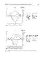
in more than 400 flights are synthesized to document the strong role of climate
in driving spatial and temporal variability of chlorophyll (chl-a) and primary productivity (PP) in the Bay. The climate-induced change is further separated from
secular change due to nutrient overenrichment. The chapter further discusses the
development of water quality ‘criteria’, including chl-a as an indicator of ecosystem responses to nutrient loading, which requires to consider climatic forcing of
phytoplankton dynamics.
Remote sensing of water quality and biogeochemical processes largely depends
on the accuracy and consistency of the in-situ data used in the calibration and validation of satellite signals and in algorithm development. Chapter 7 discusses how
remote sensing of water quality in optically complex environments can be improved
by integrating optical measurements and radiative-transfer model calculations. The
approach is illustrated with recent findings on the bio-optical characteristics of
Chesapeake Bay waters, including measurements of the magnitude and spectral
characteristics of particulate backscattering. It then discusses progress on optical
closure studies in coastal regions and proposes bio-optical relations for remote sensing retrieval of water quality indicators in the Chesapeake Bay ecosystem.
Remote sensing of benthic habitats is challenged by the confounding influence
water column attenuation on substrate reflectance. Chapter 8 reports a research effort that aims to resolve this confounding influence. High-resolution multispectral
satellite imagery and airborne hyperspectral imagery are used as inputs in semianalytical models to derive water depth and water column optical parameters which
are further used in various bio-optical algorithms to deduce bottom albedo and to
map benthic habitats along the north shore of Roatan Island, Honduras. The hyperspectral data are found to consistently outperform the high spatial-resolution multispectral imagery in terms of classification accuracy but both show similar accuracies at the coarse classification level. This study suggests the need of data fusion from high spectral and spatial resolution sensors for accurate benthic habitat
mapping.
Chapter 9 describes an effort to map benthic habitats within the Kaloko- Honokohau National Historic Park, Hawaii, USA, by combining color aerial photography,
high-resolution bathymetrical data, and georeferenced underwater video and still
photography. Individual habitat polygons are classified and several derivative data
concerning seafloor morphology are also generated. It is found that benthic habitat
and seafloor morphology vary greatly throughout the study area and the underlying
geologic framework and morphology of the submerged volcanic flows provide the
primary control on benthic habitats within the park. The habitat maps and associated data can be used as a stand-alone product or in a GIS to provide useful baseline
information to coastal scientists and managers.
10
X. Yang
Chapter 10 reports airborne remote sensing of submerged aquatic vegetation
(SAV) populations in Chesapeake Bay. The aerial mapping program began in 1978
and has continued on an annual basis since 1984; currently173 flight lines are photographed and mapped for SAV each year. Aerial mosaics are produced and the SAV
beds are delineated in a GIS environment. The SAV photo-interpretation results are
further verified by using extensive ground survey data. A composite historical SAV
coverage is also developed by using archival aerial photographs that date back to the
1930s. Comparisons of current SAV populations with historical restoration targets
are used annually to provide important indexes of bay condition and trends that are
further used to assess the effectiveness of nutrient and sediment reduction strategies
for the Bay and its associated watershed.
Chapter 11 discusses the spatio-temporal change of SAV populations in the
Hudson River estuary, New York, USA, by using remote sensing, GIS and statistical analysis. The SAV populations show obvious change but are always present
in some areas; these persistent SAV beds serve as indicators of overall estuarine
health and provide clues to the driving forces responsible for the observed changes
in the Estuary. The tidal fresh and oligohaline zones support the greatest abundance
of SAV per unit area while the mesohaline zone supports the least. Salinity, light
availability, and turbidity are found to affect the SAV distribution. At the end, the
chapter discusses how the SAV mapping and change detection information has been
used to better protect SAV habitats in the Hudson River estuary.
In many coastal areas, rich marine macrophytes grow to form subaquatic ‘forests’
that are of great industrial values. Chapter 12 describes an effort aiming to map the
marine macrophytes along the intertidal zones in the eastern coast of Tierra del
Fuego, Argentina, by using satellite imagery from Landsat, SAC-C, Aster, Radarsat
and QuickBird, as well as aerial photographs and maps. These data layers are coregistered before actual mapping the algae distribution. The final maps illustrate
the algae distribution and temporal change, which can be useful for improving the
management of coastal environment and resources in the study area.
Chapter 13 discusses algorithms and methods for shoreline extraction from remote sensor imagery and LIDAR elevation data. The shoreline extraction method
from remote sensor data consists of preprocessing, segmentation and classification,
and post-processing. Two methods are used for automated shoreline delineation
from LIDAR data. The first method consists of contouring, line selection with a
length threshold, and line smoothing and generalization; and the second one is based
on LIDAR DEM segmentation. These methods are used to process multi-temporal
digital orthorectified aerial photographs, Landsat imagery, and airborne LIDAR data
in the upper Texas Gulf coast. The shorelines delineated from a time series of remote sensor images and LIDAR DEMs are further compared in GIS environment
for coastal change analysis.
Mangroves are of great ecological and economic values and mangrove mapping
can help derive vital information for developing a mangrove management plan.
Chapter 14 discusses remote sensing based methods for mangrove species discrimination. Two IKONOS scenes acquired during dry and wet seasons are used to map
mangrove species through a Clustering-Based Neural Network (CBNN) classifier.
1
Remote Sensing, Geospatial Technologies and Coastal Ecosystems
11
CBNN is found to outperform two other conventional classifiers, namely, BackPropagation Neural Networks classifier (BPNN) and Maximum Likelihood Classifier (MLC), when using textural information; rainy season is better than dry season
for mangrove species classification. This chapter also examines the capability of
hyperspectral data for distinguishing mangrove species.
Chapter 15 reviews the spatial and temporal patterns of tidal wetland vegetation and the ecosystem services these systems provide and examines how remote
sensing has been used to map and monitor tidal wetlands. This is accompanied by
examples from the authors’ actual research and from the published literature. At
the end, the chapter discusses some of the remaining technical challenges facing
wetland managers and scientists who wish to study tidal marshes by remote sensing. The discussion is grounded in recent work in the San Francisco Bay area, but
lessons learned can be applied to other estuarine systems globally.
Chapter 16 reviews airborne LIDAR technology and assesses the capabilities and
limitations of LIDAR instruments available from research and commercial sources.
The focus is on the extraction of canopy height of short shrubs, marsh, grass, and
other vegetation found in the littoral zone. The accuracy in determining the height of
low vegetation is considerably improved when using a small-footprint, waveformresolving LIDAR system. The integration of spectral imagery and LIDAR has
the potential of significantly improving the classification and structural mapping
of coastal-plant communities. This chapter also identifies several technical challenges in LIDAR remote sensing. Overall, the chapter demonstrates that LIDAR
remote sensing is a cost-effective and reliable tool for the quantitative assessment of vegetation habitats on barrier islands, wetlands, and other coastal-plant
communities.
Chapter 17 reports a change analysis of back-barrier land cover types at Topsail
Island in southeastern North Carolina, USA, by using historical aerial photography
and GIS. Spatial analysis of land cover types indicates that when upland gains, it
replaces marsh; when upland loses, marsh replaces it; when marsh gains, it replaces
upland; when water loses, marsh replaces it; and there was no clear pattern for what
transitions when marsh is lost. A series of tests are conducted to verify the accuracy
of aerial photo rectification, digitizing and change detection. In addition, a fuzziness
test is used to identify true changes in the marsh habitats versus positional changes
(or sliver polygons). Results indicate that rectification, interpretation and digitizing
of historical aerial photography can be done with reasonable accuracy that warrants
meaningful change analysis of back-barrier land cover types.
Chapter 18 focuses on the development of remote sensing methods to detect,
inventory and monitor burnt marshes. Two very different coastal marshes in terms
of seasonal biomass turnover pattern are monitored with aerospace remote sensing
and ground measurement of canopy structure and optical reflectance. The seasonal
maidencane marsh produces a very different temporal response to burning than the
non-seasonal black needlerush saline marsh does. A vegetation indicator derived
from optical data is used to monitor the black needlerush marsh burn, and the use of
SAR data further extends the time-since-burn to approximately 900 days. Multi-date
TM data in combination with ground measurements are used to monitor the full burn
12
X. Yang
history of the maidencane marsh. This study indicates that it is possible to monitor
marsh recovery history and predict burn history by using optical and radar data.
Chapter 19 examines the response of the Kalmykian coastal zone and the Ural
River delta to sea level fluctuations by using a time series of optical and radar images. Photo-interpretation of optical data and digital analysis of radar images indicate that the reed mudflats have played a very important role in the coastal zone
dynamics. When the Caspian Sea level rose, the shoreline began to change not from
the front reed-belt bound but from the rear bound; when the sea level declined, the
rear bound moved seaward faster than the front bound. The ecological niche for reed
growth is further determined by constructing a series of profiles along the Ural River
delta. Overall, this study shows the usefulness of satellite imagery for the study of
coastal zone dynamics in the context of global changes.
Chapter 20 illustrates the utilities of integrating remote sensing and geospatial
technologies for coastal landscape pattern characterization. Central to this study
is the two satellite images that have been used to extract land cover information
through hierarchic classification and spatial reclassification techniques. To suppress
the information redundancy and improve the manageability, the initial landscape
metrics derived from the land cover information are then reduced to a core set by
using landscape ecology principles and multivariate statistical techniques, which
are further used to examine the spatio-temporal pattern of landscape. This research
demonstrates the integration of remote sensing and other geospatial technologies
(such as GIS, landscape metrics and multivariate statistical analysis) has mutually
reinforced their utilities effective for coastal landscape pattern characterization.
Chapter 21 discusses the roles of remote sensing and spatial analysis of watershed and estuarine processes for conservation planning in Elkhorn Slough, a coastal
watershed in central California. The use of archival aerial photographs helps identify significant trends of marshland conversion to other habitat types, mainly due
to hydrological modifications and off-farm sedimentation. Remote sensing research
addressing nutrient and sediment runoff demonstrate the potential to correlate estuarine disturbance and response to watershed inputs or properties. Despite some challenges, remote sensing and spatial analysis, especially when applied for salt marsh
vegetation change detection and bathymetric change detection, help identify areas
for conservation; GIS-based watershed management continues to improve estuarine
conditions, as restoration and erosion control are underway to reduce nutrient and
sediment discharge.
Chapter 22 examines the impacts of land use upon surface water and seawater quality for a coastal watershed draining into the Holetown Lagoon, Barbados.
Surface water quality was poorer in the sub-basin with the highest proportion of developed land; nutrient concentrations at the watershed outlet were quite high, suggesting overfertilization of agricultural lands and nutrient enrichment from urban
impervious surfaces. Runoff discharge into the nearshore zone causes plumes with
excessive turbidity and nutrients dispersing towards the Bellairs Reef, contributing to the chronic effects of eutrophication and sedimentation. It further recommends several remedy strategies, including improved farming practices for reducing the use of fertilizer quantities, enlargement of sewerage treatment facilities for