- Trang chủ >>
- Khoa Học Tự Nhiên >>
- Vật lý
Remote sensing of urban and suburban areas
Bạn đang xem bản rút gọn của tài liệu. Xem và tải ngay bản đầy đủ của tài liệu tại đây (10.77 MB, 355 trang )
Remote Sensing of Urban and Suburban Areas
Remote Sensing and Digital Image Processing
VOLUME 10
Series Editor:
EARSel Series Editor:
Freek D. van der Meer
Department of Earth Systems Analysis
International Instituite for
Geo-Information Science and
Earth Observation (ITC)
Enchede, The Netherlands
&
Department of Physical Geography
Faculty of Geosciences
Utrecht University
The Netherlands
André Marçal
Department of Applied Mathematics
Faculty of Sciences
University of Porto
Porto, Portugal
Editorial Advisory Board:
EARSel Editorial Advisory Board:
Michael Abrams
NASA Jet Propulsion Laboratory
Pasadena, CA, U.S.A.
Mario A. Gomarasca
CNR - IREA Milan, Italy
Paul Curran
University of Bournemouth, U.K.
Arnold Dekker
CSIRO, Land and Water Division
Canberra, Australia
Martti Hallikainen
Helsinki University of Technology
Finland
Håkan Olsson
Swedish University
of Agricultural Sciences
Sweden
Steven M. de Jong
Department of Physical Geography
Faculty of Geosciences
Utrecht University, The Netherlands
Eberhard Parlow
University of Basel
Switzerland
Michael Schaepman
Department of Geography
University of Zurich, Switzerland
Rainer Reuter
University of Oldenburg
Germany
For other titles published in this series, go to
/>
Remote Sensing of Urban
and Suburban Areas
Tarek Rashed
Geospatial Applied Research Expert House (GSAREH),
Austin, TX, USA
and
Carsten Jürgens
Geography Department, Ruhr-University, Bochum, Germany
Editors
Editors
Dr. Tarek Rashed
Geospatial Applied Research
Expert House (GSAREH)
Austin, TX
USA
Dr. Carsten Jürgens
Ruhr-University
Geography Department
Geomatics Group
Universitätsstr. 150
44801 Bochum
Germany
carsten.jü
Cover illustrations: Landsat satellite image of San Francisco, CA, USA,
combined with photograph taken by Maike Reichardt.
Responsible Series Editor: Freek van der Meer
ISBN 978-1-4020-4371-0
e-ISBN 978-1-4020-4385-7
DOI 10.1007/978-1-4020-4385-7
Springer Dordrecht Heidelberg London New York
Library of Congress Control Number: 2010929276
© Springer Science+Business Media B.V. 2010
No part of this work may be reproduced, stored in a retrieval system, or transmitted in any form or by any
means, electronic, mechanical, photocopying, microfilming, recording or otherwise, without written
permission from the Publisher, with the exception of any material supplied specifically for the purpose
of being entered and executed on a computer system, for exclusive use by the purchaser of the work.
Cover design: deblik, Berlin
Printed on acid-free paper
Springer is part of Springer Science+Business Media (www.springer.com)
Acknowledgments
The preparation of this volume was possible due to the fact that all authors
supported the original idea behind this book. We thank all authors for their contributions and their patience. The publication process did not run smoothly in all
stages and we apologize for the resulting time delay. We also thank all reviewers
whose valuable comments improved the content of the different chapters. Finally
we thank the Springer team for their continuous support and discussions from the
beginning to the end of this book project and for the publication in their book series.
We are convinced that with the publication of this book we are making an essential contribution to the knowledge about the different aspects of urban and suburban
remote sensing.
v
Contents
1
Urban and Suburban Areas as a Research Topic
for Remote Sensing .................................................................................
Maik Netzband and Carsten Jürgens
Part I
1
Theoretical Aspects
2
The Structure and Form of Urban Settlements ...................................
Elena Besussi, Nancy Chin, Michael Batty, and Paul Longley
13
3
Defining Urban Areas .............................................................................
John R. Weeks
33
4
The Spectral Dimension in Urban Remote Sensing .............................
Martin Herold and Dar A. Roberts
47
5
The Spatial and Temporal Nature of Urban Objects ..........................
Richard Sliuzas, Monika Kuffer, and Ian Masser
67
6
The V-I-S Model: Quantifying the Urban Environment .....................
Renee M. Gluch and Merrill K. Ridd
85
Part II
Techniques and Applications
7
A Survey of the Evolution of Remote Sensing Imaging
Systems and Urban Remote Sensing Applications............................... 119
Debbie Fugate, Elena Tarnavsky, and Douglas Stow
8
Classification of Urban Areas: Inferring Land Use
from the Interpretation of Land Cover ................................................. 141
Victor Mesev
vii
viii
Contents
9
Processing Techniques for Hyperspectral Data.................................... 165
Patrick Hostert
10
Segmentation and Object-Based Image Analysis................................. 181
Elisabeth Schöpfer, Stefan Lang, and Josef Strobl
11
Data Fusion in Remote Sensing of Urban
and Suburban Areas ............................................................................... 193
Thierry Ranchin and Lucien Wald
12
Characterization and Monitoring of Urban/Peri-urban
Ecological Function and Landscape Structure Using
Satellite Data............................................................................................ 219
William L. Stefanov and Maik Netzband
13
Remote Sensing of Desert Cities in Developing Countries .................. 245
Mohamed Ait Belaid
14
Remote Sensing of Urban Environmental Conditions......................... 267
Andy Kwarteng and Christopher Small
15
Remote Sensing of Urban Land Use Change in Developing
Countries: An Example from Büyükçekmece,
Istanbul, Turkey ...................................................................................... 289
Derya Maktav and Filiz Sunar Erbek
16
Using Satellite Images in Policing Urban Environments..................... 313
Meshgan Mohammad Al-Awar and Farouk El-Baz
17
Using DMSP OLS Imagery to Characterize Urban
Populations in Developed and Developing Countries .......................... 329
Paul C. Sutton, Matthew J. Taylor, and Christopher D. Elvidge
Index ................................................................................................................. 349
Contributors
Mohamed Ait Belaid
College of Graduate Studies, Arabian Gulf University, P.O. Box 26671,
Manama, Kingdom of Bahrain
Meshgan Mohammad Al-Awar
Research and Studies Center,
Dubai Police Academy, 53900 Dubai, United Arab Emirates
;
Michael Batty
Centre for Advanced Spatial Analysis, University College London,
1-19 Torrington Place, London WC1E 6BT, UK
Elena Besussi
Development Planning Unit, University College London,
34 Tavistock Square, London WC1H 9EZ, UK
Nancy Chin
Centre for Advanced Spatial Analysis, University College London,
1-19 Torrington Place, London WC1E 7HB, UK
Farouk El-Baz
Center for Remote Sensing, Boston University, 725 Commonwealth Avenue,
Boston MA, 02215-1401, USA
Christopher D. Elvidge
Earth Observation Group, NOAA National Geophysical Data Center,
325 Broadway, Boulder CO, 80305, USA
ix
x
Contributors
Filiz Sunar Erbek
Civil Engineering Faculty, Geomatics Department, Istanbul Technical University,
Maslak Campus, Maslak 34469, Istanbul, Turkey
Debbie Fugate
203 Ceret Ct SW, Vienna VA, 22180, USA
Renee M. Gluch
Department of Geography, Brigham Young University, Provo, UT 84602, USA
Martin Herold
Institute of Geo-InformationScience and Remote Sensing, Wageningen University,
Droevendaalsesteeg 3, Gaia, buildingnumber 101, P.O. Box 6708, Wageningen,
The Netherlands
Patrick Hostert
Geographical Institute, Humboldt-Universitat zu Berlin, Unter den Linden 6,
Berlin 10099, Germany
Carsten Jürgens
Geography Department, Ruhr-University, Bochum, Universitätsstraße 150,
44801 Bochum, Germany
carsten.jü
Monika Kuffer
International Institute for Geo-Information Science and Earth Observation,
Urban and Regional Planning and Geo-information Management,
Hengelosestraat 99, Enschede 7514 AE, The Netherlands
Andy Kwarteng
Remote Sensing and GIS Center, Sultan Qaboos University,
P.O. Box 50, Al-Khod, Muscat, 123, Oman
Stefan Lang
Centre for Geo-informatics, University of Salzburg, Schillerstr. 30,
Salzburg 5020, Austria
Paul Longley
Department of Geography, University College London, Gower Street,
London WC1E 6BT, UK
Contributors
Derya Maktav
Faculty of Civil Engineering, Department of Geomatics, Istanbul Technical
University (ITU), Maslak, Istanbul, 34469, Turkey
Ian Masser
Centre for Advanced Spatial Analysis, University College London, 1-19
Torrington Place, London WC1E 7HB, UK
Victor Mesev
Department of Geography, Florida State University, Tallahassee, FL
32306-2190, USA
Maik Netzband
Geography Department, Ruhr-University, Bochum, Universitätsstraße 150,
44801 Bochum, Germany
Thierry Ranchin
Center for Energy and Processes, MINES Paris Tech, 1, rue Claude Daunesse,
Sophia Antipolis Cedex, 06904, France
Tarek Rashed
Geospatial Applied Research Expert House (GSAREH),
Austin, TX, USA
Merrill K. Ridd
Department of Geography, University of Utah, 260 S. Central Campus Dr,
Salt Lake City, UT 84112-9155, USA
Dar A. Roberts
Geography Department, University of California, 5832 Ellison Hall,
Santa Barbara, CA 93106-4060, USA
Elisabeth Schöpfer
ESA-ESRIN, Directorate of Earth Observation Programmes,
Via Galileo Galilei, Frascati 00044, Italy
Richard Sliuzas
International Institute for Geo-Information Science and Earth Observation,
Urban and Regional Planning and Geo-information Management,
xi
xii
Contributors
Hengelosestraat 99, Enschede, 7514 AE, The Netherlands
Christopher Small
Lamont-Doherty Earth Observatory, Columbia University, 108 Oceanography,
61 Route 9W, Palisades NY, 10964-8000, USA
William L. Stefanov
Image Science & Analysis Laboratory/ESCG, Code KX,
NASA Johnson Space Center, Houston, TX 77058, USA
Douglas Stow
Department of Geography, San Diego State University,
5500 Campanile Dr., San Diego CA 92182-4493, USA
Josef Strobl
Austrian Academy of Sciences, Geographic Information Science, Schillerstraße
30, Salzburg 5020, Austria
Paul C. Sutton
Department of Geography, University of Denver, Denver, CO 80208, USA
Elena Tarnavsky
Geography Department, King’s College London, Strand, London WC2R 2LS, UK
Matthew J. Taylor
Department of Geography, University of Denver, Boettcher Center West,
2050 E. Iliff Avenue, Denver, CO 80208-0183, USA
Lucien Wald
Center for Energy and Processes, Ecole des Mines de Paris, 1, rue Claude
Daunesse,
Sophia Antipolis Cedex, 06904, France
John R. Weeks
Department of Geography, San Diego State University, 5500 Campanile Dr.,
San Diego, CA 92182-4493, USA
Chapter 1
Urban and Suburban Areas as a Research
Topic for Remote Sensing
Maik Netzband and Carsten Jürgens
This chapter provides an introduction into the book’s theme, its relevance for the
scientific community as well as for instructors and practitioners. It tries to give an
umbrella for the topics that have been chosen to bridge the gap between remote sensing and urban studies through a better understanding of the science that underlies
both fields. In so doing, in the second half this first chapter introduces the following
16 chapters written by leading international experts in respected fields to provide a
balanced coverage of fundamental issues in both remote sensing and urban studies.
Learning Objectives
Upon completion of this chapter, the student should gain an
understanding of:
1.1
Overview of urbanization research issues
Introduction to recent developments in Urban Remote Sensing
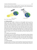
Introduction
Starting the theme of research on urban and suburban areas, a recently taken aerial
photograph in bird’s eye perspective is illustrated. Figure 1.1 pictures a recent
suburban development in the City of Rio Vista, California.
As a prosperous plan, 750 houses should be developed here once – most strikingly, these plans originate from a time, when still nobody suspected, what the term
“largest economic crisis since 80 years” meant. And in such a way on 20 November
2008, thus few weeks after the collapse of the investment bank Lehman Brothers, the
M. Netzband (*) and C. Jürgens
Geography Department, Ruhr-University, Bochum, Universitätsstraße 150,
44801 Bochum, Germany
e-mails: ; carsten.jü
T. Rashed and C. Jürgens (eds.), Remote Sensing of Urban and Suburban Areas,
Remote Sensing and Digital Image Processing 10,
DOI 10.1007/978-1-4020-4385-7_1, © Springer Science+Business Media B.V. 2010
1
2
M. Netzband and C. Jürgens
Fig. 1.1 Aerial photograph ‘Rio Vista, California/USA’ (Credits: Justin Sullivan/AFP)
house development project was already being adjusted in California’s Rio Vista.
Only the roads are still remaining – and a few sample houses. In the meantime the
city in the north of the Sunshine state considers even to announce insolvency
bankruptcy. Source: AFP
It is a general argument, that every period of socioeconomic
progress in
development is joined by different effects on population and
information and
landscape dynamics, e.g. the transition from agricultural-based
communication
economies to industrialization forced the urbanization process
technologies and
and the development of cities, predominantly accompanied by
the decentralizaa monocentric urban growth pattern due to the concentration
tion of economical
of industries, residences, and commerce in metropolitan areas
activities are
(e.g., Mexico City, Beijing, London, New York) (Parés-Ramos
modifying the
et al. 2008; Anas et al. 1998). Today, one can observe in
traditional
many countries a major transformation from an industrial-based
patterns of urban
economy to a knowledge-based economy (OECD 1996). As a
agglomerations
result, innovations in information and communication
technologies along with the decentralization of commercial, industrial, and financial
activities are altering and diversifying the traditional patterns of urban agglomerations
and driving new population and landscape dynamics (Munroe et al. 2005).
The consequences of these current socioeconomic trends comprise changes in the
spatial structure of urban and rural areas, such as urban core population decline, the
appearance of brownfields, suburban growth, and the urbanization of rural areas
(Munroe et al. 2005). Decentralization tendencies are forcing urban sprawl and the
conversion of agricultural lands and open spaces into urban land uses. Conversely, urban
agglomerations with their manifold employment opportunities in manufacturing, trade,
tourism, and other service sectors, attract more people, particularly the young and educated, to urban areas and supports the decline in agriculture jobs (Losada et al. 1998).
1
Urban and Suburban Areas as a Research Topic for Remote Sensing
3
The cities today are spreading into their surrounding landscapes, sucking food,
energy, water and resources from the natural environment, without taking into due
account the social, economic and environmental consequences generated at all levels by
their ‘urban footprints’. The urban environment itself is profoundly changing the entire
global ecosystem. Environmental changes are also expressed in land-use changes.
Social, economic or political trends are conveyed spatially. In recent decades, the strongest per capita growth shifted to the more rural areas of the urban fringe (Bugliarello
2003). Open spaces are increasingly included between cities,
cities today are
villages, and traffic axes. An urbanizing landscape, accompaspawling into
nying technical infrastructure, and uncontrolled dynamics of
their surrounding
urban growth patterns are the results. The conversion from
landscapes,
land cover to land being used progresses, i.e., predominantly
without taking
agricultural surfaces are transformed into settlement and trafinto due account
fic surfaces, resulting in decreased settlement density,
the social,
increased traffic, and costly infrastructure development.
economic and
Especially the increase of imperviousness at the expense of
environmental
the decrease of green and open spaces must be documented
consequences
from local to global scale, and it is a ‘must’ that the knowlgenerated by
edge is integrated into climate change investigations and
their ‘urban
further global change issues. Socio-spatial patterns are
footprints’
expressed in different building activities for single family
houses of different strata, with different amounts of green
spaces, shopping facilities and infrastructure have driven settlement areas to further
expand. The settlement density and, correspondingly, the inner urban densification
continue to decrease.
Merely characterizing and monitoring land-cover and land-use change is of
limited use in understanding the development pathways of cities and their resilience
to outside stressors (Longley 2002). Geological, ecological, climatic, social, and
political data are also necessary to describe the developmental history of an urban
center and understand its ecological functioning (Grimm et al. 2000). It is the process of urbanization that must be described, monitored, and even simulated on
different scales. Dependent on the issue to be investigated upon, the relevant scale
must be selected (see Fig 1.2). Local and regional environmental effects must be
documented, analysed, evaluated, and, if possible, predicted. Without researchers
and stakeholders exchanging and collaborating, the goal cannot be achieved.
In recent years ‘Urban Remote Sensing’ (URS) has proved to be a useful tool for
cross-scale urban planning and urban ecological research. Remote sensing in urban
areas is by nature defined as the measurement of surface radiance and properties connected to the land cover and land use in cities. Today, data from earth observation systems are available, geocoded, and present an opportunity to collect information relevant
to urban and periurban environments at various spatial, temporal, and spectral scales.
The urban pattern causes deterioration in air quality, the urban ecosystem
processes and biodiversity. In this context URS is a necessary prerequisite to
examine how urban forms modify the landscape as a complex system. It can help
to detect and evaluate the distribution of impervious or, likewise, sealed surfaces,
a key parameter of urban ecology (surface and groundwater availability and runoff,
4
M. Netzband and C. Jürgens
Fig. 1.2 Scale-dependent urban analysis (Banzhaf and Höfer 2008; modified after Wickop et al.
1998)
vegetation dynamics) and planning (storm water runoff, flooding hazards,
landslides). Kühn (2003) explains the development of urban landscapes being
shaped by the penetration of settlement and open-space structures. Remotely
sensed data will be used to detect and evaluate the physical structure and composition
of urban areas, such as the structure of residential, commercial or mixed neighborhoods, green spaces or other open spaces.
The growth of ‘Spatial Data Infrastructures’, Geo-portals
increase of
and private sector initiatives (e.g. Google Earth, Microsoft
geographical data
Virtual Earth, etc.) produced an increase of geographical
availability has
data availability at any scale and worldwide. This growth
not been fully
has not been fully coupled by an increase of knowledge to
accompanied by
support spatial decisions. Spatial analytical techniques and
an increase of
geographical analysis and modeling methods are therefore
knowledge to
required in order to analyse data and to facilitate the decisupport spatial
sion process at all levels. As cities can be described as a
decisions, thus
concentration of people it is most striking to find coherence
spatial analytical
between urban land use and socio-demographic as well as
techniques are
socio-economic parameters. The statistical analysis of
needed
census data infers information on the human usage of the
land, the human exposure to potential hazards in the
1
Urban and Suburban Areas as a Research Topic for Remote Sensing
5
city, and the configuration of each neighbourhood indicating the urban quality of
life. For example, overlaying choropleth maps of socio-demographic features with
land-use maps give information on gender and age distribution connected with proximity to urban green spaces, income and building density, or water consumption and
level of provision of infrastructure. In this context URS aids at providing spatial
information being linked to social indicators to explain the interrelations between
ecological conditions and socio-spatial development (Banzhaf et al. 2009).
In this volume we try to cover most of but not all of the afore-mentioned topics
and assembled widely known scholars of urban sciences specializing in the application of geospatial technologies or, vice versa, geo-information specialists with a
distinct focus on urban and peri-urban developments to draw a widespread overview of the state-of-the-art knowledge in the growing field of urban remote sensing.
“Remote Sensing of Urban and Suburban Areas” has been primarily assembled to
introduce scientists and practitioners to this emerging field. Additionally it provides
instructors with a text reference that has a logical and easy-to-follow flow of topics
around which they can structure the syllabi of their urban remote sensing courses.
The following six chapters of this book provide a comprehensive introduction in
urban theories adapted to geospatial problems and solutions. In the second part of
this book we present techniques and applications of various data sources and methodologies relevant for the analysis of urban status and dynamics.
Remote Sensing for Urban and Suburban Areas
Remote sensing in urban areas is by nature defined as the measurement of
surface radiance and properties connected to the land cover and land use in
cities. Today, data from earth observation systems are available, geocoded, and
present an opportunity to collect information relevant to urban and peri-urban
environments at various spatial, temporal, and spectral scales.
1.2
Introduction to the Chapters
Chapter 2 by Elena Besussi, Nancy Chin, Michael Batty and Paul Longley introduce the different theoretical and methodological approaches to understand and
measure urban growth and urban patterns, their structure and form. The authors
emphasize the idea that the contemporary city in both developed and developing
worlds needs much more than just one theory or one method of analysis or one
typology of data to be fully understood. It clearly appears to be a challenge to
traditional analytical methods requiring interaction of social sciences and earth
sciences, and urban economics using GIS techniques to understand patterns and
trends of urbanization.
In Chapter 3 John R. Weeks reviews the vast literature on dimensions of urbaneness,
but focuses especially on issues, such as classifying places as urban or rural by
6
M. Netzband and C. Jürgens
adequately capturing changes over time in the characteristics of a place. The urbaneness of a place as a continuum is determined based on a range of elements encompassing population size and density, social and economic organization, and the
transformation of the natural and agricultural environments into a built environment.
This chapter introduces you to one of such indices, i.e. an urban index that combines
census and survey data (to capture aspects of the social environment) with data from
remotely sensed imagery (to capture aspects of the built environment).
Martin Herold and Dar A. Roberts describe in Chapter 4 the spectral properties
of urban areas, how different urban land-cover types are spectrally discriminated,
and which sensor configurations are most useful to map urban areas. They also
demonstrate potentials of new remote sensing technologies improving capabilities to
map urban areas in high spatial and thematic detail. The authors stress the fact that
urban areas with roofing materials, pavement types, soil and water surfaces, and
vegetated areas represent a large variety of surface compositions. It is emphasized
that most suitable wavelengths are characterized by specific spectral features to
separate urban land cover.
The purpose of Chapter 5 authored by Richard Sliuzas, Monika Kuffer and Ian
Masser is to examine the utility of remote sensing data on urban and suburban areas
for Urban Planning and Management (UPM) from an application perspective. This
chapter especially discusses the use of remote sensing at two different spatial
scales, city-wide and neighborhood or site specific, the information needed with
respect to monitoring planned and unplanned development, and the optimal spatial
and temporal requirements for images used in this regard.
Rene M. Gluch and Meryll K. Ridd emphasize in Chapter 6 the ecological
nature of urban places and introduce the V-I-S (Vegetation-Impervious surfaceSoil) model to be used for remotely sensed data to characterize, map, and quantify
the ecological composition of urban/peri-urban environments. The model serves
not only as a basis for biophysical and human system analysis, it also serves as a
basis to detect and measure morphological/environmental changes of urban places
over time.
In Chapter 7 Debbie Fugate, Elena Tarnavsky, Douglas Stow review the development of remote sensing systems and their contribution to the emergence of urban
remote sensing, especially how they promoted the pursuit of novel approaches to
the study of urban environments. The chapter also covers data availability and
requirements for a number of the most common earlier remote sensing applications
such as land use and land cover classification, building and cadastral infrastructure
mapping and planning, and utility and transportation system analysis. Additionally,
the chapter highlights first attempts that have already been made to link the physical and social attributes of urban environments.
In Chapter 8, Victor Mesev explores the role of ancillary data (information from
beyond remote sensing) for improving the contextual interpretation of satellite sensor
imagery during spectral-based and spatial-based classification. Supplementary,
explanations are given to the distinctions between urban land cover and urban land use,
and how the inherent heterogeneous structure of urban morphologies is statistically
represented between hard and soft classifications.
1
Urban and Suburban Areas as a Research Topic for Remote Sensing
7
Basic knowledge about the differences between multispectral and hyperspectral
data is provided by Patrick Hostert in Chapter 9, where the potential of hyperspectral image analysis is distinguished. He presents relevant pre-processing steps and
different ways to analyze hyperspectral data. Moreover, relevant analysis approaches
are explained including material detection techniques, spectral angle mapping, or
spectral mixture analysis, to name some. The chapter closes with a short outlook on
expected developments with relevance for urban applications.
Chapter 10, written by Elisabeth Schöpfer, Stefan Lang and Josef Strobl, focuses
on segmentation of remotely sensed image data and object-based image analysis of
urban areas. It also discusses the differences between the two different approaches
‘pixel-based’ and ‘object-based’ image analysis. They explain the main concepts of
object-based image analysis: to work on homogeneous image objects rather than on
single pixels and to use spectral and spatial information while merging pixels into
homogeneous groups (image objects, segments). The chapter depicts very briefly
urban applications by means of two case studies.
Thierry Ranchin’s and Lucien Wald’s Chapter 11 concentrates on techniques
related to image and data from different sources with varying spatial and spectral
resolutions. It presents and discusses some of the technical issues that influence
data fusion in the urban context. Several fusion cases studies are discussed here to
illustrate the potential of data fusion techniques. The authors emphasize on the
importance of the diversity of data fusion. The few examples provided cannot fully
describe its complexity and this field is still a strong and active research in urban
remote sensing and the other civilian domains.
A case study from Phoenix, Arizona is depicted by William L. Stefanov and
Maik Netzband in Chapter 12. They examine the relationships between ecological
variables and landscape structure in cities. These relationships are assessed using
ASTER and MODIS data; and through the techniques of expert system land cover
classification and grid-based landscape metric analysis. The authors argue that this
multi-scale approach is of great use to urban ecologists and spatial planners, as
landscape structural analysis and measures of ecosystem function provide monitoring
tools for regional habitat and climatic alteration associated with urbanization.
Furthermore, the applied uniform spatial reference systems provided by remotely
sensed data permit quantitative evaluation in comparative studies regarding the
spatial configuration of existing developed and open spaces.
Chapter 13 by Mohamed Ait Belaid focuses on remote sensing (RS) of desert
cities, within the context of developing countries. The characteristics of urban areas
in the desert environment are described, and the potential of satellite imageries is
discussed, how they are used to map and monitor changes in these areas over space
and time. Urban and sub-urban landscapes of desert cities are shaped by various
factors such as desertification, economic development, and wars and conflicts. In
their chapter the authors include photo-interpretation techniques assisted by computer techniques to produce the classified imagery maps of land use categories and
the comparison of the classified land use changes in urban areas.
In Chapter 14 Andy Kwarteng and Christopher Small give an overview over
urbanization and the urban environment connected to urban vegetation, surface
8
M. Netzband and C. Jürgens
temperature and public health issues. They explain techniques for urban vegetation
mapping, urban thermal mapping, and show the results of a comparison of urban
vegetation and surface temperature and their impact on environmental conditions in
New York City and Kuwait City. The authors advance the opinion that most successful applications of remote sensing to the urban environment generally involve
measurement of physical quantities related to environmental conditions such as
vegetation abundance and surface temperature.
In alignment with other application oriented chapters in the book discussing the
context of developing countries, Derya Maktav and Filiz Sunar Erbek discuss in
Chapter 15 the impact of rapid urban growth on land use changes, especially on the
agricultural land in Turkey. The way in which remote sensing is used to monitor
and assess these changes is pointed using a case study from a suburban area in the
greater Istanbul region. The results of the analysis show how it is possible to utilize
urban remote sensing in generating reliable measures and new layers of information
that are otherwise not readily available in developing countries with relatively
simple techniques such as image differencing and vegetation indices.
Demonstrating a case study of Dubai in the United Arab Emirates, Meshgan
Al-Awar and Farouk El-Baz discuss in Chapter 16 the role of remote sensing technology in the monitoring and management of security in cities and in assuring the
timely policing of urban environments. This chapter presents application examples
from the Dubai’s Police to show how the utilization of geo-referenced satellite
images on top of GIS platforms can allow the immediate allocation of the needed
response. It is a good example on how these imagery and geospatial technologies
can be used for a better command level decision-making and, furthermore, how
they are most useful in the reconstruction and enhancement of crime scenes.
Nighttime Satellite imagery examined by Paul C. Sutton, Matthew J. Taylor and
Christopher D. Elvidge in Chapter 17 shows great potential for mapping and monitoring many human activities including: (1) population size, distribution, and growth,
(2) urban extent and rates of urbanization, (3) Impervious Surface, (4) Energy
Consumption, and (5) CO2 emissions. They argue that the relatively coarse spectral,
spatial, and temporal resolution of the imagery proves to be an advantage rather than
a disadvantage for these applications.
Within two case studies (first of exurbia in the United States and second in
Guatemala) they explain that while nighttime satellite imagery is no substitute for
an ‘on the ground census’ of the population, it can be used in innovative and interesting ways to supplement mapping human presence and activity on earth.
References
Anas A, Arnott R, Small KA (1998) Urban spatial structure. J Econ Lit 36:1426–1464
Banzhaf E, Höfer R (2008) Monitoring urban structure types as spatial indicators with CIR aerial
photographs for a more effective urban environmental management. In: Journal of Selected
Topics in Applied Earth Observations and Remote Sensing (JSTARS), IEEE. 1(2):129–138.
ISSN: 1939-1404. Digital Object Identifier: 10.1109/JSTARS.2008.2003310
1
Urban and Suburban Areas as a Research Topic for Remote Sensing
9
Banzhaf E, Grescho V, Kindler A (2009) Monitoring urban to peri-urban development with
integrated remote sensing and GIS information: a Leipzig, Germany case study. Int J Remote
Sens 30(7):1675–1696
Bugliarello G (2003) Large urban concentrations: a new phenomenon. Heiken G, Fakundiny R,
Sutter J (eds) Earth science in the city: a reader. American Geophysical Union, Washington,
DC, pp 7–19
Grimm NB, Grove JM, Redman CL, Pickett SA (2000) Integrated approaches to long-term studies
of urban ecological systems. Bioscience 70:571–584
Kühn M (2003) Greenbelt and Green Heart: separating and integrating landscapes in European
city regions. Landscape Urban Plann 64(1–2):19–27
Longley PA (2002) Geographic information systems: will developments in urban remote sensing
and GIS lead to ‘better’ urban geography? Prog Hum Geogr 26(2):213–239
Losada H, Martinez H, Vieyra J, Pealing R, Cortés J (1998) Urban agriculture in the metropolitan
zone of Mexico: changes over time in urban, sub-urban and peri-urban areas. Environ
Urbanization 10(2):37–54
Munroe D, Clark J, Irwin E (2005) Regional determinants of exurban land use in the U.S.
Midwest. Prepared for the 52nd Annual North American Meetings of the Regional Science
Association, Las Vegas, NV, USA
Organisation for Economic Cooperation and Development (OECD) (1996) The knowledge-based
economy, Paris, France (online), />Parés-Ramos IK, Gould WA, Mitchell Aide T (2008) Agricultural abandonment, suburban
growth, and forest expansion in Puerto Rico between 1991 and 2000. Ecol Soc 13(2):1
(online), />Wickop E, Böhm P, Eitner K, Breuste J (1998) Qualitätszielkonzept für Stadtstrukturtypen am
Beispiel der Stadt Leipzig. UFZ Bericht 14:156
Part I
Theoretical Aspects
Chapter 2
The Structure and Form of Urban Settlements
Elena Besussi, Nancy Chin, Michael Batty, and Paul Longley
This chapter introduces you to the different theoretical and methodological approaches
to the understanding and measuring of urban growth and urban patterns. Particular
attention is given to urban sprawl as one of the forms of suburbanization. Urban
sprawl today represents a challenge for both scientists and decision makers, due to
the complexity of its generative processes and impacts. In this chapter, we introduce
ways of measuring the spatial pattern of sprawl noting how remotely sensed imagery
need to be integrated with spatial socioeconomic data, and how this integration is
essential in making accurate interpretations of very different urban morphologies.
Learning Objectives
Upon completion of this chapter, you should be able to:
Speculate on the range of processes which generate urban
growth and its different structures
Differentiate between approaches used to define and measure
urban and suburban patterns
Describe some of the zone-based spatial statistical methods
available to measure urban growth dynamics and patterns
E. Besussi (*)
Development Planning Unit, University College London, 34 Tavistock Square,
London, WC1H 9EZ, UK
e-mail:
N. Chin and M. Batty
Centre for Advanced Spatial Analysis, University College London, 1-19 Torrington Place,
London WC1E 7HB, UK
e-mails: ;
P. Longley
Department of Geography, University College London, Gower Street, London
WC1E 6BT, UK
e-mails:
T. Rashed and C. Jürgens (eds.), Remote Sensing of Urban and Suburban Areas,
Remote Sensing and Digital Image Processing 10,
DOI 10.1007/978-1-4020-4385-7_2, © Springer Science+Business Media B.V. 2010
13
14
2.1
E. Besussi et al.
Urban Structure and Urban Growth: An Overview
of Theories and Methodologies
Cities emerge and evolve from the coalescence and symbiotic interaction of infrastructures, people and economic activities. These interactions are systematic, generally in that they are related to development in the global
traditional
economy, and more specifically in that they manifest building
urban theories
and transport technologies. But these interactions are also
investigate how
sensitive to local context, in that settlements are individually
cities develop
resilient to constraints in their evolutionary path. Given
and grow
advances in technology, and the sheer scale and pace of conthrough
temporary urban growth, the most rapid changes in urban
systematic
form, pattern and structure, are taking place where historical
interactions of
roots are weakest – as in the recent suburbs of long estabinfrastructures,
lished Western cities, or in the new cities of developing counpeople and
tries. A city like London would never have been able to
economic
develop its contemporary form, skyline, and density of activity
activities
were it not for technological innovations such as its underground transport network and its role in global financial markets. Yet there are local and institutional factors such as the role of “green belt
planning policy,” peculiar to the UK that has prevented the kind of sprawl characteristic of North American cities taking hold throughout the functional region.
Traditional urban theories investigate how cities develop and grow through these
kinds of interactions, and in macro terms are based on advantages that co-location
(i.e., the physical location where urban and economic activities are in close spatial
proximity to one another) can offer to economies and societies. Agglomeration
economies, defined by those economic production systems that benefit from colocation, have been identified as key forces at work in the growth of cities at any
time and in every place. However, over the last half century our traditional understanding that the only outcomes of these forces should be an accelerating concentration of population, infrastructures and jobs has been challenged by the evidence
of de-concentration, first in the United States and now in Europe. The migration of
agricultural populations into the city which has been a centuries old factor in rural
depopulation and the dominant force in creating urban agglomerations is now giving
way to a reverse migration into the countryside, at least in many western cities, as
suburbanization and sprawl become the modus operandi of urban growth.
Of course, the inertia in the skeletal structure of the built form of the city in its
buildings and streets are important principally because they accommodate the loci
of activities of “urban” populations. There is nearly a century of interest in understanding the socio-spatial differentiation of urban populations, that can be traced back to
the 1920s in the work of Park, Burgess and the Chicago School of urban ecologists,
if not before in the writings of Max Weber and his nineteenth century contemporaries.
Here again, urban research has focused upon the general as well as the specific.
The classic ringed socio-economic structure of 1920s Chicago, for example, was