Nghiên cứu sự phân bố và đa dạng thực vật bậc cao trên các vùng sinh thái khác nhau tại tỉnh an giang tt tiếng anh
Bạn đang xem bản rút gọn của tài liệu. Xem và tải ngay bản đầy đủ của tài liệu tại đây (1.69 MB, 30 trang )
MINISTRY OF EDUCATION AND TRAINING
CAN THO UNIVERSITY
-oOo-
SUMMARY of THE PhD THESIS
Major: Soil and water environment
Code: 9440303
NGUYEN THI HAI LY
THESIS TITLE
STUDY ON HIGHER PLANT SPECIES
DISTRIBUTION AND DIVERSITY ON
THE DIFFERENT ECOLOGICAL AREAS
IN AN GIANG PROVINCE
Can Tho, 2019
This Study Was Achieved At Can Tho University
Scientific Supervisor: Assoc. Prof. Dr. Nguyen Huu Chiem
This dissertation was defended at the University
Examination Council
At: ……………………………………...
At…hour.., on date…month….year…
Reviewer 1:……………………………
Reviewer 2:……………………………
The dissertation is available at:
Learning Resource Center of Can Tho University.
National Library of Viet Nam.
LIST OF PUBLICATIONS
[1]. Nguyen Thi Hai Ly, Lu Ngoc Tram Anh, Tran Quoc Minh
and Nguyen Huu Chiem, 2018. Vascular plant resources by soil
types in mountainous area of An Giang province. Journal of
Science, Can Tho University (ISSN 1859-2333), 54:106-116.
[2]. Nguyen Thi Hai Ly and Nguyen Huu Chiem, 2017.
Surveying vascular plant species component based on the types
of soil in opened depression of flood plain in An Giang
province. Journal of Science, Can Tho University (ISSN 18592333), (2): 120-128.
[3]. Nguyen Thi Hai Ly, Lu Ngoc Tram Anh and Nguyen Huu
Chiem, 2016. A survey of vascular plant species in the dry
season, Cam Mountain, An Giang province. Journal of Science
and Technology, Vol. 54, 2016. ISSN 0866-708X
[4]. Nguyen Thi Hai Ly, Le Van Quy and Nguyen Huu Chiem,
2016. Assessment of higher plant status in Cam mountain, An
Giang province. Journal of Environment (ISSN 1859-042X),
4:39-40.
[5]. Nguyen Thi Hai Ly, Lu Ngoc Tram Anh, Huynh Thi
Tron and Nguyen Huu Chiem, 2017. Species composition
of medicinal plants in Tinh Bien district, An Giang
province. Proceedings of the 7th National Scientific Conference
on Ecology and Biological Resources, Hanoi (ISBN: 978-604913-615-3), 1332-1339.
CHAPTER 1: INTRODUCTION
1.1. Introduction
Terrestrial plants usually absorb nutrients from the different
soil, water and air environments (Chapin et al., 2002), so when
the changing environment can change plant composition (Tavili
and Jafari, 2009). The groups of factors which affected their
distribution and diversity were the geographical group
(topography, slope), the group of direct physiological impact on
plant growth but are not consumed (pH) and nutritional groups
effect to their growth (Austin et al., 1984). In the same ecological
conditions, the soil was a filter to prevent the presence of plant
species that lacked essential physiological characteristics for
surviving (Pausas and Austin, 2001). The physicochemical
properties of soil have influenced the distribution and diversity of
flora (Zuo et al., 2009; Ritu et al., 2010; Shabani et al., 2011).
The texture, pH, and nutrients were factors that closely affected
the change of vegetation in areas (Fayolle et al., 2012; Dado and
Jiwen, 2014). Therefore, the distribution and diversity of plants
follow the soil condition need to be studied.
An Giang province has a variety of topography and many
different ecosystems. Besides the agricultural ecosystem, there
also has the forest ecosystem on the mountains and the forest
ecosystem of plain (Nguyen Duc Thang, 2003). Many rare and
precious native species adapted to the specific ecological
condition of the province (Vo Van Chi, 1991; Nguyen Duc
Thang, 2003; Nguyen Van Minh et al., 2008; Nguyen Van Kien,
2013). Nowadays, the loss of forests and overexploitation has led
to the disappearance of many rare and precious species. Facing
the risk of biodiversity loss, in 2008, the Biodiversity Law was
born and became the principle for developing biodiversity
conservation planning. In the same climatic conditions, the
differences in geography, soil and depth of flooding were the
basis of science to determine three different ecological areas in
An Giang as fluvial plain, mountainous area, opened depression
of floodplain (Nguyen Huu Chiem, 1993; Nguyen Hieu Trung et
al., 2012). Although plant diversity has been studied in An Giang
1
province (Vo Van Chi, 1991; Nguyen Duc Thang, 2003), the
results only focused on taxon diversity. These studies have not
mentioned the distribution and diversity of plant according to soil
condition and factors affecting this status in various ecological
areas. Therefore, it is necessary to determine the distribution and
diversity of plants and factors that impact on this status according
to the soil in different ecological areas in An Giang province.
Because of these issues, the thesis "Study on the distribution and
diversity of higher plants on different ecological areas in An
Giang province" has been implemented.
1.1. Objectives of study
1.1.1. General objective
Determination of the distributional and diverse status of higher
plants in different ecological areas will be considered the
scientific basis for the conservation and sustainable exploitation
of plant resources in An Giang province.
1.1.2. Specific objectives
+ Determination of the physicochemical characteristics of soil in
ecological areas of An Giang province according to the soil depth.
+ Determination of the distribution and diversity status of
vascular plants and factors that affected this status follow the soil
condition in three ecological areas of An Giang province.
1.3. The contents of the study
+ Surveying and assessing soil characteristics in ecological areas.
+ Investigating and assessing the plant diversity status according
to the soil environment in these ecological regions.
+ Analysing the relationship between soil and plant diversity.
+ Building the distributional map of dominant and rare plant
species which representing each ecological areas.
+Proposing the solutions for conservation and sustainable
exploitation of plant resources in An Giang province.
1.4. New findings of the thesis
+ The results have been added 56 species, belonging to 30
families to the flora of An Giang province.
+ The thesis identified the number of wild species and anthropospecies and the distribution of rare, endemic, local and dominant
2
species according to soil properties for three ecological regions in
An Giang province.
+ The results added some chemical and physical characteristics of
each soil type in three ecological regions and some data on soil
characteristics according to elevation belts in mountainous areas.
+ The study assessed the status of diversity through the various
diversity indices according to the characteristics of soil in each
ecological region. From there, the results indicated that soil and
human factors influenced the diversity and dominant plant.
+ Three distribution maps of dominant and rare species have been
built to support the management of plant resources and
biodiversity conservation in An Giang province.
1.5. Objects and scope of the research
1.5.1. Objects of the research
Vascular plant species and physico-chemical parameters of soil.
1.5.2. The scope of the research
+ Three different ecological areas in An Giang are fluvial plain
(Cho Moi, Phu Tan, Tan Chau, Chau Phu, Chau Thanh, Thoai
Son), mountainous area (Bay Nui area in Tri Ton and Tinh Bien
district), opened depression of floodplain (the plain of Tri Ton
and Tinh Bien district).
+ Research at quadrats on the surveyed transects in these
ecological regions with woody (D1,3≥6 cm) and herbaceous plants.
+ The samples were collected from June to December (except for
dry season) in mountainous areas and from December to June
(except for flooding season) in fluvial plain and opened
depression of floodplain.
1.6. The scientific and practical significance of the study
+ Scientific significance: The thesis provides a scientific basis for
the current distribution and diversity of vascular plants according
to the soil environment of three typical ecological regions in An
Giang province.
+ Practical significance: The informations of thesis that can be
used in forestry, environment and local management agencies.
3
CHAPTER 2: LITERATURE REVIEWS
2.1. The concept of vascular plant
The vascular plants are characterized by specialized vascular
tissue and have reproductive organs with spores, cones or flowers
(Nguyen Nghia Thin, 2008). The two types of vascular
tissue, xylem and phloem, are responsible for moving water,
minerals, and the products of photosynthesis throughout the plant
(Hoang Thi San and Nguyen Phuong Nga, 2003). They include
Rhyniophyta, Psilotophyta, Lycopodiophyta, Equisetophyta,
Polypodiophyta, Pinophyta and Angiospermatophyta.
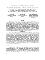
2.2. Overview of ecological areas in An Giang province
Based on the topographical features, the depth of inundation in
the flood season and soil conditions, An Giang province was located
in three main ecological areas as mountainous area, fluvial plain, and
opened depression of floodplain (Nguyen Huu Chiem, 1993; Nguyen
Hieu Trung et al., 2012).
a
b
)
Figure 2.1: (a) The agro-ecological zones map in Mekong Delta
(Nguyen Hieu Trung et al., 2012) and (b) The agro-ecological zones
map in An Giang province.
+Climate condition: The three ecological areas were the same
features of temperature, humidity and the average of rainy days.
However, the average annual rainfall in the fluvial plain (1200–1700
mm) was higher than two remaining ecological regions (1200-1600
mm) (Luu Van Ninh et al., 2018).
+ Characteristics of topography and soil
4
The mountainous area has a slope of 150-350, including many
mountains with the highest peak of 710 m in Cam Mountain. Also,
the field around the foot of mountains has an elevator of 5-10 m and
not inundation in the flood season (Nguyen Duc Thang, 2003). The
mountainous soil has three main types as Ferralsols, Leptosols, and
Acrisols (Southern Sub-National Institute of Agricultural Planning
and Projection, 2003).
The opened depression of floodplain is a low-lying field in Long
Xuyen Quadrangle surrounding two districts of Tri Ton - Tinh Bien.
Due to the low topography and upstream position, it is flooded
annually for 3-4 months with a depth of inundation over 0.5 m and
heavy acid sulfate soils (Nguyen Duc Thang, 2003). The soil in this
area consists of three types of soils as acid sulfidicpeat soil, active
acid sulfate soil with sulfuric materials present near layer (0-50 cm),
and depth in soil (>50 cm).
The fluvial plain along Tien and Hau rivers has geomorphological
units such as natural levees, sandbars and backswamps (Nguyen Huu
Chiem, 1993), and a depth of inundation over 0.5 m (Nguyen Hieu
Trung et al., 2012). Alluvial soil types are classified into four
categories such as Anofluvic and Orthofluvic fluvisols, Gleyic and
Cambic fluvisols.
CHAPTER 3: METHODOLOGY
3.1. Methods of plant diversity investigation and assessment
3.1.1. Plant survey method
a) The flora survey in the mountainous area: 230 quadrats (100m2)
were done from June 2015 to May 2017 in the soil of Ferralsols,
Leptosols and Acrisols. The quadrats were located at each altitude
level of 100 m, with square100 m2 for woody plants (D1.3≥ 6cm) and
shrubs. Each quadrate (100m2) was designed 3 sub-quadrates (1m2)
for the herbaceous plants diagonally. The fields were also established
3 quadrates (1m2) (Le Quoc Huy, 2005; Hoang Chung, 2006).
b) The flora survey in the opened depression of floodplain: From
July 2016 to April 2017, 85 quadrats (100m2) were surveyed in acid
sulfidicpeat soil, active acid sulfate soil with Jarosite at depth 0-50
cm and Jarosite at depth over 50 cm in the plains of Tri Ton and Tinh
Bien districts. Each quadrate (100m2) was designed 3 sub-quadrates
(1m2) for the herbaceous plants diagonally. The fields were also
established 3 quadrates (1m2).
5
c) The flora survey in the fluvial plain: From January 2017 to
December 2017, 155 quadrats (100m2) were surveyed in a part of the
floodplain along the Hau River and Tien River including Cho Moi,
Phu Tan, Tan Chau, Chau Thanh and Chau Phu districts. The
quadrats were located in four types of alluvial soils as Anofluvic and
Orthofluvic fluvisols, Gleyic and Cambic fluvisols.
Figure 3.1: The position of quadrats in three ecological areas (IRMC, 2003)
Using GPS to determine coordinates of quadrats. In the quadrats,
data were collected including (i) the number of species; (ii) the
number of individuals (the number of root for shrubs and herbs, the
number of stems for climbing herbs) (Le Quoc Huy, 2005). The local
people were interviewed for local names and uses, frequency of
changes in crop, cutting down and planting, herbicide spraying, take
out weeding, fertilizer application and tillage. The number of
households were surveyed in the mountainous areas as n=60 (woods)
6
and n=75 (herbs); in the opened depression of floodplain as n=32
(woods) and n=41 (herbs), in the fluvial plain as n=92 (woods) and
n=108 (herbs).
3.1.2. Identifying the scientific name of species and list of plant
The morphological comparison method was applied to determine the
species’s name based on Cay co Viet Nam – Vol. 1,2,3 (Pham Hoang
Ho, 1999), Tu dien thuc vat thong dung – Vol. 1,2 (Vo Van Chi,
2002). The uses of plants were investigated in the local communities
and searched from some documents such as Nhung cay thuoc va vi
thuoc Viet Nam (Do Tat Loi, 2004), Tu dien cay thuoc Viet Nam
(Vo Van Chi, 2018) and Tinh dau (Le Ngoc Thach, 2003). The list of
plants was done with information of taxon, stems characteristic,
utility and the types of distribution soil.
3.1.3. Method of diversity assessment
+ Determinating of rare and precious species based on the Vietnam
Red Book - Part II (Plant), Decree No. 32/2006/ND-CP and rare
index (RI).
𝐧
𝐑𝐈 = (𝟏 − ) × 𝟏𝟎𝟎
𝐍
RI is a rare index; n is the number of quadrats that appeared the
survey species; N is the total quadrats in the surveyed area.
+ Diversity assessment by alpha diversity indexes (Table 3.1):
Table 3.1: The alpha diversity indexes (Clarke and Gorley, 2006)
Index
Formulas
Meaning
S: total
A measure of the
Margalef
species
abundance of species
d=(S-1)/logeN
(d)
N: total
present for a given
individual number of individuals.
H’:
A measure of degree of
Pielou’s
J’=H’/logeS
Shannon
evenness in species
(J’)
index
abundances.
A measure of species
Shannon H’=-∑ 𝑃𝑖 ∗
Pi: Ni/N
diversity
in
a
(H’)
log(𝑃𝑖)
community.
Ni: total
A measure of species
Simpson λ’={∑ 𝑁𝑖(𝑁𝑖 −
individual dominance in a
(λ’)
1)}/{𝑁(𝑁 − 1)}
of species i community.
+ Assessing the similarity of flora through Sorensen index:
𝐒 = 𝟐𝐜/(𝐚 + 𝐛). S: Sorensen index (from 0 to 1); a: number of
7
species of community A; b: number of species of community B; c:
the number of species in common of two communities A and B.
3.1.4. Important value index (IVI)
For woody plants: IVI = RD + RF + RBA. RD (%) is relative
density, RF (%) is the relative occurrence frequency and RBA
(%) is the relative body section area. For herbaceous plants and
shrubs, the IVI index is calculated by the formula: IVI = RD + RF
(Razavi et al., 2012).
3.1.5. Method of diversity data analysis
+ Identifying diversity indexes and species accumulation curves
by Primer Ver.6. Data were analyzed by analysis of variance
(ANOVA) and Tukey/Tamhana’s Test in the SPSS package ver.22.
3.2. Methods of soil survey and assessment
+ In quadrats 100 m2 & 1 m2, the soil samples at 4 corners and
center were collected and mixed approximately 0.5 kg. A shovel
was used to reach a depth of 50 cm and a small knife was used to
mark and take soil samples at layer 0-20 cm and layer 20-50 cm.
Soil samples were brought to the laboratory and dried at room
temperature, and crushed through a sieve with a diameter of 2 mm
(Doan Van Cung et al., 1998).
+ Analysis of soil parameters:
Table 3.2: Analytical methods of soil parameters
Parameter
Unit
Analytical methods
Texture
%
Robinson method.
Bulk density
g/m3
Samples are taken in a 100 cm3 box and
then dried at 1050C for 24 hours
3
Particle density
g/m
Pycnometer
Porosity
%
((Particle density-Bulk density)x100)/
Particle density
pHKCl
Extracted by KCl 1N; soil:KCl=1:5
EC
µS/cm
Extracted by demineralization water;
soil:water=1:5.
Organic matter
%OM
Walkley Black method.
Total nitrogen
%N
Digestion with salicylic acid+H2SO4
98%+CuSO4+K2SO4 and distillated by
Kjeldahl method.
N available
mg/100g Extracted by KCl 1N; distillated by
Kjeldahl method.
8
Total
phosphorus
%P2O5
Digestion with H2SO498%–HClO4, show
color of phosphomolybdate, colorimetric
on spectrophotometer at 880nm.
P available
mg/100g Extracted by H2SO4 0.1N, show color of
phosphomolybdate, colorimetric on
spectrophotometer at 880nm.
Total potasium
%K2O
Digestion with HF–HClO4, measure K by
AES method.
K available
meq/100g Extracted by CH3COONH4 1N, measure
K by AES method.
Cation
meq/100g Extracted by BaCl2, measure Ca2+ and
2+
2+
(Ca , Mg )
Mg2+ by AAS method.
+ Method of soil data analysis: Data were analyzed by analysis
of variance (ANOVA) and Tukey/Tamhana’s Test in the SPSS
package ver.22. at 5% significance level. In addition, the PCA
method was applied to analysis in Past ver 3.0.
3.3. Methods to study the effect of soil and human factors on
the distribution and diversity of plants
The relationship between plant and soil factors was analyzed
by CCA method in Canoco software ver.4.5. The relationship
between plant and human factors was analyzed by regression
analysis method in the SPSS package ver.22. Quantitative analysis
of the contribution of soil and human factors to the diversity
status was analyzed by the RDA method in Canoco software 4.5.
3.4. Methods of building the species distribution status map
These map of rare and dominant species distribution were done
by ARC-GIS Desktop 10.1 software based on data resources of
An Giang soil distribution map in 2003 (Center for Integrated
Resource Maps, 2003), rare and dominant species data.
CHAPTER 4: RESULTS AND DISCUSSION
4.1. Soil characteristics of three ecological areas in An Giang
At layer 0–20 cm and 20–50 cm, mountainous soil properties
were characterized by the main sandy component, moderate
acidity, rich total phosphorus, and poor organic matter (OM),
available phosphorus, potassium and nitrogen. The properties of
soil in opened depression of floodplain was the highest proportion
of clay, heavy acidic; high content of EC, CHC, Ca2+ and Mg2+;
9
low porosity, poor total potassium and potassium. The alluvial
soil in the fluvial plain was the high level of silt and porous, weak
acidic; abundant content of nitrogen, available phosphorus and
potassium at 0–20 cm and 20–50 cm. In general, the soil
properties of three regions were the difference of physicochemical
characteristics. And this was a more closely ecological element
that affected the distribution and diversity of vascular plants in the
same climatic conditions.
4.2. The distribution and diversity in the mountainous area
4.2.1. Physicochemical features of soil in mountainous areas
A common feature of all three soil types was the highest sandy
proportion, from 50.00 ± 0.05% to 68.32 ± 2.85% (0-20 cm) and
from 64.73 ± 2.13 to 82,30 ± 4.17 (20-50 cm), whereas Acrisols
soil was higher sand than the other soil types (p<0.05). Besides,
Ferralsols and Leptosols soil were a higher level of porosity than
Acrisols soil (p<0.05). In terms of chemical features, the
Ferralsols and Leptosols soil were the lower mean value of pHKCl.
The contents of OM, total nitrogen, total potassium were higher
than Acrisols (p<0.05), not included available nitrogen, Ca2+ and
Mg2+. Especially, available phosphorus and total phosphorus of
Ferralsols soil are higher than the other two soil types.
4.2.2. The plant distribution in mountainous areas
The flora of the mountainous ecological areas was recorded
444 species, 329 genera, 115 families which belong to five phyla
(Lycopodiophyta, Polypodiophyta, Pinophyta, Cycadophyta and
Magnoliophyta). Leptosols and Ferralsols soil were more variety
of families, genera and species. Of the 115 families, there were 10
most diverse families of species (accounting for 8.70%), mainly
distributed in two just mentioned soil types. The Fabaceae and
Asteraceae were a high diversity of species and they commonly
distributed in Leptosols soil, whereas Zingiberaceae, Poaceae,
Euphorbiaceae and Menispermaceae were mainly distributed in
Ferralsols soil. Research results added 56 species, belonging to 30
families to the flora of An Giang province.
4.2.3. Useful diversity
The study recorded 440 species of useful value (accounting for
99.09%). The medicinal plant was the most diverse group and
10
widely distributed in Leptosols soil (350 species). Many families
that diversified species were Asteraceae, Zingiberaceae, Fabaceae
and Verbenaceae. The edible plants were the second diversity
group and the timber plants were the third diversity group. Out of
444 species, wild plants were 364 species belonging to 77 families
and agricultural plants were 79 species belonging to 38 families.
4.2.4. Endangered plant species
The result identified 12 endangered species including
Pterocarpus macrocarpus, Aquilaria crassna, Curculigo
orchioides, Diospyros mollis, Dioscorea membranacea, Stephania
rotunda; 2 native local species were Mangifera mekongensis and
Nang Nhen rice; and 17 endemic species that need to be preserved.
4.2.5. Diversity assessment in mountainous areas
+ The similarity of flora in mountainous areas: Plants of
Ferralsols and Leptosols soil were relatively closer (S=0.75),
followed by Leptosols and Acrisols soil (S=0.41) and the lowest
similarity of Ferralsols soil and Acrisols soil (S=0.36).
+ Assessment through alpha diversity indexes: For woody plants,
the value of Margalef (d), Pielou (J'), Shannon-Wiener (H') were
the highest, and Simpson (λ') was the lowest (p<0.05) in
Leptosols soil. For herbaceous plants, there was more diversity in
Acrisols soil than the other two soil types, but its dominance was
worse (Table 4.1).
Table 4.1: The value of diversity indexes in mountainous areas
The types
of soil
Ferralsols
Leptosols
Acrisols
Ferralsols
Leptosols
Acrisols
The diversity indexes of woody plants
Margalef
Pielou
ShannonSimpson
(d)
(J’)
Wiener (H’)
(λ’)
1.13±0.09a 0.55±0.03b
0.89±0.07b
0.50±0.04b
1.26±0.06a
0.83±0.01a
1.17±0.04a
0.34±0.02c
b
a
c
0.67±0.07
0.79±0.03
0.60±0.08
0.65±0.05a
The diversity indexes of herbaceous plants
1.39±0.09a 0.73±0.03b
1.41±0.07b
0.33±0.02b
b
b
c
1.09±0.05
0.68±0.02
1.16±0.05
0.42±0.03a
a
a
a
1.62±0.08
0.81±0.02
1.76±0.06
0.21±0.01c
Note: Values followed by dissimilar letters (a,b,c) under the same column are
significantly different at p<0.05.
The mountainous area is also diverse three specific ecosystems
such as natural forest, planted forest, and agricultural ecosystem.
11
Though natural forests occupy a small area, there have higher species
richness, diversity and evenness of woody plants and herbaceous
plants than planted forest and agricultural ecosystem (p<0.05), and
worse dominant than agricultural ecosystems (p<0.05) (Table 4.3).
Table 4.3: The diversity of three ecosystems in mountainous areas
Types of
ecosystem
Natural forest
Planted forest
Agriculture
Natural forest
Planted forest
Agriculture
The diversity indexes of woody plants
(d)
(J’)
(H’)
(λ’)
1.43±0.09a
0.84±0.01a 1.38±0.05a 0.27±0.02b
1.32±0.08a 0.78±0.03ab 1.16±0.07a 0.35±0.03ab
0.84±0.06b
0.67±0.02b 0.85±0.04b 0.47±0.01a
The diversity indexes of herbaceous plants
1.50±0.09a
0.69±0.02a 1.43±0.07a 0.35±0.03b
b
0.98±0.04
0.66±0.03a 1.09±0.05b 0.45±0.02ab
c
0.55±0.04
0.55±0.04b 0.62±0.04c 0.55±0.03a
Note: Values followed by dissimilar letters (a,b,c) under the same column are
significantly different at p<0.05.
CCA analysis results shows that the wood’s diversity indexes in
Leptosols soil correlated positively with some factors as potassium,
porosity, clay, OM and nitrogen total. In Ferralsols soil, the dgo index
correlated positively with phosphor, silt and nitrogen total, while J’go
positively correlated with pHKCl and EC. In Acrisols soil, the
diversity indexes of herbaceous plants correlated positively with
available nitrogen, Ca2+, Mg2+ and sand. Correlation coefficients
were 0.893 (Axis 1) and 0.703 (Axis 2) (p<0.05) (Figure 4.1).
Figure 4.1:
Influence of soil
factors on the
diversity indexes
of wood and herbs
in the mountainous
areas. dgo, Jgo, Hgo,
(Lambda)go are the
woody indexes (d,
J’, H’ and λ'); dthao,
Jthao,
Hthao,
(Lambda)thao are the
herbaceous indexes
(d, J’, H’ and λ').
12
The results of the correlation analysis show that the local
human impact was significant on herbaceous plants in Leptosols
and Acrisols soil. This impact increased the value of (d) index
but reduced the value of H' and J' with 0.32
Table 4.4: The impact of local people on the herb’s diversity indexes
Index
d
J’
H’
λ’
d
J’
H’
λ’
Leptosols
Acrisols
R
0.667
-0.563
-0.694
0.687
0.601
-0.563
-0.667
0.581
R2
0.445
0.318
0.481
0.472
0.361
0.318
0.444
0.337
Sig.
0.00
0.00
0.00
0.00
0.00
0.00
0.00
0.00
RDA analysis results show that soil was the main factor
affecting the diversity of plant species because it explained 45.6%
diversity data in mountainous areas (Table 4.5).
Table 4.5: The contribution of soil and human to diversity in
mountainous areas
Explanatory variables
Total variables
Soil
Impact of human
Soil and Impact of human
The contribution of
explanatory variables
for diversity data (%)
54.9
45.6
1.2
8.1
P-value
0.002
0.002
0.004
-
4.2.5. Effect of soil on dominant species in this area
Wood species were dominant in Leptosols soil (12 species)
and Ferralsols soil (14 species) (IVI≥5.0). The herbaceous
dominant species was from 10 to 11 species. A. conyzoides, Z.
zerumbert, C. domestica, B. rotunda, Amomum spp., C. dactylon,
L. prostrate and C. chelidonii had high IVI value.
Table 4.6: The dominant species in mountainous area
Soil types
Leptosols
Scientific name
Mangifera mekongensis
Acacia auriculiformis
Artocarpus heterophyllus
13
IVI
48.96
30.66
20.35
Wood
Ferralsols
Acrisols
Ferralsols
Herb
Leptosols
Acrisols
Acacia auriculiformis
Hopea odorata
Pterocarpus macrocarpus
Eucalyptus camaldulensis
Borassus flabellifer
Mangifera indica
Curcuma domestica
Boesenbergia rotunda
Zingiber zerumbert
Amomum spp.
Ageratum conyzoides
Zingiber zerumbert
Oplismenus comporitus
Boesenbergia rotunda
Cynodon dactylon
Ludwigia prostrata
Cleome chelidonii
44.82
31.81
20.48
66.34
26.40
20.41
38.63
23.16
13.01
10.16
18.14
16.46
14.76
12.69
24.43
13.69
13.08
Figure 4.2 (a&b) shows that in Leptosols soil, elements that
determined the distribution of dominant species in order of
available potassium, total potassium, porosity, total nitrogen and
OM. In Ferralsols soil, phosphorus, silt and clay were important
elements. In Acrisols soil, the sand, Ca2+, Mg2+, EC, available
nitrogen were the main factors that affected the distribution of
dominant woody and herbaceous species. Correlation coefficients
of dominant species and soil factors in Axis dropped from 0.926
(Axis 1) to 0.665 (Axis 2) for woody stems (p<0.05) and for
herbs from 0.986 (Axis 1) to 0.962 (Axis 2) (p<0.05).
4.3. Distribution and diversity of flora in the opened
depression of floodplain
4.3.1. Soil features in the opened depression of floodplain
The typical features of soils were characterized by the main
clay component, high acidity and poor phosphorus. The acid
sulfidicpeat soil and active acid sulfate soil with Jarosite near
layer (0-50 cm) were the highest amounts of clay in two layers
(from 56.59±2.36 to 68.22±0.99) (p<0.05). The porosity of acid
sulfidicpeat soil was higher than the other two soil types (p<0.05).
14
15
a)
b)
Figure 4.2: Influence of soil factors on the dominant species of woods (a) and herbs (b) in mountainous areas. In which 1=
Leptosols; 2= Ferralsols; 3= Acrisols. Wood’s name: Acaaur=Acacia auriculiformis; Acaman=Acacia mangium; Aqucra=Aquilaria
crassna; Anaocc=Anacardium occidentale; Arthet=Artocarpus heterophyllus; Azaind=Azadirachta indica; Bamste=Bambusa stenostachya;
Bamvar=Bambusa variabilis; Bacram= Baccaurea ramiflora; Borfla=Borassus flabellifer; Cassia=Cassia siamea; Chrcai= Chrysophyllum
cainito; Citret=Citrus reticulate; Dipala=Dipterocarpus alatus; Euccam=Eucalyptus camaldulensis; Garcoc=Garcinia cochinchinensis;
Gretom=Grewia tomentosa; Hopodo=Hopea odorata; Lagcal=Lagerstroemia calyculata; Manmek=Mangifera mekongiensis;
Manind=Mangifera indica; Morcit= Morinda citrifolia; Ptemac=Pterocarpus macrocarpus; Samsam=Samanea saman; Syzcum=Syzygium
cumini. Herb’s name: Achasp= Achyranthes aspera; Adevis=Adenostemma viscosum; Agapol=Aganonerion polymorphum;
Agecon=Ageratum conyzoides; Altses=Alternanthera sessilis; Amomum=Amomum spp.; Amoriv=Amorphophalleus rivieri; Ampara=
Ampelocissus arachnoidea; Biosen=Biophytum sensitivum; Boerot= Boesenbergia rotunda; Caytri=Cayratia trifolia; Chrodo=Chromolaena
odorata; Cleche= Cleome chelidonii; Comcom=Commelina communis; Curdom=Curcuma domestica; Curorc=Curculigo orchioides;
Cycpar= Cyclosorus parasiticus; Cyndac= Cynodon dactylon; Echcru= Echinochloa crusgalli; Eleind= Eleusine india Gaertn; Lepchi=
Leptochloa chinensis; Ludpro=Ludwigia prostrata; Oplcom=Oplismenus comporitus; Pasfoe=Passiflora foetida; Phyuri=Phyllanthus
urinaria; Piplot= Piper lolot; Mimpud=Mimosa pudica; Zinzer= Zingiber zerumbert.
pHKCl ranged from 3.90±0.07 to 4.62±0.06 (0-20 cm) and from
3.56±0.06 to 4.47±0.11 (20-50 cm). The active acid sulfate soil
with Jarosite near layer (0-50 cm) had the lowest value of pHKCl
(p<0.05) but the value of EC was the highest (p<0.05). In the acid
sulfidicpeat soil, the content of OM, nitrogen and potassium were
the highest (p<0.05), not included Ca2+ and Mg2+ (p<0.05).
4.3.2. The plant distribution in the open floodplain
The flora of opened floodplain area were 142 species, 120
genera, 58 families that belong to Magnoliophyta (136 species)
and Polypodiophyta (6 species). The most diversity appeared in
active acid sulfate soil with Jarosite deep in soil (>50 cm) that
presented 55 families, 113 genera and 129 species. Poaceae,
Fabaceae, Cucurbitaceae and Rubiaceae have many species.
Based on the Vietnam Red Book, the study identified two species
that classified as VU level (Oryza rufipogon and Elaeocarpus
hygrophilus). Floating rice is a precious genetic resource that can
adapt to acidic soil and flooding conditions. The results identified
74 wild species, belonging to 25 families and 68 planted species,
belonging to 33 families in this area.
4.3.3. Useful diversity
The study recorded 137 species that used in 8 functional
groups, of which the highest diversity is the medicinal group (120
species) and the edible group (67 species). Both groups were
widely distributed in deep acid sulfate soil. The diverse families
were Fabaceae, Cucurbitaceae and Asteraceae.
4.3.4. Diversity in opened depression of floodplain
+ The degree of similarity through Sorensen index: The flora of
near active acid sulfate soil and deep active acid sulfate soils were
very close together (S=0.83), followed by deep acid sulfate soil
and sulfidicpeat soil (S=0.60), near acid sulfate soil and
sulfidicpeat soil (S=0.59).
+ Assessment through alpha diversity indexes: The value of
woody indexes (d and H') in both active acid sulfate soils were
higher than in acid sulfidicpeat soil (p<0.05). Because of diversity
of less disturbed quadrats in Tra Su Melaleuca forest, the value of
herbaceous indexes (d and H') were the highest in near active acid
sulfate soil (p<0.05) (Table 4.7).
16
Table 4.7: The value of diverse indexes in open floodplain
Soil types
Near acid sulfate soil
Deep acid sulfate soil
Acid sulfidicpeat soil
Near acid sulfate soil
Deep acid sulfate soil
Acid sulfidicpeat soil
(J’)
Woody plants
0.65±0.01a
0.67±0.04c
a
0.57±0.06
0.93±0.01a
b
0.43±0.03
0.74±0.02b
Herbaceous plants
2.45±0.23a
0.83±0.02a
b
1.95±0.08
0.86±0.009a
b
2.07±0.06
0.77±0.01b
(d)
(H’)
(λ’)
0.61±0.05b
0.75±0.06a
0.52±0.01c
0.59±0.02b
0.42±0.02a
0.53±0.01b
2.05±0.10a
1.92±0.04ab
1.86±0.05b
0.19±0.02b
0.55±0.02a
0.64±0.03a
Note: Values followed by dissimilar letters (a,b,c) under the same column are
significantly different at p<0.05.
Table 4.8 shows that in woody trees, d and H' indexes in
Melaleuca ecosystems are higher in agricultural ecosystems
(p<0.05), while the (λ') dominant index of Melaleuca forest
ecosystems is lower (p<0.05). Similarly, in herbaceous plants, d
and H' diversity indexes of Melaleuca forest ecosystem are higher
than agriculture ecosystem (p<0.05), while J' and (λ') indexes of
the two ecosystems are not statistically different (p>0.05).
Table 4.8: The diversity of two ecosystems in open floodplain
Ecosystem
Melaleuca forest
Agriculture
Melaleuca forest
Agriculture
(J’)
Woody plants
1.09±0.07a 0.53±0.04a
0.39±0.03b 0.51±0.08a
Herbaceous plants
2.74±0.13a 0.85±0.02a
2.09±0.07b 0.82±0.01a
(d)
(H’)
(λ’)
0.82±0.04a
0.48±0.06b
0.54±0.02b
0.67±0.05a
2.17±0.15a
1.93±0.03b
0.17±0.03a
0.20±0.008a
Ghi chú: Trong cùng một cột, các chỉ số có chữ cái (a,b,c) khác nhau thì khác biệt
nhau về ý nghĩa thống kê (p<0,05) và ngược lại.
Figure 4.4 was the CCA result that analyzed the influence of
soil factors on woody and herbaceous diverse indexes. The Axis 1
was explanted by 80.1% of variable and described that near acid
sulfate soil correlated with soil factors with a correlation score of
0.98 (pHKCl), 0.81 (silt), 0.57 (porosity) and -0.51 (clay),
respectively. Axis 2 was explanted by 19.9% of variable and
described acid sulfidicpeat soil positively correlated with clay
(0.86), and similarly, deep acid sulfate soil with sand (0.91). The
diversity indices that positively correlated with silt and pH KCl
17
were λ’thao and J'go, while dgo, H'thao, dthao and J'thao
inversely correlated with pHKCl and silt in the soil. On Axis 2,
Hgo and J'thao positively correlated with sand and silt, while
dthao and λ’go positively correlated with clay and porosity.
Besides the limited soil factor, the human was also an additional
cause of reducing the diversity of plants in this area (Table 4.9).
Table 4.9: Local human impact on herbaceous diversity indexes
Indexes of herbs
R
R2
Sig.
d
-0.70
0.49
0.00
J’
-0.82
0.66
0.00
H’
-0.88
0.78
0.00
λ’
0.52
0.27
0.00
Figure 4.4: Influence of soil factors on the woody and herbaceous
diversity indexes in open floodplains. dgo, Jgo, Hgo, (Lambda)go are
the woody indexes (d, J’, H’ and λ'); dthao, Jthao, Hthao, (Lambda)thao are
the herbaceous indexes (d, J’, H’ and λ').
Table 4.10 shows that the combination of soil and human
factors explained 20.8% of diversity data.
18
Table 4.10: The contribution of soil and human factors to diversity in
open floodplains
Explanatory variables
Total variables
Soil
Impact of human
Soil and Impact of human
The contribution of
explanatory variables for
diversity data (%)
39.0
16.0
2.2
20.8
P-value
0.01
0.008
0.004
-
4.3.6. Effect of soil on dominant species in open floodplain
Table 4.11 shows that the dominant woody species are
Melaleuca, Eucalyptus camaldulensis, Acacia auriculiformis,
Elaeocarpus hygrophilus, Sesbania javanica and Melastoma
affine. For herbaceous plants, there are 11 dominant species, of
which Oryza sativa, Eleocharis and Ludwigia prostrata were the
most dominant species.
Table 4.11: The dominant species in the opened floodplain
Vietnamese name
Tràm rừng
Tràm Úc
Wood Bạch đàn
Keo lá tràm
Cà na
Lúa
Năng ống
Herb Năng kim
Rau mương
Cỏ chác
Scientific name
Melaleuca cajuputi
Melaleuca leucadendra
Eucalyptus camaldulensis
Acacia auriculiformis
Elaeocarpus hygrophilus
Oryza sativa
Eleocharis dulcis
Eleocharis ochrostachys
Ludwigia prostrata
Fimbristylis miliacea
IVI
56.629
37.796
20.037
18.653
13.823
66.550
33.729
13.431
11.640
10.503
Figure 4.5 shows that M. affine, A. auriculiformis and E.
camaldulensis were positively correlated with pHKCl, silt and sand
but negatively correlated with clay. In contrast, Melaleuca and E.
hygrophilus species were positively correlated with clay and
negatively correlated with pHKCl, silt and sand. For herbaceous
plants, Eleocharis was affected by pHKCl, of which Eleocharis
dulcis positively correlated with pHKCl but E. ochrostachys is
negatively correlated with pHKCl. Correlation coefficients between
19
dominant species and soil factors in Axis 1 and Axis 2 axes were
0.940 and 0.607, respectively (p<0.05).
Figure 4.5:
Influence of soil
factors on the
dominant woody
and herbaceous
species in opened
floodplain. Melcaj=
Melaleuca cajuputi;
Melleu= Melaleuca
leucadendra;
Euccam=Eucalyptus
camaldulensis;
Acaaur= Acacia
auriculiformis;
Elahyg= Elaeocarpus
hygrophilus; Sesjav=
Sesbania javanica;
Melaff= Melastoma
affine; Orysat=Oryza sativa; Eledul=Eleocharis dulcis; Eleoch=Eleocharis
ochrostachys; Ludpro=Ludwigia prostrata; Fimmil= Fimbristylis miliacea;
Eleind=Eleusine indica.
4.4. Distribution and diversity of plants in the fluvial plain
4.4.1. Physicochemical characteristics of soil in the fluvial plain
The types of alluvial soils in this area were the main silty clay
soil that had a high level of silt and clay. In both layer 0-20 cm
and 20-50 cm, the porosity in all soil types was high but these
values were not significantly different (p>0.05). These alluvial
soils were characterized by slight acidity with the value of pHKCl
from 5.29±0.11 to 5.95±0.16 (p<0.05). The content of OM,
nitrogen, phosphor, potassium, Ca 2+ and Mg2+ were assessed as
the medium to rich nutrients.
4.4.2. The flora distribution in the fluvial plain
The results recorded 230 plant species and 173 genera which
belong to 73 families and two phyla (Polypodiophyta and
Magnoliophyta). The Anofluvic soil was the most diverse of
families, genera, and species. The 12 of recorded families were
20
common distribution and high diversity in all four alluvial soil
types. The most diversity family was Fabaceae, followed by
Poaceae, Asteraceae and Cucurbitaceae. Especially, D. mollis
belong to Ebenaceae family is listed within Vietnam Red Book
(2007) at endangered levels (EN A1c, d, B1+2a).
4.4.3. The diversity of useful species in fluvial plain
The results identified 80 wild species belong to 20 families and
150 planted species belong to 53 families that distributed in this
area. Of which 221 species (accounting for 96.09%) have many
utilities in human life. The edible plants constituted the majority
of useful species group. Of which 98 species were food crops,
fruit trees and vegetable crops. The families that were widely
grown in agriculture were Poaceae, Fabaceae, Cucurbitaceae,
Rutaceae, Solanaceae, Asteraceae, and Brassicaceae.
4.4.4. Diversity assessment in fluvial plain
+ The similarity of plants through Sorensen index: The flora of
alluvial soil types had a very close relationship (S>0.82), of which
the most similar plant composition was the flora of Gleyic and
Cambic fluvisols (S = 0.89).
+ The plant diversity through alpha diverse indexes: For wood,
the value of indexes (d, J' and H') were the highest in Orthofluvic
fluvisols (p<0.05) because of species diversity at home gardens
with many fruit trees and other plants such as Calophyllum
inophyllum, H. odorata, S. saman (Table 4.12).
Table 4.12: The value of diversity indexes in fluvial plain
The diversity indexes of woody plants
Types of
Margalef
Pielou
ShannonSimpson
alluvial soil
(d)
(J’)
Wiener (H’)
(λ’)
Anofluvic
1.93±0.19b
0.87±0.02a
1.62±0.09b
0.22±0.02b
Orthofluvic fluvisols
3.48±0.24a
0.92±0.02a
2.18±0.08a
0.10±0.02a
bc
b
c
Gleyic fluvisols
1.47±0.07
0.74±0.03
1.26±0.04
0.36±0.03c
c
b
c
Cambic fluvisols
1.27±0.08
0.73±0.02
1.22±0.05
0.39±0.02c
The diversity indexes of herbaceous plants
Anofluvic
2.13±0.13ab
0.91±0.007b
1.92±0.04c
0.13±0.005a
a
ab
bc
Orthofluvic fluvisols
2.29±0.07
0.92±0.01
2.05±0.05
0.14±0.008a
b
a
a
Gleyic fluvisols
1.94±0.09
0.94±0.002
2.24±0.05
0.12±0.007a
b
ab
ab
Cambic fluvisols
1.81±0.10
0.93±0.004
2.14±0.04
0.13±0.005a
Note: Values followed by dissimilar letters (a,b,c) under the same column are
significantly different at p<0.05.
21
Although, the most herbaceous abundance was occurred in
Orthofluvic fluvisols (d=2.29±0.07), the most diversity and
evenness were happened in Gleyic fluvisols (Table 4.12).
The right side of Axis 1 describes the characteristics of Gleyic
and Cambic fluvisols. The correlation score of clay is 0.847 and
represent a positive correlation with the diverse indexes of
herbaceous plants. The left side of Axis 1 also describes the
features of Anofluvic and Orthofluvic fluvisols that characterized
by the high level of porosity, sand, and silt. These factors
represent a positive correlation with the diversity indexes of
woody plants, of which correlation score for each factor was
respectively r=-0.969 (porosity), r=-0.880 (sand) and r=-0.791
(silt). Axis 1 had the explanatory variable of 75.8% and the
correlation coefficient was 0.643 (p<0.05). In Axis 2, the
explanatory variable was 24.1% and the correlation coefficient
was 0.449 (p<0.05) (Figure 4.6).
Figure 4.6:
Influence of soil
factors on the
diversity
indexes in
fluvial plain.
dgo, Jgo, Hgo,
(Lambda)go are
the woody
indexes; (d, J’,
H’ and λ'); dthao,
Jthao, Hthao,
(Lambda)thao are
the herbaceous
indexes (d, J’,
H’ and λ').
Local human activities have created a positive correlation with
some diverse indexes of woody plants and a negative correlation
with some indexes of herbaceous plants. The planting habits and
hobbies of the local people increased the diversity status of woods,
22