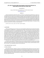
shoreprotectionmanual1984 scan 120603023043 phpapp02
Bạn đang xem bản rút gọn của tài liệu. Xem và tải ngay bản đầy đủ của tài liệu tại đây (29.66 MB, 652 trang )
u,6. A^vM^ocuSr.ec^ K'^.Gtv-
t2ijuc.o2_
ta^^LcJr.
v-Wu.
SHORE PROTECTION
MANUAL
VOLUME
I
Coastal Engineering Research Center
DEPARTMENT OF THE ARMY
Waterways Experiment
Station,
PC Box
Corps
631
Vicksburg, Mississippi
Vv
H
of Engineers
39180
I
1984
Approved For Public Release; Distribution Unlimited
Prepared for
DEPARTMENT OF THE ARMY
US Army Corps
Washington,
of
DC
Engineers
20314
r
Reprint or republication of any of this material should give
Army Engineer Waterways
Experiment Station Coastal Engineering Research Center,
P.O. Box 631, Vicksburg, Miss. 39180
appropriate credit to the U.S.
This publication
is intended as a guide for coastal engineering
planning and design and is not intended to replace the
judgement of a qualified design engineer on a particular
project. The United States Government and the U.S. Army
Corps of Engineers assume no liability for interpretations or
implementations made by users of this publication.
The contents
of this publication are not to be used for
advertising, publication, or promotional purposes. Citation of
trade names does not constitute an official endorsement or
approval of the use of such commercial products.
SHORE PROTECTION
MANUAL
VOLUME
(Chapters
1
I
Through
5)
DEPARTMENT OF THE ARMY
Waterways Experiment
Station,
Corps of Engineers
COASTAL ENGINEERING RESEARCH CENTER
1984
Fourth Edition
For
sale
by the Superintendent of Documents, U.S. Government Printing Office
Washington, D.C. 20402 (2-part set; sold in sets only)
Original Printing
1973
Second Printing
1974
Second Edition
1975
Third Edition
1977
Fourth Edition
1984
11
PREFACE
The Coastal Engineering Research Center (CERC) of the U.S. Army Engineer
Waterways Experiment Station (WES), and its predecessor, the Beach Erosion Board,
has, since 1930, conducted studies on shore processes and methods of shore protection.
CERC continues an extensive research and development program to improve both
coastal engineering (including shore protection) and offshore engineering techniques.
The scientific and engineering aspects of coastal processes and coastal and offshore
structures are in the developmental stage, and the requirement for improved techniques
for use in design and engineering of coastal structures is evident. This need was met in
1954, to the extentof available knowledge, by publication of "Shore Protection, Planning
and Design," Technical Report Number 4 (TR 4); revised editions thereof appeared in
1957, 1961, and 1966.
This Shore Protection Manual (SPM), originally published in 1973, incorporated
new material with appropriate information extracted from TR 4, and has expanded
coverage within the coastal engineering field. Previous revised editions were published
in 1975 and 1977. The present edition incorporates substantial revisions to all chapters of
the SPM. This edition has been reduced from three volumes to two by moving Chapter 5
from Volume II to Volume I and including the appendices within Volume II.
This edition was prepared under the direction of Dr. Robert W. Whalin, Chief,
Dr. Fred E. Camfield, Acting Chief, Engineering Development Division, and
Chief, Coastal Design Branch; Mr. Neill E. Parker, former Chief, Engineering
Development Division; Mr. Robert A. Jachowski, former Chief, Coastal Design Branch;
and Dr. J. Richard Weggel, former Chief, Coastal Structures and Evaluation Branch.
Chapter 1 was revised by Mr. James W. Eckert and Dr. Steven A. Hughes. Revisions to
Chapter 2 were prepared by Dr. Fred E. Camfield and Mr. William N. Seelig. Chapter 3
was revised by Drs. Jon M. Hubertz, Edward F. Thompson, and C. Linwood Vincent, and
Chapter 4 by Mr. William A. Birkemeier, Drs. Robert J. Hallemeier, Robert M.
Sorensen, Edward F. Thompson, and Todd L. Walton, Jr., and Mr. Philip Vitale.
Revisions to Chapter 5 were prepared by Mr. William Dally, Dr. Richard D. Hobson, Mr.
Paul L. Knutsen, and Mr. Philip Vitale, and to Chapter 6 by Mr. James W. Eckert, Dr.
Steven A. Hughes, and Mr. Paul L. Knutsen. Chapter 7 was revised by Dr. Fred E.
Camfield, Mr. D. D. Davidson, Mr. James W. Eckert, Dr. Steven A. Hughes, Mr. Robert
E. Ray, Ms. Debra L. Rouse, Mr. William N. Seelig, Mr. Orson P. Smith, and Dr. J.
Richard Weggel. Chapter 8 was revised by Dr. J. Richard Weggel, Dr. Yen-hsi Chu, and
Ms. Mary A. Cialone. The present index was prepared by Ms. Alfrieda S. Clark, Ms.
Katherine M. Kennedy, and Mr. Paul A. Taccarino, Special Projects Branch, Technical
Information Center. Editors for this edition were Ms. Betty Hall, Ms. Mozelle Jones, and
Ms. Kathryn B. (Taffy) Stept. Editorial assistance was provided by Ms. Goldie Booth, Ms.
Mary Pikul, and Ms. Josephine Head. Typing and composing were done by Ms. Peggy
Johnson, Ms. Dorothy T. Lauria, and Ms. Mary L. Logan.
CERC;
Commander and
edition
Director of
was COL Tilford
Comments
WES during final preparation and publication of this
C. Creel,
CE. Technical Director was Mr.
F. R.
Brown.
or suggestions on material in this publication are invited.
This report is published under authority of Public Law 166, 79th Congress, approved
July 31, 1945, as supplemented by Public Law 172, 88th Congress, approved November
7,
1963.
Ill
TABLE OF CONTENTS
VOLUME
I
CHAPTER 1. INTRODUCTION TO COASTAL ENGINEERING
— Overview of Coastal Engineering and the SPM, page 1-1; II — The Coastal Area, page 1-2;
III— The Beach and Nearshore System, page 1-4; IV— Dynamic Beach Response to the Sea, page
1-9; V— Causes of Shoreline Erosion, page 1-15; VI— Coastal Protection Methods and Navigation
I
Works, page
CHAPTER
1-17;
VII— Conservation
of Sand,
page
1-25; Literature Cited,
page 1-27
MECHANICS OF WAVE MOTION
2.
I— Introduction, page 2-1; II— Wave Mechanics, page 2-1; III— Wave Refraction, page 2-60;
IV— Wave Diffraction, page 2-75; V— Wave Reflection, page 2-109; VI— Breaking Waves, 2-129;
Literature Cited, page 2-137; Bibliography, page 2-147
CHAPTER
3.
WAVE AND WATER LEVEL PREDICTIONS
I— Introduction, page
3-1;
II— Characteristics
of
Ocean Waves, page
3-1;
III— Wave
Field,
page
IV— Estimation of Surface Winds for Wave Prediction, page 3-27; V— Simplified Methods
for Estimating Wave Conditions, page 3-39; VI— Wave Forecasting for Shallow Water, page 3-55;
3-19;
VII— Hurricane Waves, page 3-77; VIII— Water Level Fluctuations, page
page 3-130; Bibliography, page 3-140
CHAPTER
4.
3-88; Literature Cited,
LITTORAL PROCESSES
I— Introduction, page 4-1; II— Littoral
Materials, page 4-12; III— Littoral
Wave
Conditions, page
V— Littoral
IV— Nearshore
Transport, page 4-55; VI— Role of
VII— Sediment Budget, page 4-113; VIII—
Engineering Study of Littoral Processes, page 4-133; IX— Tidal Inlets, page 4-148; Literature
Cited, page 4-182; Bibliography, page 4-208
Currents, page 4-46;
Foredunes in Shore Processes, page 4-108;
4-29;
CHAPTER
5.
PLANNING ANALYSIS
I— General, page
5-35;
5-1;
II— Seawalls, Bulkheads, and Revetments, page
5-2;
III— Protective
IV— Sand Dunes, page 5-24; V— Sand Bypassing, page 5-26; VI— Groins, page
VII— Jetties, page 5-56; VIII— Breakwaters, Shore-Connected, page 5-58; IX— Break-
Beaches, page
5-6;
waters, Offshore, page 5-61;
5-75
X— Environmental Considerations, page 5-74; Literature Cited, page
VOLUME
II
CHAPTER 6. STRUCTURAL FEATURES
— Introduction, page 6-1; II — Seawalls, Bulkheads, and Revetments, page 6-1; III — Protective
Beaches, page 6-14; IV— Sand Dunes, page 6-37; V— Sand Bypassing, page 6-53; VI— Groins, page
6-76; VII — Jetties, page 6-84; VIII — Breakwaters, Shore-Connected, page 6-88; IX — Breakwaters, Offshore, page 6-93; X— Construction Materials and Design Practices, page 6-95;
I
Literature Cited, page 6-99
CHAPTER
7.
STRUCTURAL DESIGN: PHYSICAL FACTORS
I— Wave Characteristics, page 7-1; II— Wave Runup, Overtopping, and Transmission, page 7-16;
III— Wave Forces, page 7-100; IV— Velocity Forces— Stability of Channel Revetments, page
7-249; V— Impact Forces, page 7-253; VI— Ice Forces, page 7-253; VII— Earth Forces, page 7-256;
Literature Cited, page 7-261; Bibliography, page 7-277
CHAPTER
8.
ENGINEERING ANALYSIS: CASE STUDY
I— Introduction, page 8-1; II— Statement of Problem, page 8-1; III— Physical Environment, page
8-1;
IV— Preliminary Design, page 8-46; V— Computation of Potential Longshore Transport, page
VI— Beachfill Requirements, page 8-90; Literature Cited, page 8-93
8-85;
APPENDIX
APPENDIX
APPENDIX
APPENDIX
B.
GLOSSARY, page A 1
LIST OF SYMBOLS,
C.
MISCELLANEOUS TABLES AND PLATES,
D.
INDEX,
A.
page
D
page B
1
iv
1
page C-1
CHAPTER
1
Introduction to
Coastal Engineering
Fort DeRussy, Oahu, Hawaii, 27 August 1970
.
.
CONTENTS
CHAPTER
1
INTRODUCTION TO COASTAL ENGINEERING
Page
I
II
III
IV
V
VI
VII
OVERVIEW OF COASTAL ENGINEERING AND THE SPM
1-1
THE COASTAL AREA
1-2
THE BEACH AND NEARSHORE SYSTEM
1. The Sea
The Beach and Nearshore Zone
2
1-4
1-4
1-7
DYNAMIC BEACH RESPONSE TO THE SEA
1
Normal Beach Response
2. Beach Response to Storms
3. Beach and Dune Recovery from Storm Attack
4. Littoral Transport
5. Effect of Inlets on Barrier Beaches
6. Beach Stability
1-9
1-9
1-10
1-13
1-13
1-14
1-15
CAUSES OF SHORELINE EROSION
1. Natural Causes
2
Man- Induced Causes
1-15
1-15
1-16
COASTAL PROTECTION METHODS AND NAVIGATION WORKS
1-17
CONSERVATION OF SAND
1-25
LITERATURE CITED
1-27
TABLES
1-1
Causes of coastal erosion
1-16
FIGURES
1-1
Visual definition of terms describing a typical beach profile
1-2
1-2
Large waves breaking over a breakwater
1-5
1-3
Wave characteristics
1-5
1-4
Undeveloped barrier island on the gulf coast of Alabama after
Hurricane Frederic
1-8
1-5
Developed barrier island, Atlantic City, New Jersey
1-9
1-6
Sand dunes on Padre Island, Texas
1-11
1-7
Sand dunes at Nauset Spit, Cape Cod, Massachusetts
1-11
1-8
Schematic diagram of storm wave attack on beach and dune
1-12
1-9
Littoral barrier, Ocean City Inlet, Maryland
1-18
1-10 Damage after the 1962 storm, Rehoboth Beach, Delaware
1-20
1-11 Undermining of structures by storm waves,
1-21
Potham Beach, Maine
1-12 Beach restoration, Dade County, Florida
1-13 Weir jetty at Murrells Inlet,
South Carolina,
1-22
1981
1-25
CHAPTER
1
INTRODUCTION TO COASTAL ENGINEERING
I.
OVERVIEW OF COASTAL ENGINEERING AND THE SPM
The Shore Protection Manual (SPM) assembles in a single source the current
state-of-the-art of coastal engineering to provide appropriate guidance for
application of techniques and methodology to the solution of coastal design
As the state-of-the-art advances,
problems.
the manual is periodically
This is the fourth edition of the SPM and the seventh major revision
revised.
of this material since its predecessor report "Shore Protection, Planning
and Design" (TR-4) was originally published (U.S. Army, Corps of Engineers,
1954).
Coastal engineering, a specialized branch of the engineering profession, is
composite of the many physical science and engineering disciplines having
application in the coastal area.
Coastal engineering addresses both the
natural and man-induced changes in the coastal zone, the structural and nonstructural protection against these changes, and the desirable and adverse
impacts of possible solutions to problem areas on the coast.
Although the SPM
focuses primarily on shore protection, i.e., coastal works designed to stabilize the shores against erosion due principally to water wave action, most of
the material is also applicable to the design of harbor works and navigation
channel improvements.
a
Because the nature and complexity of most coastal problems vary widely with
location, the proper solution of any specific problem requires a systematic
and thorough study.
The first requisite for such a study is a clear
definition of the problem, the causes, and the objectives to be met by the
solution.
Ordinarily, there will be more than one method of achieving the
immediate objectives.
Therefore, the immediate and long-term effects of each
method should be studied, not only within the problem area but also in adjacent shore areas.
All physical and environmental effects, advantageous and
detrimental, should be considered in comparing the overall cost, including
annual maintenance, and benefits to determine the justification of protection
methods.
SPM
The
and
engineering
provides
sufficient
introductory
material
methodology to allow a person with an engineering background to obtain an
understanding of coastal phenomena and to solve related engineering problems.
The manual includes detailed summaries of applicable methods, techniques, and
useful data pertinent to the solution of coastal engineering problems.
Chapter 2,
Chapter 1 presents a basic introduction to the subject.
"Mechanics of Wave Motion," reviews wave theories, wave refraction and
diffraction, wave reflection, and breaking waves.
Chapter 3, "Wave and Water
Level Predictions," discusses wave forecasting and the water level fluctuations caused by tides, storm surges, and tsunamis.
Chapter 4, "Littoral
Processes," examines the characteristics and sources of littoral material,
nearshore currents, littoral transport, and sand budget techniques.
Chapter
"Planning Analyses," treats the functional planning of shore protection
5,
Chapter 6, "Structural Features," illustrates the structural design
measures.
1-1
—
of various coastal or protective structures.
Chapter 7, "Structural Design
Physical Factors," considers the effects of environmental forces on the design
Chapter 8, "Engineering Analysis Case Study," presents
of protective works.
a series of calculations for the preliminary design of a hypothetical structure.
Each chapter includes a listing of bibliographic sources.
—
The SPM concludes with four supporting appendixes.
Appendix A is a glossary of coastal engineering terms used.
Appendix B lists and defines the
symbols used.
Appendix C is a collection of miscellaneous tables and plates
that supplement the material in the chapters, and Appendix D is the subject
index.
II.
THE COASTAL AREA
In any discussion on engineering, an agreement on the meaning of terms is
necessary before effective communication can occur.
Since the varied meanings
of coastal engineering terms used over the years have complicated dialogue,
the glossary in Appendix A has been assembled to establish a common vocabulary
for the SPM.
Figure 1-1 provides a visual definition of the terms discussed
in this chapter.
Figure 1-1. Visual definition of terms describing a
typical beach profile.
Any overview of the coastal area quickly reveals a wide variability of
coastal landforms.
The "Report on the National Shoreline Study" (U.S. Army,
Corps of Engineers, 1971) indicates that of the total 135,550 kilometers
(84,240 miles) of U.S. shoreline, 55,550 kilometers (34,520 miles) (41 percent) is exposed shoreline and 80,000 kilometers (49,720 miles) (59 percent)
is sheltered shoreline (i.e., in bays, estuaries, and lagoons).
About 33,000
kilometers (20,500 miles) of the shoreline (or 24 percent of the total) is
eroding.
Of the total length of shoreline, exclusive of Alaska (59,450
1-2
kilometers or 36,940 miles), about 19,550 kilometers (12,150 miles) (33
percent) has beaches; the remaining 39,900 kilometers (24,790 miles) is rocky
or otherwise lacks the typical beach characteristics described in Figure 1Likewise the coast along shorelines varies.
1.
In New England, it is
frequently rocky promontories while the south Atlantic and gulf coasts are
generally low, dotted with backbays, wide estuaries, and marshes.
Southern
California with a history of a rising landmass has coastal cliffs of
conglomerate material, some of which were at one time beaches.
The coast of
the north Pacific and Alaska is dominated by the basaltic deposits of
postvolcanic activity, weathered by the action of water. Even on a more local
scale, beaches and coasts can vary widely reflecting their differences in
geologic history and recent wave and current action.
Where the land meets the ocean at a sandy beach, the shore has natural
defenses against attack by waves, currents, and storms.
The first of these
defenses is the sloping nearshore bottom that causes waves to break offshore,
dissipating their energy over the surf zone.
The process of breaking often
creates an offshore bar in front of the beach that helps to trip following
waves.
The broken waves re-form to break again, and may do this several times
before finally rushing up the beach foreshore.
At the top of wave uprush a
ridge of sand is formed.
Beyond this ridge, or crest of the berm, lies the
flat beach berm that is reached only by higher storm waves.
During the early days of the United States, natural beach processes molded
the shore as in ages past.
As the country developed, shore activity was confined principally to harbor areas, and development along the shore progressed
slowly as small, isolated fishing villages.
As the national economy grew and
transportation improved, more people began to use the beaches.
Gradually,
extensive housing and commercial, industrial, recreational, and resort developments replaced the fishing villages as the predominant coastal manmade
features.
Examples of this development are Atlantic City, Miami Beach,
Honolulu, and Imperial Beach south of San Diego.
Numerous factors control the growth of development at beach areas, but
The
undoubtedly the beach environment is the development's basic asset.
desire of visitors, residents, and industries to find accommodations as close
In
to the ocean as possible has resulted in man's encroachment on the sea.
their eagerness to be as close as possible to the water, developers and property owners often forget that land in the coastal area comes and goes, and
that land which nature provides at one time may later be reclaimed by the
sea.
Once the seaward limit of a development is established, this boundary
between land and sea is perceived as fixed and must be held if large investWhether the problem is one of natural erosion
ments are to be preserved.
processes working on the coastal land that threatens man's presence there, or
erosion induced by man's encroachment on the sea, the results are similar.
Erosion generally leads to either great monetary losses due to storm damage or
even larger expenditures for shore protection to prevent the loss.
Another problem in the coastal area is the need for inland waterborne
commerce on rivers and bays which must pass through the coastal area to reach
Inlets which once migrated to suit the water and wave forces
deep water.
acting on them are now being pinned in place by jetties, creating accretion
and erosion problems on their flanks.
1-3
To
Coastal engineering is the discipline which deals with these problems.
must
not
only
design
a
solution
but
also
have
do this, the coastal engineer
knowledge of the natural processes at work, the wind and water forces driving
them, and the probable impact of the solution on the existing coastal system
Coastal engineering is a very site-specific discipline, and
and environment.
solutions successful at one point may not work at another.
achieve the objectives of coastal engineering, practitioners must
From field investigations and a knowledge of
utilize several disciplines.
physics, they develop an understanding of the coastal processes at the project
Then using models, both physical and numerical, they study the possible
site.
However, no factor is more important for the
solutions and their impacts.
Monitoring of constructed projects provides
engineer than past experience.
tremendous assistance towards planning the next.
To
understanding
coastal engineer's work is divided into three phases:
nearshore physical system and the shoreline's response to it; designing
coastal works to meet project objectives within the bounds of acceptable
impact;
and overseeing
the
construction of coastal works and
coastal
monitoring their performance to ensure that projects function as planned.
The
the
III.
THE BEACH AND NEARSHORE SYSTEM
The beach and nearshore zone of a coast is the region where the forces of
The physical system within this region is
the sea react against the land.
composed primarily of the motion of the sea, which supplies energy to the
system, and the shore, which absorbs this energy.
Because the shoreline is
the intersection of the air, land, and water, the physical interactions which
occur in this region are unique, very complex, and difficult to fully underAs a consequence, a large part of the understanding of the beach and
stand.
nearshore physical system is simply descriptive in nature.
1.
The Sea.
Water covers 71 percent of the Earth, and thus a large part of the Sun's
radiant energy that is not reflected back into space is absorbed by the water
of the oceans.
This absorbed energy warms the water, which in turn warms the
air above the oceans, and forms air currents caused by differences in air temperature.
These air currents blow across the water, returning some energy to
the water by generating wind waves.
The waves then travel across the oceans
until they reach land where their remaining energy is expended on the shore.
The power in the waves as they arrive in the nearshore zone can vary from 1.39
megawatts per kilometer (3,000 horsepower per mile) of beach on a relatively
calm day (0.6-meter or 2-foot waves) to 25 times this amount or more during a
storm.
The motions of the sea which contribute to the beach and nearshore physical
system include waves, tides, currents, storm surges, and tsunamis. Wind waves
are by far the largest contribution of energy from the sea to the beach and
nearshore physical system.
As winds blow over the water, waves are generated
in a variety of sizes from ripples to large ocean waves as high as 30 meters
(100 feet)
(see Fig.
1-2).
1-4
j
I
Portland Cement Association)
Figure 1-2.
Large waves breaking over a breakwater.
Wind waves, which are also known as oscillatory waves, are usually defined
Wave height is the verby their height, length, and period (see Fig. 1-3).
Wavetical distance from the top of the crest to the bottom of the trough.
Wave period is
length is the horizontal distance between successive crests.
As waves propagate
the time between successive crests passing a given point.
in deep water, only the waveform and part of the energy move forward; the
water particles move in a nearly circular path.
Direction of
Wove
Wove Trove!
Crest
Crest Length
^
Wove
Region
Trougti
Stiliwoter Level
—— Trougti
Lengtfi—«—
Region
d
=
Deptti
Oceon Bottom-
Figure 1-3.
Wave characteristics.
1-5
The height, length, and period of wind waves at a site in the open ocean
are determined by the fetch (the distance the wind blows over the sea in generating the waves), the windspeed, the duration (the length of time the wind
blows), the decay distance (the distance the wave travels after leaving the
Generally, increases in fetch, windgenerating area), and the water depth.
The water depth, if shallow
speed, or duration result in larger wind waves.
The wind simultaneously
enough, will also affect the size of waves generated.
generates waves of many heights, lengths, and periods as it blows over the
sea.
If winds of a local storm blow toward the shore, the waves will reach the
Under these
beach in nearly the same waveform in which they are generated.
conditions, the waves are steep; i.e., the wavelength is 10 to 20 times the
If waves are generated by a distant
Such waves are called seas.
wave height.
storm, they may travel through hundreds or even thousands of miles of calm
Under these conditions, waves decay
wind areas before reaching the shore.
short, steep waves are transformed into relatively long, low waves which reach
the shore.
Such waves, which have lengths from 30 to more than 500 times the
wave height, are called swell.
—
Tides are created by the gravitational force of the Moon and, to a lesser
extent, the Sun.
These forces of attraction, and the fact that the Sun, Moon,
and Earth are always in motion relative to each other, cause waters of ocean
These tidal motions of water masses are a form of
basins to be set in motion.
very long period wave motion, resulting in a rise and fall of the water surThere are normally two tides per day, but some localities
face at a point.
Tides constantly change the level at which waves
have only one per day.
attack the beach.
The range of tides varies tremendously with geographic location.
Some
areas, such as Eastport, Maine, experience an average tidal range of about 5.5
meters (18 feet) while other locations, such as Mobile, Alabama, experience
Even more dramatic is the difference between
variations of about 0.6 meter.
mean tidal ranges at Anchorage (7.9 meters or 26 feet) and Kodiak Island (2.1
These sites are only 415 kilometers (224 nautical
meters or 7 feet), Alaska.
miles) apart.
Currents and surges sometimes play an important role in the nearshore
physical system.
When water in one area becomes higher than water in another
area, water from the higher elevation flows toward the lower level, creating a
current.
Significant currents generated by tides occur at inlets to lagoons
and bays or at entrances to harbors.
Tidal currents in these constricted
places flow in when the tide is rising (floodtide) and flow out as the tide
falls (ebbtide).
Exceptions can occur at times of high river discharge or
strong winds. Currents can be caused by differences in water elevation due to
The river
(a) wind, (b) waves breaking on a beach, and (c) river discharge.
discharge to the sea introduces currents into the nearshore zone.
Wind creates currents as it blows over the water surface, producing a
stress on surface water particles and starting the movement of the particles
in the direction in which the wind is blowing.
Thus, a surface current is
created. When the surface current reaches a barrier, such as the coast, water
1-6
.
Strong winds create wind setup or stovm
tends to pile up against the land.
The height of storm surge depends on wind speed and
suvges in this way.
direction, fetch, atmospheric pressure, offshore bathymetry, and nearshore
In violent storms, storm surge may raise the water level at the shore
slope.
In the United States, larger surges occur on
as much as 6 meters (20 feet).
the gulf coast because of the shallower and broader shelf off that coast comStorm surges
pared to the shelf off both the Atlantic and Pacific coasts.
may also be increased by a funneling effect in converging shorelines within
estuaries.
When waves approach the beach at an angle, they create a current in shallow
This current,
water parallel to the shore, known as the longshore aurrent.
under certain conditions, may turn and flow seaward in what is known as a vip
current
Tsunamis are waves created by earthquakes or other tectonic disturbances on
These long-period waves can travel across entire oceans at
the ocean bottom.
Tsunamis can cause
speeds exceeding 800 kilometers (500 miles) per hour.
extensive damage at times, but fortunately major tsunamis do not occur
frequently.
2.
The Beach and Nearshore Zone .
The shoreline, the intersection of the land and the sea, is where tides,
winds, and waves attack the land; and it is where the land responds to this
attack by a variety of "give and take" measures which effectively dissipate
The shores of the United States include practically all
the sea's energy.
known landforms of many clastic materials from various stages of geologic
evolution.
The areas most directly affected by the forces of the sea are the
heaeh and the nearshore zone regions that experience the full impact of the
Hence, they are the most dynamic areas in the coastal zone.
sea's energy.
Beach sediments on most beaches range from fine sands to cobbles. The size
and character of sediments and the slope of the beach are related to the
forces to which the beach is exposed and the type of material available on the
coast. Much of the beach material originates many miles inland where weathering of the mountains produces small rock fragments that are supplied to the
When these fragments reach the shore as sand,
beach by streams and rivers.
This longshore transport is
they are moved alongshore by waves and currents.
Beach material is
a constant process, and great volumes may be transported.
also derived from erosion of the coastal formations caused by waves and currents and, in some cases, by onshore movement of sediment from deeper water.
In some regions, a sizable fraction of the beach material is composed of
Clay
marine shell fragments, coral reef fragments, or volcanic materials.
and silt do not usually exist on ocean beaches because the waves create such
turbulence in the water along the shore that these fine particles are kept in
The particles settle and deposit on the bottom only after moving
suspension.
away from the beaches into the quieter water of lagoons and estuaries or the
deeper water offshore.
Beach characteristics are usually described in terms of average size of the
sand particles that make up the beach, range and distribution of sizes of the
sand particles, sand composition, elevation and width of berm, slope or
1-7
steepness of the foreshore, the existence (or lack) of a bar, and the general
Generally, the larger the sand
slope of the inshore zone fronting the beach.
Beaches with gently sloping foreshores
particles the steeper the beach slope.
and inshore zones usually have a preponderance of the finer sizes of sand.
Daytona Beach, Florida, is a good example of a gently sloping beach composed
of fine sand.
Bavvier islands are an important part of the physical system in some areas
1-4).
These are long narrow islands or spits lying parallel to the
Most of the coast on the U.S. Atlantic south of Long Island and
mainland.
During severe storms these
along the gulf is composed of barrier islands.
barrier islands provide protection for the mainland by absorbing the brunt of
However, many barrier islands are so highly developed that
the wave attack.
the protection of their beaches has become an important consideration (see
(see Fig.
Fig.
1-5).
Figure 1-4.
Undeveloped barrier island on the
Alabama after Hurricane Frederic.
gulf
coast
of
Lagoons are shallow bodies of water separating the barrier beach from the
mainland.
They are usually connected to the sea by narrow channels through
which tidal currents flow.
Lagoons provide a habitat for a wide variety of
wildlife, and many lagoons serve as safe harbors and navigable waterways.
Inlets
An inlet is the narrow opening between the lagoon and the ocean.
occur at fairly regular intervals along a barrier island chain, and they
When barrier
often, when improved, provide a navigation passage to the sea.
beach dunes are breached by storm wave attack, the result may be the cutting
of a new inlet.
An inlet can permit beach material removed by storms to enter
a lagoon and be deposited there.
It may also allow some bottom material from
a lagoon to be carried oceanward by tidal currents and then be transported
along the shore by wave action. Over time, changing conditions may cause some
inlets to close and new inlets to open.
1-8
Figure 1-5.
Developed barrier island, Atlantic City, New Jersey.
IV.
DYNAMIC BEACH RESPONSE TO THE SEA
The beach constantly adjusts its profile to provide the most efficient
means of dissipating incoming wave energy.
This adjustment is the beach's
natural dynamic response to the sea.
Although an equilibrium is sometimes
reached between the beach and the sea, the "peace" is short-lived and the
"battle" soon begins anew.
There are two general types of dynamic beach response to wave motion:
response to normal conditions and response to storm conditions.
Normal conditions prevail most of the time, and the wave energy is easily dissipated by
the beach's natural defense mechanisms.
However, when storm conditions generate waves containing increased amounts of energy, the coast must respond with
extraordinary measures, such as sacrificing large sections of beach and
dune.
In time the beach may recover, but often not without a permanent loss.
1.
Normal Beach Response .
As a wave moves toward shore, it encounters the first beach defense in the
form of the sloping nearshore bottom.
When the wave reaches a water depth
equal to about 1.3 times the wave height, the wave collapses or breaks. Thus
a wave 0.9 meter (3 feet) high will break in a depth of about 1.2 meters (4
feet).
Breakers are classified as four types plunging, spilling, surging, or
collapsing.
The form of breakers is controlled by wave steepness and
Breaking results in a dissipation of wave energy by
nearshore bottom slope.
the generation of turbulence in the water and by the transport of sediment
lifted off the bottom and tossed around by the turbulent water.
Broken waves
often re-form to break again, losing additional energy.
Finally, the water
travels forward as a foaming, turbulent mass and expends most of its remaining
energy in a rush up the beach slope.
If there is an increase in the incoming
—
1-9
energy, the beach adjusts its profile to facilitate the dissipation of
This is most frequently done by the seaward transport
the additional energy.
of beach material to an area where the bottom water velocities are suffiEventually enough material is
ciently reduced to cause sediment deposition.
deposited to form an offshore bar which causes the waves to break farther
seaward, widening the surf zone over which the remaining energy must be disTides compound the dynamic beach response by constantly changing the
sipated.
elevation at which the water intersects the shore and by providing tidal
Thus, the beach is always adjusting to changes in both wave energy
currents.
and water level.
wave
are formed by winds blowing onshore over the
Natural protective dunes
foreshore and berm, transporting sand landward from the beach (see Figs. 1-6
Grass and sometimes bushes and trees grow on the dunes, and the
and 1-7).
Dunes provide a reservoir of
dunes become a natural levee against sea attack.
beach sand which in turn provides the final natural protection line against
wave attack.
2.
Beach Response to Storms
.
The subtle changes in the beach which occur during normal conditions are
nearly imperceptible to the untrained observer, but the beach's defense
Storms do not occur often, but
mechanisms become obvious when storms attack.
their effects are often devastating in terms of shoreline erosion.
In addition, these
During storms, strong winds generate high, steep waves.
winds often create a storm surge which raises the water level and exposes to
The
wave attack higher parts of the beach not ordinarily vulnerable to waves.
storm surge allows the large waves to pass over the offshore bar formation
When the waves finally break, the remaining width of the
without breaking.
surf zone is not sufficient to dissipate the increased energy contained in the
The remaining energy is spent in erosion of the beach, berm, and
storm waves.
sometimes dunes which are now exposed to wave attack by virtue of the storm
surge.
The eroded material is carried offshore in large quantities where it
This bar
is deposited on the nearshore bottom to form an offshore bar.
eventually grows large enough to break the incoming waves farther offshore,
This process is
forcing the waves to spend their energy in the surf zone.
illustrated in Figure 1-8.
Beach berms are built naturally by waves to about the highest elevation
When storm waves erode the berm and carry the
reached by normal storm waves.
sand offshore, the protective value of the berm is reduced and large waves can
overtop the beach.
The width of the berm at the time of a storm is thus an
important factor in the amount of upland damage a storm can inflict.
In severe storms, such as hurricanes, the higher water levels resulting
from storm surges allow waves to erode parts of a dune.
It is not unusual
for 18- to 30-meter-wide (60- to 100- foot) dunes to disappear in a few
hours.
Storm surges are especially damaging if they occur concurrently with
high astronomical tides.
1-10
1976
Figure 1-6.
Sand dunes on Padre Island, Texas.
1977
Figure 1-7.
Sand dunes at Nauset Spit, Cape Cod, Massachusetts.
1-11
Dune Crest
Profile
D - After storm
wove oftock,
normol wove octlon
Profile
Figure 1-8.
A
Schematic diagram of storm wave attack, on beach and dune.
1-12
.
In essence,
the dynamic response of a beach under storm attack is a
sacrifice of some beach, and often dune, to provide material for an offshore
This bar protects the shoreline from further erosion.
bar.
After a storm or
storm season, natural defenses may again be re-formed by normal wave and wind
action.
Besides causing erosion of the shoreline, storm surges can damage shore
structures that are inadequately protected and located close to the water by
either direct wave attack or undermining of the structure.
At locations where there is a low section of protective dunes, or when the
storm conditions are particularly severe, the storm surge and wave action may
succeed in completely overtopping the dunes causing extensive coastal flooding.
When this occurs, beach and dune sediments are swept landward by the
water, and in the case of barrier islands, are deposited as ovenjash fans on
the backshore or in the lagoon.
This process results in a loss of sand from
the dynamic beach system.
Often, storm overwash and storm flooding return
flow will erode enough sand to cut a new tidal inlet through the barrier
island.
Depending on various factors, the new inlet may become a permanent
feature of the coastline.
3.
Beach and Dune Recovery from Storm Attack
.
Following a storm there is a return to more normal conditions which are
dominated by low, long swells.
These waves transport sand from the offshore
bar, built during the storm, and place the material on the beach.
Winds then
transport the sand onto the dunes where it is trapped by the vegetation.
In
this manner the beach begins to recover from the storm attack.
The rebuilding
process takes much longer than the short span of erosion which took place.
Therefore, a series of violent local storms over a short period of time can
result in severe erosion of the shore because the natural protection does not
have time to rebuild between storms.
Sometimes full recovery of the beach
never occurs because sand is deposited too far offshore during the storm to be
returned to the beach by the less steep, normal waves which move material
shoreward.
This is particularly true in the Great Lakes and in bays and
estuaries where waves are fetch-limited and do not develop into long swell
waves
Alternate erosion and accretion may be seasonal on some beaches; the winter
storm waves erode the beach, and the summer swell (waves) rebuilds it.
Beaches also appear to follow long-term cyclic patterns, where they may erode
for several years and then accrete for several years.
4.
Littoral Transport
.
Another dynamic feature of the beach and nearshore physical system is littoval transport, defined as the movement of sediments in the nearshore zone by
waves and currents.
Littoral transport is divided into two general classes:
transport parallel to the shore (longshore transport) and transport perpendicular to the shore (onshore-offshore transport).
The material that is
transported is called littoral drift.
Onshore-offshore
transport
is
determined
1-13
primarily
by
wave
steepness,
sediment size, and beach slope.
offshore, and low waves of long
The onshore-offshore
onshore.
illustrated in Figure 1-8.
In general, high steep waves move material
period (low steepness waves) move material
process associated with storm waves is
Longshore transport results from the stirring up of sediment by the breaking wave and the movement of this sediment by both the component of the wave
energy in an alongshore direction and the longshore current generated by the
The direction of longshore transport is directly related to
breaking wave.
the direction of wave approach and the angle of the wave (crest) to the
Thus, due to the variability of wave approach, longshore transport
shore.
direction can vary from season to season, day to day, or hour to hour.
Reversals of transport direction are quite common for most U.S. coasts.
Direction may vary at random, but in most areas the net effect is seasonal.
The rate of longshore transport is dependent on the angle of wave
Thus, high storm waves will generally
duration, and wave energy.
material per unit time than that moved by low waves.
However, if
exist longer than high waves, the low waves may be more significant
sand than the high waves.
approach,
move more
low waves
in moving
Because reversals in transport direction occur, and because different types
two components of
the
waves transport material at different rates,
longshore transport rate become important. The first is the net rate, the net
amount of material passing a particular point in the predominant direction
The second component is the gross rate, the total
during an average year.
of all material moving past a given point in a year regardless of direction.
Most shores consistently have a net annual longshore transport in one direcDetermining the direction and average net and gross annual amount of
tion.
In
longshore transport is important in developing shore protection plans.
inland seas, such as the Great Lakes, a longshore transport rate in one direction can normally be expected to be no more than about 115, UUU cubic meters
(150,000 cubic yards) per year. For open ocean coasts, the net rate of transport may vary from 75,000 to more than 1.5 million cubic meters (100,000 to 2
million cubic yards) per year. The rate depends on the local shore conditions
and shore alinement, as well as the energy and direction of wave approach.
of
5.
Effect of Inlets on Barrier Beaches
.
Inlets may have significant effects on adjacent shores by interrupting the
During ebblongshore transport and trapping onshore-offshore moving sand.
tide, sand transported to the inlet by waves is carried seaward a short distance and deposited on an outer bar.
When this bar becomes large enough,
the waves begin to break on it, moving the sand over the bar back toward the
beach.
During floodtide, when water flows through the inlet into the lagoon,
sand in the inlet is carried a short distance into the lagoon and deposited.
This process creates shoals in the landward end of the inlet known as middleground shoals or inner bars. Later, ebb flows may return some of the material
in these shoals to the ocean, but some is always lost from the littoral system
and thus from the downdrift beaches.
In this way, tidal inlets store sand
and reduce the supply of sand to adjacent shores.
Estimates of the amount of
material deposited in the middleground shoals range from 100,000 to 160,000
cubic meters (130,000 to 210,000 cubic yards) per year for inlets on the east
1-14
coast of Florida (Walton and Adams,
widely according to local conditions.
6.
Beach Stability
1976),
but
quantities
elsewhere
vary
.
Although a beach may be temporarily eroded by storm waves and later partly
wholly restored by swells, and erosion and accretion patterns may occur
seasonally, the long-range condition of the beach whether eroding, stable, or
accreting depends on the rates of supply and loss of littoral material. The
shore accretes or progrades when the rate of supply exceeds the rate of loss.
The shore is considered stable (even though subject to storm and seasonal
changes) when the long-term rates of supply and loss are equal.
Thus, conservation of sand is an important aspect of shore protection.
or
—
—
V.
CAUSES OF SHORELINE EROSION
Before embarking upon any method of coastal protection, it is important to
identify and understand both the short- and long-term causes of coastal erosion.
Failure to do this may result in the design and placement of shore
protection measures which actually accelerate the process that the protection
measure was intended to alleviate.
Although the most serious incidents of
coastal erosion occur during storms, there are many other causes, both natural
and man-induced, which need to be examined.
Natural causes of erosion are those which occur as a result of the response
the beach to the effects of nature.
Man-induced erosion occurs when human
endeavors impact on the natural system.
Much of the man-induced erosion is
caused by a lack, of understanding and can be successfully alleviated by good
coastal zone management. However, in some cases coastal erosion can be due to
construction projects that are of economic importance to man.
When the need
for such projects is compelling, the coastal engineer must understand the
effects that the work will have on the natural system and then strive to
greatly reduce or eliminate these effects through designs which work in
harmony with nature.
of
Natural and man-induced causes of erosion, as discussed below, are given in
Table 1-1.
1.
Natural Causes
.
a.
Sea Level Rise .
A long-term rise in sea level relative to the land
exists in many areas of the world.
This rise results in a slow, long-term
recession of the shoreline, partly due to direct flooding and partly as a
result of profile adjustment to the higher water level.
b.
Variability in Sediment Supply to the Littoral Zone . Changes in the
world's weather pattern that cause droughts can result in a reduction in the
occurrence of floods on rivers supplying sediment to the coastal zone.
Steep waves from a coastal storm cause sand to be transStorm Waves
c.
ported offshore with temporary storage in a bar or shoal.
Later partial
recovery of the beach may be made through natural transport of this material
onshore by longer period, flatter waves.
But, in most cases, some material is
permanently lost into the greater offshore depths.
.
1-15