Bài giảng Tiếng Anh Chuyên ngành giao thông Đại học Công Nghệ GTVT (UTT)Unit 1part1
Bạn đang xem bản rút gọn của tài liệu. Xem và tải ngay bản đầy đủ của tài liệu tại đây (2.12 MB, 14 trang )
PLANNING AND DESIGN
FOR ROADS AND BRIDGES
Unit 1
PART 1
1.
PLANNING AND DESIGN FOR ROADS
READING
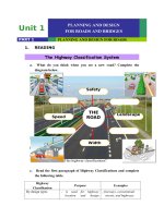
The Highway Classification System
a.
What do you think when you see a new road? Complete the
diagram below.
Safety
THE
THE
ROAD
ROAD
Speed
Landscape
Now, compare your diagram with your partners.
Width
b. In groups, discuss the different types of classifying highways.
How many categories are there?
What are the purposes of the highway classifications?
c.
Read the first paragraph of Highway Classifications and complete
the following table.
Highway
Classification
By design types
Purpose
Examples
- is used for highway - freeways, conventional
location and design
streets, and highways
procedures
By route numbering
Administrative
classification
Functional
classification
HIGHWAY CLASSIFICATIONS
The classification of highways is necessary for communication among
engineers, administrators, and the general public. Different classification
schemes have been applied for different purposes in different rural and
urban regions. Classification of highways by design types based in the
major geometric features (e.g., freeways, conventional streets, and
highways) is the most helpful one for highway location and design
procedures. Classification by route numbering (e.g., U.S., State, County) is
the most helpful for traffic operations. Administrative classification
(e.g., National Highway System or Non-National Highway System) is used
to denote the levels of government responsible for, and the method of
financing, highway facilities. Functional classification, the grouping of
highways by the character of service they provide, was developed for
transportation planning purposes. Comprehensive transportation planning,
an integral part of total economic and social development, uses functional
classification as an important planning tool.
Functional classification is the process by which streets and highways are
grouped into classes according to the character of traffic service that
they are intended to provide. There are three highway functional
classifications: arterial, collector, and local roads. All streets and
highways are grouped into one of these classes, depending on the
character of the traffic (i.e., local or long distance) and the degree of
land access that they allow. These classifications are described in Table
1.
Table 1. Functional Classification Systems
Functional
Services Provided
System
Arterial
provides the highest level of service at the greatest speed for
the longest uninterrupted distance, with some degree of access
control.
provides a less highly developed level of service at a lower
Collector
speed for shorter distances by collecting traffic from local
roads and connecting them with arterials.
consists of all roads not defined as arterials or collectors;
Local
primarily provides access to land with little or no through
movement.
Typically, travellers will use a combination of arterial, collector, and local
roads for their trips. Each type of road has a specific purpose or
function. Some provide land access; others provide travel mobility at
varying levels.
There is a basic relationship between traffic mobility and land access, as
illustrated in Figure 1.
Mobility
Land Access
Figure 1. Relationship of functionally classified highway systems in
serving traffic mobility and land access.
Once the functional classification of a particular roadway has been
established, the allowable range of design speed, the principal limiting
design parameters, and horizontal and vertical alignment have also
defined. Similarly, functional classification establishes the basic roadway
cross section in terms of lane width, shoulder width, type and width of
median area, and other major design features (see Figure 2).
Figure 2. The flexibility available to a highway designer is considerably
limited once a particular functional classification as been established.
The importance of the functional classification process as it relates to
highway design lies in the fact that functional classification decisions are
made well before an individual project is selected to move into the design
phase. Moreover, such decisions are made on a systemwide basis by city
or county as part of their continuing long-range transportation planning
functions. Thus, the functional classification of a particular section of
highway may well represent a decision made 10 or more years ago.
d. Match the terms to the definitions
Accessibility
a.
provide a balance between mobility and land access.
Mobility
b.
refers to the ease of reaching destinations
Design speed
c.
provide a high level of mobility for through
d.
movement with low level of accessibility.
provide a high level of access to adjacent properties
Arterial roads
but a low level of mobility.
Collector roads
e.
is the ability to move or travel around easily.
Local roads
f.
is a selected speed used to determine the various
geometric features of the roadway.
Arterial road
Collector road
Local road
e. Fill in the blank with suitable words
1. All streets and highways are grouped into one of these classes,
depending on the character of the traffic and the degree
of ........................... that they allow.
2. Travellers will use a ........................... of arterial, collector, and local
roads for their trips.
3. Collector roadways provide a balance between ........................... and
land access.
4. ........................... provides the highest level of service at the greatest
speed for the longest uninterrupted distance.
5. A determination of functional classification establishes the basic
roadway...........................
6. Functional classification decisions are made as part of their continuing
long-range ........................... functions.
f. Decide whether the following statements are True (T) or False (F)
1.
Arterial, collector and local are grouped into highway
functional classifications.
2. Traffic mobility and land access don’t have any relationship.
3. Local roads provide a high level of access to adjacent
properties but a low level of mobility.
4.
Without defining the allowance range of design speed,
horizontal and vertical alignment can’t be defined.
5. The functional classification of a particular section of
highway may well represent a decision made 10 or more
years ago.
3.
SPEAKING
In pairs, describe the figure 1 Relationship of functionally classified
highway systems in serving traffic mobility and land access using
comparison of adjectives.
Arterials provide higher mobility than collectors and locals
4.
READING AND WRITING
Expressways Category
a. Complete the table with the appropriate descriptions of Functional
Classification.
A. Highways generally providing direct service between cities and
important economic, political, cultural centres; Partial Controlled
Access Highways; ≥4 lanes
B. Local Roads providing direct service between districts, cooperatives,
etc.
C. Super high class Highway for high speed traffic with controlled
access and quick travel time, providing transport service between
large important cities.
D. Highways providing direct service between several towns and local
economic, political, cultural centres. Roads connecting them to the
arterial network and expressways.
E. Highways providing direct service between big economic, political,
cultural centres; Road connecting them to the Ind category or
expressways – 2 lanes.
Traffic
Volume
PCU/day
Technical Classification
Functional
Classification
Level
Administrati
ve
Rollin Mountainou Classificatio
g
s
n
120
100
National Road
80
80
60
100
>25000
≥ 15000
110
100
90
80
70
60
National Road
I
II
≥6000
100
80
80
60
60
40
National Road
60
40
50
30
National or
≥1000
80
60
III
Provincial
Road
60
40
≤2001 lane
> 200-
IV
40
30
30
20
Local Road
2 lanes
b. Translate the above table into Vietnamese.
Grammar focus: Zero relative clause (Omitting relative pronouns)
E.g.
Arterials are the highways providing the highest mobility.
(understood: Arterials are the highways which provide the highest mobility)
HIGHWAY CROSS-SECTION ELEMENTS
1.
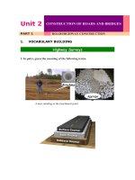
VOCABULARY BUILDING
Property Lines
a. Guess the meaning of the following terms.
Clearing
Limits
Right-of-Way
Clearing Limits
Roadway (Construction Limits)
Traveled Way
Shoulder
Shoulder
Cut Slope (Back Slope)
C
L
Surface Course
Base Course
Fill Slope
Subgrade
(Embankment)
Ditch
Road bed
Toe of Slope
Property Lines
Clearing Limits
Natural Ground
b. Label the following cross-section elements.
MEDIAN
Cross-section Elements for a Divided Highway
Information sign
Median
Sound/Noise barrier
Flexible
Curb
Roadway
Railing/Wall barrier
Shoulder
Shoulder (Inner)
Traveledway
Pavement
railing
(Outer)
2.
LISTENING
a. What is a safe highway? How can we design a safe highway?
b. Watch a video and choose the best answer (A, B, C, or D) for the
following sentences.
1. .......... will be a new arterial highway for Japan.
A. Expressway
B. New Tomei
C. This
Expressway
D. New Tomei
2. We aim to make this the world’s safest, most pleasant expressway coexisting harmoniously with ..........
A. environment
B. natural
C. nature
D. feature
3. We are engaged in a wide range of measures to .......... accidents on
expressways.
A. maximize
B. optimize
C. customize
D.
minimize
4. We have widened the road, reduced .......... and so decreased driver stress
and improved road visibility.
A. curves and bends
B. curves and slopes
C. slopes
D.
curves
5. We have made traffic signs and .......... much easier to read by improving the
colors and shapes based on intensive testing.
A. signboards
B. signboard
C. side roads
D.
side road
6. The expressway is paved with ....................... paving material.
A. traditional
B. modern
C. advanced
conventional
D.
7.
The expressway has been planned and designed anticipating a
possible ..............
A. tsunami
B. typhoon
C. earthwork
D.
earthquake
8. In addition to being light and pleasant to drive through, we have
employed .......... lighting consuming less power than conventional lights.
A. eco-friendly
environment-friendly
B. ecosystem
C. economic
D.
9. We use advanced ............. systems with TV cameras to monitor the entire
expressway.
A. supervising
B. monitoring
C. inspecting
D.
observing
c. Watch again for more information. What have they done to make
New Tomei Expressway the world’s safest, most pleasant
expressway?
3.
SPEAKING
HORIZONTAL AND VERTICAL ALIGNMENT
Horizontal and vertical alignments are permanent elements that should not be
designed independently. They complement each other, and poorly designed
combinations can spoil the good points and aggravate the deficiencies of each.
Working drawings, with the profile plotted jointly with the plan, assist in
analyzing the horizontal alignment and profile relationship in roadway design.
Indicate in the following figures whether the layout is a good or poor
highway design practice by checking the appropriate box.
Useful expressions:
I think
so...
I don’t
think...
Probably.
..
I’m
sure...
As you can
see...
Because..
.
Good design practice Poor design
practice
Good design practice Poor design
practice
Good design practice Poor design
practice
Good design practice Poor design
practice
Good design practice Poor design
practice
Good design practice Poor design
practice
Good design practice Poor design
practice
Good design practice Poor design
practice
Good design practice Poor design
practice
Good design practice Poor design
practice
Good design practice Poor design
practice
Good design practice Poor design
practice
Good design practice Poor design
practice
Good design practice Poor design
practice